


Bob Sihler - Nov 1, 2006 10:29 pm - Voted 10/10
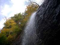
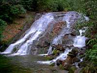
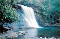
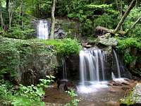
WaterfallsThis album is a great idea. I share your sentiments about the region, especially the falls in Shenandoah National Park. I added several shots myself, and I also attached your album to my new Blue Ridge Mountains page. If you want it detached, just let me know.
Bob

dwhike - Nov 1, 2006 10:42 pm - Hasn't voted
Thanks...I appreciate the nice comments. Thank you also for all the great shots you contributed. I havn't been up to the Shenandoah in search of falls yet but you've certainly whetted my appetite!
-Dan
dwhike - Nov 3, 2006 4:59 pm - Hasn't voted
Thank you...so much for the comment. I'm glad you enjoy it.
-Dan
SteveinFXBG - Nov 3, 2006 10:53 pm - Hasn't voted
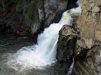
NiceI'm glad to see this album get created. Some great images and looking forward to seeing more. I'd post some that I have but I don't want to lower the standards of this nice album!
dwhike - Nov 3, 2006 11:22 pm - Hasn't voted
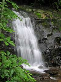
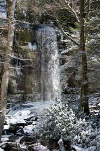
Re: NiceI appreciate the comments. I went ahead and attached your image of Elakala Falls, its a beautiful shot. I havn't been to any falls in WV yet. Don't worry about quality, if you have some go ahead and post them!
-Dan

e-doc - Nov 7, 2006 9:57 pm - Hasn't voted
locationGood page. What it be better placed elsewhere? People will not enjoy unless they go to Smokies page. But I'm not sure where to put it.
dwhike - Nov 8, 2006 2:44 am - Hasn't voted
Re: locationI had the same thoughts, I've attached it to a couple range pages but aside from attaching to every single mountain page (which I won't do)I don't know. Some of the falls are in the vicinity of some more popular mountains (i.e Mt. Rogers) so maybe I'll just attch it to a select few with owners permission. If you (or anyone else) has more thoughts on this I'd be very open to ideas.
-Dan

WoundedKnee - Dec 4, 2006 11:48 am - Voted 10/10
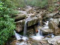
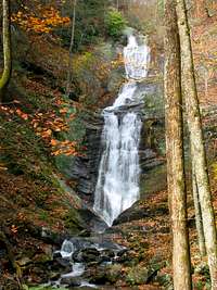
Excellent ideaI have some pics of waterfalls near the South Mountains State Park that I'll post. Another great spot for falls.
dwhike - Dec 6, 2006 4:13 am - Hasn't voted
Re: Excellent ideaThanks, I visited South Mountains myself a month or so ago and was amazed to find such large falls in an area so far from the higher mountains of NC. I'd love to see some of the pics you have, the darn sun came out the day I drove there so I wasn't real happy with many of my shots.

MarkDidier - Aug 9, 2008 10:29 am - Voted 10/10
Excellent Page!Excellent page on the waterfalls of this area. Most everyone I know loves waterfalls. This page gives me some great research for organizing a trip that my wife would actually enjoy! I wish I had more than one picture to post, but most of my good waterfall pictures are prints - not digital - and I haven't scanned them to digital yet. FYI, I did post some LeConte/Boulevard pictures to your Mt. LeConte page. Great work!
dwhike - Aug 10, 2008 9:05 am - Hasn't voted
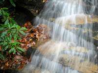
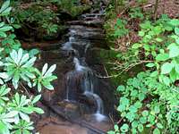
Re: Excellent Page!Thanks for stopping by! Glad you find it useful. Your shot of the cascade on Jakes Creek is a nice addition, I love those pics of unnamed trailside falls. Cheers, Dan
Comments
Post a Comment