Tuesday, 08.16.11 - Wednesday, 08.17.11: Getting Low
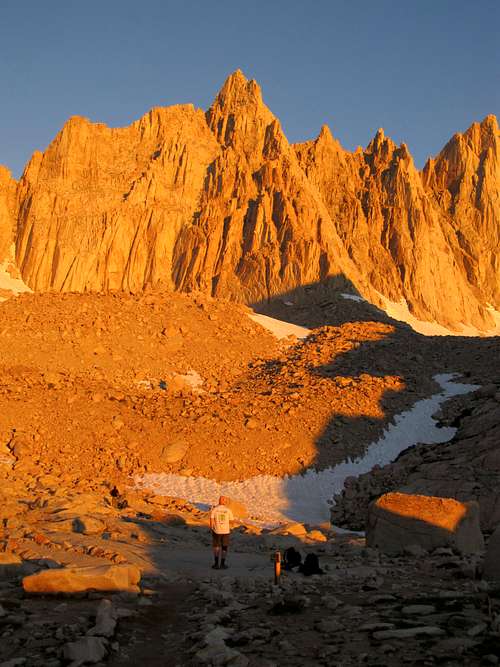
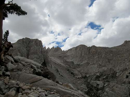
![Mt. Whitney]() Whitney - American Icon Whitney - American Icon |
Our humble version of the wolfpack took off from Providence, Rhode Island on a Tuesday evening, en route to Las Vegas for another bachelor party. Like my last two trips to Vegas the partying itself would come after some time spent in the great outdoors. This time around however, there were two not so subtle differences: I would not be trekking alone, and we would have less than two days in the mountains.
In fact, Mt. Whitney was the bachelor’s idea. Given the same time frame and proximities I probably would not have chosen Whitney, with all its red tape and preponderance of riff raff and rabble (maybe Telescope, only slightly less popular I guess, or Langley, or Kern or Olancha), but Whitney was, in John’s words, the top item of his “bucket list”, and he wanted more than anything else to cross that item off before marriage took away what little remained of his spare time. Tagging along would be his brother Jake, and their best friend from home, Tony.
We spent most of Tuesday in their hometown of Mansfield Massachusetts, where Jake and Tony (and myself, reluctantly) began carbo-loading on pancakes at a delicious local diner (blueberry banana pancakes for myself); everyone else spent the remainder of the day packing while I did some office work remotely. Tony’s wife Jackie drove us to Providence Airport, from which we took off for our first destination: a quick stop at Chicago Midway Airport and a thorough enjoyment of all the Burgers, Sandwiches, and frozen margaritas that the Harry Carey’s Restaurant, Airport style, had to offer. Then, the long haul to Vegas, where, knowing what lay ahead, I tried to get as much sleep as possible and, having a poor track record of falling asleep on planes, was surprisingly successful at. We landed in Vegas around midnight and retrieved in order, our bags, our rental, and snacks. I was already full from everything else and regrettably passed on the In and Out Burgers, on our way out of Vegas, that everyone else used to continue their carbo-loading.
Not having known the exact dates of the bachelor party eight months in advance meant that we had not gone through the onerous permit lottery process. Our plan involved driving to Lone Pine through the wee hours of Wednesday morning and checking at the Ranger Station for last minute openings from cancellations. There was no guarantee of a permit, but we had backup plans in mind, including Langley, Telescope, and White Mountain Peak. We rotated driving duties through the night, taking side trips to Badwater and the Devil’s Golf Course in Death Valley. The extreme heat (around 100 F) at that late hour was interesting, and though we could not see much, walking around the salt beds in pure darkness proved exhilarating to the three western newbies (and even to a jaded veteran such as myself).
The sun cleared the Inyo range as we rounded the sand dunes near Stovepipe, and I pointed out to John the scene far ahead of my failure on
Grapevine/Wahguyhe several months prior. The drive through the windy canyon and barren desert moonscape between Stovepipe and Lone Pine left everyone’s jaws several inches lower; equally awe-inspiring were the views of the Sierras as they crested closer and closer. No one else in our group had seen mountains like this before, and everyone else found it hard to believe the imminence of our expedition to seemingly insurmountable heights.
Wednesday, 08.17.11: Up to Camp
Though nothing was guaranteed John had called the ranger station several times already during the week, and based on the fact that there had been btw 5-15 openings every day we were fairly confident we could obtain a permit for the hike. As the experience and fitness level in our group ranged from beginner to intermediate, we obviously would opt for the main trail over the Mountaineer’s Route. I would have preferred to still attempt the hike in one day, but John jumped on some overnight passes, so after another pancake breakfast in Lone Pine (corned beef hash for me) we found ourselves lugging our food, water, and bear canisters up under a blistering sun. We had expected to camp, but at the Portal trailhead, not Outpost Camp 3.7 miles later, so much of our tents, sleeping bags, bear bins, and other equipment hung about our backpacks like, as one group of hikers observed, the belongings of a pack of hobos. Having a marked preference for bottled water I was the only one in the group without a Camelbak. With around 12-14 bottled waters along with two whole boxes of granola bars stuffed in my bag I was more worn during these initial miles than any other point during the hike. In order to distribute the burden equally John, Tony, and I rotated some extra baggage while Jake, having spent all summer getting exercise only in the form of cigarettes smoked, toiled up in a perfect cocktail of torment consisting of little sleep, heat exhaustion, and lack of synergy with our newfound altitude.
![Whitney Trailhead]() Portal Trailhead Portal Trailhead |
![Lone Pine Lake; Inyo Range]() Lone Pine Lake Lone Pine Lake |
![Arriving at Outpost Camp]() Arriving at Outpost Camp Arriving at Outpost Camp |
![Arriving at Outpost Camp]() Arriving at Outpost Camp Arriving at Outpost Camp |
Having never really struggled with altitude before I definitely overlooked this aspect of the hike and probably overestimated the ability of our group to acclimate to higher elevations. Regardless, I still ideally would have planned some acclimatization hikes before Whitney (such as Telescope) beforehand but ultimately our schedule, including the need to be at the ranger station bright and early Wednesday morning, meant that we would not have been able to fit such a hike in even if we desperately wanted to. At this point, I could only hope that the hike up to camp and a subsequent night over 10,000’ would suffice, assuming that people would be able to sleep well at this elevation. I had no such problems myself, passing out on a rock the moment we got to Outpost Camp. Once the tents were set up I crawled in and once again passed out stone cold until the next morning, when, around 4 AM, the group woke and prepared itself for summiting.
Thursday, 08.18.11: Getting High
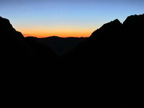
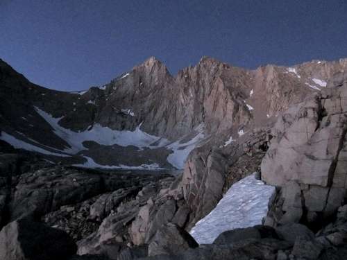
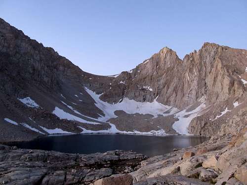
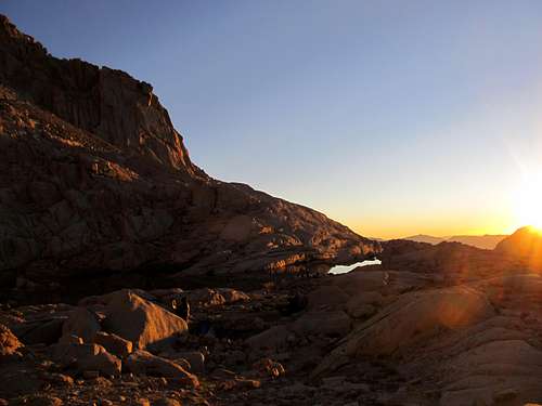
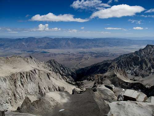
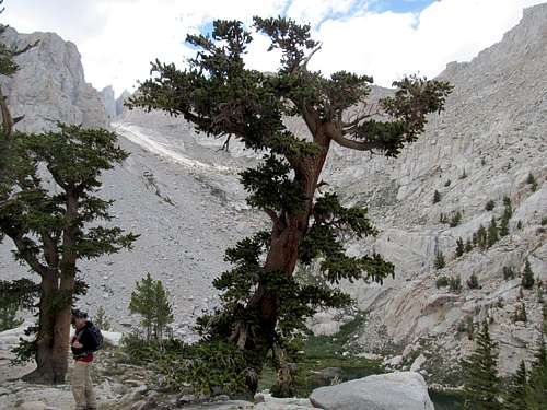
I had nary a chance to really notice or grasp the scenery around me the prior day, besides noting the pristineness of Lone Pine Lake and the tranquility of the meadows as one approaches Outpost Camp. I have had a few pre dawn starts before, but none under a bright moon, and as we packed up for the day I marveled at the giant surrounding cliffs glistening clearly under the moonlight. A flashlight wouldn’t even have been necessary, though we utilized one at times, as we made our way up towards Trail Camp. Jake was feeling better after a good night’s sleep, experiencing for now nothing more than simple exhaustion and the corresponding huffing and puffing. The sun rose before we reached Trail Camp, and I waited as Jake and Tony filled up and filtered their Camelbaks at a nearby creek. (John, unbeknownst to all of us, thinking that his water was still 2/3rds full, decided there was no need for a refill, even though this would be our last stop for water.)
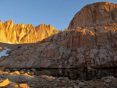
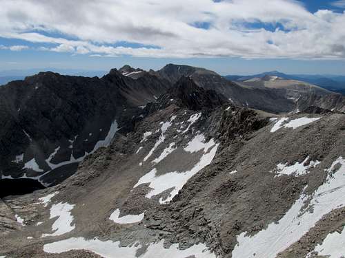
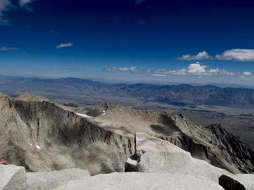
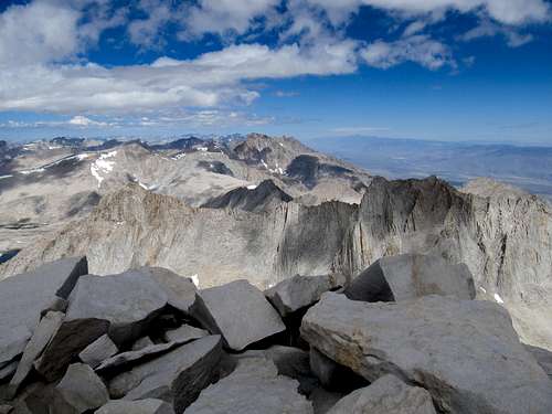
Behind us the sun rose over the Inyos, and I pointed out to John the far flung peaks in Nevada horizon that I had explored only three months prior. We were all awestruck when the emergence of Whitney, Muir, and the Needles at Trail Camp coincided with a fresh new dose of morning alpenglow. Even though this was their first taste of this uniquely alpine phenomenon, I think the enthusiasm of the rest of the group were dampered by the thought and sight of the 99 switchbacks leading up to the trail crest. Jake’s exhaustion was starting to return in full force, and the prospect of the next two miles was not appealing to him.
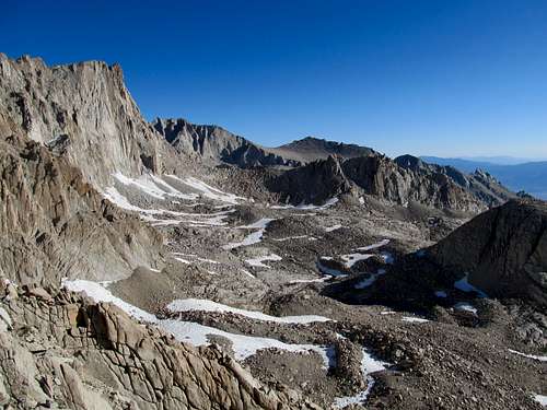
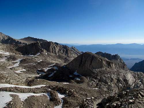
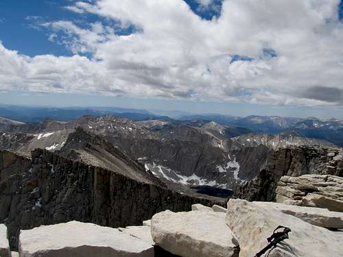
Nevertheless we trooped onwards and upwards. It was a few hundred feet above Trail Camp that the altitude really started to hit our party. Jake had been struggling for a bit, but it was Tony who first started experiencing some pretty bad headaches, and John and Jake soon joined him in that club. We were continuing forward for decent stretches but taking really long rest breaks, where once seated everyone lost the will to continue climbing. I decided that the longer breaks rather than overall speed was killing our time, and thus decided to change our tempo. I would run up a short section to mark a rest stop, wait for everyone to catch up, watch everyone drink some water and seemingly catch their breath, and repeat, while shouting words of (what I hoped was) encouragement. This process continued over and over again as the trainloads of people passed us on their progress up the switchbacks. Finally we appeared to near the trail crest. I ran up ahead to see how much longer we had (and get a sneak preview of the other side). The views were impressive, and I had hoped, as the rest of the group lugged down to this last section of the trail, that the views would provide inspiration for all, John especially, as seeds of today’s adventure were very likely planted years ago when he first glimpsed the ridges of the Great Western Divide from Moro Rock, miles and miles to our west in Sequoia National Park. But it was more exhaustion than wonder that settled in as we took a long (and well deserved) snack, food, and mental break at the saddle. I thought it would be time for a go no go decision for everyone; if Tony or Jake needed to turn back here due to sheer altitude sickness than no one would blame them, as they had already accomplished much hiking eight miles to over 13,600 ft. John however, since this was his dream, I would have pushed him, short of really severe sickness or vomiting, step by step, through hell and high water, to the top of the mountain.
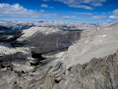
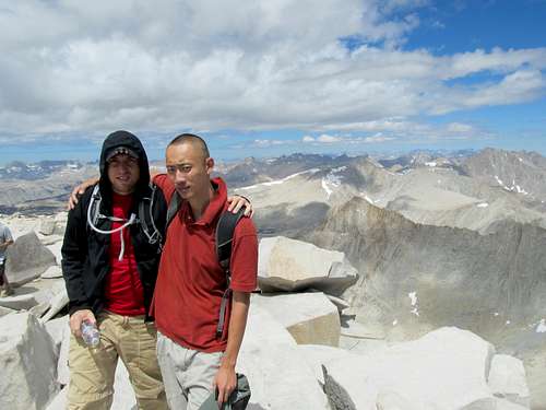
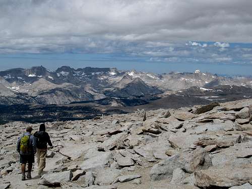
![The Crew at Trail Crest]() Trail Crest... Trail Crest... |
![Sequoia NP]() ...into the Sequoia NP backcountry ...into the Sequoia NP backcountry |
But after a good rest everyone wanted to continue on, at least to the descent and the junction with the John Muir Trail, before gauging how they felt once climbing resumed. It was not much longer past the junction when Tony decided during a rest break that he would turn back; he was not happy about this, because every part of his body, legs, back, lungs, felt fine, and it was only his inability to acclimate that betrayed his summit goal.
![Tony s 1st Goodbye]() Tony's 1st Goodbye Tony's 1st Goodbye |
![Onwards and Upwards]() lugging up the trail lugging up the trail |
We continued on, but as we passed above Tony on the next switchback we saw him get up and charge furiously towards us. The anger helped him overcome his pounding headache just to the point where he caught up with us again; then reality came crashing down, and we bode farewell to him a second time.
![Tony s 2nd Goodbye]() Tony's 2nd Goodbye Tony's 2nd Goodbye |
![Cairn marking Muir sidetrail]() Muir sidetrail cairn Muir sidetrail cairn |
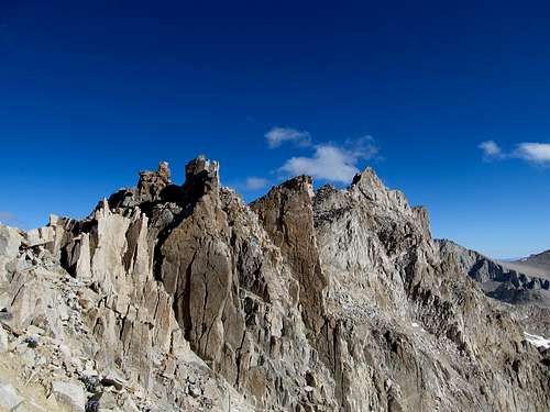
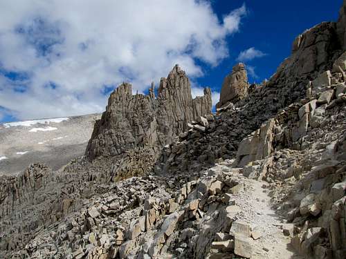
Both John and Jake felt better following the rest we had at the saddle. Going up a little further ahead on the trail I spotted a small cairn on the side and waited for them to catch up. It was here, as I watched them continue up, that our party split once again, this time for me to take a quick sidetrip up Mt. Muir, which I decided that I would rather climb now as opposed to on the way down. 200 feet of a scree scattered climbers trail brought me to the final summit rocks.
![Looking up from Mt. Muir splitoff]() Up rubble towards Muir Up rubble towards Muir |
![Upper Stretches of Muir]() Nearing summit block Nearing summit block |
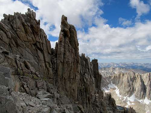
I have always maintained that California Class 3 is Class 4 anywhere else in the country, and I stand by this statement. Even browsing the climber’s log here on SP for Muir I see reactions ranging from “it was a breeze” to “I really wish I had a rope.” I started up first the rocks on the right side (further towards the drop-off of the east face) before coming to a stop. Knowing that I would need to come down what I went up, I faced a section that I knew, while ascent would be tricky but doable, descent would be more than sketchy for my standards. After deliberating a bit I retreated and started up the summit blocks further away from the east face. A few ledges later, and I came to what I now know is the traverse section. I first tried to climb the over the out-jutting block to my left, but soon realized that the move would be tough and, were I to lose control on a surface with few good hand or footholds there would be nothing stopping me from falling a good distance down and over the overhanging rock. Alternatively I then tried climbing up some ledges to the right, but what appeared to be a viable route from further away seemed a little sketchier close up; there still could’ve been a route, but it could’ve also cliffed out over the east face, so I decided to return and consider the jutting rock once more. I thought now about a traverse, tried putting my left foot around the rock, before, after some more consideration, finally unlocking the secret of the traverse: holding onto the jutting block with my hands while moving my feet across the steeply sloped but still solid rock below it.
![Down class 3]() Muir summit blocks Muir summit blocks |
![Muir Summit Blocks]() Muir summit blocks Muir summit blocks |
![Down Class 3]() Muir summit blocks Muir summit blocks |
![Muir Summit Blocks]() Muir summit blocks Muir summit blocks |
From there on it was only a few hops to my first 14er summit of the day on a rock smaller than a southern fried couch potato’s ass. I took pictures, waved in exhilaration to the crowd atop Whitney (perhaps John and Jake were among them already?), and shouted down to passerby's on the main trail 300 ft below (partly out of excitement, partly to ensure that they could hear me were I to take a slip on the descent).
Surprisingly, perhaps because I knew the way, I found the descent to have been easier than the ascent, and soon found myself bounding back upwards on the main trail.
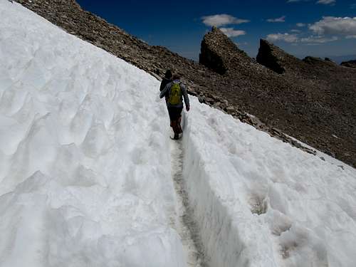
Though I hadn’t really broken a sweat all day the giant lump of Whitney still loomed large up ahead, and I did feel a slight, passing twinge of discouragement from the sight. Little did I know how magnified this feeling was for John and Jake at this same moment. I thought it possible that they were near or on the summit. As I approached a lone snowfield still covering the trail, with probably 300-500 ft of ascent remaining, I saw the two of them waiting for me. The altitude was too much, and they, looking at the task still ahead, the summit so close and yet so far, had given up, and John especially was pretty distraught at the thought of coming so close yet falling short of his dreams. But then they saw me in my bright red polo bounding merrily up the trail and decided, as they rested while awaiting my approach, to follow me up one last push towards the top. We crossed the small snowfield and grunted step by step towards the ever approaching summit, John and Jake fighting the throbbing pain underneath their skulls and toughing it out as they’ve never had before.
I saw a glimpse of the summit hut and shouted below the exciting news. John followed, but Jake just stopped. Apparently he had felt some major grumblings in his stomach even before we reached Trail Camp, but instead of taking care of his business further down he had held it until now, where, mere yards from the summit, he could hold it no longer. Jake wandered only a few feet from the trail, got out his wag bag not knowing he needed to liquefy the powder to activate the odor control, and dropped down into a prolonged squat while staring at the dozens of people passing him by enroute to the summit.
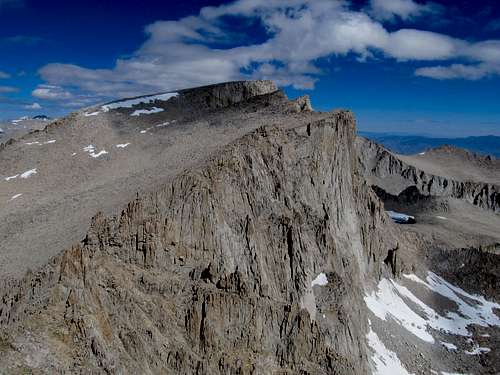
![Muir from Whitney Trail]() Muir from higher up Muir from higher up |
![Jake and John]() Jake and John approach Whitney Jake and John approach Whitney |
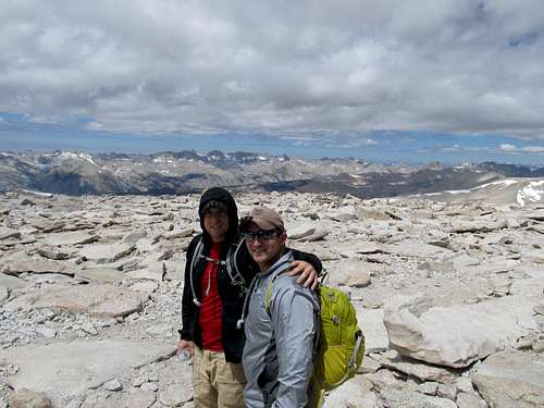
We stayed at the top for awhile, me taking pictures, John resting, texting his fiancée, and contemplating his dreams, his accomplishment and his migraines all at the same time.
We were starting to head back when Jake finally made it to the hut. I asked him whether he wanted to get to the true summit, and he said “why the hell not”, so we backtracked a few seconds back up the rocks. John and Jake gave each other a heartfelt hug only brothers could understand after a long, shared ordeal.
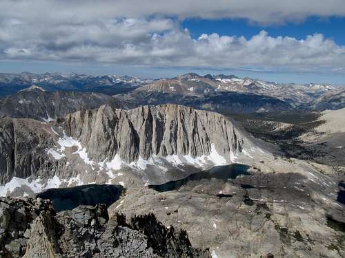
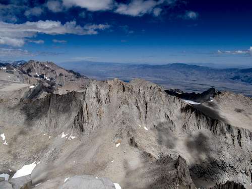
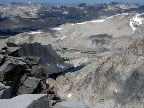
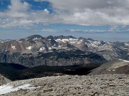
Both John and Jake felt much better the moment we started descending, Jake commenting that now he was finally able to enjoy, indeed marvel, at the views of the Great Western Divide, the Kaweahs, and the numerous little Sierra Lakes.
The two uphill sections still knocked the wind out of all of us though, while another slight problem presented itself. I’d been giving John bottled waters ever since the 99 switchbacks, where he ran out, and I’d been giving Jake water for the last stretch up as well. Now all three of us were out (I had one bottle left at camp), and while Tony had given us the wag bags before he descended back to camp, he kept the water treatment solution, meaning that we were out until we got back to camp as well. Still, the descent down the 99 switchbacks breezed by, and at Trail Camp I gave John what remained of my last bottle while I scrounged the last drops of the empty bottles in my backpack. We had picked up speed significantly on the descent, passing the people who had (deservedly) passed us going up. The last stretch to Outpost Camp dragged a little, and I didn’t remember the trail being so rocky on the night ascent prior, but the sight of Tony greeting us at camp with food, water and tents and everything else all packed up was a satisfying indeed.
(Along the way we had met a father and two sons, all either BYU alumni or students. They, being the nicest people ever, had brought too much food and, besides storing some in our bear canisters, told us to feel free to take whatever food of theirs we wanted, since that would give them less to pack out and down the mountain. They reinforced this when they bumped into Tony, and later the rest of us, on our descents, and Tony, stumbling into camp exhausted, took them for their word and then some, making two peanut butter & jelly sandwiches as well as discovering an odd fascination with their tuna fish. I myself, after subsisting on decidedly delicious granola bars the last day and a half, enjoyed some Reese’s Pieces and we all shared a bag of turkey jerky before heading down for the final haul).
John and I argued mileage while we trucked the last 3.7 miles back to the Portal. All of us tried to walk in front of Jake while he observed LNT principles to the hilt by hauling the full contents of the un-de-odorized wag bag down the trail. Things resumed their hectic pace. Peeps had already arrived in Vegas, and we had a long way to drive before we could commence dance partying. Arriving at our rental (unscathed by bears, by the way) we unpacked and packed again, then drove into town.
Everyone else but myself wanted to take a shower at the hostel. Having not really sweated all day, and not trusting public showers, I opted to postpone my shower until we arrived at more luxurious settings at our resort. After dropping them off I got some gas, some food, and was heading back to the hostel when I noticed the sun setting behind the mighty Sierras, Whitney among them, to my right. I recalled almost fifteen years ago, passing through Lone Pine as a child, gazing longingly at Whitney, what I knew even then as the highest (and in my naïve mind, the bestest) mountain in the US outside of Alaska. I remembered traveling through Kings Canyon and Sequoia and being disappointed that this mountain was not visible anywhere off the main tourist road. The distinct and memorable outlines and contours of the peak have stayed with me through the years, even before I actively started my summit chasing ways. I realized that Whitney had, in some ways, remained on my bucket list too all this time. The only difference is that it is but one of many summits on my list, which will hopefully and forever be an ever perpetual project.


Comments
Post a Comment