Page Type Page Type: Trip Report
Location Lat/Lon: 37.09040°N / 118.5069°W
Date Date Climbed/Hiked: Jun 30, 2008
Activities Activities: Hiking, Mountaineering, Scrambling
Seasons Season: Summer

Stats

Peak Name
CA Rank
Contiguous US Rank
Elevation
"Barrett Peak"
17
77
13962

Distance: ~21 miles
Elevation Gain: ~7000’
Time: 13:30

"Barrett Peak"

I camped at the South Lake Trailhead Sunday night. Monday morning, I hiked up to Bishop Pass, then continued cross country towards “Thunderbolt Pass”. The terrain was primarily small boulders and grassy slopes at first, but soon turned to talus, large boulders and snow. From “Thunderbolt Pass”, I traveled towards Potluck Pass by contouring high, but when past North Palisade’s southwest chute, the sand, loose talus and scree became unbearable, so I descended nearly to Barrett Lakes before continuing towards Potluck Pass. At this point, I could see "Barrett Peak" and was concerned that it would be too technical for me to free solo.
"Barrett Peak"

I thought to myself that I should have expected "Barrett Peak" to be difficult since the surrounding peaks were also difficult. I had no route beta and was simply taking the easiest way the map suggested. I started gaining the south ridge of "Barrett Peak" before reaching the pass. The slope was sandy, then became talus and larger boulders. The view of 12968 above Potluck Pass was great.
12968

As the ridge made a turn towards the northwest, there was more exposure on both sides and route-finding became more difficult. In addition, the quality of the rock was poor. I had to test many holds before trusting them. The view of Palisade Crest from here was great.
Palisade Crest

I first stayed to the southwest side of the ridge, then switched over to the northeast at a small notch. I then downclimbed some class three rock into a southwest-facing gully, then back up the gully towards the summit area. The climbing got more difficult and steeper, so I downclimbed to a notch on the northwest side of the gully and investigated the northeast side of the ridge. By now, the winds were blowing hard and continuously. A short downclimb and traverse led to a primarily solid pitch of easy fourth class rock to another small notch. I climbed to the southeast to find that the summit was to the northwest. I climbed northwest to the summit. The views of Polemonium Peak and Mount Sill were enjoyable.
 
Mount Sill

I wasn’t too surprised to find a summit register but was surprised by the 30 or more names since the 1970s. I considered heading down a prominent southwest-facing gully northwest of the summit, but decided to retrace my ascent route to avoid making a long day an epic. I found some easier terrain by descending directly northeast off the summit, then traversing back to the fourth class pitch. I followed the ridge down, but got on the west side of the ridge too soon and found myself climbing over ribs to get to easier terrain. With careful route-finding and patience, the south ridge is no more than fourth class, perhaps easier routes can be found from the north. On the return, I dropped nearly to Barrett Lakes, then ascended to “Thunderbolt Pass” instead of dealing with the loose, higher ground.
Map


Comments

Post a Comment
Viewing: 1-5 of 5
peninsula

peninsula - Jul 8, 2008 9:33 am - Hasn't voted

Blue Sky

Good to see you had smoke-free skies. Dusy Basin is a beauty. Congratulations on your success.

Brian Kalet

Brian Kalet - Jul 8, 2008 1:17 pm - Hasn't voted

Re: Blue Sky

Thanks!

orandall

orandall - Jul 8, 2008 12:07 pm - Voted 10/10

Great pictures

Good job. It's great to see some of the non-name peaks get exposure.

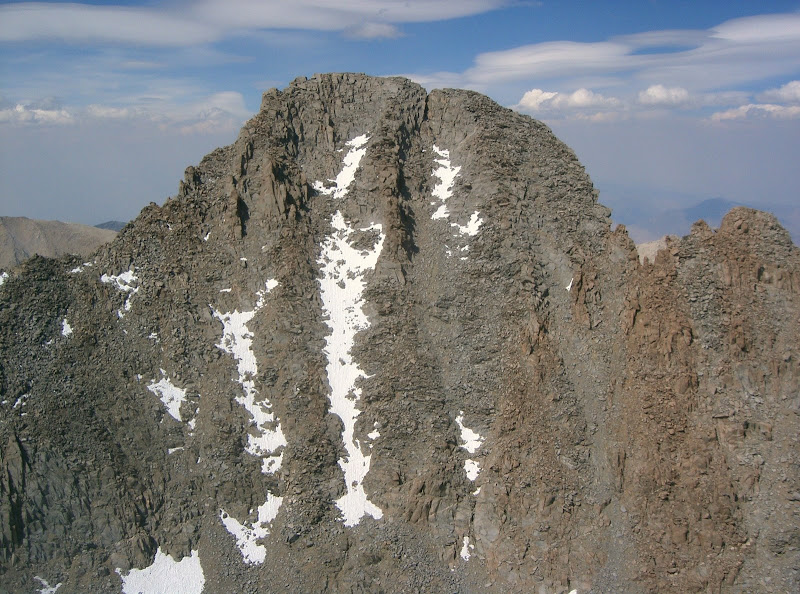
Did you see much snow in the chutes of the Palisades as you passed below?

Brian Kalet

Brian Kalet - Jul 8, 2008 1:19 pm - Hasn't voted

Re: Great pictures

Thanks.
I didn't notice any snow in the chutes of the Palisades.

Dave K - Jul 10, 2008 4:07 pm - Voted 10/10

Nice!

I've considered climbing this one for awhile.

Viewing: 1-5 of 5