Scott & Crater Lake - October 7th, 2014
One of the more memorable books I read from my childhood The Talisman by Stephen King which, stripped of its fantastic and supernatural quantities, amounts to basically your classic young male adolescent coming of age tale. It follows the protagonist from the then rustic seacoast of New Hampshire across the country and ending in a dystopian mansion overlooking California’s Redwood Coast. Despite the fantastic brushes King painted his landscapes with, his descriptions of this lost coast, a place out west similar to, perhaps in some ways acting as a bizarro New England, left an indelible impression on me. That and the Oregon Coast became somewhat of a holy grail for me, and throughout my three years out west I yearned to explore this land whose mysticism grew by the day as it festered in my imagination.
But the Pacific Coast always remained out of reach, especially with my focus on peaks and my lack of taking anything more than a three day weekend for peakbagging purposes while living in Utah. But as I made my plans to move back east and climb and travel beforehand, I was dead set on seeing the Oregon Coast before I left, ever thinking how it would serve as the perfect finale after years, months, and weeks of travelling and going after peaks with varying degrees of intensity, hoping to still capture some of the magic lingering in my imagination after all these years.
I was tired, so fucking tired. Months of travelling and peakbagging mixed in with a few bachelor parties/weddings/cross country trips had worn me down. Driving north after a failed Lassen excursion (damn trail closures) I hoped to salvage what remained with as little mental cost and physical effort as I could.
With two buddies flying into Salt Lake in a week or so to move me back east, I needed to pack in as much as I could of the PNW must-sees. I had originally figured I could try to get in Adams on my two months plus off, but the injuries and other plans cutting in meant that I needed to take Washington entirely out of the picture. What remained was Oregon…Crater Lake was a must see, and I needed to get one good last peak accomplishment out of the way in South Sister, probably the easiest of the major coastal volcanoes yet still a significant effort with 5000 feet of gain required. Then, with my last major mountain out of the way, I looked forward to unwinding the rest of my time here, driving the length of the Oregon Coast drinking, eating, doing basic sightseeing, and maybe getting an easy coastal peak or two in.
One persistent dilemma plagued me up from Lassen as I tried to work out the timetables in my head. Near the southern end of the Coast I could pivot east and try to get some of the peaks near Ashland (Ashland, Brandy), etc. Or I could continue down and see the Redwoods, something that’s always been high on my secondary, basic betch-oriented non-peak bucket lists. Coming into Klamath Falls I was leaning towards the Redwoods, seeing as Ashland and Brandy were basic hikes I could easily put off for another day (year(s)).
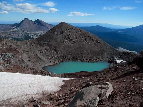
I was more than happy to sleep in early in Klamath to get a head start the next morning. The goal was to check out Crater Lake, drive around the damn thing, hike Mt. Scott, the lake/park’s easy highpoint, then head up to Newberry Volcanic National Monument, check off Paulina Peak, a busted volcano drive-up summit, maybe see a bit of the monument proper, you know, volcanoes ‘n shit, before doing up the city of Bend in preparation for South Sister the next day.
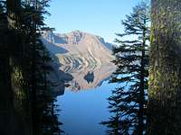
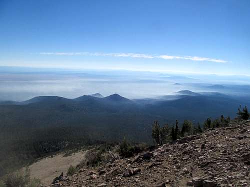
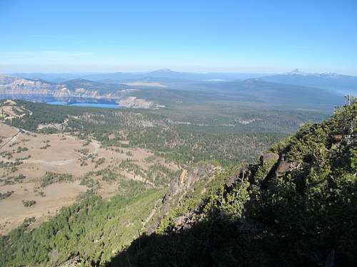
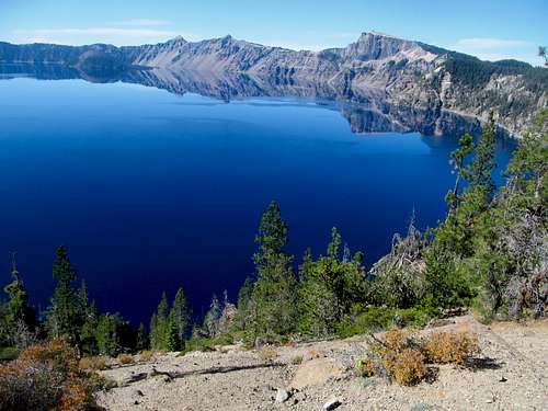
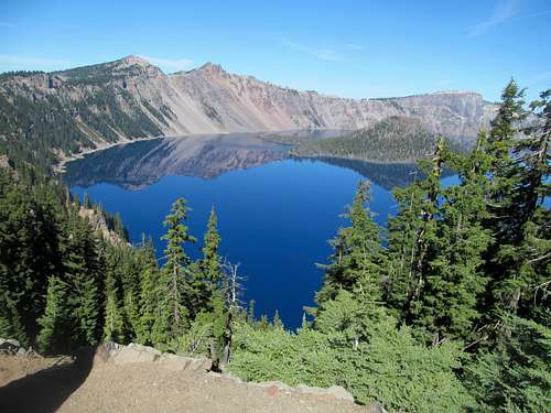
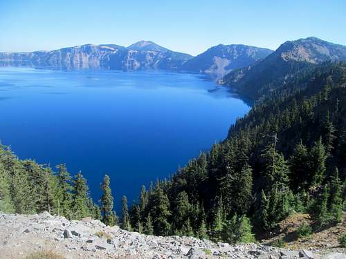
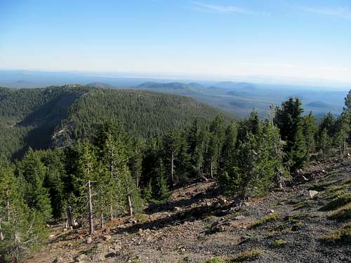
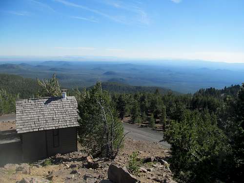
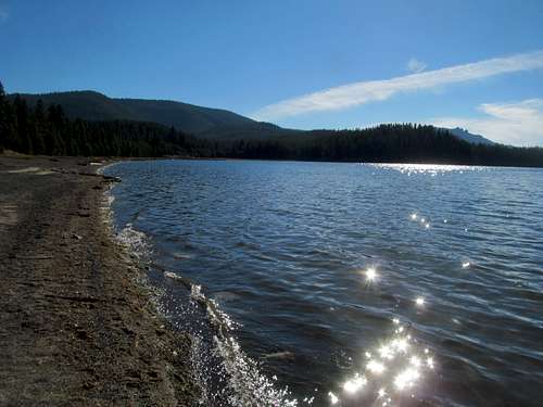
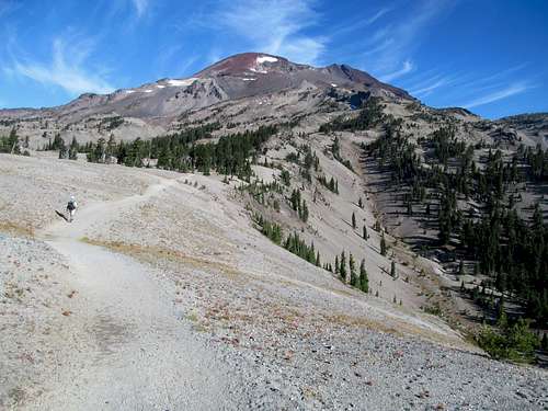
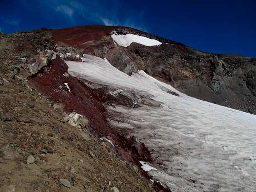
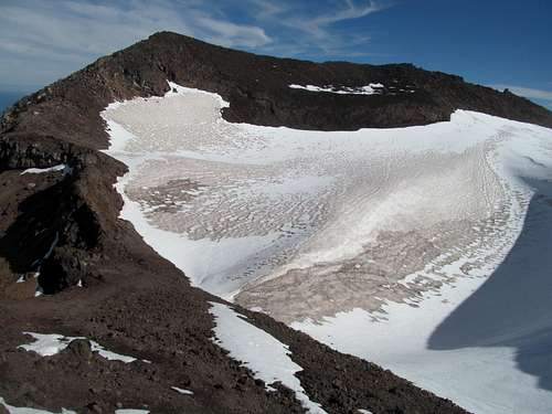
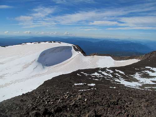
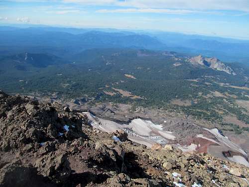
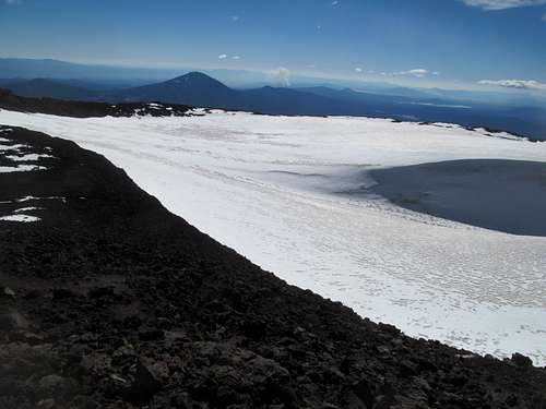
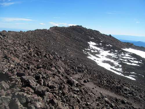
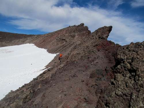
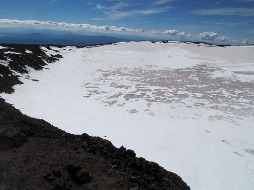
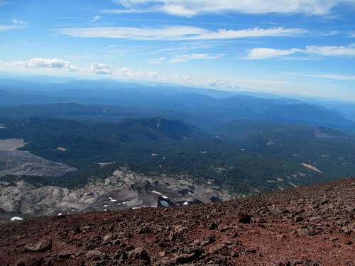
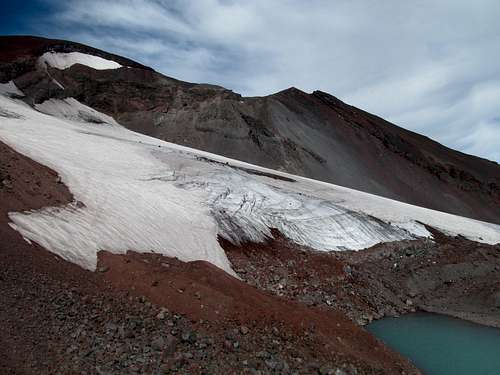
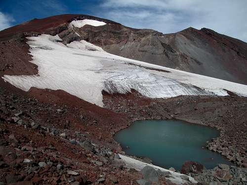
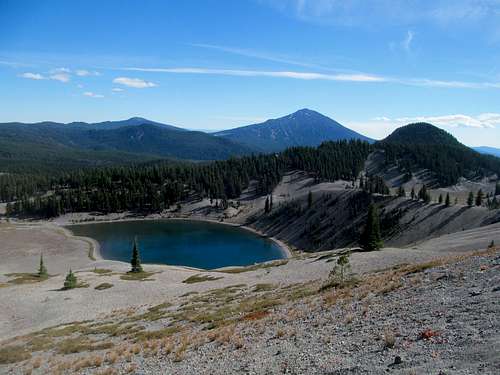
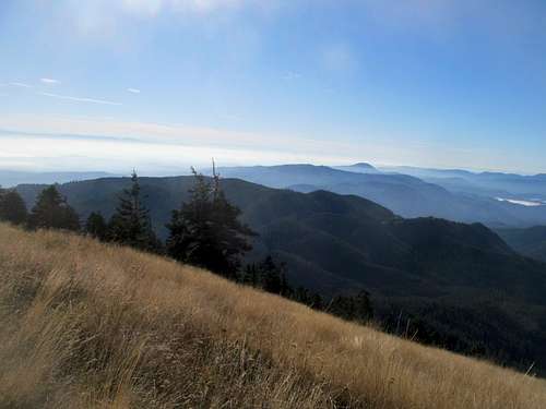
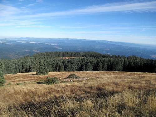
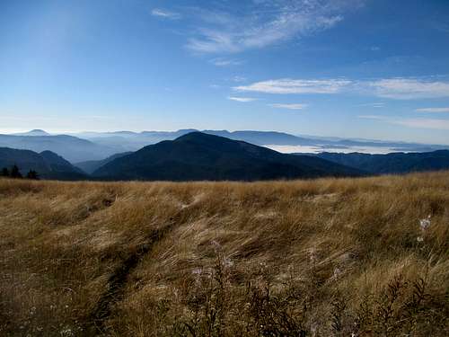
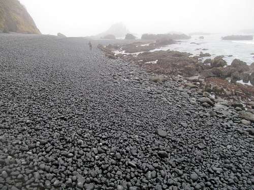
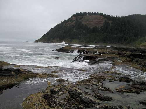
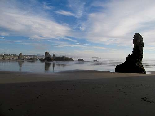
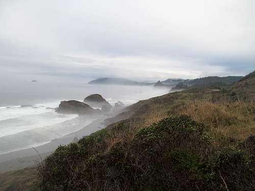
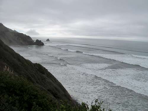
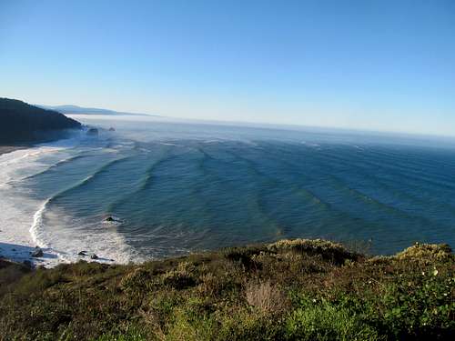
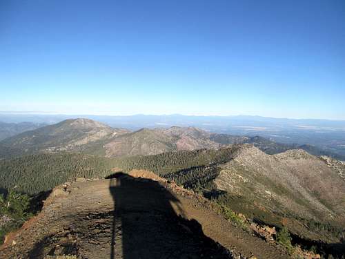
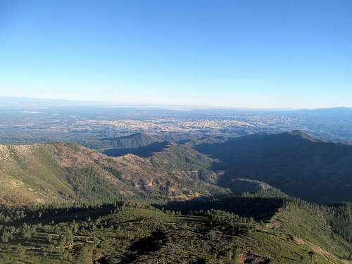
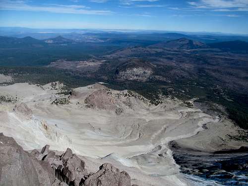
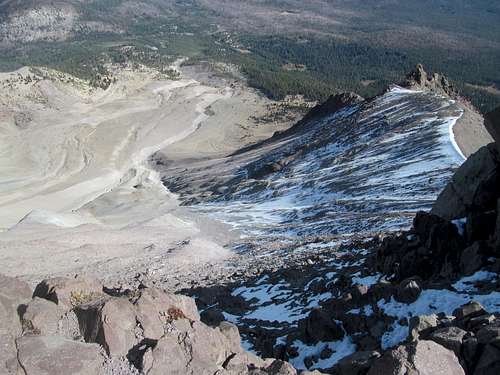
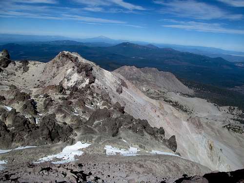
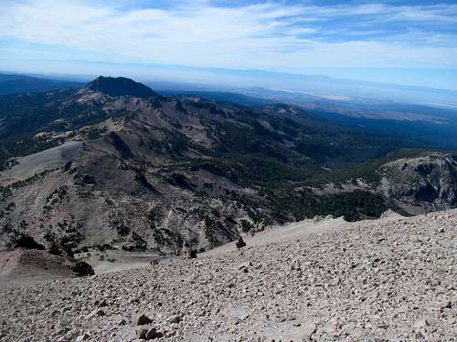
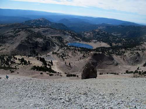
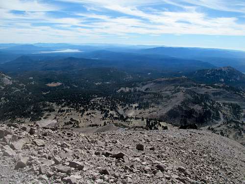
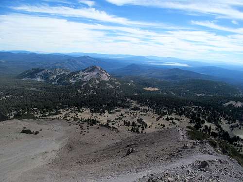
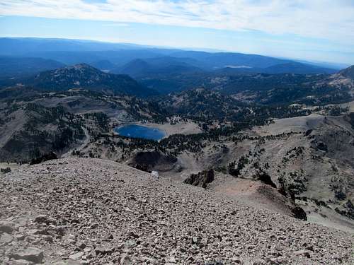
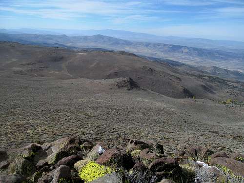
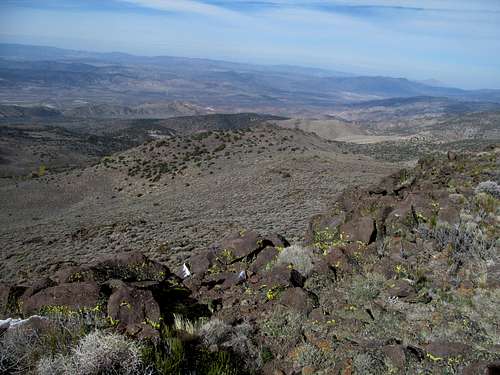
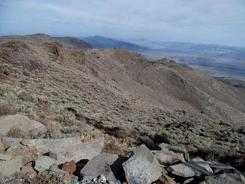
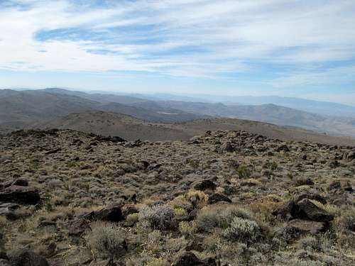
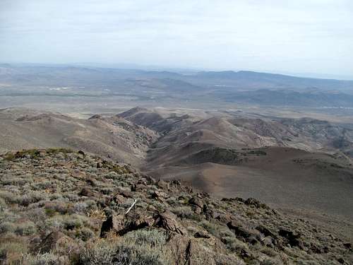
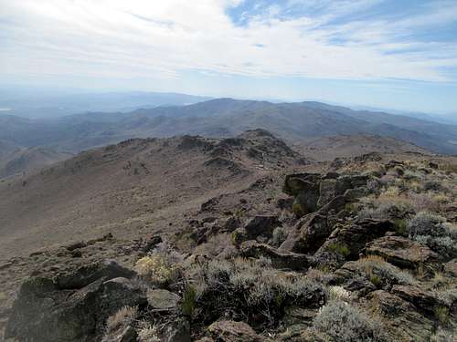
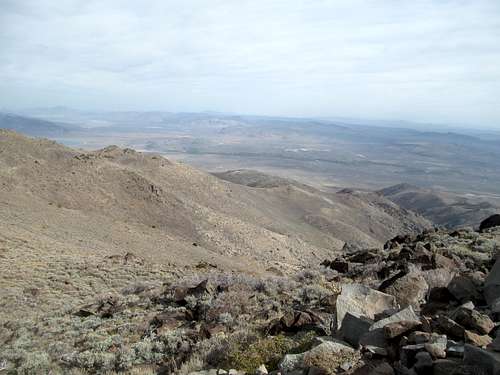
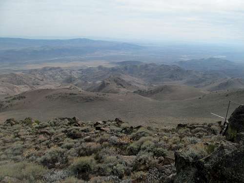
I drove through the wooded southern end of the park richly anticipating the spectacular. It took awhile, as the first overlooks only offered partial, tree obstructed glimpses of the lake, but eventually I made my way to better viewpoints the closer I got to Scott.
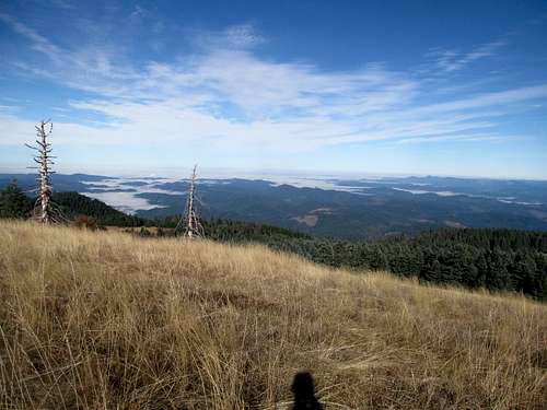
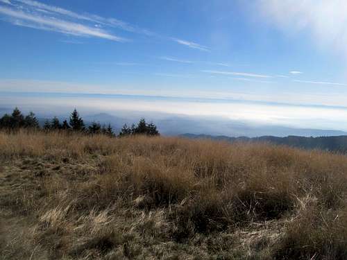
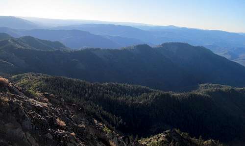
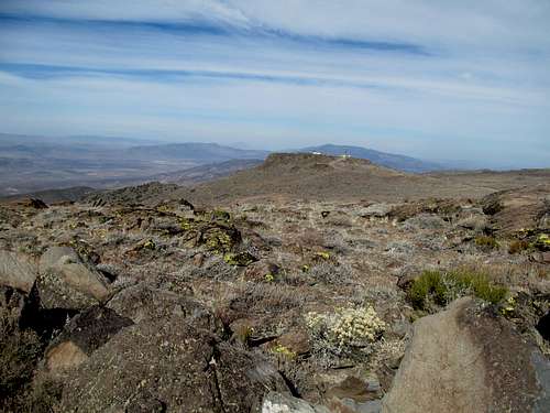
I found room at the busy trailhead and started up, passing through a broad meadow below the west face of Scott then switchbacking onto its backside. I passed several hikers and was passed by one en route to the lookout tower. Most of the hike was gracious enough to allow me expansive views of southeastern Oregon transition zone between Cascade conifers and the outback.
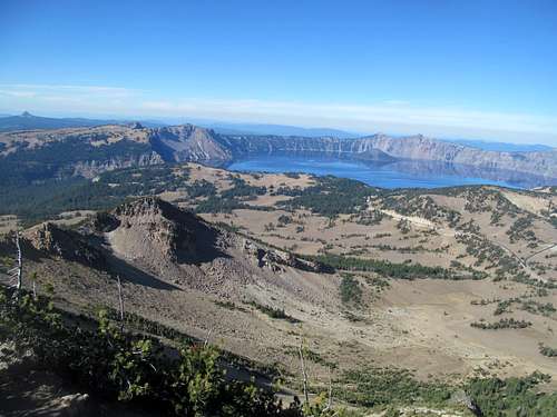
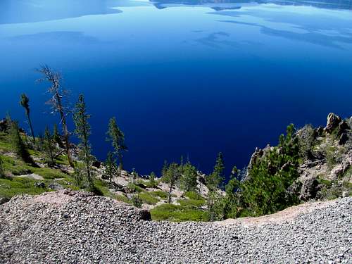
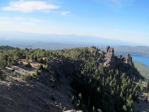
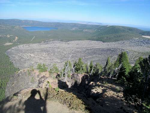
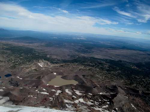
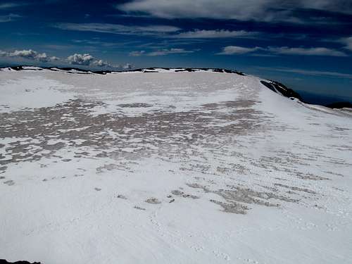
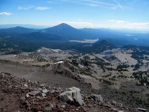
I ambled around in my crutches dodging the myriad of tourists at the summit. After taking plenty of pictures of spectacular Crater Lake I walked back to the car in short order.
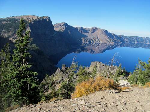
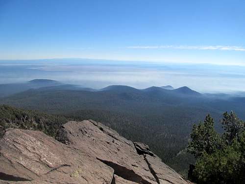
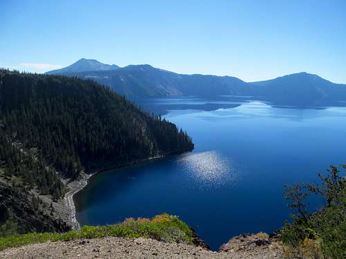
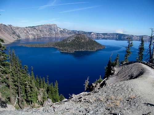
With plenty of basic betch tourist left to play for the day, I made my way up the east and northern rims of the lake, taking care to check out all the viewpoints and gauge each vantage point the lake.
As spectacular as the national park was, I found it to be surprisingly small. Maybe the park felt a little cozier than most due to the fact that you could see across it from one end of the park to the other in most points.
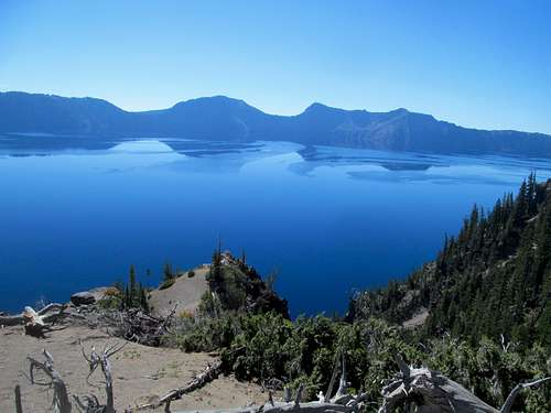
I continued down to the Rim Village Visitor Center and took one last walk around the guardrails before turning back and leaving the park via the north entrance. While I was glad to have checked Crater Lake off my list, I was dismayed at how easily it happened. I would definitely visit again, and next time to check out other park hikes (Llao Rock, the Watchman, etc), maybe take a ride to Wizard Island, but part of me was disappointed by the fact that any future trip I took would essentially be the same shit...driving around and gazing at an admittedly exceptionally blue lake.
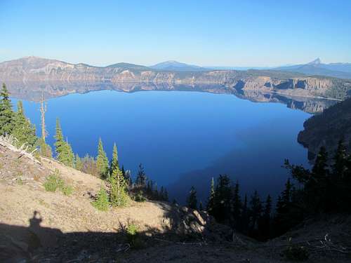
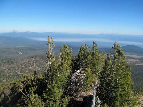
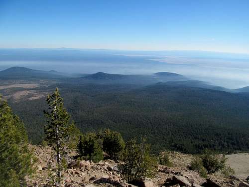
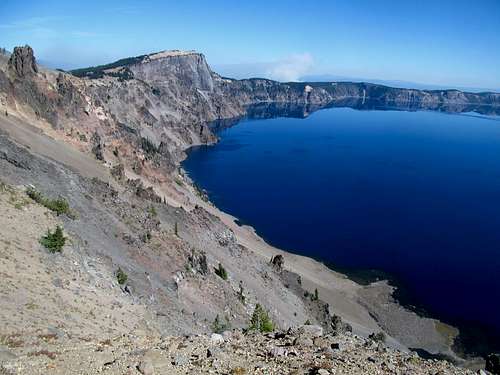
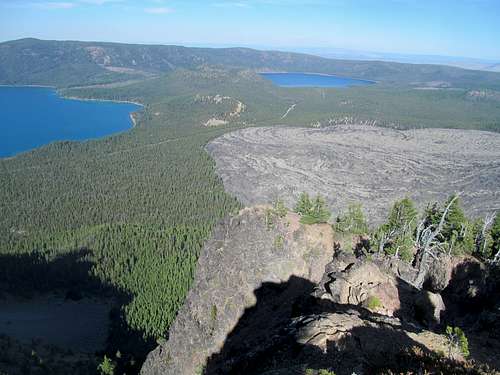
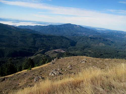
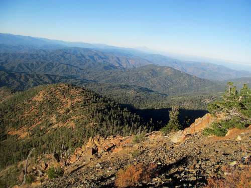
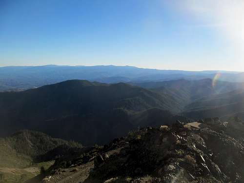
Thielsen was burning. That's what I saw at least from Scott and various viewpoints along rim drive. I drove through the smoke en route to US-97 and proceeded on the second part of the day, gassing up on fuel and Taco Bell in la Pine before pulling off into Newberry Volcanic National Monument east of town.
Parlaying Paulina - October 7th, 2014
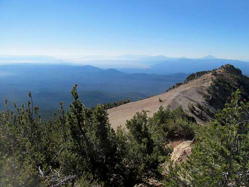
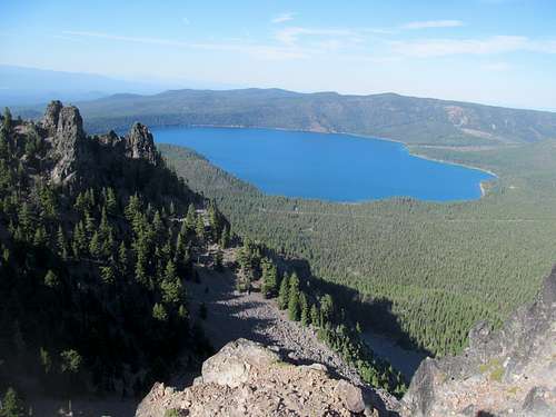
I had already stretched out my legs on Scott for South Sister the next day and felt no urgent need to over exert it doing a road walk up Paulina.
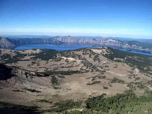
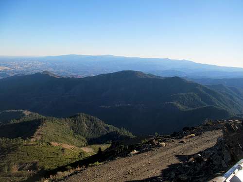
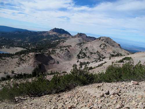
Justified in driving it, I enjoyed the views from this major P3K drive up of a Cascade Volcano, the views of the Three Sisters in the distant enough to remind of my impending goal.
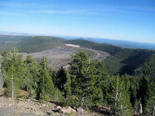
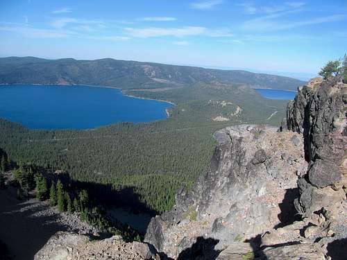
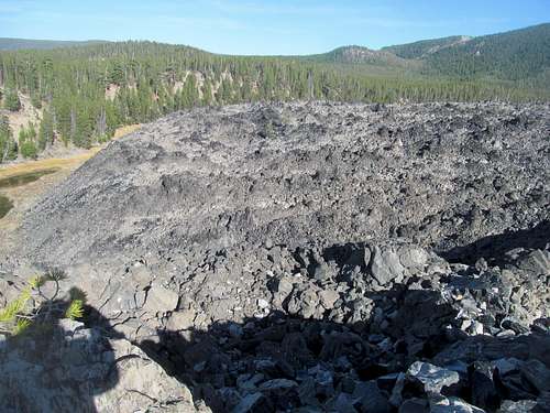
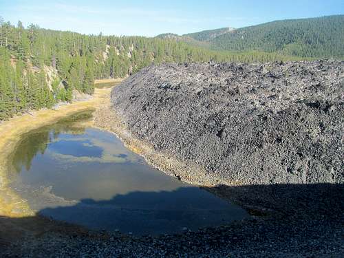
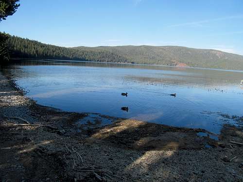
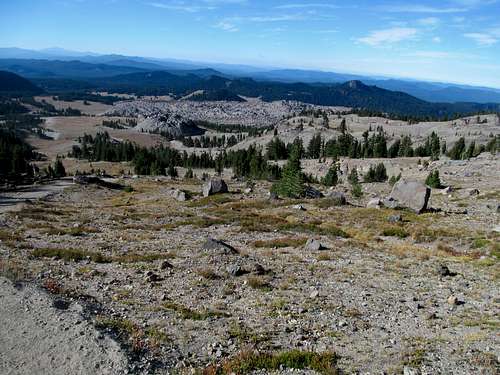
I took a quick loop hike up into the Big Obsidian Flow, a unique volcanic feature along Paulina's northern flanks, then drove down to touch the waters of East Lake before doubling back to take in some last views of Paulina from its namesake lake.
My 2014 Drew Bledsoe Tribute Tour continued. Having already stalked his sports bar hangout in Whitefish Montana, I now pulled into his favorite winter ski resort in Bend. Despite two summits and two national monuments already in the bag I still had plenty of daylight left. Grabbing a Bend Ale Trail pamphlet at the motel check, I was amazed by the amount of breweries in town, something like 11! Obviously I had to check out Deschutes downtown, then wandered over to the Bend Brewing Company, where they had an amazing happy hour deal...something like Locals' Tuesday, with 2 dollar drafts. The best thing was their loose definition of "Local" (ie anyone who shows up), so I enjoyed a few more excellent brews along with the baseball playoffs.
South Sister Finale - October 8th, 2014
...nothing too late though, as Wednesday meant the most strenuous peak of this entire damn trip. I couldn't let 3 years out west go by without climbing a Cascade Volcano, an PWN Ultra, and have a 10,000 foot peak in every state. South Sister fulfilled all three of those criterias, catapulting it to the top of my PNW to-do list. (I had originally planned on pre-car accident for Adams in Washington to check off the 10er list for all the western states, but the schedule scuffle caused by my rehab compelled me to take that off the list).
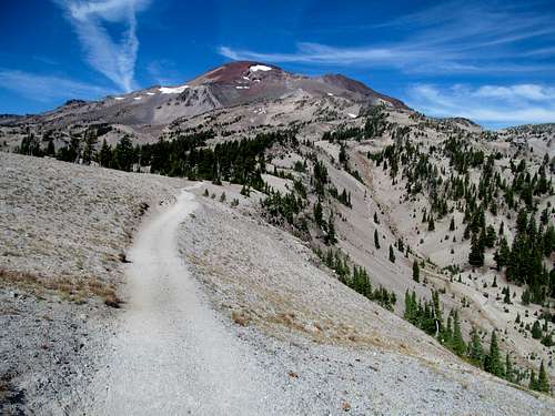
I woke Wednesday morning with the faint acceptance that my extended summer had finally given way to winter’s impending clutches. The morning air was the coldest for me in a month, since the Homer Youngs trailhead, though I knew I had a beaut of a clear and sunny forecast in front of me. Frost lined the windows of cars parked at the Devil’s Lake trailhead following a most scenic approach road from Bend, my goal looming above the highway, but the trail gained elevation early in such a convincing manner that my early morning chills were a thing of the past after a few switchbacks.
This was the steepest part of the climb and while I made pretty good time, I noticed a kid behind me keeping up, gaining ground ever so slightly when we both walked, and even more so when I had to stop to retie my bootlaces or take off and stash my windbreaker now that I had broken out a sweat.
He passed me just before the trail left the lush rain forests and ascended into an open volcanic plain below the south face of South Sister. Here the trail seemed to turn into a broad, well-manicured interstate.
I caught up with the other hiker, and learned that he had just finished a thru hike of the PCT a few weeks prior, and South Sister was a re-warmup for him after a few weeks off.
We talked mountains and outdoors the rest of the way to the summit as gradually the trail got crowded with groups of backpackers starting the second leg of their trip from the flats to the summit. Both of us were relatively fast and made good pace together, passing most parties on the way up and greeting a few that were on their way down.
The trail started getting steeper with a couple of loosey sections. It’s here where the difference in experience between the kid (it’s been so long that I forget his name, unfortunately) and I showed. He was probably outpacing me slightly on the lower, steep section of the trail; he described how the PCT usually traveled at a reasonable gradient rarely more, according to his calculations, than 600 feet gain per mile, which to him was average…aka anything below that was easy, and anything above was steeper. For me the difference between a reasonable gradient and steep was 1,000 ft. per mile, where anything up to that point meant a good workout but still easy enough to allow for steady inertia with need for very few breaks. As the terrain got a little more choppier with rocks and shit my experience on backcountry scree and scrambling seemed to gain an advantage as I paced up the rocks and around the crowds, surprising for a casual Wednesday afternoon, with little difficulty while the kid was starting to slow down a bit.
I say this not to try and be a hardo or anything. Obviously being a dude you’re always comparing yourself to other dudes to some degree, but mostly it was interesting to me how different types of activities and experiences, thru-hiking and backpacking, vs peaks and trailless travel, yield different advantages in different circumstances for those versed more in one or the other.
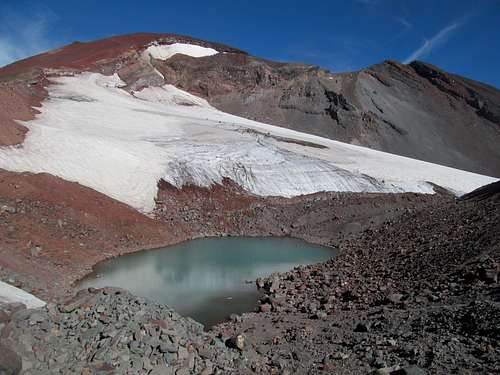
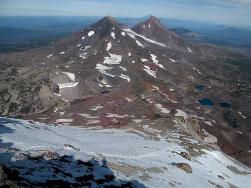
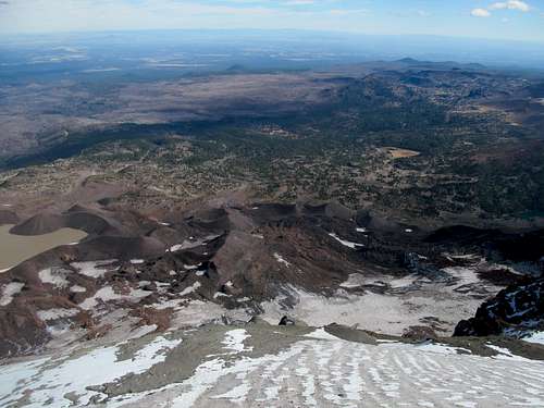
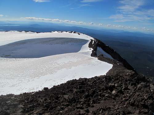
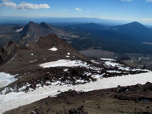
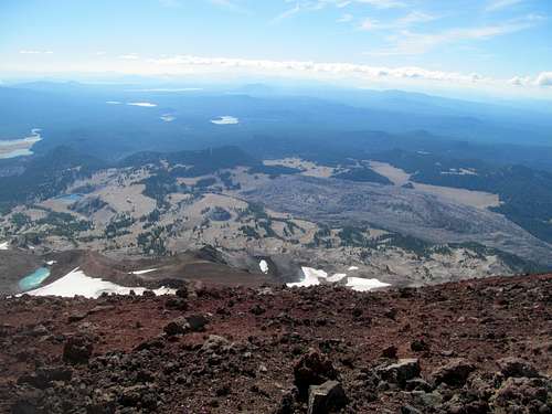
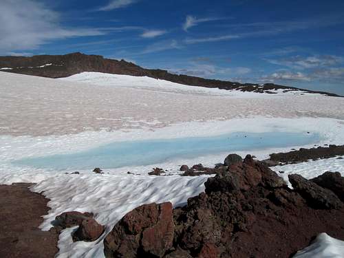
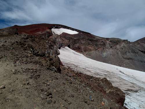
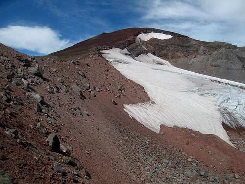
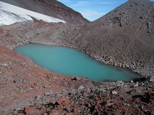
For me personally, this was my first true blue PNW experience, and I was blown away by the magnificence of the sheer volcanic magnitude represented by South Sister and imagined that other peaks such as Rainier or Hood could only be similar in magnificence yet much larger in scale (and more heavily glaciated). Seeing certain geographic features for the first time with mine very own eyes, I was already starry eyed before cresting at the small saddle at the bottom of Lewis Glacier and my first experience up close with a glowing emerald glacier tarn sitting at the foot of the glacier and below the trail. Above, I studied the contours of the ice melding seamlessly into the red dust of a landscape suddenly turned alien and Mars-like.
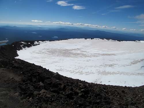
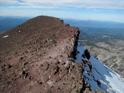
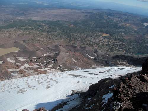
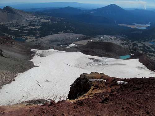
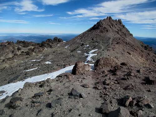
The last 600 feet or so up the mountain was a steep huff up loose red volcanic ash, but wasn’t too bad for me since I slowed my pace a bit as the kid made his way up to the summit rim. Here the true summit was still a ways away, separated from us by more virgin sights for me…a vast volcanic caldera snowfield and cornice.
We traveled through and around this delightful snowfield to amble up on some more loose volcanic rock leading up to a small perch, which accounted for the actual highpoint.
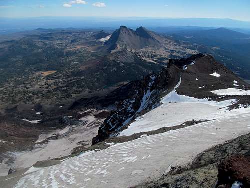
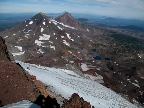
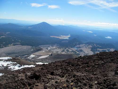
The views of Middle and North Sister, as well as Hood and unforgiving Jefferson further beyond, alternating pockets of snow, scree, ash and lakes of all sizes and colors, were beyond mesmerizing. For me, years on mountains usually yielded long ridges, chains, cliffs, etc…all spectacular, but the monolithic nature of these Cascade Volcanoes, different, even alien from what's typs for Rocky Mountains terrain, is tough to imagine until it strikes you for the first time.
The kid reminisced about passing through here months ago on the PCT…he described the terrain below circumventing the Three Sisters as pretty dry, rough and dull on the thru-hike itself. He also described how he had to take a break near the end of the thru hike, having suffered a severe flu and needing to recover for several weeks in Portland before resuming and finishing at the Canadian Border.
I could relate somewhat as we compared experiences. The PCT had been an all-consuming and life changing experience for him; the journey coming to an end had left him driftless, bored, looking for something to do…thus South Sister this day. I compared it to my three year journey in Utah, from one peak, one trailhead, one weekend, one state to the next, now coming to an end. Sitting at the top of South Sister was literally the exclamation point to the conclusion, and the rest of my trip in the PNW what I hoped to be a nice relaxing wind-down to my last week out west. At this moment in time I was satisfied with the journey yet most fatigued from it already. A huge part of me felt a huge relief having surmounted my last real climb, real challenge, and cheered in the thought that I could rest and relax in the coming days, weeks, and months. And I wondered if I would feel the same way after the journey…would I miss the purpose, the goals, the satisfaction of being in the middle of a work in progress? Part of the reason for moving back east was for me to see how I would answer those questions.
Another gentleman joined us on the summit. Somehow talk turned to Drew Bledsoe (of course!). Maybe I had mentioned stopping through Whitefish a few weeks ago…I forget. But the guy, who worked seasonally at a resort down in town, mentioned how my childhood idol often stayed at his resort when he was in town...yet another near miss with Drew!
I ventured southwest along the summit rim to get some additional glimpses and views, including down the peak’s steep and icy north face. I returned to the main summit, now filling up as more and more with the various parties we passed by started arriving at the summit. The thruhiker kid was content to chill and keep enjoying the views, but I had a long day yet ahead of me, so I bade him good luck and started my way down.
The hike down was conducive to running and jogging, though I stopped at various points to chat with fellow hikers, many of whom were perplexed by my use of a single remaining crutch as a souvenir of my fairly recent rehab. I encountered a crew of young bros, one of whom was merely weeks away from enlisting in the military and starting basic training. I thanked him for his service in advance and continued hiking down feeling just a little better about my country.
I lingered a bit at the saddle below the glacier to get one last glimpse of the ice and lake, then continued the relatively easy downward hop back to the plateau. This stretch was long and a bit hot under the afternoon sun, but views of Broken Top were just as outstanding if not more so than the morning’s.
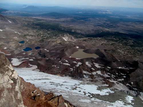
Somehow I had not noticed Moraine Lake on my way up, but its sparkling blue waters certainly caught my attention on the way down.
One last steep stretch and I was back at the car feeling a sense of closure and relief.
The constant chase for summits over the last three years, often at the expense of other things in life, had taken a toll on my psyche. I was burnt out from mountains but knew that I needed to make my last two months climbing count in order to justify a move back east, leaving only brief trips in the summer to satisfy those urges. South Sister marked an end to that era, as my last stress inducing big peak I had to fuss and worry about. I was ready to coast through my last few days on the road and enjoy the PNW’s more basic tidings.
Thus, despite flirting with thoughts of getting Diamond Peak en route to the Coast at the expense of the redwoods, I passed its trailhead with some regret driving through Willamette Pass. The scenery was spectacular and the long, gradual forested denouement down the mountains to I-5 consciously symbolic of where I was in life.
Mary's & Oregon Coast - October 9th, 2014
Once more I felt the relief of being back on the Interstate, arriving in Corvallis in the early evening. I was exhausted but ready to binge, hitting up a small bar outside my motel. It proved to be a delightful experience chatting with the bartender and the patrons, and as a perfect example of some of life’s unexpected pleasures, was highlighted by the bartender's decision to put on South Park so that the entire bar could laugh outrageously at one of the show’s most bizarre masterpieces (the Randy Marsh/Lorde episode).
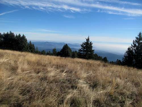
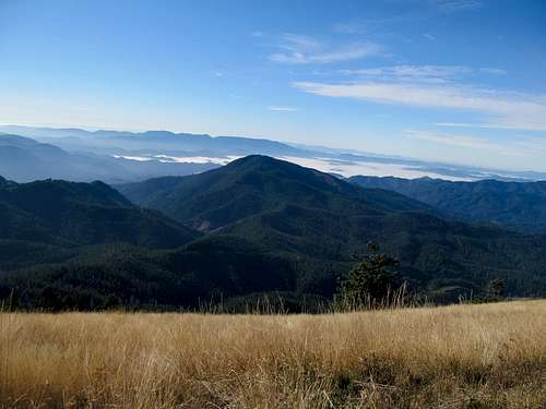
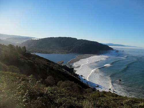
The reason I picked Corvallis was because of its striking distance to Marys Peak, which would be a nice and easy driveup en route to the coast. The highway west for Corvallis quickly turned rural, and I passed several small villages before the turnoff for the peak, following a very good if windy road, past a pretty roadside waterfall, to parking area below the summit.
You still have to walk a hundred feet or so up to the top, and I did, enjoying the views of the fogstrewn inlets below.
I had great views of the lush green hills in this corner of Oregon but could not see the ocean itself, a harbinger for the rest of the day.
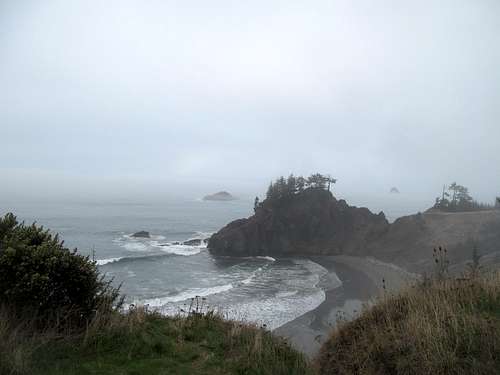
Back down, I could have followed US-20 directly into Newport but my goal was to drive as much of the coast as possible. A few years back I had visited Cannon Beach and Astoria with some friends, and I hoped to follow up the end of that trip by starting my coastal drive south from Tillamook. Thus, I took a long array of small highways north and west before arriving in town, where I enjoyed lunch at the Pelican Brewery.
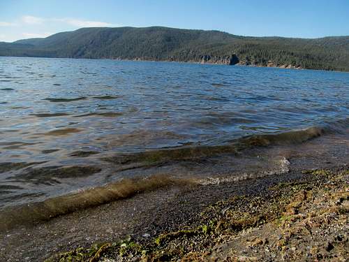
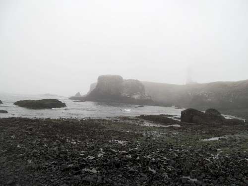
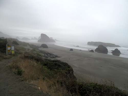
Full speed ahead towards the coast, the goal, what I envisioned as the catharsis of this trip, if not my entire tenure out west…yet after driving past sunny fog lined hills I finally arrived at the Pacific to see…nothing. Nada, zilch, zero views except for one of the densest fogs I had ever experienced.
Not that fog was entirely unexpected…my last short trip to the coast had been on a gray, foggy day, and I knew about how the shore always held an entirely different microclimate from even a few more miles inland. But while I was fine with a little doom and gloom, I hoped to at least see the ocean when standing on the beach…a pleasure not granted me at this time.
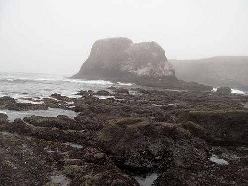
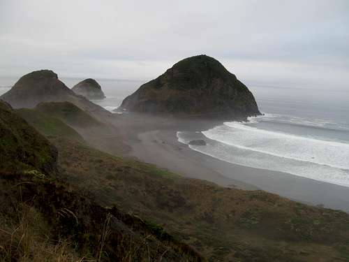
Further down the shore, I stopped by the Devil’s Punchbowl scenic area. I could see the namesake rock formation, if not much else, but luckily I noticed a small winery after leaving the visitor center and enjoyed a quick tasting there.
The fog relented just slightly by the time I arrived at the Yaquina Head scenic area. Well no, the lighthouse still looked damn scary and Stephen King/New England-esque amidst the mists, but the black rock beach below make for delightful exploring, and I chatted with a ranger who was also a fellow Masshole like myself.
I found a cheap spot to crash in Newport, a city I chose partly due to the presence of Rogue Brewing. I went to their tasting room/pub for the night, enjoyed the most delicious beer and chatted it up with a motley crew of tourists all passing through, like me, from places near and far. The pub, located in the historic downtown waterfront, also functions as a bed and breakfast, and according to rumors a weary lodger could expect to arrive in their room with a complimentary sixpack on their bed. Not that there aren’t serious contenders, but I still rank Rogue’s Newport bar my favorite brewery visited (as of this writing around 70 and counting).
Oregon in Perpetua - October 10th, 2014
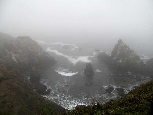
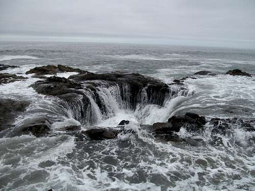
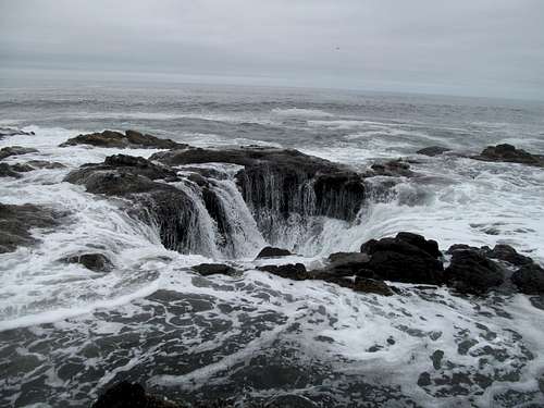
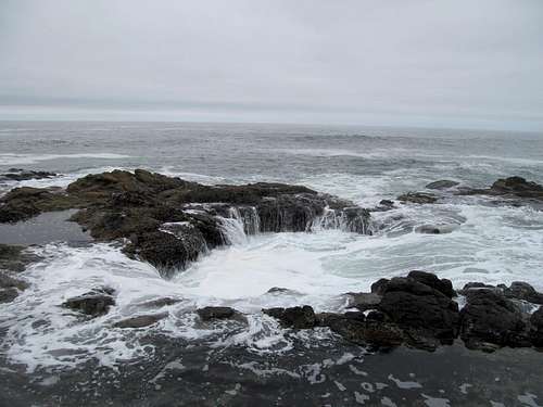
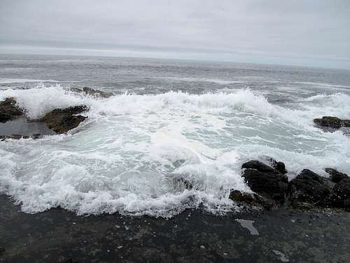
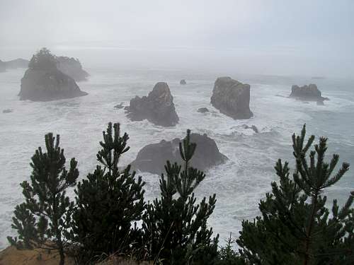
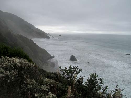
I got a tip from one of the pub goers travelling south to north along the shore about Cape Perpetua south of town…how it was the highlight of their trip so far. They showed us pictures of Thor’s Well, a fascinating “sinkhole” in the ocean that wasn’t advertised or well known…that was shockingly still a local’s secret in this world of instagrams and top 10 places in Oregon to smell a starfish queef clickbait lists. I made it a point to check out Cape Perpetua Friday morning after a quick morning walk on the beach near Seal Rock.
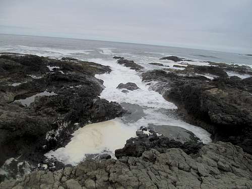
The Cape Perpetua visitor’s center is well marked, just before a small bridge over a narrow chasm. A trail leads here downhill through the woods to the beach to several marked sites, such as the Devil’s Churn and the Spouting Hole…all rocky beachside attractions similar to Bah Hahbah up in Maine. But where was the well? Answers at the Visitor Center was vague.
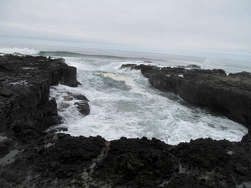
I passed first by the Churn, trekking down several switchbacks of stairs down to near eye level with water astride signs warning basic tourists not to obey Darwin’s call to get that extra up close and personal selfie. It was cool though, actually damn mesmerizing to watch the rhythm of the waves come up and into this geologic trap, wondering how dramatic each ebb and flow would end up.
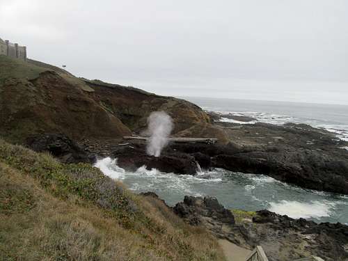
I made my way to the other end of the recreation area and saw the Spouting Hole..again something out of Acadia.
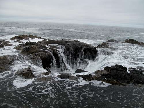
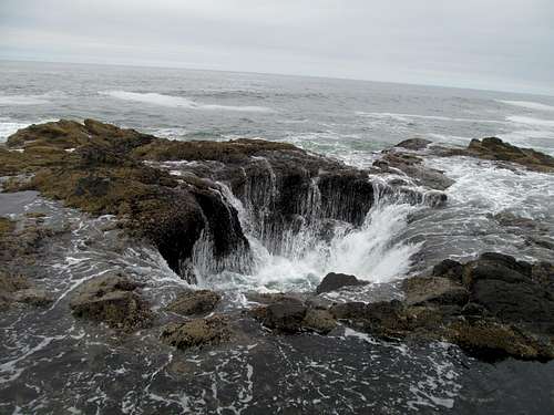
But where was the well? I wandered around the beach amidst googling on 1 bar reception before finally coming across a photographer with a pretty impressive camera/tripod setup…surely he knew what he was doing? And he did, pointing me in the right direction.
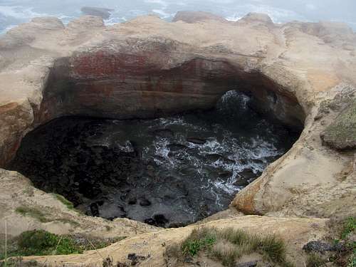
Despite following the guy’s instructions I still had to orient myself a few times to find the well…it’s a fairly small formation, very non-descript from afar and can’t really be spotted until you’re right up on it.
And when you’re right up on it, you’re damned right up on it, standing on a tiny, wet, slippery rock perch watching the water gush in and out of this Lovecraftian hole just a few feet in front of you. If the rest of the coast was mesmerizing, this was the damn siren herself…and I stood there for some time watching the ocean come alive in lecherous fury with each wave.
Having been bombarded with billboards for Mo’s, supposed the Coast’s most popular seafood joint, I stopped in at the Florence location for lunch. The place was a zoo, but the chowder and seafood was pretty decent, and I got one of the many tables next to the large open space windows facing the Siuslaw River as it flowed into the Pacific. I think back to that moment in time, sitting there tranquilly watching the seals and dolphins go by on a perfectly cloudy day, the burden of peakbagging after three years in the immediate past, and nothing but hundreds of miles of coastal exploration ahead of me…I remember feeling at peace, feeling a sense of accomplishment over my last three year and that, after all those miles of early morning driving and all those endless efforts of toil and sweat, I could finally sit and enjoy this reward to myself. And yet I felt the immense fatigue from weeks on the road and most poignantly, that creeping sense of longing and homesickness…not for Utah, but for New England, and the northeast, and friends and family, all of that less than two weeks away.
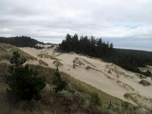
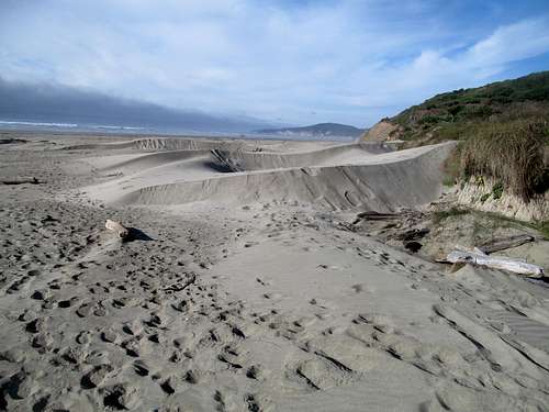
I decided to skip Roman Nose, a P2K nearby, that day in order to focus my afternoon on the Oregon Dunes ahead. In hindsight it probably wasn’t the best decision, since there wasn’t much to see in the dunes, but I don’t sweat it too much, as what’s another drive up in this special place that I hope to return someday?
As I mentioned, the Oregon Dunes were cool but anti-climactic. The weather cleared by the time I took some side roads down some marshes and ponds. I took in some overlooks but it was kinda chilly and breezy so I moved on.
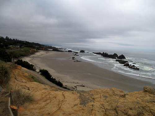
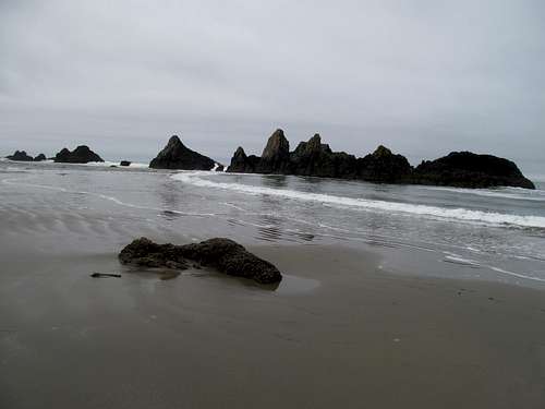
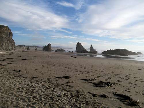
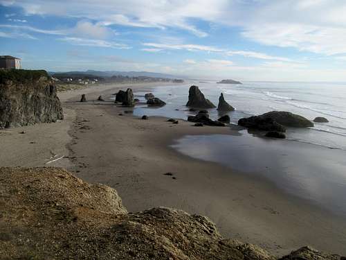
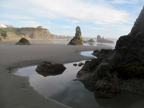
I couldn’t afford to dilly-dally too much. Reward or not, I still had a schedule, as my goal was to see the redwoods Saturday morning before watching the college football games in Crescent City, which meant that I needed to get myself within an hour or two of the Redwoods by Friday night. As a result, I sped through Coos Bay and North Bend, towns I heard good things about back then (though I know now that it’s a big biker gang place :/), checked out the beach along some back roads in the seven devils/cape arago area past town, and settled in at Bandon, where I took a walk along the beautiful beachside monoliths just off a residential part of the town at sunset.
I stopped by a local bar for dinner and caught the end of a scintillating Baylor/TCU game (the frogs got hosed), then settled down at my surprisingly cozy and affordable second floor room overlooking downtown for a relatively early night in.
Redwoods Border Crossing - October 11th, 2014
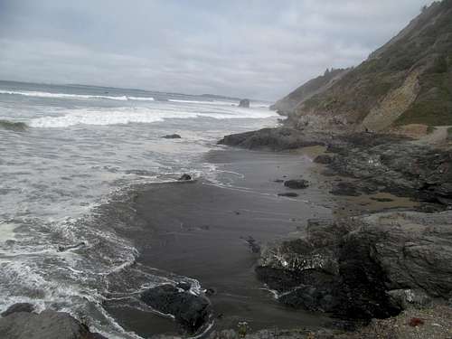
Saturday morning started off cloudy, foggy and drizzly yet again, and the roads south of Bandon alternated along the backside of coastal hills and recreational beaches.
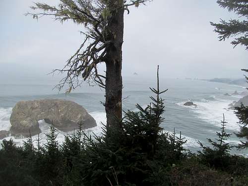
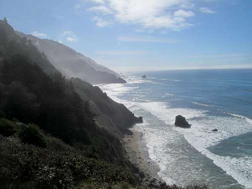
I took in cliff-top views of Lookout Rocks and an arch near the Samuel Boardman State Park area before finally moving on past Oregon.
And that was that, Oregon hashtag done. Next up, the Redwoods. Somehow the sun magically came out around the time I crossed over into California, and I saw my first views of farmland in days. As the road creeped ever closer to the national park I examined the pastoral hills in the distance and looked for signs of greatness, but saw only normal hills. Even after turning off US-199 towards the Jedidiah Smith Woods section of the park I saw nothing out of the ordinary. If these trees were supposed to be so special why the hell couldn’t I see them even though I was practically there.
I found the dirt road leading to the Stout Grove and did the quick drive, park and walk around in small circle tour that I would find to be typical for the park. While I guess the trees weren’t all that noticeable from afar they were pretty spectacular up close, though the partly cloudy skies above the high canopies doesn’t make for great optics when it comes to capturing the things on film.
Wanting to check into a motel to watch the afternoon college games, I rushed back to the highway after a quick stop at the Simpson-Reed Grove, then skipped through Crescent City to take in the namesake beach, parking at the end of the spur road and following the trail down to water level below.
The ebb and flow of the waves here was just as hypnotizing as those of California’s northern neighbor, just as mesmerizing whether viewed from eye level or from the overlook a hundred or so feet above. The sun kept an untenable advantage over the clouds as I descended to the beach, and it was warm enough that I started to sweat under my long-sleeve shirt. The clouds were back in full force as I climbed the trail back to my car though, and stayed on afterwards whilst I explored the strange metropolis of Crescent City.
I had barely any TV reception on my shitty bar and needed to watch college football games…therefore, I needed a bar, preferably of the sports kind. I googled one north of town…it was decrepit and boarded up. Plenty of nice beachside homes on the picturesque beach north of town, but no bars. Some kind of outdoor market going on in an otherwise eerily empty and seemingly purposefully bland and lackluster downtown…but no bars. Lots of touristy motels in the strip south of town towards the national park…but no bars! Okay, maybe one bar.
I found my spot in a family restaurant adjunct type place next to a motel (Best Western?), but it had a bar and more than one TV (one for college ball, one for the baseball playoffs), so I was happy. The locals were a bit offputting but explained when I asked about the weirdness of the town that most of the populace were hopped up on meth, or on welfare, or both. It was a strange, strange place; never had I been to an actual city, for christsakes, next to a world-famous national park and perfect tourist trap environs, with the added bonus of an actually unbelievably scenic backdrop (not to mention prime waterfront real estate) in town, and yet with all the personality of a comatose mental patient (with the exception of maybe a few places in Utah…).
I enjoyed a few games, drinks, and dinner at that bar, but needless to say I had no problems abiding with an early curfew, but before that I ventured back out to the Simpson Reed area to take in another quick hike and loop around the trees, walking off the afternoon's beers and memories from an unmemorable slate of football games.
Trees, Beach & Bully Choop - October 12th, 2014
My challenge on Sunday was as follows: drive down and see the Redwood sites and groves between Crescent City and Eureka, then make it to the Six Rivers Brewery (owned by two smokes apparently) in McKinleyville to catch the 1 PM EST (that would be 10 AM Pacific) Pats/Bills game.
The basic bitch tourist in me told me to do a couple reasonable scenic drives en route, so I did, driving the narrow Requa Road up to an overlook over Klamath Beach, where its namesake river emptied out into the Pacific.
Next up, a walk around the Big Corkscrew Tree, then finally the Lady Bird Johnson Loop Hike, which was crowded but fun…nice and basic and perchance even relaxing were I not in a hurry with kickoff looming in minutes.
I cruised down 101 as it became a highway approaching the Eureka area. The brewery was packed but perfect as they had a designated TV for every NFL game and I got a table facing the good guys vs. Buffalo along with my beer flights and lunch. The Pats won comfortably enough and I moved on.
I thought about stopping at the Lost Coast Brewery in Eureka to drink some clementine beer straight out of their taps, but the town was as ghetto as advertised, and I was running late for, you see, even with all this basic shit going on, I still wanted to get a peak for the day. I sought revenge on Lassen tomorrow, which meant a stay in Redding for the night, which meant a drive through the coastal mountains via CA-299, which meant that I’d be traversing right by Bully Choop Mountain. The alternative was backtracking to do more Redwoods shit, but the trees were starting to look the same after a day of me feeling all tiny and insignificant beside them, plus I hated backtracking, plus Bully Choop was a P3K.
I felt a sense of loss though driving eastwards, as in my mind it marked the end of one era and at the very least the prologue of a return trip that will take me across the country literally one ocean to the other, as eight days later I’d be standing on the Atlantic in Hoboken New Jersey. My four days on the coast had been breathtaking and unforgettable and, despite the early frustrations with the fog, met and exceeded every expectation I’ve harbored over this storybook land for the last decade or whatevs. Oregon was charming, but rustic and cozy a la New England, Crescent City was just odd and depressing, and I felt a little dismayed that I now had to leave so soon after arriving in what appeared to be the most cosmopolitan spot on the Pacific this side of Marin County.
299 was scenic but windy and slow as hell with no cell reception, which meant for the second Sunday in a row I suffered for upwards of an hour with no access to live NFL scoring. Weaverville seemed like a charming town with tons of backpackers roaming the streets on a casual Sunday, but I labored on east, following a peakbagger.com TR instructions for the access road.
The junction was unmarked and as a result I never had full confidence that I was on the right road despite its immediate steep climb up very rough and tumble switchbacks. I had my GPS but no topo map as well no DeLorme or Benchmark Atlas, which meant that I was driving blind with only hope and a vague internet screenshot to guide me. Several times the road dragged on and passed junctions where I could only hope that I was taking the right path, assuming I was on the correct one to begin with. At times the very rutted and bumpy road seemed a little too long in the tooth and wandered in what appeared to be the wrong direction for way too long, and I made a couple u-turns and circles to try and regather my bearings.
Cresting a ridge I found that I had a bar or two of reception, so I loaded the peakbagger page and waited ever so patiently for each topo map to load as I traced the summit access roads to see if they matched what I had driven. There actually seemed to be some sense of correlation, so I continued, and eventually regained faith as the road approached what visibly looked like the most prominent peaks in the area.
I parked at a switchback just before the gate and walked up to the summit tower in the gathering twilight.
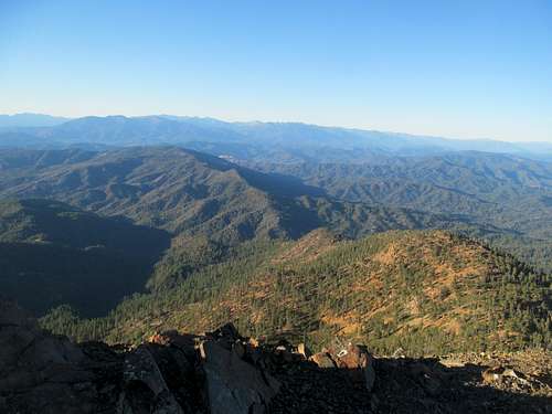
The hike was unmemorable, the drive had sucked, the mountain itself seemed uninterestingly lumpy, but the views, from the jagged peaks of the Trinity Alps to the glow of Shasta against the setting sun, salvaged the moment.
I retraced the awful road back to the highway and cruised into Redding just after dark, feeling once more that feeling of relief returning to Interstate-America after many days off the beaten blue-shielded path. Redding has a bad reputation and I’m sure it’s got the faces of meth to back it up, but I had a good night despite a motel in what seemed to be a seedy section of downtown. I had no problem walking to a nice Irish pub a few blocks down, where I talked to a scant but friendly crowd and watched the Giants win yet another postseason game.
Lasso'ing Lassen - October 13th, 2014
My revenge on Lassen, just like everything else this trip, was anti-climactic, though that in itself isn’t a bad thing. South Sister would always be in many ways the zenith of this PNW sojourn, and everything afterwards from the coast on out was intended to be a slow winding down from many weeks on the road and three years chasing summits out west. Lassen I hoped to be both an exclamation point as an ultra-prominent Cascade Volcano yet just as easy of a walk in the park as yesterday’s redwoods had been.
The drive from Redding was slow and tedious, not because of the roads, which were pretty, but because of the shitty drivers, many of which I had to engage in complex passing maneuvers around. I cruised through the now familiar park road to the trailhead, taking off and exercising already creaky muscles.
Alas my muscles were fine, but mother nature wasn’t. Perhaps my luck had run out…after several months of an Indian Summer and fog aside, perfectly clear and mild temperatures on this trip since Vegas, I was reacquainted by that harsh wind that had seemed to plague me all spring and early summer.
The wind made a lot about this hike really suck. Much of the view from the trailhead is of the highway sized trail wheeling up the lower sandy slopes of the peak more akin to a handicap ramp, but once out of sight from the parking lot the hike becomes a little more pastoral as you turn into a small flat plateau lined by light woods and meadows. Unbeknownst to me, this would be my last sanctuary from the blistering wind until my return romp, as the trail returned to the main wind exposed ridge for the rest of the way to the summit.
You expect crowds even on a Monday when dealing with an easy major ultra-prominent national park volcano and highpoint accessible to the public only four or so times a year, so all things considered it wasn’t that bad…no conga line or such. I crested to the top surprised to find the true summit perched up on some ragged looking rocks a small traverse away. It was fascinating looking at sharp and rusty volcanic surface of the summit ridge up close, and I did some mild scrambling on the right side of the summit massif to bypass some hikers going up the main trail.
I emerged from my wind sanctuary on occasion to snap a few pictures; surprisingly there wasn’t that much to look at. The lakes down by the parking lot were nice, but there wasn’t much in terms of neighboring mountains to make the immediate landscape all that interesting.
Perhaps I would’ve enjoyed the views a little better if the wind wasn’t so miserable, but all in all I think the wind really enhanced my fatigue, and I descended eager as hell to leave the high life and return to civilization ASAP.
I ran back down the switchbacks as fast is I could, desperate to escape the wind that, after three years of facing the elements, felt like an ungainly shove out the door. My last real hike, my last time above 10,000 ft, my last time donning hiking boots for the foreseeable future, I contemplated none of this; all I felt was the mental drain and exhaustion and the inconsolable urge to escape the wind, the wild, the road, to return to the creature comforts of civilization, to go home, to be around family and friends...to sleep, just sleep, for a long time and forever.
I sped through Susanville barely acknowledging my surroundings as the landscape transitioned from mountains back down to desert. Returned at last to the Great Basin I gazed passively at bare sagebrush bumps in the desert, looking only for streetlights, strip malls, and all those other telltale harbingers of civilization.
I drove from one end of Reno to the other, seeing from block to block the university, downtown and the famous sign, the iffy parts just south of town, and the more cookie cutter suburban casino resorts at the south end of the city. Greg had worked here for weeks at a time and recommended the southern area, but I opted for a motel closer to midtown at an especially convenient location near the Great Basin Brewing Company. I had my usual sample flight, watched Monday Night Football between the Niners and Rams, and laughed as members of a nearby paint and wine group sequestered in a separate conference room kept sneaking out every few minutes to catch a down or two of the football game.
The beers were exceptional (I didn't know of their relatively famous reputation among beer nuts at the time), but I had to close out my last night on the road with one last visit to the Lucky Beaver, from Tahoe fame. The bar was hopping, and by hopping I mean it was just me, a cute bartender, and one old British dude. Still, the lack of a crowd made for a lively and varied conversation into the wee hours of the night. I stepped out at some point after the Brit, leaving the poor waitress to toil through yet another shift through the wee hours of the night, but I guess you know what you're getting when you sign up for the 24/7 bar life.
Virginia & the Road Home - October 14th, 2014
I had vague thoughts of getting Star Peak on the way back to Salt Lake. Greg certainly encouraged me to do it, but I was pessimistic; the wind promised to be just as bad, and even disregarding my inherent laziness, I dreaded on its own merits the prospects of toiling up yet another 4wd road.
I decided to play it by ear when I woke, and obviously at this point laziness got the best of me. I drove north from Sparks and took the rocky yet Camry friendly road to the top of Virginia Peak, but even this drive-up was not without difficulties, as I spent time roaming and photographing scenes from the top in my sneakers (vulnerable to even the smallest and most inconspicuous cacti) before realizing that the true summit was probably that slightly higher bump to the southeast.
I drove over, took some more pictures in the wind, and returned to my car, thinking nothing of the last peak I would do while a resident of the west (for now).
My last transcendent summit moment was atop South Sister. With this Indian Summer my expectations were still at Northern Rockies levels, and while views from a drive up Nevada range highpoint would be most groovy in winter or spring, everything felt pretty blasé only a few days/weeks removed from the Cascades/Northern Rockies, and I left the last summit I would register for more than half a year feeling nothing but the prevalent fatigue.
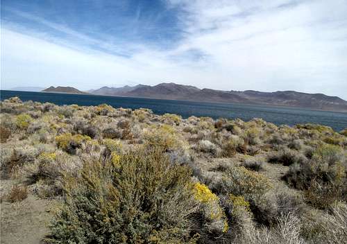
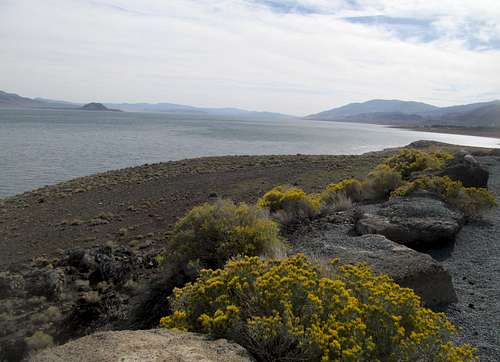
I drove around the shores of Pyramid Lake as one last escapade before returning to Interstate country for good.
Driving by Star Peak I thought of what could have been but those thoughts were overwhelmed by the dread of just the prospect of stress driving jeep tracks and fighting the wind and my own physical laziness. That was my mindset at the time...just keep driving east until you’re home, and sleep, and rest, and live amongst the basic people and be happy you’re one of them, and you’re finally amongst your own.
I felt slight pangs of regret near Elko whilst gazing at the Rubies at Sunset. I still needed and wanted wholeheartedly Ruby Dome, and had I even one extra day I would’ve stayed in town and banged out one more peak. But I had a deadline, my buddies were due in Salt Lake in 48 hours, and I needed to finish all my packing in the meantime.
So after almost three weeks away I got back to Salt Lake on Tuesday night. I packed for two straight days, had a couple goodbye dinners/lunches with some friends and coworkers, grabbed greek food to go and watched the end of the Jets/Patriots game with Greg, Kadee and Oquirrh just before picking up my buddies Brian and Mochismo at the airport near midnight Thursday. I had always been 50/50 on my buddy driving back across the country with me; on one hand it would be nice to have company and I could show these yokels from back east a thing or two about my part of the country. On the other hand, it severely limited my freedom…from proscribing the timelines I had to finish my two plus months of freelance traveling, to limiting my drive across the country to only four days. Locked in yet another endless 9 to 5 as I write this (not to mention an onerous lease unheard of outside of the northeast corridor/Cali), I really regret not having a freer hand in my last extended period free of responsibilities.
But we still had fun, from the frustrations of my buddies not being able to get into a bar in Utah because they stopped serving at midnight, to demonstrating that Utah had some worthy shit by taking them up through Park City and the Western Uintas via the Mirror Lake Highway, to Mochismo drinking 25 or so beers/vodka sodas in the back seat between Kamas and Nebraska the first day of driving, to a blacked out Mochismo waking up and asking where the fuck were we three separate times driving the five miles from one end of Cheyenne to the other, from hitting up a brewpub in every state between Utah and Illinois, to crashing with a friend who lives next to the Sears Tower and drinking Malort in a dive bar in north of downtown at 5 AM, to showing my buddies Notre Dame and barely making it back to New Jersey at 5 AM on Monday morning barely in time for Brian to get an hour before going to work, to me and Mochismo sleeping in and the aforementioned daydrinking and day wandering around Hoboken New Jersey on a Monday afternoon, myself fully aware of how far I’ve travelled in the last week, much less months…nothing would change those memories, but they’re so damn unique for better or for worse (especially the whole crippled peakbagging shit) and, everything taken as a whole, probably unlike anything I’d ever experience again in this lifetime.
And so that’s that…two months plus of dirtbag climbing and travelling without a job to try and get that shit out of my system for a few months. I’ll go back, I went back (with mixed results), and the mountains and the lists will always be there. But people and mindsets change, and that period of my life will always stand out. At the time, especially during the later stages of the trips, I felt only exhaustion and the urge to rest. But despite all that I knew how special and fleeting those moments were, and could predict how I would always look back at it with an indescribable nostalgia for the rest of my days.
Comments
No comments posted yet.