What can happen if you choose to make a ski-mountaneering in early fall, without skis and after many weeks without rainfalls ?
That was the question I had in my (twisted) brain last week (the conversion from being a young mountaneer to be an old hiker sometimes is sad !).
I heard about the "Cervino di Sondrio" (so Corna Mara is locally named, but I still have to understand why) as a very fine ski mountaneering trip with fine steep slopes that allow a descent starting from the summit (2807m) and arriving to Sondrio (307m) (... wow 2500m !!!) when the snow is there, good and abundant of course.
Overview
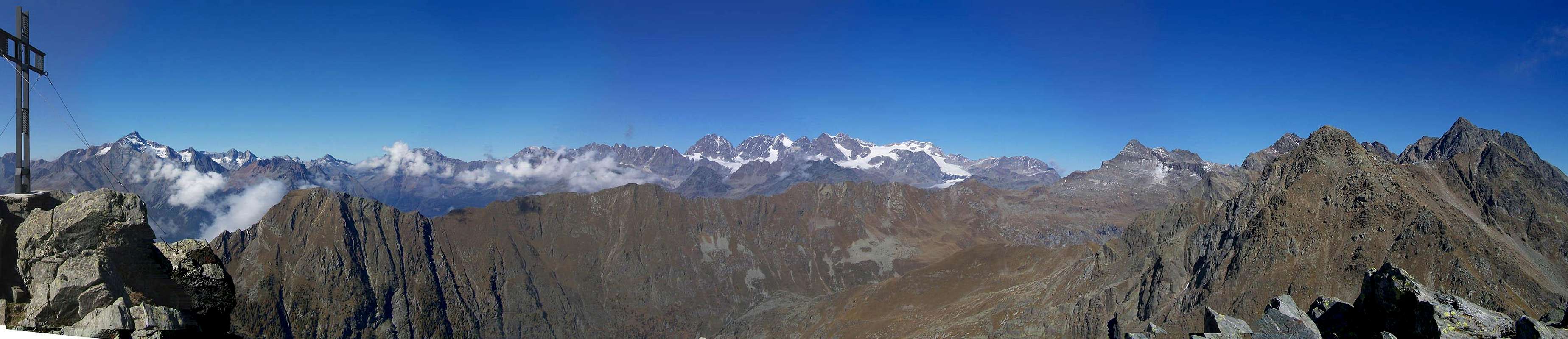
South of the eastern part of the Bernina group, on the S side of Val Lanterna, there is a range of mountains whose main summit is Pizzo Scalino (3323m): from this summit 3 different ridges go down (toward South) to the Valtellina (Adda river valley); between the 3 ridges 2 lonely wild valleys scoured only by hunters and, in the lower parts, by people picking up chestnuts and mushrooms.
Corna Mara is the last summit of the SW ridge coming down from Pizzo Scalino and its hillsides are wooden up to about 1800m, then made only by meadows and screes, very wild, very low populated, with only 1 narrow road (tarred up to 1200m) that leads to the small built up area named Alpe Mara (4 houses at 1749m).
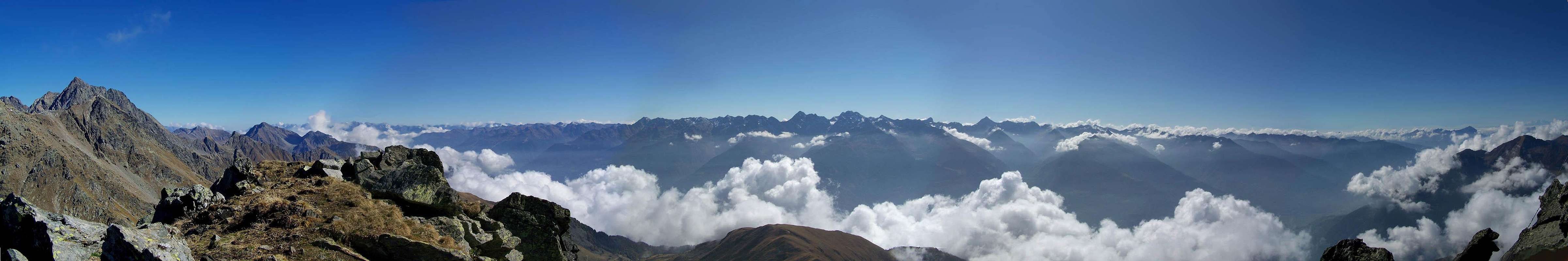
Herefrom a dirt road, forbidden to tourists and practicable only being able to use well a 4x4 car, goes on arriving to the small refuge Gugiatti-Sertorelli (2137m).
Which are the reasons to come here ?
Spend one day with friends (avoid to come here alone: no help available, very low or missing dial tone!)
Keep a good training
The fantastic panorama from the summit (of course a fine weather day is required)
A long ski downhill (with good abundant snow, of course)
Getting There
From the Valtellina main road (SS 36 - Strada Statale dello Stelvio) enter in Sondrio, follow for Montagna in Valtellina.
Once there, follow the road toward Paini and S. Giovanni up to the Alpe Mara : the tarred road ends at Nesarolo, but you can go on (after few km, at a fork turn to the left).
Route to the summit
From Alpe Mara follow the dirt road (good short cut after some hundreds of metres) and follow to a first building, don't go along the road toward left but keep on going on, along a good track to get again the road leading near the refuge Gugiatti-Sertorelli.
Herefrom no marked paths, only some small vanishing tracks here and there.
Start going on, without tracks, toward the grassy ridge you see in the skiline : (see main photo)
The route to the summit follows the ridge, steep and a little tiring, with small deviations but the one (at 2500m) that, crossing to the left, gives access to a big stony hollow.
Cross it on the left side and follow along the steep channel leading (to the right) to a small saddle (in the right skiline) above some small rocky spurs (warning, danger of stones).
Following the ridge, climbing on big stones (a little attention is required) you get the Cross of the summit.
from Alpe Mara :
Difference in elevation = 1.050m
Time required (up) 2h 30' - 3h
difficulty
EE (experienced hiker) in fall
BS (good skier) in winter
special advice
better using rigid mountain boots than the usual light hiking boots: you have to walk on clumps made of long grass, as glassy as snow
Parents refers to a larger category under which an object falls. For example, theAconcagua mountain page has the 'Aconcagua Group' and the 'Seven Summits' asparents and is a parent itself to many routes, photos, and Trip Reports.