
-
 14820 Hits
-
 82.95% Score
-
 16 Votes
|
|
Mountain/Rock |
|---|---|
|
|
43.88597°N / 109.58259°W |
|
|
Hiking, Scrambling |
|
|
Summer |
|
|
11580 ft / 3530 m |
|
|
Overview
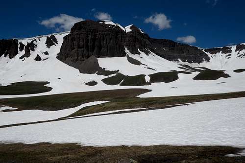
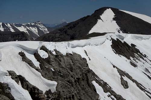
Basin at the Head of Frontier Creek
More than 30 miles from the closest town and paved road, well into Greater Yellowstone's largest and broadest mountain range, atop an otherwise-unremarkable flat summit, is a mysterious feature that only a collective few have ever seen: the Devils Graveyard. It is a collection of stones set perpendicular to the ground amid the tundra. Yes, they look like gravestones. Some look so much like gravestones that standing there, especially alone, is downright eerie. But they were not set that way by people. No one seems to know how they ended up the way they are, but the formations are natural.
Although the name is associated with a peak, the Devils Graveyard is actually a feature of a peak.
If you go out with a map looking for the Devils Graveyard, there is a good chance you will fail. This is because the map is mislabeled. The peak on the Emerald Lake quad labeled as Devils Graveyard is not the actual location of the site. Instead, the next peak north from it, an unmarked peak with an interpolated elevation of 11,580', is where you will find the stones.
False Devils Graveyard
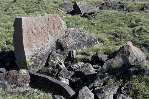
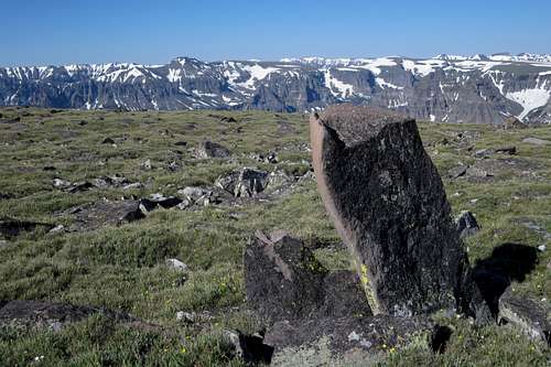
A Devil's Gravestone
 Devils Graveyard | 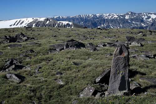 Devils Graveyard |
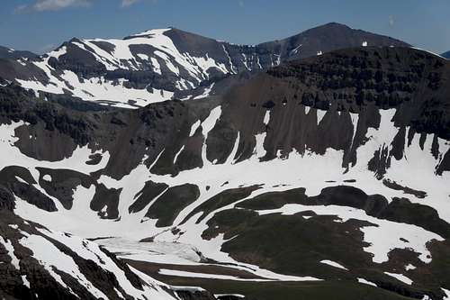
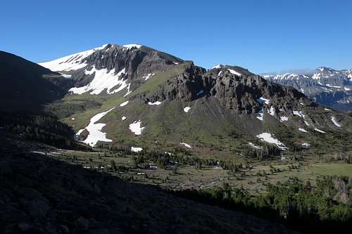
The "graves" are not the only attractions, though. The scenery is fantastic, for you are in a truly remote area and surrounded by alpine peaks in all directions. Younts Peak and Thorofare Mountain, the former being by some accounts the most remote peak in the Lower 48, seem tantalizingly close even though they are still more than 10 miles away. A ridge walk north or south will provide views of alpine gems such as Green Lake, Emerald Lake, and Snow Lake. You can see the Tetons. And you can see Gannett Peak, the highest in Wyoming.
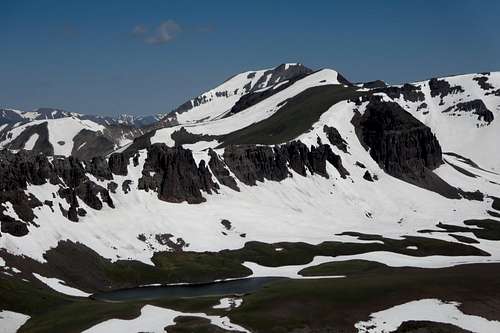
Red Tops and Green Lake
Emerald Lake
Getting There
From Main Street in Dubois, turn north onto signed Horse Creek Road. Drive past the residences and through a section of the Dubois Badlands. After several miles the road enters national forest land and becomes unpaved. Pay attention to signs and keep following the principal road to Double Cabin Campground. Drive past the campground to a large open area. Find the trailhead and sign. You will want to head up Frontier Creek. This is 25 miles from Dubois. In dry weather, these roads are easily passable to most passenger vehicles.
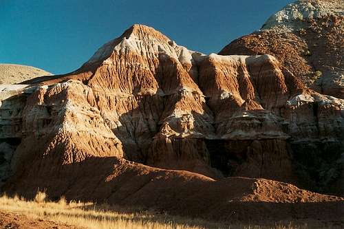
Dubois Badlands
It's actually easier to get onto the right trail by picking up a trail just across the road from the campground entrance. Regardless, you are going to be crossing Frontier Creek and heading up the canyon on the right (east) side of the creek.
Frontier Creek can be challenging to cross before July and in the afternoon.
Have plenty of water. After crossing Frontier Creek, the trail is not often close to it and frequently is well above it.
Route
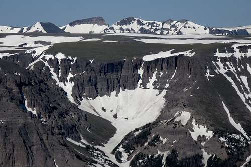
Peak 12,025
There are four principal ways to get to Devils Graveyard. All are long and/or arduous.
- Some maps show a pack trail heading up from Frontier Creek and leading to the ridge just north of the unnamed peak just north of what the map calls Devils Graveyard. Remember, this unnamed peak is where the graveyard actually is. On TopoQuest, for example, you can see the trail. On my USGS Emerald Lake quad, you cannot. But the trail, an old trail that the Forest Service apparently abandoned, is there, and it is in remarkably good shape. It fades out near the summit plateau, but by that point it's easy to know where you're going. Finding the trail is the crux. You can pick it up near the end of a second meadow about 6.5 miles from the trailhead. Use the map in this section to help you. By this route, it is about 9.5 miles to the summit with 3600' of elevation gain. This was my ascent route.
- Nine miles up Frontier Creek, the official trail ends, but you can continue up into the basin at the head of Frontier Creek. This basin is truly stunning, and in it you will find Green Lake and a higher, unnamed lake. Lakes are pretty rare in the Absarokas, and almost all are concentrated in this area of the southern part of the range. Enjoy. Anyway, head up the basin and then hike steep scree to a saddle just south of Peak 12,025. (This, by the way, is a very worthwhile peak; a Class 4 chimney gets you up from the saddle to easier ground, where the rest is easy going. The summit is 12 miles from the TH.) Now follow the ridge south until you get to the Devils Graveyard. You will cross two summits along the way, one ranked and the other unranked. Going from the saddle to the next summit south directly via the ridge is spicy but fun. I think it was Class 3, but the rock was so rotten it felt more like Class 4 in my gut. However, there is a workaround on the west side if you want it. This way to the summit is around 14 miles, and elevation gain is something like 4200'. This was my descent route. A word of warning: it is a tedious experience going between trail's end and the basin because game trails disappear, the terrain is very uneven, and there are numerous debris-strewn avalanche chutes to cross. But again, the basin is so beautiful that it makes the suffering worth it. And almost no one ever comes up here because of the distance and the lack of a good trail.
- About a mile from the trailhead, maybe half a mile past Double Cabin, the trail crosses a significant creek coming from the east. This drainage will lead all the way to Snow Lake, and from there you can head north to the peak, heading over the "wrong" Devils Graveyard as you go. The ridge between the incorrect peak and the correct one cliffs out, but it's easy to bypass that. This way to the summit is 7.5-8 miles, and elevation gain will be around 4000'. However, I do not know the difficulty of the route firsthand, but someone who has climbed it has told me it's not bad at all. As such, it would certainly be the fastest way to reach the summit and the best option for someone wanting to climb the peak as a day trip.
- Instead of heading up Frontier Creek, head up the Wiggins Fork and then Emerald Creek. This is a longer and harder undertaking, for it is 12 miles to Emerald Lake and there are several stream crossings, none of which are said to be easy. From Emerald Lake, you can get to the saddle south of Peak 12,025 and then follow the second option described above. Distance to the summit would be about 15 miles, with 4200' of elevation gain.

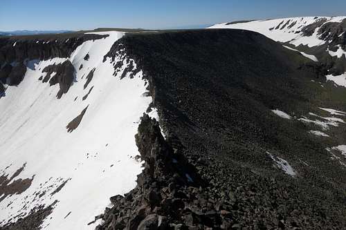
Devils Graveyard and Abandoned Trail
Looking back down into the basin where the trail disappears
Petrified Forest
About 8 miles up the Frontier Creek Trail, there is a petrified forest on the west side of the creek. It is very difficult to see any petrified wood from the trail, so if the creek is low enough, cross it and go check the site out. Be aware that it is illegal to remove any petrified wood.
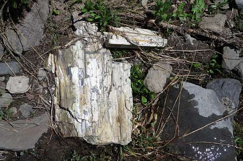
Petrified Wood
Red Tape
Obey posted wilderness regulations.
This is grizzly country. Carry pepper spray.
Leave an itinerary with someone and carry extra food and water on you. I could not get a cell signal on the summit, and the off-trail portions of these routes are remote and seldom traveled; getting injured with no backup plan could turn out to be disastrous.
Coffman Butte
When to Climb
Late July and August are best for water and snow levels.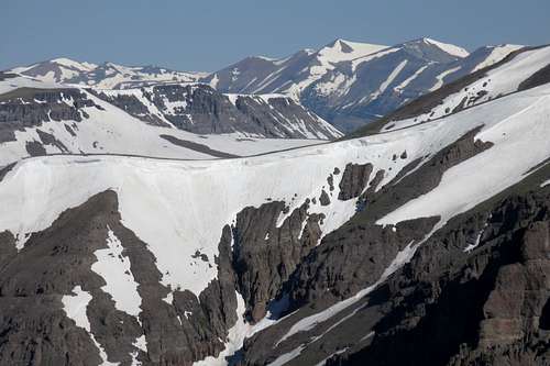
Summit View
Summit View
Camping
The meadows along the trail make excellent campsites. My friend and I camped in a sweet spot by the creek near the old pack trail.
Developed sites are available (for a fee) at Double Cabin CG. Many people do dispersed, free camping in the trailhead area.
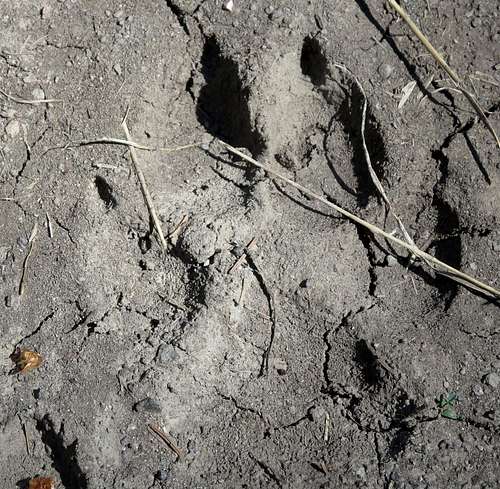
Wolf Print?