
-
 9876 Hits
-
 84.09% Score
-
 19 Votes
|
|
Mountain/Rock |
|---|---|
|
|
45.38703°N / 92.65997°W |
|
|
Polk |
|
|
Hiking |
|
|
890 ft / 271 m |
|
|
Overview
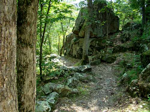
View of Eagle Peak Trail
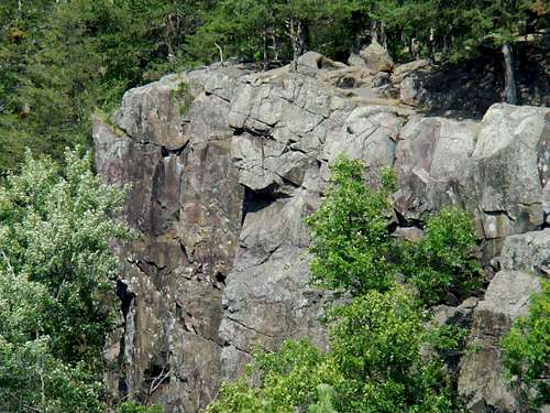
There are not that many publicly-accessible named summits in Wisconsin. The number is smaller still, that offer a wilderness experience as well. Though Eagle Peak is an easy summit to reach, it holds a special appeal to area hikers because of the rugged terrain. Located at Interstate Park in Polk County, Wisconsin, it is listed in their publications as “the highest point of the park overlooking the valley”. The summit is just 120 feet in elevation gain from the trailhead and stands 200 feet above the nearby St. Croix River. The trail winds through many outcroppings of volcanic rock. Nearby Summit Rock, located on sheer rocky river bluffs less than 2 miles north, offers clearer views of The Dalles of the St. Croix River, but the summit of Eagle Peak gives hikers the most panoramic view of the area. The terrain along the Eagle Peak trail reminds me of some parts of the Black Elk Wilderness in The Black Hills.
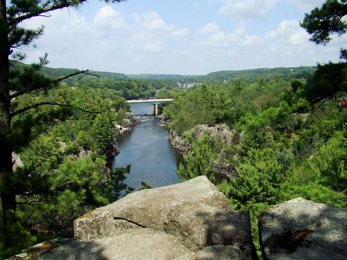
Summit Rock view of the St. Croix River
Because the Eagle Peak trail is only 1.6 miles out and back, most hikers will have no difficulty making time to explore many of the other short, but scenic trails in the park, including the Summit Rock Trail, Echo Canyon Trail, River Bluff Trail, Pothole Trail, and others. Both sides of the river offer some noteworthy rock climbing opportunities, quite worthy of a separate page. However, since I have no expertise in rock climbing, I will have to leave this to the experts.
The Pothole Trail is also the western terminus of the 1,200-mile National Scenic Ice Age Trail, and is probably the most geologically unique trail in the park. These incredible “potholes” in this park, and across the river in Minnesota, were carved thousands of years ago during the last major glacial period. The whole area has a fascinating geologic history, and the Ice Age Interpretive Center at the park offers a wealth of information to interested visitors. There are more hiking opportunities on the Minnesota side of Interstate Park.
Visitors who desire more than just hiking will find that the Dalles of the St. Croix River offers great kayaking or canoeing. For those interested in a different approach, the Taylors Falls Queen riverboat (Minnesota side of the river) offers another fun way to see more of what the river valley has to offer. Interstate Park has great camping facilities, a swimming beach, a biking trail, and fishing opportunities.
Getting There & Route
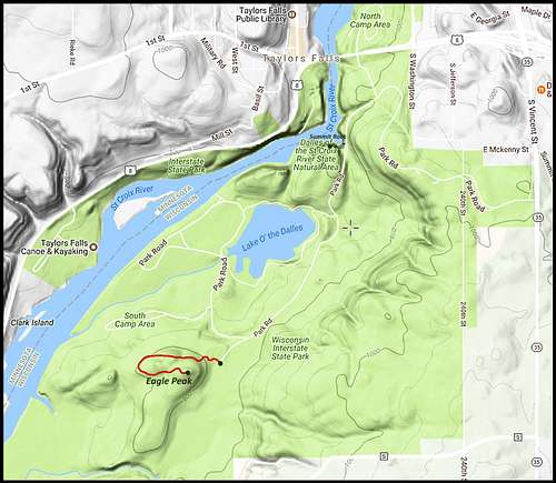
Eagle Peak Map
Interstate Park is on the edge of St. Croix Falls, Wisconsin and Taylors Falls, Minnesota, just an hour’s drive from the Twin Cities. From Interstate 94, go 44 miles north on Highway 95 (Minnesota side of the St. Croix River) to Taylors Falls. Turn east on Highway 8 and cross the river to St. Croix Falls, Wisconsin. It is .8 mile to Highway 35. Take 35 south and follow the signs to Interstate Park.
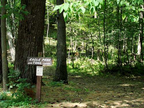
This is the trail sign at the Eagle Peak trailhead.
This whole route from Interstate 94 to the Taylors Falls - St. Croix Falls area is a popular fall colors scenic route each year. Needless to say, planning your hiking/climbing/camping trip in late September or early October could certainly provide you with great photo opportunities with a memorable camping experience.
Route: At the park entrance, you will be given a map. Please follow the route on the map to the Eagle Peak Trailhead. There is limited parking at the trailhead, but is usually not full. The trail is nicely marked until you get to the really rocky area at the summit. Remember which way you came up, so you can get back to the right trail.
Red Tape
There is a vehicle entrance fee to the park, or you can walk in for free. Holders of National Parks passports receive a waiver of the vehicle admission fees, but camping fees are not affected. Maps and park rules are given to all visitors at the park entrance.
Online Map of Interstate Park
For an online map of Interstate Park, click here: Interstate Park Map
When to Climb
Interstate Park is open year-around. Please be prepared for seasonal weather. Fore the latest weather forecast for the area, click here:
Interstate Park Area Weather
Camping
The famous rock formation, "The Old Man of The Dalles"
Interstate Park has two campgrounds plus a primitive campground. You can reach the park office by phone at: 715-483-3747. The park website offers campground maps, rules, and more info by clicking here:
Interstate Park Camping
The chamber of commerce office of St. Croix Falls, Wisconsin and Taylors Falls, Minnesota also has information on other camping or lodging opportunities in the area. You can reach that office by phone at: 715-483-3580.
Two other camping sites in the area include:
Camp Waub-O-Jeeg Phone number: 651-463-3500
Wildwood Campground Phone number: 651-465-6315
External Links

Some rock climbers on the Minnesota Side of the river
For more information, click on any of the links below:
InterstatePark Wisconsin
Interstate Park Minnesota
Polk County Wisconsin Tourism
Taylors Falls Chamber of Commerce