Early Start, Lunar Eclipse and Best Berries
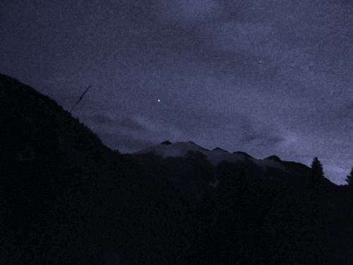
![Ruth at night]() Ruth barely lit by eclipsed moon
Ruth barely lit by eclipsed moon
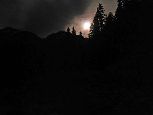
| ![eclipse over]() eclipse ending
eclipse ending
|
Gimpilator picked me up in the afternoon on the way to a trailhead bivy at Hannegan Pass. Naturally, we stopped for Salvadorian burritos in Bellingham. Our epic 15.5 hour, 25 mile, 10,000' gain hike started with a total
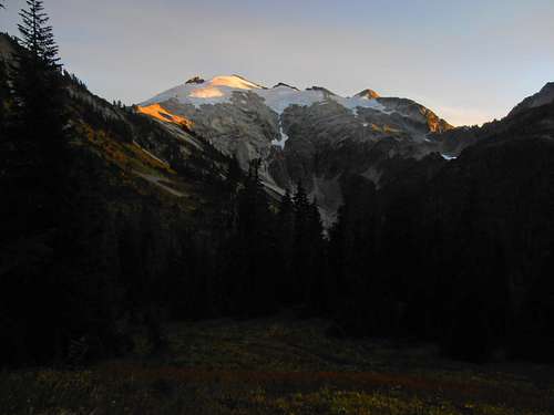
syzygy of the Sun, Earth and Moon. Times like these I wish I was my brother Josh with a fancy camera but this astronomical event would have to be for our eyes only. We got up at 3:00 am just in time to eat breakfast and watch the eclipse phase the moon into red under Earth's penumbra. I thought it would be over quickly or get lost behind the shadow of Mt. Sefrit but to my surprise, over an hour later it was still going when we got to Hannegan Camp half a mile from the pass. Of course it was too dim for my dinky Olympus camera but it made for quite possibly a once in a lifetime vista. I desperately attempted a few photos and we hurried along the trail making the pass about 45 minutes before sunrise.
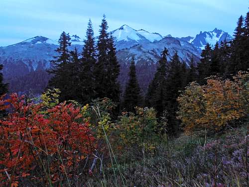
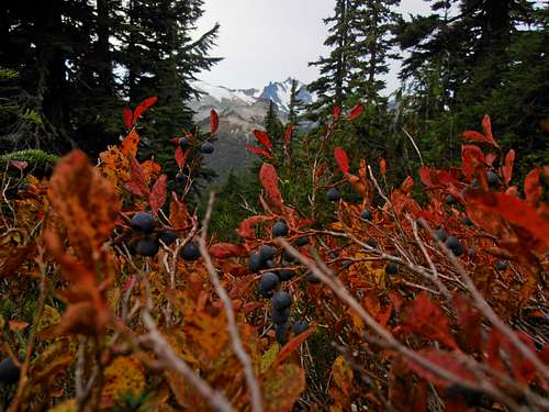
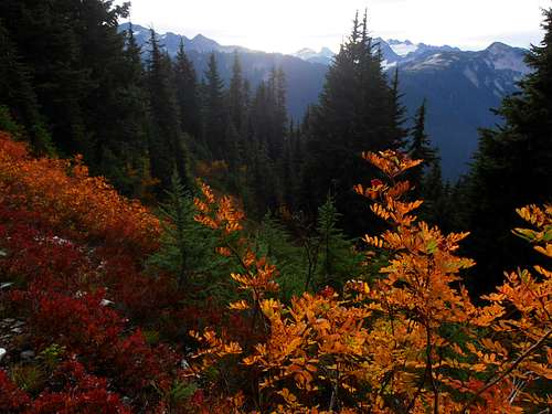
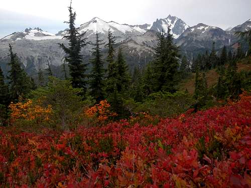
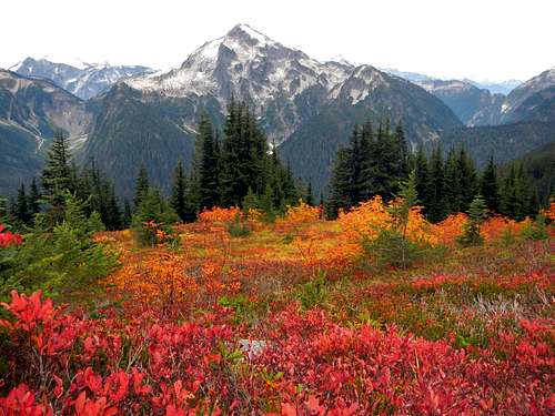
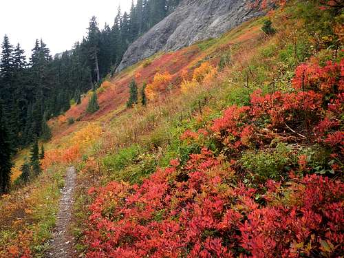
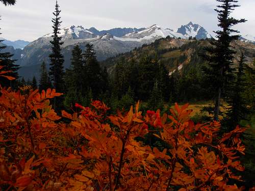
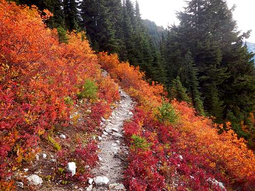
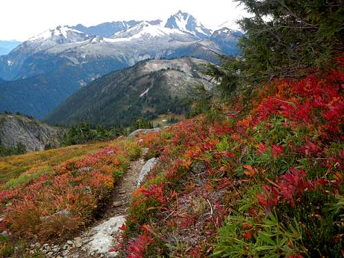
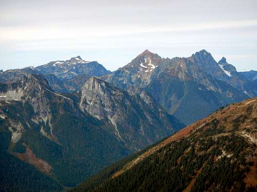
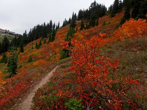
We were both packed pretty much the lightest we've been all year, aside from porting water. Just tennis shoes, a coat and not enough food. A high overcast meant that we'd have reduced light during the day and I wasn't sure if it would blanket heat or keep the air chilly. Luckily it turned out to be the latter and made the miles less sweat-inducing than usual. From the pass we dropped down towards Chilliwack then took the first left at a junction near a bear box and toilet with a sign for Copper Mountain Ridge. Then we had to regain our lost elevation to gain the ridge to Copper. When things leveled out the sun started to light up the surroundings enough to gather that blueberry season had not yet ended. I don't remember them being so ripe this late in the year and we couldn't help but lose time picking a few handfuls for a breakfast supplement. The colorful setting of Blueberry, Mountain Ash and high glaciated peaks was not lost on me. It was lost on my weak image sensor though, so many of my non-amazing photos had to be lightly photo-shopped back to life. Fortunately gimpilator could capture the colors much more brightly in between berry munching sessions.
![Blue Peaks and Anthocyanins]() Blue Peaks and Anthocyanins
Blue Peaks and Anthocyanins
| ![Blueberries still ripe near Egg lake]() Blueberries still ripe near Egg lake
Blueberries still ripe near Egg lake
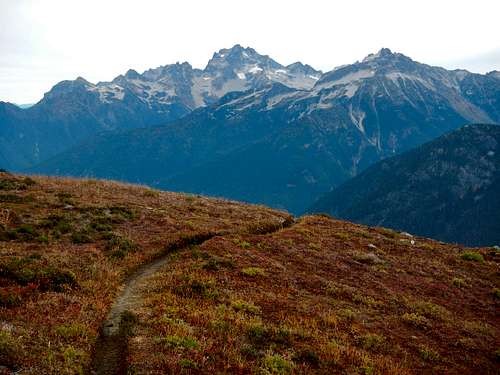
| ![Autumn colors towards Challenger]() Autumn colors towards Challenger
Autumn colors towards Challenger
|
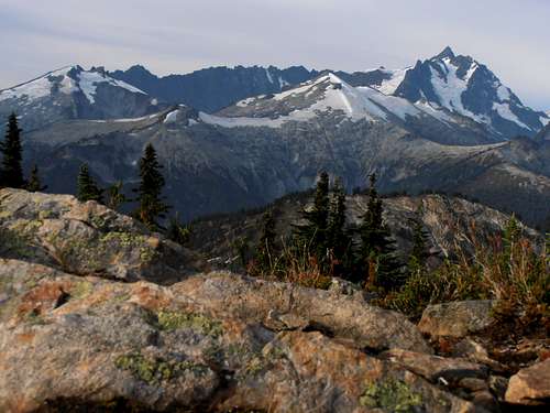
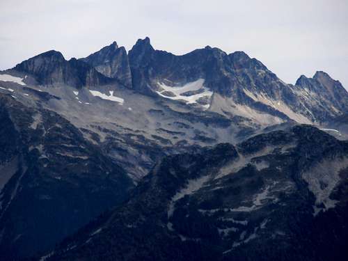
![Icy, Ruth, Shuksan]() Icy, Ruth, Shuksan
Icy, Ruth, Shuksan
| ![Orange Slopes]() Orange Slopes
Orange Slopes
| ![Pink and Orange]() Pink and Orange
Pink and Orange
|
![Mineral Mountain]() Mineral Mountain
Mineral Mountain
| ![Best Berry Slope]() Best Berry Slope
Best Berry Slope
|
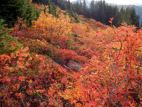
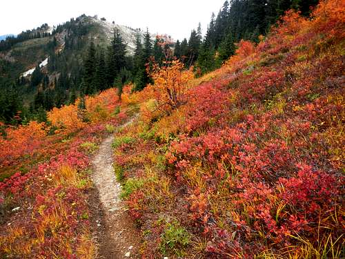
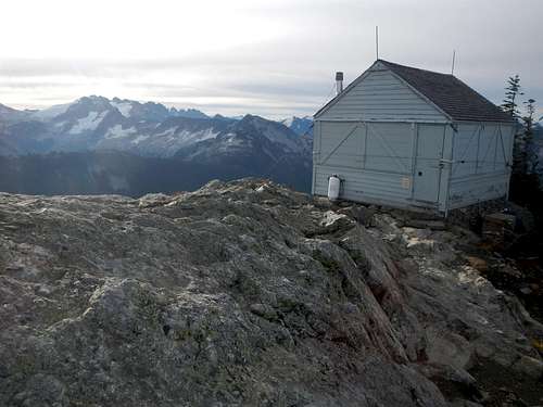
When I got to the point of acid reflux it seemed prudent to stop eating and continue the hike so that we could get back before it was too late. The bushes didn't stop being amazing until at least the Copper Mountain Lookout. Along the way we came across Egg Lake and several open slopes that I could not believe were bear free. We were certain we'd see a bear today with all the bounty everywhere... oh well. Sometimes you just have to settle for boring old blazing red hillsides. We kept the pace as even as possible since this would be my longest, and his second longest day-hike of the year. That meant few full on breaks (aside from berry detours) so when we arrived at the lookout I was glad to have some real food.
The Lookout
I have to concur with Redwic on this one. It is the best view from a lookout that I have yet seen. And our timing in Autumn must have made it that much more asthetic. Gimpilator's eyes have been places, so he might disagree. Opinions... or experience?
![Mountain Ash with Shuksan]() Mountain Ash with Shuksan
Mountain Ash with Shuksan
| ![Egg Lake]() Egg Lake
Egg Lake
| ![Bright Berry Bushes]() Bright Berry Bushes
Bright Berry Bushes
|
![Fall in the North Cascades]() Fall in the North Cascades
Fall in the North Cascades
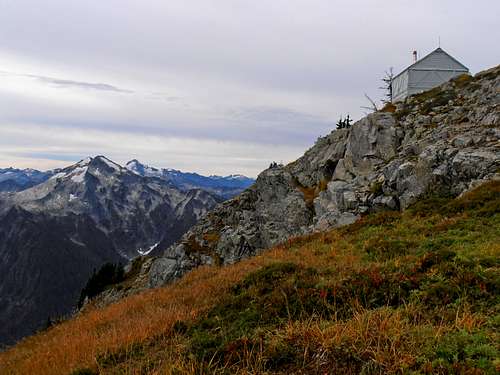
| ![Copper Mountain Lookout]() Copper Mountain Lookout
Copper Mountain Lookout
| ![Copper Mountain Lookout]() Copper Mountain Lookout and Mineral
Copper Mountain Lookout and Mineral
|
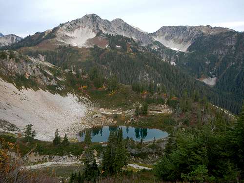
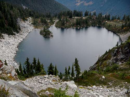
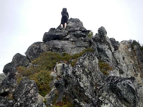
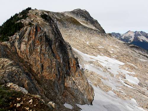
Well, we couldn't stay long since we had unknown miles more to our destination which looked pretty far off. The point in front of our destination looked intimidating enough and I was beginning to think we would be cutting it close on day-light. The wind started to pick up just slightly and I realized that it was actually getting cold for the first time since June. A layer change and we continued marching down the trail until a point where it leaves the ridge. Then the old-trail (sometimes no trail) portion began. It starts with a large scree field (probably snow most of the year) on the West side of a bump we avoided gaining on the way over to Point 6880'. A few short terraces of easy class 3 made travel more interesting. Copper Lake became visible somewhere along the walk. Half way up the point it became obvious that the easiest navigable route was right over the top of it. The route was only class 2 but very airy and I can imagine snow would change that dynamic dramatically. The summit looked very sharp from the South but once on it, it turned out to be just a ridge-walk.
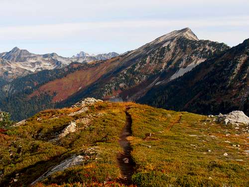
![Trail Less Traveled by...]() Trail Less Traveled by...
Trail Less Traveled by...
| ![Icy to Shuksan from Copper Lookout]() Nooksack shrouds Ruth
Nooksack shrouds Ruth
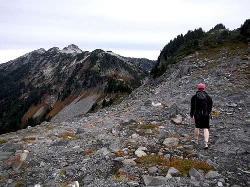
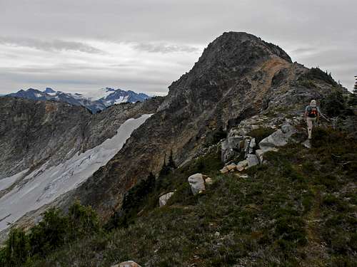
| ![Hiking Copper Mountain Ridge]() Hiking Copper Mountain Ridge
Hiking Copper Mountain Ridge
|
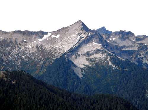
![Mount Redoubt and Bear Mountain]() Mount Redoubt and Bear Mountain
Mount Redoubt and Bear Mountain
| ![Copper Lake]() Copper Lake
Copper Lake
| ![Scrambling Over Point 6880]() Scrambling Over Point 6880
Scrambling Over Point 6880
|
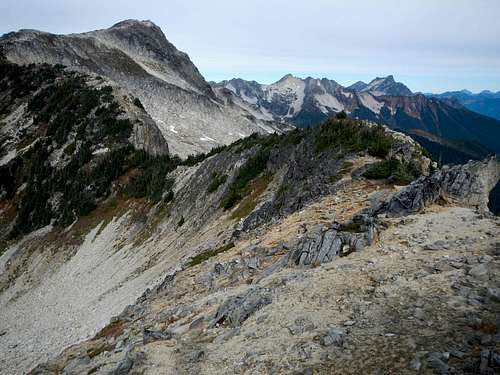
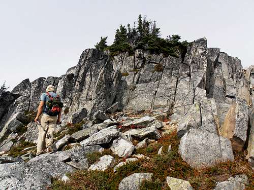
The north side rolled down easy yellow gravel, somewhat reminiscent of the Southern slopes on Golden Horn with a few tricky sections covered in krumholtz. The low point between 6880' and Copper Mountain was a tight squeeze between trees and a steep gouge where a large snowfield and talus basin lay below. From there it was a slightly uncomfortable but short veggie belay up down-sloping rock to easier travel above it. Just easy rocky steps and open meadows until the end. It had a kind of Scottish feel. Looking back I was surprised to see small crevasse like features on the snowfield on Point 6880's NE face. I tried taking some video of the adventure and practice one armed scrambling since most of the scramble sections had very little if any exposure. After some puffing away, the summit was reached and the clouds parted for about half an hour. The warmth should have been nice but instead, a south wind had me wearing all my layers while I ate the last of my food.
![The Final Ridge]() The Final Ridge
The Final Ridge | ![Mount Chardonnay]() Mount Chardonnay
Mount Chardonnay | ![Tomyhoi, Larrabee, and the Border Peaks]() Tomyhoi, Larrabee, and the Border Peaks
Tomyhoi, Larrabee, and the Border Peaks |
![Copper Mountain moraine slabs]() moraine slabs
moraine slabs
| ![The Easy Step]() Easy Step
Easy Step
| ![Gimpilator on Copper Mountain]() Gimpilator on summit
Gimpilator on summit
|
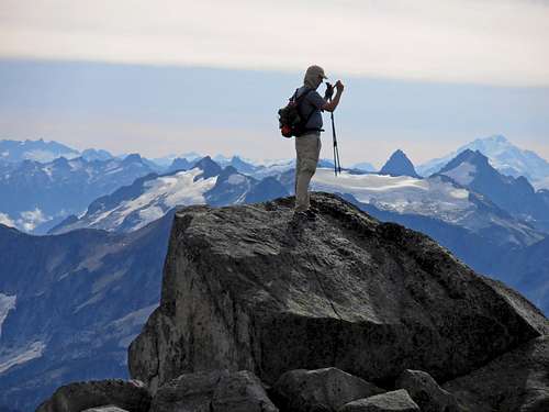
The Summit
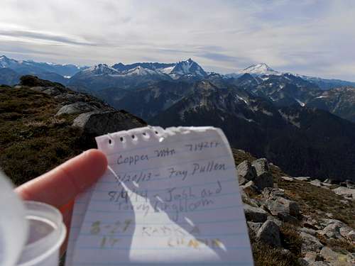
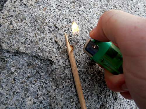
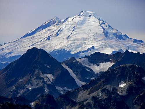
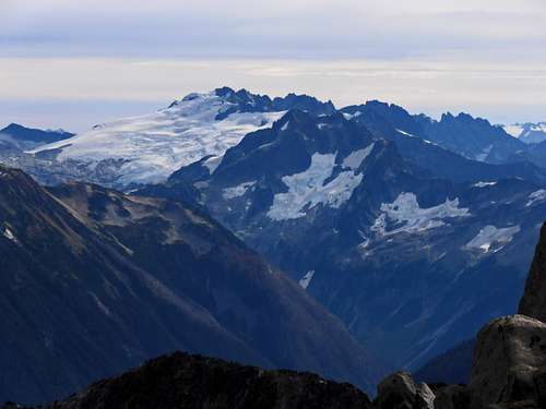
We were greeted to a Fay Pullen register that had only a few entries. There was nothing to write with so I had to get smart and look for something to make charcol. The summit was barren and a quick search didn't yeild any decent timber (or pencils) but I remembered that I had forgotten to take chopsticks out of my pack (hooray for bad memory! -maybe it's all the msg?) I pulled one out then broke off a piece of it with a rock, because, you know, I want to use them for noodles later. It burned well for about an inch which was plenty to add our names. We wrapped it back up in plastic to prevent smearing and tossed it in with the papers just in case the next person doesn't bring a writing utensil. The view was expansive but clouds hung low in the West which had me concerned that we might have to book it out of there. The ceiling was overall still above the peak tops.
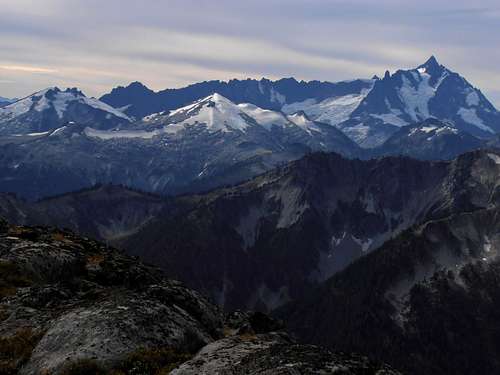
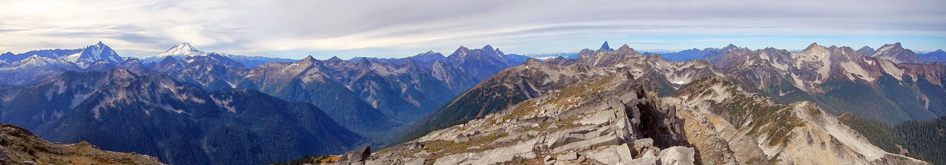 View West to North from Copper Mountain by gimpilator
|
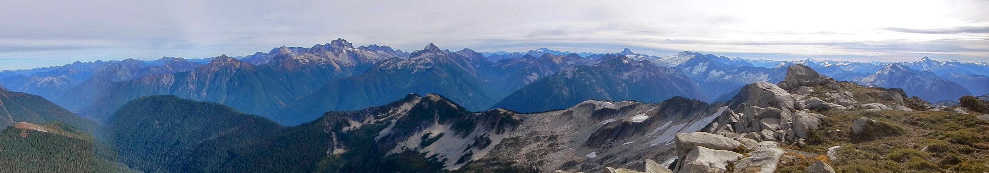 View East to South from Copper Mountain by gimpilator
|
![Icy to Shuksan from Copper]() Weird light makes Ruth pop Weird light makes Ruth pop
| 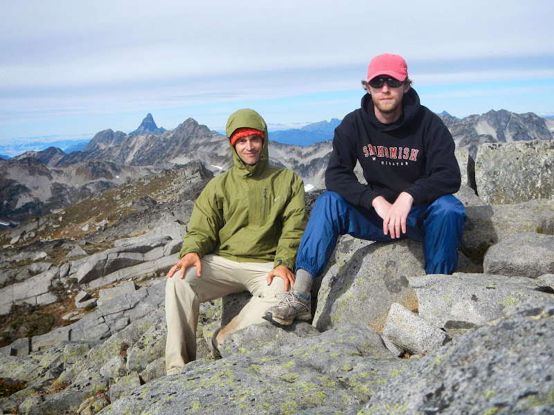 Me (smiling on the inside) and gimpilator
|
Well, without snow this is most likely the half-way point in our time budget so we knew we had to get going to make it by dusk. Thus we flew pretty quickly. Most of the way back to Pt. 6880 we bumped into a ptarmagin. I learned from gimpilator a hunting trick where if you walk to the side of one instead of straight at it, then spiral in slowly, the bird will not notice you at first and will try to hold still hoping its disguised feathers will keep it safe. The one we caught was almost white so it was a bit amusing. Energy was starting to dwindle for me from this point so we doubled down. We still grabbed a few more pictures and blueberries on the way back to Hannegan Pass. Didn't get to see a bear but maybe that's a good thing. We jogged the last 4 miles out by 7:30 and I felt pretty thrashed. But unlike last time walking was not impossible several days later. I think that either the coconut water or the after-hike burrito made a huge difference. Either way, Thanks gimpilator!
![looking back at Pt 6855]() looking back at Pt 6880
looking back at Pt 6880
|  hold still for the camera
| 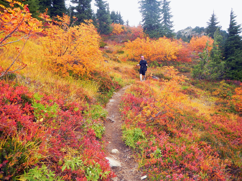 More color on the way out
|
![Red on Copper]() Red hill
Red hill | ![Ruth Autumn Alpenglow]() Ruth Autumn Alpenglow
Ruth Autumn Alpenglow |


Comments
Post a Comment