
-
 12455 Hits
-
 91.14% Score
-
 34 Votes
|
|
Mountain/Rock |
|---|---|
|
|
46.54598°N / 10.64639°E |
|
|
Mountaineering |
|
|
Spring, Summer, Fall, Winter |
|
|
11552 ft / 3521 m |
|
|
Overview
Angelo Grande - Hohe Angelus Spitze 3521 m
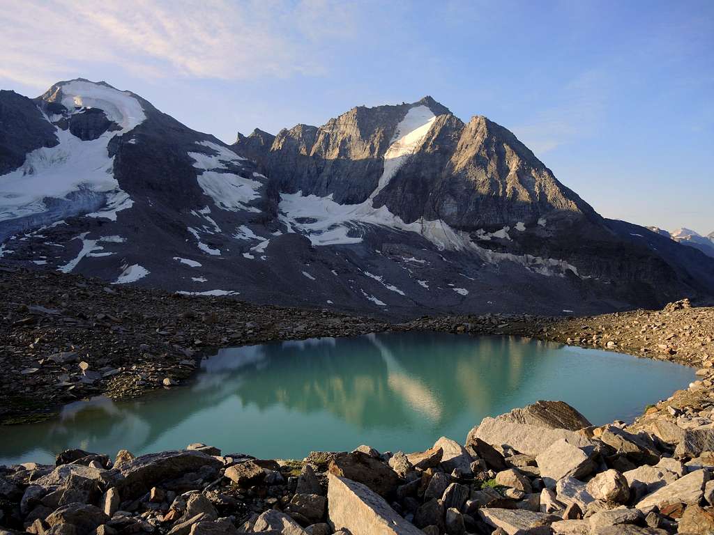
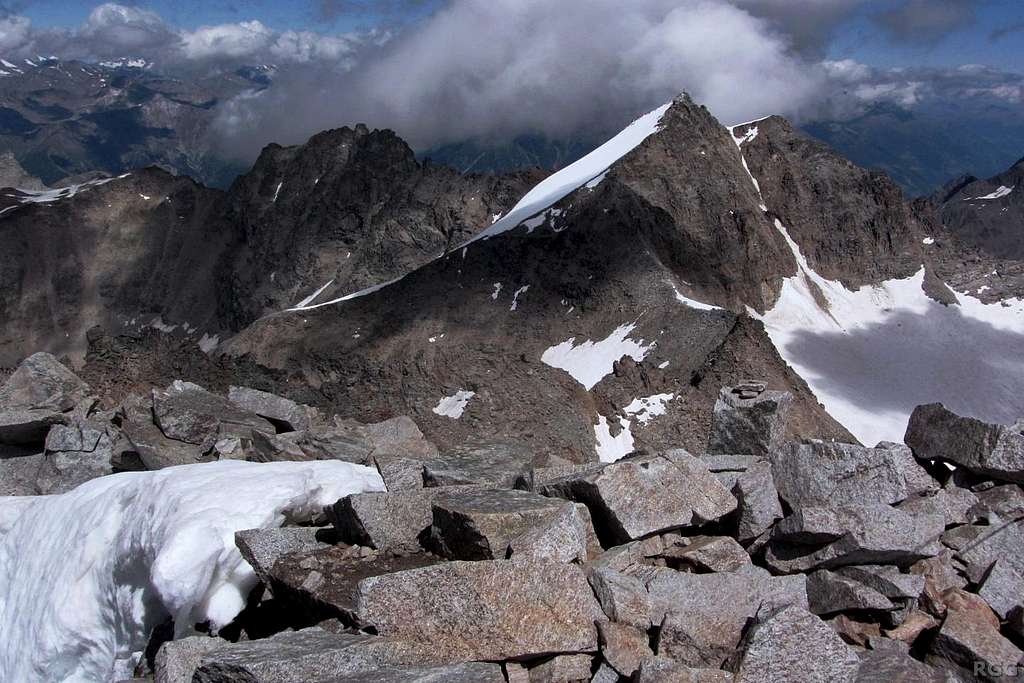
As all the mountains in the region South Tyrol/Bolzano Alto Adige, located near the boundaries between Italy and Austria, this peak has two names: Angelo Grande, the italian name, and Hohe Angelus Spitze, the original tyrolese place-name. Located in the Ortles-Cevedale Group, it's a fine pyramid, surrounded by three glaciers, and has an altitude of 3521 m. It lies on the East side of the Zay Valley, North of the more famous Cima Vertana-Vertainspitze and South-East of the Croda di Cengles-Tschenglser Hochwand.
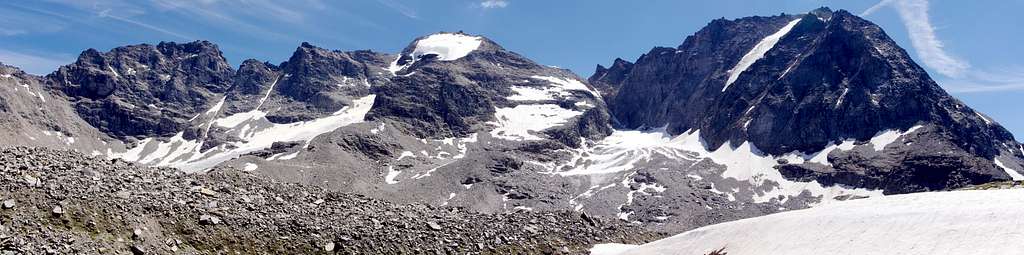
The mountain presents various aspects: rocky towards the South, snowy towards the North and imposing towards the East. It is frequently climbed in combination with Cima Vertana and with descent along the magnificent Rosim Valley. The shortest and safest way up the mountain runs along the North-West ridge which is now considered the Normal route, called the "Reinstadler route", wich is secured with some cables.
Getting There
Road access
The best outgoing point to Angelo Grande is the village of Solda/Sulden 1907 m. There is no train station. Solda is best reachable by car (or bus):
- From Lombardia: from Milan by SS36 towards Lago di Como, later by SS 38 towards Sondrio, through Passo dello Stelvio, in Gomagoi turn right towards Solda.
- From Bolzano Alto-Adige: Bolzano – by road SS38 Merano – Schlandres – towards Passo dello Stelvio, in Gomagoi, before the pass, turn left towards Solda.
- From Southern Germany: Munich – Garmisch – Landeck – Reschenpass, then in Italy road SS 40 via Mals, later SS 38 via Schlunders to Passo dello Stelvio, in Gomagoi, before pass, turn left to Solda
- From Austria: Innsbruck – Landeck - Reschenpass, in Italy road SS 40 via Mals, later SS 38 via Silandro towards Passo dello Stelvio, in Gomagoi, before pass, turn left towards Solda.
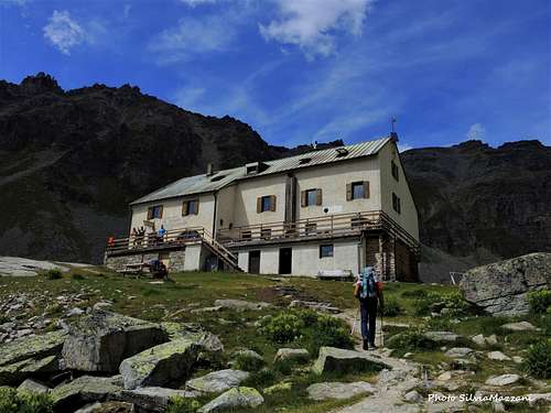
To the Rifugio Serristori ((Düsseldorfer Hut)
There are two options:
1. By the cable car (from Solda to Il Pulpito "Kanzel"). Then follow the path n. 12, that leads to the hut. About 1 hour from the "Kanzel Cable car station" to the hut.
2. From Solda follow the path beside the Zaybach/stream (path 5) all the way to the hut. About 2 hours.
Routes
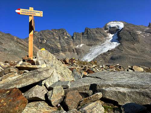
Normal route from the Rifugio Serristori - "Reinstadler route"
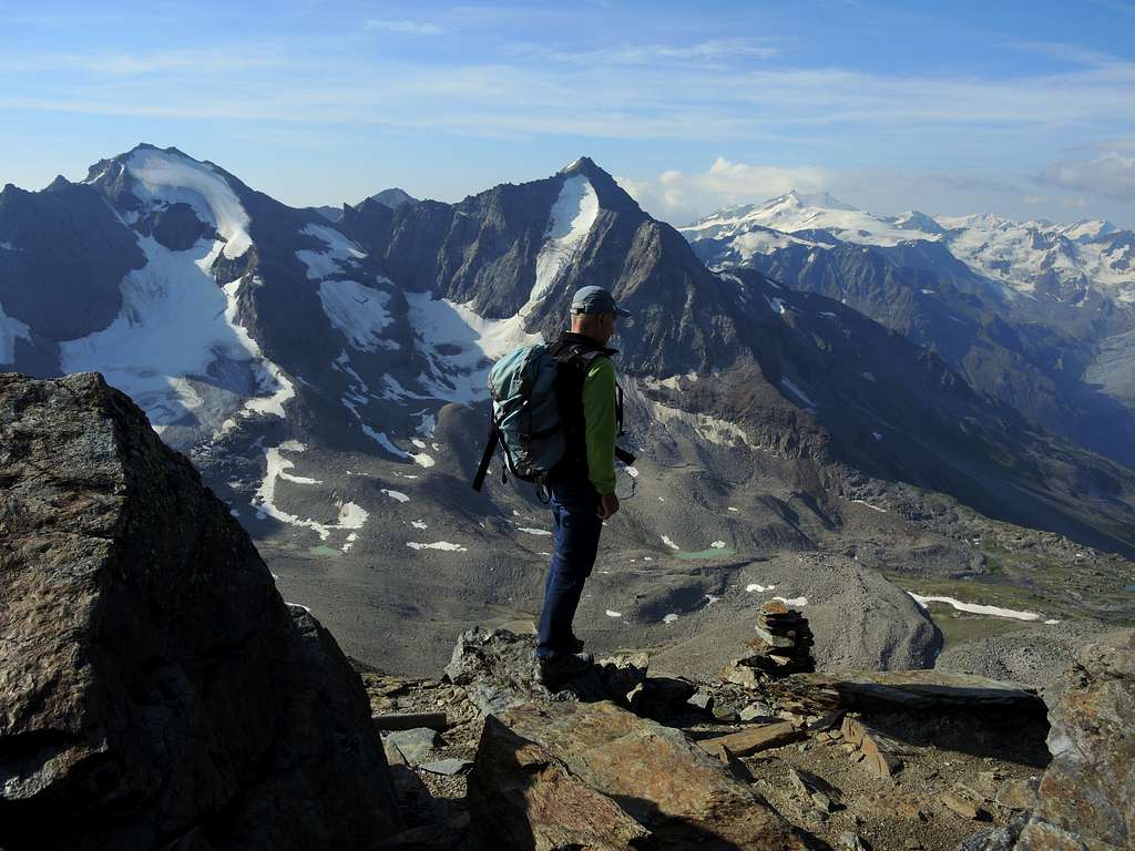
Behind the hut in the Northeast direction following moraines and further up to the base of the rock face of the NW rigde (on wich the Reinstadler route goes). First of all it goes over steep rock terrain with sometimes cables that will help you to go up. After the steep rock section you'll have an impressive view to the summit with the ice-covered North face. Always the rock ridge following, you reach the summit after having climbed more demanding passages (I-II).
Alpine climbing grade: WS-, I-II, 3 hours from Rifugio Serristori
Alternative routes
* Old normal route, West ridge (not recommended because of rockfall). To the Angeluscharte (3337m) and then over the west ridge.
* North face, nice short steep ice climb. The face is only 200 meters high but has sections up to 80° steepness.
* Traverse of the Hoher Angelus and the Vertainspitze.
Red Tape
No permits or fees for climbing are required. The mountain lies in the area of Parco Nazionale dello Stelvio (National Park Stilfser Joch).
No particular restrictions in hiking and climbing inside this area. Respect the general rules regarding the National parks. The whole fauna and flora is protected. Don’t disturb fauna and other mountaineers and hikers’ peacefulness with every kind of noise.
Official site of the Stelvio National Park
Hut
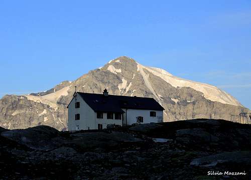
The only hut near Angelo Grande is the Rifugio Serristori, called also Düsseldorfer Hütte and Zaytalhütte. It lies at 2721 m in Zaytal (Valle di Zai). This hut exists since the year 1892 and today belongs to Milan section of CAI (Club Alpino Itatliano). It is managed by Reinstadlers, a famous family of alpine guides in Ortles area. The hut is reachable from the Pulpito-Kanzel lift station, on the marked path n 12. Details (in German or Italian only) are to find here: Rifugio Serristori/Duesseldorfer Huette
Check also the dedicated page by lodewijk here on SP: Düsseldorferhütte / Rifugio Serristori.
Guidebooks and maps
Guidebooks

"Ortles-Cevedale" by Gino Buscaini - Collana Guide dei Monti d'Italia TCI-CAI
"Gebiedsführer Rother Ortler Alpen" by Peter Holl, ISBN 978-3-7633-1313-6
"Hochtouren Ostalpen" by Edwin Schmitt and Wolfgang Pusch, ISBN 978-3-7633-3010-2
"Firn- und Eisklettern in den Ostalpen" by Axel Jentzsch-Rabl and Andreas Jentzsch, ISBN: 3-9500920-0-5
Maps
Kompass: Nr 72, Ortler/Ortles-Cevedale, 1:50.000
Kompass: Nr 636, Ortler/Ortles-Stilfser Joch/Passo dello Stelvio, 1:25.000
Tabacco Ortlergebiet 1:25.000 Nr. 08
Kompass Vinschgau 1:50.000 Nr. 52
Meteo