
-
 21170 Hits
-
 79.75% Score
-
 13 Votes
|
|
Mountain/Rock |
|---|---|
|
|
38.43150°N / 78.4735°W |
|
|
Greene |
|
|
3569 ft / 1088 m |
|
|
Overview
The Big Meadows, Lewis Mountain, and Loft Mountain campsites are located near the summits of peaks in Shenandoah National Park. The Lewis Mountain campsite is near the summit of Lewis Mountain in the Central District of the Park (not to be confused with Lewis Peak or Lewis Mountain in the South District of the Park). Lewis Mountain also has an overlook near its summit with views of Bluff Mountain, Flattop Ridge, Kirtley Mountain, and Point 3620.Getting There
Lewis Mountain Trail: From Harrisonburg, follow US 33 east until reaching Skyline Drive. Turn left on Skyline Drive and continue to the Lewis Mountain campground. Find a parking spot.Walk through the campground and find the blue-blazed Lewis Mountain Trail at the far end. Hike for 0.4 miles on the Lewis Mountain Trail to the overlook. Shortly before the trail starts descending towards the overlook, there is a side trail that leads to the summit, which has a thicket of bushes. At the overlook, you can see from left to right Bluff Mountain, Flattop Ridge, Kirtley Mountain, and Point 3620. The Lewis Mountain Trail formerly went all the way to the valley floor, but now it is now maintained only to the overlook. There is an unblazed trail that continues after the overlook, but it only curves back up to the summit.
Round trip: A little over 1 mile with an elevation gain of 150 feet.
 Leading Ridge and Lewis Mountain subpeak
Meadow School Road: From Harrisonburg, follow US 33 east until reaching US 340 in Elkton. Go north on US 340 until reaching SR 609. Turn right onto SR 609 and follow it to SR 759. Continue straight on SR 759, which becomes a steep, narrow gravel road to the boundary of Shenandoah National Park. There are a few parking spots near the side of the road.
Hike up the yellow-blazed Meadow School fire road for 1.3 miles until reaching Skyline Drive. Turn right and walk on the shoulder of Skyline Drive for about 100 feet. Make a left onto a side road and and follow it to the intersection with the white-blazed Appalachian Trail. Turn right on the Appalachian Trail and follow it for about 1 mile. Make a left at the Lewis Mountain Trail and follow it for 0.4 miles to the summit and the overlook.
Round trip: About 5.5 miles with an elevation gain of 1,400 feet.
Appalachian Trail from Bootens Gap: From Harrisonburg, follow US 33 east until reaching Skyline Drive. Turn left on Skyline Drive and continue to the Bootens Gap parking lot on the right.
Turn right onto the Appalachian Trail, and follow it until reaching the blue-blazed Bearfence Trail. Scramble over the rocks and enjoy the views of Stony Man, Bluff Mountain, Fork Mountain, Jones Mountain, Green Mountain, and Devils Tanyard. Continue on the Bearfence Trail and make a right onto the Appalachian Trail. The Appalachian Trail descends and eventually ascends over the next 1.5 miles. Then, make a left at the Lewis Mountain trail and follow it to the summit and the overlook.
On the way back, follow the Appalachian Trail for 3.4 miles to Bootens Gap.
Round trip: About 7.8 miles with an elevation gain of 1,200 feet.
 Stony Man Stony Man |  Fork Mountain Fork Mountain | 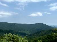 Bluff Mountain Bluff Mountain |
 Green Mountain Green Mountain |  Devils Tanyard Devils Tanyard |  Bearfence Summit Bearfence Summit |
Slaughter Trail: From Harrisonburg, follow US 33 east until reaching SR 638, where you make a left. Make another left at SR 637 and a right at SR 642. Then make a left at SR 667 and follow it to the Slaughter trailhead. Finding parking is difficult here.
Hike for 3.8 miles on the yellow-blazed Slaughter Trail. Turn right on the Appalachian Trail and follow it for about 1 mile. Make a left at the Lewis Mountain Trail and follow it for 0.4 miles to the summit and the overlook.
Round trip: About 10.4 miles with an elevation gain of about 2,800 feet.
Red Tape
The $15 entrance fee is only applicable on Skyline Drive. The Meadow School and Slaughter Trails are free. Please respect private property near the Meadow School trailhead and do not block the road.When to Climb
Lewis Mountain can be climbed nearly all year round. However, the Lewis Mountain campground is closed in the winter, which rules out the shortest route to the summit. Skyline Drive is often closed during the winter beyond the park entrance gate because of snow and ice, making the Meadow School and Slaughter Trails a necessity instead of the Appalachian Trail from Bootens Gap.The hike can be particularly delightful in mid to late October when fall colors are at their peak; many trees below 3,000 feet elevation still have their leaves on Veterans Day. Summer is the worst time for mosquitoes, ticks, and other hostile little critters. The heat and humidity are also at their worst in summer, but it also the best time to see mushrooms.
Mushrooms on the Appalachian Trail in August.
 Red Red |  Orange Orange |  Purple Purple |
 White White |  Brown Brown |  Black Black |
Camping
 Cabin at Lewis Mountain Campground
There are 31 campsites available at the Lewis Mountain Campground on a first-come, first-served basis. Campsites cost $15 per night and are available for a maximum of 30 consecutive days. The campground also has 15 cabins. Camping is not allowed during the winter.
Additionally, free backcountry camping is allowed throughout Shenandoah National Park. The required permit can be obtained through mail or at entrance stations, park headquarters, or visitor centers. Campfires are only permitted at pre-constructed fireplaces at backcountry huts and day-use shelters.
Campsites must be at least:
•10 yards away from a stream or other natural water source.
•50 yards away from standing buildings and ruins.
•100 yards away from a hut, cabin, or day-use shelter.
•1/4 of a mile away from a paved road or park boundary.
Extrernal links
Shenandoah National ParkThe Potomac Appalachian Trail Club maintains the trails in the Shenandoah National Park, and provides maps, guidebooks, and other information.