Conjuring up Conger - March 2nd, 2014
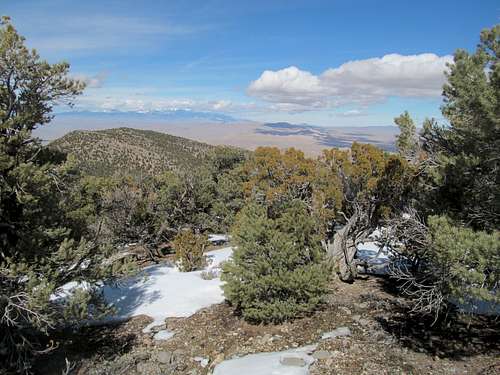
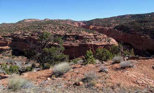
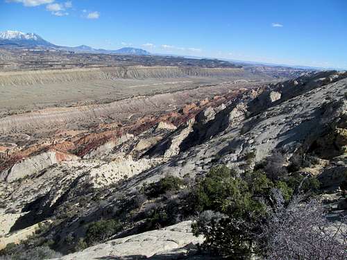
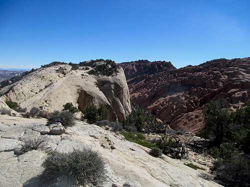
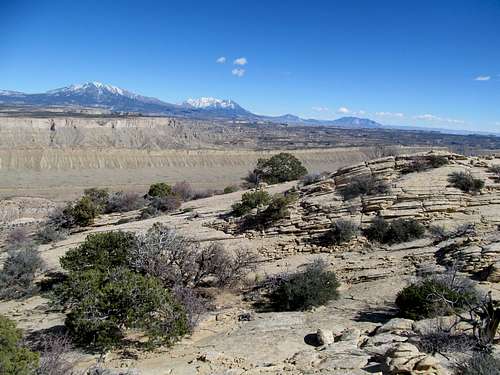
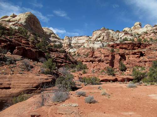
Several years, several hundred peaks, and even more miles after the fact was about when I finally joined the GPS club, having done some online shopping plugging away hungover at a Starbucks in Cheyenne, Wyoming on Black Friday enroute driving to Boston. Having hiked mostly with Greg since coming back to Utah I had bothered with neither activating and learning how to use the device nor downloading all the topo maps I would need in conjunction with it. Having finally procrastinated long enough, I was ready to test out the equipment on a warm spring day on Conger Mountain, a good opportunity to see how it would work on an easy cross country desert peak with pretty basic route finding.
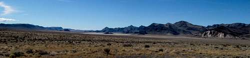
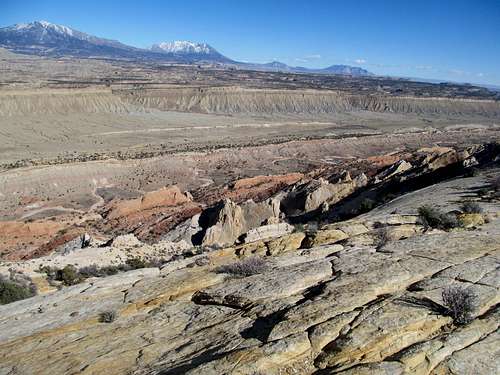
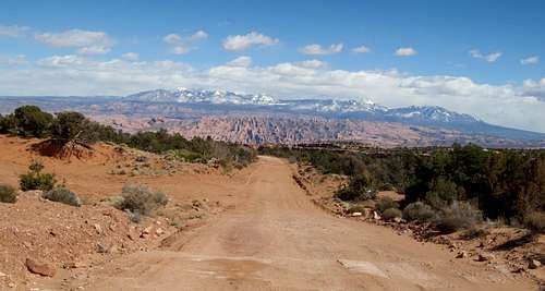
I took my time to make the long solitary drive to a single peak. The road, hidden past the crest of US-50 over the Confusion Range was easy to find using Dean’s directions. Conger is actually part of the northern section of the Confusions and a P1K that’s listed in Utah’s 100 most prominent.
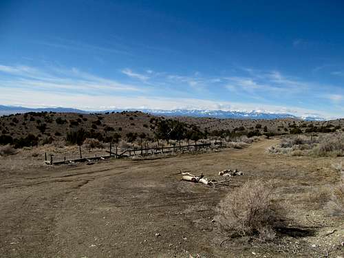
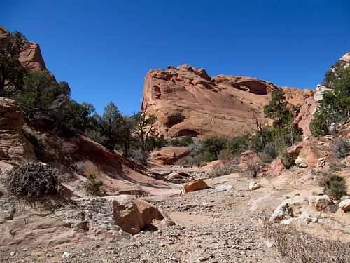
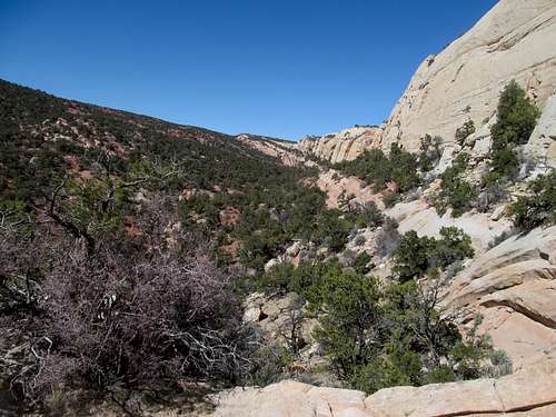
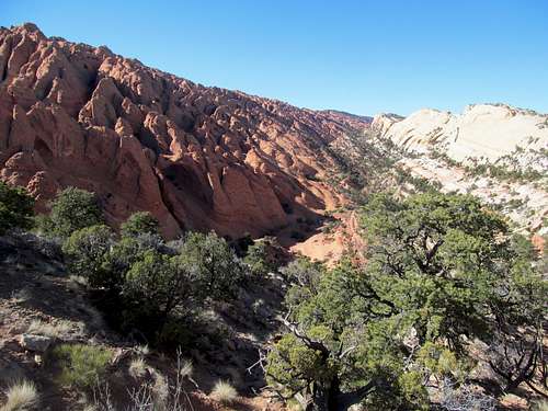
The wide gravel road was easy going to the 2WD trailhead, and I opted to start my hike from here. Somehow though I wasn’t able to find the jeep road leading off from the very same trailhead (thanks GPS!) and ended up traversing easy desert terrain east (to the right) of the road to a slight divide that offered good views of the peak in front of me.
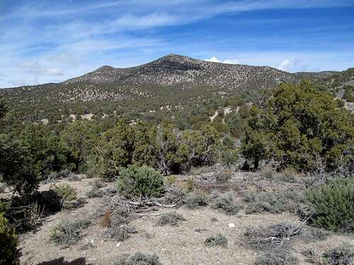
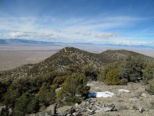
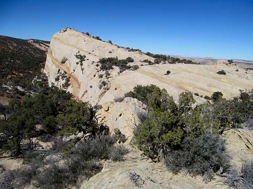
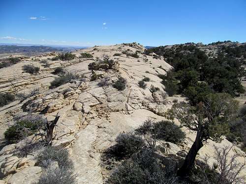
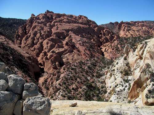
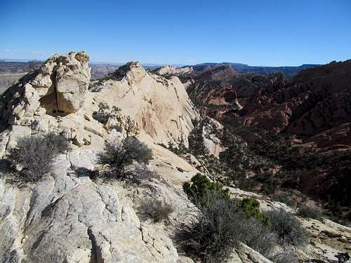
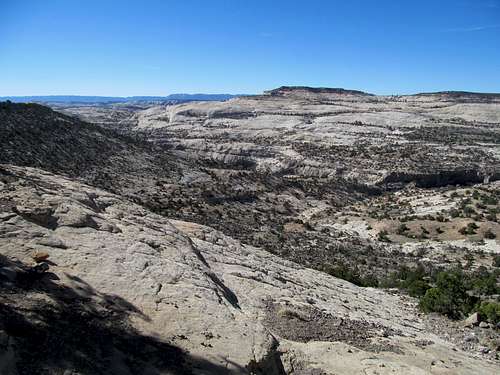
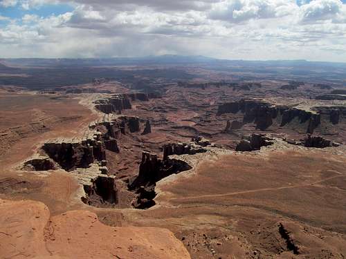
I dropped down to a sharp drainage and ascended the sandy and rocky slopes to reach the ridge crest, which I followed to the moderately open summit.
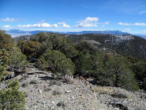
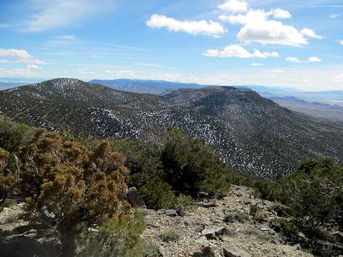
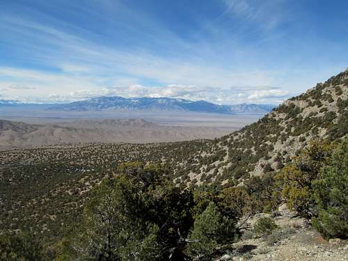
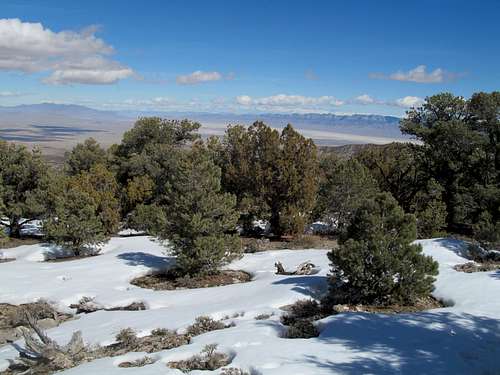
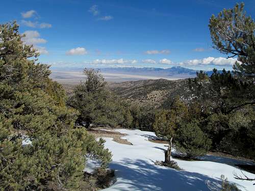
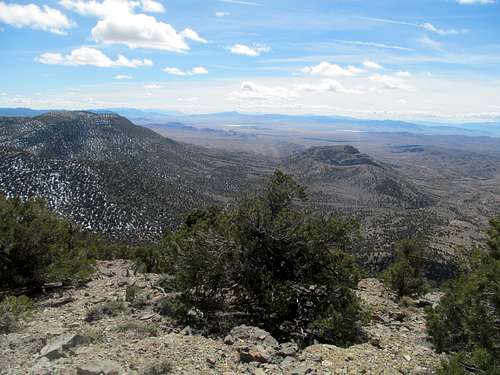
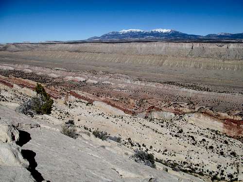
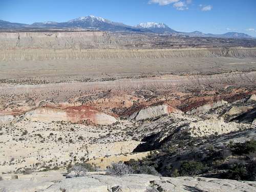
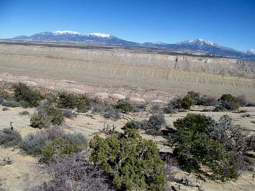
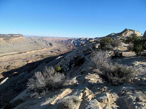
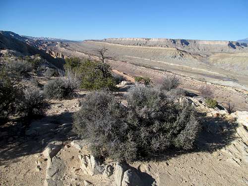
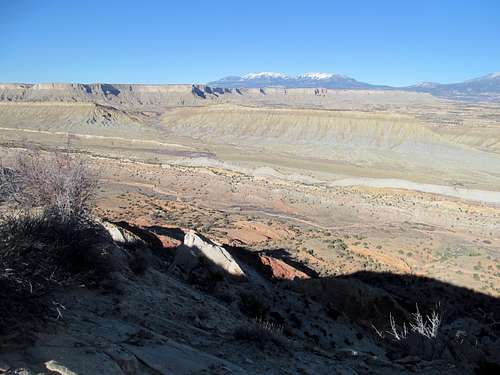
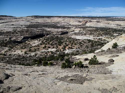
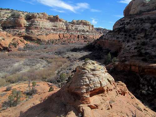
I had to wander around the top a bit to get in all the views the summit had to offer, and it was especially refreshing to see Swasey and Notch Peaks in the House Range for the first time as finished peaks.
The distant icy visage of Wheeler and Moriah Peaks in Nevada and the Deep Creeks to the north offered a distinct contrast to the balmy conditions in the desert.
I was able to locate the jeep road halfway through the descent as I finally familiarized myself with the GPS and my preferred settings on it.
Twistin' around Upper Muley - March 8th, 2014
Greg’s parents were visiting Utah once more, which meant that he would have to take a break from his heavy duty peakbagging to do some of the more touristy shit…or in theory at least; in practice the past spring a quick weekend hike of Water Canyon on Canaan Mountain in Southern Utah saw us venture into treacherous slippery and snowclad slickrock surfaces.
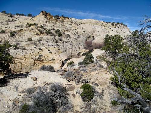
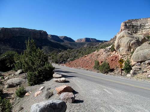
But alas Southern Utah was once more on the docket. Their plan was to leave Salt Lake Sunday morning towards Boulder and Escalante before swinging through Bryce and St. George, so I suggested the Calf Creek Falls area as a good meeting spot. As for myself, I departed a morning earlier over the snowclad Aquarius Plateau, down into the always charming town of Boulder, and down the ruggedly scene Burr Trail as it wound its way through the very remote canyons in the shadow of the Henry’s and Navajo Mountain to arrive in Capitol Reef National Park and the Upper Muley Twist trailhead.
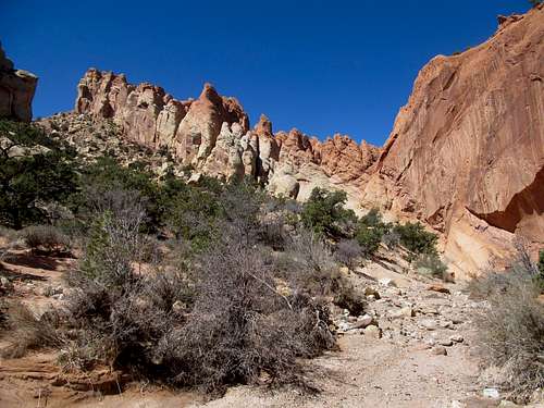
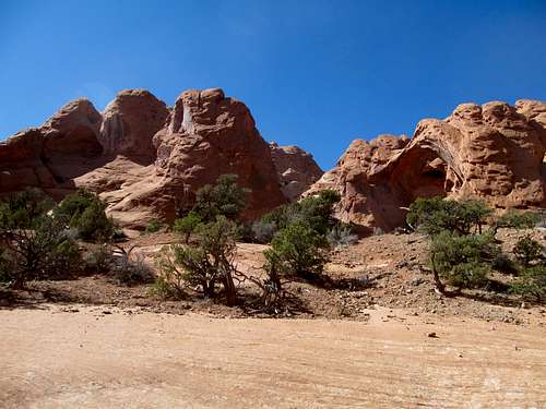
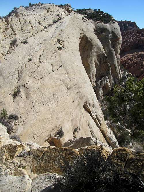
I will say in advance that Upper Muley Twist Canyon really should be on EVERY hiker's bucket list, and also that afterwards I was a little surprised at, for someone with a fear of heights, how much vertigo this supposedly trailed route can inspire, and how the route finding could be a little tricky at times, trying to spot the right cairns in spots when it climbs into the upper route.
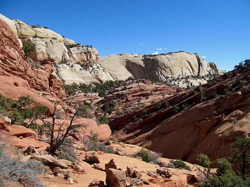
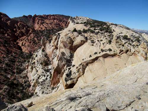
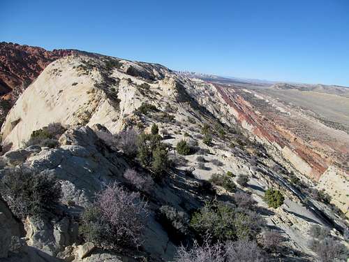
Which gives away the order in which I did the hike, divided into a lower canyon section, an upper section along the reef fins lining the east side of the canyon, the latter of which loops back towards the former.
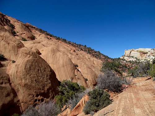
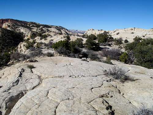
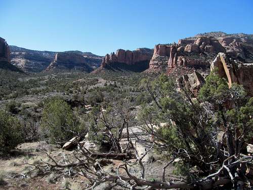
The endless supply of arches along the lower route was pretty cool, as were the odd looking red scale like formations on the left side of the canyon, but nothing compared to the upper route.
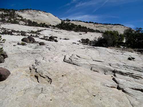
As the lower route disappeared into the oblivion of a narrow slot canyon I played a difficult game of connect the dots (cairns) as the trail informally switchbacks up the slickrock ledges towards the upper section and twisted my routefinding skills into bolivian.
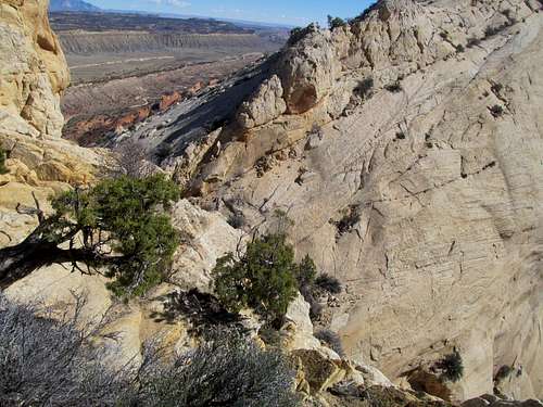
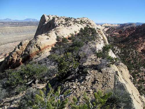
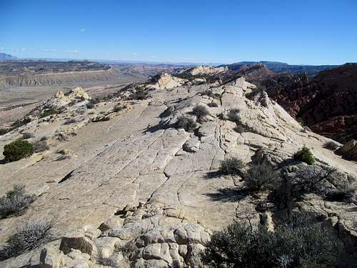
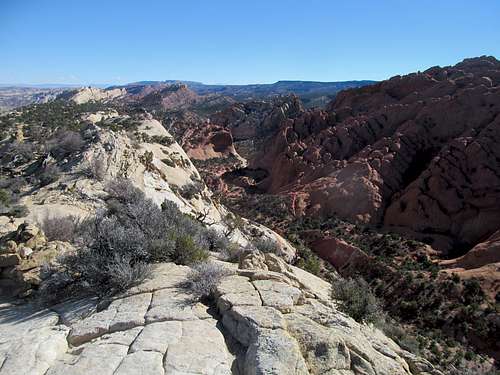
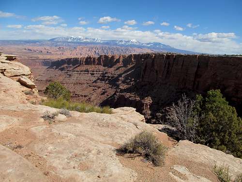
Cresting the top of the fin brought me the aforementioned breathtaking views, of the Henry’s yes, of Notum Road and the Strike Valley yes, but most crucially the views of the Waterpocket Fold seen in near entirety from one end to the other, with vistas north stretching all the way towards the route 24 area; here the view contrasts from the views up top in the former, whereas while the Fryingpan Trail gives you a perspective of the fold from up high, the Muley sections are much narrower, both the trail and the geology, and you really feel like you’re walking along the spine of the world.
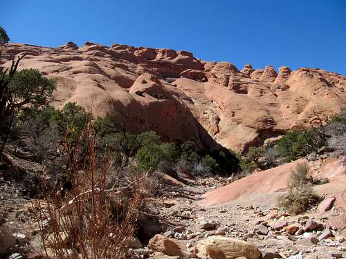
I savored this last section, admiring the Henry’s to the east as the sun slowly dwindled its reach on that remote range, and tried my best to ignore the sheer drop offs on either edge.
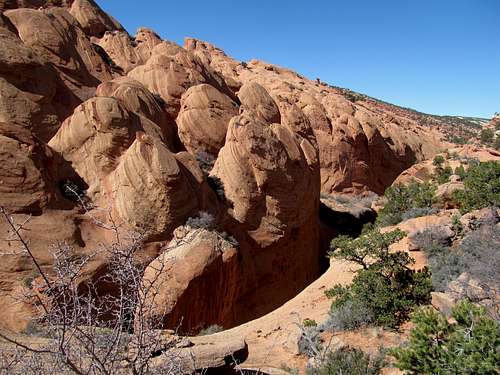
At one point the trail disappears steeply into a notch between fins, and I had to put my faith in the trailbuilders (as well as the guidebooks and the hundreds of thousands of people who have traversed this trail safely) that this route would not fade into the good night, cliff out style.
The ingenuity of the trailbuilders proved itself at the end, and I enjoyed re-surveying the arches on my way back to the trailhead.
I talked to a couple of hikers there, then took a quick jaunt to the Strike Valley Overlook to get my final vistas for the day.
I had surveyed the Notum Road firsthand while on the reef. I kind of wanted to return to Torrey at a reasonable time to catch the Duke UNC game, and Notum, while a good road, seemed slow going with its many curves along the river. I had heard about how washboarded it was too, so I decided to stick with the known quantity, the very well maintained Burr Trail, for the trip back.
Falling for Calf Creek - March 9th, 2014
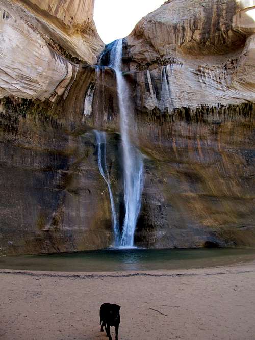
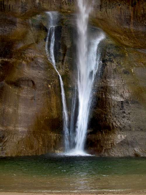
Upper Calf Creek Falls
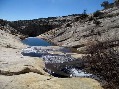
While waiting for Greg and co to make their way down from Salt Lake Sunday I managed to fit in Upper Calf Creek Falls after gorging on coffee and candy from the always satisfying Castle Rock Coffee in Torrey (they have delicious sandwiches too!), then taking a quick moment to check out the Anasazi ruins state park in the middle of Boulder. The remarkable trailhead sitting at the edge of a vast maze of slickrock canyons was unremarkably signed (ie none), and it took me a few times to locate the turnoff near the famous gangplank section on UT-12.
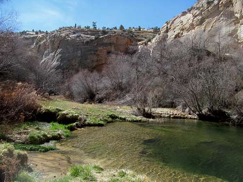
The route down seems impossible but makes for a fun downward jog along the seemingly smooth rock, taking you a few hundred feet down to a small bench where the actual chasm of the Calf Creek Canyon becomes apparent.
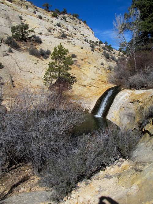
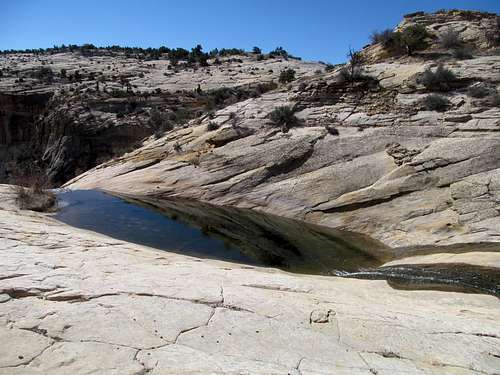
I followed it as it swung right, then split. I first took the right fork as it ended at several glimmering pools above the waterfall proper, taking some time to explore the area before backtracking and then finding the lower track down to the falls.
I took a moment here to enjoy not just the sights but the sounds and smells emanating from the tranquil cove and the quaint little waterfall and, like Negro Bill Canyon a few weeks prior, listen to the rare harmony of the ephemeral desert oasis.
I had thought about following a route some guidebooks suggested downstream from the upper falls but time and a lack of suitable wading footwear kept me from exploring the upper canyon further.
I hopped back up the slickrock, stopped at the always remarkable spectacle of the Kiva Coffee hut perched in the midst of the most labyrinthian canyons this side of Escalante, and awaited Greg and co from the Lower Falls trailhead.
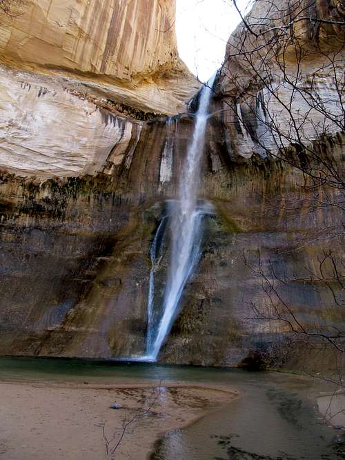
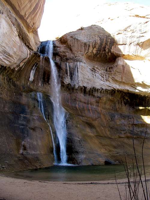
Lower Calf Creek Falls
They arrived, and we left the surprisingly crowded parking lot. The hike to the falls is very easy, following a well groomed and flat trail through a wide and vaguely scenic canyon. Similar to the arches in Muley Twist the day before, rumors of petroglyphs kept us on the lookout. The dry and bare willows and cottonwoods in the canyon kept the ambiance below transcendent levels and served to remind us that, despite the warm temperatures we were enjoying, spring had not yet truly arrived in southern Utah.
The falls themselves were a further reminder. First off, they are unexpected, hidden in a narrow cul de sac cove that you hear but don’t see until you’re at point blank range. The acoustics of the cove made it loud, and combined with the draft from the furiously flowing cascades served to keep the entire area chillier than a Bostonian conversing with tourists from Iowa. The falls themselves were spectacular, exotic, breath and belief defying, everything that should make it a premier hiking destination, the ambiance similar that of a well done not so tacky casino waterfall, except 100% real and natural, and I pondered how great it would be to have a giant resort casino here with the falls serving as the backdrop to a pool/nightclub area, maybe name it something like the Sandstone Resort, or Anasazi Moon?
The chilly breeze from the main attraction, likely bad vibes from it directed towards me for wanting to resortify it, kept us from staying too long, and besides, it was most proper for us to make way for the slow but steady stream of hikers newly arriving at this mobbed spot, relative at least compared to the basic bitch Utah hangouts (ie Moab, Zion). We enjoyed a relaxing hike out of the canyon, with me heading back for Salt Lake and Greg and co continuing on south towards Escalante.
Bumpin' around Gooseberry - March 15th, 2014
It’s ironic that just one year later I spent St. Patty’s Day working late followed by the usual gym routine, drinking maybe a third of a beer afterwards sitting at home, probably writing up this trip report. Back in my already fading last life in Utah my main goal for the weekend was to NOT spend it in Utah, or at least the Salt Lake Valley. I wanted to get away to somewhere fun, where they cared about the holiday, though my options were limited to either Moab or Grand Junction...preferably somewhere with either tourists or a good pipeline of resident drinkers as well as a small walkable downtown.
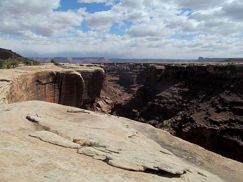
I ultimately opted for Colorado since it would be a change of pace, but not before venturing first into the Moab area. Having done the Murphy loop, I wanted a trail descending the eastern side of Island in the Sky. With a bevy of college conference basketball tournament games going on I also wanted to be at a bar drinking relatively early in the day, so I opted for the shorter and supposedly steep Gooseberry Trail to still get in a moderate workout.
A storm brewed over the La Sals as I started down the trail. Indeed it was steep going but short enough that I never really wavered my attention from the views of the mountains and the complex canyons in the foreground.
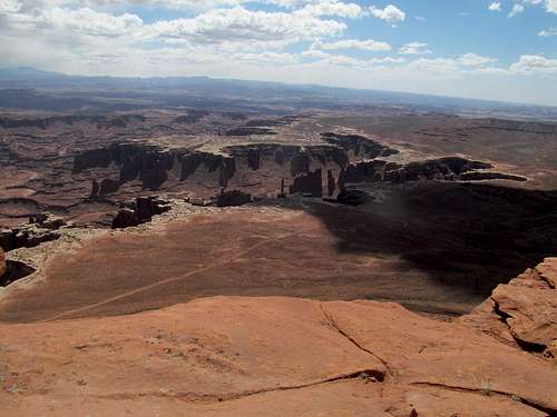
Compared to the Murphy trail everything Gooseberry happens quick. You speed below the cliffs, and there’s not much dilly dallying in the no man’s land of washes and drainages before you reach your destination, the thick and immediate overhanging cliffs of Gooseberry Canyon.
Pretty amazing that in such a popular spot in a national park (though I did have the canyon to myself on a Saturday) no one’s yet slipped down the easily slippable edge.
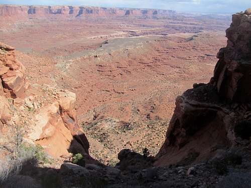
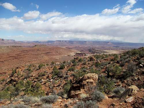
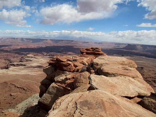
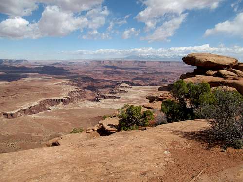
After a steep but short hike back up I followed the trail back to my car, then set off for the short spur to White Rim Overlook, which offered a slightly different perspective of Gooseberry and its trail.
Having been starved of actual summits of late I made a sidetrip to hop up to the Knoll on the way to Moab. The short scramble right off the main park road near the entrance to Island in the Sky offered decent distant views, though the immediate vicinity on the plateau was saturated with Kansan flatness.
Taking the Long Canyon 4WD road down to the highway, I skipped the town of Moab to drive through the scenic Castle Valley, stopping by the picturesque winery sitting at the foot of Dome Plateau to do a little bit of mid day wine tasting (they had a great Merlot…or Cab…I forget which but whichever it was I helped myself to a bottle.)
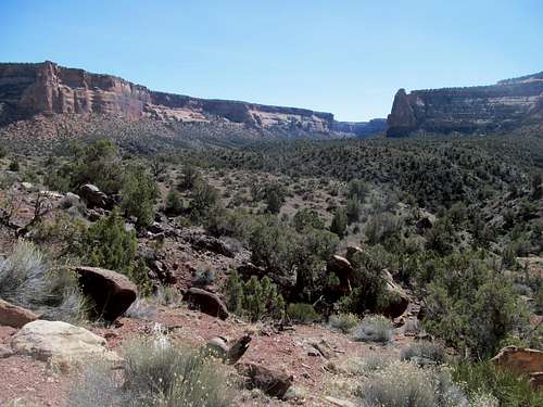
Monumentally Basic - March 16th, 2014
I arrived at GJ in the evening, started with a Providence College Big East Tourney win alongside brews and a meal at the Rockslide Brewing a friend had suggested to me (incidentally my friend had done her Physical Therapist residency here years ago; in fact I may have half consciously picked GJ trusting the judgment of a fellow Bostonian, the fact that she enjoyed her time here I hoped bode well for my interlude in town).
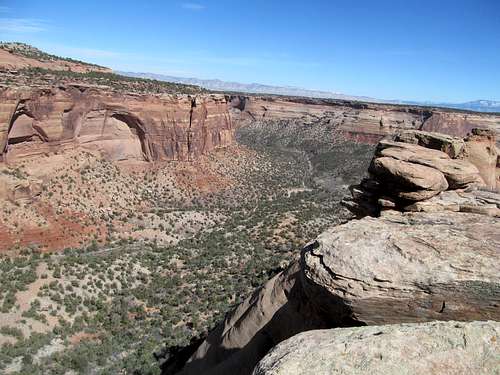
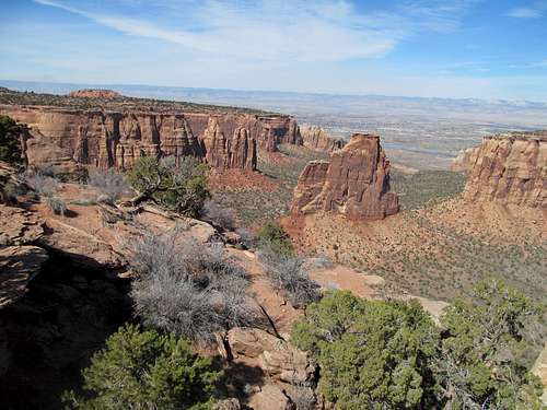
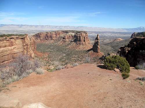
And drink I did, plenty of beer and Jameson, and damn did I feel it the next morning. I shelved any vague ambitious notions to get nearby Mt. Garfield or Rattlesnake Arches, deciding instead to play the basic tourist at Colorado National Monument.
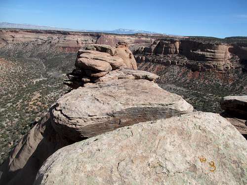
My hungover did not impede me enough to navigate the winding switchbacks of the monument, nor did it prevent me from comprehending the sheer terror of the steep drop-offs so close to the popular drive. I overcame my terror to stop at the basic overlooks and take my basic pictures.
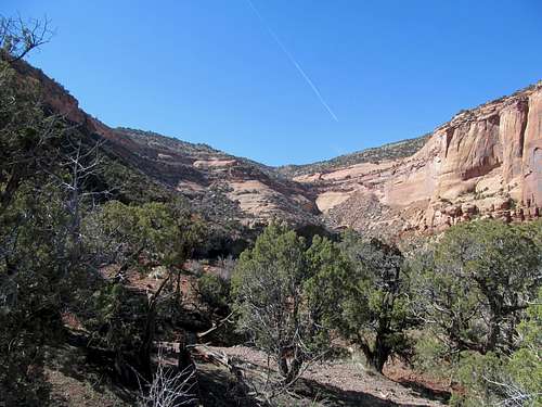
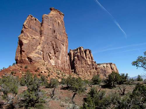
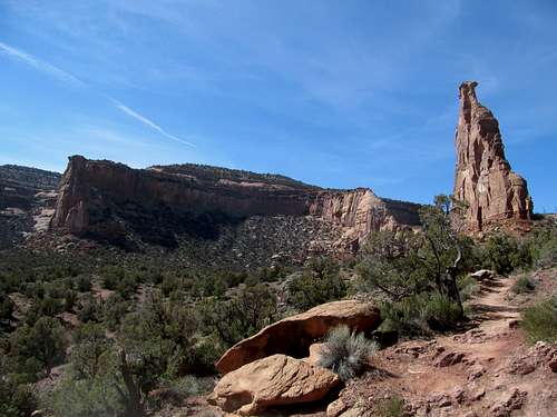
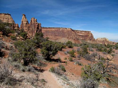
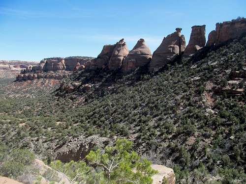
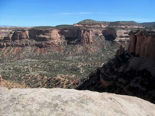
I still wanted to burn off some calories and thus chose the Monument Canyon trail as the vehicle to do so, hoping the 600 or so feet or elevation loss and subsequent would burn off the carbs as well as the hangover from the previous night. Like a broken record I skipped gingerly down the trail. The bottom of the Canyon was pleasant, quiet and pastoral. Grand Junction was seemingly a outdoorsy town, far more compared to SLC, or at least judged by the constant flow of hikers I encountered along the hike.
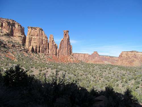
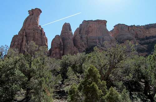
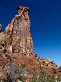
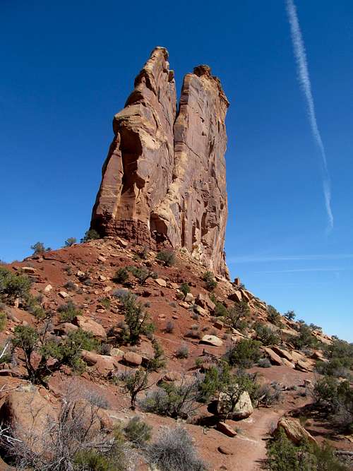
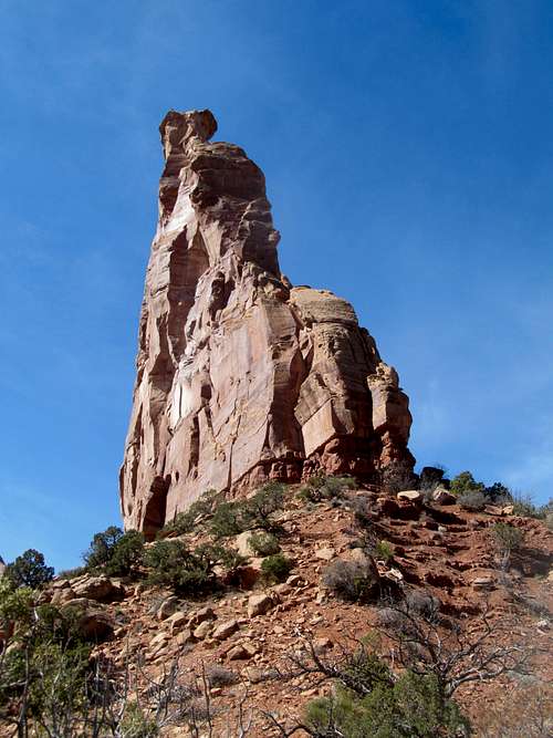
I gulped and admired the rock climbers perfecting their art on the Independence Monument, following the trail as it swung around the monolith.
I ventured a little further towards the GJ end of the trail before heading back after taking the short sidetrip along the Coke Ovens overlook near the TH.
Some more white knuckle driving mixed in with more basic photography and a pit stop at the informative visitor center brought me out of the park and to another winery just below the Monument Plateau west of the city.
Two Rivers Winery offered some good wine and conversation with fellow tasters, and I headed back to SLC with two additional bottles of wine as souvenirs from this last St. Patrick’s Day west, (or at least for the time being).


Comments
Post a Comment