
-
 28000 Hits
-
 95.67% Score
-
 54 Votes
|
|
Area/Range |
|---|---|
|
|
39.10026°N / 108.7351°W |
|
|
Hiking, Trad Climbing, Bouldering, Scrambling |
|
|
Spring, Summer, Fall, Winter |
|
|
7028 ft / 2142 m |
|
|

This page mostly covers Colorado National Monument but does have a subsection for locations in the vicinity. If anyone else ever decides to make a page for that complex-- the McInnis Canyons National Recreation Area-- I will edit this page accordingly.
Overview
Right in the back yard of Grand Junction is a slickrock wilderness that is a snapshot of what much of southern Utah is all about. This place, Colorado National Monument, is filled with monoliths, red-walled canyons, and scrub-topped mesas and plateaus. Although it is very popular with local residents, it does not seem to attract that much attention from others, perhaps because it is not a national park and because Grand Junction is not a major travel city. 23-mile Rim Rock Drive twists, turns, and climbs through the monument, yielding far-ranging vistas of the canyon country, the Grand Valley, and the Book Cliffs. Desert wildlife abounds, and those keen on raptors may be delighted; on one morning, in the span of just two hours, I saw a pair of nesting owls and a peregrine falcon. Golden eagles are also commonly seen here. Colorado National Monument is high desert country, which means that although it can be scorching hot in the summer, winters can be very cold. Aridity is what the seasons have in common, though snow sometimes graces the sandstone and late summer sees a lot of thunderstorms. We have engineer John Otto to thank for the preservation of this landscape. Starting in 1907, Otto lived alone out in this country and loved it so much that he led the charge to protect the place as a national park. Inspired by him, many citizens of Grand Junction wrote letters to Washington urging the creation of the park. Otto also built trails out here so others could enjoy the natural beauty. In 1911, Colorado National Monument was established, and Otto became the park's caretaker and did that job for 16 years, earning only $1 a month, for it was really a labor of love.
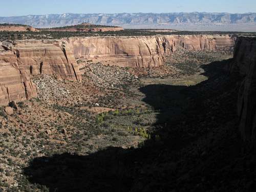 Ute Canyon
McInnis Canyons National Conservation Area
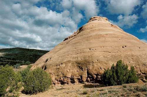
 Photo by theplugger
Take Care of the Crust
As much as possible, avoid stepping on the biological crust out here; it is alive and is critical to the desert ecology, and it is fragile. If the soil looks lumpy, dark, or crusty, avoid it. Better yet, try to stay on exposed rock and in sandy washes as much as you can. More about the crust...Technical Rock Climbing
There are outstanding objectives here for those who enjoy climbing on gritty sandstone. Cracks, walls, and towers galore await. Most routes are trad ones, but there are supposed to be a few aid routes, too. The classic route is probably Otto's Route (5.9) on Independence Monument, but there are many other named formations that are technical-only, and there are many opportunities here for first ascents.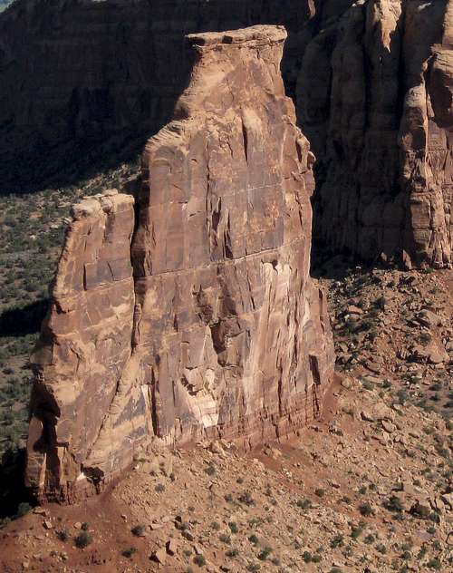 Independence Monument
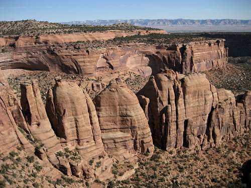 Coke Ovens
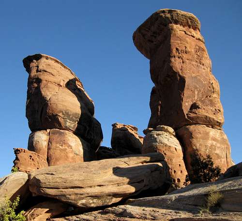 Devil's Kitchen
Climbing Regulations
The following is copied from the NPS site for Colorado National Monument. Regulations: * No new permanent climbing hardware may be installed in any fixed location. If an existing bolt or other hardware item is unsafe, it may be replaced following consultation with park staff. This will limit all climbing to existing routes or new routes not requiring placement of fixed anchors. * The use of power tools to facilitate the installation of rock climbing hardware or for any other purpose is prohibited. * Climbing anchors and/or protection points may not be placed with the use of a hammer except to replace belay and rappel anchors and bolts on existing routes, or for emergency self-rescue. * The use of permanent anchor fixtures and hardware shall be installed or used for the protection of climbers on established climbing routes only, and only where such hardware devices now exist. * Software (webbing, accessory cord, etc.) that is left in place must match the rock surface in color. * The installation or use of permanent anchor fixtures and hardware must be brown or black. * Fixed ropes should not be left in place for more than 24 hours. Fixed ropes left in place longer than 24 hours shall be considered “abandoned property” and removed. * The physical altering of rock faces such as chiseling new holds is prohibited. * The intentional removal of lichen or plants from rock is prohibited. * Camping on the summit of Independence Monument is prohibited. * Chalk used for climbing must be of a color that blends in with the native rock. * The following areas and exposures are closed to recreational rock climbing: 1. Any exposure above any tunnel portal, aboriginal rock-art site, the Balanced Rock in Fruita Canyon, and Mushroom Rock below the northwestern rim of Monument Mesa near the mouth of Monument Canyon 2. Any area which has the potential to disturb naturally occurring wildlife activity, such as, but not limited to, feeding, mating, or nesting activities 3. Any climbing activity in an area which has the potential to damage an archeological site, historic structure, or paleontological resource is prohibited.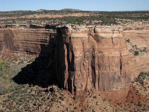 Red Canyon
Scrambling and Bouldering
For those who like the convenience of climbing without gear, Colorado National Monument is a wonderland. They will be shut out from the best of the towers and peaks, of course, but options are otherwise virtually unlimited. With crags small and large, next to the road and in the backcountry, the question isn't where to go but where one cannot go, for possibilities are everywhere one looks. Scrambling objective near the eastern entrance and off the Serpents Trail
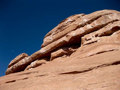 Cleopatras Couch