
|
|
Mountain/Rock |
|---|---|
|
|
39.46690°N / 119.7006°W |
|
|
Washoe |
|
|
Hiking |
|
|
Winter |
|
|
6075 ft / 1852 m |
|
|
Overview
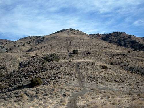
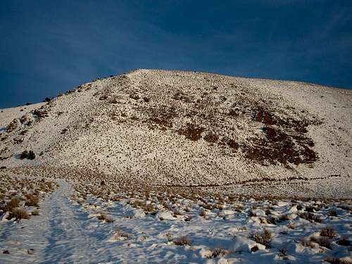 Peak 6075 in winter from below the summit ridge
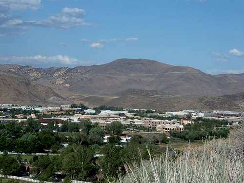
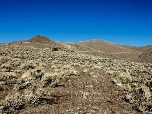
The Road to Nowhere Mountain, is a mountain in Washoe County, just east of Reno. A fixture in the Reno skyline looking east, it sits due south of colorful orange hills and has a prominence of about 850'.
The mountain is known for a road that curves around it, seemingly coming out of nowhere. The road actually splits at points high on the mountain, and the west side road can be accessed via a very strong 4WD, and is not recommended. The road on the mountain dead ends at random spots, including around the south side, where it ends and inexplicably restarts again perhaps 50 yards away, as if they were going to connect it, and decided to quit before they got all the way around.
The name "Road to Nowhere" is a local one, and there is no official USGS name. On USGS maps, it is simply "6075".
There are five primary routes to the summit. Each route involves at least two miles of one way distance to the summit and 1500'+ elevation gain. Two of the routes start in Hidden Valley Regional Park, and require meandering trails over colorful hills. Two routes start at the end of Alexander Lake Road. A final route starts at a the Mira Loma Substation to the south, accessed not far past the end of Alexander Lake Road.
It is recommended that you hike here in late fall or winter. Insects, animals, and rattlesnakes are prevalent on the slopes most of the year and the mud is unbearable at certain times of the year. The views from the summit are excellent, with the colorful hills to the north, the Sierra Nevada Mountains to the west and southwest, the Pah Rah Range to the northeast, the rest of the Virginia Range to the southeast, Peavine Peak to the northwest, and the city of Reno 1600' below.
Getting There
Road to Nowhere Mountain is located in the Western edge of the Virginia Range as well as the northern part of the range. This section rises over Reno in the Eastern skyline. There are multiple trailheads and routes. Five are described below. Getting to these trailheads is easy and quick from anywhere in Reno.
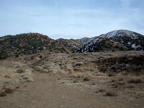
 The Virginia Range, including Peak 6075 on the right
Trailhead #1 - Northwest ridge
From McCarren Blvd, turn left on Alexander Lake Road, which is just in front of Rattlesnake Mountain. Take Alexander Lake Road as it winds around hilly terrain. It ends at a dirt road. Take a left up the hill and park anywhere to start the hike.
Trailhead #2 - North ridge
From McCarren Blvd, turn left on Pembroke Lane, heading towards the mountain. Take Pembroke for 1.8 miles until you see Parkway Drive. Take a right on Parkway Drive which enters Hidden Valley Regional Park in less than half a mile. You can park in the main parking lot (paved), or go left and find a parking spot up closer to the start of the trail. From here, take either of the two routes described below.
Trailhead #3 - North side canyon
From McCarren Blvd, turn right on Mira Loma and follow the road as it winds around to Hidden Valley Drive. Take a right and follow as it winds around. Shortly after the road turns back to the left (north), take a right on Mia Vista Drive, and head to the parking area inside Hidden Valley Regional Park.
Trailhead #4 - West side canyon
From McCarren Blvd, turn left on Alexander Lake Road, which is just in front of Rattlesnake Mountain. Take Alexander Lake Road as it winds around hillyterrain. It ends at a dirt road. Across from the end of the pavement is alocked gate. The road just to the right heads up to another trailhead. Take the well graded dirt road for a half mile to the parking area.
 Trailhead #4
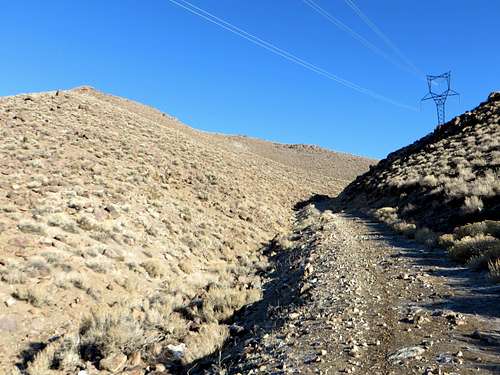
Trailhead #5 - Back-side (eastern) approach - from Mira Loma substation
This is the only route that approaches Road to Nowhere Mountain from the back side. It starts from the west side, but is able to hug around to the east side without major mileage. As with Trailhead #4, from McCarren Blvd, turn left on Alexander Lake Road, which is just in front of Rattlesnake Mountain. Take Alexander Lake Road as it winds around hilly terrain. It ends at a dirt road. Take aright and continue for almost a mile. Pass a No Trespassing area at a dumping ground. Just past that is a road on the left heading towards a substation. Drive up the road and find a place to park on the side.
Route finding
Route from Trailhead #1 - Northwest ridge
From the trailhead, take the hill to the left, or follow the “road to nowhere” to the right and head up to the first ridge. There is a slight use trail that winds up and around an obvious false summit, which tops out at 5,295 feet. At the top of this false summit, you reach a ridge below the true summit. From the ridge, the true summit rises steeply (over 700'). A 4WD road sits below this steep rise. You take the road to the right and find a way up. The steeper grades are all walkable, but there is a gully less than 1/4 mile down the road from the steepest, that is pretty standard. The gully heads up about 375 feet to the final summit ridge. Once you reached the final ridge, it is an easy 1/2 mile walk up to the summit, with about 290' of gain left.
You can descend the same way you came, or you can possibly take the side 4WD road that leads down to a canyon, by heading down the south ridge. You can take the canyon back down to the trailhead. Depending on which way you take, the shortest is about 4 miles round trip, and the longest about 4.75 miles round trip with an elevation gain of about 1500 feet either way.
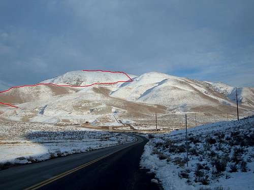 Side view of Route #1. The red line shows the route
Route from Trailhead #2 - North ridge
This route starts by heading up one of the two hills described below.
Hill 1
Head up the the hill at it steeply heads up into the hills.
 Hill/road up to the Colored hills.
Once you reach near the top of the hill you will see an obvious trail. The trail turns into a jeep road. Follow this south towards Peak 6075. You will follow the jeep road around for less than half a mile until you see a wide side trail heading right to the summit ridge. You take this trail up and over a couple hills until you descend a little bit and the trail ends. From here you are 20 minutes from the summit. You go up and down three hills as you make your way up to the summit. Once you get up to the third hill, you will see the summit ahead. The true summit is obvious from this point. The whole hike round trip is about 4 1/2 miles. The elevation gain is about 2,000 feet due to the ups and downs on the summit ridge.
Hill 2
You can either head to the left of this hill up a gully, or you can head straight up the hill. In both cases, the trail only goes for about half a mile until you have to find your own way up, which will be very steep no matter the route you choose. Once you reach near the top of the hill you will see an obvious trail. The trail turns into a jeep road. You take the jeep road for a few hundred yards until you see a wide side trail heading right to the summit ridge. From here, take the same route as described for Hill 1.
 Click here to see the red line showing the route. Note that the route from Trailhead 3 uses the canyon to the right below the red line.
Route from Trailhead #3 - North side canyon
Head slightly left and up the hill (northeast from the parking area) and find a trail heading up the slope. Follow this steeply until you reach a trail higher up. That trail will be on the right atop a plateau. It is hard to follow at spots, but gets more obvious higher up. The trail then winds to the right (south) and hugs the mountain side, eventually winding around the back side of some prominent points north of the Peak 6075 plateau. A use trail heads up these hills to the back side of Peak 6075. There is no trail then, but the summit rock pile is obvious from this point. This route is pretty short and straightforward. The final stretch up the back side is the same as Route #2. If you lose the trail early on, the trick is to look for plateaus, and pick the obvious route to the top. The higher up you are, the more obvious the route. If not hopelessly lost, it is about 2 miles and 1500' of elevation gain from the trailhead to the summit.
Route from Trailhead #4 - West side canyon
From the trailhead, head up the road along a fence line. After a couple hundred yards the road peters out, but continues to the right. Take aright and then the road curves back towards Road to Nowhere Mountain. After three-quarter miles, there is a road heading right and another road continuing slightly left. Take either road to reach the base of the peak. You can head up a gully up to the saddle, or take the road heading to the right which reaches the road further south. Then head up the steep slope to the summit ridge. Regardless of what way you take, it is about 4½ miles round trip with an elevation gain of about 1550feet.
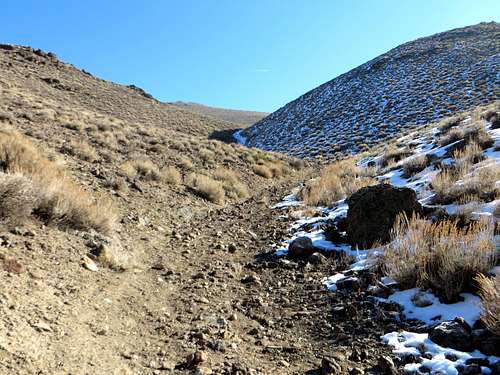 Ascending the canyon
 Looking back down the canyon
Route from Trailhead #5 - Back-side (eastern) approach - from Mira Loma substation
After passing the substation on the left, pass the water tower. About a mile past the water tower, the main road heads right along a hill. Before the road turns, there is another road heading left. This road climbs up a half mile and reaches the back side.
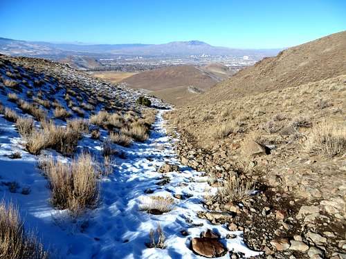
 Road leading to the back side
 At the backside looking up towards the summit plateau
At this point, continue up the slope and get on the road further north. Once on the road head up until you find a good spot to head up towards the summit. It is about 3 miles one way to the summit with an elevation gain of 1,600 feet.
Red Tape
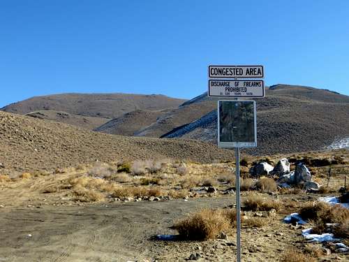
For Route #1 - There is private land in certain areas near the parking area. The landowners seem to change hands periodically, and access changes slightly each time I go there. The recommendation is to heed all signs, and make sure to walk around fences with hard metal wire. Some of the fences in the area appear to keep wild horses in their habitat, although it doesn't work too well, since they are everywhere anywhere. Overall, access isn't a problem, and the last time I visited, there were no signs saying "keep out" or "no trespassing".
For Routes #2 and #3 - Hidden Valley Regional Park closes at 5pm during the winter.
For Routes #4 and #5 there should be no access issues.