
|
|
Mountain/Rock |
|---|---|
|
|
39.48974°N / 119.57271°W |
|
|
Storey |
|
|
Hiking |
|
|
Spring, Fall, Winter |
|
|
6395 ft / 1949 m |
|
|
Overview
Sitting west of Clark Mountain 7,196’ is a prominent unnamed summit listed as 6395 on topographic maps. With a prominence of 395', it is definitely its own summit. It is easily accessible from Lockwood, and offers nice views of surrounding peaks.Peak 6395 is not a popular mountain. Few, if anyone, actually hikes it or knows it exists. Yet, it is so easily accessible from Reno, it is odd that is doesn’t get more traffic.
Peak 6395 can easily be combined with Clark Mountain. Both mountains are typically hiked during the winter, spring, and fall. The best months to hike are typically March-April, October-November. Winter snow can make things muddy and more difficult.
Getting There
There is really only one standard access route to Peak 6395. From Reno, Nevada take I-80 east to exit 22 (Lockwood). From the exit, go straight through the town of Lockwood (speed limit 20 MPH). Drive just under 3 miles past a sign for a rock quarry. There is a gate ahead that blocks access. But there is access before the gate at the unmarked trailhead for the Long Valley Creek. The coordinates are 39.4821, -119.6204. This is an obvious hiking area. There is a dirt trailhead with no signs, but room for 5-6 cars. The elevation here is about 4,550'.Route
Start hiking through the canyon. After about 1/3rd of a mile, head up a very slight use trail. This is now past the fence line that is up in the hills during the very first part of the hike. Once you reach the top of the plateau, there is a jeep road. Continue on the jeep road until you pass a larger road. You will see a sign off to the left about 60 yards that notes there is "No Trespassing". That is associated with the nearby landfill. All you are doing is crossing the road; so no problems there.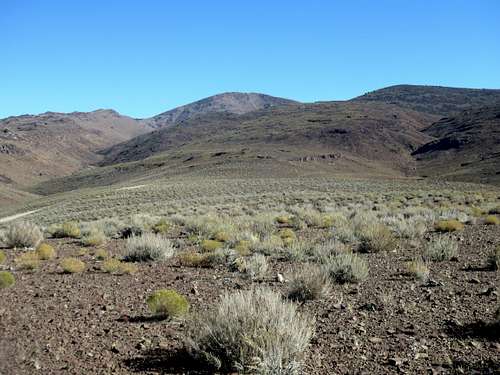
View from the 2nd plateau. Peak 6395 (right), Clark Mountain 7,196' (center-left)
Continue on the jeep road, but then head up the slope. This is the 2nd plateau encountered. From here, head up and over the hillside directly above the plateau. Peak 6395 is reached within about 1.1 miles, gaining nearly 1,100’. The total distance is three miles to the summit, gaining a respectable 1,900'.
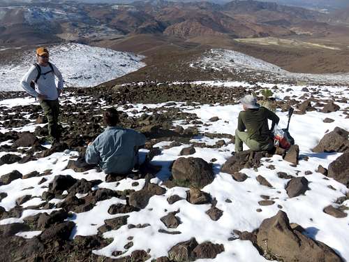
Getting close to the summit, looking back down the slope