
|
|
Mountain/Rock |
|---|---|
|
|
46.52148°N / 11.99634°E |
|
|
Veneto |
|
|
Hiking, Trad Climbing, Sport Climbing |
|
|
Summer |
|
|
8127 ft / 2477 m |
|
|
Overview
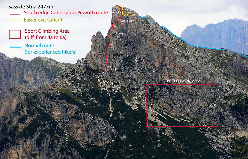
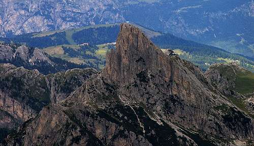
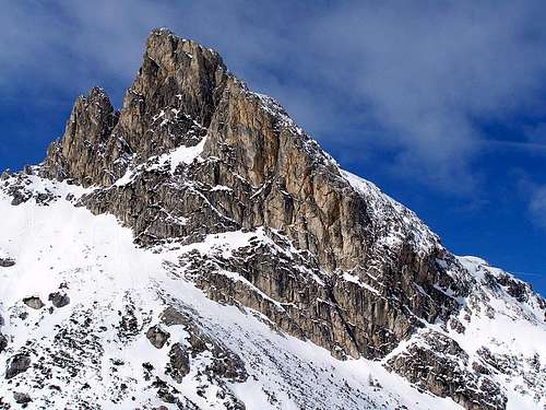
Sass de Stria 2477 m
There are different towers and walls of good dolomia in the area of Passo Falzarego; one of these is the sunny Sass de Stria, a sharp tower located just in the surrounding of the Falzarego Pass. Sass de Stria belongs to the Fanis group and is placed to the West of the Passo Falzarego and to the South of the Passo Valparola. It's an isolated mountain and, for this reason, you can see a large view from its summit.
Sass de Stria, which name in ladin means "Rock of the Witch", is a little but beautiful looking mountain, offering many opportunities for all kind of mountain lovers: hikers, sport and trad climbers, WWI history fans. It shows a rocky and vertical side to the South, but mild and anonimous slopes on the other sides.
At the feet of its North side, lies the little but nice Valparola lake. This horn-shaped peak, belonging to the Fanis group, is easily recognizable from far, due to his beautiful South edge, where it runs the famous Route Cobertaldo-Pezzotti.
Although in comparison with the near mountains it has a humble size, it was an important stronghold in the Austro-Hungaric defense line in WWI. Italian alpine troops gained it in the first days of war, in 1915, with a daring action, but they had to withdraw from it few times later... From the emplacements of Sass de Stria, Austro-Ungarian soldiers could face the italian positions on the near Piccolo Lagazuoi.
Today, the Austro-Hungarian lines with trenches, tunnels, emplacements are restored and can be visited by hikers, by a beautiful assured path leading from Valparola pass to the Sass de Stria summit.
Getting There
Various different road approachs are possible depending from where you're coming.
- From Val Pusteria: take the Brennero Highway, exit to Bressanone and take the Val Pusteria, getting Brunico and Dobbiaco; here turn to right to Val di Landro, reaching Carbonin and then Cortina d’Ampezzo. In Cortina take the road SS48 to Passo Falzarego on the pass (about 17 km from Cortina)
- From Longarone: follow the road SS 51 to Longarone and Pieve di Cadore; in Pieve turn to left, getting to Cortina d’Ampezzo, and here take the road SS48 to Passo Falzarego. Park the car as for the previous point.
- From San Cassiano and La Villa in Val Badia (North): by Valparola Pass (route SP37 and SP24, about 10Km from San Cassiano)
- From Alleghe: by Caprile and Falzarego pass (route SR203 and SR48, about 25Km form Alleghe)
Routes Overview
Hiking routes
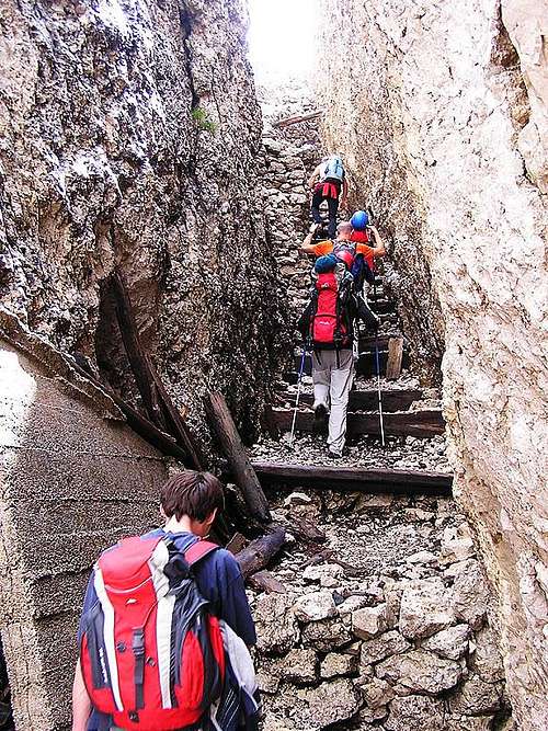
From Valparola Pass (Intraissass Fort) by the war path: EE (expert hikers) 300m of elevation gain, 1h. Interesting route, partially assured with iron cables and ladders, running through trenches and path digged in the rocks. Opportunities to visit the military galleries of Goiginger Tunnel (headlamp or torch needed!)
Climbing routes:
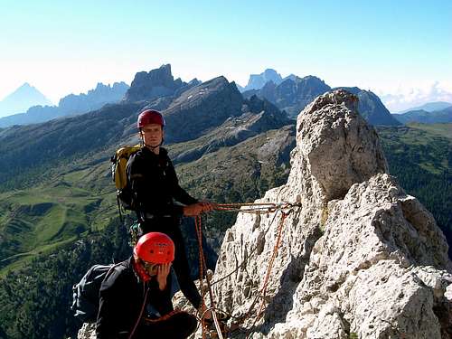
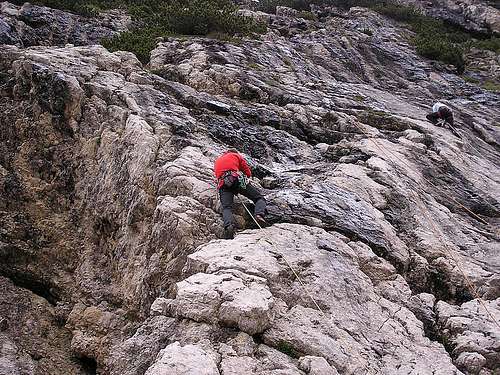
Several routes. The most famous is Cobertaldo-Pezzotti route on South edge (also known as "Spigolo Colbertaldo"), 7/8 pitches, IV-IV+. See here on Summitpost the route description: Spigolo Colbertaldo
Sport climbing
At the base of East side of Sass de Stria, there's an amusing Sport climbing area, with a couple of dozens of single pitch routes (from 4a to 6a).
The place is sunny in the morning, in shadow for the remaining part of the day. After big rains, the rocks could remain wet for some days after the rainfalls. More info here: Planetmountain - Falesia Sass de Stria
Via Ferrata Fusetti
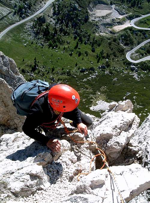
The starting point to climb is the fortress “Intra i sass”, which is located on the Valparola pass, between the Falzarego pass and the Val Badia and where it's located the Great War Museum. We walk along a downhill path that starts right behind the fortress-museum, on its east side (Passo Falzarego side). A table with the indication Historic Route Col di Lana shows us the way to follow. The path, at first steep, takes us to a small valley and then continues gently up to an Austrian war post, the Edelweiss Stellung. It is a former military village consisting of several barracks, six of which have been rebuilt. Reached the first of the buildings we leave it to the right, continuing downhill along the path that becomes steep after a while. The route now goes around the base of Sass de Stria in an anti-clockwise direction and leads us to the narrow ledge. On the most exposed stretch, a chain allows us to proceed. Then the route begins to climb and soon leads us to the start of the Via Ferrata, well marked with a red writing. The Sass de Stria via ferrata does not present great difficulties and develops for about 240 meters. Above, right next to the metal cable, one of the many caves excavated in time of war indicates the end of the Sass de Stria via ferrata. From here, along trenches and ravines, the well-marked path allows us to reach the summit of Sasso di Stria.
Descent: we retrace a stretch of the uphill path backwards, then continue along the trenches located on the ridge of the Sasso di Stria (Normal route).
Red Tape
No fees no permits required
When to climb
Best months to climb and hike are June, July, August, September, but also autumn and late spring can be good for hikers.
Accomodations
On Falzarego Pass and surroundings, Valparola Pass and Alta Badia area there are different possibilties of accomodation
Bibliography
"IV grado Dolomiti Orientali" - E. Zorzi, L. Brigo, C. Piovan