|
|
Mountain/Rock |
|---|---|
|
|
35.71472°N / 83.25528°W |
|
|
Haywood County, North Carolina, Cocke County, Tennessee, Sevier County, Tennessee |
|
|
Hiking |
|
|
Spring, Summer, Fall, Winter |
|
|
6370 ft / 1942 m |
|
|
Overview
Old Black is the eleventh highest of the forty recognized Southern sixers. It's one of the easier peaks in one of the more remote areas in the eastern United States (the northern Smokies). And it's a tough day hike from Cosby campground. We didn't see anyone on the Snake Den Ridge trail, but saw several hikers once we reached the AT. Apparently most of the hiker traffic in this area really is on the AT.The summit is marked by a small cairn (with a bolt reading 696) in the middle of a balsam forest. We were surprised, but there were still some blueberries on the bushes in mid-September.
Getting There
This mountain is really pretty remote (about 7 miles from the nearest road). The shortest route starts from the Cosby campground (the Snake Den Ridge trail), but the mountain can be climbed quite easily by AT through hikers (it's 13 miles from Davenport Gap and 17 miles from Newfound Gap). It's also accessible from Pin Oak Gap on the Balsam Mountain Road via an 11 mile hike on the Balsam Mountain Trail and the AT. And from the Indian Camp Creek and Madron Bald trails which join the Snake Den Ridge trail after a 7 1/2 mile hike(this make for about a 9 1/2 mile hike to get to the top of the mountain).The next time we're in this area we will try to do the Madron Bald hike. It passes next to a stand of virgin forest: the Albright Grove. This is named for Horace Albright, an early superintendent of the NPS; he was the one who prevented a road from being built along the Smokies crest.
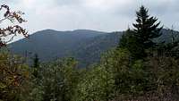
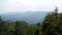
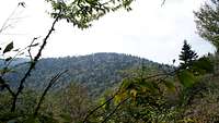
From the cairn, it's about 1/4 mile to the summit. There was a ribbon trail from the cairn, but it's been obscured by blowdown.
Follow the ribbon trail to the blowdown and then keep bearing left and up at the numerous cane fields. The summit is definitely the highest point around.
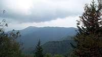
Btw, we counted 19 switchbacks from where the Snake Den Ridge trail really begins until it reaches the AT. Some of those may be dubious, tho. The trail itself is not extremely steep, but it is unrelenting in its climb up the mountain (4,000 feet in 4 1/2 miles).
Red Tape
None.But no dogs are allowed in any of the Smokies backcountry.
Camping
Cosby campground. There are some other private campgrounds around as well.And plenty of motels in Cosby, Newport and Gatlinburg, Tennessee.
External Links
WikipediaSouth Beyond 6000


hgrapid - Sep 29, 2010 12:28 pm - Hasn't voted
Longitude is off83.25528°E is incorrect. Wrong hemisphere. To place the mountain in the U.S.A. put -83.25528
mlandau3 - Oct 1, 2010 9:01 pm - Hasn't voted
Re: Longitude is offThank you.