Mapping Software
| Page Type | Gear Category |
|---|---|
| Object Title | Mapping Software |
| Page By | Alan Ellis |
| Created/Edited | Jan 15, 2007 / Feb 11, 2007 |
| Object ID | 35 |
| Hits | 8178 |
| Page Score | 86.29% |
| Vote |
Vote: Log in to vote |
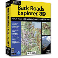
There is some very expensive and sophisticated mapping software available both for personal and professional uses. However for general outdoor use, software like National Geographic Topo! and Maptech will to the trick.
Mapping Software and GPS Units
Being able to use your mapping software in tandem with your GPS unit is a very handy tool and can really enhance your outdoor navigation experience. To use mapping software on your GPS unit, make sure you understand the abilities of your unit and what type of mapping software works best with your particular unit.
Maps and charts that can be down-loaded to your GPS unit are only available from the GPS unit manufacturer. Maps downloaded from the manufacturer's software can be seen directly on the GPS unit screen. Examples of these types of software are Garmin Mapsource, and Magellan Mapsend.
There are several companies that also make mapping software that is GPS Compatible. GPS compatible means that you can use the mapping software on your PC to plot waypoints and routes and down-load them to your GPS unit. However, the maps on the software WILL NOT down-load and be seen on the unit's screen. With GPS Compatible software, only the waypoints and routes will be seen on the unit screen. Examples of these types of software are National Geographic Topo! and Maptech.
Online Mapping
Several sites have on-line topographic maps.
Topozone.com Free
Maptech Mapserver Free
Microsoft Terraserver Free
Google Earth Free
Mapquest Free street maps
Check this link (USGS) out for more sites that provide maps for a fee or are free.
Images
 |