
-
 6738 Hits
-
 78.27% Score
-
 9 Votes
|
|
Mountain/Rock |
|---|---|
|
|
49.20078°N / 19.70364°E |
|
|
Hiking |
|
|
7110 ft / 2167 m |
|
|
Overview
|
Red Tape and Camping
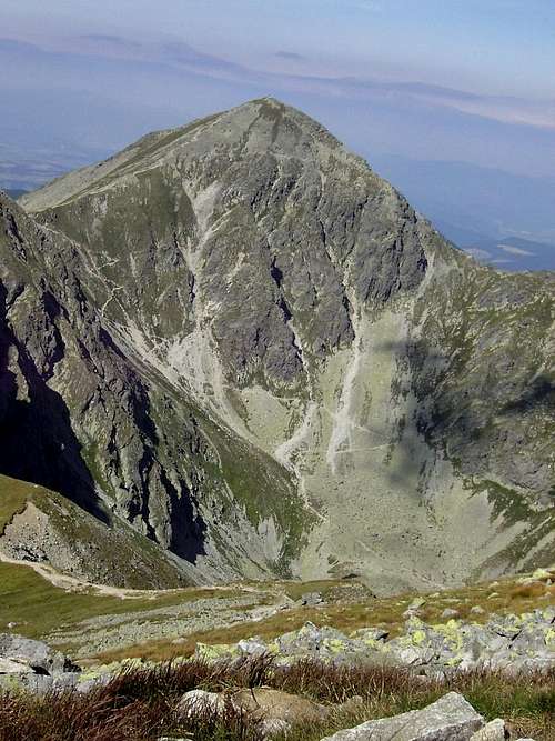
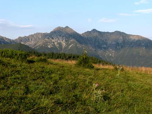
 Pachoľa (right) from N - photo by Petr Drápalík
You are in Tatra Mountains National Park.
In Slovakia, the trails are open from 15th June to the end of October.
You can't camp here, should walk only on marked trails.
No dogs, on open fire.
You can't go camping in the Tatras, the nearest campsites are in Habovka, Oravice and Pribilina. There are a few mountain huts: Ziarska Chata - in the Ziarska Dolina (Valley) and Tatliakova Chata and Zverovka in the Rohacska Dolina.
Getting There

Rohačká Dolina
- Rohačká Dolina starting point:
From Poland, cross to Slovakia at the road toll at Sucha Hora, to reach Oravice and Zuberec. From Slovakia, reach Zuberec via Zilina and Dolný Kubín. - Jamnická or Jalovecka Dolina starting points:
From Poland, very long way... from Krakow, prefer the border point at Chyżne. From Silesia, choose Korbielow or Rajcza/Novot. Reach Dolný Kubín and circumvent Tatras. From Slovakia, via Dolný Kubín and Liptovsky Mikulas.
Routes

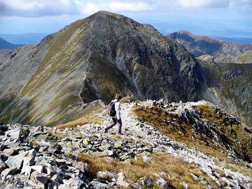
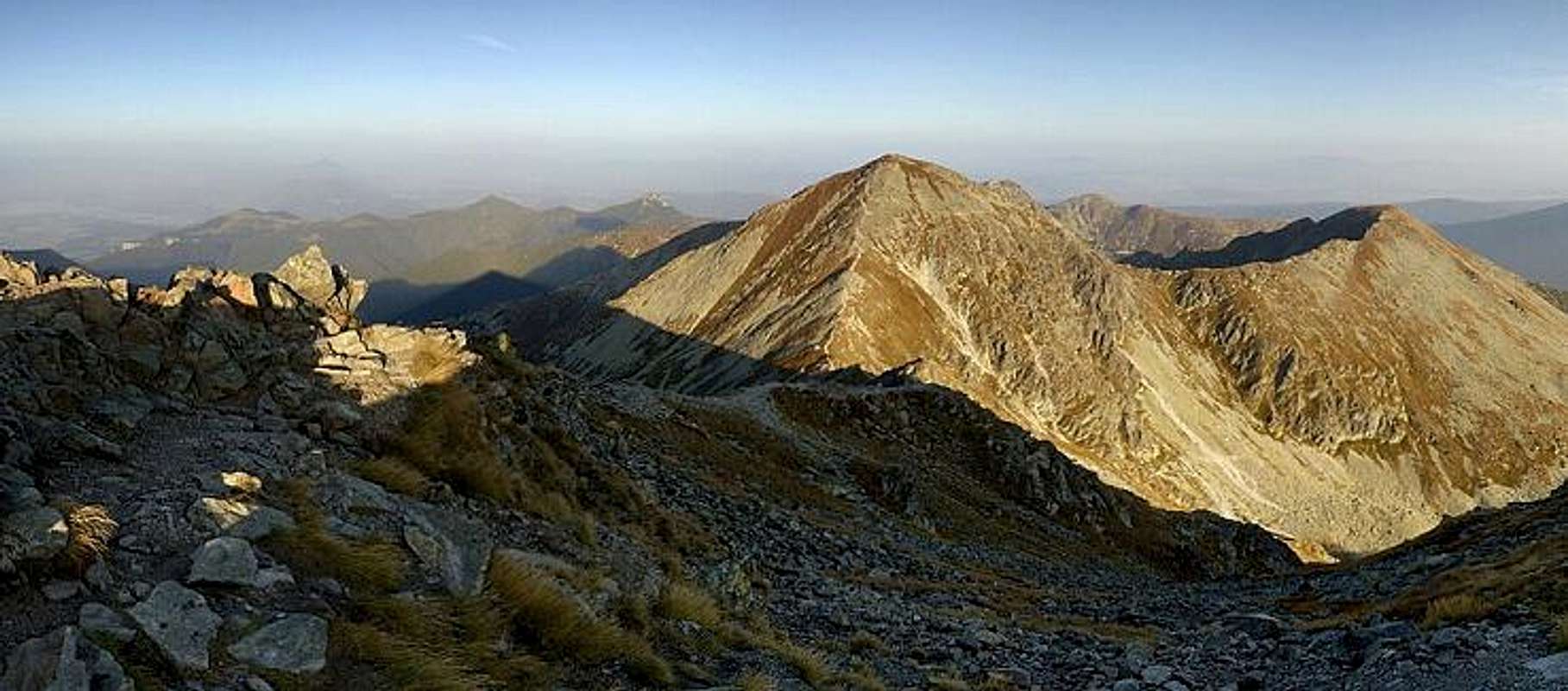
Toward Pachoľa from NE
- From the North: parking near Zverovka in the Rohacska Dolina (Valley), about 45 minutes along an asphalt road, at the junction called Razcestie pri Adamculi turn right and follow the yellow/blue marked trail, on the way you'll pass a nice waterfall (Rohacsky Vodopad). Keep to the yellow trail until you reach the saddle named Banikovske Sedlo (2040 m). From here take the red trail west, and soon you'll reach the top - 4 hours up
- From the South: the starting point is the village of Jalovec: take the yellow trail up the Jalovecka Dolina, then turn right onto the blue trail leading up the valley called Parichvost, to Banikovske Sedlo - 4 hours
Both trails are not demanding, however, the latter makes for a rather arduous ascent.
From Pachoľa you can continue west along the main ridge, to the summits of Salatin, Brestova, and if you are strong enough even to Sivý Vrch.
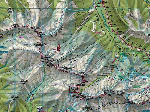
Maps
As for the analog maps, there are plenty of options, for example the plastic 1:25,000 map of the Polish and Slovak Tatras by WiT. It is waterproof, durable and cheap.
External Links
visentin - Jan 8, 2010 3:00 am - Voted 10/10
maphere is a map you could include : http://www.mapytatr.net/PRODUKTY/MAPY_TAT/ZACHODNI/SLICES/tpn_64.jpg Have you done Salatin, Konrad ? I think this is the most important missing mountain to add to Tatry Zachodnie
Konrad Sus - Jan 8, 2010 2:57 pm - Hasn't voted
Re: mapOK
yatsek - Jan 28, 2010 6:13 pm - Hasn't voted
AdditionsI'd like more links (working:)) and perhaps info that the origin of the name is not clear.
Konrad Sus - Jan 29, 2010 1:53 pm - Hasn't voted
Re: AdditionsI added to You user privileges, so you can edit this page