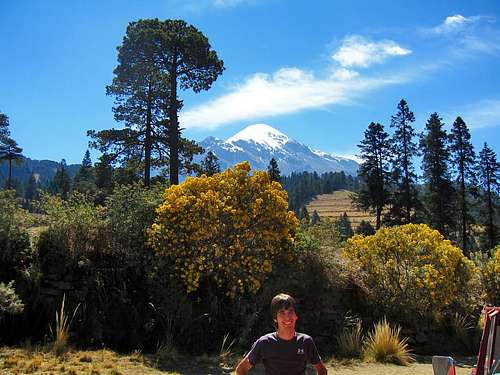
So if you remember my last trip report about Mount Whitney I said that trip was inspired by a friend of mine. This trip was also inspired by the same person. She posted on Facebook way back in December asking if anyone wanted to do Pico de Orizaba in March. I told her the days I'd be able to go (which is my spring break) and she was all for it. Unfortunately like my last trip, she was unable to come but my roommate joined in and we bought our plane tickets bound for Mexico City. It cost me round trip $600 for the tickets. This was my very first international trip and at first I was a little bit worried about traveling in Mexico but after all was said and done, I felt very safe, nd had the time of my life there and met many very nice people along the way.
Stats Time: 1 week Peaks Climbed: Pico de Orizaba at 18,491 feet and Iztaccihuatl at 17,159 Elevation Gain: 11,000 cumulative gain Miles Traveled: 6000 Miles RT by planes, 350 miles total by car and 20 miles total on foot
My trip began Sunday March 11, 2012 at the start of Spring Break. After finishing my last couple winter peaks in Colorado I would be able to do the days before, Stephan gave me a ride to DIA and my plane for Los Angeles was off by 10:30pm. I had the unfortunate event of having to sleep at the gate for 8 hours in Los Angeles for my connecting flight to Mexico City. This was an interesting moment as it was my first time flying out of the US. I was a little nervous but also very excited to embark on a new kind of adventure. I finally arrived in Mexico City at 1pm and to my surprise, they are on the same time as Denver. Going through customs was almost a joke. It took a mere 5 minutes when I expected it to take well over a half hour. Stephan's flight came in about an hour after mine and we were easily able to meet in the airport.
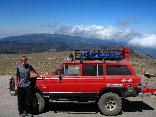
We waited for Antonio to meet us and believe it or not, right at 2:30pm when I said to meet, he showed up and greeted us nicely. He helped carry our bags and after a hop, skip and a jump we were in his car on our way to Tlachichuca to meet Joaquin Canchola where we would stay the night. Thank you Ryan and Annie for recommending me to Antonio, he remembered you guys well and asked me to thank you for the recommendation.
Now about the drivers in Mexico City: If you think people in US cities are crazy drivers, you are badly mistaken! People in Mexico City are perhaps the most skilled, but also the absolute worst drivers on the planet. I called it controlled chaos on the roads. Not once did we ever see a crash nor did we ever expect to see one. The nature of the driving there is so chaotic that no one crashes...if that is even possible. Street lights and lanes were taken as mere guidelines. A two lane road, especially around ramps and intersections always had three lines of cars. You also better run that red light if no one is coming to avoid having ten people honk at you!
We saw hundreds of cops all over the roads, many of which did have nice cars but they often drove even worse and didn't seem to be doing anything. I counted three cops sitting in their cars sleeping on the side of the road while others just roaming around talking with the locals. Antonio did a great job getting out of Mexico City, a feat that I firmly believe no American driver could accomplish. A couple other things I noticed while riding to Tlachichuca was that the Mexicans really slow down for the speed bumps, which are also hidden and never signed; and they also use their flashers for any reason possible. Actually, I think they just like pushing that button! Passing cars on two lane highways is as common as passing cars on an eight lane freeway. Road kill is everywhere and speed limits are below the level of guidelines, they are more like suggestions!
So, now that you know how people drive in Mexico, let me tell you a little about what we saw on the way. Heading out of Mexico City (which was HUGE by the way) we noticed big thunderheads forming and as we headed east over a mountain pass we get into a much more forested area with many small villages. We descend into Puebla and had to stop to make the first tire change. Fifteen minutes and 150 pesos later Antonio has a new tire and we're ready to go (this would be like a 2 hour ordeal in the US). I also distinctly remember having to slow down for a traffic jam through Puebla because there was an old overpass being demolished and a new one being built right over traffic. An attempt to confine traffic into two lanes was made by using a few cones but they were routinely ignored and people drove right through the construction zones weaving around fallen debris and cones not to mention workers dangling from ropes above six other lanes of traffic!
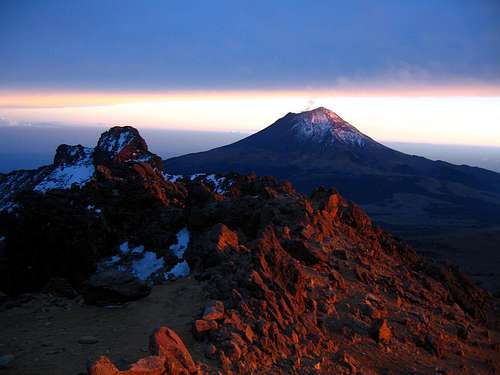
After leaving Puebla, things slowed down and we hit the two lane country roads to Tlachichuca. We saw our first views of Pico de Orizaba as the storms cleared out for the evening and after three hours of driving we arrived and met Joaquin where we were instantly greeted with great respect. Stephan and I were fed a great dinner and took a walk around the small town in the evening after too many hours just sitting in planes and cars. We slept good Monday night and were excited to get on the Mountain.
Tuesday March 13th
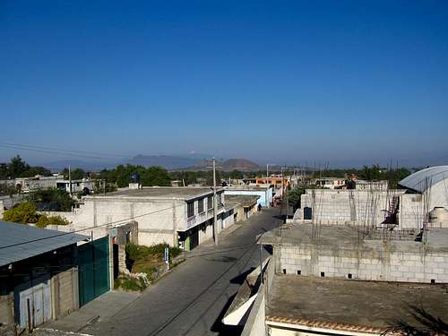
After a good nights rest we woke and was fed a great breakfast. We were the only ones there that night as Joaquin had started to drive a group to the hut merely 15 minutes before we arrived. We would later meet this group and talk with them a lot. I went up to the roof of the hotel and took a look around the town. It really is a third world town where codes and building laws are not in effect. I felt like I was thrown back 75 years. Most of the roads were cobblestone and people in the town had stores of all kinds to try and make money. Joaquin and his family were likely the wealthiest in town largely due to the great idea they had to cater to American (and worldwide) climbers. Their family has been hosting climbers for over two generations. Even Fred Beckey stayed here when he did Pico de Orizaba back when he was in his early seventies! I remember Adam talking about this in his 10 days in Mexico TR and Joaquin showed me that same book you looked at. Truly a great piece of literature!
A look at Tlachichuca
At 10am we leaded the jeep and Joaquin took us to the hut. We got about halfway though when we met a couple guys who had been walking down the road as they forgot something important for their live feed. These were guys that went up the night before and they are teachers at a Minnesota middle school that teach their students through trips around the world. On this trip, their students were learning geology and geography and they kept a live feed through their website at all times. I thought it was a great idea and I remember wishing my middle school teachers did something like that.
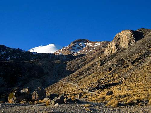
Looking up at Pico de Orizaba from the jeep road
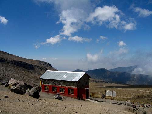
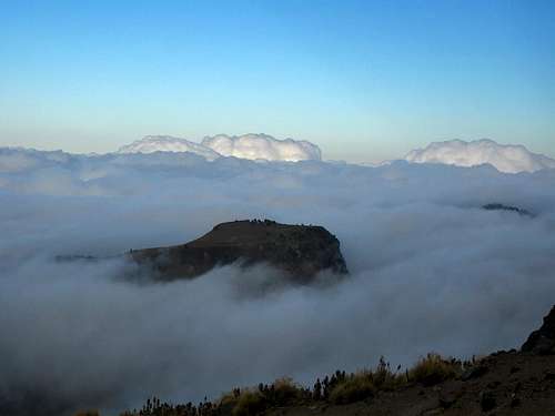
Anyway, we had to head back down so they can pick up their cable. We bought some Cokes in town and I began to think that they must think every American climbs mountains! We eventually arrived at the hut with an elevation of 14,000 feet. This was a long, bumpy and dusty ride and the jeep had a low ceiling so I had to constantly bend my neck to avoid hitting my head. Right as we arrived it began to fog up heavily. This is the typical weather pattern for Pico de Orizaba. Clear and sunny every morning followed by afternoon fog from the Gulf and convection clouds around the summit. Moral of the story, be back to the hut before noon!
Arriving at the hut via old jeep
The hut at 14,000 feet
We unloaded everything and set up the tent. We decided to sleep in a tent as we had heard lots about how loud the hut gets. We met with a large guided English group that were just coming down from the summit that day and they all went right to sleep while their guide cooked them dinner. I had some good conversations with their guide while we cooked our dinner. They had a very successful day and told us about their climb. This got us even more excited. We went for a very short walk up the aqueduct for about 300 feet just to get some blood moving. Felt a little weird hiking for ten minutes and getting higher than Colorado! We both felt fantastic and watched the clouds recede for the evening. I slept pretty well for my first night at 14,000 feet. It never got really cold and the mountain was very silent.
An island in the sky as the fog recedes
Wednesday March 14th
By 9am we were awake and ready for our training hike. We ate a quick breakfast and wished all the English group a safe trip back home. Once they left there was a total of 13 people on the mountain. The five from Minnesota would spend this day packing up to a high camp at the base of the Labyrinth at 15,7000 feet while another group of four rested all day after their training hike on Tuesday. There was also a brother and sister who planned to do the same training hike as us. All 13 people planned to summit Thursday.
Sunrise on Pico de Orizaba from our tent
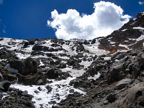
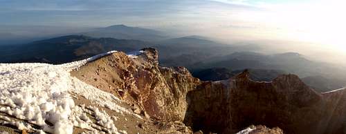
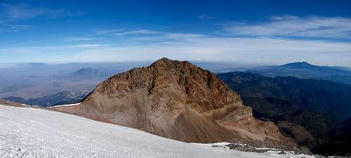
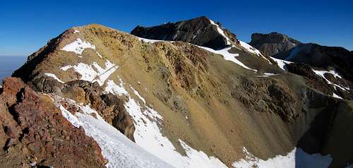
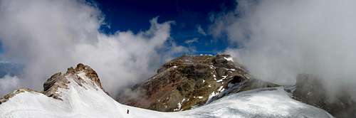
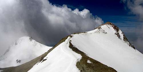
The trail was very easy to follow. It followed an old aqueduct for a short distance before breaking into a number of social trails and heading steeply and to the right of a black cliff. Keep to the left, just to the right side of the deep gully where water flows pretty quickly during the day as the snow high above melts. It passed a couple more aqueducts along the way before flattening out a little and heading up a small valley just to the right and along a distinct cliff band that was only about 15 feet high. At the end of this valley was the high camp with room for a couple tents. We then followed along the other side of this cliff/ridge as it headed right for the Labyrinth. Locating the correct gully to ascent this feature on the mountain can be tricky but in reality, it was far easier than what I had been led to believe. It is the second prominent snow gully to the left of the Sarcofago. Don't take the one closest to the Sarcogago at the far right but also don't head really far left.
View of the Labyrinth, crux of the route
We stopped right at the base of the Labyrinth and marked the correct gully with a big cairn and flags. We also stashed lots of gear like crampons axes, rope, picketts (which we didn't need) and water for our ascent the next day. We took some photos and hung around the high camp as the Minnesota group pitched their tents.
View down the mountain from the high camp
We began to descend back to our tent as we were planning to start at midnight and meet the five at high camp at 2am. We had no interest on carrying more stuff up the first 1700 feet so we, along with the other couple and the group of 4 who were in the smaller hut went to bed right as the sun set and set all the alarms we had for 11:30 pm to give us time to eat.
Thursday March 15th
Having 4 alarms hidden all around the tent helped wake us us pretty well. Within minutes we were cooking breakfast under a brilliant display of stars. By exactly midnight we were off. We had to re-climb the 1700 feet to high camp to meet the others. We arrived early though as it took less time than we thought to ascend. By 1:45 am we were all on our way up the Labyrinth together except for the group of 4 who lagged a little behind. At most the Labyrinth was 45 degrees on some hard icy snow. Some people were worried than if someone fell they would take out everyone below them but the snow was so cuspy and rough I believed you wouldn't even slide. Unless someone would get rolling out of control I wasn't too concerned. We made very good time heading up the Labyrinth and all 9 of us were feeling great. It soon became apparent to us that we needed to slow down significantly if we wanted to summit as late as sunrise!
Looking down behind us we could see many lights for all the towns surrounding the mountain. We hit 16,500 feet around 3:30am and knowing we still had a couple hours until twilight started Stephan and I really slowed down on purpose. I felt great and was completely able to continue on at a brisk pace but I didn't want to have to sit up top freezing waiting for the sun to rise so we took a few long breaks just sitting. It really wasn't very cold at all. I guessed it was only 25 degrees with light winds so keeping warm wasn't too hard. We succeeded in making a very slow ascent from 16,500 to 17,500 feet in nearly two hours. The Jamapa Glacier averaged only about 30 degrees for this section and by now Stephan and I were a couple hundred feet below the rest of the front crowd. We were among people who had climbed Denali without using a plane, Aconcagua and Saint Elias. There were some pretty good mountaineers in that group from Minnesota.
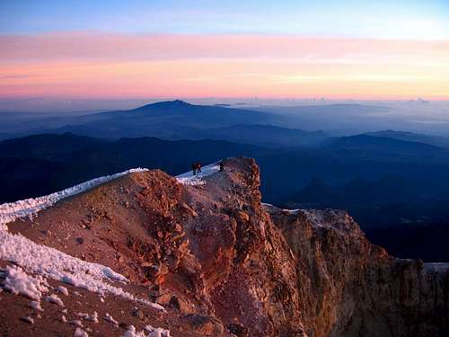
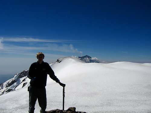
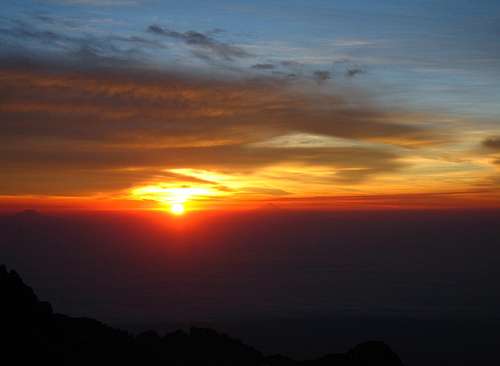
I decided to push on ahead for the last 1000 feet. I quickly caught up to the rest of the group over the next 500 feet and we all decided to take about 15 minutes at the large rock that's exposed a few hundred feet below the crater rim. Here, first light hit us all and the eastern sky was becoming lit with a band of red and orange. With only 300 feet to go I figured we had paced it out well to avoid summitting way before sunrise. However despite my slow ascent pace down lower, this last 300 feet is I began to feel the altitude. I really couldn't take more than 10 steps at a time. Maybe the fact that the glacier steepened to about 42 degrees didn't help but I was thanking myself for going slow earlier on. I never got any headaches or anything but that last 300 feet felt like 600. Being the competitive person I am I tried to be the first too summit. It was me and one other that got to the crater rim first. I was so astonished by the massive depth of the rim I was forced to slow down and admire it. After all, it was only about 5 more minutes to the summit. As I crested the rim, twilight was ending and the sun was getting close to rising.
Twilight on the crater rim taken shortly before summitting
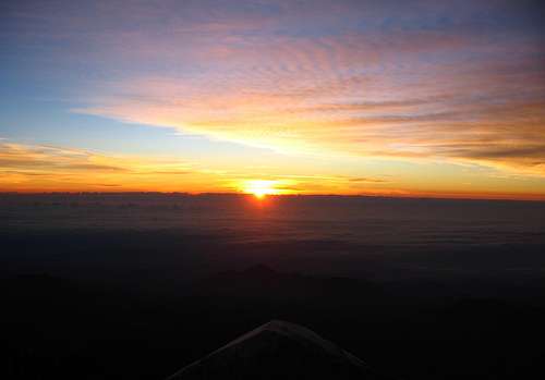
I finished the short walk around the rim topping out second behind the guy who has climbed Aconcagua and Saint Elias...what do you know apparently he had nearly ran the last stretch. No way could I even have done that! Only seconds after I summitted did the sun finally rise!!
Sunrise from the summit of Pico de Orizaba
I quickly caught my breath and to my astonishment it was warm enough to hang out on top while the rest of the group to summit. Everyone made it and congratulated one another. We all took out summit photos and took in the beauty. The crater dropped an amazing 2000 feet! That's almost back down to the base of the Jamapa Glacier on the outside of the mountain.
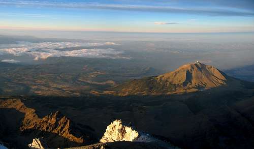
Looking down at the 14,000 foot Sierra Negra from the summit with that large dish
A look down the crater
View of the crater on Pico de Orizaba
Here is a couple videos I took from the summit. This was truly a once in a lifetime moment I'll never forget. This summit was the most satisfying and during my final hundred feet I had a feeling I've never had before. I was almost in tears from the accomplishment of summitting Pico de Orizaba and I can imagine this is the feeling someone gets after winning an Olympic gold medal or something similar...
...a feeling you only get after completing a very difficult goal for something you are truly passionate about.
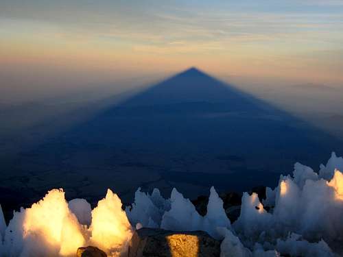
One thing in particular that I will never forget is seeing the massive shadow the mountain cast on the landscape.
Orizaba's shadow
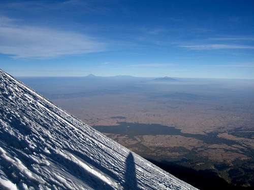
After about a half hour on the summit, Stephan and I began the descent. I hated to leave such a fantastic place. For a moment on March 15th, 2012 we were the highest people in North America because we were certain no one was climbing Logan or Denali at this time of year. And so we dropped off the crater rim and began the long and steep descent. This seemed to last for a long time heading down the glacier and I even managed to rip a hole in my gaiters with my crampons but I was very thankful to have them as the snow was more like ice the entire way. Halfway down the glacier the sun was beginning to really warm things up and I put on some sunscreen and glasses.
A look at the steepness of the glacier
Looking down the glacier
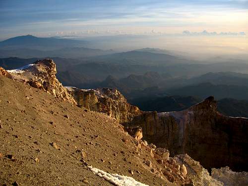
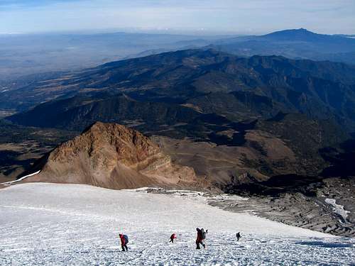
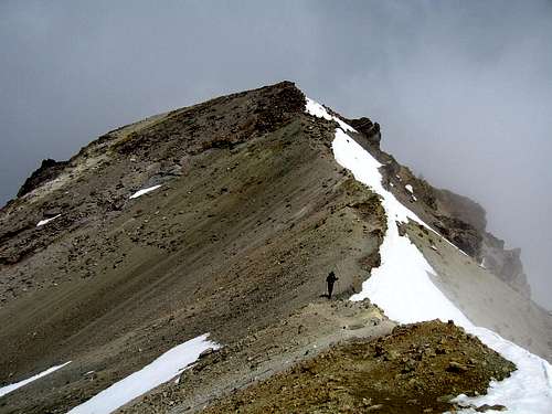
I keep calling this a glacier but I believe it isn't a glacier anymore. It is thin at best and there are no crevasses anymore. The thickest crack I saw was about a half inch thick and short. Years ago it was much larger and actually covered the entire way down the Labyrinth from photos we saw of the mountain from the 1950's but those days are long gone. Someday in the future the whole glacier may disappear leaving all routes on this mountain miserable scree slogs. We continued down to the very base of the glacier and our group took a good hard-earned break.
Descending back to the Sarcofago
We continued the uneventful descent down the Labyrinth and back to the high camp where we re-packed our bags and drank some much needed water. 15,700 feet never felt so low! Felt like Golden as far a swe were concerned lol. Stephan and I also carried a rope, pickets, and harnesses all the way up the mountain only to not need them. We soon found ourselves back at the hut where the rest of us soon followed. The group of 4 that lagged a little behind summitted shortly before we returned to the hut around 11am giving us a 100% success rate for the day. Around noon Joaquin came driving up along with his brother in the other jeep to take the 9 of us back into town. The other group of 4 had their own car.
The long jeep ride went well and we all talked about how great that morning went, got to know one another very well and talked about past and future trips. Upon returning, we dried out our gear, showered and had one of the best dinners I think I've ever had. By 6pm we were sleeping and a night down at 8000 feet allowed us to recover very well.
Friday March 16th
Antonio came right on time to pick us up from the hotel at 10:30am. We had barely got up and eaten breakfast when he arrived. We re-packed everything into out two packs and put everything we wouldn't need for Izta into the big green duffel that Antonio graciously agreed to leave in the trunk of his car for us. This way no one would steal our stuff while on Izta
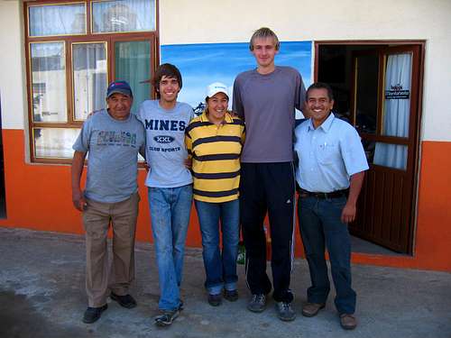
Group photo
We got a group photo and signed the logbook and said our goodbyes to everyone and we were on our way to La Joya. Another 15 minute tire change was in the books before we headed up the long windy road to Paso de Cortez where we bought our permits for the Izta-Popo National Park. Antonio really helped us translate as the workers in the visitor center didn't speak any English. The 9 kilometer dirt road to La Joya was actually in great shape. We did take it slow as Antonio's car is a VW Jetta but it had no problems at all. W donned our packs, informed to be picked up at 9am on Sunday and by 3pm we started trekking up the trail to the Grupo de los Cien hut located between the feet and the knees of the sleeping woman known as Iztaccihuatl.
Starting up the trail at 13,000 feet with 50 pounds on my back (mostly water) was pretty difficult but doable after such a great nights rest down low. Keep in mind that the map you see at La Joya showing the route and distances LIES! I found that if you were to change all the numbers seen on that map from kilometers to miles it would be more accurate. Plan on Izta being 12 miles round-trip. We first followed around some cliff bands and crossed a very minor saddle around 13,400 feet. The trail continued to the right and climbed steeply on some loose scree to another small saddle around 13,800 feet. We took a good break here to watch the cool looking clouds race up the mountainside and make the surrounding cliffs look very eerie.
The clouds racing up Izta
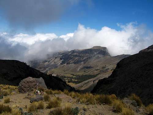
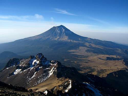
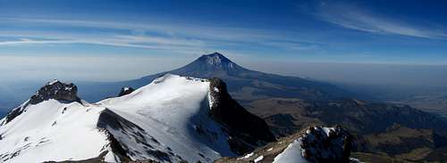
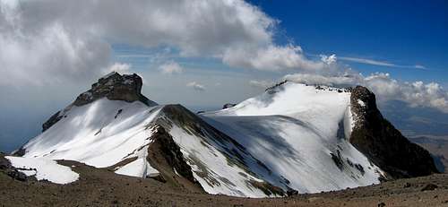
The mountain was very complex and beautiful unlike the simple appeal to Pico de Orizaba which is mainly one very large cone. The views towards the smoking Popo were astonishing. I also remember distinctly the tall grasses that grew below 14,000 feet on the slopes of Izta. It was a beautiful sight to look all the way down the valley and the slopes with healthy grass and marshlands in a place like Mexico where much of the land is scarred with trash. Cliffs and rock pillars seen all over this mountain especially with the usual clouds and fog make it feel like a scene from the Alps. We continued right up the ridge and crossed a more major saddle around 14,200 feet crossing to the east side of the ridge for awhile. The views of Popo became even better and we began to look down on the feet of the sleeping woman.
Popo and the feet
After one final push to reach the ridge crest once again our hard work with packs was done. We crested the ridge right as the sun set and took a good break here.
Alpenglow on the ridge crest and Popo
From here it was a short walk to the hut at 15,000 feet. I was impressed with this effort. Never had I ever carried so much at such a high elevation but we estimated we needed 12 liters of water for the two of us and since I was feeling stronger I carried 9 of them. We walked in the hut that is designed to sleep 12 comfortably to find only 5 other people so it was a nice quiet night...although sleepless because this was a new record for booth of us for our highest night. At 15,000 feet we were a thousand feet higher than our camp of Pico de Orizaba but we both still felt strong. I firmly believe that we felt so good the whole trip because we always made an effort to stay hydrated. This was the first time in a very long time I was forced to get up in the middle of the night to pee on multiple occasions.
Saturday March 17th
Since we had already hiked halfway up Izta we agreed to start at first light. Midnight was a little ridiculous. At about 6:30am we were off. The first part of the climb was up a steep scree slope to gain the ridge once again. To my astonishment I found a 90 centimeter ice axe just laying there. Score! I knew it was good for the taking because a guy from Texas who was descent back to La Joya the day before told me if I found it it was mine since it was too long for him. If you know me personally you will know how tall I am and when he saw me, he simply told me it's mine if I find it. It was brand new too!
Above the scree slope the crux of the climb of Ixta is reached. A class 3 scramble up some rocks is needed to gain the cliffs that guard the knees. We headed right and scrambled up along cliff bands that face east. Small yellow dots painted on the rocks marked the best way. We crossed a large iron cross which marked the top of the class 3 section where steep class 2 led to the summit of the knees at 16,400 feet. We got here in about an hour at 7:30. Since Izta is only 17,150 feet we figured most of the work was done...well we would be wrong. Lots of horizontal travel was still needed which included ups and downs crossing over all the different body parts of the sleeping woman.
View north from the Knees. Summit cannot be seen yet
From the knees we descended about 100 feet and skirted on the east facing slope around the hips and to the next saddle. From here we saw a long flat snowfield to cross which marks the top of the Knees Glacier. We walked right across the long flat icy snowfield with no crevasse dangers whatsoever. We gained the next saddle and turned left heading steeply up and over a narrow ridge that smelled very strongly of sulfur and to another sub-summit known as the belly.
Popo seen in the distance. The long snowfield in the foreground
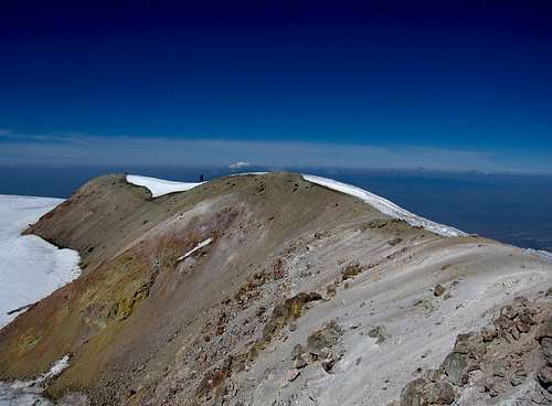
From the belly we were able to see most of the remaining route. What we thought was the summit from here turned out to be another false summit however La Arista del Sol (the ridge to the sun) started here. This ridge walk was very simple and not steep at all although it was fairly long. Since I felt so good I was able to stride at 100 percent and make quick time. We finally got to what we thought was the summit only to see the true summit merely feet hire a quarter mile away on the other side of the old crater. These two summits, the breasts mark the highest point on Izta however the northern breast was slightly higher. We decided to cut across the crater since it has been inactive for so long and filled with snow and ice. We regained the crater rim a short distance from the summit and I shot this photo of Stephan finishing up the ridge-run as I stood on the summit.
The final ridge to the summit of Izta
By 9:50 I summitted, over two hours from the Knees moving fast. Stephan made it by 10am and noting how fast we saw the clouds building we decided to spend only five minutes on top before heading back. From the top we were able to look down to the north at the head of the sleeping woman. I found it amazing that I climbed the entire way in trail-runners when I had read that mountaineering boots, crampons and axes are a must. I didn't need any of those things and I carried them all! Even had two axes because I found one!
Me on the summit of Izta
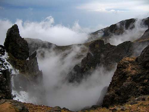
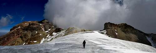
We retraced our steps across the crater and back over the belly back down to the long snowfield. It was amazing...I had never seen clouds build so fast! In a mere 25 minutes clouds were towering above us and billowing over the ridges. I though clouds in Colorado built fast, these were the fastest I had ever seen clouds build.
View of the traverse as clouds build
I looked at the weather forecast prior to doing Izta and I expected this however I assumed they would come in closer to 1pm not 11am. No problem though, with my weather knowledge I knew they were not thunderstorm clouds yet...just fog that could hinder our way back. We never really did hot complete whiteout until we got back to the hut though so they weren't a problem. They sure made things pretty on the way back though.
Stephan crossing the snowfield as clouds quickly build
Re-ascending the final snow slope
Looking down on the knees and the hips
The traverse around the hips was a muddy mess now that the sun had been hitting it so I went over the hips to avoid it as I only had trail runners on. By the time we re-gained the knees more fog had come in but we started the long descent back to the hut.
At the saddle between the knees and hips on the way back
View looking down towards the hut
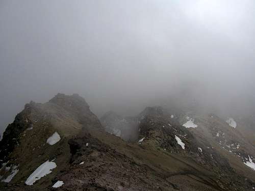
We managed to made the descent of the class 3 section and the long scree slope without any problems despite the occasional whiteout. We made it back to the hut by 12:30pm. Everyone who stayed at the hut that previous night had left and soon after we returned the few day hikers that had come up also left leaving us by ourselves at the hut for a brief moment of time.
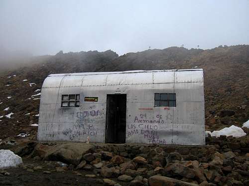
The Grupo de los Cien Hut
The fog was basically constant by this point and we just went in the hut to nap. Deep down we had hoped no one would come that afternoon but I knew that wouldn't happen. Within a couple hours a group of ten came. Great...12 people, should be fine right? Half hour later another group of ten came, then a group of 4 and three groups of two. We all managed to fit inside the hut with five people on each platform...talk about cozy!
Most of them were from Mexico City coming to the mountain for the weekend. The big groups had guides and they all planned to attempt Izta the next day on Sunday. Boy were we happy to have done it Saturday. We were actually the only ones to summit this day and from what we saw with even more people coming up with tents, there was looking to be 60 people on the mountain the next day.
We talked for awhile with some of the people who spoke English while making dinner and hoping the fog would go away for a nice sunset. It never did and we both actually got some good sleep despite the altitude and the large amount of people in such a small hut.
Sunday March 18th
This would be our last day in Mexico. We agreed to start the hike down at 6:30 am to meet Antonio at La Joya by 8:30. We gave away the rest of the water we had so we didn't have to carry it and we were on our way. The morning started with a brilliant sunrise with Pico de Orizaba and La Malinche way in the distance to the east.
Sunrise seen near the hut on Izta
The hike down, in addition to the huge amount of people that came up the previous afternoon we counted about 40 more coming up the trail for an estimated 100 people on Izta. We were the only ones going down in the morning. We did it right by breaking it up into three days as all these people were trying to summit in one day. We noticed the clouds build even earlier on our way down and doubted if anyone was going to make it this day, certainly not the ones who started at La Joya. We took our time on the descent and talked with some of the people heading up. We were able to meet Antonio at about 9am and I remember the first thing he asked us was if we had any rain the previous night.
Apparently it had rained a lot in Mexico City that night which I assumed so due to all the lightning we saw in the distance. We didn't have any rain or snow though. We stopped for breakfast at an old lady's little gazebo where she made us fresh chicken and vegetable tortillas that were bomber! Antonio was even nice enough to take us to a place for us to shower and wait for us as we re-packed our gear for the plane ride back to Denver. After dropping us off at the airport we paid him and I gave him a tip since he was so nice and helpful and we flew home...after a long wait and a delayed flight. I had to once again wait for hours in LA before finally arriving in Denver at 9:30am on Monday.
Aftermath
I would put this up with my Wind River trek I did last August as one of the best trips I've ever done. It was my first international climb and I plan for many more in the future. Thanks to Stephan (my roommate) for joining me and helping make the trip such a success. We may have our preferences and differences but we work together well.
The overall cost for this trip was surprisingly cheap:
$600 for plane tickets
$160 total for the two nights at the hotel which included meals, 4X4 transportation to and from the hut on Pico de Orizaba, and 30 liters of purified water
$200 for Antonio's transportation service
$7 for permits
$3 for a shower
$20 tip
and a few dollars for some random things in town
I would highly recommend this trip to anyone. If you do not want to climb in Mexico because you are worried about being mugged and killed, you may fall into the same misconception that every square inch of Mexico is a very dangerous place. Countries are big and smart traveling is all you need against anything that may go wrong in Mexico. Don't wander or drive at night; don't make anyone angry at you; don't look overly wealthy etc. Not once did I feel unsafe on the whole trip. If planned and executed correctly, as I believe we did very well, this can be a very safe trip.
"This summit was the most satisfying and during my final hundred feet I had a feeling I've never had before. I was almost in tears from the accomplishment"
I've only felt it a few times before, Rainier, Orizaba, Aconcagua, Kilimanjaro, but it's addictive and it leaves you wanting more. So what's the next big peak on your agenda?
I likely won't be able to do another international trip until 2013 when I may have more money but I am thinking about something in S America. For the rest oof 2012 I have hundreds of peaks planned in CO, UT, MT, WA, CA, and ID
Thanks for commenting!
Matt, as discussed on our last trip, check out some photos of the peaks (not Orizaba) I took back in 1992 (the photos aren't that great, but will show the changes):
Well done Matt - like the Gimpilator, I really related to how you felt reaching the summit - I have also felt that way on a few summits. But I was also particulary interested in your TR since I climbed Popo back in the days when you still could. I also didn't get mugged in Mexico - but my wife & I did 2 years ago in Buenos Aires!
I seem to recall that the Eiger is on your list for the summer - best of luck and I shall look forward to reading about that - and any future 'big-ones' if you remain inspired by Orizaba.
Best wishes, Mark
Thanks Mark!
The Eiger is certainly one of my big goals but I won't have the money by this summer to make it happen. I am focusing on Canada this summer. But soon enough I'll make it happen. Thanks for commenting!
Orizaba was my first international trip. Now I've been to Antarctica, South America, Denali ((almost a new country) and now Russia! You may be hooked my friend! Scotty P
I really enjoyed your climbs of both of the big Mexican peaks. You wrote it well and had some great photos. My wife is from Colombia and I have had some great trips there. The driving in Bogota might compare with Mexico City drivers. Thats awesome you felt safe and you knew how to handle yourself in a Latin country. I hope to one day climb a big peak in Colombia, not as many Americans or guides, but still doable. Good luck in your future endeavors. I really like your Wind River TRs.
Standing straight and tall on this summit you were probably breathing higher air than any previous summiteer. Carrying this logic a step further, you effectively made an 18,491' peak an even 18,500' measured to your frost- tossled hair!
Really enjoyed your report. I must try this peak one day!
Parents refers to a larger category under which an object falls. For example, theAconcagua mountain page has the 'Aconcagua Group' and the 'Seven Summits' asparents and is a parent itself to many routes, photos, and Trip Reports.


Comments
Post a Comment