-
 16849 Hits
-
 74.01% Score
-
 4 Votes
|
|
Mountain/Rock |
|---|---|
|
|
33.24719°N / 116.49765°W |
|
|
San Diego |
|
|
Hiking, Scrambling |
|
|
Spring, Summer, Fall, Winter |
|
|
5779 ft / 1761 m |
|
|
Overview
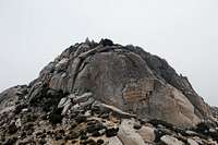
The Thimble is located in the San Ysidro Mountains in northeastern San Diego County. It is located near White BM and San Ysidro MountainThere is a nice class 3 scramble required to reach the top. From the summit you can see most of Eastern and Central San Diego County including many SDC peaks. This peak offers some fine scrambling from any side. The North Face may also offer more technical routes.
The route starts right after the sign for Anza Borrego State Park along state route S22. This is also right before the road takes a turn down into the Borrego Valley. The first portion of the route follows the boundary fence all the way to Chief Rock
The best way to go to the east of Chief Rock under White BM.
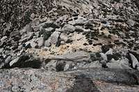
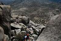
This will keep you out of all private land and in Anza Borrego. Once past Chief Rock and White BM you will cross a road, this road leads back to one of the homesteads on private land. Cross the road and head straight for The Thimble directly in front of you. The easiest route is the south face. This most difficult move was only class three, this is near the top.
The view from the Summit is excellent of the surrounding area. The most dominant feature is San Ysidro mountain which is only a half mile away. Borrego Springs is visible to the east 5,000 feet below. Whale Peak is visible to the southeast. Cuyamaca Peak is visible to south west. The Palomar range is visible to the west.
Getting There
Directions-Take CA 78 east to Santa Ysabel
-Take CA 79 north to S2
-S2 a few miles to S22
-Stay on S22 until you see the sign for Anza Borrego State park
-Park just past the sign on either side of the road
Red Tape
There is private land along the western edge of the trail. This is marked by an old barb wire fence.Camping
Camping is permitted anywhere in Anza Borrego State ParkExternal Links
-4/9/2011 Trip Report-4/17/2010 Trip Report
-1-23-2010 Photos
-Anza Borrego State Park
GPX Track


