
|
|
Mountain/Rock |
|---|---|
|
|
43.83630°N / 114.7113°W |
|
|
10110 ft / 3082 m |
|
|
Titus Peak Overview

Titus Peak is a large, rounded mountain and is the second most northern peak in the Smoky Range. Although not overly impressive or dominant in the skyline, it is an attractive peak with a rugged west face that towers over the upper Sawtooth Valley.
Titus and Lower Titus Peaks are synonymous with back country skiing in the Wood River Valley. These two peak's close proximity to a popular highway, relatively gentle slopes, and high elevation, creates a paradise for outdoor enthusiasts of all kinds.
Many confuse Lower Titus Peak for Titus as the SNOTEL confuses the fact that there are indeed weather stations on the summits of both peaks. In turn, Titus is often believed to be Bromaghin Peak, which is located just to the south on the Smoky Crest.
Titus Peak, as well as Titus Lake located near the peak, is named for William Titus who was a member of the 1915 USGS survey party.
Whether it is a group of climbers making the traverse from Galena Summit to Saviers Peak in the summer, or the hordes of back country skiiers and snowboarders in the winter, Titus Peak is a well-traveled mountain. The easiest route to the summit is a class II allowing anyone who wishes to summit Titus Peak.
 |  |  |  |
Getting There
From the pullout a small dirt road leads west toward the canyon. The road then fords the Big Wood River, which is impossible until late-summer, and even then is quite difficult. After the river crossing, the road climbs onto a high meadow into the forest next to Owl Creek. The road is in surprisingly good shape for the first 1.5 miles.
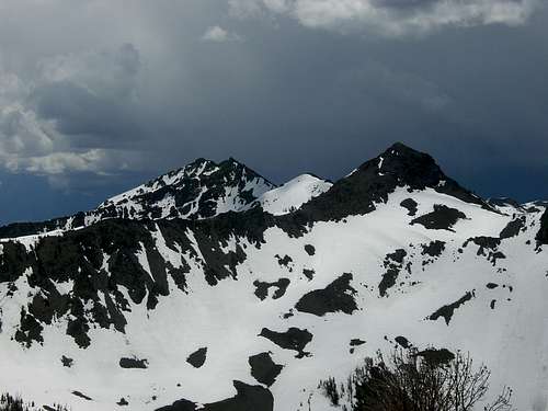 Saviers and Bromaghin from Titus
At 1.5 miles, a large tree has fallen and blocked the road. Follow the faint path that cars have made around the south side of the fallen tree and return to the Owl Creek Road. The road continues to be relatively smooth with an exception here and there of stream crossings and rock outcroppings.
Just before the road ends at about 7,900', the road is burmed up and is no longer passable by vehicles.
Red Tape
No red tape or permits required for the Titus Peak area.Even though a high number of people ascend and ski Titus Peak in winter, remember that this mountain is no different than others and there have been avalanche fatalities.
The Owl Creek Road is closed during winter while Galena Summit is only closed during the strongest of snowstorms.
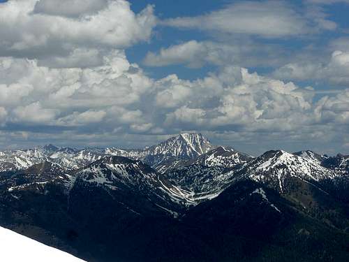 Castle Peak from Titus.
When To Climb
Unlike the majority of peaks in Idaho, Titus Peak most likely sees highest number of people travel to its summit during the winter months.The back country skiers usually develop a snow path along the ridge from Galena Summit to Titus during the duration of the winter months, which provides for an excellent snowshoe trail.
During the summer the peak is also an enjoyable destination as it is quite close to Highway 75 and has a relatively easy approach.
 View East
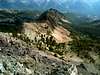
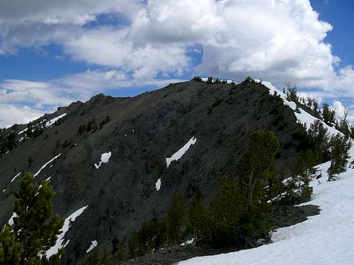 Titus' West Face
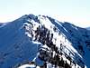
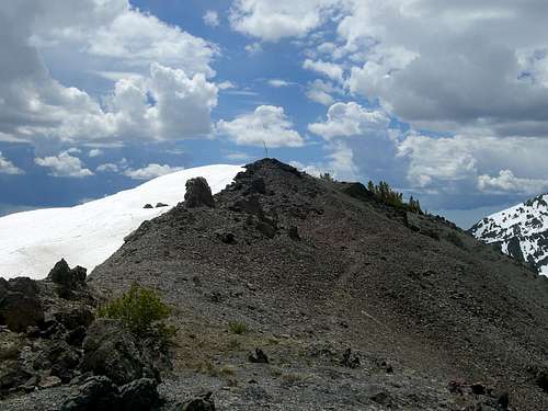 Titus' Summit
Camping
There is plentiful camping in the Upper Wood River Valley and a few good spots along the ridge in the woods.Several excellent campgrounds are located nearby including Prairie and Baker Creek CGs.
 Galena Peak from Titus
Mountain Conditions
Although it may not be apparent at the summit, there is a seasonal reporting weather station near the top of Titus Peak. The Titus Peak Weather Station is active from October through June in most years.These are also some excellent links for current and future conditions.

Sawtooth Avalanche Center- Gives daily avalanche reports during winter.