


-
 3272 Hits
-
 79.78% Score
-
 11 Votes
|
|
Area/Range |
|---|---|
|
|
45.73580°N / 7.31389°E |
|
|
Hiking |
|
|
Spring, Summer, Fall, Winter |
|
|
8202 ft / 2500 m |
|
|
Note
La montagna chiama i suoi figli, ed essi rispondono fedelmente al suo appello… Osvaldo Cardellina, Diario alpinistico, 1964-65 Page texts: @ OsvaldoCardellina "Osva", passed away on May 2, 2022. Page owners: Christian Cardellina e Osvaldo Cardellina. Any updates from September 12, 2022: Antonio Giani, page administrator, friend and climbing companion. Testi della pagina: @ OsvaldoCardellina "Osva", scomparso il 2 maggio 2022. Proprietari pagina: Christian Cardellina e Osvaldo Cardellina. Eventuali aggiornamenti dal 12 settembre 2022: Antonio Giani, amministratore della pagina, amico e compagno di salite. |
Wild Overview
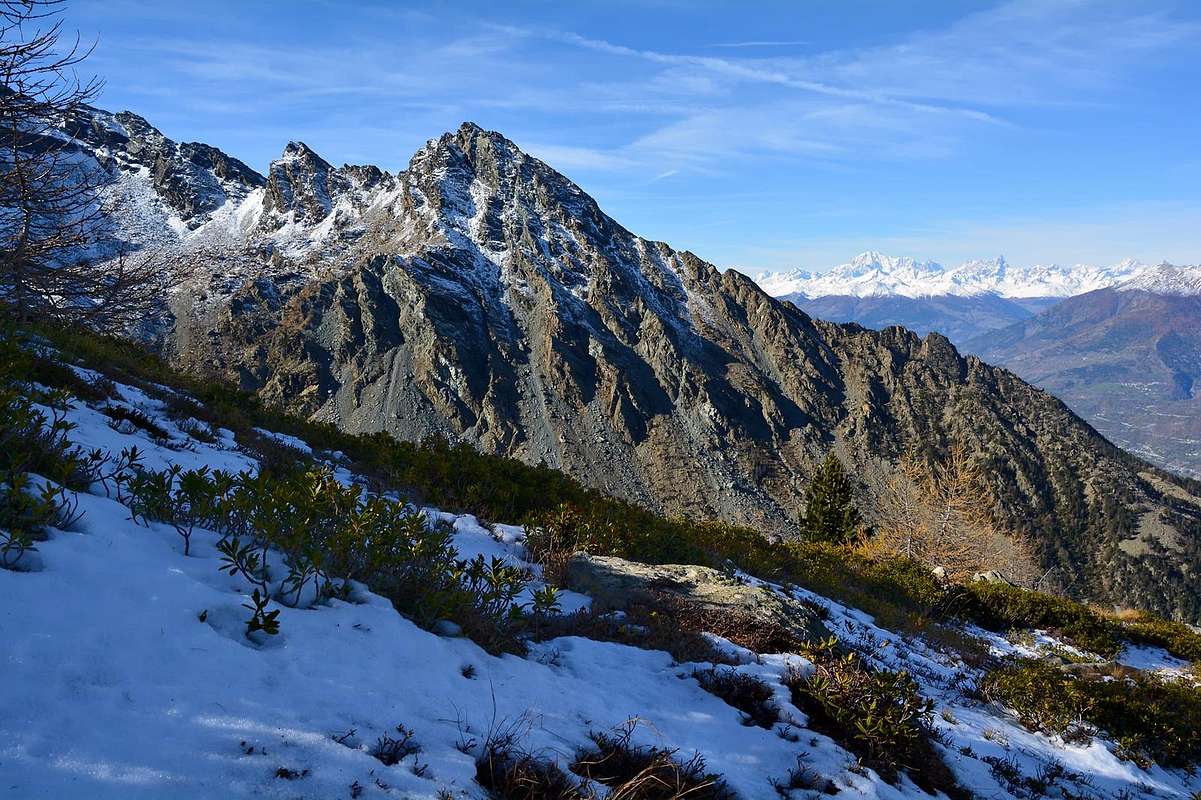
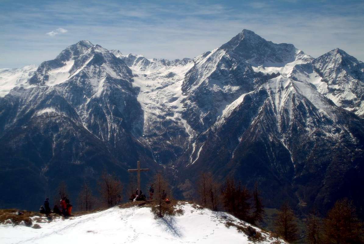
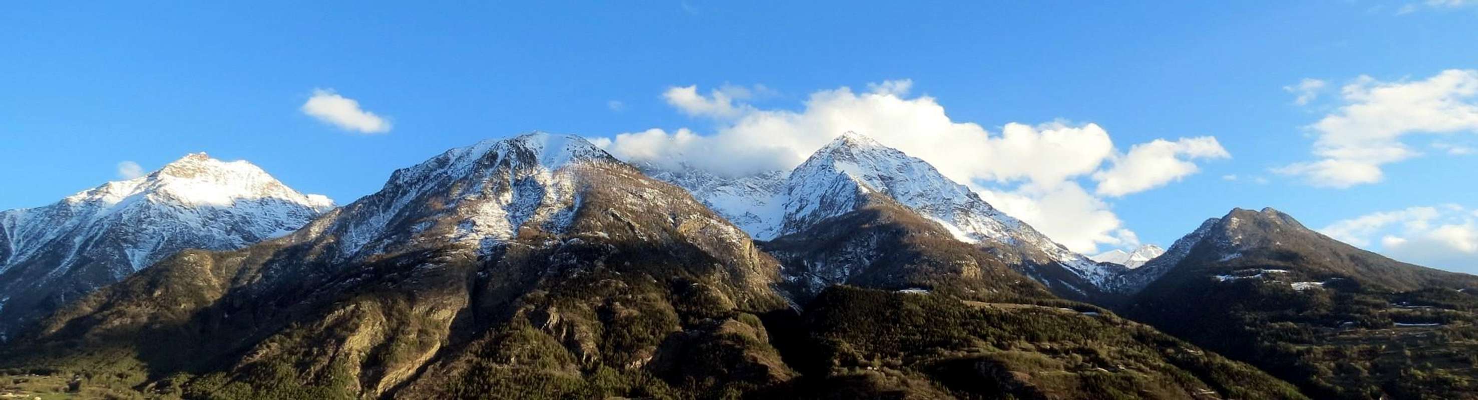
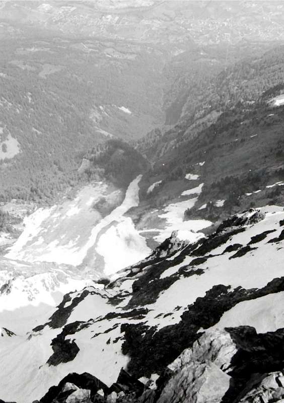
We group these five vallons all located in the South of Dora Baltea and amongst those of Champdepraz (East), Fénis, Saint Marcel and the last to the West of these before you get off Pila Basin. Unlike the other three who, by extension and width, can be considered real valleys, these five vallons, despite their importance, need to be in this manner considered. Together with Valleys previously treated we carry out a complete survey, a round up of all those valleys, less important walloons or secondaries at the South course of the main river that divides into two distinct parts of the Aosta Valley, or by following its course by West (Monte Bianco) towards Southeast until the end of the same in Aosta Valley (Municipality of Pont Saint Martin), before the City of Ivrea that anticipates the Po Valley to the East. A discussion in which we are analyzing in progression from East to West on the orographic and hydrographic right of the Vallons Valmeriana (at the base of Mont Rouvìc or Revì), Ponton (at the foot of the Western Slope of Mont Avìc and not to be confused with the same name in Vallone of Urtier above Cogne), Les Laures, Arpisson (East and North of the pyramid of Mount Emilius) and Dard, the latter at the end of the overlying Arbolle and Comboé Vallons Southern at the slopes of Mount Emilius and those of Western Becca Nona. The first of these, after the Champdepraz Valley or Lakes, is to Valmeriana, just ahead, always to the East, by the two Vallons secondary Banchettes and Bellecombe (famous for minerals with garnets and Vesuviane) above the village of Ussel (991m; beautiful stone castle from not long renovated). This vallon opens between Mont Barbeston East and Cima Nera the opposite before reaching its end the Mont Rouvìc (2.922m), where the crests meet, before proceeding to Avìc (3.006m), highest elevation in the entire Sub-group to which it gives its name.
![]()

Raggruppiamo questi cinque valloni tutti situati a Mezzogiorno della Dora Baltea e compresi tra quelli di Champdepraz (Est), Fénis, Saint Marcel e gli ultimi ad Occidente di questi prima di arrivare al largo Bacino di Pila. A differenza degli altri tre che, per estensione e larghezza, possono essere considerate delle vere e proprie valli, questi cinque valloni, pur nella loro importanza, tali devono essere considerati. Insieme alle Valli già precedentemente trattate completano il quadro di tutte quelle site a Sud del corso del fiume principale che divide in due parti ben distinte la Valle di Aosta, ovvero seguendo il suo corso da Ovest (Monte Bianco) verso Sudest fino al termine del medesimo in Valle (Comune di Pont Saint Martin), prima della Città di Ivrea anticipante ad Oriente la Pianura Padana. Una disamina che ci vede analizzare in progressione da Est ad Ovest sul lato orografico ed idrografico destro i Valloni di Valmeriana (alla base del Mont Rouvìc o Revì), Ponton (ai piedi del Versante Occidentale del Mont Avìc e da non confondere con l'omonimo nel Vallone dello Urtier sopra Cogne), Les Laures, Arpisson (ad Est ed a Nord della piramide del Monte Emilius) e del Dard, questo ultimo a conclusione dei soprastanti di Arbolle e Comboé alle pendici Meridionali del Monte Emilius ed a quelle Occidentali della Becca di Nona. Il primo di questi, dopo la Valle di Champdepraz o dei Laghi, é quello di Valmeriana, appena preceduto, sempre ad Est, dai due Valloni secondari di Banchettes e Bellecombe (famoso per i minerali con splendidi granati e vesuviane) sopra il Villaggio di Ussel (991 m; bel castello in pietra da non molto tempo ristrutturato). Il vallone s'apre tra il Monte Barbeston ad Est e la Punta Nera all'opposto per raggiungere al suo termine il Rouvìc o Revì (2.922 m), ove le creste si riuniscono, prima di procedere verso l'Avìc (3.006 m), massima elevazione dell'intero Sottogruppo al quale dà il nome.
 |
 |
 |
 |
 |
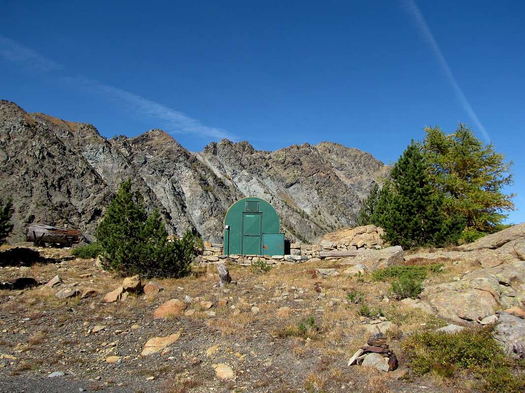
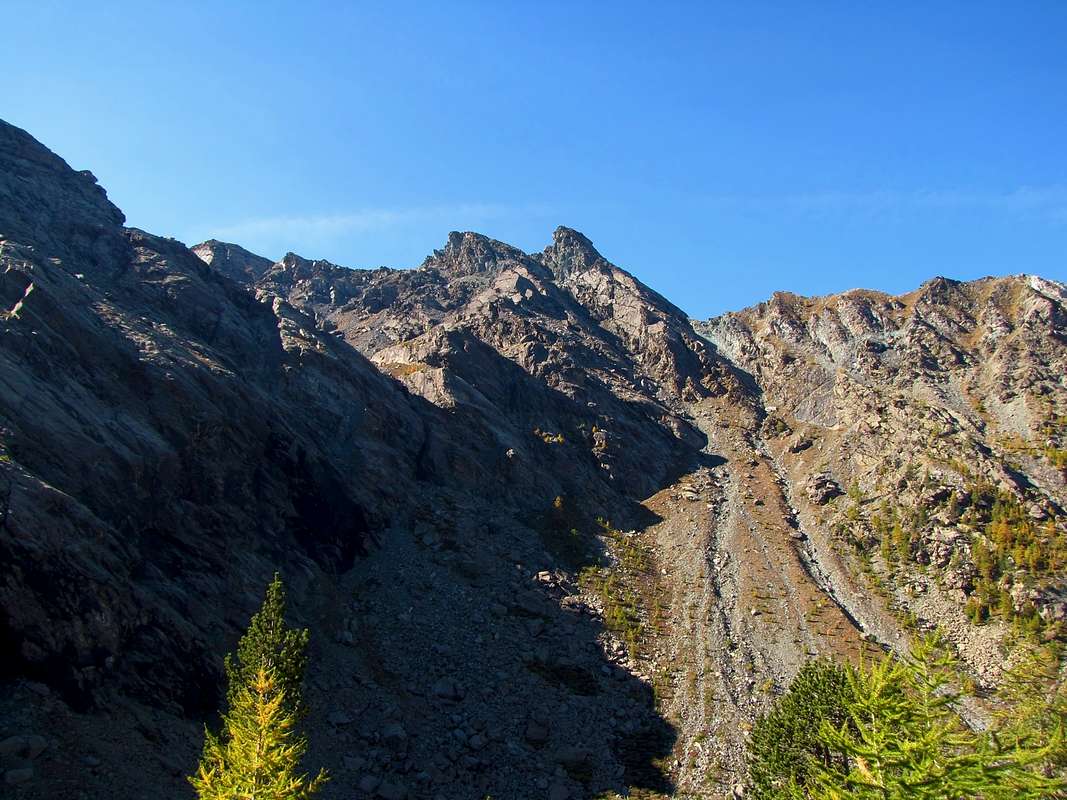
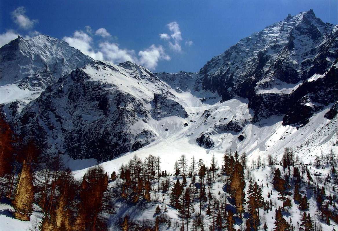
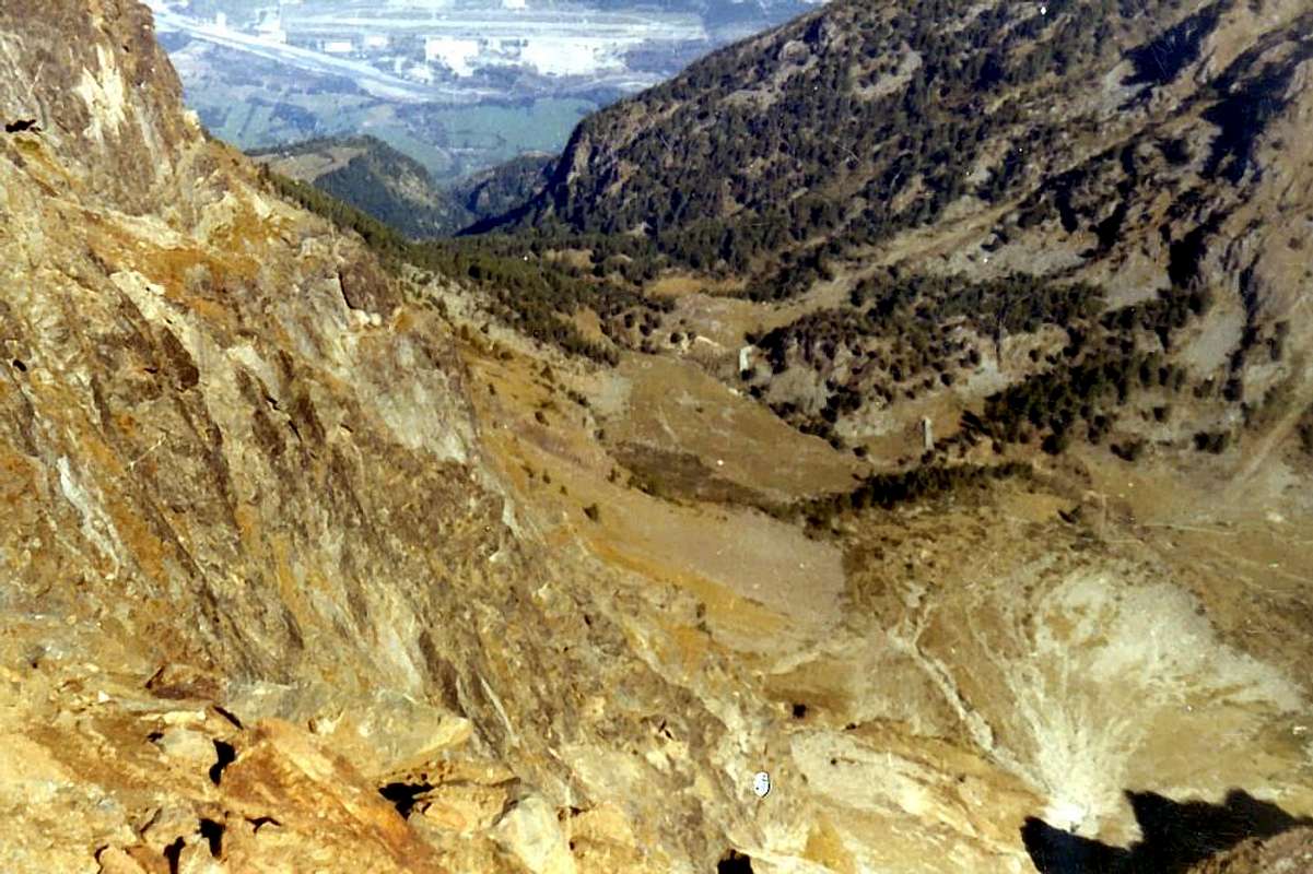
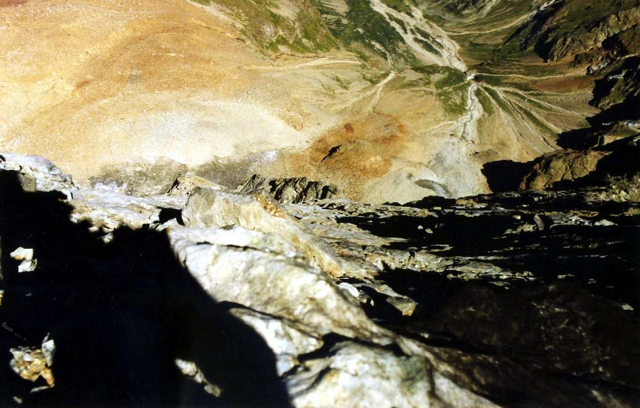
This goes up vallon between the Commons of Pontey (East) Fénis (West). Seemingly forgotten, has instead a "life" although it certainly is not known and frequented by mass; mostly attendance concern locals and chamoises hunters, while it is supervised by the Forest Service of the Autonomous Region of the Aosta Valley to which belongs the only refuge of the whole area (2.168m; private, always closed), placed in a rocky promontory overlooking the Seiser Ponton (2.040m). In fact the same splits, or at least unfold its paths, now to Northeast Alpe The Morgnetta or La Morgnettaz (1.837m, below the Bec Courbo and then the border with Val-Fénis-Clavalité) in altitude of 1.650/70 meters about. A branch via the path n° 1 runs through the valley floor towards South reaching the above alp, and then continue as a small track towards Raye Chevrère (2.830m) and the homonym hill (2.703m) to the triple border with the Vallons of Savoney (West) and Champdepraz or Vallon of the Lakes (East). The more goes up instead unnumbered with a diagonal parallel and halfway below the long Arête de Ponton up to the bivouac. From this point the same turned decidedly to the East reaching, through a step path with numerous hairpin bends, the Varotta Hill (2.830m), located on the border with the Champdepraz Valley and sited between the pyramids of Mont Rouvìc Avìc.
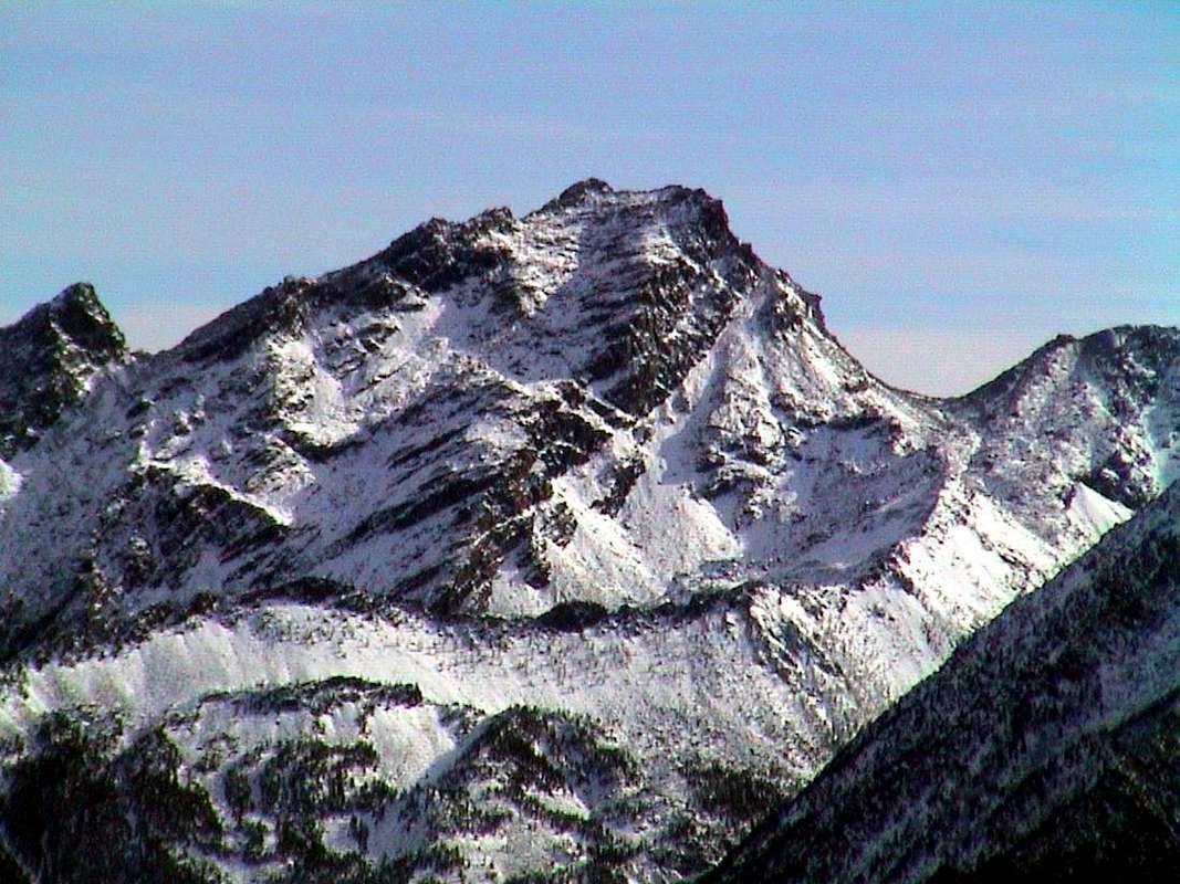
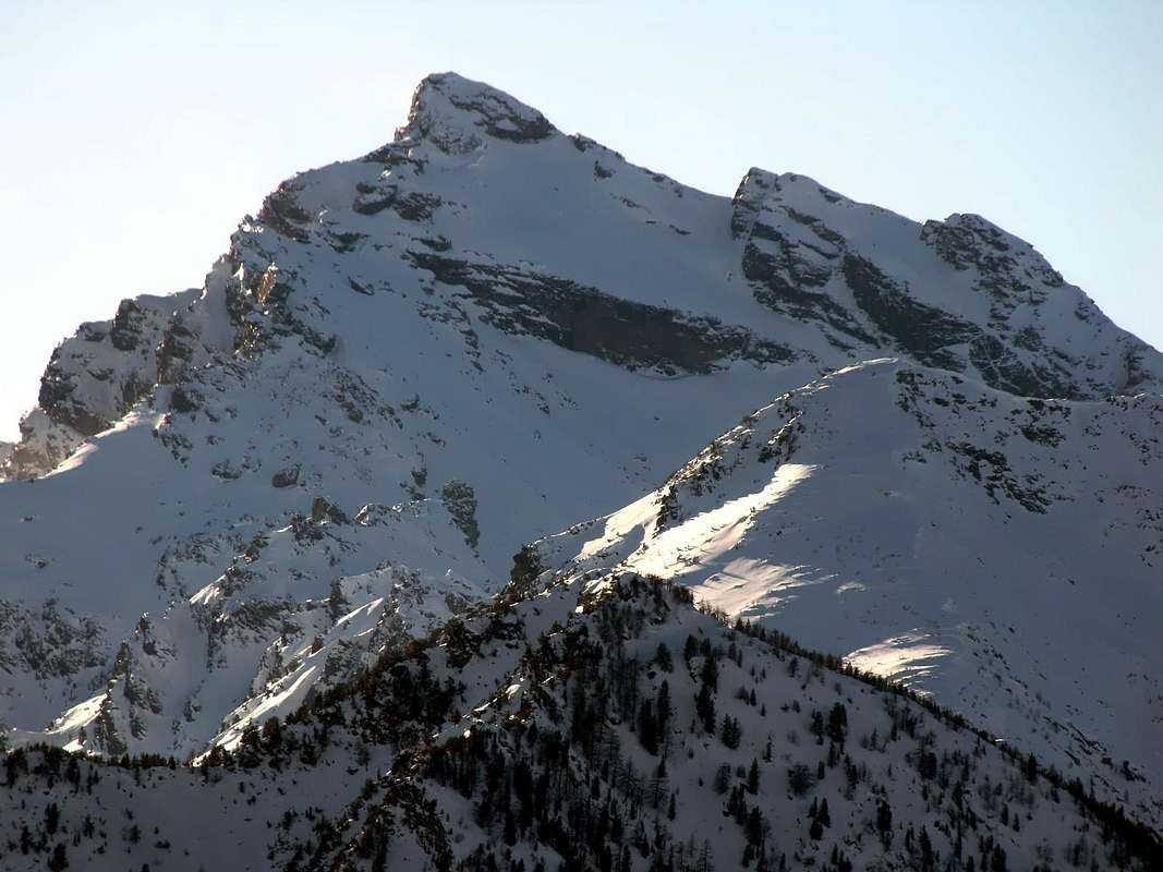
This last is like the higher elevation of the vallon and, along with the first, as the mountain more illustrative of the same valley; but it is certainly the Mont Rouvìc or Revì to be the highest mountain in sight with his great Western Slope, while the Avìc or Aü (acute) remains hidden behind a little and one admires only coming to a long wooden fence in the last part of the trail. The tours are aimed primarily at Colle Varotta (2.589m), but already long trip profitable starting from Villages or Luxe also called Lusey or Perrod/Verthuy (1.127m, 1.050m); even longer, with a more complicated trail and without a good path, towards the Raye Chevrère Hill at the foot of Mount Iverta (2.939m) and towards Champdepraz Valley. You can reach the Monte Avìc through its long Crest North-northeast and Rouvìc with the bumpy Ridge South-southwest that takes several workarounds to the West and good ability to know find the location with not always simple and easy connections. Even worse with regard to the Western Slopes, which require a good experience. Even more to avoid the watershed with the opposite Val-Fénis Clavalité both for Tête de Plan Fret that Mont Chermontane with slopes are very steep and paths to steep, wild and very dangerous rocky couloirs, as well as for the Bella Lana Pass (2.501m). All three are achieved much more easily by Clavalité departing from Lovignana Alp above Barche Hamlet (Fènis Common). In summary it is a vallon more frequented by Hunters or Poachers than by Hikers or Mountaineers, they really rare.
 |
 |
 |
 |
 |
Vallone di Ponton
Quest'ultimo risulta come la maggior elevazione del vallone ed, insieme al primo, come la montagna più esemplificativa del vallone medesimo; ma é certamente il Mont Rouvìc o Revì ed ancora Revìc ad essere la montagna più in vista con il suo grande Versante Occidentale, mentre l'Avìc od Aü rimane un pò nascosto dietro e lo si ammira soltanto arrivando ad una lunga staccionata in legno, sotto l'Arête de Ponton e protettiva su di un sottostante dirupo, nell'ultima parte del percorso prima di raggiungere il promontorio del Bivacco della Forestale. L'escursioni son rivolte principalmente al Colle Varotta, gita remunerativa ma già lunga partendo dai Villaggi di Luxe o Lusey oppure di Perrod/Verthuy (1.127 m, 1.050 m), entrambi nel territorio di Fénis sopra le Frazioni di Arlier o Arly (582 m) e Margnier. Ancor più lunga, con percorso più complicato nonché privo di un buon sentiero, quella verso il Colle Raye Chevrère (2.703 m) ai piedi del Monte Iverta (2.939 m) al confine con il Vallone dei Laghi sopra Champdepraz. Dal Varotta si possono raggiungere anche il Monte Avìc tramite la sua lunga Cresta Nord-nordest ed il Rouvìc con l'accidentata Cresta Sud-sudovest che richiede però diversi aggiramenti ad Ovest e buone capacità di sapere individuare il percorso con non sempre semplici e facili collegamenti. Peggio per quanto concerne i Versanti Occidentali, tali da richiedere una buona esperienza. Maggiormente da evitarsi sullo spartiacque opposto con la Val Fénis-Clavalité: infatti sia la Tête de Plan Fret che il Mont Chermontane presentano versanti selvaggi, dirupati e percorsi da ripidi e pericolosi canaloni rocciosi, così il Colle della Bella Lana (2.501 m). Tutti e tre si raggiungono molto più agevolmente dalla Clavalité con partenza da Lovignana sopra Barche (Fènis). In sintesi un vallone più per Cacciatori o Bracconieri che non da Escursionisti od Alpinisti, quest'ultimi veramente rari.
 |
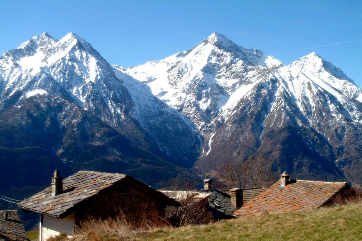
Questo splendido vallone appartiene al Comune di Grand Brissogne (827m).
 |
 |
 |
 |
 |
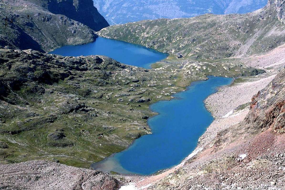
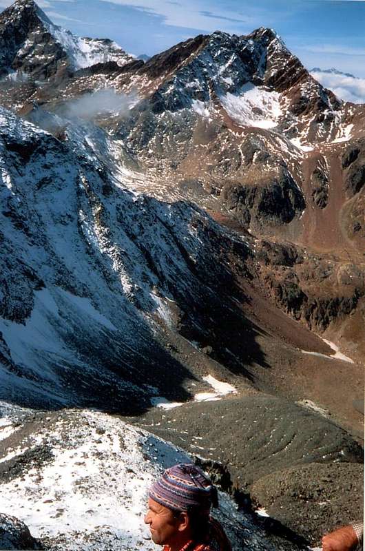
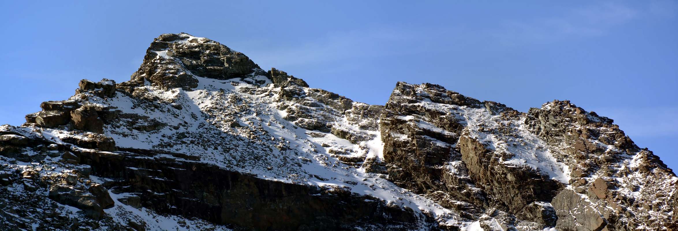
As regards the Excursions are preferred those to Hills and Passes not to the Summits.In fact all have difficulties that exceed the concept of Hiking, beginning with the "Normal Via" to the Monte Emilius through Crest South-southeast, which coincides with the route that comes from Vallon Arbolle but this side more complicated and, if in the presence of hard snow, certainly for the achievement of the Pass of Tre Cappuccini (3.242m). Turning to the other and starting to the East with the watershed of Roises, the only "affordable" are the first and the last, or Becca di Salé to the North, just above the Rifugio Menabreaz, and Punta Ilario Antonio Garzotto on the opposite side of the same partition. The Becca di Salé which is more easy by the eponymous hill (3.008m) and through the easy South Ridge; but the latter has some small passage upwards, if in the presence of snow, it can create some problems. The Punta Garzotto is just more challenging with the climb by Leppe Hill (3.110m), just below the Summit, however, presents some brief passage that requires the ability to choose the path; also in the middle part must be careful not to dislodge stones. To disregard the trio of Roises, all mountaineering and more exposed passages that difficult. The watershed South, that the Tip Leppe reaches the Col des Laures then getting up in the homonymous Summit and in the Eastern Punta Rossa of Emilius, presents the opportunity of two beautiful trips to Leppe Hill, partially with the path and then through the moraine with tracks and in the final part snowfields and the Col des Laures (3.035m), always with good path and the possibility by means of a short descent to go visit the third and fourth Lake Lussert (2.906m, 2.923m) in the highest part of this vallon that descends to Cogne Valley. The Punta di Leppe is easily accessible via the Northeast Ridge from Colle di Leppe, while on the opposite side or Western of the watershed can quite easily climb the nearby Mont des Laures. Col des Laures the watershed reaches the homonym Summit before heading to Punta Rossa inserting the watershed Western, attached Vallon of Laures first with that of Arbolle and then, from the Top of Emilius, with that of Arpisson.
This whole area is in practice little for Mountaineering and grants to Hiking. Discarded a priori these two Summit you get to Arbolle Hill (3.154m), which gives a beautiful crossing between the first two vallons; while the rising phase is easy and simple via a good path becomes a track in the last 70-80 meters, the other side offers a descent to Lake Gelato (2.956/7m) is not always primary and simple. In fact, you can find the "verglass" in the first section and in the crossing of the pitiful remains of the ancient Glacier Emilius also called of Lac Gelé you must pay attention to the fall of stones that come from the North Face of the three Punta Rossa. Then the ridge crosses Punta Tre Cappuccini or altitude 3.284 meters reaching the eponymous pass (3.242m). But of this we have already said. Besides descends towards the North-northeast an edge, very steep, after the Black Triangle, reaches below Col Blantsette (3.126m) and the head of the same name, also called Becca des Boucs (3.140m); the path on the side Laures is not difficult but you have to pay attention in the last 50/60 meters, where a steep gully earthy wedged into the rock reaches carving. Here come the crossing to North ridge is easy and fun. The next Peckoz Pass (3.042m) offers an easy hike starting from the shelter with a good path that goes between the Testa (Head) Blantsette and Becca of Seneva; trip is recommended for beautiful views of the East and North Walls of Emilius and the impressive Black Triangle; from the hill, just under the crest to the East, without great difficulty to reach the Becca di Seneva (3.086m), from where the views are even more grandiose and also above the range below the City of Aosta. Finally the rounded Mont Père Laurent (3.086m), where he completed the watershed "falling" over the Municipality of Grand Brissogne (827m) and Château, Grand and Petit Pollein Fractions (639m, 617m, 587m) not be reached by continuing on the ridge. An old path, starting from Le Tramouail (1.975m) before arriving at Les Laures, reached him with a long crossing to the West-northwest. At first large landslides from North-northeast Wall of Seneva and subsequently vegetation have made it practically unusable and almost impassable.
 |
Per quanto concerne le escursioni son da preferirsi quelle verso i colli che non alla Cime. In effetti tutte possiedono delle difficoltà che superano il concetto d'Escursionismo, incominciando dalla "Via Normale" all'Emilius per la Cresta Sud-sudest, coincidente con l'itinerario proveniente dal Vallone di Arbolle ma da questo lato più complicata e, se in presenza di neve dura, sicuramente per il raggiungimento del Passo dei Tre Cappuccini (3.242 m). Riguardo alle altre ed iniziando ad Est con lo spartiacque delle Roises, le uniche "abbordabili" risultano la prima e l'ultima, ovvero la Becca di Salé a Settentrione, giusto sopra il Rifugio Mènabreaz, e la Punta Ilario Antonio Garzotto sulla parte opposta del medesimo divisorio. La Becca di Salé risulta più che facile dall'omonimo colle e tramite la Cresta Sud; ma questo ultimo presenta qualche piccolo passaggio verso l'alto che, se in presenza di neve fresca, può creare qualche problema. La Punta Garzotto é appena più impegnativa con salita dal Colle di Leppe, però presenta subito sotto alla Sommità qualche breve Passaggio tale da richiedere la capacità di scelta del percorso; inoltre nel tratto medio bisogna fare attenzione a non smuovere pietre. Da escludere invece il trio delle Roises, tutte alpinistiche e con passaggi più esposti che difficili. Lo spartiacque Meridionale, che dalla Punta di Leppe raggiunge il Col des Laures rialzandosi poi nell'omonima punta ed in quella Orientale della Punta Rossa dello Emilius, presenta l'opportunità di due belle gite al Colle di Leppe, parzialmente con sentiero e quindi tramite morena con tracce e nella parte finale nevati, nonché al Colle des Laures, sempre con buon sentiero e la possibilità per mezzo d'una breve discesa di andare a far visita al terzo ed al quarto Lago di Lussert (2.906 m, 2.923 m) nella parte più elevata di questo vallone discendente verso Cogne. La Punta di Leppe risulta facilmente raggiungibile tramite la Cresta Nordest dal Colle di Leppe, mentre dalla parte opposta od Occidentale dello spartiacque si può abbastanza agevolmente salire il vicino Mont des Laures. Dal Col des Laures lo spartiacque raggiunge l'omonima Cima per poi raggiungere la Punta Rossa inserendosi sullo spartiacque Occidentale, divisorio il Vallone des Laures dapprima con quello di Arbolle e poi, dalla Sommità dell'Emilius, con quello d'Arpisson. Tutta questa area è in pratica alpinistica e poco concede all'Escursionismo.
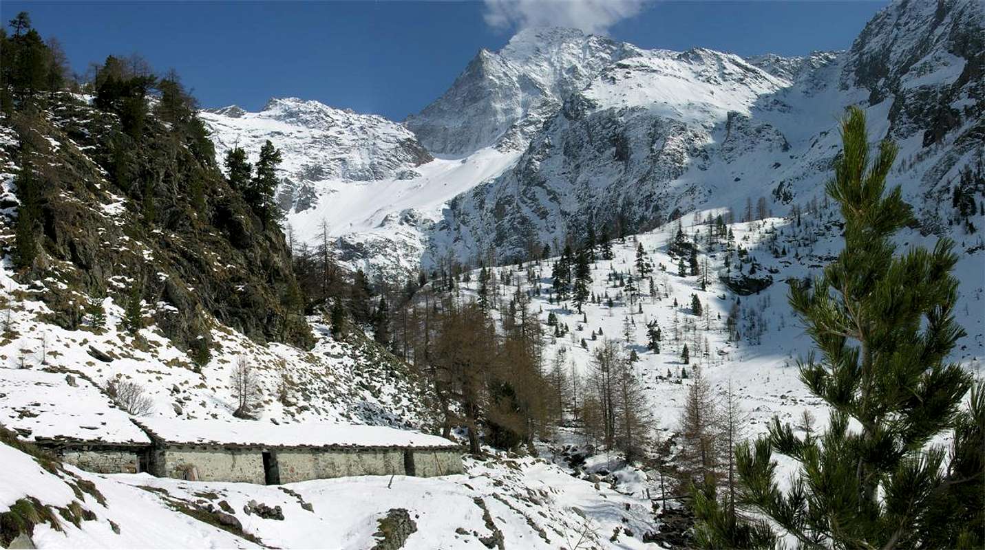
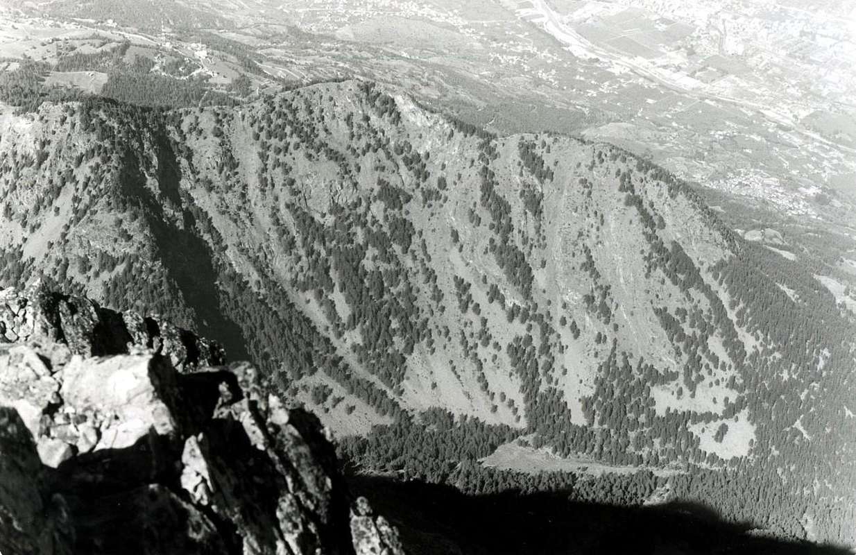
This truly wild vallon is located South of the Municipality of Pollein. At the base of the great Northern Face of Mount Emilius, goes up evenly interrupted only by a small plateau, swept by snowslides and avalanches coming down from the "Dent of the Becca", immediately below the two Pastures of same name (1.950m, 2.010 m; Lower and Superior) and just before the "Sources of Emilius", that come out from the huge moraine left by the two Glaciers Eastern and Western Arpisson. Including into a watershed in the East, after the Black Triangle of Emilius (3.378m, hence admirable in its magnificence) progressive form Pass and Tête Blantsette, Col Peckoz, Seneva's Becca with its Northern small towers and ends with the great promontory of Mont Père Laurent over the Commons of Grand Brissogne and Pollein. Closed off to the South from the North Wall of Emilius, which stretches for almost 2 kilometres to the West, reaching the Col Carrel, gets up to the Becca di Nona (3.142m) from which descends with the "Crestone North-northeast", adapted to separate this from the next Vallon or Gorge of Dard now on the border with the Municipality of Charvensod. This vallon, said "Lo Cordagnì" or the "The Shoemaker" of the Becca Seneva (3.086m; on rainy days because it looks like a shoemaker bent on his work, looking up from Grand Brissogne), is attended almost exclusively by Shepherds and by chamoises Hunters and Poachers, since all routes except the easy ascent of Mont Père Laurent (2.625m) for it even more unpopular, are very demanding and definitely is preferable to the approach of the Vallon Comboé using the Federigo Camp (2.907m) at the nearby Carrel Hill (2.916m), between Emilius "Becca".
 |
Questo vallone veramente selvaggio é situato a Sud del Comune di Pollein. Posto alla base della grande Parete Nord del Monte Emilius, sale in modo uniforme interrotto esclusivamente da un piccolo pianoro, spazzato dalle valanghe che scendono dalla "Dent della Becca", subito appresso ai due Alpeggi di ugual nome (1.950 m, 2.010 m; Inferiore e Superiore) ed appena prima delle "Sorgenti dell'Emilius", fuoriuscenti dall'enorme morena lasciata dai due Ghiacciai Orientale ed Occidentale di Arpisson. Compreso da un netto spartiacque ad Oriente che, dopo il Triangolo Nero dello Emilius (3.378 m; da qui ammirabile nella sua magnificenza) in progressione forma il Col e la Tête Blantsette, il Col Peckoz, la Becca di Seneva con i suoi torrioni Settentrionali, per concludersi con il grande promontorio del Mont Père Laurent sopra gli abitati di Grand Brissogne e Grand Pollein. Chiuso verso Mezzogiorno dalla Parete Nord dello Emilius, che si distende per quasi 2 kilometri verso Ovest raggiungendo il Colle Carrel, si rialza alla Becca di Nona dalla quale scende con il "Crestone Nord-nordest", atto a separare questo vallone dal successivo del Dard ormai ai confini col Comune di Charvensod. Questo Vallone, detto "Lo Cordagnì", ovvero del "Calzolaio", é frequentato quasi esclusivamente dai Pastori e dai Bracconieri, poiché tutte le vie, tranne la facile ascensione al Mont Père Laurent per altro anche essa poco popolare, sono molto impegnative e sicuramente é preferibile lo approccio dal Vallone di Comboé utilizzando il Bivacco Federigo Zullo (2.907 m) al Colle Carrel. Dard Vallon-Gorge
This vallon is actually a gorge underlying the Vallon of Comboé. From the slopes of Monte Emilius fact falls to the south along a Vallon of Arbolle that, with semi circular course, reaches in the direction opposite the Vallon of the underlying Comboé (2.114m). Below this opening, as a natural continuation, descends the Vallon Dard that, like a big funnel, tapering into a gorge ever closer and narrow to finally expand on the valley floor, between the Commons of Pollein (East) and Charvensod, before flowing with Torrent de Comboé in Dora Baltea. It is bordered to the East by the great Crest North-northeast of Becca di Nona, degrading to the Pastures of Plan Croix (1.745m), Martsaouchy Damon (1.420/30m about), du Meitin and Dèsott and Tchino or Chenoz (1.017m), above Pollein Municipality. The watershed opposite or Western, attached with the Pila Basin now in Gressan Commune, after Colle Plan Fenêtre, gateway to the Vallon of Comboé, the ridge form three small Summit called Punta di Ponteilles (2.262/3m), Punta Valletta (2.164 m) and Punta del Dard (2.033m), this last above the Black Forest of Combatissière and the Pasture of Pouce or Pousses (1.601m). The bottom of the vallon, however, after the Comboé Dessous (2.042m), rushes through the Torrent de Comboé with a series of waterfalls that end with a largest and most spectacular on the Alp Ponteilles (1.750m), up to where it is came the great landslide of Flood of 2000 breaking away from the base of the Northern Face of "Becca". Beyond the vallon-gorge becomes a real throat reaching before the water intake of La Mare (1.187m), then the Rongachet Bridge (1.100 meters about; what he did and then plug exploding caused seven deaths), near Alpe di Reverier Dessous (1.042m; St. Joseph Chapel). Lower down, becoming more and more a bottleneck, forms a more short waterfall at the Gym Rock between the Villages Chenaux (Pollein) Roulaz (Charvensod). The same, equipped from the first post-war period but probably also used in earlier times, has grown a little all the Mountaineers Aosta. Currently has been partially demolished in order to obtain the material to build new levees to Torrent de Comboé between Chenaux Pian Felina. Does not have great chances to go up as the routes from this side towards Becca di Nona are or challenging (Crestone North-northeast) or dangerous (North Wall), but it may be a variant of departure to go to the same or simply to Comboé Alp. For the three Summit minors, placed on the watershed with the Conca di Pila, you can reach, going after Comboé Alpage towards the Plan Fenêtre Hill, in crossing from South to North; is cheaper to make this route from this location starting precisely from Pila-Resort.
Ascending from Pontey/Verthuy or by Arlier/Luxe Hamlets on Valmeriana & Ponton more Eastern Vallons, by emilius & Corvus
VALLEYS & VALLONS In order to deploy clockwise from Middle Valley to Pila Basin & Internal Areas
VALLEYS & VALLONS In order to deploy clockwise from Grand Brissogne towards Pollein & Charvensod Municipalities
From Grand Brissogne towards Pollein/Charvensod Commons Les Laures Vallon: from Grand Brissogne (906m), Gremonenche Pasture (1.112m), L'Arp (1.310m), la Vieille (1.629m), Le Tramouail Pastures (1.795m) to Dessous Laures Lake and Ménabreaz Shelter (2.544m, 2.546m). From refuge:
 |
 |
 |
 |
 |
Questo vallone in realtà é una gorgia sottostante il Vallone di Comboé. Dalle pendici del Monte Emilius scende infatti verso Sud il lungo Vallone d'Arbolle che, con percorso semi circolare, raggiunge in direzione opposta il Vallone del sottostante Comboé. Al di sotto di questo s'apre, come naturale continuazione, il Vallone del Dard che, a guisa di grande imbuto, si restringe progressivamente in una gola sempre più ristretta per infine allargarsi sul fondovalle, tra i Comuni di Pollein (Est) e Charvensod, prima di sfociare con il Torrent de Comboé nella Dora Baltea. Viene delimitato ad Oriente dalla grande Cresta Nord-nordest della Becca di Nona, che digrada verso gli Alpeggi di Plan Croix, Martsaouchy Damon, du Meitin e Dèsott e Tchino o Chénoz sopra Pollein. Sullo spartiacque opposto od Occidentale, divisorio con la Conca di Pila ormai nel Comune di Gressan, dopo il Colle Plan Fenêtre, porta d'ingresso al Vallone di Comboé, la cresta forma tre piccole Sommità dette Punta di Ponteilles (2.262/3 m), Punta Valletta (2.164 m) e Punta del Dard (2.033 m), quest'ultima al di sopra della Foresta Nera di Combatissière e dell'Alpeggio di Pouce oppure Pousses (1.601 m). Il fondo del vallone invece, dopo il Comboé Dessous (2.042 m), precipita tramite il Torrent de Comboè con una serie di cascate che si concludono con una più grande e spettacolare sopra l'Alpe di Ponteilles (1.750 m), fino a dove é giunta la grande frana dell'Alluvione del 2000 staccandosi dalla base della Parete Nord della "Becca". Oltre, diventa una vera e propria gola raggiungendo dapprima la presa dell'acqua di La Mare (1.187m), poi il Ponte di Rongachet (1.100 metri circa; quello che fece da tappo e poi eslodendo provocò sette morti), nelle vicinanze dell'Alpe di Reverier Dessous (1.042 m; Cappella di San Giuseppe). Più in basso, diventando sempre più una strettoia, forma una corta cascata presso la Palestra di Roccia tra le Frazioni di Chenaux (Pollein) e Roulaz (Charvensod). Attrezzata già dal primo dopoguerra, ma probabilmente utilizzata anche in tempi più remoti, ha visto crescere un pò tutti gli Alpinisti Aostani. Attualmente é stata parzialmente demolita, onde ricavarne il materiale per costruire nuovi argini al Torrent de Comboé tra Chenaux e Pian Felina. Non presenta grandi possibilità di salite poichè le vie da questo versante alla "Becca" sono o impegnative (Crestone Nord-nordest) oppur pericolose (Parete Nord), ma può costituire una variante di partenza per recarsi alla stessa o più semplicemente al Comboé. Per le tre Sommità minori, poste sullo spartiacque con la Conca di Pila, si possono raggiungere, salendo dopo il Comboé al Colle Plan Fenêtre, in traversata da Sud a Nord; é più conveniente effettuarla da questa località partendo appunto da Pila.
 |
 |
 |
The mountains surrounding have an average of about 2.000/3.100 meters, except for Monte Emilius (3.559m), King and unquestioned, unchallenged Symbol of the whole area and for the Grande Roise nearby Subgroup (3.357m). Other Summit that exceed this average, always from East to West and analyzing vallon to vallon, so are. Watershed Les Laures/Saint Marcel with the Roises Range: the Petite Roise (3.279m) with the two neighboring Tips Gianni Junod also called Roise Central (3.300m). Watershed between Les Laures/Grauson-Lussert (Cogne): Punta di Leppe three Tops (West 3.305m, Central 3.300 meters about, East 3.292/3 meters about) and West Antetop (about 3.290/5 meters), Punta di Lussert (3.221m), Punta des Laures (3.367m), three Punta Rossa (Eastern 3.400m, Central 3.395 meters about, Western 3.401m). Western Watershed before between Les Laures/Arbolle then with Arpisson: East Punta Rossa (3.400m), Punta dei Tre Cappuccini (3.284m), Black Triangle (3.378 m). Always maintaining the same scan starting from the East to get to the West, other mountains or important, moreover because they are known as important nodes topographic (* * * Note: the point divides various vallons), are Mont Barbeston (2.482m), Mont Rouvìc (2.922m), Mont Giron (2.699 m), Cima Nera (2.698m). Mont Avìc (3.006m). Raye Chevrère (2.827m), Tête de Plan Fret (2.717m), Mont Chermontane (2.680m). Becca di Salé (3.137m). Mont des Laures (3.121 m). Testa (3.140m; Head) Blantsette, Becca's Seneva (3.086m), Mont Père Laurent (2.625m). Becca di Nona (3.142m), La Dent (2.736m). Punta di Ponteilles (2.262/3m), Punta Valletta (2.164m), Punta del Dard (2.033m).
Le montagne circostanti hanno una media di circa 2.000/3.100 metri, eccezione fatta per il Monte Emilius (3.559 m), Re indiscusso dell'intera area, nonché per il Sottogruppo della vicina Grande Roise (3.357 m). Altre Sommità che superano questa media, sempre da Est verso Ovest ed analizzando vallone per vallone, così risultano. Spartiacque Les Laures/Saint Marcel con la Catena delle Roises: la Petite Roise (3.279 m) con le due vicine Punte Gianni Junod od anche Roise Centrale (3.300 m). Spartiacque tra Les Laures/Grauson-Lussert (Cogne): Punta di Leppe tre Cime (Ovest 3.305/6 m, Centrale 3300 metri circa, Est 3.292/3 metri circa) con un Antecima Ovest (3.290/5 metri circa), Punta di Lussert (3.221 m), Punta des Laures (3.367 m), tre Punta Rossa dell'Emilius (Est 3.400 m, Centrale 3.395 metri circa, Ovest 3.401 m). Spartiacque Occidentale dapprima tra les Laures/Arbolle e poi con Arpisson: Punta Rossa Est (3.400 m), Punta dei Tre Cappuccini (3.284 m) e Triangolo Nero (3.378 m). Sempre con la stessa scansione dei valloni ovvero partendo da Est ad Ovest, altre montagne importanti o conosciute, oppure perché risultano come notevoli nodi topografici (* * * Nota: il punto divide i vari valloni), sono il Monte Barbeston (2.482 m), Mont Rouvìc (2.922 m), Mont Giron (2.699 m), Cima Nera (2.698 m). Mont Avìc (3.006 m). Raye Chevrère (2.827 m), Tête de Plan Fret (2.717 m), Mont Chermontane (2.680 m). Becca di Salè (3.137 m). Mont des Laures (3.121 m). Testa Blantsette (3.140 m), Becca di Seneva (3.086 m), Mont Père Laurent (2.625 m). Becca di Nona (3.142 m), La Dent (2.736 m). Punta Ponteilles (2.262/3 m), Punta Valletta (2.164 m), Punta del Dard (2.033 m).
 |
 |
 |
 |
 |
Getting There
BY CAR:
- From TORINO, MILANO, etc: Motorway A5. Exit at IVREA or Quincinetto (PIEDMONT)
- From IVREA Town: in West towards Pont Saint Martin, Donnas, Bard, Champdepraz, Pontey, Fénis, Saint Marcel, Grand Brissogne, Pollein, Charvensod, Municipalities. From Courmayeur Resort: in East to Morgex, La Salle, Saint Pierre, Sarre, Aosta, Saint Chistophe; Quart, Saint Marcel, Fénis, Châtillon, Pontey Municipalities.
- Southeastern Side: From Pontey (523m) to Valmeriana Vallon and Valmeriana Alp (1.791m; by Regional Road and farms private dirt road or paths). From Grand Brissogne (827m) to L'Arp, dirt road, Les Laures Vallon-Ernesto Ménabreaz Shelter at Lower Laures Lake (2.546m), path-muletrack. From Pollein (575m; secondary road) or from Charvensod (746m; main road and connection) to Martsaouchy Damon-Arpisson Vallon, through dirt road, and to Arpisson Lower and Upper (2.010m) Alpages with path. To Federigo Zullo Bivouac (2.907m), through moraines on Western Arpisson Glacier. From Charvensod to Dard-Comboé-Arbolle Vallons towards Ponteilles (1.697m) Alp/Waterfall, through dirt road, Comboé Alp/Saint Ours Shelter (2.114m), through dirt road, and Arbolle Refuge (2.516m), near Lakes (2.497m), by Chair Lift to Chamolé Station (2.309m), Lake (2.325m) and muletrack.
- From FRANCE: through the Mont Blanc Tunnel to Entrèves-crossroads to Vény/Ferret Valleys - Courmayeur. By Little Saint Bernard Pass, closed since November until half May to La Thuile Valley - Pré Saint Didier - Courmayeur. It is not necessary to take Motorway A5: you can drive on SS.26, in the direction of AOSTA - IVREA - TURIN.
BY PLANE:
- Aeroporto "Corrado Gex" Saint Christophe (Aosta).
All major and minor vallons
Belle Combe Vallon: from Ussel, Bellecombe (1.018m), Low, Superior, Upper Mont Ros (1.609m), Toule Alps (2.020m). Goddet Hill or Valcrusa (2.110m) to: in East
1) - Mount Lyan (2.178m);
2) - in West-Southwest Mount Barbeston (2.482m), both with path on easy crests. Minerals Vallon.
Valmeriana or Molinaz Vallon:
1) - from Pontey-Chiesanuova (523/535m), Pien, Ussert Hamlets (991m) Morgeron Alp. Plan Coca (1.675m) to Valmeriana Pasture (1.791m), through farms dirt road;
2) - from Lassolaz or Torin (466m), Plan Coca, with path. From Valmeriana in South to alternative about 1.820 meters and from this in Southeast Valmeriana Hill (2.281m) to Mount Barbeston, through easy Southwest Crest, with paths
Ruvic-Orsière Vallon: from Margnier Village (607m) in South Ronchere Pasture to Verthuy-Perrod Hamlets (1.050m) to Southeast at beginning of Orsières Vallon, with path and from this, without path in forest, to in East
1) - Giron Collar (2.580m), Mount Ruvic (2.922m), through North Ridge (F+, passages of I°/I°+/II°-);
2) - in Southeast Mount Rouvic, through Northwest long Slope by moraine, blocks and easy rock bands or snowfields.
Ponton Vallon: from Septumian (543m), Arlier or Arly (582m), Praz (748m), Goilluz (893m) Villages to Lusey also Luxe little Village (1.160m), by dirt road; from this in South, long diagonal crossing above Ponton Torrent, to Forest Rangers Bivouac (2.168m) on a rocky tableland, over Ponton Alp (2.015m) in valley floor. From bivouac in East-southeast to
1) - Varotta Hill between Mounts Avic and Ruvic, with steep path. From Hill
2) - in North Mount Ruvic, by West-southwest Face, easy way but complex ,sometimes complicated, interaction between different rock bands and snowfields in final part, experience and rope required;
3) - to Mount Avic through long traverse on North Ridge and North-northeast Face, through small chimneys bluish rocks on castle in terminal part (PD-; passages of I°/II°- on thread; challenging but not difficult, experience, rope required).
 |
1) - in East Salé Pass and Becca (3.008m, 3.187m), traces, blocks, small rocks in right traverse to pass and easy South Crest;
2) - in Southeast Long Lake (2.630m), in South fork 2.763 meters and in West Leppe Pass, Point (3.110m, 3.306m), with path, traces on moraine, snowfields, remains of old Leppe Glacier and easy Northeast Crest.
3) - In North Punta Ilario Antonio Garzotto, debris, easy rocks on South Slope.
4) - From fork in Southwest Upper Lake (2.787m), fork 2.933 meters, Laures Hill, with path, and Mount (3.035m, 3.121m), by easy West Crest and descent to Lussert Vallon and three Lochs, with paths.
5) - In West-northwest from fork 2.933m Arbolle Pass (3.154m), path, final steep earthy gully, and three Punta Rossa (3.400m, about 3.395m, 3.401m), through paths, traces and Northeast Crest, not difficult (F/I°/I°+).
6) - From Dessus Loch (2.787m) in West-northwest Iced Lake, Three Capuchins Pass (3.242m), with debris and snowfields (requires precaution if frozen), to Mount Emilius (3559m), by paths, debris and traces to East under South-southeast Crest or Standard Route.
7) - In West Peckoz Pass (3.042m), Becca of Seneva (3.081m), path and easy South-southwest Crest, under the thread to East.
1) - Mount Père Laurent (2.625m), with rare traces on Western grassy and steep Slope.
2) - In South Emilius Sources into moraine, Western Arpisson Glacier, Carrel Hill and Federigo Zullo Bivouac (2.912m, 2.907m). From this
3) - in East Arpisson Glaciers, below Emilius North Wall, to Peckoz Pass, with traces, moraine under glaciers and delicate traverse in final part (snow or ice possibility, in these conditions rope required; but better than the alternative described below).
4) - Before the pass, Tête Blantsette (3.140m), through West rocky Slope and easy traverse on ridge in South to Blantsette Carving (3.126m): ALTERNATIVE Route for the traverse to Les Laures Vallon, in descent or with snow through a steep rocky gully with soil; rope required.
5) - Via Ferrata on Northwest Ridge of Mount Emilius, required adequate equipment, technical preparation, training and adaptation to the sense of emptiness;
6) - in Northwest, always from bivouac, Normal Route to Becca of Nona (3.142m), with small path and traces on easy Southeast Crest. Dard-Comboé-Arbolle Vallons:
1) - various possibilities of departure to Arbolle Refuge (2.516m), nearby two Arbolle Lochs (2.496m).
2) - From Pila main road (the best Saint Salo-Les Gorres 1.835m, Les Pousses Pasture 1.601m or from Upper Reverier to La Mare 1.187m) to Ponteilles Alp (1.706m) and waterfall;
3) - from this to Low Comboé Alp (2.041m), Comboé Pasture (2.114m). In East up Comboé Torrent path to Plan Valé (2.379m; ruins), Gros Scez fork 2.526 meters to
4) - Becca of Nona through path on Southwest Slope;
5) - path to Federigo Zullo Bivouac. From Comboé in South Grand Plan Alp (2.158m; ruins) and
6) - connection to Plan Valé;
7) - gorge to Arbolle Refuge, with paths. From Shelter in North-norteast
8) - Three Capuchins Pass and Mount Emilius;
9) - in Northeast Arbolle Pass and three Rossa Points.
10) - In East Valaisan Pass (3.210m; absolutely not recommended for the various danger);
11) - in East-southeast Garin Hill to Franco Nebbia Bivouac and Arpisson-Gimillan Vallon, with paths.
 |
Campings
Remember that free camping is forbidden (except for emergency reasons, over 2.500m, from darkness until dawn).Mountain Conditions
- You can get meteo information at the official site of the Regione Valle d'Aosta:
- Valle d'Aosta Meteo
Books and Maps
BOOKS:- "Guida delle Alpi Occidentali" di Giovanni Bobba e Luigi Vaccarone C.A.I. Sezione di Torino Volume II (parte II), 25 Maggio 1896.
- "Guida dei Monti d'Italia–Emilius Rosa dei Banchi Parco del Mont Avic" di Giulio Berutto e Lino Fornelli-Club Alpino Italiano/Touring Club Italiano, Marzo 2005 (in Italian).
- "A piedi in Valle d'Aosta" (Vol. 2), di Stefano Ardito, Ed. Guide iter, Giugno 2004.
- "I Rifugi della Valle d'Aosta" di Stefano Ardito, Ed. Guide iter, Febbraio 2003.
- "Rifugi e bivacchi in Valle d'Aosta", di Cosimo Zappelli aggiornata da Pietro Giglio, Musumeci Editore, Luglio 2002.
- "Guida della Regione Autonoma Valle d'Aosta" di Mario Aldrovandi; Ed. S.P.E. di Carlo Fanton, Torino 1964.
- "Parco Naturale Mont Avic" di Naldo Finco e Luca Zavatta, l'Escursionista Ed., Giugno 2006.
 |
 |
 |
 |
 |
 |
MAPS:
- Kompass "Gran Paradiso Valle d'Aosta Sentieri e Rifugi" Carta Turistica 1:50.000.
- L'Escursionista "Parco Naturale del Mont Avic" Carta dei Sentieri 1:25.000.
- Enrico Editore Ivrea-Aosta "Gruppo del Gran Paradiso" 1:50.000.
- I.G.C. Istituto Geografico Centrale Torino "Ivrea Biella Bassa Valle d’Aosta" (n° 9), 1:50.000.
- I.G.C. Istituto Geografico Centrale Torino "Il Parco Nazionale del Gran Paradiso" (n° 3), 1:50.000.
- Ingenia "Parco Naturale del Mont Avic" Carta dei Sentieri 1:25.000.
- Hapax "Les Sentiers Comunità Montana Monte Emilius", Luglio 2000 1:25.000.
- Hapax "Les Sentiers de Champorcher" Comune di Champorcher, Agosto 2001, 1:25.000.
Important Information
- REGIONE AUTONOMA VALLE D'AOSTA the official site.
- FONDAZIONE MONTAGNA SICURA Villa Cameron, località Villard de la Palud n° 1 Courmayeur (AO) Tel: 39 0165 897602 - Fax: 39 0165 897647.
- A.I.NE.VA. (Associazione Interregionale Neve e Valanghe).
External Links
Useful Numbers
- Protezione Civile Valdostana località Aeroporto n° 7/A Saint Christophe (Ao) Tel. 0165-238222.
- Bollettino Meteo (weather info) Tel. 0165-44113.
- Unità Operativa di Soccorso Sanitario Tel. 118.