


-
 2075 Hits
-
 80.33% Score
-
 12 Votes
|
|
Area/Range |
|---|---|
|
|
45.62550°N / 7.44189°E |
|
|
Hiking, Mountaineering, Trad Climbing |
|
|
Spring, Summer, Fall, Winter |
|
|
11532 ft / 3515 m |
|
|
Note
La montagna chiama i suoi figli, ed essi rispondono fedelmente al suo appello… Osvaldo Cardellina, Diario alpinistico, 1964-65 Page texts: @ OsvaldoCardellina "Osva", passed away on May 2, 2022. Page owners: Christian Cardellina e Osvaldo Cardellina. Any updates from September 12, 2022: Antonio Giani, page administrator, friend and climbing companion. Testi della pagina: @ OsvaldoCardellina "Osva", scomparso il 2 maggio 2022. Proprietari pagina: Christian Cardellina e Osvaldo Cardellina. Eventuali aggiornamenti dal 12 settembre 2022: Antonio Giani, amministratore della pagina, amico e compagno di salite. |
Overview
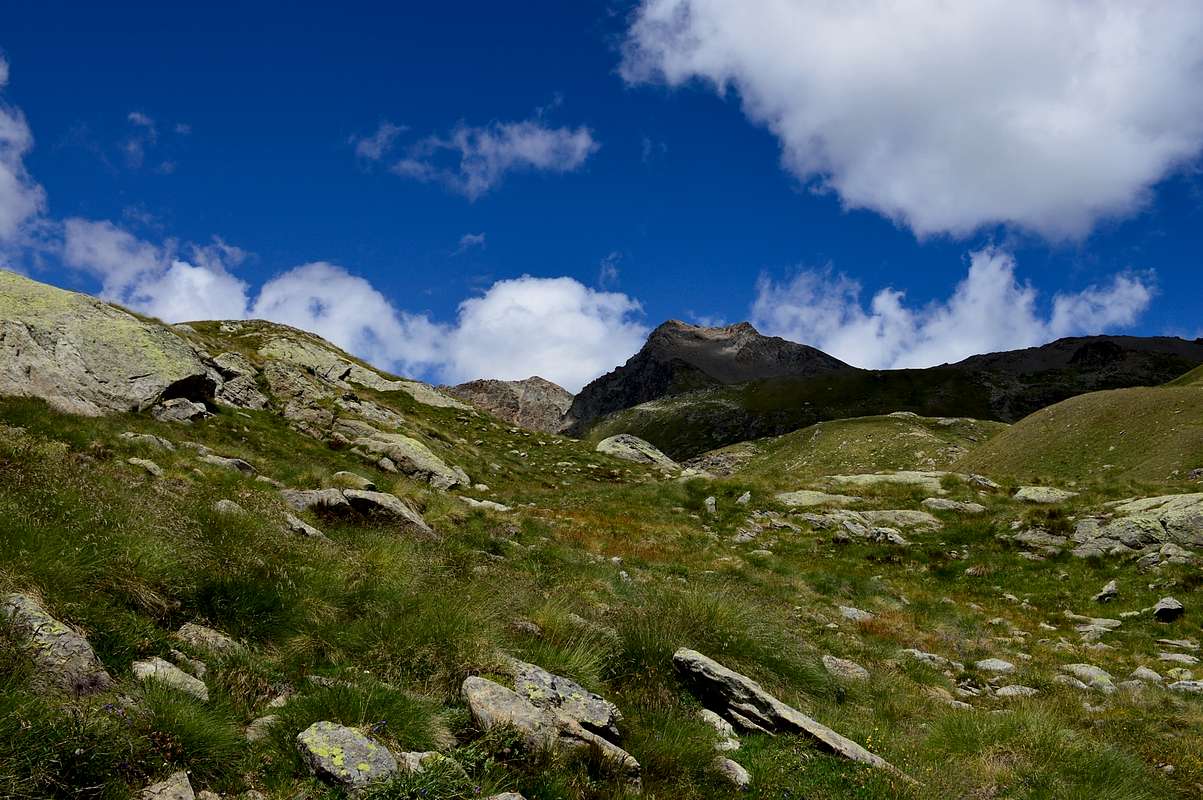
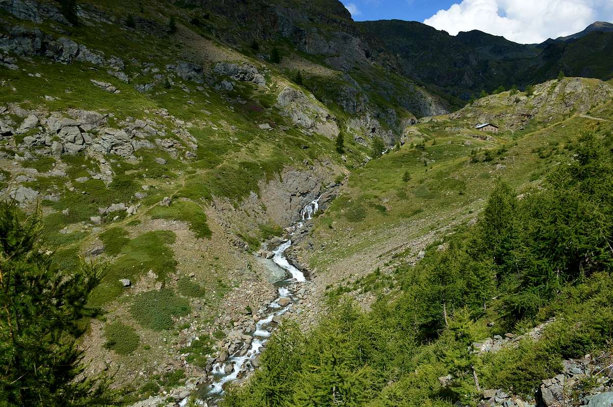
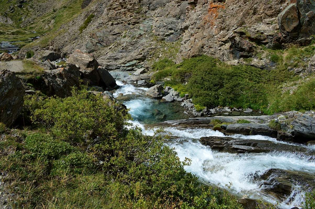
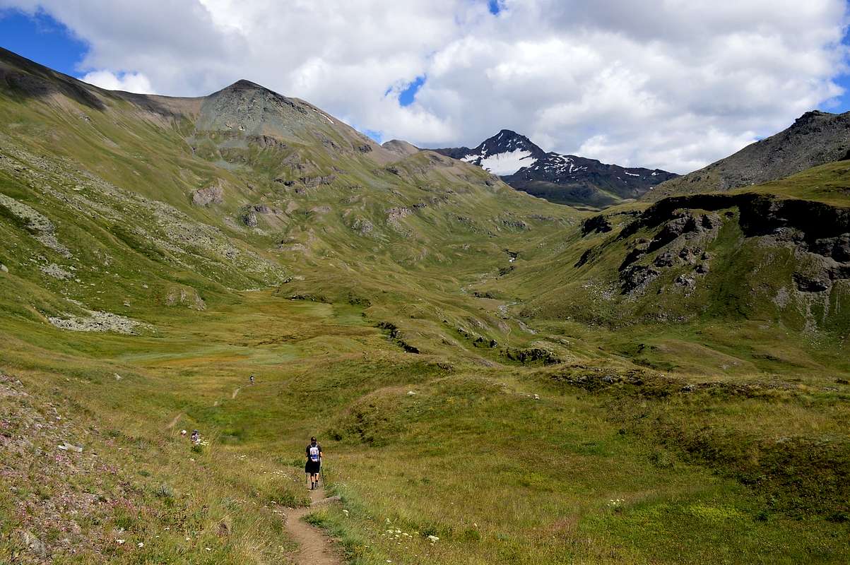
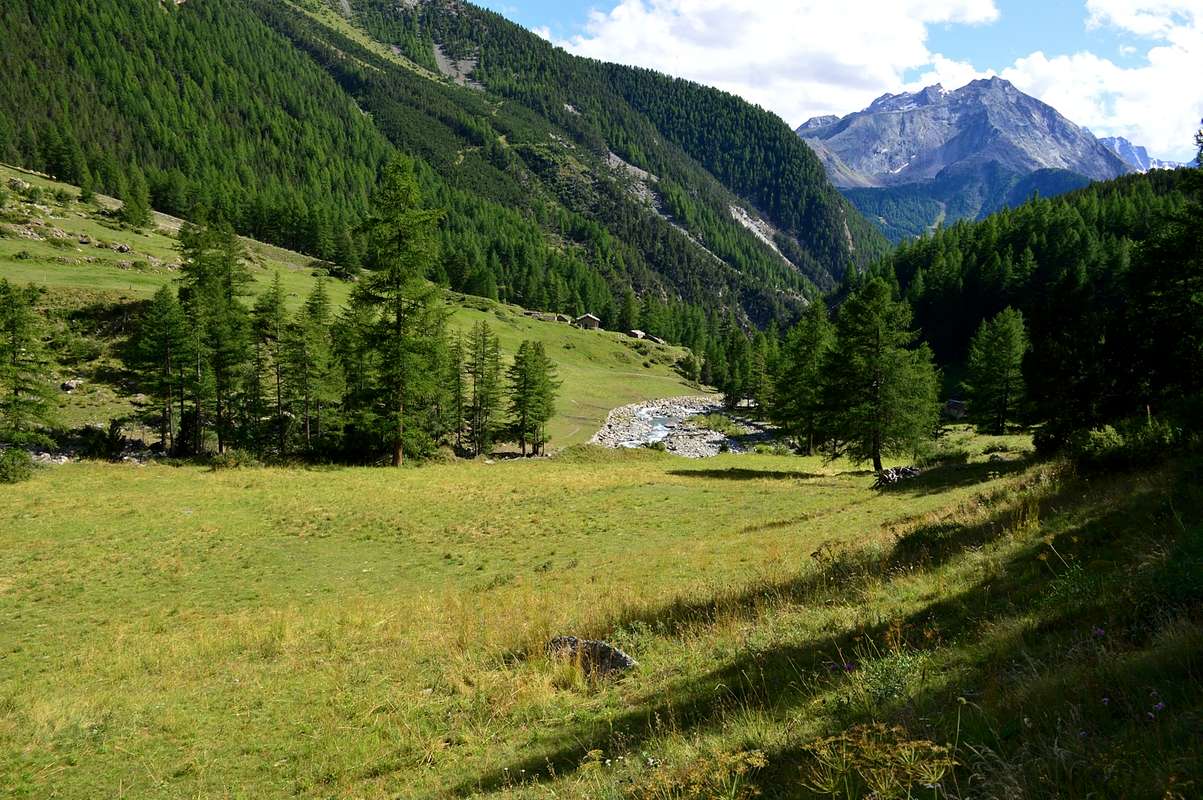
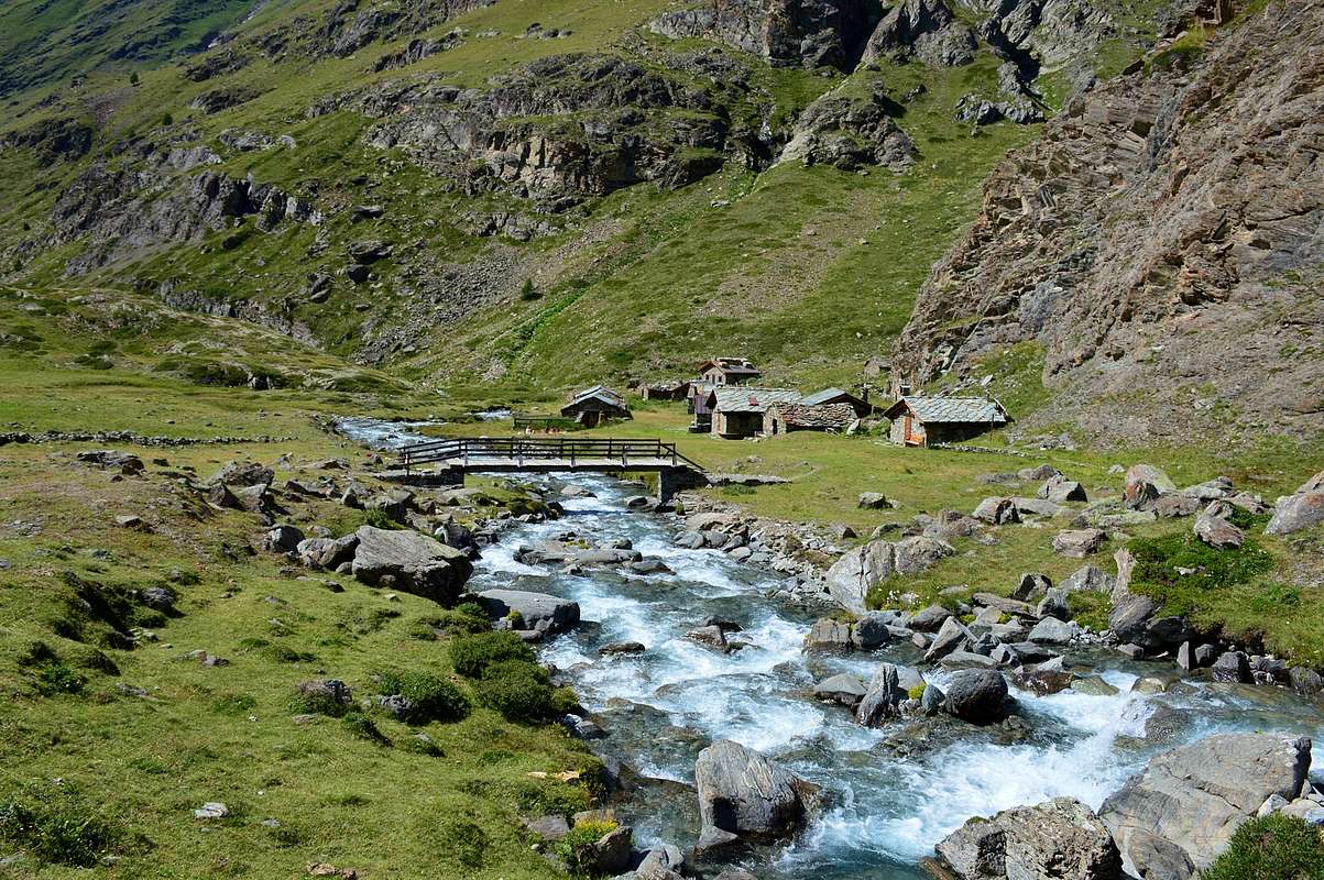
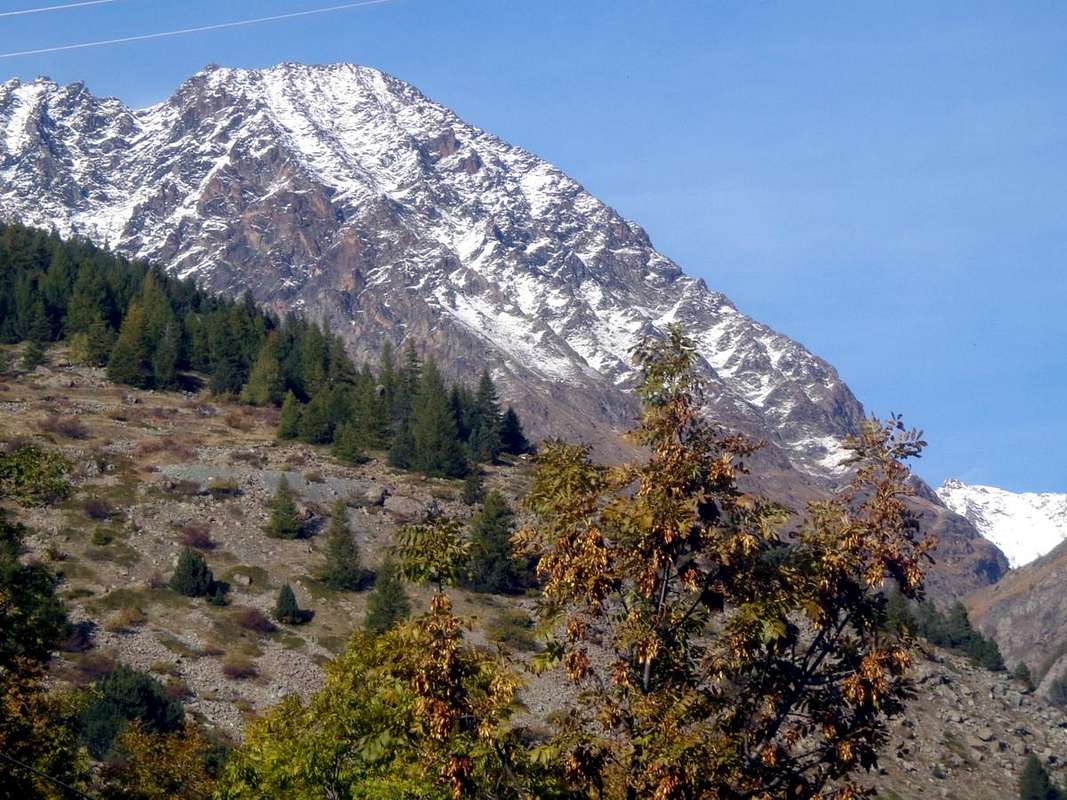
This side valley and perpendicular to that of the Grauson constitutes a Eastern branch of its own. In the old days it was also known as Vallon Doreire (golden). Indeed it was originally Vallon of Grauson is divided immediately after the Alpe di Grauson New (2.273m) by sending a branch in the direction towards the North-northeast with the Punta of Leppe and Col Corona (small valleys of Tsesère or Tsazèire/Corona or Coronas), another, full of beautiful lakes, decisively towards the West (Vallon Lussert) and a third towards the Alps Pralognan and Ervillères at the slopes of Punta Tersiva (3.515m), which is the culmination of the entire Grauson Valley. This beautiful pyramid dominates the Far East Glacier of Tessonet, flanked to the North by the homonymous peak (3.226m), while the ancient name of Doreire, with which even the Tersiva was identified, has been kept alive by attributing the same to a Tête Doreire or modest elevation (2.888m) at the foot of Crête du Tessonet between the Tip and small Tessonet Collar (3.060m). An important ramification that distinguishes two clear and different routes to the interior of Grauson Valley with different resorts goals to both Mountaineers that for Hikers. Also in the initial part of the valley you can also make beautiful short Walks or practicing as well as the fascinating discipline of Nordic Walking.
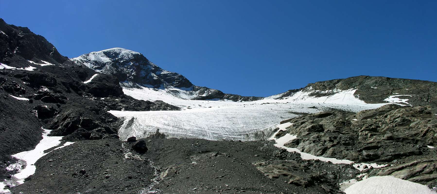 |
Questa vallata laterale e perpendicolare a quella del Grauson costituisce ramo a se stante. Nei vecchi tempi era conosciuto anche come Vallone Doreire (dorato).Infatti il Vallone originario del Grauson si divide subito dopo l'Alpe di Grauson Nuove (2.273 m) inviando un ramo verso Nord-nordest in direzione della Punta di Leppe e del Col Corona (Valloncelli di Tsesère o Tsazèire/Corona o Coronas), un altro, ricco di splendidi laghi, decisamente verso Occidente (Vallone di Lussert) ed un terzo verso le Alpi di Pralognan ed Ervillères alle pendici della Punta Tersiva (3.515 m), che costituisce l'apice dell'intero Vallone del Grauson. Questa bella piramide sovrasta all'estremo Est il Ghiacciaio del Tessonet, fiancheggiato a Settentrione dall'omonima punta (3.226 m), mentre l'antico toponimo di Doreire, col quale di identificava anche la Tersiva, é stato mantenuto in vita attribuendolo ad una modesta elevazione o Tête Doreire (2.888 m) posta ai piedi della Crête du Tessonet tra la Punta ed il Colletto del Tessonet (3.060 m). Ramificazione importante distinguente due nette e diverse rotte all'interno del Vallone del Grauson con mete differenti rivolte sia ad Alpinisti che ad Escursionisti. Inoltre nella parte iniziale-media della vallata si posson effettuare anche belle nonché brevi Passeggiate praticando l'affascinante disciplina del Walking Nordic.
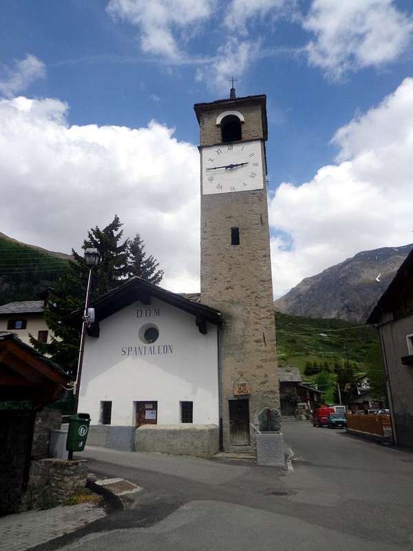
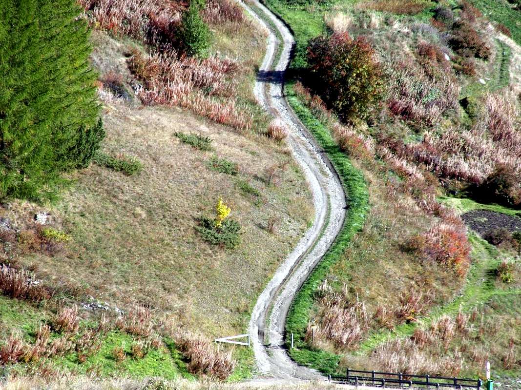
Getting There toward" Dzemeglian" Hamlet (Gimillan)
BY CAR:
- From TORINO, MILANO, etc: Motorway A5. Exit at IVREA or Quincinetto (PIEDMONT) AOSTA West/Aymavilles, Cogne Municipalities. From Aymavilles (646m) towards Cogne Valley: reacging Vieyes (1.132m), Epinel, Crétaz Hamlets to Cogne (1.534m); through Main Road. From this by Regional Road towards montroz and Gimillan (1.785m) Villages; from the last towards the above Grauson Vallon.
- From FRANCE: through the Mont Blanc Tunnel to Entrèves-crossroads to Vény/Ferret Valleys - Mountain Guides of Courmayeur - La Saxe Rock Gym - Courmayeur. By Little Saint Bernard Hill, closed since November until half May to La Thuile Valley - Pré Saint Didier - Courmayeur.It is not necessary to take Motorway A5: you can drive on SS.26, in the direction of AOSTA - IVREA - TURIN.
BY PLANE:
- Aeroporto "Corrado Gex" Saint Christophe (Aosta).
 |
 |
 |
 |
 |
Some Routes
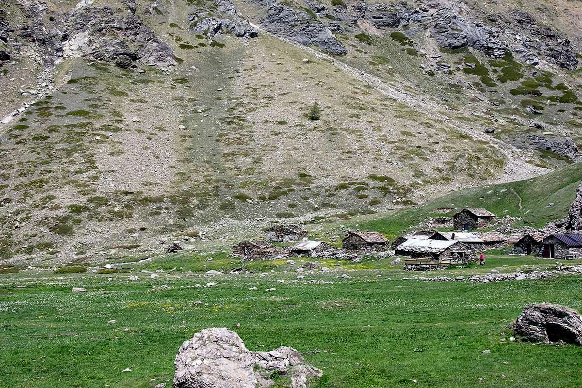
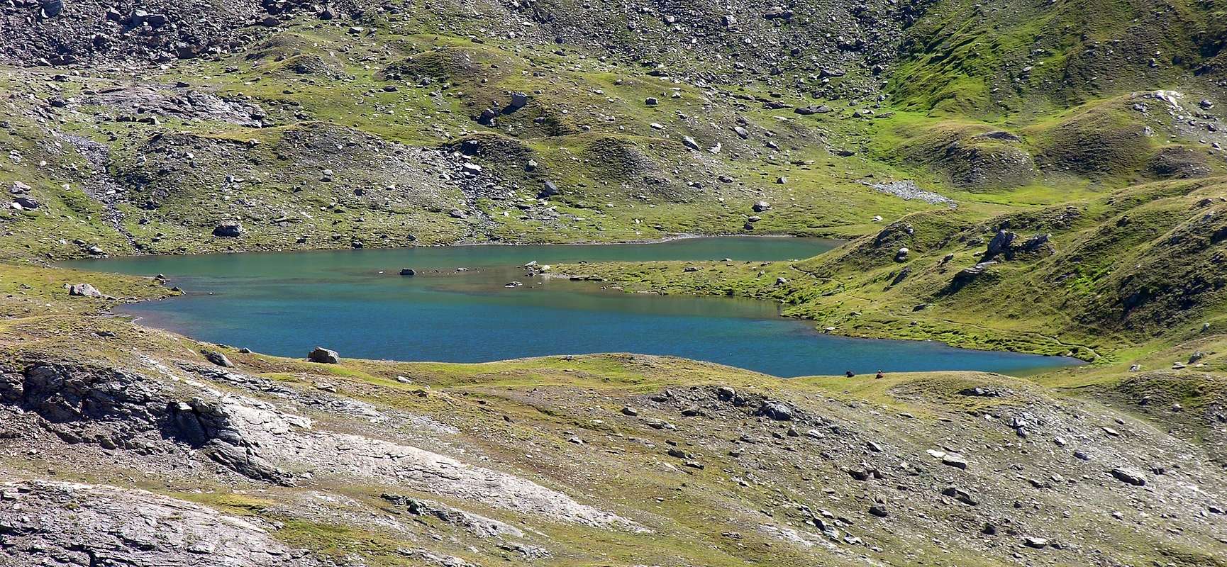
2) - From the Eastern bridge of Gimillan Hamlet (1.788m), Révènti (perimeter ruins; 1906m), Ecloseur, Pila, Grauson Vieux and Nuove Alps (1.903m, 2.273m, 2.500), Lussert three Lakes (2.713m, 2.790m, 2.906m), Laures Hill (3.305m): long Excursion from Gimillian with various paths before in North, after in North-northwest along Grua and Lussert Torrents into the valley floor Left variant (Northwest) with respect to the Valley of Doreire (EE/F; 5h'00/5h'30).
3) - Ecloseur, Pila, Grauson Vieux and Nuove Alps, Frog's and Corona Lakes (1.903m, 2.221m, 2.273m, 2.500, 2.641m, 2.702m), Saint Marcel Hill (2.913m): Excursion from Gimillian with various paths before in North, after in East-northeast reaching the hill with St. Marcel adjacent Valley (E/F; 4h'00/4h'30).
4) - Gimillan, Saint Marcel Hill (2.913m): Excursion-Climbing from hill in North to two Laval Summits and Punta Gianni Vert (3.091m, 3.099m, 3.150m) (E/F; 5h'30/6h'00).
5) - From Grauson Nuove and Tsezéire Alps towards Vallonet Pass (2.500, 2.645m, 3.062m) until the Punta di leppe (3.305m): Excursion-Climbing from Gimillian with various paths before in North, after in Northeast, Western Slope of pass and through East-southeast Crest in terminal part (EE/F; 5h'00/5h'30).
6) - From Gimillan toward Ecloseur, Pila, Créuzet Alps, Money Lake, Monte Creya (1.903m, 2.221m, 2.244m, 2.550, 3.015m): Excursion from Gimillian bridge with various paths before in North-northeast, after in Southeast to loch and final part on easy and grassy Northern Face, formed by grassy enough steep slopes (EE/F; 4h'00/4h'30).
 |
 |
 |
 |
 |
7) - Grauson Vieux, Pralognan and Ervillières Alps, (2.273m, 2.416, 2.515m): long Excursion-Climbing from Gimillian with various paths before in Northeast, after in East along Lussert-Grauson-Doreire Torrents and crossing Tessonet Glacier to Tessonet Collar (3.310m) and North-northwest ridge in terminal part (EEA/F+; 5h'00/6h'00).
8) - Grauson Vieux, Pralognan and Ervillières Alps, (2.273m, 2.416, 2.515m): long Excursion-Climbing from Gimillian with various paths before in Northeast, after in East along Lussert-Grauson-Doreire Torrents and crossing Tessonet Glacier to Tersiva Pass (3.310m) and North-northwest Crest in terminal part (A/F+; 6h'00/7h'00).
9) - Grauson Vieux, Pralognan and Ervillières Alps, (2.273m, 2.416, 2.515m): long Excursion-Climbing from Gimillian with various paths before in Northeast, after in East along Lussert-Grauson-Doreire Torrents and crossing Tessonet Glacier to Serra Madù or Madou (3.220m) and Western Ridge in terminal part (A/F+/PD-; 7h'30/8h'00).
10) - Grauson Vieux, Pralognan and Ervillières Alps, (2.273m, 2.416, 2.515m): long Excursion-Climbing from Gimillian with various paths before in Northeast, after in East along Lussert-Grauson-Doreire Torrents Lake (2.844m) towards Invergneux Pas (2.905m), always by trail. From this with traverse to the East reaching progressively through the Eastern Ridges Testa di Vallonet, East Penne Blanche, West Penne Blanche, Pointe Coupé, Testa di Money, Monte Creya (3.135m, 3.254m, 3.205m, 3.214m, 3.130m, 3.015m) and various intermediate connection passes, small saddles and carvings (EEA/F/F+; 2h'30/3h'00 from Invergneux or Hevergnes Pass; 6h'30/7h'00 by Gimillan Hamlet).
11) - Grauson Vieux, Pralognan and Ervillières Alps, (2.273m, 2.416, 2.515m): long Excursion-Climbing from Gimillian with various paths before in Northeast, after in East along Lussert-Grauson-Doreire Torrents and crossing in South Grauson Torrent to Pointe d'Ervillères through the Northern Slope (3220m) (EE/F+; 1h'30/1h'45 from Grauson Vieux; 3h'30/4h'00 by Gimillan Village). Even by snowshoes, but double check the well snow conditions in the traverses and in terminal part along little couloirs.
12) - Ecloseur Alp, Larsinaz Loadstone Mines (1.903m, 1.899m): Walk from Gimillian with paths before in North-northeast, after in South-southheast (T/F; 1h'30/1h'45).
Campings
Remember that free camping is forbidden (except for emergency reasons, over 2.500m, from darkness until dawn).
 |
 |
 |
 |
 |
Red Tape
The Southern side of the valley belongs to Gran Paradiso National park, the Western one is out of the boundaries of the Park ... but nature must be respected.Mountain Condition
- You can get meteo information at the official site of the Regione Valle d'Aosta:
- Valle d'Aosta Meteo
Books and Maps
BOOKS:- "Guida delle Alpi Occidentali" di Giovanni Bobba e Luigi Vaccarone C.A.I. Sezione di Torino Volume II (parte II), 25 Maggio 1896.
- "Guida dei Monti d'Italia Emilius Rosa dei Banchi Parco del Mont Avic" di Giulio Berutto e Lino Fornelli - Club Alpino Italiano/Touring Club Italiano, Marzo 2005.
 |
 |
MAPS:
- Kompass "Gran Paradiso Valle d'Aosta Sentieri e Rifugi" Carta Turistica 1:50.000.
- Enrico Editore Ivrea-Aosta "Gruppo del Gran Paradiso" 1:50.000.
- I.G.C. Istituto Geografico Centrale Torino "Gran Paradiso-La Grivola-Cogne" 1:25.000.
- L'Escursionista "Tour de la Vallée de Cogne Grand Paradis" Carta dei sentieri 1:25.000.
- I.G.C. Istituto Geografico Centrale Torino "Il Parco Nazionale del Gran Paradiso" (3) 1:50.000.
- L'Escursionista "Valle di Cogne Carta dei Sentieri" (n° 10) 1:25.000.
Important Information
- REGIONE AUTONOMA VALLE D'AOSTA the official site.
- FONDAZIONE MONTAGNA SICURA Villa Cameron, località Villard de la Palud n° 1 Courmayeur (AO) Tel: 39 0165 897602 - Fax: 39 0165 897647.
- SOCIETA' GUIDE ALPINE DI COGNE Tel. 347/9473526 – 328/1373728.
- A.I.NE.VA. (Associazione Interregionale Neve e Valanghe).
- A.IA.T. Cogne Gran Paradis via Bourgeois n° 34 Tel. 0165-74040. E-mail: aiat@cogne.org
- Ezio Sport articoli sportivi - via Bourgeois n° 64 Tel. 0165-74204.
 |
Useful Numbers
- Soccorso Alpino Cogne (SAR) Tel. 3482685406.
- Protezione Civile Valdostana località Aeroporto n° 7/A Saint Christophe (Ao) Tel. 0165-238222.
- Bollettino Meteo (weather info) Tel. 0165-44113.
- Unità Operativa di Soccorso Sanitario Tel. 118.