-
 17370 Hits
-
 83.55% Score
-
 17 Votes
|
|
Mountain/Rock |
|---|---|
|
|
44.01000°N / 115.3872°W |
|
|
Boise |
|
|
Hiking |
|
|
Spring, Summer, Fall |
|
|
8876 ft / 2705 m |
|
|
Overview
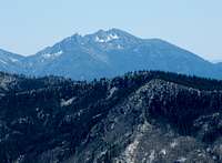
Wolf Mountain is one of the more interesting peaks in the Boise Mountains. While most of the summits have eroded and rounded over time, Wolf Mountain is comprised of broken slabs of granite. Especially when viewed from the north, the peak presents an impressive profile of jagged rock towers. Though the summit ridge is rugged, the most commonly followed route to the top is a walk-up. Due to its location, the routes up this peak will take you through dry desert landscapes that change gradually into sub-alpine conifer forests, making for an enjoyable contrast. Although there are marshlands in this area, it is dominated by aridity.Don't let the relatively low elevation fool you; this mountain is a challenging and enjoyable scramble.
The low elevation, as well as the well-maintained roads, make this mountain accessable early in the year until well into fall.
Getting There
Trappers FlatAlthough remote, Wolf Mountain is approachable from several different directions. From the east, this peak can be accessed via the Trappers Flat road (312), but this can require a four-wheel drive. If utilizing this route, from Boise drive north on Idaho 21 through Idaho city. South of Banner ridge, just past the Whoop-um-up park and ski area, turn east onto forest road 384. The road is well-maintained, but you may encounter high traffic due to logging or hunting interests, depending on the time of year. The junction with FS 312 is about 4 miles in. Several drainages, such as Shonip creek, are feasible; all involve cross-country travel.
Jennie Lake approach
The mountain can also be climbed from Jennie Lake. For this route, take FS 384 for 6.3 miles to the junction with FS 348, which is just shy of the Willow Creek campground. Follow 348 for 7.4 miles OR just after the mile marker 7 (don't count on the mile marker being there). To the north is a small spur of a road with a sign reading "road closed 0.2 miles". Take this and park at the obvious trailhead to Jennie Lake.
Special Considerations
The Boise mountains are a heavily used area with a historical emphasis on hunting, logging and mining. Roads criss-cross the area and there is no wilderness within the range. Logging trucks compete for space on all the main forest roads and the area sees especially heavy use during hunting season.Due to this mountain's remoteness, as well as the presence of more well-known climbing locations nearby, this peak sees between one and three summits per year, so don't expect to encounter many other people.
The peak is located about 12 miles east and south of Lowman, which makes it a fantastic locale for viewing some of the interesting Boise mountain peaks, such as Steele mountain, as well as the southern Sawtooths.
Camping
Once off the highway, there is ample camping almost anywhere along the forest roads. There are several maintained campsites, and many sites where someone just dug a fire pit and threw up a tent.If climbing as an overnighter, there are a couple spots near Jennie Lake, possibly enough room for two tents. Jennie Lake also makes a nice overnight destination for fishing or just getting a feeling for the area.
External Links
The Boise National Forest website is a good resource for area conditions and road closures.Tom Lopez's book, Idaho, a Climbing Guide, is the most comprehensive source for Idaho's mountains.


