La montagna chiama i suoi figli, ed essi rispondono fedelmente al suo appello…
Osvaldo Cardellina, Diario alpinistico, 1964-65
Page texts: @ OsvaldoCardellina"Osva", passed away on May 2, 2022. Page owners: Christian Cardellina e Osvaldo Cardellina. Any updates from September 12, 2022: Antonio Giani, page administrator, friend and climbing companion.
Testi della pagina: @ OsvaldoCardellina "Osva", scomparso il 2 maggio 2022. Proprietari pagina:Christian Cardellina e Osvaldo Cardellina. Eventuali aggiornamenti dal 12 settembre 2022: Antonio Giani, amministratore della pagina, amico e compagno di salite.
Overview
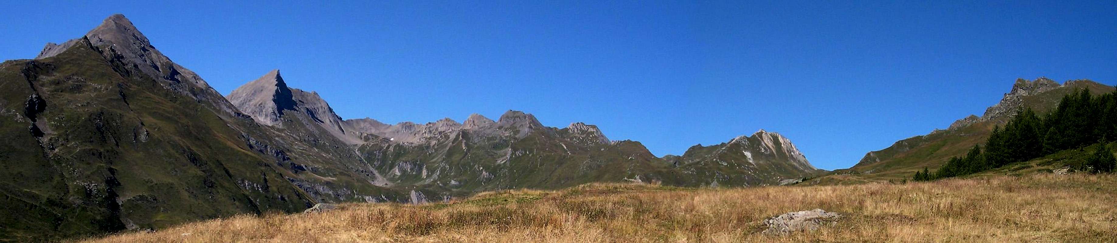
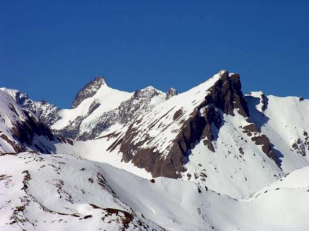
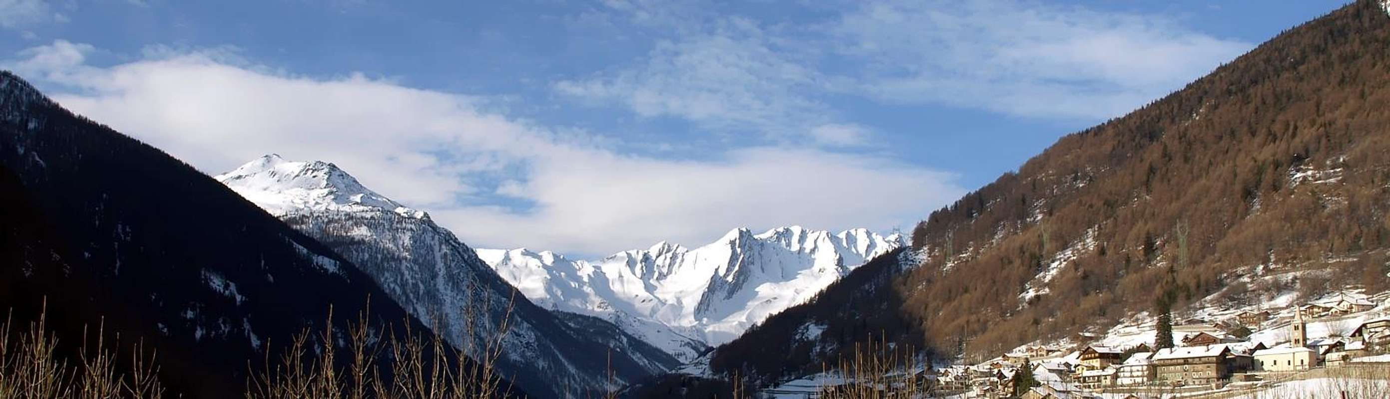
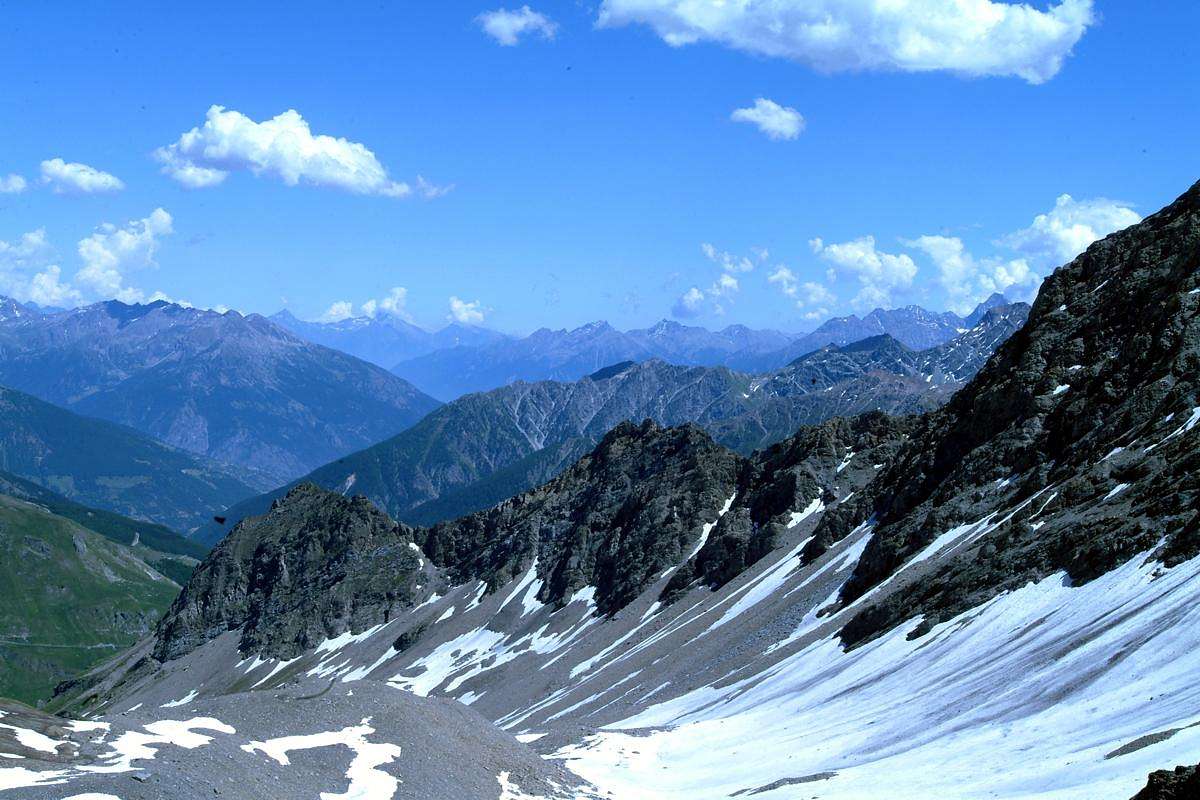
Even this Summit is part of the little Subgroup Grande Rochère (3.326m), constituting the last Summit to the Northeast before the important Malatrà Hill (2.928m) between the Valley of the same name (West) to the inside of the Val Ferret, and facing the opposite direction to the Combe du Merdeux in the Valley of the Great Saint Bernard. To look stylish and sleek on these two aspects, it provides a third much more "peaceful" and less evident to the South at the end of the long Vallon of Planaval. Like all Summit of the district has an old and crumbling rock that does not allow large climbing and that becomes dangerous moving away from its three ridges to the many faces. For this reason it is most popular in the Ski-Mountaineering than in the second, although for the first climbs are rare and usually carried out almost exclusively by local Mountaineers. Beautiful views of the Mont Blanc Mountain Chain, especially in the Northeast by the Grandes Jorasses and to Mont Dolent and on Tour Noir with beautiful shots eye on the nearby South Grand Rochère, presenting her attractive North Face above the Vallon of Malatrà, and to the North on the Group's Grand Golliaz (3.237m).
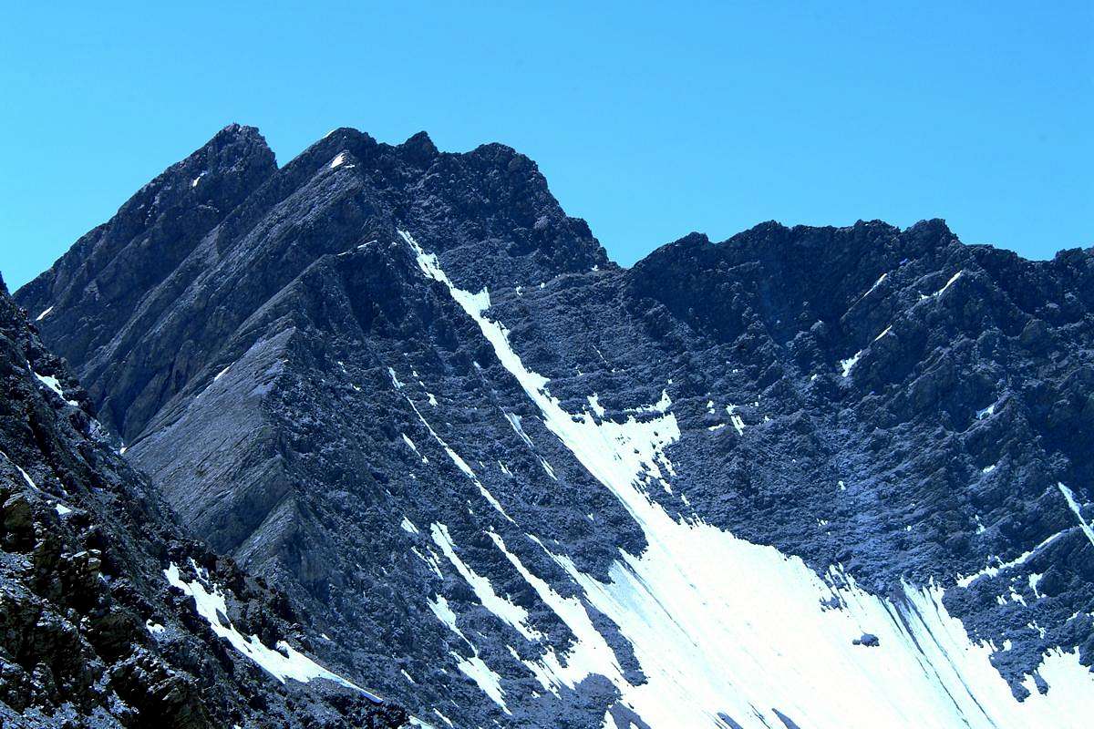
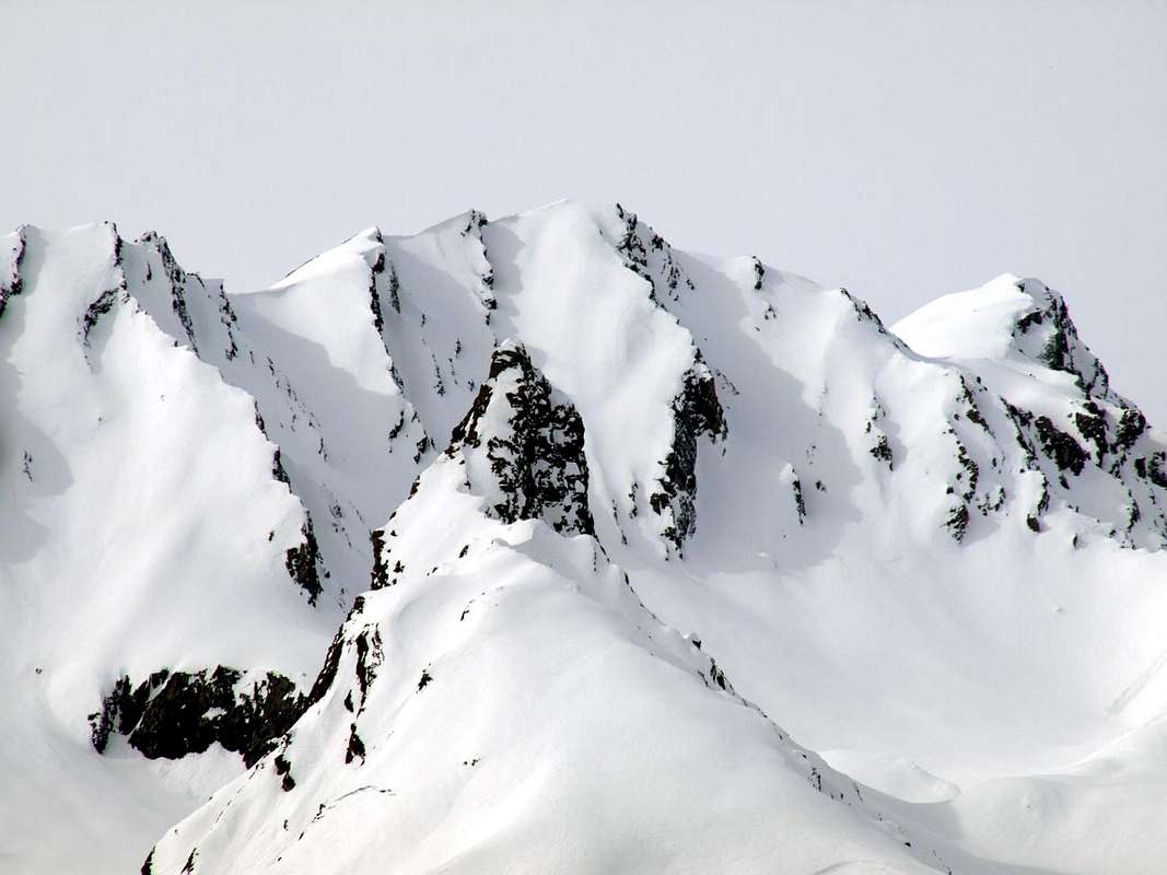
Small hatch Topographical: from the Great Rochère (3.326m), the highest elevation of this small subgroup, down to the Northeast a long ridge, which would separate the Valley of Planaval East to those overlying the Val Ferret, as the Hill of Bonalé or Bonalex (2.925m) and aiguille of the same name (3.142m), the small Aiguille de Malatrà and Artanavaz over Malatrà Hill (2.928m). Besides the crest continues, the same direction until you reach the Grand Golliaz and flexing more and more to the East, reaching the Great St Bernard Pass (2.469m). We are at the beginning of the Pennine Alps, with the majestic Chain of Mont Blanc, and at the end of the Graians as highlights very well the type of rock. There flaked and formed by mica schist transformed, here composed of solid granite. Important knot orographic and topographical, is mistakenly placed further East from the CNS (National Charter Switzerland) that confuses with the Quota 3.028 meters. From its Summit descend three crests: the first or Northern a very short with above with Malatrà, while the other two, in the shape of the sides of an isosceles triangle, down "quieter" respectively to the Southwest towards a notch with the Aiguille de Malatrà (3.142m) and Southeast to the Grand Crêton, Top with identical exact elevation (3.071m). The three sides are courtyard with rock walls somewhat route facing North-northwest over the Vallon Malatrà and East-northeast over the Combe du Merdeux, while to the South down a slope less steep composed almost exclusively of fine debris.
Anche questa Cima fà parte del piccolo Sottogruppo della Grande Rochére (3.326 m),tra il Vallone omonimo (Ovest) all'interno della Val Ferret e quello opposto rivolto alla Combe du Merdeux nella Valle del Gran San Bernardo. Di aspetto elegante e slanciato sopra questi due versanti, ne offre un terzo molto più "pacifico" e meno evidente a Mezzogiorno al termine del lungo Vallone di Planaval. Come tutte le Vette del circondario presenta una roccia vecchia e sgretolata che non consente grandi arrampicate e che diventa pericolosa allontanandosi dalle sue tre creste verso le altrettante facce. Per questo motivo è più frequentata nello Sci-Alpinismo che non nel secondo, anche se anche per il primo le ascensioni sono rare ed in genere effettuate quasi esclusivamente da Alpinisti locali. splendide viste sulla Catena del Monte Bianco, soprattutto nel settore Nordorientale dalle Grandes Jorasses fino al Mont Dolent e sul Tour Noir e bei colpi di occhio a Mezzogiorno sulla vicina Grande Rochère, che presenta la sua attraente Parete Nord sopra il Vallone di Malatrà, ed a Settentrione sul Gruppo del Grand Golliaz (3.237 m).
Piccolo tratteggio Topografico: Dalla Grande Rochère (3.326 m), massima elevazione di questo piccolo sottogruppo, scende verso Nordest una lunga cresta che, atta a separare il vallone di Planaval ad Oriente da quelli soprastanti la Val Ferret, forma il Colle di Bonalé o Bonalex (2.925 m) e l'omonima aiguille (3.142 m), la piccola Aiguille de Malatrà e quella di Artanavaz sopra il Colle di Malatrà (2.928 m). Oltre la cresta spartiacque prosegue, stessa direzione, fino a raggiungere il Grand Golliaz e, flettendo sempre più ad Oriente, raggiungere il Colle del Gran San Bernardo (2.469 m). Siamo all'inizio delle Alpi Pennine ed al termine, con la maestosa Catena del Monte Bianco, delle Graie, come evidenzia molto bene la tipologia della roccia. Là sfaldata e formata da micascisti trasformati, qua composta da solido granito. Importante nodo orografico e topografico, viene collocata erroneamente più ad Est dalla CNS (Carta nazionale Svizzera) confondendola con la Quota 3.028 metri. Dalla Sommità scendono tre creste: una molto breve con piccoli risalti sopra il col Malatrà, mentre le altre due, a forma di lati di triangolo isoscele, scendono "più tranquille" rispettivamente a Sudovest verso un intaglio con l'Aiguille de Malatrà (3.142 m) ed a Sudest verso il Grand Crêton, Cima con identica esatta altezza (3.071 m). I tre versanti son rivolti con corte pareti di roccia alquanto rotta a Nord-nordovest sopra il Vallone di Malatrà ed a Est-nordest sulla Combe du Merdeux, mentre a Sud scende un versante meno ripido formato quasi esclusivamente da roccette e fino detrito.
First Ascents
First on the Summit: unknown, probably by Chamoises Hunters. The first Mountaineering ascent note by Alfred George Topham with Mountain Guide Jean Maitre.
In winter: unknown.
Southwest Slope (Normal Route): unknown.
Southwest Crest (West Slope of): Alfred George Topham with Mountain Guide Jean Maitre; Jul 16th, 1902, from Lavachey to Malatrà Vallon and complete crossing towards Aiguille of Malatrà and Aiguille of Bonalé and Pass.
Southwest Crest (East Face Aig. de Malatrà with crossing to Artanavaz): Osvaldo Cardellina, Emilio Bertona and Gianfranco Vicentini; Jul 29th, 2001, from Planavalle Hamlet, Bonalé Alp, East Face of Aig. de Malatrà and traverse to Aig. of Artanavaz through North-northeast Crest in descent Southwest in ascent.
North-northwest Face and North Crest: unknown; note by Marcel Kurz in Guide des Alpes Valaisennes" CAS, vol. I, 1963, page 62.
West-northwest Face (Integral Direct Route just to the right of the VARIANT 44ba (Buscaini's Guide): Osvaldo Cardellina, lone; Aug 17th, 1978, in ascent from Lavachey through Malatrà Vallon bypassing High Malatrà Pasture.
North Crest (by Malatrà Pass): Robert Craveri and Jean d'Entrèves; Aug 06th, 1929, from Lavachey to Malatrà Vallon and Western Slope of the hill.
East-northeast Wall (Right Couloir) and North Crest: unknown, note by Gino Buscaini in Allpi Pennine Vol. I" C.A.I., 1971 page 117, from Comba du Merdeux.
Northwest Wall (Integral Route just to the left of Via 44b) of 1892): Osvaldo Cardellina, lone; May 27th, 2003, from Lavachey-Malatrà Alps through Comba di Malatrà (Northern Crest in descent to Malatrà Hill).
Southeast Crest: Osvaldo Cardellina, Sergio Roverso and Nino Trapani; Jun 06th, 1974, in descent to Quotas 3.028m, 3.062m with traverse to Grand Crêton.
East-northeast Wall (Direct Route): Osvaldo Cardellina, lone; May 25th, 2008, from Comba du Merdeux (Northern Crest in descent to Col Malatrà).
Little Annotation Toponymic
Small Toponymic Remarks
The Aiguille of Artanavaz has two other names: in fact in the table of the Charter of the I.G.M. (Italian Military Geographical Institute) is found as Guglia (Spire) Artereva, while in "Guide of the Western Alps Vol. II° Graian and Pennine Alps", Turin May 1896, page 277 of Giovanni Bobba and Luigi Vaccarone is as Aiguille d'Arterèva and similarly for the Malatrà Hill called alternatively with same name (page 244). The same with altitude of 3.077 meters is showing the way, then followed in 16th July 1902 by Alfred George Topham Mountain Guide Maitre Jean, in 7 hours away from Courmayeur Village. So from this side of the mountain it was already known and visited, as indicated in the statement of Topham discovery a Summit stone cairn. On the Great St. Bernard instead it is called Artanavaz with a same name on the Creek or even Rio Artanavaz. It is not clear if it is an autonomous choice or a simple distortion of the name by which it was known in Courmayeur. In fact, the Torrent Artanavaz was known locally in ancient times as Buthier (from Latin Balteus also Baltagius) de Bosses, similar to those of Ollomont Valpelline, and did not exist at all its current name Artanavaz.
Piccole Annotazioni Toponomastiche
L'Aiguille d'Artanavaz possiede due ulteriori denominazioni: infatti nella tavola della Carta dello I.G.M. (Istituto Geografico Militare Italiano) la troviamo come Guglia di Artereva, mentre in "Guida delle Alpi Occidentali", 1896, pagina 277 di Giovanni Bobba e Luigi Vaccarone risulta come Aiguille d'Arterèva e similmente per il Colle di Malatrà chiamato in alternativa con lo stesso toponimo (pagina 244). Nella stessa con altitudine di 3.077 metri si indica la via, poi seguita il 16 Luglio 1902 da Alfred George Topham con la Guida Jean Maitre, in 7 ore da Courmayeur. Quindi da questo versante la montagna era già conosciuta e frequentata, come indica l'affermazione di Topham nel ritrovamento sulla Sommità d'un ometto in pietra. Sul lato Gran San Bernardo invece viene denominata Artanavaz con un toponimo concernente anche il Torrente o Rio Artanavaz. Non si comprende se sia una scelta autonoma od una semplice distorsione del nome con il quale era detta a Courmayeur. In effetti il Torrent de Artanavaz era conosciuto in loco nei tempi antichi come Buthier de Bosses, similarmente a quelli di Ollomont e Valpelline, e non esisteva del tutto la denominazione attuale o di Artanavaz.
Getting There
BY CAR:
From TORINO, MILANO, etc: Motorway A5. Exit at IVREA or Quincinetto (PIEDMONT).
From IVREA Town: in West towards Pont Saint Martin, Donnas, Bard, Champdepraz, Pontey, Fénis, Saint Marcel, Grand Brissogne, Pollein, Charvensod, Gressan, Jovençan, Aymavilles, to Villeneuve, Arvier, Avise, Morgex and to Pré Saint Didier, Courmayeur Municipalities (Western side). From Courmayeur Resort: in East to Morgex, La Salle, Saint Pierre, Sarre, Aosta Municipalities.
Western Side in Dora Ferret & Baltea Streams: From Courmayeur towards the Val Ferret From Courmayeur-la Palud(1.370m), towards Montitaz, Planpincieux (1.593m) Villages, Tronchey (1.620m), Praz Sec du Milieu, Lavachey (1.640m), Arnouva Dèsot (1.769m) Villages, through Municipal Road, to Malatrà Vallon and Walter Bonatti Refuge nearby Malatrà Low Pasture (2.056m), below Malatrà Upper Alp (2.213m). From Morgex Common towards Planavalle Vallon From La Salle1.001m), with Regional Road, towards Challancin (1.610m), Cheverel, Morges (1.829m), Planaval Hamlets (1.750m); from this, through farms dirt road in North-northeast, passing Maison Blanche Pasture, towards the Rantin (2.333m) and Bonalé (2.340m) Alpages, in Upper Planaval small Valley. Northwestern Side in Rio Artanavaz Torrent: From Aosta Town to Merdeux Basin From Saint-Oyen(1.377m), with previous road to Mottes, continue West-northwest to Devies Village (1.723m) at the beginning of Merdeux Comba; from this with paths through Merdeux Dèsott (1.919m), Cotes (1.930m), Manda (1.973m), Tsa de Merdeux (2.285m) Pastures to Malatrà Hill (2.928m). From Saint Rhémy en Bosses Commune(1.619m), through Municipal Road, on Merdeux Comba to Tsa de Merdeux (2.285m) and Malatrà Hill (2.928m).
From FRANCE: through the Mont Blanc Tunnel to Entrèves-crossroads to Vény/Ferret Valleys - Mountain Guides of Courmayeur - La Saxe Rock Gym - Courmayeur. By Little Saint Bernard Pass, closed since November until half May to La Thuile Valley - Pré Saint Didier - Courmayeur. It is not necessary to take Motorway A5: you can drive on SS.26, in the direction of AOSTA - IVREA - TURIN.
BY PLANE:
Aeroporto "Corrado Gex" Saint Christophe (Aosta).
Approach & Route
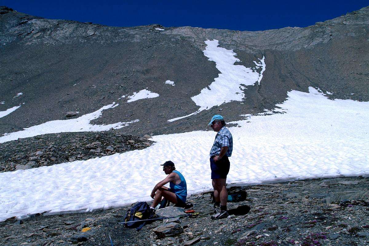
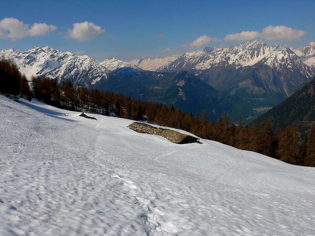
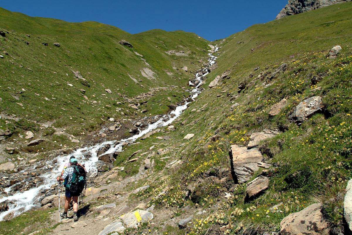
A) - Approach and route from Planavalle Village : from Planavalle tiny Village (1.750m), below Bec de l'Aouille (2.535m), proceed with the previous itineraries to reach before the Alp Rantin (2.338m), where the valley splits sending a branch to the Northeast towards the Serena Hill, and after that of Bonalé or Bonalex (2.340m; source) located immediately to the West of the long ridge called Côte de Serena (2.785m, on South Ridge of Crêton du Midi), here this ends. Leaving Northwest the way to the Great Rochère, continue further North through a small path not numbered nor reported running out towards the 2.415 meters at the end of the South "Crestone" of Crêton du Midi (3.071m). Ending the path next to the stream at the bottom vallon, progressively it flexes just right following a steep grassy promontory placed between two secondary torrents reaching the altitude of 2.740 meters. Cross the undulating vallon above, leaving the left (West) Aiguille de Bonalé, to reach the Lac de Bonalex (2.782m), just below that of Malatrà (3.142m; E/F; 1h'15/1h'30). The final part is made up of easy and even toppo steep scree slopes, where snow usually remains until the beginning of summer. The tour is in fact quite popular in Ski-Mountaineering and lets achieve this important topographic node consists of three sides turned to Northwest of Val Ferret (Vallon de Malatrà), North of the Valley of Gran San Bernardo (Combe du Merdeux) and precisely in South to the Valley of Baltea (Vallon of Planavalle) (E/F; 3h'30/3h'45).
A) - Avvicinamento e Via da Planavalle: dal Villaggetto di Planaval (1.750, m), sottostante il Bec de l'Aouille (2.535 m), procedere con i precedenti itinerari, utilizzando il lungo diagonale verso Settentrione della strada poderale sospesa sopra al vallone, fino a raggiungere dapprima l'Alpe Rantin (2.338 m), dove il medesimo si sdoppia inviando un ramo verso Nordest al Col Serena, e poi, doppiato a sinistra il costolone dalla Quota 2.710 metri, quella di Bonalé (2.340 m; sorgente) posta subito ad Occidente della lunga cresta chiamata Côte de Serena (2.785 m), ove questa ha termine. Lasciando a Nordovest la via verso la Grande Rochère, proseguire più a Settentrione tramite un sentierino non numerato e neppure segnalato che si esaurisce verso i 2.415 metri circa al termine del Crestone Meridionale del Crêton du Midi (3.071 m). Terminando il percorso a fianco del torrente lungo il suo lato idrografico di destra (Ovest) sul fondo vallone, progressivamente si flette appena sulla destra seguendo un ripido promontorio prativo posto tra due torrentelli secondari raggiungendo l'altitudine di 2.740 metri. Attraversare l'ondulata conca soprastante in genere con residui nevati, lasciando sulla sinistra (Ovest) l'Aiguille de Bonalé, per pervenire al Lac de Bonalex (2.782 m), subito al di sotto di quella di Malatrà ad Ovest e del Grand Crêton ad Est (3.142 m, 3.071 m; E/F; 1h'15/1h'30). La parte finale é costituita da facili e nemmeno troppo ripidi pendii detritici con qualche elementare roccetta, dove in genere permane la neve fino all'inizio dell'estate. La gita infatti é abbastanza frequentata nello Sci-Alpinismo e permette di raggiungere quest'importante nodo topografico costituito tra tre versanti rivolti a Nordovest alla Val Ferret (Vallone di Malatrà), a Nord alla Valle del Gran San Bernardo (Combe du Merdeux) ed appunto a Meridione alla Valle della Dora Baltea (Bacino o Vallone di Planavalle) (E/F; 3h'30/3h'45).
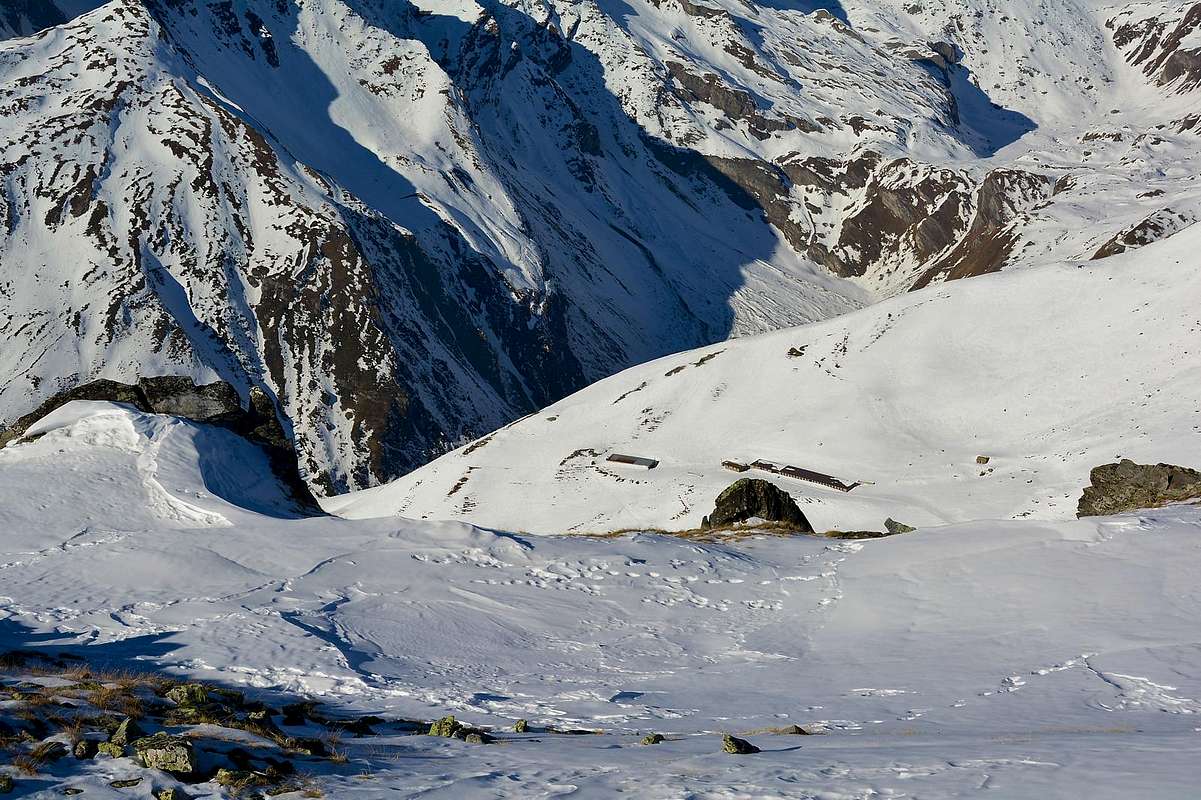
B) - From Val Ferret (Malatrà Vallon) from Lavachey Hamlet: to following alternative (1.697m; in Southwest short time to Frébouge or Fréboudze Village); instead continue Northeast on main road up to the small bridge 1.695 meters above a mini pond. Abandoning right (South) the first path to Bonatti Refuge, go Northeast with a mule-track not numbered to two hairpin bends 1.851, 1.890 meters; from this last, completely changing direction in South-southeast, reach Giué Dèsott Alp (Low; 2.007m), below Mont Charfière (2.827m) into Malatrà Vallon and below Malatrà Hill. From pasture, with same route through path and crossing Malatrà Torrent in altitude about 2.035/40 meters, to Malatrà Désott Alp (2.056m) and nearby Refuge Walter Bonatti (2.025m; T/E/F; 1h'20/1h'40), amongst Mont Quichette (3.043m), Malatrà Hill (2.928m), Aiguille d'Artanavaz (3.071m) and Aiguille de Malatrà (3.142m).
"Longer and Higher" Variant: if you having to extend the hike higher, continue East-southeast through a secondary unnumbered path over the torrent to Gioué Damon Alp or Upper (around 2.200 meters); through short connection in South, crossing the Malatrà Torrent, briefly reach the Malatrà Damon Alp (2.213m), below Tête entre deux Sex also Tête entre deux Sauts (Head between two Jumps or Cliffs; 2.729m) and at the end of imposing Northwestern Buttress Grande Rochère (3.326m; TE/M; 1h'45/2h'00).
"Lower" and more Southern Variant: from Malatrà Dèsott Pasture continue on the first path or 28/42/Alta Via n° 1, more in South, to Damon Alp (2.213m; TE/F; 0h'50/1h'00 in more), below Tête de Sécheron (2.880m) and the Northern Wall of Grande Rochère. From Damon Alpage, left to the Southeast branch with the path n° 42 that rises to Pas entre deux sauts, continue instead with the path 28/Alta Via n° 1 to the Northeast towards the Col Malatrà, me not you reach it. But, arrived in the amphitheater morainic that precedes it, at an altitude of 2.566 meters about at a small spring, you leave this too by crossing the stone to the East between the Aiguille de Malatrà (South) and that of Artanavaz in opposite; a detrital ledge tilted to the left reaches the easy Southwest Ridge not far from the Summit (Via the first climbers known, 1902). Or, continuing towards the hill, to reach the moraines on upper basin in altitude of 2.800 meters about where, flexing right (Southeast) is reached at the pitiful remains of a snowfield at the base of a narrow gully debris that, with the same inclination of previous route reaches North Ridge over three small rocky bumps; from here in short to the Summit. Logically, you can also take the entire North Crest starting from Col Malatrà (see the next route; from F+ to PD- for all three solutions; 4h'00/4h'30 Lavachey).
B) - Dalla Val Ferret (Vallone di Malatrà) Avvicinamento dal Villaggio di Lavachey (1.642 m): dal Villaggio di Lavachey in direzione del successivo bivio (1.697 m; a Sudovest in breve tempo al Villaggio di Frébouge o Fréboudze); invece proseguire a Nordest sulla strada principale insino al ponticello 1.695 metri sopra un minuscolo laghetto. Abbandonando verso destra (Sud) il primo sentiero per il Rifugio Walter Bonatti, salire a Nordest tramite la mulattiera non numerata in direzione dei due tornanti 1.851, 1.890 metri; dall’ultimo di questi, variando completamente direzione verso Sud-sudest, raggiungere l’Alpeggio di Giué Dèsott Alp (Inferiore; 2007 m), al di sotto del Mont Charfière (2.827 m) dentro il Vallone di Malatrà ed al di sotto del Col Malatrà. Dall'alpe, con la stessa via tramite sentiero ed attraversando il Torrent de Malatrà a quota circa 2.035/40 metri, verso l’Alpe di Malatrà Désott (2.056m) ed il viciniore Rifugio Walter Bonatti (2.025 m; T/E/F;1h'20/1h'40), tra il Mont Quichette (3.043 m), il Col Malatrà (2.928 m), l'Aiguille d'Artanavaz (3.071m) e l'Aiguille de Malatrà (3.142 m).
Variante più "Lunga ed Alta" ad Est-sudest: dovendo proseguire nella parte superiore del vallone in direzione del colle, continuare per non molto tempo ad Est-sudestst tramite un sentierino secondario non numerato al disopra del torrente verso l'Alpe Gioué Damon o Superiore (circa 2.200 metri). Tramite brevissima connessione verso Sud, si raggiunge altresì in breve, attraversando il Torrente di Malatrà, l'Alpe di Malatrà Damon (Superiore; 2.213 m), sotto la Tête entre deux Sex oppur detta anche Tête entre deux Sauts (testa tra due salti o dirupi rocciosi; 2.729 m) nonché al termine dell'imponente e lungo Contrafforte Nordovest della Grande Rochère (3.326 m; TE/M; 1h'45/2h'00).
Variante più "Bassa" a Sud: dall’Alpeggio di Malatrà Dèsott continuare sul precedente sentiero 28/42/Alta Via n° 1, maggiormente a Meridione, verso quella Damon (2.213 m; TE/F; 0h'20/0h'30 in più), al di sotto della Tête de Sécheron (2.880 m) e della Parete Nord della Grande Rochère. Dall'Alpe Damon, lasciato a Sudest il ramo con il sentiero n° 42 che sale al Pas entre deux sauts, si prosegue invece a Nordest con il sentiero 28/Alta Via n° 1 verso il Col Malatrà, me non lo si raggiunge. bensì, giunti nell'anfiteatro morenico che lo precede, a quota 2.566 metri presso una piccola sorgente, si abbandona anche questo attraversando la pietraia verso Oriente tra l'Aiguille de Malatrà (a Sud) e quella d'Artanavaz; una cengia detritica inclinata a sinistra raggiunge la Cresta Sudovest a poca distanza dalla Vetta (Via dei primi salitori conosciuti, 1902). Oppure, continuando verso il colle, raggiungere il bacino superiore in altitudine di 2.800 metri circa dove, flettendo a destra (Sudest) si perviene ai miseri resti di un nevaio alla base d'un canalino detritico che, con la medesima inclinazione del precedente, raggiunge la Cresta Nord sopra tre piccole asperità; da qui in breve alla Sommità. Logicamente, si può percorrere anche l'intera Cresta Settentrionale partendo dal Col Malatrà (vedi l'itinerario successivo; da F+ a PD- per tutte e tre le soluzioni; 4h'00/4h'30 da Lavachey).
C) - From Great St. Bernard Valley (Combe du Merdeux) Approach from Mottes Fraction: from Saint-Oyen, Mottes Fraction (1.660m; parking under Saint Bernard Road) also from Bosses-Cuchepache/Ronc Fractions (+; 1.648m; 1.775m) towards Comba Merdeux, Montagna Merdeux Dèsott (Low; 1.919m), Muanda or Moindaz Alp (1.973m), Tsa de Merdeux Upper Alp (2.285m), with various paths sometimes concurrent with the farm dirt road to the isolated little Villages of Devies and Maytie on Alta Via n° 1. Through the same towards the Malatrà Hill, with small path-traces alwais of or nearby the Alta Via n° 1, (2.928m), between Mont Quichette (3.043m) and Aiguille of Artanavaz (3.071m; E/F+; 4h'15/4h'30 from Mottes Fraction).
"Lower" Variant: from Maytie (1.676m) towards Limassey Alp (1.808m) through private road and from this, through unnumbered small path to Potz-Ardusi and Muanda Alps (1.784m, 1.973m), along the Torrent de la Belle Combe, at the entrance in Merdeux Comba towards the last Alp of Merdeux Damon (2.285m; T/E; 1h'10/1h'20 by Mottes). From Col Malatrà goes up through the short and quite easy Northern Crest: after a stretch more linear to reach a small shoulder followed by three little elevations presenting some passages fun and interesting, one of wich avoidable through an exposed step to Malatrà Slope (West; I°+/II°-) with, unfortunately, rotten rock, often friable. Reached a following shoulder "almost flat", more easily in terminal part to arrive on Summit (F+/PD-; 1h’00/1h’15 for the Northern Ridge from Malatrà Pass; 5h’30/6h’00 by Mottes).
C) - Dalla Valle del Gran San Bernardo (Combe du Merdeux) Avvicinamento dalla Frazione di Mottes: dal Comune di Saint-Oyen, Mottes Frazione (1.660 m; parcheggio sotto la Strada del San Bernardo) oppure da Bosses-Cuchepache o da Ronc Frazioni (+; 1.648 m; 1.775 m) verso la Comba du Merdeux, Montagna Merdeux Dèsott (Inferiore; 1.919 m), Alpeggio di Manda, Muanda oppure Moindaz (1.973 m), Tsa de Merdeux Alpe Superiore; 2.285 m), tramite vari sentieri a tratti concomitanti con la strada poderale per gli isolati Villaggetti di Devies e Maytie sull'Alta Via n° 1. Con questa al Col Malatrà (2.928 m), tramite sentierini e tracce, sito tra Mont Quichette (3.043 m) ed Aiguille d’Artanavaz (3.071m; E/F+; 4h'15/4h'30 dalla Frazione di Mottes).
Variante "Bassa": dall'Alpeggio di Maytie (1.676m), subito appresso a Mottes e Devies, verso quello viciniore di Limassey (1.808 m) tramite la strada privata poderale e da questo, con sentierino non numerato a quelle di Potz-Ardusi e Muanda o Moindaz (1.784m, 1.973m), affianco al Torrent de la Belle Combe affluente del sottostante Rio Artanavaz (antico Buthier de Bosses), nonché all'entrata della Comba du Merdeux Comba in direzione dell'Alpe ultima o Tsa del Merdeux Damon (2.285 m; T/E; 1h'10/1h'20 da Mottes) Dal Col Malatrà salire tramite la breve nonché abbastanza facile Cresta Nord. Dopo un tratto più lineare si raggiunge una spalletta seguita da tre piccole asperità che presentano qualche passaggio divertente ed interessante, una delle quali può essere aggirata con passaggio esposto sul versante Malatrà (Ovest; I°+/II°-) purtroppo con roccia spesso friabile. Raggiunta una successiva spalla "quasi piatta" più facilmente con l'ultimo tratto si raggiunge la Vetta (1h’00/1h’15 per la Cresta Nord; 5h’30/6h’00 da Mottes).
Difficulty & Equipment
This route can be considered E/F or EE/F+ (Experts Hikers) in winter (even by snowshoes or Ski).
L'itinerario è da classificare in E/F oppure EE/F+ (Escursionisti Esperti) in inverno (anche tramite Racchette da neve od in Scialpinismo).
Hiking gear, in winter as for Ski-Mountaineering or with Snowshoes.
Da Escursionismo, in inverno da Scialpinismo o con Racchette da neve.
Campings
Remember that free camping is forbidden (except for emergency reasons, above 2.500m, from darkness until dawn).
Mountain Condition
Meteo: you can find all the needed informations at the official site of the Valle d'Aosta Region:
"Guida dei Monti d'Italia-Alpi Pennine" (Vol. I°) di Gino Buscaini-Club Alpino Italiano/Turing Club Italiano, Luglio 1971 (in Italian).
"Diari Alpinistici" di Osvaldo Cardellina e Indice Generale accompagnato da Schedario Relazioni Ascensioni 1964-2019 (inediti).
"80 itinerari di Escursionismo Alpinismo e Sci Alpinismo in Valle d'Aosta", di Osvaldo Cardellina, Ed. Musumeci, Giugno 1977 (in Italian); seconda Ed. Luglio 1981; terza Ed. Luglio 1984; (in French), prima Ed. Febbraio 1978; seconda Ed. Marzo 1980.
Kompass "Massiccio del Monte Bianco Valle d'Aosta Sentieri e Rifugi" Carta turistica 1:50.000.
I.G.C. Istituto Geografico Centrale Torino "Massiccio del Monte Bianco" (carta n° 4), Torino, 1998 1:50.000.
I.G.C. Istituto Geografico Centrale Torino "Monte Bianco-Courmayeur-Chamonix M.B.-La Thuile" (carta n°107), Torino 1989 1:25.000.
I.G.M. Istituto Geografico Militare "Gr. Rochère" 1:25.000.
Parents refers to a larger category under which an object falls. For example, theAconcagua mountain page has the 'Aconcagua Group' and the 'Seven Summits' asparents and is a parent itself to many routes, photos, and Trip Reports.


 4233 Hits
 84.82% Score
 19 Votes