
-
 7323 Hits
-
 88.19% Score
-
 26 Votes
|
|
Mountain/Rock |
|---|---|
|
|
45.82108°N / 7.06833°E |
|
|
Hiking, Mountaineering, Skiing |
|
|
Spring, Summer, Fall |
|
|
10502 ft / 3201 m |
|
|
Overview
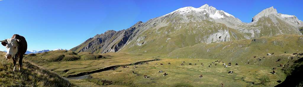
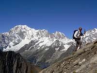
Aiguille de Bonalè (or Bonalex) is one of the spectacular balconies to admire the Italian side of Monte Bianco Chain. It belongs to the watershed between Ferret valley and Comba di Planavalle.Looking from the Ferret valley, its NW side together with Grand Rochere forms an impervious vertical wall, while, looking from Comba di Planavalle, it appears as a graceful rocky pyramid.
All its sides are steep and the quality of the rock is bad, for these reasons it is rarely climbed and always following the normal route.
First known ascent: 1892 by Alfred George Topham and Jean Maitre.
  |
Getting There
From Turin, Milan, Switzerland (Tunnel or Grand St. Bernard Pass): Motorway A5 - Courmayeur direction, Morgex exit. Turn right to La Salle. Follow Planavalle direction and park the car just 100 meters above the small village of Planavalle (1750m).
From Seez (France), Bourg St. Maurice, Petit St. Bernard Pass (France). Drive through La Thuile to Pre Saint Didier, turn right to La Salle on SS.26, until La Salle. Turn lefto for Morge (Planavalle).
From Chamonix/Geneve (Mont Blanc Tunnel) Drive through Courmayeur on SS.26 road, until La Salle. Turn left for Morge (Planavalle).
Routes overview

Normal route
Height difference: 1451 m
Difficulty: hiking partially out of trails and 10 meters of easy climbing (II+);
Notes for skinners: A) ice-axe recommended. B) presence of avalanched slopes, in the second part of the route, that are sometimes un-skiable.
Park the car just 100 meters above the small village of Planavalle (1750m). Follow the unpaved road to Alpe Les Écules (1880m ) , then walk along the path to Capanna Bonalè (2340m). Abandon here the path and walk towards the pyramidal summit (direction NW), crossing some picturesque pastures. Climb a steep grassy slope, enter into a small and arid valley then reach the Bonalè Pass (2925m) climbing a steep and slippery slope.
From the pass climb the SW ridge that is quite easy except a 10 meters high step, conquerable bridging in a chimney (II+), then reach the summit.
 Northern side in two different versions
Approximately same route for ski tourers
Nobody usually follows other routes due to the bad quality of the rock.
When to climb
Hiking: June to OctoberSki-mountaineering: April to May

Red Tape
Free camping is forbidden (except for emergency reasons, over 2500 meters, from darkness until dawn).Huts
The Rifugio Bonatti is placed not far from the base of the NW wall, but due to the bad quality of the rock it is never climbed.No huts on the side of the normal route.
Books and maps
Books:Gino Buscaini - "Alpi Pennine I" in the "Guida dei Monti d'Italia" series CAI/TCI
Maps:
I.G.M. - Istituto Geografico Militare 1:25.000
I.G.C. - Istituto Geografico Centrale " Carta dei sentieri e dei rifugi" 1:25.000
I.G.C. - Foglio n. 4 - Massiccio del Monte Bianco, scale 1:50.000
Kompas - Monte Bianco Valle d'Aosta "Sentieri e Rifugi" Carta turistica 1:50.000
External Links
Weather forecasts:NIMBUS: Piemonte and Valle d’Aosta- Italian version
Thanks to the closeness of the borderline, could be useful to consult Meteo Switzerland-Italian, French and German versions
Webcams of Courmayeur and Val Ferret
livioz - Oct 5, 2006 12:19 pm - Voted 10/10
In some maps and guides......one can also find Bonalex instead of Bonalè