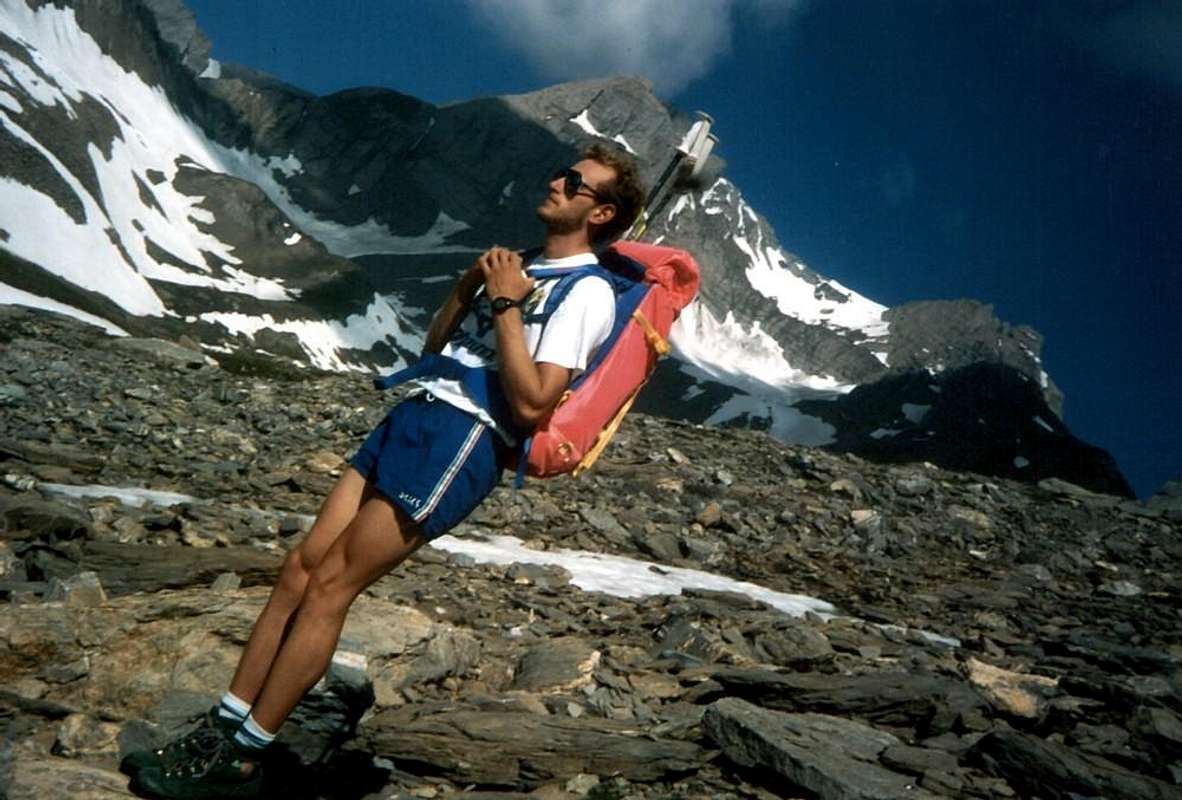
La montagna chiama i suoi figli, ed essi rispondono fedelmente al suo appello…
Osvaldo Cardellina, Diario alpinistico, 1964-65
Page texts: @ OsvaldoCardellina"Osva", passed away on May 2, 2022. Page owners: Christian Cardellina e Osvaldo Cardellina. Any updates from September 12, 2022: Antonio Giani, page administrator, friend and climbing companion.
Testi della pagina: @ OsvaldoCardellina "Osva", scomparso il 2 maggio 2022. Proprietari pagina:Christian Cardellina e Osvaldo Cardellina. Eventuali aggiornamenti dal 12 settembre 2022: Antonio Giani, amministratore della pagina, amico e compagno di salite.
Unknown Overview
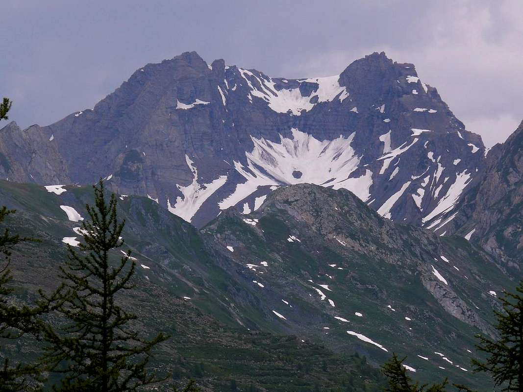
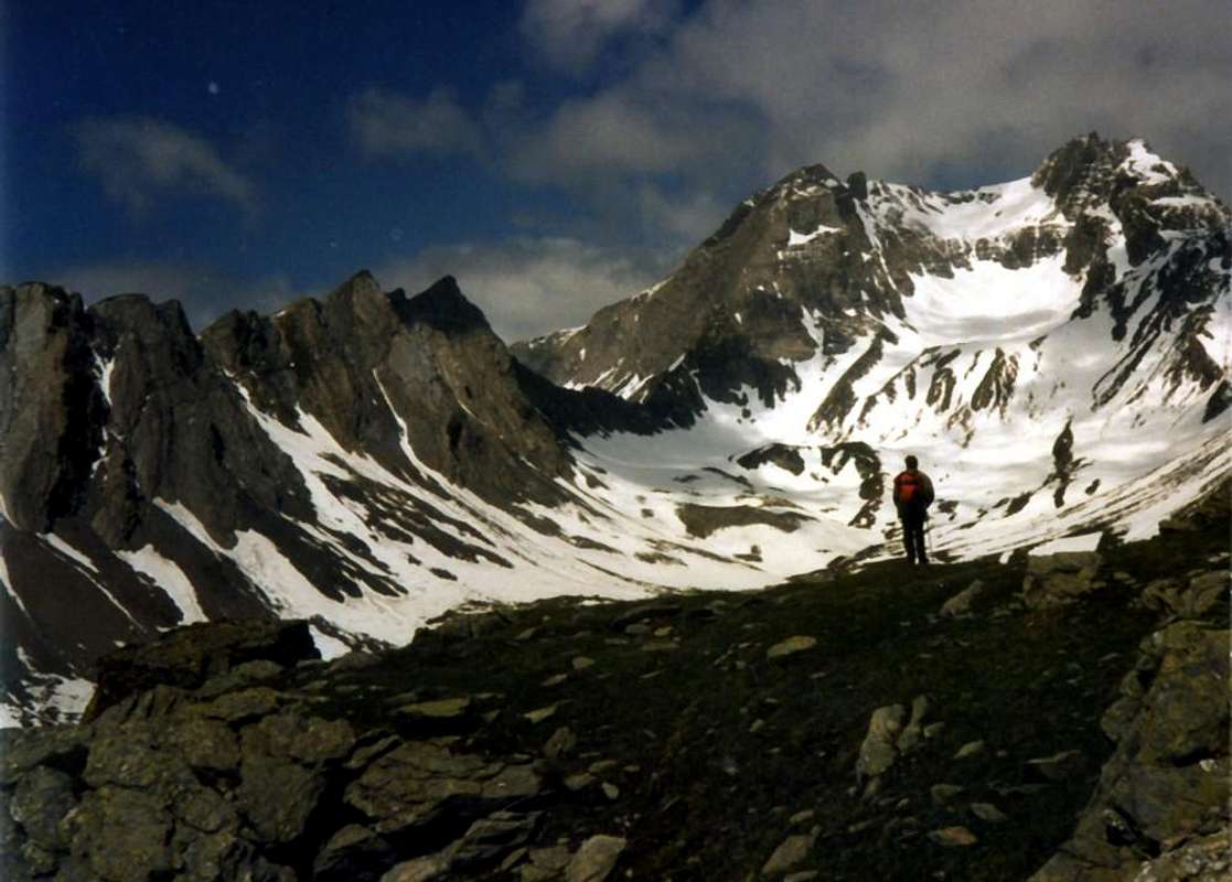
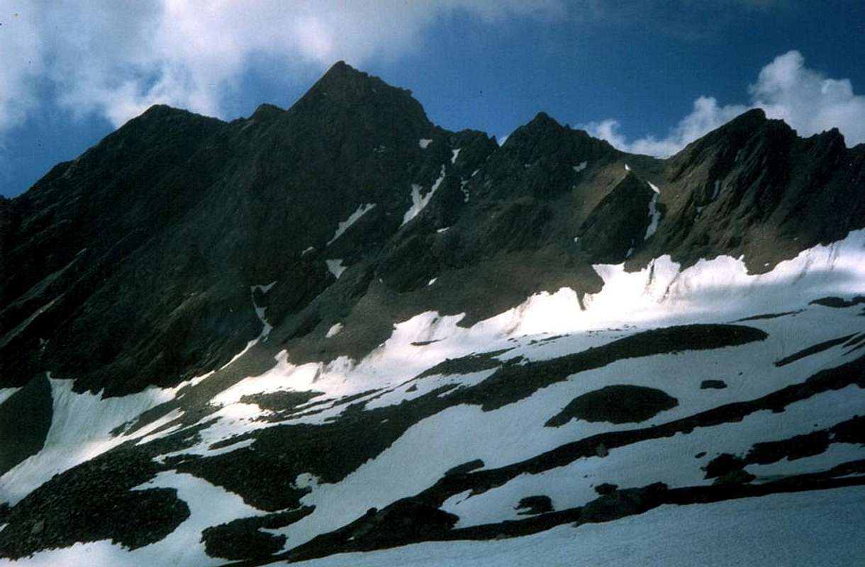
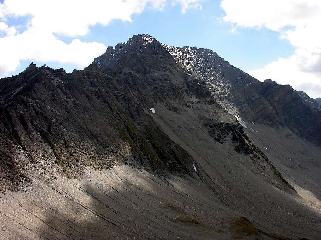
We continue the search for mountains that that are not well known and even less busy. Although this certainly appears to be a mountain little known and even less visited, except by a few ascents by locals or by chamoises hunters. Even the main, or the Grand Golliaz or Golliat (3.237m), of this Group does not record an excessive number of ascents, despite the lure tied to the name, perhaps the most famous in the past at the time of the Mountaineering Classic, and the relatively middle-high altitude. Then imagine for these satellites supporting actors that are certainly not comparable for example to those of Mont Blanc de Tacul; there we rock sound and compact, but here we find it somewhat broken, if not in decay. So there? Is to be not expected much for climbing, while the sense of a visit is the search for "exploratory", for those who still love it. Just from Grand Golliaz a short ridge, almost straight down towards the South reaching near Petit Golliaz, just a few feet lower (3.234m), from this last the same splits sending a branch towards South-southwest, act to separate the higher, or Northwestern, the Combe du Merdeux from Vallon of Bellecombe in Val Ferret. The second branch is directed instead toward Southeast reaching the Col de Saulié (2.817m), located between the first basin and that of Thoula and to the foot of the slope of the Eastern Grand Golliaz. From this point the same direction and the same goes with "snaking" path with semi circular shape and through different elevations for then finish on the Alpe Mondaz or de la Manda (1.973m). From Saulié Hill in succession we will have the same name Aiguille (2.869m), a tooth of rock that has been called "L'Aiguillon de Saulié", beyond which, after forming a brèche, the crest rises again to form a more larger and unnamed Top (2.916m); other three elevations (2.865m, 2.755m, 2.607m)) on the same divide, flexing more and more towards the South, ending above the private dirt road above the pasture. As a whole this long ridge is known locally as "Crêt des Ceingles", where the name goes reduced to "sengla", or belt and not to a wild boar, despite the large presence of the latter to whom the hunters give a stubborn fighter. In effect, the ridge has the form of a belt as for La Sengla between our Valpelline and the adjacent Swiss Valais.
Continuiamo la ricerca di montagne che non siano molto conosciute e frequentate. Anche questa sicuramente risulta esserne una poco conosciuta ed ancora meno frequentata, se non da qualche visita da parte di cacciatori locali. Anche la principale, ovvero il Grand Golliaz o Golliat (3.237 m), di questo Gruppo non registra un eccessivo numero d'ascensioni, nonostante il richiamo legato al nome, forse più famoso nel passato ai tempi dell'Alpinismo Classico, ed all'altitudine relativamente elevata. Immaginiamo quindi per questi satelliti comprimari, che non sono certamente paragonabili ad esempio a quelli del Mont Blanc de Tacul; lì abbiamo roccia sana e compatta, qui invece la troviamo alquanto rotta, se non addirittura in disfacimento. Quindi non c'é da attendersi molto per l'arrampicata, mentre il senso di una visita consiste nella ricerca "esplorativa", per coloro che ancora la amano. Proprio dal Grand Golliaz una breve cresta, quasi rettilinea, scende verso Mezzogiorno raggiungendo il vicino Petit Golliaz, di appena qualche metro più basso (3.234 m); da quest'ultimo la medesima si sdoppia inviando un ramo vero Sud-sudovest, atto a separare la parte più elevata, o Nordoccidentale, della Combe du Merdeux dal Vallone di Bellecombe in Val Ferret. Il secondo ramo s'indirizza invece verso Sudest raggiungendo il Col de Saulié (2.817 m), a cavallo tra la prima comba e quella di Thoula ai piedi del Versante Orientale del Grand Golliaz. Da questo punto la medesima prosegue con identica direzione e "serpeggiando" con percorso semi circolare forma diverse elevazioni per poi terminare sopra l'Alpe Mondaz o de la Manda (1.973 m). Dal Col de Saulié in successione avremo l'omonima Aiguille (2.869 m), un dente di roccia che é stato chiamato "L'Aiguillon de Saulié", oltre il quale, dopo aver formato una brèche, la cresta spartiacque si rialza a formare una quota di maggiori dimensioni (2.916 m); altre tre elevazioni (2.865 m, 2.755 m, 2.607 m)) si ergono sulla stessa che, flettendo sempre più A Sud, termina sopra la strada poderale soprastante l'alpeggio. Nell'insieme questa lunga cresta é conosciuta in loco come "Crêt des Ceingles", ove il giusto toponimo và ricondotto a "sengla", cioè cintura e non a cinghiale, nonostante la numerosa presenza di quest'ultimi ai quali i cacciatori dan ostinata caccia. In effetti la cresta possiede la forma d'una cintura come per La Sengla tra la nostra Valpelline ed il confinante Vallese.
First Ascents
On the Summit: Unknown.
In winter: Unknown.
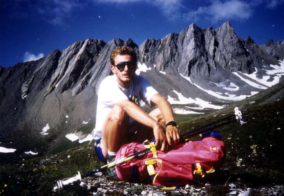
West-northwest Crest: Osvaldo Cardellina, lone; June 26th, 1996; in crossing from Col and Aiguille de Saulié with Giuseppe Lamazzi.
East-southeast Crest: Osvaldo Cardellina, lone; June 26th, 1996, in descent towards the Eastern Brèche.
Getting There
BY CAR:
From TORINO, MILANO, etc: Motorway A5. Exit at IVREA or Quincinetto (PIEDMONT).
From IVREA Town: before in West to Aosta, after in Northwest to Gignod, Etroubles, Saint-Oyen, Saint Rhémy en Bosses, (Southwestern and Northwestern Sides) and in North to Allein, Doues, Valpelline (Northeastern Side) Municipalities.
From Courmayeur Resort: before in East to Aosta, after in Northwest to Gignod, Etroubles, Saint-Oyen, Saint Rhémy en Bosses, (Southwestern and Northwestern Sides) and in North to Allain, Doues, Valpelline (Northeastern Side) Municipalities. Northwestern Side: From Malatrà Hill to Grand Saint Bernard Basin Basin up to the
FromSaint-Oyen(1.377m), with previous road to Mottes, continue West-northwest to Devies Village (1.723m) at the beginning of Merdeux Comba; from this with paths through Merdeux Dèsott (1.919m), Cotes (1.930m), Manda (1.973m), Tsa de Merdeux (2.285m) Pastures to Malatrà Hill (2.928m). From Saint Rhémy en Bosses Commune(1.619m), through Municipal Road, on Merdeux Comba to Tsa de Merdeux (2.285m) and Malatrà Hill (2.928m). From Saint Rhémy en Bosses Commune(1.619m) to Tula Comba to Saulié Pass (2.817m), Aiguille des Ceingles (2.869m) and Angroniettes Pass (2.936m).
From FRANCE: through the Mont Blanc Tunnel to Entrèves-crossroads to Vény/Ferret Valleys - Mountain Guides of Courmayeur - La Saxe Rock Gym - Courmayeur. By Little Saint Bernard Pass, closed since November until half May to La Thuile Valley - Pré Saint Didier - Courmayeur. It is not necessary to take Motorway A5: you can drive on SS.26, in the direction of AOSTA - IVREA - TURIN.
BY PLANE:
Aeroporto "Corrado Gex" Saint Christophe (Aosta).
Approaches
At the entrance Comba du Merdeux through the Thoula Vallon
A) - From Mottes (1.670m; Hamlet of Bosses, reachable from the route SS.27 of Gran San Bernardo) toward West, descending a little to pass under the trail Highway n°1,near the "big bend". Cross the Torrent Artanavaz on a small bridge the on to the Pastures of By (1.767m), Potz-Ardusi (1.784m) and Moindaz or Manda, even Muenda (1.973m), all at the entrance of real and long Comba's Merdeux, bordering the waterfalls of Thoules Torrent. You can arrive here also starting from the Devies car parking, just beyond the winding road, through the Pastures of Merdeux Dèsott (1.919m) and Côtes (1.930m). From Moindaz cross twice the torrent and follow the Eastern bank till the Pastures of Comba Toula and near the Saint Rhémy Hill; follow the path n° 12 coming from it, but from here not numbered, passing some dry channels toward West, up toward the moraine of the small Glacier des Bosses. Almost reach it at about 2.700 meters, where originates two small torrents, and after to follow to the left the minuscule path to Col de Sauliè. Reach the same through a progressively more small path into the moraines and with traces in terminal part (EE; 3h'30/4h'00 by Mottes).
From Comba du Merdeux through the Vallon "des Envers"
B) - You can reach the Col de Saulié also through his Southern Slope or rather starting from Comba du Merdeux, through the locally known as "Vallone des Envers" that which remains behind the shoulders, to the North, or, more simply, towards the less sunny slope. In this case proceed with the Approach A)- to Manda or Moindaz also in local dialect Mouenda Alpage (1.973m), at the second entrance of Comba du Merdeux, via the previous route. Leaving right (North) to the deviation of the Comba Thoula, continuing instead to West-northwest through the path Alta Via n° 1, which goes along the entire small valley, reached the Malatrà Hill (2.928m), on the border with the valley of the same name into the Valley Ferret Italian. Arriving at Tsa du Merdeux (2.285m; Alp most High; 1h'45/2h'15 from Mottes Fraction) leave this to the left (West) and, taking a small path unnumbered, climb to the North from the outlet of the water and along the torrent and the Western slopes of the Crêt de Ceingles until it joins 2.525/30 meters around, passing in this part of the journey on an evident cattle trail. Here comes a trail that starts later on the High Via, passes through the two tiny Lacs des Merdeux (2.539m) at the foot of the Aiguille of Bellecombe or Bella Comba (3.087m); choose between the two options, bearing in mind that the first is more direct, while the other presents a path definitely better and more panoramic. Followed by the conjunction for a short time, on the shore hydrographic left of the torrent, the path is transformed quickly into a simple and less defined trace; following this and with semi-circular trail is reached through the debris or in the middle of blocks scattered on Southern Slope the Col de Saulié (2.817m) and, with just short steeper on the terminal part, the same (EE/F; 1h'30/2h'00 from Tsa; 3h'15/3h'45 by Mottes Hamlet after Bosses Common).
By Comba du Merdeux or from Ferret Valley passing on Malatrà Hill (2.928m)
C) - You can reach the Col de Saulié always through his South Slope but passing through the Colle Malatrà, both coming from the same Comba du Merdeux or on the opposite side with departure from Val Ferret.
1) - In the first case continue Westward through the path Alta Via n° 1 and with this reach the hill (EE/F; 3h'30/4h'00 from Mottes); if you want you can take the top private dirt road that goes to Alpe Gioia and below the Testa Crevacol. From the hill down to the Northeast and, passing under the Spur Southeast of Mont du Tapier (3.014m), crossing at the Lakes du Merdeux and also bypassing the counterpart and the next ridge of the Aiguille de Bellecombe (3.087m) in altitude of 2.550 meters about, it connects us to the way the previous (EE/F; 1h'45/2h'15 from hill to hill). Logically, it is also possible to go back to the two Lakes des Merdeux by a deviation in the previous 2.430/40 altitude metres about at the junction of more paths, but in such a case you do not make the crossing between the two hills.
2) - Definitely has a more logical path coming from the Val Ferret and connecting the two hills. Starting from Lavanchey (2.642m) and along the entire Malatrà Vallon you reach through good path Alta Via n° 1 the Malatrà Pass (EE/F; 3h'00/4h'00) and from this, with the crossing descent described above, the Saulié Pass (5h'30/6h'00 altogether).
High Variant bypassing Testa di Crevacol, Mont Rodzo and St. Rhémy Hill with traverse on Middle Thoula Vallon
D) - From Mottes Fractions, not wanting to walk the long vallon floor, you can travel the entire watershed that separates the Vallon of Thoula from the adjacent Valley of St. Bernard. I this case, left this last valley on the right (North), from the junction before St. Rhémy-en-Bosses continue through the Regional Road to the West until you reach the small Villages of Grand Rocher, Couchepache and Ronc; from these by means of small Municipal Roads to reach the Northwest Pastures of Arp du Jeu and Plan de Moudzon (1.994m; signs prohibiting to continue with the car). A long farm road goes first to the Northeast to the junction 2.130 meters and then turn in the opposite direction reach and cross the Torrent Toussac; leave on the right the next branch, which leads to the Tête Basse, continuing instead to the North coming to an alp unnamed, just below the Western slopes of Mont Borzalet. These paths are the ski slopes in winter but can also be used with snowshoes. A final stretch to the Northeast, passing near a small pond, leading to the Crévacol Hill placed on the watershed; a short climb leads to the Tête Crévacol at the stone Hut by Forest Rangers (2.610m; closed and private; E/F; 1h'30/2h'00 by Arp du Jeu). From this point, continue along the ridge and, turning slightly to the Northwest, to reach and cross the Mont Rodzo and just after the Col 2.540m; EE/F+; 0h'30/0h'45). This stretch, known site as "Côtes des Ollines", is more dangerous for the grass "ollina" that is not for the difficulties: it still requires a little caution, especially to the Southwest where the mountain presents a short but steep wall of reddish rocks, hence the name "Rodzo". From here to the previous approaches.
Variant with departure Gran St. Bernard Valley, St. Rhémy Hill and crossing into the Middle Thoula Vallon
E) - From Grand Saint Bernard Valley: in the lower part you can get the high Comba Toula from the hairpin bend 2.075 meters of the road State Road of Grand Saint Bernard n°27 before the Praz de Farcoz Pasture (2.223m), before along the military muletrack, after with the path n° 12 in West towards Saint Rhèmy Hill, below the long Southeast Ridge of Aiguille de Leisasse or Aiguilles des Leisasses or Guglia di Lesache and even Aiguilles des Sasses (2.540m; EE; 2h'30/3h'00 from State Road). If desired, coming from Switzerland, you can start directly from the Great St Bernard Pass neighbor of the eponymous lake (2.449m) with a series of small paths downhill towards the Southwest that passes below the Tour de Fous (2.579m) and always at the State Road , connecting with each other and with the signaling VA, that reach Praz d'Arc (calculate half an hour longer with the increase of about 230 meters in altitude).
Dall'ingresso nella Comba du Merdeux tramite il Vallone della Thoula
A) - Da Mottes (1.670 m, Frazione di Bosses, raggiungibile dalla SS.27 del Gran San Bernardo) indirizzarsi ad Occidente scendendo leggermente a sottopassare l'autostrada alla "grande curva". Superato il Rio Artanavaz su d'un ponticello, si raggiungono in progressione le Alpi di By (1.767 m), Potz-Ardusi (1.784 m) e Moindaz o Muenda ed ancora Manda (1.973 m), tutte all'ingresso della vera e propria nonché lunga Comba del Merdeux, dopo aver fiancheggiato le cascate del Torrent de Thoules. Qui giunge anche il sentiero dell'Alta Via n° 1, che parte dal parcheggio di Devies, appena oltre il curvone, per le Alpi Merdeux Dèsott (1.919 m) e Côtes (1.930 m). Dall'Alpe Moindaz attraversare il torrente due volte per proseguire senza percorso obbligato sulla sponda Orientale e portarsi sui pascoli della Comba Tula sino nei pressi del Colle di Saint Rhémy; seguire il sentiero n° 12, proveniente dallo stesso ma da qui non più numerato, e con direzione Ovest, superati alcuni solchi torrentizi ormai essiccati, puntare alla morena frontale del piccolo Glacier des Bosses. Quasi arrivarci a quota 2.700 metri circa ove s'originano due torrentelli, seguendo poi verso Sudovest il sentiero per il Col de Sauliè, raggiungendolo tramite un sentierucolo progressivamente sempre più minuscolo nelle morene, e con un'esile traccia nella più ripida parte finale (EE; 3h'30/4h'00 dal Villaggetto di Mottes).
Dalla Comba du Merdeux tramite il Vallone "des Envers"
B) - Si può raggiungere il Col de Saulié anche per mezzo del suo Versante Meridionale, in loco detto e conosciuto come "Vallone des Envers" ovvero che resta dietro, alle spalle, a Settentrione o, più semplicemente, quello meno soleggiato. In questo caso procedere con l'Avvicinamento A)- fino all'Alpe Manda o Moindaz (1.973 m), all'ingresso della Comba du Merdeux, tramite il precedente itinerario. Lasciando a destra (Nord) la deviazione per la Comba di Thoula, continuare invece verso Ovest-nordovest per mezzo del sentiero Alta Via n° 1, che, percorrendo l'intero vallone, raggiunge il Col Malatrà (2.928 m), al confine con l'omonimo vallone all'interno della Valle di Ferret italiana. Arrivati alla Tsa du Merdeux (2.285 m; Alpeggio più Alto; 1h'45/2h'15 da Mottes) lasciare questo sulla sinistra (Ovest) e, prendendo un piccolo sentiero non numerato, salire verso Nord dalla presa dell'acqua e lungo il torrente ed alle pendici Occidentali della Crêt de Ceigles fino alla congiunzione 2.525/30 metri circa, transitando in questa parte di percorso anche su evidenti tracce di bestiame. Qui arriva anche un sentiero che, partendo più avanti sulla Alta Via, transita per i due minuscoli Lacs des Merdeux (2.539 m), ai piedi della Aiguille di Bellecombe o Bella Comba (3.087 m); scegliere tra le due possibilità, tenendo presente che la prima risulta più diretta, mentre l'altra presenta un sentiero sicuramente migliore e più panoramico. Dalla congiunzione seguire per breve tempo, sulla sponda idrografica sinistra del torrente, il sentiero che si traforma ben presto in una semplice e sempre meno definita traccia; seguendo questa e con percorso semicircolare si raggiunge tramite fine detrito o frammezzo a blocchi sparsi il Versante Meridionale del Col de Saulié o des Ceingles (2.817 m) e, con breve tratto appena più ripido nella parte terminale, il medesimo (EE/F; 1h'30/2h'00 dalla Tsa du Merdeux 3h'15/3h'45 dalla Frazione di Mottes).
Dalla Comba du Merdeux o dalla Val Ferret passando dal Colle Malatrà (2.928m)
C) - inoltre si può raggiungere il Col de Saulié sempre per mezzo del suo Versante Meridionale ma transitando per il Colle Malatrà, sia arrivando allo stesso dalla Comba du Merdeux oppure sul versante opposto con partenza da Lavanchey nella limitrofa Val Ferret.
1) - Nel primo caso continuare verso Ovest tramite il sentiero Alta Via n° 1 e con questo raggiungere il colle (EE/F; 3h'30/4h'00 dalle Frazioni attorno a Mottes); volendo si può percorrere la superiore strada poderale che passa per l'Alpe Gioia ed al di sotto della Testa di Crevacol (2.610 m). Dal colle "rientrare" e discendere a Nordest e, passando sotto lo Sperone Sudest del Mont du Tapier (3.014 m), attraversando presso i Laghi du Merdeux ed aggirando anche l'omologo e successivo crestone dell'Aiguille de Bellecombe (3.087 m) in altitudine di 2.550 metri circa, ci ci ricollega alla via precedente (EE/F; 1h'45/2h'15 da colle a colle). Logicamente é anche possibile risalire ai due Laghetti des Merdeux (2.539 m) da una deviazione precedente in altitudine 2.430/40 metri circa presso l'incrocio di più sentieri sul fondo del vallone, ma in siffatto caso non si effettua la traversata tra i due colli.
2) - Sicuramente possiede una maggiore logica di percorso arrivando dalla Val Ferret e collegando i due colli. Partendo da Lavanchey (2.642m) e percorrendo l'intero Vallone di Malatrà si raggiunde tramite il buon sentiero Alta Via n° 1 il Colle di Malatrà (EE/F; 3h'00/4h'00) e da questo, con traversata in discesa precedentemente descritta, il Col de Saulié (5h'30/6h'00 per entrambe partenze e vie relative).
Variante Alta scavalcando la Tête de Crevacol, Mont Rodzo e Colle di St. Rhémy e traversata nel Medio Vallone della Thoula
D) - Dalle Frazioni di Mottes, non volendo salire per mezzo del fondovalle, si può percorrere l'intero spartiacque separante il Vallone della Tula dall'adiacente Valle del Gran San Bernardo. In questo caso, lasciata quest'ultima valle sulla destra (Nord), dal bivio prima di St. Rhémy-en-Bosses continuare tramite la Strada Regionale verso Ovest fino a raggiungere i piccoli Villaggi di Grande Rocher, Couchepache e Ronc; da questi per mezzo di piccole Strade Comunali verso Nordovest raggiungere gli Alpeggi di Arp du Jeu e Plan de Moudzon (1.994 m; cartelli di divieto per proseguire con le auto). Una lunga strada poderale risale dapprima verso Nordest fino al bivio 2.130 metri per poi volgere nel senso opposto per raggiungere ed oltrepassare il Torrent Toussac; lasciare sulla destra la successiva diramazione, che conduce alla Basse Tête (2450 m), continuando invece verso Nord arrivando ad un'alpe innominata (2.379 m) alle pendici Occidentali del Mont Borzalet (2.513 m). Questi tracciati costituiscono le piste da sci in inverno, ma sono utilizzabili anche con le racchette da neve. Un ultimo tratto a Nordest, passando nei pressi d'un minuscolo laghetto, conduce al Colle di Crévacol (2.498 m) posto sullo spartiacque; un'ultima breve salita porta alla Tête Crévacol presso il Rifugio in pietra della Forestale (2.610 m; chiuso e privato); E/F; 1h'30/2h'00 da Arp du Jeu). Da questo punto continuare sempre in cresta e, volgendo di poco a Nordovest, raggiungere ed attraversare il Mont Rodzo (2.632 m) e subito dopo il Colle di St. Rhémy (2.540 m); EE/F+; 0h'30/0h'45). Questo tratto, conosciuto in loco come "Côtes des Oliines", risulta più pericoloso per l'erba "Ollina" presente che per le difficoltà: richiede comunque un pò di cautela soprattutto a Sudovest dove la montagna espone una corta ma ripida parete di rocce rossicce, donde il nome "Rodzo" or "Rotzo". Da questi una facile e breve discesa porta al Colle di St. Rhémy, donde ai vari avvicinamenti precedenti.
Variante con partenza dalla Valle del Gran San Bernard Valley, Colle di St. Rhémy e traversata nel Medio Vallone della Thoula
E) - Dalla Valle del Gran San Bernardo: Si può accedere all'alta Comba Toula dal tornante 2.075 metri della SS.27 prima dell'Alpe Praz de Farcoz (2.223 m), dapprima tramite la mulattiera coincidente con la strada militare, eppoi per mezzo del sentiero verso Occidente n° 12 che risale attraverso a prati sempre più ripide verso il Colle di Saint Rhèmy, appena sotto la lunga Cresta Sudest dell'Aiguille de Leisasses o Leisache o Sasses (2.540 m; EE; 2h'30/3h'00 dalla piazzola sulla Statale del Gran San Bernardo). Volendo, arrivando dalla Svizzera, si può partire direttamente dal Colle del Gran San Bernardo presso l'omonimo lago (2.449 m) con una serie di sentierini in discesa verso Sudovest che, passando al di sotto della Tour de Fous (2.579 m) e sempre presso la Strada Statale del Grande, vanno connettendosi tra di loro e con la segnalazione VA raggiungono Praz d'Arc (calcolare mezz'ora in più con la maggiorazione di circa 230 metri di dislivello in discesa e poi logicamente in risalita per effettuare il rientro al colle).
Route
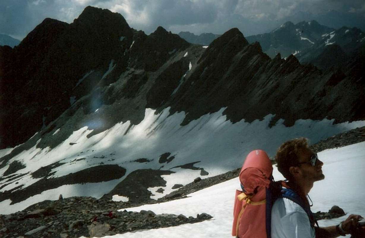
From Col de Saulié easily continue Eastward through the Ridge West-northwest; crossed a first small bumps (I °+ on the edge of the ridge) and continue on thread with rocks always very broken with debris, overcoming in progression through a continuous up and down a good dozen tiny spires. Climb on the wire with the possibility of circumvention to the South over the rocky features slabs who dive in this direction with an angle of about 50°, overlying a steep grassy slopes that are directed towards the Comba Merdeux, until reaching a square tower rocky immediately before the Summit. The path, if carried on the wire of the crest, can offer passages from the I° to the III°-, but the rock is very jagged with very broken rocks and requires special attention (from F+ to PD+, depending on the route choice; 0h'30/0h'45). Wishing to continue the traverse to the East, down through an easy inclined plate that leads to a second narrow saddle which leads to the base of the slender, especially when viewed from North or Grand St. Bernard Valley.
Aiguillon de Saulié
This is climbed beyond four consecutive rocky steps that lead directly on aerial Summit (I°+/II°-/II°+); the descent takes place by means of the opposite side or Eastern and staying always on the edge of the ridge through a reddish plaque, not difficult (I°+), it leads to a net carving, before a small rounded hump. Continuing the journey you climb another two elevations secondary, they also separated by a small notch, to the next reaching a closer brèche. From this you can go directly into the Thoules Vallon by a steep, winding gully that leads to the basal moraine, typically with residual snowfields, whence there is a link to the same route at the Torrent de Thoula in altitude of 2.620 meters about (PD-/PD; 1h'30/2h'00 from Col du Saulié; 1h'00/1h'15 by Aiguille de Saulié to the more Eastern Brèche; from 4h'00/6h'00 according to the various approaches). *** Important note: by the above Brêche is not convenient continue on the ridge to the mightiest Quote 2.916 meters and subsequent, because not are more chances to fall easily into Comba Thoula; in that case you will then go down to the South to that du Merdeux with large logistical problems if it is started from the SS.27.
Dal Col de Saulié continuare facilmente verso Oriente tramite la Cresta Ovest-nordovest; oltrepassata una prima piccola asperità (I°+ sul filo di cresta) continuare su rocce molto rotte con detriti, superando in progressione tramite un continuo saliscendi una buona dozzina di minuscole gugliette. Continuare sul tagliente con possibilità di aggiramenti verso Mezzogiorno sopra le caratteristiche banconate rocciose che s'immergono in questa direzione con inclinazione attorno ai 50°, soprastanti a ripidi pendii erbosi che si indirizzano verso la Comba del Merdeux, fino a raggiungere una squadrata torretta rocciosa subito prima della Vetta. Il percorso, se effettuato sul filo ci cresta, può offrire dei passaggi dal I° al III°-, ma la roccia é molto frastagliata e richiede un'attenzione particolare (da F+ a PD+, a seconda del percorso scelto; 0h'30/0h'45). Volendo proseguire nella traversata ad Est, scendere tramite una facile placca inclinata conducente ad una seconda e più stretta sella alla base dello slanciato, soprattutto se osservato da Nord o dal San Bernardo.
Aiguillon de Saulié
Questo viene salito superando quattro gradoni rocciosi consecutivi che portano direttamente sull'aerea Sommità (I°+/II°-/II°+); la discesa avviene per mezzo del versante opposto e reastando sempre sul filo di cresta tramite una placca rossastra, non difficile (I°+), si perviene ad un netto intaglio, prima d'una piccola gobba arrotondata. Continuando la traversata si scavalcano altre due elevazioni secondarie con intaglietto, arrivando alla successiva e più stretta brèche. Da questa si può scendere direttamente nel Vallone di Thoule per mezzo d'un canalino ripido e sinuoso conducente alla morena basale, in genere con nevati resisui, donde ci si ricollega alla via di salita presso il Torrent de Thoule a quota 2.620 metri circa (PD-/PD; 1h'30/2h'00 dal Col du Saulié; 1h'00/1h'15 dall'Aiguille de Saulié alla brèche; 4h'00/6h'00 a seconda degli avvicinamenti). *** Nota importante: dalla Bréche suddetta non conviene proseguire sulla cresta verso la più possente Quota 2.916 metri e successive, poiché non esistono più possibilità di rientrare agevolmente verso la Comba Thoula; in questo caso si dovrà poi scendere a Sud verso quella du Merdeux, con grandi problemi logistici se si é partiti dalla SS.27.
Difficulties & Equipment
DIFFICULTIES From F to F+ for the Route up to the Aiguille de Saulié. From PD- to PD for the Route towards the Aiguillon traverse.
Da F a F+ per la Via fino all'Aiguille de Saulié. Da PD- a PD per la Via fino alla traversata dell'Aiguillon.
EQUIPMENT For Mountaineering, but surely better if with rope.
Da Alpinismo, ma certamente meglio se con corda.
Campings
Remember that free camping is forbidden (except for emergency reasons, above 2.500m, from darkness until dawn).
Mountain Condition
Meteo: you can find all the needed informations at the official site of the Valle d'Aosta Region:
"Guida dei Monti d'Italia-Alpi Pennine" (Vol. I°) di Gino Buscaini-Club Alpino Italiano/Turing Club Italiano, Luglio 1971 (in Italian).
"Diari Alpinistici" di Osvaldo Cardellina e Indice Generale accompagnato da Schedario Relazioni Ascensioni 1964-2019 (inediti).
"80 itinerari di Escursionismo Alpinismo e Sci Alpinismo in Valle d'Aosta", di Osvaldo Cardellina, Ed. Musumeci, Giugno 1977 (in Italian); seconda Ed. Luglio 1981; terza Ed. Luglio 1984; (in French), prima Ed. Febbraio 1978; seconda Ed. Marzo 1980.
Kompass "Massiccio del Monte Bianco Valle d'Aosta Sentieri e Rifugi" Carta turistica 1:50.000.
I.G.C. Istituto Geografico Centrale Torino "Massiccio del Monte Bianco" (carta n°4), Torino, 1998 1:50.000.
I.G.C. Istituto Geografico Centrale Torino "Monte Bianco-Courmayeur-Chamonix M.B.-La Thuile" (carta n° 107), Torino 1989 1:25.000.
I.G.M. Istituto Geografico Militare "Gr. Rochère" 1:25.000.
Parents refers to a larger category under which an object falls. For example, theAconcagua mountain page has the 'Aconcagua Group' and the 'Seven Summits' asparents and is a parent itself to many routes, photos, and Trip Reports.


 6180 Hits
 85.36% Score
 20 Votes