Overview
Geographical Classification : Eastern Alps > Dolomites > Cima Bocche Group > Cima Bocche
 Cima Bocche and Gronton as seen from Col d'Orso
Cima Bocche is the highest summit of the little group, which is located between the San Pellegrino and Travignolo Valley to the south of the Dolomites. It is a easy but panoramic destination as it offers views towards all the surrounding Dolomite Groups as well as the Lagorai Chain to its south. It has long been disputed to which greater range the little group belongs and depending on whom you ask or into which guidebook you look you will get different answers. I decided to put up a combined mountain <-> group page and will elaborate on the reasons in the following section.
Let's concentrate on the mountain itself at first: Cima Bocche - like its direct neighbours
Cima Iuribrutto and
Gronton is composed of red porphyritic blocks. The north face is a massive, near vertical 400m drop, while the south face could be described as a sloping plateau (Lastè di Bocche). Porphyry blocks are abundant everywhere, even in the north face - and a glimpse at some of the pictures will surely tell you that climbing the north face surely is no option. Thus regular ascent routes lead across Lastè di Bocche to its south or the ridges of the neighbouring peaks.
Passo di San Pellegrino and Passo Valles were strategically important positions during World war I and Cima Bocche (again like Iuribrutto and Gronton) has an old fort at its summit. You can still see the trenches and part of the western ascent route leads along old support paths dating back 90 years. Cima Bocche commands views of both passes and a good stretch of the upper San Pellegrino Valley which explains the importance of the mountain during the war. This was the Italian frontline while the Austrian one lay across San Pellegrino Valley on the Monzoni Ridge.
Cima Bocche is contained in the Parco Naturale Paneveggio - Pale di San Martino and is actually its northernmost point. The park bends northward through the central Cima Bocche Group while the eastern and western parts are excluded. The contrast between these parts couldn't be starker. Beautiful tranquil pastures in the center contrast with heavily developed downhill ski slopes. The cable cars ensure that the central summits see their share of traffic but the ascent routes are too long and thus scare off the picnic crowds. Be sure to start early to have the summit to yourself.
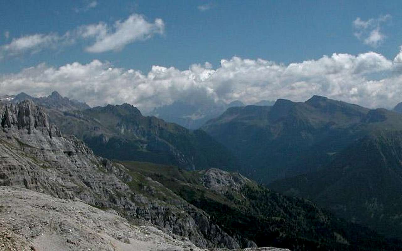
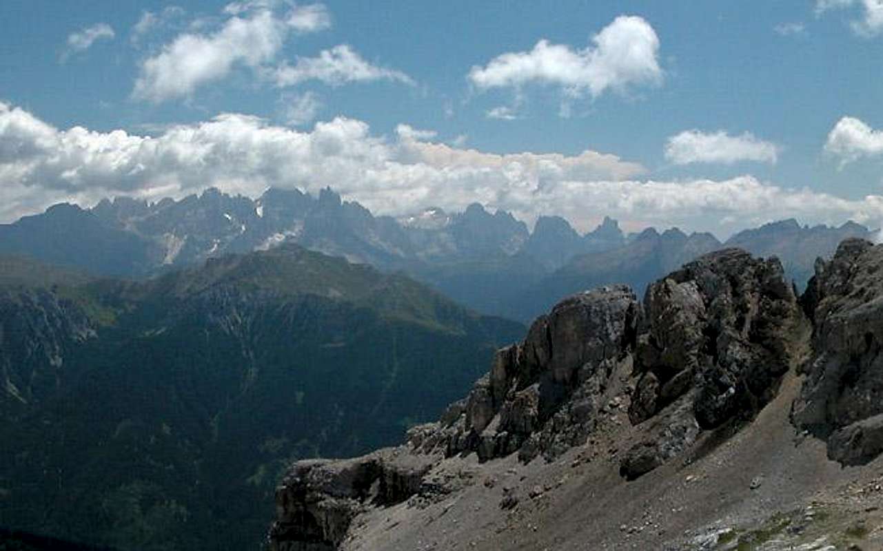
The Cima Bocche Group
Overview of the Cima Bocche Group with the Pale di San Martino Group in the background Hide / Show annotations (upcoming)
The "Big Bocche" Controversy (or confusion)
Though located to the south of the Dolomites between the
Latemar,
Pale di San Martino and
Marmolada Groups the mountains of the Cima Bocche Group are completely different in geologic terms and rather resemble Lagorai to the south. Guidebooks don't help either - you find the same discrepancies.
It gets even worse if you try to counter geology versus geography - in the Europe forum we had
a discussion about this and got nowhere near a real solution. We actually full circled back to a first suggestion that Vid had done - consider the group a subgroup of the Pale di San Martino and part of the Dolomites.
Therefore I decided to put up the Group together with its highest summit, Cima Bocche. We can attach the summits in the group to any of the surrounding groups and I will start with Pale di San Martino (though this is the most absurd attachment in my eyes).
The Bocche Group
 Handdrawn Map of the Cima Bocche Group
As said in the overview section the Bocche group is located between the San Pellegrino Valley in the north and the Travignolo Valley in the south, while being bounded by Val di Fiemme in the west and the confluence of the San Pellegrino and Valles Valleys in the east. The western summits of the group are composed of limestone while the bulk of the group is made of porphyritic blocks. All summits reach only moderate heights but are excellent lookout peaks.
There are two ferrate in the Group, the "Alta Via di Viezzena" in the west and the "
Sentiero Attrezzato del Gronton" in the north. In the vicinity of the ski lifts and cable cars you find a number of rifugios most of which are open only in winter during the ski season.
In the following listing the summits are listed west to east.
- Monte Mulat (2159m)
- Costa di Viezzena (2027m)
- Viezzena (2490m)
- Le Pezze (2374m)
- Col de Pozza (2280m)
- Sas da Mezodi (2301m)
- Piavac (2272m)
- Cima di Lastè (2410m)
- Cima di Luija (2490m)
- Camel (2227m)
- Pamperg (2224m)
- Gronton (2622m)
See the Gronton Page for more information.
- Cima Bocche (2745m)
- Col de le Palùe (2266m)
- Col d’Orso (2250m)
- Cima Iuribrutto (2697m)
See the Cima Iuribrutto Page for more information.
- Col Margarita (2550m)
- Monte Pradazzo (2279m)
Getting There
 Cima Iuribrutto, Cima Bocche and Gronton as seen from the Monzoni Ridge
The best access to the group can be had by the cable cars to the west and east of the group. Northern starting points are Moena in Val di Fassa or Passo di San Pellegrino. To the south Predazzo, Bellamonte and Passo Valles are the best trailheads.
From the North (Brenner / Brennero)
Follow motorway A22 down to Cornedo (north of Bozen / Bolzano). There turn east on SS241 (Dolomite Highway) across Karerpass / Passo Carezza to Vigo di Fassa. At Vigo turn southward on SS48 which leads you to Moena. In the centre of the town SP346 turns off eastward in direction of Passo San Pellegrino. The Lusia cable car is located 5km outside of Moena, the Col Margherita cable car can be found 1km east of Passo San Pellegrino. From both cable car stations you can also hike to your destination (Passo San Pellegrino is the better trailhead though).
For the southern trailheads follow SS48 further south to Predazzo. Here turn onto SS50 east which you need to leave east of Lago di Paneveggio on SP81 north. You can find all three southern trailheads on these two roads.
From Verona
Take A22 north until the exit Ora / Auer. There turn east on SS48 direction Val die Fiemme which in the end will take you to Predazzo and Moena. For the remainder follow the instructions above.
Red Tape
Gronton and the centre of the Cima Bocche Group are located within the park boundaries of the Parco Naturale Paneveggio - Pale di San Martino.
The Natural Park consists of the area of the Pale di San Martino Group as well as the forest of Paneveggio and the porphyritic chain of Lagorai. It contains an area of 125 sqare km which in 1987 has been divided in three different levels of protection:
33% of the area have been declared complete protected areas,
60% are restriced areas while
7% are controlled area.
For more information you can look at the
Park's official website.
There are no fees or limitations for hiking and climbing, however you might have to be prepared for small parking fees within Moena. The cable car parking lots and the big lot at Passo San Pellegrino are free.
When To Climb
Cima Bocche and all of the summits of the group can be climbed all year round. As stated above, the eastern and western ends of the group have developed downhill ski courses. The area in between with its sloped plateaus is ideal for easy backcountry skiing. Cima Bocche and Cima Iuribrutto are popular ski tour destinations, mostly climbed from the Travignolo Valley to the south.
The summer season runs from late May / early June through end of September. The cable cars open in mid June and close in mid September.
Accommodation
Camping
There are two campgrounds in the vicinity of the Cima Bocche Group, one to the south at Bellamonte, the other at Falcade to the east of the group:
Camping Bellamonte
via Cece, 16
38030 Bellamonte di Predazzo (TN)
Tel.: +39 0462 576119
E-mail: info@campingbellamonte.it
Campeggio Eden
Loc. Molino - Via Pecol 2
32020 FALCADE BL
Tel.: +39 0437 599138
Fax: +39 0437 599138
E-mail: edenk@tin.it
Hotel Rooms and Apartments
The best information on boarding houses and hotels can be found on
www.dolomiti.it. The site is not complete – you might find more information on local tourist web sites, but it already offers an impressive list. The following listing gives you an overview for the surrounding villages and towns:
Val di Fassa
Agordino
Weather Conditions
Weather and avalanche conditions in Trentino (west of Passi San Pellegrino / Valles):
www.meteotrentino.it
Weather conditions in Belluno (east of Passi San Pellegrino / Valles):
www.meteoalpin.com. For the english text you have to scroll down the right frame.
Weather conditions Dolomites:
www.dolomitimeteo.com
Maps & Books
Maps
The Cima Bocche Group is located at the intersection of just about all sets of maps I know. The mapping companies rather concentrate on the surrounding Dolomites than on the small Bocche Group. Therefore I have to offer you a huge amount of maps.
- Pale di San Martino
1:50000
Kompass Map WK76
Kompass Verlag
ISBN: 3-85491-086-x
The best overview as it contains the whole group.
- Pale di San Martino
1:25000
Tabacco Map 022
Editione Tabacco
Contains the western part of the Bocche Group starting from Passo Lusia.
- Tabacco Maps 006, 014, 029 also contain parts of the Bocche Group
Books
In contrast to the maps there are several books which deal with the Bocche Group:
- Hiking
- Dolomiten 4 (Fassatal, Marmolada, Rosengarten)
F. Hauleitner
Rother Verlag
ISBN: 3-7633-4061-0
- Dolomiten
F. Köck
Kompass Verlag
ISBN: 3-87051-409-4
- Ferrate
- Hülslers Klettersteigführer Dolomiten
E. E. Hülsler
Bruckmann Verlag
ISBN: 3-7654-4161-9

 14748 Hits
 88.19% Score
 26 Votes
 Cima Bocche and Gronton as seen from Col d'Orso


 Handdrawn Map of the Cima Bocche Group


 Cima Iuribrutto, Cima Bocche and Gronton as seen from the Monzoni Ridge


