


-
 4628 Hits
-
 83.69% Score
-
 17 Votes
|
|
Mountain/Rock |
|---|---|
|
|
45.87740°N / 7.66325°E |
|
|
Hiking, Mountaineering |
|
|
Spring, Summer, Fall |
|
|
9688 ft / 2953 m |
|
|
Note
La montagna chiama i suoi figli, ed essi rispondono fedelmente al suo appello… Osvaldo Cardellina, Diario alpinistico, 1964-65 Page texts: @ OsvaldoCardellina "Osva", passed away on May 2, 2022. Page owners: Christian Cardellina e Osvaldo Cardellina. Any updates from September 12, 2022: Antonio Giani, page administrator, friend and climbing companion. Testi della pagina: @ OsvaldoCardellina "Osva", scomparso il 2 maggio 2022. Proprietari pagina: Christian Cardellina e Osvaldo Cardellina. Eventuali aggiornamenti dal 12 settembre 2022: Antonio Giani, amministratore della pagina, amico e compagno di salite. |
Marmore Overview Aran

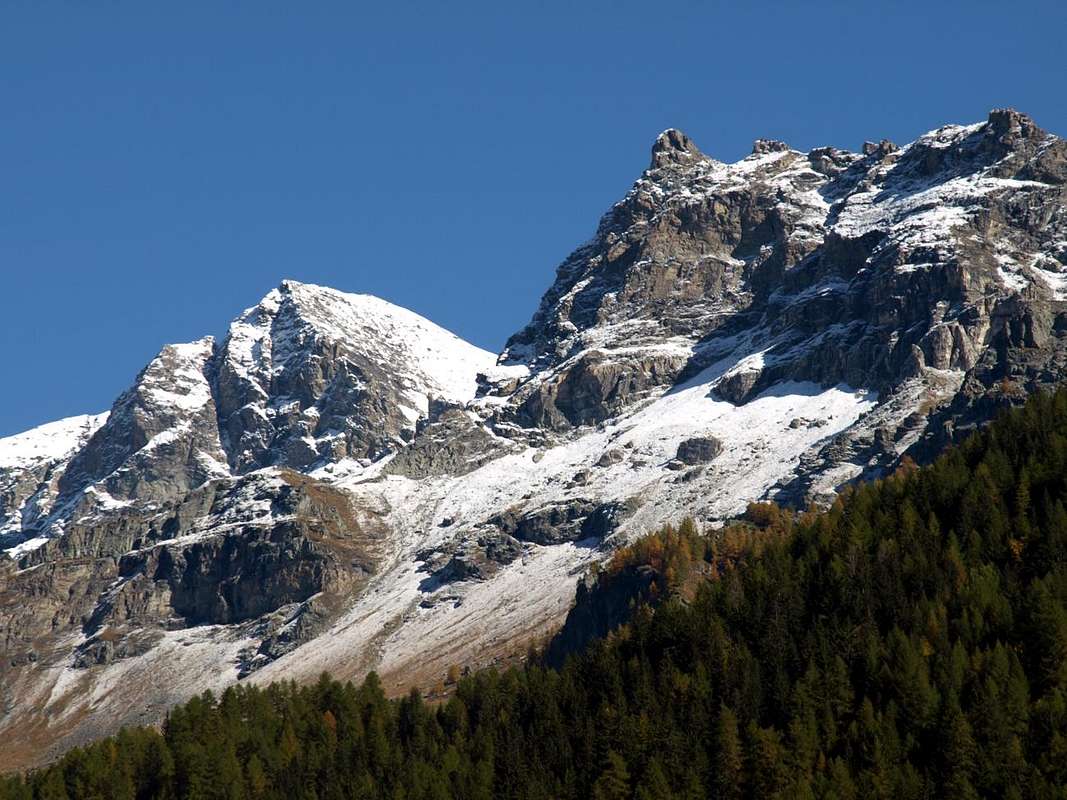
This massive Summit is situated almost at the end of the long watershed that, coming from Mont Roisetta (3.332m). Descend towards the Southwest detaching from the same that continues to the Grand Tournalin (3.379m) between the Valley of the Torrent Marmore or Valtournanche and the Valley of Ayas. After a series of altitudes known as the "Cigars of Bobba" or Dents of Aran (2.939m, 2.928m, 2.947m, 2.959m, 2.951m, 2.953m) precedes a fairly wide saddle (2.922m) before reaching Becca d'Aran (2.952/3m). The same small buttress ends with the Mont de Molar (2.502m) just above the Village of Cheneil (2.097m), located between the Municipalities of Valtournanche (to the Northeast) and Chamois (towards the Southwest). Located on the Southwest / Northeast axis has two diametrically opposite sides with the simple Southeast Side formed from easy grassy slopes, while on the opposite or Western down a steep rock wall high up to 270 meters and on which were traced between 1931 and 1983 somewhat difficult climbing routes. The Normal Route, which dates from the Cheneil on Vallon above the village of the same name, does not present any difficulty and is suitable for any Hiker, but in winter presents its unknowns as very exposed to avalanches. Especially in the lower middle part, for which it requires prudence and fair assessment of the state of the snow.
![]()
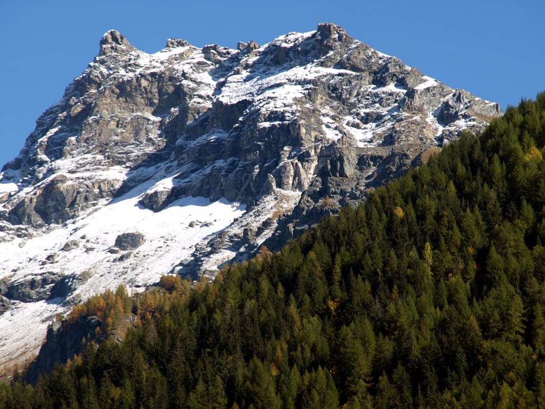
Becca d'Aran from Southwest nearby Cheneil Village
![]()
Generalmente é raggiunta a scopo panoramico offrendo belle vedute sulla parte Settentrionale della Valtournanche e bei colpi di occhio verso il Grand Tournalin. Il tutto in un'area che é posta ai piedi del celebre Cervino, dove, iniziando dai Colli di Cime Bianche e dalla Grande Sometta (3.166 m), lo spartiacque tra le Valli del Torrente Marmore e di quello di Ayas si distende verso Mezzogiorno raggiungendo il Mont Roisetta ed i due Tournalins per concludere con Becca Trecare (3.033 m), Grand Dent (2.832 m), Mont Tantané e Zerbion (2.720 m) sulla Valle Centrale della Dora. Un'area che certamente non può competere con Sua Maestà ma che ha presentato una serie nobile di famosi nomi dell'Alpinismo. Da Jean Antoine Carrel ad Eward Whymper (al Grand Tournalin nel 1863), ad Ugo De Amicis, Guido Rey, Amato ed Angelo Maquignaz (sempre al Tournalin nel 1904), all'Abate Ame o Aimé Gorret nel 1850 ed all'invernale di Giuseppe Corona accompagnato da Jean Antoine e Jean Joseph Maquignaz nel 1873, a Denise Haarscher con Luigi Carrel il "Carrellino" nel 1925 al Petit Tournalin, a Giovanni Bobba e Casimire Thérisod al Mont Roisetta ed ai Dents d'Aran nel 1901 fino all'imprese sulla Becca d'Aran dal 1931 (Vedi in "First Ascents" con dettagliato elenco). Quindi una visita panoramica ma pur istruttiva per comprender la Storia del territorio ...
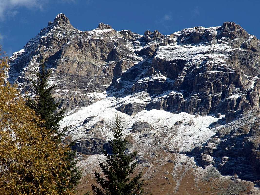
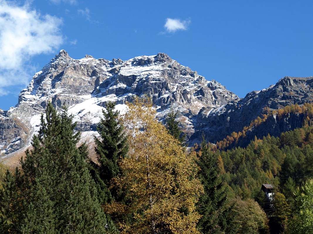
Becca d'Aran (2.952/3m) from Southwest, South and Southeast, by mar.ali 2005, Corvus 2008, buxlex 2006 & Osw 2015
![]()
Becca d'Aran (2.952/3m) from Southwest, by Osw 2015
Questa massiccia Cima é situata quasi al termine del lungo spartiacque che, provenendo dal Mont Roisetta (3.332 m). Scende verso Sudovest distaccandosi dallo stesso che prosegue verso il Grand Tournalin (3.379 m) tra la Valle del Torrent Marmore o Valtournanche e la Valle di Ayas Dopo il Mont Roisetta una serie di altitudini chiamate "Sigari di Bobba" o Dents di Aran (2.939 m, 2.928 m, 2.947 m, 2.959 m, 2.951 m, 2.953 m) precede una abbastanza larga sella (2.922 m) prima di raggiungere la Becca d’Aran (2.952/3 m). Lo stesso contrafforte concludesi con il Mont de Molar (2.502 m) appena al di sopra del Villaggio di Cheneil (2.097 m), posto tra i Comuni di Valtournanche (a Nordest) e Chamois (a Sudovest). Posizionata sull'asse Sudovest/nordest presenta due versanti diametralmente opposti con quello Sudest facile e formato da facili pendii erbosi, mentre sull'opposto od Occidentale scende una ripida parete rocciosa alta fino a 27 metri e sulla quale sono state tracciate tra il 1931 ed il 1983 vie di roccia alquanto difficili. La Via Normale, risalente nel Vallone di Cheneil al di sopra dell'omonimo villaggio, non presenta difficoltà alcuna ed é adatta per qualsiasi Escursionista, ma nel periodo invernale presenta le sue incognite poiché alquanto esposta alle valanghe. Soprattutto nella parte medio-bassa, per la quale cosa richiede prudenza e giusta valutazione della neve.
Is typically achieved pano-purpose offering beautiful views over the Northern part of Valtournanche Valley and beautiful glances towards the Grand Tournalin. All in an area that is at the foot of the famous Matterhorn, where, starting from the Hills of Cime Bianche and the Grande Sometta (3.166m), the watershed between the Valleys of the Torrent Marmore and one of Ayas stretches toward the South reaching Mont Roisetta and the two Tournalins concluding with Becca Trecare (3.033m), Grand Dent (2.832m), Mont Tantané and Zerbion (2.720m) on the Central Valley of Baltea. An area that certainly is no match for His Majesty but who presented a noble series of famous names of Mountaineering. By Jean Antoine Carrel Eward Whymper (the Grand Tournalin in 1863), Ugo De Amicis, Guido Rey, Amato, Angelo Maquignaz (always Tournalin in 1904), the Abbot Ame or Aimé Gorret in 1850 and the first winter ascent of Giuseppe Corona accompanied by Jean Antoine and Jean Joseph Maquignaz in 1873, Denise Haarscher with Luigi Carrel or said "Carrellino" in 1925 at Petit Tournalin, Giovanni Bobba Casimire Thérisod to Mont Roisetta and on Aran's Dents in 1901 up to the exploits on Becca d'Aran starting since 1931 (See in "First Ascents" detailed list). Then a sightseeing tour but also instructive to understand the local History ...
 |
 |
 |
First Ascents
- First known on the Summit: unknown.
- First in Winter: unknown.
- East-southeast Slope (Normal Route): unknown.
- West Wall (Via Pellissier): Cesare Taddei with Valtournanche Guide Camillo "Cammillotto" Pellissier; November 04th, 1942.
- West Wall (Via Picchiotti: Giuseppe Picchiotti with Valtournanche Guides Marcello Lombard and Camillo Pellissier; September 15th, 1961.
- West Wall (Via Anita): Anita Cignolini and Cesare Taddei with Valtournanche Guide Camillo Pellissier; August, 1952.
- West Wall (Via Balestreri): Umberto Balestreri and Erminio Piantanida; August 18th, 1931.
- Northwest Edge (Via Deanoz): Egidio Grange and Giuseppe "Pino" Deanoz; August, 1983).
- Northwest Wall (Via Carrel): italio Muzio and Pier Luigi Ferrero with Valtournanche Guide Luigi Carrel; August 25th, 1940).
- North Crest (Via Muzio): Italo Muzio with Valtournanche Guides Luigi Carrel and Marcello Carrel; March 08th, 1953).
 |
 |
 |
 |
 |
Getting There
BY CAR:
- From TORINO, MILANO, etc: Motorway A5. Exit at IVREA or Quincinetto (PIEDMONT) also Pont Saint Martin, Châtillon Municipalities. From Piedmont or by Courmayeur/Aosta City towards Châtillon From Ivrea Town: before in West (Southern side) to Pont Saint Martin, Verrès, Saint Vincent and Châtillon Municipalities, after in North until Valtournanche.
- From Courmayeur Resort: in East-southeast towards Pont Saint Martin, Verrès, Saint Vincent and Châtillon Municipalities, after in North until Valtournanche in locality Losanche; from this last towards Cheneil Hamlet.
- From Aosta City: before in West towards Châtillon, after towards Antey and Valtournanche (locality Losanche) Commons; from this last towards Cheneil. It is not necessary to take Motorway A5: you can drive on SS.26, in the direction of AOSTA - IVREA - TURIN.
- From FRANCE: through the Mont Blanc Tunnel to Entrèves/Courmayeur. By Little Saint Bernard Pass, closed since November until half May to La Thuile Valley - Pré Saint Didier - Morgex – Aymavilles, Aosta, Châtillon and Valtournanche Municipalities. It is not necessary to take Motorway A5: you can drive on SS.26, in the direction of AOSTA - IVREA – TURIN.
BY PLANE: Aeroporto "Corrado Gex" Saint Christophe (Aosta).
Approach & Route
From Cheneil Hamlet (2.097m: parking), reached by the Regional Road from Valtournenche in locality of Losenche, move towards the Northeast on the namesake Comba and following, by means of the trail n° 26, the Torrent of Cheneil reaching the very old Pasture of Aran (2.325m). Continuing in the same direction and passing below the Western Faces of Petit and Grand Tournalin (3.207m, 3.379m), and leaving on the left (West) gradually deviations with little pathways unnumbered to the Mont de Molar (2.502m) and Ledzan Alps Dèsott and Damon (2.585m, 2.688m), you reach the first crossroad 2.675 meters and then turn decisively towards the West. Left just left the Alpe de Ledzan Damon and on the right the spring 2.732 meters, continue on alternate traces a small path unnumbered and not reported that, beyond the small rocky-grassy promontory 2.782 meters, easily leading to the Summit straight pseudo ridge. On this there are three small Summit on the highest of which is positioned a high Cross (E/F; 2h'45/3h'15).
Da Cheneil (2.097 m: parcheggio), raggiungibile con la Strada Regionale da Valtournenche-Losanche, indirizzarsi verso Nordest lungo l’omonima Comba e seguendo, per mezzo del sentiero n° 26, il Torrent de Cheneil raggiungendo l’Alpeggio di Aran (2.325 m). Continuando nella stessa direzione e passando al di sotto di Petit e Grand Tournalin (3.207 m, 3.379 m), nonché lasciando sulla sinistra (Ovest) progressivamente le deviazioni con sentierini non numerati verso il Mont de Molar (2.502 m) e le Alpi di Ledzan Dèsott e Damon (2.585 m, 2.688 m), si raggiunge dapprima il bivio 2.675 metri per poi svoltare decisamente verso Occidente. Lasciata appena sulla sinistra l’Alpe de Ledzan Damon e sulla destra la sorgente 2.732 metri, si prosegue su tracce alternate ad un sentierino non numerato e neppur segnalato che, oltrepassato il piccolo promontorio roccioso 2.782 metri, conducono facilmente alla cresta sommitale pseudo rettilinea. Su questa sorgono tre piccole Sommità sulla più alta delle quali è posizionata un’alta Croce (E/F; 2h’45/3h’15).
Difficulty & Equipment
This route can be considered E/F or EE/F+ (Experts Hikers); in winter BSA (Good Skiers-Mountaineers, even by snowshoes or Ski).
L'itinerario è da classificare in E/F oppure EE/F+ (Escursionisti Esperti); in inverno BSA (Buoni Sciatori-Alpinisti, anche tramite Racchette da neve od in Scialpinismo).
![]()
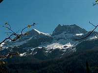
Becca d'Aran (2.952/3m) from Southwest, by Osw 2015
Hiking gear, in winter as for Ski-Mountaineering or with Snowshoes.
Da Escursionismo, in inverno da Scialpinismo o con Racchette da neve.
Mountain Conditions
- You can get meteo information at the official site of the Regione Valle d'Aosta:
- Valle d'Aosta Meteo
Books and Maps
- "Guida dei Monti d'Italia - Alpi Pennine" (Vol. 2) di Gino Buscaini - Club Alpino Italiano/Turing Club Italiano, Luglio 1970 (In Italian).
- "Diari Alpinistici" di Osvaldo Cardellina e Indice Generale accompagnato da Schedario Relazioni Ascensioni 1964-2019 (unpublished).
 |
 |
- Kompass "Breuil/Cervinia-Zermatt" Carta turistica, 1:50.000.
- I.G.C. Istituto Geografico Centrale "La Valpelline", (carta n° 115) Map1:30.000.
- Hapax "Les Sentiers" Luglio 2000, 1:25.000.
![Maen small Church just below Valtournenche 2015]()
![Le Cervin]()
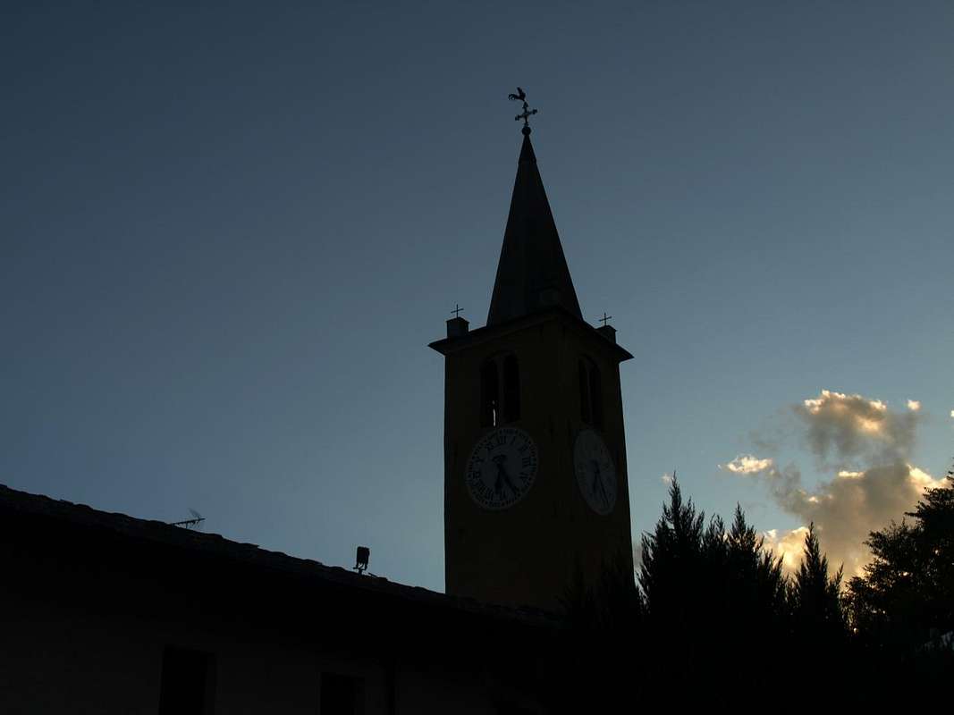
![Dark Profiles Valtournanche 1412 & 1855 Church 2015]()
Important Information
- REGIONE AUTONOMA VALLE D'AOSTA the official site.
- FONDAZIONE MONTAGNA SICURA Villa Cameron, località Villard de la Palud n° 1 Courmayeur (AO) Tel: 39 0165 897602 - Fax: 39 0165 897647.
- A.I.NE.VA. (Associazione Interregionale Neve e Valanghe).
Useful numbers
- Protezione Civile Valdostana località Aeroporto n° 7/A Saint Christophe (Ao) Tel. 0165-238222.
- Bollettino Valanghe Tel. 0165-776300.
- Bollettino Meteo Tel. 0165-44113.
- Unità Operativa di Soccorso Sanitario Tel. 118.