
-
 8936 Hits
-
 79.78% Score
-
 11 Votes
|
|
Mountain/Rock |
|---|---|
|
|
33.56138°N / 115.34479°W |
|
|
Download GPX » View Route on Map |
|
|
Riverside |
|
|
Hiking |
|
|
Winter |
|
|
4504 ft / 1373 m |
|
|
Overview
The Chuckwallas
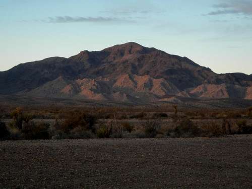
Black Butte South Face
Black Butte is a California P2k (has over 2000 feet of prominence) as well as a wilderness highpoint. The Chuckwalla Mountains Wilderness was created in 1994 as part of the Desert Protection Act and encompasses an area of nearly 100,000 acres. Perhaps most compelling, Black Butte is included on the Sierra Club’s Desert Peak Section List. If not for that fact, the peak would seldom be visited at all.
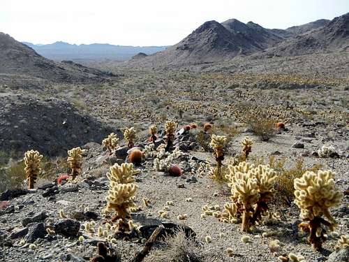
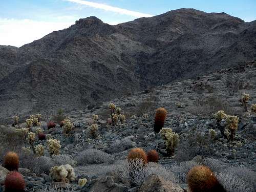
Plentiful Cholla
The north side of this range was once home to at least one Native American tribe. There are multiple village sites as well as numerous petroglyphs at Corn Springs and over near Desert Center. If you are coming to climb the peak, you will not see any petroglyphs because Black Butte is located on the southern side of the range which was not likely inhabited.
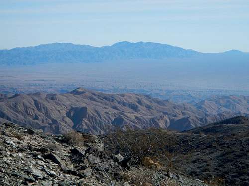
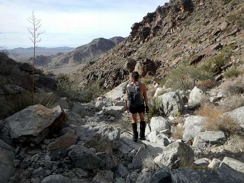
Overlooking The Approach Canyon
The Chuckwalla Mountains are near the Triple Divide where three deserts join, the Colorado, the Sonoran, and the Mojave. In fact, just 3 miles south of the peak is the exact Triple Divide point.
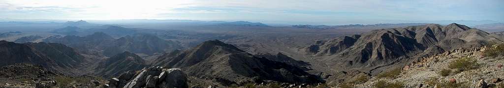
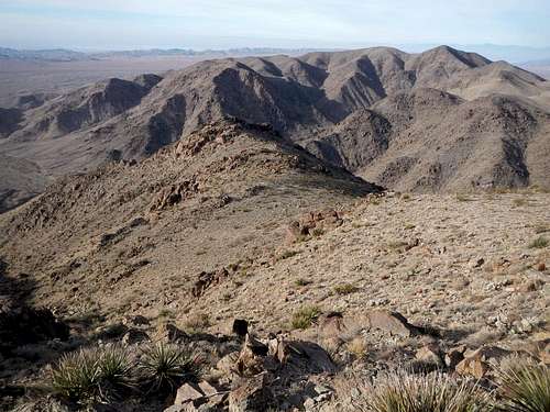
Summit Panorama South
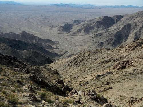
In general the south side of the range is extremely arid and scarcely supports any flora aside from cactus, ocotillo, and creosote. Most of the ground here is bare rock. Animal species that frequent the area include the desert tortoise, chuckwallas (a large lizard), sidewinders, bighorn sheep, coyotes, kangaroo rats, and raptors.
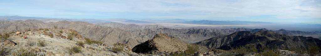
Summit Panorama North
Just 15 miles to the southeast, at the end of the range, is Chuckwalla Mountain. Chuckwalla Mountain is also on the DPS list and makes use of the same Bradshaw Trail access road. Since both peaks are short easy hikes, most peakbaggers visiting the area opt to climb them in the same day. Just make sure you get an early start.
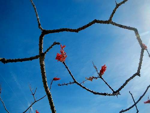
Ocotillo In Bloom
The valleys surrounding these ranges are very sandy. As of December 2016, the main access road was in good shape, however visiting this area in a normal car is not recommended. High clearance is suggested and 4-wheel or all-wheel drive is an absolute must! Always keep lots of extra water in your vehicle as well as emergency supplies when travelling in the desert. Never try to climb these peaks in the summer.
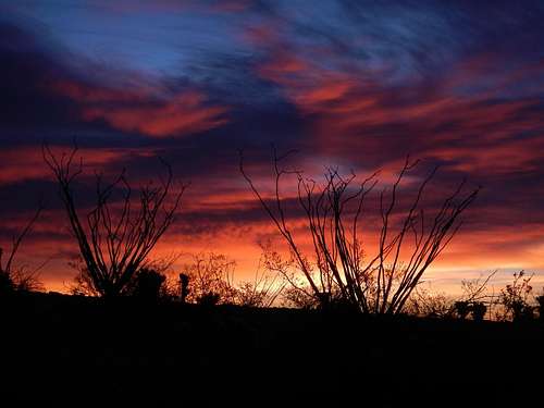
Ocotillo Sunrise
Finally, don’t be startled by the sound of explosions nearby and don’t venture south of the Bradshaw Trail access road that you drove in on. Everything down south is part of a military aerial bombing range.
Interactive Route Map
This GPX file can be downloaded in the link near the top of the page.Route Description
Southwest Canyon and West Shoulder
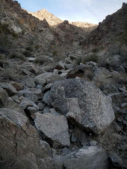
Boulders In the Southwest Canyon
There are a few short dryfalls to scramble up along the way. The dryfalls have work around options if you prefer that.
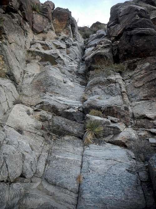
![Dryfall]()
Dryfall
Alternatively, you could hike to the pass at the northern end of the canyon and then follow the longer west ridge eastward to the summit.
![Top Of The Canyon]()
The West Shoulder and Southwest Canyon Below
If you can drive to near the base of the gully, the route is 4 miles round-trip with 1600 feet of gain, but if not its 8 round-trip. See the driving directions for more on this.
Dryfall
Alternatively, you could hike to the pass at the northern end of the canyon and then follow the longer west ridge eastward to the summit.
The West Shoulder and Southwest Canyon Below
If you can drive to near the base of the gully, the route is 4 miles round-trip with 1600 feet of gain, but if not its 8 round-trip. See the driving directions for more on this.
Descending
Driving Directions
Follow Interstate 10 either 9 miles east from Chirico summit or 9.5 miles west from Desert Center. Get off at exit 182 and go to the south side of the freeway. Proceed nearly 3 miles southeast on one of two roads, depending on which side of the freeway you exited on. These roads join together to form Red Cloud Mine Road.
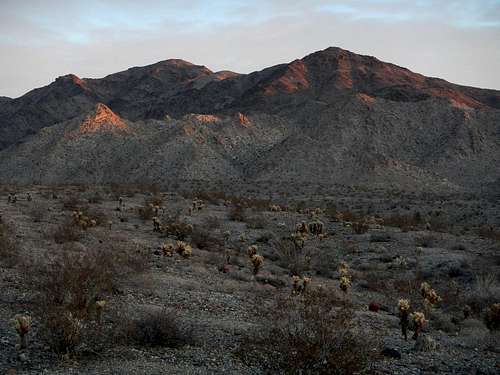
Chuckwalla Mountains
Continue southeast for nearly another 2 miles and watch for a junction on your right. Turn right (south) onto Gas Line Road and continue another 7.9 miles to an intersection. Turn left onto Bradshaw Trail Road and continue east by southeast for another 7 miles.
The final turn is not easy to spot, especially at night. It is located at (33.500277, -115.380132). Turn left (northeast) and continue on the dirt track for 2.5 miles to where the main track takes a sharp right and crosses a deep wash. This wash has regular washouts and may not be passable for your vehicle. Better park and take a look first. There is also good camping here (33.528273, -115.356761).
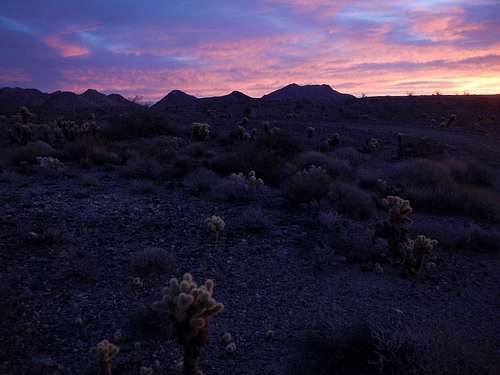
Twilight
Jeeps and the like can probably proceed another 2 miles into the broad canyon and near the base of the southwest gully.