
-
 8272 Hits
-
 83.69% Score
-
 17 Votes
|
|
Mountain/Rock |
|---|---|
|
|
39.78130°N / 105.892°W |
|
|
Clear Creek & Grand |
|
|
Hiking |
|
|
Spring, Summer, Fall, Winter |
|
|
12803 ft / 3902 m |
|
|
Overview
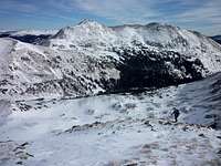
 Ascending the Basin toward Bobtail Benchark (left).
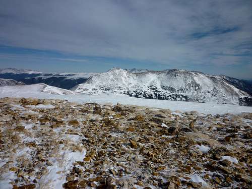
Less than one mile north of Jones Pass, along the Continental Divide, sits Bobtail Benchmark. Right on the edge of the Vasquez Peak Wilderness, this mountain is surrounded by plenty of wild country.
Surrounded by a maze of drainages including Vasquez Creek, West Fork Clear Creek, Jones Creek and McQueary Creek, Bobtail Benchmark is one of numerous peaks rising to 12,000 feet or higher in this vicinity, making for breath-taking, unimpeded views from the summit and the ridges leading to it. Vazquez Peak (12,947 ft.) rises nobly to the east-northeast of Bobtail Benchmark, in stark contrast the depressing, crumbling husk of the mined-out Red Mountain (12,315 ft. today, possibly lower tomorrow) across the valley.
Colorado Rank: 781st highest peak in Colorado
Prominence: 781 feet
Mountain Range: Front Range
USGS Quad: Byers Peak
Trails Illustrated Map: #103 (Winter Park/Central City/Rollins Pass)
*Rank and Prominence Reference: Lists of John
Getting There
Bobtail Benchmark rises along the Continental Divide on the border between Clear Creek County & Grand County. There are numerous points of access to this summit, but the one with the shortest approach and most convenient to the Front Range would be via US Hwy 40 out of Empire to Big Bend Picnic Area.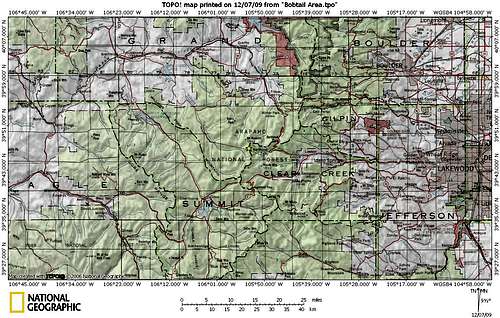 Click map image to enlarge
Red Tape
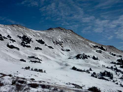
 Ascending Pt 12673, Vasquez background
 Bobtail Summit Cairn
The area southeast of Bobtail Benchmark, specifically Red Mountain, is heavily mined. Many forms of recreation are accommodated and parking is allowed along the West Fork of the Clear Creek, but please mind any signs restricting access to mining property or dangerous areas in the vicinity of the Henderson Mine.
There is no fee to park or access the area from the Henderson Mine operations vicinity (eastern approach).
Camping & Lodging
 Ridge guarding northeast edge of basin
 West from the summit
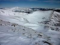 East across the basin
Backcountry and 4x4 camping
Depending on your approach to Bobtail Benchmark, there will be plenty of backcountry camping opportunities should you wish to backpack in. Be warned that the area around Jones Pass Road sees heavy motorized vehicle use year-round.
Winter Park Ski Area
The Winter Park Ski Area is less than 70 miles northwest of Denver, but some visitors may wish to make a vacation out of their stay to the area . Vistit the Winter Park Lodging page for detailed information about hotels, cabins and condos in the area. Winter Park is approximately 20 miles north/east from the Big Bend picnic area.
National Forest Service Camping
Mizpah Campground
Mizpah Campground is the nearest established National Forest Service camping area to Big Bend Picnic Area. It is a small campground with limited amenities.
Elevation: 9,200 ft.
Season: Late-May through early September
Number of Sites: 10
Fee: $11 per night
Amenities: Water spigot, vault toilet
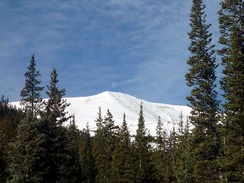
 Vasquez Peak from the ridge
Weather & Seasons
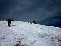 Last few steps up Pt 12673
 South along the summit ridge
Bobtail Benchmark is a year-round peak for those with the right knowledge & abilities.
In the Summer, hikers may visit the peak for the cool breezes of the Continental Divide above 12,000 feet, but be aware that many others may have the same idea, reducing the level of solitude to be enjoyed on this peak in the warmer months.
Fall through Spring will likely bring the strong, bitter cold winds that the Continental Divide peaks are infamous for. During snow season, be very wary of heavy cornices forming on the east side of the Continental Divide. Also be warned that following the path of Jones Pass Road can expose hikers to avalanche risk as they near the ridge. For this reason, the Winter Route which gains the Divide via Point 12,673 is recommend.
 Moonset from FS 144