
-
 6342 Hits
-
 83.1% Score
-
 16 Votes
|
|
Mountain/Rock |
|---|---|
|
|
46.43360°N / 9.25941°E |
|
|
Hiking, Skiing |
|
|
Spring, Summer, Fall, Winter |
|
|
9390 ft / 2862 m |
|
|
Overview
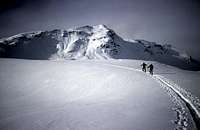
The Cima di Barna is the highest and central summit of the ridge between the Passo Baldiscio (N) and the Passo di Barna (S)Together with the nearest summits : Pizzo Baldiscio (N) and Monte Bardan (S) this summit becomes a good ski-mountaneering goal in the early winter, after the first abundant snowfalls.
The high (1600-1800m) difference in elevation, both starting from Campodolcino (the road to Starleggia is normally closed in winter) or from Isola, require anyway a good training.
The sweet (even too much) slopes of Pian dei Cavalli that give access to the channel (the only steep section) leading to the saddle left of Monte Bardan are absolutely safe with any condition of snow.
Getting There
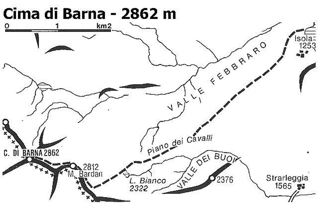
The starting point is Campodolcino where you can arrive starting from Milan (Italy) by car following the route 36 to Colico, Chiavenna, CampodolcinoHere follow the new road to Isola (left at the fork of the road) till you arrive to a Campingplace.
Once here you have 2 choices to access the Pian dei Cavalli :
cross the bridge on the left and follow to Starleggia (1565m) where you must park the car, if the road is open.
Now you have to gain the San Sisto plan (~ 1700m) that can be reached in 2 different ways :
- the longest, but sweeter, is following the road starting toward South that leads to Morone, at the S border of the plan
- the shortest, but steeper, is crossing the built up using a narrow path that leads directly to the houses of S.Sisto.
Cross straight toward N passing through the first houses to get the not steep slopes leading to Alpe Zocana - Pian dei Cavalli
don't cross the bridge and go on along the road on the right (Spluga pass)
after few km you arrive to the lake of Isola where you can park the car.
Follow the channel on the left (West) to access the road leading to the small villages on the west side of the valley. Fastly you arrive to a small bridge where, on the left, starts the muletrack (signs) to Alpe Zocana - Pian dei Cavalli.
Ski mountaneering - Hiking route
 |  | From Alpe Zocana (the lower limit of Pian dei Cavalli) follow at best toward west pointing to a well distinguished saddle to the right of a rocky spur. |
(In summer this site is full of horses and the Lago Bianco (White Lake) is a fine wild picnic area (keep it clean please) for families
 |  | Once arrived to the saddle you have to follow to the right, along a very wide ridge, leading to the main summit where normally the trip ends (I've never heard of ski-mountaneers that went on to Baldiscio) |
 |  | The downhill is along the same route, a long plan can require an heavy use of skipoles |
Map
Accomodations
In winter You can spend the night only in the small hotels in CampodolcinoIn summer you can find good accomodations is Starleggia or in San Sisto