Private property of a Carpathian team - no trespassing, no voting.&#; ăâîşţ&#;&#;&#;&#;&#;&#;&#;&#;&#;&#;&#;&#;
The table below lists the most attractive natural and cultural sites of the Bucegi Mountains that sit away from its summits.
Name
Photo
Status
Short description
Abruptul Prahovean Bucegi
Nature Reserve
The most extensive protected territory with an area of almost 3500 ha. Varied relief with an elevation ranging from 1300 to 2500 m: sheer cliffs, corries, jagged side ridges, rock spires, karst features, mountain glades and pristine woodland.
Sfinxul
Monument of Nature
This 8 m tall and 12 m wide, natural megalith resembling Egypt´s Great Sphinx of Giza is said to be thrown into sharp relief on November 21st. The first photo of this hotbed of old folk tales and modern mystery stories was probably taken in 1900.
Lacul Țigănești
This tiny tarn, still being slowly enlarged by nivation, sits at 2050 m.
Cheile Tatarului
Nature Reserve
A kilometer long canyon whose the most spectacular segment is Tatarul Mare. The reserve encompasses an area of 145 ha and boasts varying karst formations, alpine glades and numerous fossils in the limestone beds.
Legend has it that once Tatar invaders were so charmed by the beauty of the Bucegi Mountains that they changed their minds and stopped looting. They rushed back home in order to share that experience with their loved ones. What is more, they didn't notice that in the canyon they had lost all the treasures stolen from other peoples.
Peștera Ialomiței
In C18 the monks from Sinaia Monastery established a small hermitage at the entrance. The first historical record was made by I. Kleinlauf in 1793. The first description of the cave was completed in 1897 and the first research was conducted in 1953. Since 1967, the Ialomita Cave has been illuminated by electric lighting. Formed in limestone at 1560 m, the Ialomita Cave is more than one kilometer long, of which 400 m is accessible to the public without a guide. It is made up of active and fossil galleries arranged in two floors. The temperature varies between 5 to 6 °C and humidity ranges from 85 to 100%.
Mănăstirea Caraiman
Founded in 1998, in its center it has a unique fir tree with six branches. It is situated at the foot of a namesake peak adorned with a cross.
Cascada Urlatoarea
A 15 m tall waterfall.
Turbaria Laptici
Botanical Reserve
Covers an area of 15 ha with 1 m thick layers of turf. A relic from the Ice Age called Salix myrtiloides grows here at its European southern range boundary.
Babele
Monument of Nature
Mushroom shaped rock formations are a result of erosion and varying resistance of the local conglomerate. According to legend, Emperor Traian tried to entice a shepherd´s girlfriend with wealth. When the shepherd expressed his will to stay here forever, they turned into the rock..
Portița Caraimanului
Natural rocky window accessible via an unmarked path named Brâul Portiței.
Mănăstirea Ialomiței
Consecrated in 1996.
Cheile Zanoagei
Nature Reserve
Carved in Jurrasic limestones on a length of about 2 km, it boasts more than 200 m tall cliffy walls surrounded by pristine woodland.
Lacul Bolboci
Nicknamed the Sea of the Bucegi, it was constructed in 1928.
Arcada din Valea Gaura
An interesting rock arch to be found near the red stripe hiking trail.
Strymba
Стримба Horgas (HU) Strimba (ČS) Strymba (PL)
Strymba is the most prominent mountain of Mizhgiria district and highpoint of Synevyr National Park. It belongs in the Gorgany Mts. being part of Northeastern Carpathians
Snow-capped Strymba and Streminis massif
W face from Darvayka
Strymba is mighty and ragged twin-peaked summit relatively isolated (Isolation.....Prominence....). It dominates the landscapes of Kolochava and Nemecka Mokra villages. This pyramid-shaped massif formed of sandstone is about 3 km long and includes also Streminis peak (1652 m).There is remarkable contrast between steep SW face with scree and SE moderate grassy hillsides which boast tiny tarn (8 meters long, 4 meters wide, 1 meter deep. This reservoir sitting at 1600 m elevation never dries and presents suitable habitat for an endemic species of the Carpathian newt.
Tiny tarn in the saddle
Strymba-Streminis massif in spring
Wooden cross on the top
Top part of Strymba is covered by a mixture of dwarf pines, junipers, blockfields and mountain glades. It is adorned by a wooden cross erected in 2008 by a group of locals. Annually on 23.8. huge national flag of Ukraine is carried here by the Synevyr NP staff. During the interwar period Strymba used to be favourite destination for hikers. It is said to be one of the best vantage points in the Ukrainian Carpathians affording excellent views of both adjacent polonynas Pishkonya and Krasna and almost entire ranges in Transcarpathia.
The table below lists most of the major summits of the Borzhava.
Summit
Elevation in Meters
a.s.l.
Photo
A few words about
Stiy
1681
The highest summit and No.5 in the so called Crown of the Beskids. Its steep NE face was chiseled by a Pleistocene glacier. On its summit used to be a radar station monitoring a vast area to the west during WWII. In 1995 it was demolished. Nowadays the ruins of its reinforced concrete base can be seen. The peak stands on the lateral ridge heading SW, about 4 km off the main ridge. Blue stripes from Vovchyi or green stripes from Bereznyky.
Velykyi Verkh
1598
The highest summit on the main ridge. It is a junction of the lateral ridges trending SW (Stiy) and NE (Riapetska). In the center of Polonyna Borzhava proper. Red/blue stripes.
Magura-Zhyde
1516
Rounded summit covered by blueberries. In the eastern part of the main ridge of Polonyna Borzhava. The red stripe main ridge trail or green stripes from Izky.
Hymba
1491
Dome shaped massif with a large, avalanche prone nival niche on its northern side. It stands in the central part of the main ridge, between Velykyi Verkh and Magura Zhyde summits. The red stripe main ridge trail or blue stripes from Pylypets resort.
Hrab
1378
Springs on its north and south sides (traverse). The slopes of the mountain are covered by pristine beech woodland with admixture of fir and spruce trees. In the eastern part of the main ridge of Polonyna Borzhava. The red stripe main ridge trail or yellow stripes from the valley of the Borzhava river.
Kuk
1361
Distinctive grassy peak with a steep, hardly accessible SE slope. The highpoint of a namesake polonyna in the central stretch of its main ridge. Accessible via an unmarked path.
Temnatyk
1343
First conspicuous summit in the westernmost tip of Borzhava. The W and E sides are covered by pristine beech woodland (a namesake preserve) while S slopes are part of Potik Osa reserve. It is reached by the red stripe main ridge trail.
Plai
1323
Easily distinguishable summit thanks to a weather station on its top. In the western part of the main ridge. The red stripe main ridge trail, yellow stripes from Volovets.
Getting There
Signpost
In contrast to the other polonynas in Transcarpathia, it is possible to take a day round-trip thanks to the proximity of mountain resorts. Trailheads for particular hiking destinations are tabulated below.
Access route
Trailhead at
Times of walk up (hr:min)
Distance (km)
Elevation gain (m)
Marks
Destinations
Mukachevo-Volovets
Volovets railroad station
3:00/3:30
6/8
850/800
red stripe/yellow stripe
Temnatyk/Plai
Volovets-Pylypets
Pylypets
3/2:30
7/5
1000/900
green stripe/blue stripe
Velykyi Verkh/Hymba
Khust - Mizhgiria
Mizhgiria
4
9
650
red stripe
Kuk
Khust - Nizhnyi Bystryi
Shyroke
2:30
6
600
yellow stripe
Palenyi Hrun
Camping & Red Tape
It is possible to pitch a tent anywhere on the main ridge of the Borzhava. There are some preferred campsites with good sources of water, e.g. the saddle between Kychera and Kruhla summits, glade below Pryslip peak, tiny tarn near Kamianka massif or Polonyna Kuk.
CAMPSITE IN THE SADDLE BETWEEN KYCHERA AND KRUHLA SUMMITS
The table below lists protected areas.
Name
Photo
Established (year)
Area (ha)
Elevation (m)
Location
Characteristics
Temnatyk
2009
1215
400-1200
E and W hillsides of namesake massif+SE slope of Boziovo summit
pristine beech woodland
Potik Osa
1998
500
350/1100
S faces of Plai and Temnatyk summits+W side of Velykyi Verkh massif
Duty officer of Ministry of Emergency - (+38 0321) 660 701, 660 114 or (+38 0442) 473 103 Emergency numbers of rescue services - 101 (only from UA operators) Video
By LukZem
Národní Park Apuseni
Největší kras střední Evropy. První listopadový den oslavený návštěvou nejmohutnější ledové jeskyně Rumunska - Scarišoary. Polany s rozesetými chaloupkami legendárních Moců. Romantický nocleh na seníku nad osadou Arieseni. Bihorské sedlo a zrzavě vyhlížející jáma zařezaná jako hluboká jizva do hory Tapu.
podzimní Bihor
jeskyně Scarišoara
Groapa Ruginoasa
Žlutá soutěska nejprve spatřená shora s dominantní nasvícenou stěnou dekorovanou podzimními barvami bučin. Druhý den sestup k vyvěračce Galbeny. Postup exponovanými úseky jištěnými ocelovými lany a řetězy. Neúspěšný pokus o průstup tunelem, kde se žlutá řeka na pár desítek metrů ztratí, aby se posléze objevila ve formě krásného Evantajova vodopádu. Náročný výstup do skalních otvorů. Vzpomínka na Czárána Gyulu - neúnavného průzkumníka, který umožnil instalaci technických pomůcek před více než stoletím. Díky němu lze tuto nejkrásnější Apušenskou soutěsku prolézt až do jejího vyústění na senem provoněnou polanu Florilor, obklopenou dackými bukovými pralesy hrajícími všemi barvami.
Poiana Florilor
Cascada Evantai
Dhácký prales
Lesní ohně dávající nejpřirozenější teplo a světlo u propasti Borcig. Kvarteto belvederů - vyhlídkových míst nabízejících hluboké pohledy na dna propastí Ponorných hradů. Hlídkující kamzíci na skalním ostrohu sledující skupinku turistů kráčejících v desítky metrů hluboké propasti. Darování tolik potřebné vody Maďarským párem. Krkolomný sestup po kluzkých kamenech ke gigantickému skalnímu portálu vysokému 70 metrů, jež je symbolem Západních hor. Přelezení po žebřících do třetí propasti, připomínající svým charakterem tundru.
propast Borcig
Cetatile Ponorului (Ponorný hrad)
Dolina 3
Velkolepý výhled ze Žlutých skal. Dosed dravce. Pozoruhodná jeskyně zvaná Živoucí oheň, kudy otvorem proniká denní světlo, jež zvýrazňuje ledovou výzdobu uvnitř. Zamrznuté Černé pleso a jeskyně. Propasti Barsa a Zapodie. Vynucený sestup na polanu Glavoj, kde je možnost nejvýhodnějšího bivakování. Křišťálový pramen, vyplašená liška. Pohádkové pěšinky ve Ztraceném světě tvořeném bukovo-smrkovým pralesem a čtyřmi propastmi. Romantická polana Ponor vybízející k bivakování.
Poiana Ponor
stropní okno jeskyně Živoucí oheň
plošina Padiš
Totálně opuštěná Pádišská plošina s pěti psy hlídajícími stejnojmennou chatu. Celodenní doprovod jinou pěticí "svobodnějších" psů. Tunel Radeasa dlouhý přes 200 metrů symbolizující soutěsku Teplého Someše. Vyhlídka na vápencovou skálu s pohořím Vladeasa. Volně přístupná jeskyně Honu. Vyčerpanost psů po celodenním plahočení. Tři věrní přespali vedle stanu u údajně jediného krasového plesa v celém Rumunsku - Varasoaia.
soutěska Somesul Cald
krasové pleso Varasoaia
Cetatile Radesei
Dva z nich se po ranním vymočení na něj odebrali zpět k plošině Padiš. Nejvěrnější mladá fenka putovala ještě druhý den k amfiteátru Boga nabízejícímu úchvatný pohled na pohoří Bihor. Loučení s neopakovatelnou podzimní atmosférou Apusenského parku stejně jako s mladou fenkou, která by nejradši jela se mnou až domů....
Video - pro zajímavost v deváté minutě jsem na tom exponovaném úseku
Velká (Great) Fatra
The Veľká Fatra mountains lie just south of the Krivánska Fatra, i.e. the highest part of the Malá Fatra mountains, which extend north of the Váh River. The adjectives 'veľká' and 'malá' translate as 'great' and 'little' respectively. The Veľká Fatra is over a hundred metres lower than the Malá Fatra, but it covers a larger area, resembling a rectangle around 40x20 km, its longer axis running SSW to NNE. The other ranges adjacent to the Veľká Fatra are the Chočské vrchy to the northeast, the Nízke Tatry (Low Tatras) to the east, the Starohorské vrchy to the southeast and the Kremnické vrchy to the south. In the west, the Veľká Fatra borders Turčianska kotlina (Turiec Basin).
Fatra-Tatra area
Thanks to being surrounded by three mountain ranges which are a little higher, the Veľká Fatra is not packed with hikers even in summer. In fact, you are more likely to run into a bear than crowds here. With their impenetrable forests, lush meadows, extensive views, varying geology and old shepherds' huts serving as shelters, the mountains are ideal for trekking.
Heading south - for the Hôľna Fatra
Like most other mountain ranges inside the Northwestern Carpathians, the Veľká Fatra has a crystalline foundation covered by sedimentary rocks, primarily limestone and dolomite which give rise to rugged relief, but also marl, sandstone,conglomerate, flint and others. Most of these sediments belongs in either the Choč nappe or the Krížna nappe. The exposed part of the crystalline core (granite and schists) - compared to the neighbouring Carpathian ranges - is relatively small and found near Smrekovica (1530 m). Rather surprisingly, most of the highest summits, namely Ostredok at 1596 m, Frčkov at 1585 m, Krížna at 1574 m, marred by a radio mast, and Ploská (literally Flat) at 1532 m are formed of marls, which results in very gentle relief.
Hôľna Fatra
Main Ridge
In the south of the Veľká Fatra, between Krížna and Ploská, its main ridge trends at first south-north, then northeast, for about 7 km. This is the highest swath of the mountains, known as the Hôľna Fatra. The Slovak adjective ‘holý’ has nothing to do with the English ‘holy’ but translates as bald/bare, ‘hoľa’ means an alpine meadow and ‘hôľna’ means ‘made up of alpine meadows’. The Hôľna Fatra used to be extensively grazed, which caused the treeline to drop to less than 1300 m. The range was not glaciated in the Ice Age, only large nival niches are to be found at valley heads near the highest summits. Since the upper zone of trees made way for grassland a few centuries ago, the Holná Fatra has been infamous for avalanches.
At the summit of Ploská, the main ridge of the Veľká Fatra forks, divided by the valley of Ľubochnianka (Ľubochnianska dolina), which is the longest mountain valley in Slovakia, extending almost straight north for around 25 km. The higher branch of the main ridge, still bearing the name of Holná Fatra, is also referred to as the Liptov Ridge (Liptovský hrebeň). It runs northeast and sports pretty summits such as Čierny kameň at 1479 m (formed of limestone and dolomite, with a swath of extant upper montane and dwarf pine zones) and conical Rakytov at 1579 m. The lower, western branch of the main ridge, called the Turiec Ridge (Turčiansky hrebeň) does not exceed 1400 m in elevation, except for the short spur just west of Ploská which makes for one more high summit of the Holná Fatra, namely Borišov at 1509 m. On the Turiec Ridge proper (i.e. excluding Borišov), the highest and the most interesting summit is limestone Kľak, which falls six meters short of the 1400 m mark.
Turiec Ridge in foreground (left) and Liptov Ridge beyond Ľubochnianska Valley
Čierny kameň (left), Ploská (center) and Borišov (right) seen from Liptov Ridge
Bralná Fatra
West of the highest summits of the Veľká Fatra spreads a vast, forested mountainous country composed of limestone and dolomite, which is aptly named the Bralná (Cliffy) Fatra. This wild area is home to the elusive lynx, but has a good network of waymarked trails. The trails run along the major valleys and lead to the three highest and most interesting summits: Ostrá at 1247 m, Tlstá at 1373 m and Drieňok at 1268 m.
Zvolen Massif
Malý Zvolen (1372 m)
The massif of Zvolen was officially included in the Veľká Fatra in the late 1970s; before it was thought to be part of the Nízke Tatry. The massif lies several kilometers east of the highest summits of the Veľká Fatra, between the Revúca River and its right-bank tributary Korytnica, beyond which rise the Nízke Tatry. At the south foot of the summit of Zvolen (1402 m) sits the ski resort of Donovaly, one of the most popular in Slovakia. The summit of Zvolen may be worth visiting for the breathtaking panoramas of the main ridge of the Veľká Fatra, Nízke Tatry and other nearby mountain ranges.
Seen from the summit of Zvolen - pano by Konrad Sus
Šípska Fatra
Zadný Šíp at 1143 m
Sidorovo at 1099 m
Just like the massif of Zvolen, the Šípska Fatra was officially included in the Veľká Fatra in the late 1970s; before it was believed to be part of the Chočské vrchy. Besides, according to the Slovak geologists of today, the Šípska Fatra extends on both sides of the Váh River west of the town of Ružomberok. Still, most hikers as well as some geographers are used to calling the Šípska Fatra only what rises just north of the river. Consequently, to the geologist the highpoint of the Šípska Fatra will be Vtáčnik at 1236 m whereas the hiker will point to Šíp at 1169 m, towering impressively over the valley of the Váh. xxxxxxxxxxxxxxxxxxxxxxxxxxxxxxxxThe Buila-Vânturariţa massif, a conspicuous ridge of the Căpăţânii Mountains sitting in their south-eastern part south of the main ridge and stretching from NE to SW for approximately 14 km, does look odd against the background of the bulk of the mountains, which are one of the major components of the Parâng group (which in turn comprises a major unit of the Southern Carpathians). Most of the main ridge of the Căpăţânii as well as the lateral ridges west of Buila are made up of metamorphic rocks. This results in a rather monotonous, fairly gentle relief. In contrast, the Buila-Vânturariţa ridge is made of limestone, which yields a jagged skyline, rugged cliffs and a plethora of karst features. In fact, the whole northwest side of the crest is cliffy, whereas the eastern slopes are gentler.
Video by LukZem
The northeast end of the Buila-Vânturariţa massif is demarcated by the upper reach of the River Olănești about 3 km south of the main ridge of the Căpăţânii Mountains, where the river has its source. The northeast part of the Buila-Vânturariţa massif, cut off from the Buila-Vânturariţa ridge proper by a spectacular gorge of the River Cheia, is dominated by Stogu (Haystack) at 1494 m.
At Claia Strâmbă (1379 m), on the southern side of the Cheia gorge, begins the Buila-Vânturariţa ridge proper with its numerous summits, of which the most distinctive are: Vânturariţa II/Mică at 1655 m, Vânturariţa I/Mare at 1885 m (the highest peak), Vioreanu at 1866 m, Stevioara at 1847 m and Buila at 1849 m. The relief is most varied in the northeast. Beyond Curmătura Builei (Buila pass at 1540 m) extends the southwest stretch of the main ridge, which tops out at 1643 m. Past that point (Vârful Piatra), the relief is becoming more and more monotonous.The main ridge trail between Curmatura din Oale and Vioreanu is hardly accessible, dangerous and recommended to the experienced scramblers. The path descends the chimneys and winds through shrubs resulting in the problems with orientation.
Buila Saddle
The southwest segment of the Buila-Vânturariţa massif, between the gorges of the Costeşti and Bistrița rivers, is called Muntele Arnota and does not exceed 1184 m.
The table below lists most of the major summits of the Buila–Vânturariţa massif.
Summit
Elevation in Meters
a.s.l.
Photo
A few words about
Vânturariţa Mare
1885
The highest summit with a sheer drop on its W face. It stands 2 km NE from the Buila pass, on the main ridge. It is reached by a red dot trail.
Vioreanu
1866
The 2nd highest summit, about half a kilometer NE from Vânturariţa Mare. It can be climbed via an unmarked path, difficult access.
Buila
1849
It has a craggy NW face. In the central part of the main ridge, about 1 km NE from the Buila pass. A red dot traverse.
Stevioara
1847
Like pretty much of the main ridge, the summit has a precipitous, cliffy NW face, which contrasts sharply with the gentle, grassy SE slope.It stands in the central part of the main ridge, about 1 km SW from Vânturariţa Mare. A red dot traverse.
Albu
1659
Isolated cliffs dotted with spruce trees.In the central part of the main ridge, just half a kilometre NE from the Buila pass. Red dots.
Piatra
1643
In the southwest stretch of the main ridge, opposite Albu across the Buila pass.Red dots.
Claia Ţucla
1581
This crag stands off the main ridge, about half a kilometer to the SSE from the Buila pass. It is reached by a blue cross trail.
Claia Strâmba
1379
A vertical limestone wall towering almost 400 meters above the bottom of the Cheia gorge.In the NE part of the main ridge. An unmarked path to the top.
Stogşoare
1270
A wild, forested jumble of crags opposite Claia Strâmba, on the NE side of the Cheia gorge. A yellow cross traverse.
One of the most impressive karst features is the rock arch named Casa de Piatra (The House of Rock), located half a kilometre NW of Pătrunsa hermitage.
The House of Rock
The Cheia Gorge (also known as the Recea Gorge) is about one kilometre long, 300 m deep and – at its narrowest place – just two meters wide. Most of the time, the river is merely a brook, which cascades over limestone boulders, until at some point (Sorbul Mare) it disappears into a swallow hole to resurge several hundred meters away.
Cheia Gorge from Fotoreporter Ridge
Claia Strâmba
Cheia Gorge from Fotoreporter Ridge
<br=clear all="">
Rock Climbing
Rock climbing is concentrated on the walls of the canyons carved by the Olăneşti, Cheia, Costeşti and Bistriţa rivers. There are 76 climbing routes in 10 different areas. Details can be found on the national park's website.
UNESCO WHS
2007 UNESCO WHS
Location
Photo
Core zone (ha)
A few words
Status
Uholka-Shyrokyi Luh (UA)
11 860
The largest virgin beech woodland in Europe with the tallest beech specimens in the world. 65 different forest communities across a range of environmental conditions, with beech trees up to 55 m in height and 130 cm in diameter and with a number of endemic and relict species, form this so called phytocoenotic core of the Carpathian Biosphere Reserve
Biosphere Reserve
Svydovets (UA)
3 030
Diverse beech forest communities and the richest flora in the Ukrainian Carpathians
Biosphere Reserve
Stužica-Bukovské vrchy (SK)
2 950
Perhaps the most beautiful pristine beech-fir woodland in the Carpathians (400 old fir trees with 1,8 m diameter and more than 50 m tall). A continuous complex of primeval beech forests comprising four forest preserves and parts of the core zone of Poloniny National Park, extending along the Slovakian, Ukrainian and Polish borders, and connecting directly to Stuzhytsia-Uzhok
National Nature Reserve
Vihorlat (SK)
2 578
National Nature Reserve contains primeval beech forests on volcanic bedrock in military zone.
Protected Landscape Area
Stuzhytsia-Uzhok (UA)
2 532
The first forest preserve was established in 1908. A part of the Uzhanskyi National Park containing mature beech forests, extending along the Ukrainian, Slovakian and Polish borders, and connecting directly to Stužica-Bukovské Vrchy.
National Nature Reserve
Chornohora (UA)
2 476
Diverse beech-fir-spruce forest communities and representative of what natural beech forests originally looked like in much of Central Europe
Biosphere Reserve
Maramarosh (UA)
2 244
Mostly mixed beech-spruce and beech-fir forests in strictly protected forbidden zone. Since 1912 one of the oldest preserves in Transcarpathia has been established in this territory.
Biosphere Reserve
Kuziy-Trybushany (UA)
1 370
Oak-beech-fir forests remarkable because of their diverse forest communities and 35 Red Data Book species
Biosphere Reserve
Havešová (SK)
171
Nearly homogenous, largely mono-dominant mature beech forests and the tallest and largest European beech specimens in the world.
High degree of naturalness occuring in a landscape covered with about 72% of forest predominantly formed of beech trees. In 1932 Mt.Domogled reserve was established as one of the first of its kind in Romania.
Nature Reserve
Izvoarele Nerei (RO)
4 677
One of the largest remnant virgin forests of temperate Europe. Maximum age of the most impressive tree is estimated to be 477 years.
Nature Reserve
Stužica-Bukovské vrchy (SK)
2 950
Perhaps the most beautiful pristine beech-fir woodland in the Carpathians (400 old fir trees with 1,8 m diameter and more than 50 m tall). A continuous complex of primeval beech forests comprising four forest preserves and parts of the core zone of Poloniny National Park, extending along the Slovakian, Ukrainian and Polish borders, and connecting directly to Stuzhytsia-Uzhok
National Nature Reserve
Vihorlat (SK)
2 578
National Nature Reserve contains primeval beech forests on volcanic bedrock in military zone.
Protected Landscape Area
Stuzhytsia-Uzhok (UA)
2 532
The first forest preserve was established in 1908. A part of the Uzhanskyi National Park containing mature beech forests, extending along the Ukrainian, Slovakian and Polish borders, and connecting directly to Stužica-Bukovské Vrchy.
National Nature Reserve
Chornohora (UA)
2 476
Diverse beech-fir-spruce forest communities and representative of what natural beech forests originally looked like in much of Central Europe
Biosphere Reserve
Maramarosh (UA)
2 244
Mostly mixed beech-spruce and beech-fir forests in strictly protected forbidden zone. Since 1912 one of the oldest preserves in Transcarpathia has been established in this territory.
Biosphere Reserve
Kuziy-Trybushany (UA)
1 370
Oak-beech-fir forests remarkable because of their diverse forest communities and 35 Red Data Book species
Biosphere Reserve
Havešová (SK)
171
Nearly homogenous, largely mono-dominant mature beech forests and the tallest and largest European beech specimens in the world.
Memorial of Slovak national Uprising by Kráľova studňa
Although the territory of Velká Fatra was declared National Park, bivouacing (one night) is possible in a circle of 50 meters outside the existing huts, hostels, refuges, log cabins and chalets. Moreover, NP authorities permitted making use of these designated campsites:
NB Both writers of this page have had tense encounters with sheepdogs in the Romanian Carpathians, but only once has each of us been bitten by a sheepdog – both incidents took place in the Căpățânii Mountains.
The Căpățânii Mountains are an east-west trending range that is part of the Parâng group and spans about 40 km between the Făgăraş and the Cozia mountains in the east, beyond the Olt River, and the Parâng Mountains in the west. The north boundary of the Căpățânii is formed by the Latorița and Lotru rivers, which separate the Căpățânii from the Latorița range (usually regarded as part of the Parâng Mountains) and the Lotru mountains. In the west, the main ridge of the Căpățânii is divided from the main ridge of the Parâng by the pass named Curmătura Oltețului at 1615 m. The southern frontier of the Căpățânii is the subcarpathian zone and the Polovragi-Horezu depression.
The main ridge of the Căpățânii, formed of metamorphic rocks, mainly crystalline schists, is rather gentle and grassy like the other ranges in the Parâng group except the Parâng Mountains. The rolling summits, long lateral ridges which trend south, timberline at 1800 m or less (as it has often been lowered by man) are conducive to intensive pastoral activity.
Despite this and the fact that the Căpățânii is one of the lowest ranges in the Parâng group, it is the second most interesting range in the group (after the Parâng Mountains), owing to large areas formed of limestone and dolomite, whose most spectacular sections are the Buila-Vânturariţa massif at 1885 m in the southeast and a smaller ridge of Târnovu (1880 m) in the northwest. Calcareous rocks breeding karst landforms also occur in the southwest corner of the Căpăţânii, between Olteţ and Horezu creeks (Olteţ canyon, Polovragi cave, Taraia and Cerna ravines). The northeast corner of the Căpățânii is an inhospitable maze of relatively low, but complicated in terms of geology (gneiss, conglomerate, limestone, marl) and morphology, heavily forested mountains - similar to the Cozia Mountains across the Olt River, but wilder and less visited - whose highpoint is Narăţu at 1509m. Since 2017, its most valuable cluster of pristine woodland encompassing Lotrişor creek is on UNESCO's World Natural Heritage List as part of Ancient and Primeval Beech Forests of the Carpathians and Other Regions of Europe.
The main ridge of the Căpăţânii Mountains rises in the east, just below where the Lotru River empties into the Olt, to the summit of Foarfeca (824 m), then Sturii lui Pavel (1380m) and Narăţu (1509 m). Then the ridge turns southwest to Sturii Olaneştilor (1415 m) to soon curve back north. From Vf.lui Stan (1450 m) the main ridge runs west via the following summits: Folea (1647 m), Gera (1886 m), Vf.Preota (1954 m), Ionaşcu (1979 m), Zmeuret (1938 m), Văleanu (1847 m), Cocora (1895 m), Ursu (2124 m), Coşana (2041 m), Căpăţâna (2097 m), Funicelu (1948 m) and Beleoaia (2036 m). There the main ridge veers north towards its highpoint, i.e. Nedeia (2130 m), from which it runs northwest, skirting the summits of Negovanu (2064 m), Turcinu (1963 m) and Boul (1913 m) to finally end after approximately 75 km at Curmătura Olteţului in the west. Slight traces of Pleistocene glacial activity can be found in the highest segment, especially around the summit of Ursu.
A south-north transect of the Căpăţânii would reveal an asymmetric structure – the lateral ridges (called plaiuri by the locals) branching off the main ridge to run north are steeper and shorter (max. 9 km) than the southern branches (max. 15 km). For the hiker, the most important is the ridge which runs southeast from Govora (1958m, south of the town of Malaia) via Lespezi and Scânteia summits, thus linking the main ridge of the Căpăţânii Mountains with the Buila-Vânturariţa massif.
North of the main ridge, about an hour's walk-up southwest from the village of Malaia, sits one of the tallest waterfalls in all of the Carpathians, Cascada Scoruşu/lui Ciucă, whose height is estimated to be between 80 and 100 meters.
Scoruşu/lui Ciucă Falls
Getting There
Transalpina
Lotru empties into Olt
The easiest access to the Căpățânii Mountains is from the east, where a major railway line and road E81 run along the gorge of the Olt River which splits the Southern Carpathians meridionally. However, the easternmost part of the Căpățânii is a heavily forested maze of medium-height ridges, usually omitted by hikers. The most convenient entry into the heart of the mountains is from the north, from road 7A running west from the town of Brezoi at the northeast corner of the Căpățânii up the valley of the Lotru River. To hike the main ridge one may prefer the pass of Curmătura Olteţului as a start point. The pass, which forms the east end of the Căpățânii, is crossed by the Transalpina (road 67C) and – as elsewhere in the mountains of Romania – you are quite likely to hitch a ride there. At the south foot of the mountains runs road 67, but that is about twenty air kilometers from the main ridge.
Camping and Red Tape
At Balota dam
You can pitch your tent virtually anywhere except the Buila-Vânturariţa National Park, where several campgrounds have been designated. There are some unmanned refuges and a couple of mountain huts in these mountains as well.
Refuge
Elevation (meters)
Photo
Distance from nearest source of water
Capacity (persons)
Location/Access
Cabana Cheia
900
25
In the upper part of a namesake canyon, blue triangles or yellow stripes from Cheia village, red triangles from Zmeuret massif.
Ursu
1800
50 m to the south
16
In the central segment of the mountains, about 3 km from the summit of Ursu, stove and firewood, red triangles from Vaideeni or Curmatura Piatra Roşie.
Căşăria
1800
10 m
16
In the western part, about 2 km S of Funicel massif, stove and firewood, yellow cross from Funicelu saddle (about an hour's walk from the main ridge), blue stripes from Vaideeni, red dots from Balota lake.
Gerea/Geruţa
1600
100 m
14
In the eastern section, about 1 km E from Gera summit, red stripes from Valea lui Stan or Zmeuret massif.
Buila
1560
150 m to the south
12
In the central part of the Buila-Vânturariţa massif, on the main ridge trail (red dots), yellow dots from Patrunsa, blue crosses from Barbatesti, reconstructed in 2009.
Piscul cu brazi
1600
200 m
12
In the northern sector of the Buila-Vânturariţa massif, about 2 km NW of its highpoint, red triangles from Pietreni village or Cheia canyon, reconstructed in 2011.
Maps & Guidebooks
Crossroads
A perfect online map can be studied HEREA 2012 guidebook by Gheorghe Ploaie can be purchased HEREAccording to Gheorghe Ploaie´s BLOG, both printed documents can be obtained for FREE at the Office of Vaideeni Commune.The owner of this page happened to be given a map of the mountains at the foot of Funicelu summit. Thanks!
Weather forecast for the highpointMountain Rescueversion 1.0Being natural extension of the Parâng massif, the Căpăţânii Mountains with an area of almost 1 000 sq km belong in the Southern Carpathians. The Olt river divides the Căpăţânii Mountains from the Cozia massif (E) and the Făgăraş Mountains (NE). Their northern boundary is formed by the Lotru river, separating them from namesake mountains, while the Latoriței Mountains create NW limit. The southern boundary is the subcarpathian zone and Polovragi-Horezu depression.
The principal ridge of the Căpăţânii Mountains lifts just behind great meander (hook) of the Olt river named Cârligul Mare in the easternmost segment. After about 75 km it ends at Curmătura Olteţului far in the west, including these summits: Foarfeca (824 m) - Sturii lui Pavel (1380m) - Narăţu (1509 m). Then continue towards SW to Sturii Olaneştilor (1415 m) and takes sharp turn to NW, reaching Vf.lui Stan (1450 m). From here the main crest runs to the west via Vf.Folea (1647 m) - Vf.Gera (1886 m) - Vf.Preota (1954 m) - Vf.Ionaşcu (1979 m) - Vf.Zmeuret (1938 m) - Vf.Văleanu (1847 m) - Vf.Cocora (1895 m) - Vf.Ursu (2124 m) - Vf.Coşana (2041 m) - Vf.Căpăţâna (2097 m) - Vf.Funicelu (1948 m) - Vf.Beleoaia (2036 m). Then the main ridge trail goes on towards the north culminating in Vf.NEDEIA (2130 m) - the highpoint of the Căpăţânii Mountains. After that it winds to NW skirting the massifs of Negovanu (2064 m) - Turcinu (1963 m) and Boul (1913 m).
Corşor spur
Rounded summits and rolling hills with prolonged S-oriented secondary ridges and mountain glades provide suitable conditions for intensive pastoral activity (timberline at 1800 m). On the contrary, the most remarkable feature is the presence of two parallel limestone massifs oriented NE-SW: higher Buila-Vânturariţa (SE) and lower Târnovu (NW) with distinctive relief full of karst landforms. East of the principal crest there is vast inhospitable country Narăţ massif made of gneisses and conglomerates which result in rather complicated relief.
Massif
Photo
Location/Delimitation
Relief/Geology
Highpoint/Connecting ridge
Buila-Vânturariţa
SE/Olanesti river
14 km long ridge made of limestones and dolomites, jagged skyline, rugged vertical cliffs, plethora of karst features, cliffy NW face, gentle E slope, four gorges, more than 100 cavities, NP since 2004 (the smallest in Romania).
Vânturariţa Mare 1885/Govora-Lespezi-Scânteia (blue stripes)
Târnovu
NW/Latoriţa-Repedea rivers
Representative calcareous intrusion into the mountain massif of the Căpăţânii of metamorphic origin. About 10 km long distinctive ridge oriented SW-NE, W segment dominated by fragmented sharp crest with cliffy walls, impressive abrupts, couloirs and chimneys - Piatra Târnovului preserve - in stark contrast with the alpine glades of Târnovu summits, moderate SE slope and steep NW face, in recent years the timberline moved forward stabilizing the rocky terrain, which has been enriched by new flora species. SCI with 10 types of habitats (1366 ha), including Pădurea Latoriţa (larch woodland) with admixture of Arolla pine, reaching remarkable altitude (1800 m) - especially picturesque scenery in autumn. Red dot main ridge trail, blue striped traverse of SE face
Distinctive "Stone Forest" full of anthropo and zoomorphic cliffs, pinnacles, needles made of gneisses, conglomerates and limestones, chutes with precipices dotted with patches of glades, hardly accessible ravines and gullies with exposed passages luring advanced scramblers and adventurers, lush vegetation cover and increased presence of vipers and scorpions, lack of fresh water sources. Wildest and least visited segment of the Căpăţânii. NP Cozia
Narăţu (1509m)/Vf.lui Stan - Mocirle saddle - Clăia cu brazi.
From the treker´s perspective, the morphology of the main crest is relatively compact in the alpine segment from the Oltet pass to Muntisoru saddle (about 50 km), reaching higher altitudes in the western part. Due to the fact, that main ridge trail skirts S faces of the mountains (gravel road often utilized by SUV´s), this result in virtually none problems with orientation (except misty weather conditions:). Medium width of the principal ridge is about 20 km, but owing to its asymetric axis the northern slopes are shorter (max.9 km) and steeply inclined, while the southern ones are prolonged (max.15 km) and gentle. There are countless spurs (called plaiuri by the locals). The most significant secondary ridge towards the north extends from Negovanu saddle (parallel with the Latorita valley), connecting grassy alpine region with craggy Tarnovu massif. Although Nedeii and Frasanet belong in the longest southern spurs (about 25 km), the most important (from a hiker´s point of view) is the ridge stretching from Govora massif via Lespezi and Scanteia summits, linking the B-V range with the main crest of the Căpăţânii Mountains (bearing its name due to skull-shaped Căpăţâna-Balota massif:).From geologic point of view, the Căpăţânii Mountains can be divided into three different zones: In the west (between Oltet and Horezu creeks) granits, gneisses and calcareous rocks predominate. The central part (from Horezu to lui Stan creek) is dominated by crystalline schists, while in the eastern sector marls, conglomerates and jurassic limestones appear. Remarkable karst zones are to be found especially in the SE (Bistrita, Costesti, Cheia, Olanesti gorges, the caves of Stogsoare and Stogu massifs), SW (Oltet canyon plus Polovragi cave accessible to a public, Taraia and Cerna ravines) and NW (cavities and abysses of Piatra Tarnovu).Traces of recent glacial activity are worth mentioning especially in the highest segment around summits of Negovanu, Nedeia, Căpăţâna and Ursu.Vast area of the Căpăţânii Mountains boasts the highest concentration of sacred sites in Romania featuring monasteries and hermitages of exceptional cultural and historical value.The main natural landmark represents Cascada Scorosu/lui Ciuca. Its height is estimated to be about 100 meters, thus belongs in the grandest waterfalls of the Carpathians.
Scorus waterfall
The biggest hydroenergetic internal river system in Romania - Lotru-Ciunget including Malaia and Bradisor reservoirs is to be found north of the Căpăţânii Mountains.
Video by LukZem
The table below lists the highest and some other important summits outside the Buila-Vânturariţa massif.</br=clear>
Summit
Elevation in meters
Photo
A few words about
Nedeia
2130
A pyramid-shaped highpoint guarding the valley of Repedea, formed of crystalline schists. In the western part of the main ridge. Horizontal tracks traverse its sides and there is a red dot trail to its top.
Ursu
2124
The second highest peak. A cliffy north face and and a small cirque on the east side of the mountain. Perhaps the best vantage point in the range. In the central part of the main ridge. Red stripe traverse.
Căpăţâna
2097
This mountain, to some resembling a skull, gave the name to the entire range. A partly wooded north side, grassy south slopes, crooked woodland on the west side. In the central section. Red stripe traverse.
Negovanu
2064
A dome decorated with a necklet of tiny chutes. From the namesake saddle extends a ridge that connects the main ridge with the Târnovu massif. In the western part, about 2 km northwest of Nedeia. Red stripe traverse of S side, blue stripe traverse of W side.
Ionaşcu
1979
The highest summit of Zmeuret massif, south of the village of Malaia. In the eastern segment. Red stripe traverse.
Preota
1954
A rounded summit around 2 km northeast of Ionaşcu. Red stripe traverse.
Funicelu
1948
Rounded massif with Coasta Lacurilor lateral ridge stretching towards the south. In the western section. Red/blue stripe, yellow cross traverse.
Zmeuret
1938
The first summit of a namesake massif when seen from the west. In the eastern part. Red and blue stripe traverse.
Piatra Târnovului
1880
An impressive limestone crag with cliffs, couloirs, chimneys and caverns. A great viewpoint and a nature reserve. In the southwestern tip of the Târnovu massif, opposite the highest summit of the Căpăţânii. Red dot trail to its top, blue striped traverse of its south side.
The table below lists the most attractive natural and cultural sites of the Căpăţânii Mountains that sit away from its summits.
Name
Photo
Status
Short description
Abruptul Prahovean Bucegi
Nature Reserve
The most extensive protected territory with an area of almost 3500 ha. Varied relief with 1200 elevation gain boasts rocky outcrops, cliffy walls, couloirs, corries, sheer drops, needles, lapies, dolines, mountain glades and pristine woodland.
Sfinxul
Monument of Nature
This 8 m tall and 12 m wide megalith has its clearest outline on November 21st resembling that of Egypt´s Great Sphinx of Giza. The first photo of this hotbed of folklore and conspiracy theories was probably taken 1900.
Lacul Țigănești
Created by mechanical action of snow, this tiny tarn sits at 2050 m elevation.
Cheile Tatarului
Nature Reserve
A kilometre long canyon with the most spectacular segment called Tatarul Mare. This protected territory with an area of 145 ha preserves ravines, dolines, lapies, cavities, blockfields, alpine glades and fossil deposits in the limestone layers.
Legend has it, that ethnic group from Mongolia - Tatars - were charmed by the beauty of the Bucegi Mountains. Suddenly, they started to change their minds and forgot to loot. They rushed in order to share their experience with loved ones. When passing through this place, they haven´t registered losing all their treasures stolen in the other empires.
Peștera Ialomiței
In C18 the monks from Sinaia Monastery established small hermitage at the entrance. The first historical record was made by I.Kleinlauf in 1793. The first description of the cave was completed in 1897 and the first research was conducted in 1953. Since 1967, the Ialomita cave has been electrified. Carved in limestone at 1560 m elevation, the Ialomita cave is more than one kilometre long, from which 400 m is accessible to the public without a guide. It is made up of active and fossil galleries arranged over two floors. The temperature varies between 5 to 6 °C and humidity ranges 85-100%.
Mănăstirea Caraiman
Founded in 1998, it has in its center unique fir tree with six branches. It is situated at the foot of namesake peak adorned with a cross.
Cascada Urlatoarea
A 15 m tall waterfall.
Turbaria Laptici
Botanical Reserve
Covers an area of 15 ha with 1 m thick layers of turf. A relic from the glacial period called Salix myrtiloides grows here at the southernmost habitat in all of Europe.
Babele
Monument of Nature
Mushroom shaped rock formations are the result of erosion and varying hardness of rock layers made of conglomerates. The legend has it, that Traian tried to entice a shepherd´s girl with wealth. When a shepherd expressed his will to stay here forever, they turned into the rock...
Portița Caraimanului
Natural rocky window accessible via an unmarked path named Brâul Portiței..
Mănăstirea Ialomiței
Consecrated in 1996.
Cheile Zanoagei
Nature Reserve
Carved in Jurrasic limestones on a length of about 2 km boasting more than 200 m tall cliffy walls encompassed by pristine woodland .
Lacul Bolboci
Nicknamed as the Sea of the Bucegi it was constructed in 1928..
Arcada din Valea Gaura
An interesting rock arch can be found near red striped hiking trail.
Pietrele Stroieştilor
An interesting formation of vertical lapies located by a yellow cross/blue stripe trail, a stone's throw from Căşăria refuge.
Cascada Lotrişor
A man-made 30 meters tall cascade located in its namesake gorge. Accessible via red dots.
Peştera Polovragi
Nature Reserve
Fossil meander of the Olteţ located about 25 meters above its riverbed at 670 meters altitude. It is the secondary cave shaped in jurassic limestone and consists of 11 km long galleries of which a guided tour measures about 700 meters. Polovragi cave has optimal conditions with constatnt temperature of 9 degrees Celsius and 90 % humidity. As for the specific formations, columns, curtains, parietals and coraloids are worth mentioning as well as non calcareous forms e.g.Leopard´s skin. Each representative formation has got its name corresponding with its characteristic pattern. Former site of hermits is marked by symbol of the death from the 19th century. The legend has it, that Zamolxis lived in this cave after the defeat of the Dacians by the Romans. Owing to the fact, that Polovragi cave is home to approximately 300 bats, it is closed to a public during hibernation period (December-March). Situated 300 meters north of the mouth of the Olteţ canyon. Accessible via blue triangle trail
Cheile Cernei
Calcareous pinnacles on a length of about 2 km. A cross carved into the cliffy wall called Piatra Crucii. Rock formation named Piatra Cernei with Sfinxul Cernei outcrop. Waterfall Moara Dracilor and side cascade named Cheişoara. A needle called Piatra Colţului resembling a tusk. In the southwestern corner, about 6 km north of Cerna village. Blue cross trail
Poiana Scărişoara
One out of eight designated campsites in the Buila – Vânturariţa. There is also a shelter with spring of water. In the southeastern sector, about 4 km north of Pietreni village. Red triangle trail or yellow dots from Bărbăteşti.
Schitul Pahomie
Founded in 1520, the monk's name of the voivod of Oltenia. The legend has it, that he and his companions among them Sava the Outlaw was the most prominent, found salvation here when getting away from Mihnea the Bad. Pahomie’s monastery represents a unique historical place in Romania as it played an extraordinary role in bringing together the Christian faith and the anti-communist armed resistance for almost a decade in the mountains of Oltenia. The exceptional prestige this place is known for among the people who live in the northern part of the Vâlcea County is due, however, to Iosafat – a monk who lived 45 years of solitary life at Pahomie until his tragic end in 1987. In the southeastern sector, about a dozen km NW of Cheia village. Red cross trail.
Radiţa-Mânzu
Nature Reserve
Also known as Bacea, its area is 10 ha and altitudinal gradient varies between 650-950m. It protects peculiar landforms made of conglomerate with rare species of flora. In the Olăneştilor massif, about a dozen km NW of Băile Olăneşti resort. Yellow stripes plus unmarked path.
Lacul Marginea
Sits at the edge of a spur trending south of the Ursu massif. Red triangles from Vaideeni or blue crosses from Tănăseşti.
Peştera Urşilor
The impressive portal is 35 m tall and 20 m wide and this cave is about 400 m long made of main gallery and other small ones. There were found fossils of the cave bear and human traces from the Neolitic period. Located about 50 m above the bottom of the Bistriţa Gorges in the SW part of the Buila – Vânturariţa. Blue triangles from Bistriţa plus an unmarked path (railing-assisted scramble).
Cheile Bistriţei
This wonderful canyon about 1,5 km long belongs in the narrowest ravines carved in limestone in Romania, - at its narrowest place only 4 meters wide. In the SW part of the Buila – Vânturariţa. Blue triangles from Bistriţa village.
Poiana Târnovu Mic
A convenient site to pitch a tent. In the SW part of the Târnovu massif. Blue stripes/dots from Ciunget.
Mânăstirea Alina-Maria
Sitting in the highest altitude (1700 m) of all sacred sites, consecrated in autumn 2014, 32 photovoltaic panels with a capacity of 8 kW. In the center (brand new mountain resort) of lateral ridge trending south of Ursu massif, about 2 km S of Vf.lui Roman. Red triangles from Vaideeni.
Pietrele Goale
Formed of conglomerate. In the center of the Narăţ massif, at the edge of Poiana Târsa. Red dots/blue crosses from Brezoi.
Cascada Moara Dracilor
About 5 meters tall cascade. In the Cerna ravine, about 6 km N of namesake village. Blue crosses from Cerna.
Peştera Arnăuţilor
Nature Reserve
150 m wide with huge entrance (24/15 m, free access), easily seen from the bottom of the valley. In the northermost tip of the Buila-Vânturariţa, at the right slope of the Olăneşti Gorge. Yellow stripes/tringles from Băile Olăneşti resort.
Cheile Mânzului
Also known as Cheile Olăneşti, Cheile Folea, Valea Rea, Cheile Râului Sec it boasts spectacular limestone formations with vertical walls, cascade and caves on a length of almost 2 km. In the northermost tip of the Buila-Vânturariţa. Yellow stripes/tringles from Băile Olăneşti resort.
Poiana lui Pavel
Superb vantage point, which affords fine views of the Cozia massif with clusters of primeval beech forests (2017 extension of transnational World Natural Heritage). In the center of the Narăţ massif. Red dots from the Olt defile.
Mănăstirea Polovragi
A convent for nuns founded in 1505. The temple is built in the byzantine style and its mural paintings were executed by renowned masters of the Brancoveanu school from Horezu. In the SW part, in the mouth of the Oltet canyon, about 1 km N of namesake village.
Muntele Basarab
Formed of limestone and conglomerate dotted with gneiss and sandstone, abrupt hillsides towering above the Olt defile (Turnu reservoir). In the E part (Olaneştilor massif).
Padurea Polovragi
Nature Reserve
Protects mighty chestnut trees on an area of 10 ha. In the SW part in the mouth of the Olteţ canyon. Red dots from Polovragi village.
Cheile Lotrişor
Captivating ravine carved in gneiss and conglomerate on a length of about 5 km. In the E part, separating the Narăţ and the Olaneştilor massifs. Red dots from the Olt defile.
Mănăstirea Bistriţa
Dates back to 1490 and the present church is neo-gothic with generous dimensions similar to the cathedral including a big tower. In the SW tip of the Buila – Vânturariţa massif. Blue triangles from namesake village.
Old version
Velká Fatra
Wielka Fatra
Being one of the most extensive and diverse mountain ranges in Slovakia, the Velká Fatra belong in the Northwestern Carpathians. On the west, the Velká Fatra rises from the basin of Turiec river, while in the south it faces the Kremnica hills and Starohorské (Old mountain) hills (SE). The eastern limit form the range of the Low Tatras, while the Choč hills make for transition behind the summits of Čebrať - Kečka - Šíp, being part of the Velká Fatra. Váh river divides these mountains from the opposite Little Fatra in the north.
Velká Fatra range on the horizon (right)
NB: Since 1978 the limits of the Velká Fatra changed dramatically - divide among neighbouring mountain ranges usually follows the line separating limestones from volcanic rocks. The southern boundary was transfered from Harmanec valley towards S face of Kotolnica massif making entire Harmanes karst part of the Velká Fatra. On the eastern side the summits of Zvolen group were affiliated, but the most remarkable change happened in the northern border - nowadays including former western segment of the Choč hills.
Velká Fatra is relatively compact 40x20 km massif with Y shaped principal ridge. Its distinctive main crest splits into two branches in Ploská summit, separated by 25 km long Lubochnianska valley.
Western (Turčiansky) ridge (foreground) and Eastern (Liptovsky) ridge (background, divided by Lubochnianska valley
Čierny Kameň (1479) - Rakytov (1567) - Skalná Alpa (1463) - Malá Smrekovica (1485) - Šiprúň (1461)
15
SW-NE
middle (higher than the western ridge), patches of woodland alternating with grassy summits
Western/Turčiansky
Borišov (1510) - Kľak (1394)
15
S-N
lower than the eastern ridge, completelly wooded
Main/Holná Fatra ridge
Veľká Fatra is divided into seven areas:
Subgroup
Photo
Location/Massifs/Karst
Relief
Geology
Holná (Bald) Fatra
S segmentMalá Krížna, Krížna, Frčkov, Ostredok, Chyžky, Ploská, Rakytov, Smrekovica
Smoothly shaped, rounded and vast ridges with gentle slopes, avalanche prone troughs and nival depressions. Remarkable fragments of original levelled surface (e,g,Kráľova studna). Deforested between 15.-17.century, more than 2000 ha of alpine meadows, glades and pastures
The rocks of Krížna nappe and less resistant rocks - marls, marl-limestones, conglomerates and slates
Bralná (Cliffy) Fatra
W partTlstá, Ostrá, Chládkové úplazy, Drieňok, Smrekov, Králova skalaBlatnicky, Harmanecky
Ragged relief with complicated structure due to erosion activity. Cliffy walls (e.g.Čierny kameň), rocky hillsides (e.g.Ostrá), craggy tiers (e.g.Tlstá), towers (e.g.Králova skala), cracks, windows and gates (e.g.Čertova brána), canyons and ravines (e.g.Gader and Blatnica valleys), caves (more than 50 - e.g.Harmanecka being the only one accessible to a public), overhanging cavities and abysses, galleries and ledges.
Massive complexes and huge blocks of hard (resistant) rocks in the Choč nappe - limestones and dolomites
Šípska Fatra
N sectorZadný Šíp, Šíp, Kečky, Radičiná, Čebrať, SidorovoKraľoviansky
Dominant massif with bizzare cliffs, nicknamed as the guard of Orava and Liptov regions. Váh river divides it into two parts - the northern dominated by three peaked Šíp summit and the southern with Kopa summit.
Classic example of Choč nappe structure, limestones in the lower and dolomites in the upper parts.
Zvolen
E partMotyčská hoľa, Zvolen, Malý Zvolen, Končitá
Rounded summit with gentle slopes, superb vantage point.
NE partČervený grúň, Magurka, Maďarovo, Šiprúň, Pulčíkovo
Namesake twin-peaked summit, wooded top parts.
Limestones and dolomites
Revúcke podolie
E sectionRevúcky
The line of deep faults, one of the most important sinter sedimentation in Slovakia, 3 km long range of travertine heaps (e.g.Jazierske travertines) and terrace tiers, cliffy formations with overhangs (e.g.Sokol).
Limestones and dolomites
The geodiversity of the Velká Fatra is very interesting. The crystalline core made of granites and slates in the center of the Velká Fatra protrudes to the surface in the northern part (e.g.Smrekovica). The structure of sedimentary rocks encompassing the core is rather complicated made of limestones and dolomites. In addition to prevailing calcareous rocks, marls. alums, conglomerates and sandstones do occur in particul series.
Velká fatra is typical example of the nappe structure consisting of basic tectonic units such as Krížna and Choč nappe being put on each other. Disintegration and erosion of the rocks of Choč nappe resulted in creation of the most spectacular karst formations in vast country named Cliffy Fatra with more than 200 caves (e.g.Harmanec cave) and chasms (the karsts of Gader, Blatnica, Necpaly or Harmanec valleys, the massifs of Kopa. Šíp or Čebrať). The rocks of Krížna nappe constitute mainly the highest segment named Bald Fatra and the prevalent section of Lysec. The adjacent Turiec basin and SW sector of the Velká Fatra bordering with Kremnica hills lie on volcanic rocks.
Video by LukZem
The table below lists the highest as well as some other conspicuous summits.
Summit
Elevation in meters
Photo
A few words about
Ostredok
1596
"Ostredok" is a complete misnomer since "ostry" translates as "sharp". Ostredok is composed of marls, therefore it is smoothly shaped and has avalanche prone slopes. It sits in the central part of the Hôľna Fatra and can be reached via trails marked with red or green stripes. The height of the mountain has recently been corrected.
Frčkov
1586
The second highest peak about one kilometer south of Ostredok. Red stripes.
Krížna
1574
At the south end of the main ridge, at its intersection with a massive ridge trending west to east. Alpine meadows with patches of dwarf pine on the NE side; nicknamed the "mother of avalanches" with huge nival niches. A radio mast, military objects and a memorial of a plane crash from 1961 on its top. The trails that run north (towards Ostredok), west (towards Kráľova skala and Drieňok) and east (towards the sedlo of Veľký Šturec and the massif of Zvolen beyond it) from Krížnaare all waymarked with red stripes. A blue-striped trail approaches the summit from the south.
Rakytov
1567
The highest peak of the Liptov ridge, in its central part, shaped like a pyramid. A superb vantage point with a wooden cross on its top. It can be climbed via a green trail. There is an interesting formation named "Skalná brána" (Rocky gate) at its south base. The summit is bypassed by a yellow trail that contours its west side.
Suchý vrch
1550
A patch of limestone designed a nature reserve between Ostredok and Ploská, strongly contrasting with the smoothly shaped relief of its surroundings. In the central part of the main ridge, about 1 km NE of Ostredok. Red stripes.
Ploská
1532
This aptly named summit ("ploská" literally means "flat"), at which the main ridge splits into two, stands over 4 km northeast of Ostredok. Its west side is prone to avalanches. On the top is the grave of Ondrej Kisso which dates back to the times of the Slovak national uprising. Red/yellow stripes to the summit; a green striped traverse of its north side and a blue striped traverse of its west side.
Smrekovica
1530
An extensively wooded massif, formed of crystalline schists, halfway down the Liptov Ridge. The massif has been designated a nature reserve. The main summit, only accessible by unmarked paths, stands on a lateral ridge over 2 km east of the main ridge, where sits a namesake mountain resort.
Borišov
1509
A conical peak around 2 km west of Ploská, a nature reserve. The north side of the mountain is covered by spruce woodland, the south side is notorious for avalanches, just east of the peak sits a mountain hut known as Chata pod Borišovom, from where you can get to the summit via a yellow trail.
Čierny kameň
1479
One of the landmarks of the Veľká Fatra - an isolated, distinctive piece of the Choč nappe at the south end of the Liptov Ridge, formed of resistant limestone and dolomite. It is a spectacular formation with almost vertical walls trending southeast and a continuous dwarf pine cover. Its gentler, western side is protected as a nature reserve, across which runs a green trail, which keeps a few hundred meters away from the summit.
Skalná Alpa
1463
A sharp ridge with steep west and east sides, between Rakytov and Smrekovica, named by Austrian cartographers in the 19th century. Alternating layers of limestone and dolomite on a granite bedrock, a nature reserve. The east side of the peak is traversed by a green stripe trail.
Šiprúň
1461
A twin-peaked wooded summit formed of limestone and dolomite. At the north end of the Liptov Ridge. Red stripes.
Zvolen
1403
A rounded mountain with gentle slopes which makes for a superb vantage point. In the east part of the namesake ridge, 2 km north of the winter resort of Donovaly, very popular with skiers and tourists. Red/yellow stripes.
Kľak
1394
The highpoint of the Turiec Ridge, located in its central part, formed of limestone. A great vantage point and a significant junction of red/yellow/blue/green trails.
Lysec
1381
Situated between the Belianska and Hornojasenska valleys, about 3 km west of the Turiec Ridge, with a cliffy northeast face. Lysec is mostly formed of limestones of the Krížna nappe. It is a nature reserve accessible by blue and yellow stripes.
Kráľova skala
1377
A distinctive cliff over 2 km west of Krížna, formed of limestones and dolomites with calciphilous vegetation, towering a stone's throw from an important trail junction at a spring called Kráľova studňa, about 1 km north of the namesake mountain hut and 1 km east of an old-fashioned chalet used as a shelter. Yellow stripes.
Tlstá
1373
A huge limestone and dolomite massif in the heart of the Bralná Fatra, resembling a table mountain with a vast summit plateau and steep sides made up of vertical cliff bands and ledges that separate them, endowed with multiple caves. A nature reserve. Blue/green stripes.
Majerova skala
1283
This impressive limestone crag on the southern outskirts of the Hôľna Fatra, 2 km southeast of Krížna, gives a fine view of the Starohorské hills. The hill is a monument of nature, its cavities and hollows being favourable winter dens of the brown bear. Blue stripes.
Drieňok
1268
A wooded cone in the Bralná Fatra, rising above the Blatnica valley. Blue stripes.
Ostrá
1247
One of the most spectacular massifs in the Bralná Fatra, between the valleys of Blatnica and Konský dol: a twin-peaked summit, limestone towers, narrow rocky window, nature reserve. Yellow stripes.
The highest segment of the Great Fatra
The table below lists the most attractive natural and cultural sites of the Velká Fatra that sit away from its summits:
Name
Photo
Status
Short description
Vlkolínec
UNESCO World Cultural Heritage
The best preserved settlement with traditional log buildings in the Carpathian region, inscribed on the World Heritage List in 1993. The existence of the village was first recorded in 1376. Today it features 73 objects of folk architecture, including a bellfry dating back to 1770 and a wooden well from 1860. The village sits on the outskirts of the town of Ružomberok and is accessible via an interpretive trail.
Jánošíkova kolkáreň
National Nature Reserve
This reserve, established in 1964 and covering 243 ha, protects a swath of pristine spruce woodland with some 400 year old specimens. It is located under the summit of Malá Smrekovica, within the crystalline part of the Velká Fatra. A green stripe trail winds through the core zone of the reserve.
Krkavá skala
Monument of Nature
This legendary, 15 meter tall, dolomite crag belongs in the highest karst towers in Slovakia. It rises by a route named the Royal Road, about 2 km south of Ružomberok. Green stripes.
Harmanecká jaskyňa
National Monument of Nature
The most spectacular cave in the Velká Fatra, in the southern tip of the range which used to be regarded as part of the Kremnické vrchy, south of the Harmanecká Valley. The cave is nicknamed the White Cave owing to its ceiling formed of pure limestone, with plenty of moonmilk. It houses the Great Dome with two pagodas (12 m tall, 3 m in diameter). A huge number of bats winter there. Of the total length of more than 3 km, over 1 km is accessible to the public (guided tours only). To the entrance leads a zig zag interpretive trail (260 m net elevation gain).
Vodopád v Došnej
A 6 m tall waterfall with three tiers, on a tributary of Beliansky creek. Accessible via yellow strips from Havranovo guesthouse.
Čertova brána
A narrow passage between massive limestone blocks approaching each other at a distance of three meters. In the middle of the Gader valley, about half a kilometer from the intersection with Dedošová and Selenec ravines. Yellow stripes.
Vodný žľab Rakytovo
National Cultural Monument, Special Forestry Site
The last fully operational wooden water flume in Europe, built in C19, reconstructed in 2006, length 2450 m, altitudinal range 700-532 m, made of coniferous wood. The flume was originally used to transport wood - trunks and branches were chopped into one meter long logs that floated 2,450 m downstream. Accessible via an interpretive trail from Dolný/Horný Harmanec winding through the Harmanec karst area near two old railway tunnels.
Blatnický hrad
Historical Monument
The castle was built in mid-C13 to protect the trading route Magna Via to Nitra town. Deserted since 1790, these days volunteers help to conserve the ruins. On Plesovica hill above the Gader valley, about 2 km northeast of Blatnica village. An interpretive trail marked with yellow stripes.
Jazierské travertiny
Monument of Nature
Established in 1952, preserves a chain of travertine terraces, 250 m long, created by a karst spring. The process is still underway. Interesting circular depressions ("jazierce") and the curious-looking Jazierska cascade, rare species of orchids. In the Revúca valley, about 4 km south of Ružomberok, an unmarked path.
Harmanecká tísina
National Nature Reserve
Designated in 1949, 20 ha, protects a very special site boasting the highest density of natural yew tree (relic from the Tertiary Period) stands in Europe. The oldest specimens reach the age of 600 years. About 1 km northwest of Horný Harmanec, near the Čremošniansky tunnel, which was the longest in Czechoslovakia (4.7 km). A green striped trail crosses the reserve.
Ľubochnianska dolina (The valley of the Ľubochnianka)
The longest mountain valley in Slovakia, extending almost straight north for around 25 km. It divides the higher branch of the main ridge, still bearing the name of Holná Fatra which is also referred to as the Liptov Ridge from the lower, western branch of the main ridge, called the Turiec Ridge. Between 1904-1966 there used to be the first electrified narrow-gauge railroad in the central Europe. It is located on the northern flank of the Velká Fatra. Accessible via an asphalted road.
Rock climbing
As the Ceahlău Massif is formed mostly of conglomerates, it offers few rock climbing routes, most of which are to be found on more solid limestone. Some of those routes, for example on Panaghia, have pitons which were placed there several decades ago and are far from reliable. The most suitable for rock climbing are the cliffs of Ocolaşul Mic and Ocolaşul Mare, and also the following rocks/areas: Piatra Miresei (near the Dochia hut), Fundul Ghedeonului, Piatra Sură, Detunate, Piatra Ciobanului, Turnul lui Budu, Panaghia, Claia lui Miron and Turnul Sihastrului.
E face of Ocolaşul Mare
Rocky Dracula
Due to its towering walls and needles, the Hăşmaş Mountains are perfect "climbers' paradise", offering the highest number of the most difficult rock-climbing routes in Romania. Below is the list of the most attractive ones:
With high sandstone and limestone cliffs providing hours of vertical entertainment, including multi pitch challenges, there is plenty to whet the appetite of any adventurer.
Nedozírné moře bučin, táhnoucí se tucet kilometrů, extrémně komplikovaný terén, jako někde na konci světa a ne uprostřed Evropy. Božský občerstvující vliv, znovuzrozenost a dokonalá očista po 12 dnech bez jakéhokoliv kontaktu s lidskými vlivy. Jen divocí tvorové – modranka karpatská, mloci, srny a laně, liška, kuna. Excelentní záběry lovícího puštíka uralského – vzácné to pralesní sovy. Párek bělohřbetých strakapoudů, jež jsou vázáni výlučně na pralesní prostředí. Žluna s typickým halekavým hlasem. Černý čáp na břehu Lužanky – jedné z nejdivočejších karpatských řek. Blyštivý třpyt blankytně modrého ledňáčka. Stopy kočkovité šelmy v hlubokém sněhu. Ani ve slovutném indickém Sunderbanu – největším mangrovovém pralese na světě, není tolik druhů savců, co se skrývají jako přízraky v bukových pralesích.
Karpatská liška
Puštík bělavý
Modranka karpatská
Ledové krápníky zkrášlující krasový most. Duchovní fotografie podobná kulovému blesku. Nejvyšší buky na celém světě přesahující padesátimetrovou výšku jsou hlavním magnetem přitahujícím milovníky divočiny do tohoto největšího bukového pralesa Evropy.
Podzimní nádhera přírodního chrámu, teplé listopadové sluníčko, zvědavá veverka, uležená hřejivá vrstva čerstvě spadeného bukového listí. Zapadajícím sluncem nasvícený krasový most – unikátní dílo přírody, které obdivovali už i poslové Ivana Hrozného. Výhled z podivné skály zvané Čur. Sedmdesátimetrová velkolepá skalní stěna Velké Kopice (literálně stohu), ční vysoko nad pralesním baldachýnem. Na jejím vrcholku vzácná květena, ale přístup k ní je komplikovaný.
Krasový most
Aplikace fraktálních rovnic na listu kapradiny
Pralesní jeskyně Mléčný kámen
Letní bujnost všech porostů – středoevropská džungle. Hluboké rozjímání v pralesní jeskyni zvané Mléčný kámen. Silný vliv na duši i tělo, po němž i zuby přestaly bolet. Bivak mezi vyvrácenými mohykány narušený hromy a blesky. Jen málokdy člověk pociťuje tak obrovský respekt k síle přírodních fenoménů. Stačí být v nesprávném místě v nesprávný čas a je po všem. Ale v takových momentech člověk spíše o to víc myslí na ty druhé. Vždyť strom má mnohem těžší pozici a citliví pralesní tvorové musí vše vnímat daleko intenzivněji. Hlavou proběhnou vzpomínky na zprávu o nebohých Afričanech, jímž blesk uhodil přímo do stanu a ve vteřině je zprovodil z tohoto světa. Když se po takovém bouřlivém rámusu ozve holoubek doupňáček, člověk cítí obrovskou úlevu, očistu a radost z toho, že mu ještě bylo dopřáno pokračovat ve službě druhým. Jarní svěžest dekorovaná všemi barvami hrajícími koberci šafránů, bledulí, ladoněk, sasanek a žláznatých kyčelnic. Trsy devětsilů, blatouchů, dymnivek a jedovatých pablenů.
šafrán heuffelův
bledule jarní
pablen kranský
Zaplněná ramena rozvodněné Lužanky. Ztížený postup podél břehu. Naslouchání duchu pralesa – vždyť je jako my – dýchá, šumí, sténá. Občas jakoby člověk zaslechne tisíce různých hlasů. Jaká to urozená společnost miliónů živých bytostí. Spojit se s nimi, procítit je – toť největší úkol. Pohádkové pralesní pěšinky vystlané bukovým listím jako stvořené akorát pro jeden pár bot. Odpočinek v dřevěném altánku. Třísetleté buky jako sloupy gotických katedrál rostoucí v nejoptimálnějších ekologických podmínkách. Otvor do jeskyně Družba, která je nejdelší v Ukrajinských Karpatech. Vciťování se do lesního hlodavce – norníka rudého – který pak za odměnu v noci vyhlodal dirky do vnitřní vrstvy stanu. Vůbec jsem se na něj nezlobil, vždyť on je ke hlodání čehokoliv stvořen, zatímco já jsem jen host. Myšmi prohlodaná díra v batohu – tabulka bílé čokolády jim přišla vhod. Strmý hřebínek Uholské Pleše s karpatskými zvonky. Pralesní chýše se dvěma dřevěnými palandami a kamny přišla vhod. Cenný záběr vzácné zlatohlavé lilie zapsané v Červené knize. Úmorné plahočení jedním z nejdivočejších úseků, kdy se věci musely poponášet z jednoho povaleného kmene na druhý. Zoufalé hledání vody ve vyschlém korytu. I toť jasný doklad rychlosti klimatických změn – vždyť prales dokáže nejlépe hospodařit s vodou a ještě nikdy se nestalo, aby žíznivý poutník musel sestoupat tak hluboko kvůli životadárné tekutině. Do srdce vtisknutý obraz Uholského pralesa s pozadím Marmarošských hor a rumunské Rodny. Mlsání divoce rostoucích jahod.
lilie zlatohlávek
srna v pralese
nedozírné moře bučin
Sestup Širokolužanským masívem. Inspirující scenerie s polomy a vývraty obklopujícími pralesní bystřinu. Už jen rys chyběl ke kompletnosti této prvotřídní divočiny. Hrůzostrašné kotle plné popadaných stromů, obklopené třicetistupňovými svahy, lezitelnými pouze po čtyřech. Jakpak si s nimi dokáže poradit medvěd? Zoufalé pátrání po vzácném modro-černém alpském tesaříkovi vázeném na tlející kmeny buků. Nejsložitější postup v životě. Nejdříve slézání strmého svahu, sevřeného dvěma kotly. Průchod potokem zataraseným vývraty. Vynucený výstup spojený s traverzem sotva lezitelného terénu. Stačilo podklouznout či podvrtnout si kotník a bylo by… Opětný sestup a přebrodění říčky. Krátké vydechnutí při pokračování po druhém břehu. Nutnost zase přejít vlevo po mokrých valounech. Břehy obrostlé bujnými lopuchy. Další z nesčetných nabrání do bot. A pak už nepopsatelná radost z dopachtění se ke známému soutoku. Ještěže jakási intuitivní orientace ještě funguje, jinak by se v těchto končinách člověk mohl motat týdny a ne to zvládnout za dva dny. Spontánní rozhodnutí zabivakovat mezi dvěma řekami. Nečekaný příval zvedl hladiny natolik, že člověk na vlastní kůži pocítil, jaké to je mít obavy z každé další dešťové kapky. Spoléhání na schopnost pralesa zmírnit tuto událost. Hlubší pochopení toho, jak nesmírným prospěchem je v takových chvílích vertikální struktura pralesa, kde je využit každý čtvereční centimetr. Lidé dole by měli děkovat a konečně jednou pochopit genialitu tohoto nejsložitějšího pozemského ekosystému. Zaplať Bůh, že něco takového na po tisíciletí osídlovaném starém kontinentu ještě vůbec existuje.
Duty officer of Ministry of Emergency - (+38 0321) 660 701, 660 114 or (+38 0442) 473 103 Emergency numbers of rescue services - 101 (only from UA operators)
Karpatské dolomity. Zřejmě nejkrásněji zvýrazněný hřeben nejrozlehlejšího pohoří Evropy. Ne nadarmo nese hrdě jméno Královský kámen.
VIDEO
Bělostné vertikálně zahnuté vápencové vrstvy zdálky připomínají vznešenost mohutné ozubené vlny táhnoucí se dva tucty kilometrů, vyzvednuté nad okolní krajinu do výšky přes dva kilometry - to vše dekorované celodenním slunečním svitem. Jaká to pastva pro oči všech, kteří sem zavítají.
Jižní hřeben brzy zrána
Příjemné procvičení mluvené angličtiny při probírání nejrůznějších témat počínaje horami, přes historicko-politickou situaci či klimatické změny a konče filosofickou rozpravou o času, který je pouze funkcí bytostné mysli. Škoda, že jsem s sebou neměl anglickou verzi knihy BYTÍ.
hvozdík kalizon
hvězdnice alpínská
zvonek karpatský
Purpurově zbarvené kvítky hvozdíku kalizonu, který neroste nikde jinde na světě, jsou nejcennějším skvostem této "botanické zahrady", kde nalezla útočiště třetina všech rostlin, které se vyskytují v Rumunsku. Suchý hřbet a dokonce i strmá bezvodná údolí. Nebýt slovenských kolegů, marné by bylo pátrání po životadárné tekutině.
kamzík na hlídce
Pohádkové přivítání kamzíkem a svištěm po exponovaném výstupu jištěném ocelovými lany, vyplašení klid milující tetřevi, mihnoucí se sokol, vyhřívající se zmije, vzácný obyvatel smrčin - datlík tříprstý - to je jen nepatrná výpověď o celkové divokosti a nenarušenosti Královského kamene. Ale kamzíci jednoznačně vévodí, ať už byli pozorováni ve stádu, při pastvě či odpočinku ve stinných srázech.
La Zaplaz
La Cerdacul Stanciului
skalní okna
Pozoruhodná skalní okna řazená vertikálně a prostorově pod nimiž se srdce žíznivého zpoceného poutníka zachvělo a v očích se objevily slzy radosti při vzpomínce na polského kolegu, který tuto oblast prozkoumával již koncem sedmdesátých let. Pamětní kříž věnovaný naší Evě Drongové, kterou si tyto hory "vzaly" těsně před pádem komunismu. Škoda, že nestihla tehdy dojít k jednomu ze dvou "refugií" - útulen ve tvaru polovičního fotbalového míče - které se v dnešních dobách na tomto ostrém hřebeni nacházejí.
La Om aka Piscul Baciului (2239m) - nejvyšší bod Královského kamene s útulnou nad sedlem
Velkolepé výhledy na okolní dvouapůltisícová pohoří Bucegi a Fagaraš. Nezapomenutelné loučení s tímto rozeklaným vápencovým hřbetem, který zapadající slunce nasvicovalo do oranžova.
Královský kámen při západu slunce
Animované snímky
Călimani
VIDEO by LukZem
Gigantický kráter ve tvaru koňského kopyta o průměru tuctu kilometrů je svého druhu největším neaktivním vulkánem Evropy. V jeho srdci se ještě ukrývá nemalé množství žlutého prvku (síry), který neuvážliví lidé svými necitlivými zásahy za komunistické éry nestačili vytěžit. Naštěstí dnes je celá oblast opuštěná a čeká na své zrestaurování.
blízko srdce pradávné sopky
Ty tam jsou obavy z agresivních pasteveckých psů, před nimiž jsem byl varován polským kolegou, který zde před více než třiceti lety zažil krušné chvíle. od té doby se ale časy dramaticky změnily, salaše chátrají, lidé a spolu s nimi jejich stáda z hor mizí a celá oblast se postupně zarůstá vegetací a stává se divočejší.
Transcălimanská středověká cesta
Zmije demonstrující sílu svého stisku na holi pastevce, vyplašený srnec, ořešníci na špičkách smrků, všudypřítomní krkavci s vytříbeným smyslem pro humor. Jsou to prý jedni z nejinteligentnějších ptáků a jejich vzdušná akrobatická cvičení jsou toho názorným dokladem. Karpatský modrý slimák na ranní stezce připomněl slova pana Nevrlého.
Symbolické
Pomalé
Idylické
Termální inverze jsou pro toto nejvyšší vulkanické pohoří Karpat typickým fenoménem. Někdy trvají i celých 24 hodin a být zpocený už hodinu po východu slunce ve výšce 2 km to není zase až tak úplně běžné. Jaký to kontrast s drkotajícím se Romem na koňském povozu v hlubokém a zrána studeném údolí. Stabilní bezvětrné pozdně letní slunečné počasí s pouhými čtyřmi bouřemi. Obavy ze zásahu bleskem vyprchaly, nicméně vzpomínka na loňské vyprávění rumunského kolegu, který v Kalimanských horách ztratil přítele, zůstala. Dokonce i duha se vyjevila po jedné z bouří. A pak že jsou jen tři základní barvy - asi ti naši učitelé nikdy bedlivě nepozorovali lom světla.
Čtyři barvy
Pleso Iezer
Meteo stanice
Jediné jezero se ukrývá uprostřed těchto hor kousek od Transkalimanské starobylé prašné cesty, která se vlní jako had až k Meteorologické stanici do výšky 2 km. Velká polana asijské rozlohy tvořící náhorní plošinu. Nezapomenutelný bivak přímo pod mohutným masívem s nejvyšším vrcholem zvaným Pietrosul (2103m).
Vysněné ráno
Borůvkové snídaně a večeře. Osmihodinový vyčerpávající pochod sycený vidinou jednoho z nejpozoruhodnějších divů Rumunských Karpat - unikátních vyvřelých 12 Apoštolů.
Dvanáct Apoštolů při východu slunce
Těžko představitelné jak pradávnou vulkanickou činností vznikly tyto bizarní sochy, které v součinnosti s několikatisíciletým modelováním přírodními živly a procesy dávají poutníku okázale najevo, že to pravé sochařské umění se nedá ničím zaplatit. Neboť trpělivost, kterou Matka příroda s tímto velkolepým dílem má přesahuje veškeré myslitelné hranice. Nejmystičtěji tyto skalní formace působí při západu a východu slunce, jehož paprsky zvýrazňují kontury útvarů do oranžova. Nebylo lepšího prostředí v Kalimanských horách pro rozjímání v předvečer druhého nejduchovnějšího dne v roce...
Maršál
Mystický západ slunce
Průhled k Pietrosulu
Labutí den zpestřený jídlem a vodou od sběračů brusinek. Loučení v poslední prázdninový den s geologicky nejmladším masívem Rumunska, tvořícím přirozenou bariéru mezi třemi starodávnými říšemi - Moldávií, Transylvánií a Bukovinou.
Maďarský Negoiu - Pietrosul
Nera virgin forest & gorges
Both the Izvoarele NereiNera virgin forest Scientific Reserve and Cheile NereiNera gorges are located in the Southwestern Carpathians - the western part of Romania, called Banat region.
Situated in the Semenic Mountains, the Springs of Nera covering approximately 5 000 ha is one of the largest virgin forests in Europe. Being part of the Semenic – Cheile Carasului National Park, this primeval beech forest has a highly diversified structure along a 700 m altitudinal gradient. The largest trees reach diameters over 1 m and heights of about 50 meters. Impressive tree dimensions result in a standing volume of over 1200 cubic meters per hectare.
Colourful canopy
Poiana Mare
Crowns of beech trees
Nera virgin forest was established in 1975 by the management plans, first as a „forest reserve“, and in 2000 came to the current status as a „scientific reserve“. All the site conditions are very favourable for the beech species, especially the climate, which can be considered as a „climatic climax“ situation for this species. This is the most plausible explanation for the monospecific composition of this almost pure beech forest.
Aureole
VIDEO by LukZem
At the point where Nera river enters Anina Mountains, the water flow has carved out a breathtaking landscape, whose most attractive part is the Canyon of the Nera river. The Nera gorges can be crossed along the red striped hiking trail, which is about 25 km long or for those who are fond of water by rafts. Located off the main hiking trail, the Devil´s lake is a unique karst phenomenon. The geological substratum consists of karst phenomena, giving this region a very picturesque look.
Entrance
Devil's lake
Beauty
The path in some parts is cut into the rock passing through terraces and two tunnels dug by man, entering a wide riverside coppice, following a large fairy meanders of the Nera river. The vertical walls falling down to the river of this very wild rocky canyon are sporadically 400 meters high.
Terrace at the hooks
Tunnels
Vertical walls
For their beauty of limestone cliffs, high scientific value, unique karst formations, colourful forests and many species of great importance, Nera gorges can be considered as an intact corner of a virgin nature and a superb destination for adventurers, because of its isolated, authentic and dramatic wild landscapes.
The canyon of the Nera river
Ciucaş Mountains Overview
Munţii CiucaşCsukás-hegység (HU)Tschukasch (GE)
East from the Bucegi Mountains, in the Carpathian Bend, part of the Eastern Carpathians, extends a series of lower mountain ranges, none of which rises over 2,000m. Their ridgelines are rather monotonous, wavy or undulating, covered with either woods or pastures. The borders between particular ranges, some of which are known under more than one name, are far from obvious. The Ciucas Mountains stand out from their surroundings in that they are a few hundred metres higher and boast spectacular, peculiar rock formations thus resembling a medieval fortress. These mountains sit between the Grohotiş Mountains in the southwest and the Siriu Mountains in the east. From the north they are bounded by Întorsurii Mountains. The Ciucaş Mountains embrace the Tesla and Dungu massifs, situated northwest of Ciucaş Peak.
Bratocea Ridge, Ciucas Peak top right
The highpoint of the Ciucas Mountains has the same name as the mountain range. At 1954m, it stands near the north end of the Bratocea Ridge, which runs from the southwest, from the pass named Bratocea (the national road Brasov-Cheia). The Bratocea Ridge forms the western part of the main ridge of the Ciucaş Mountains. At Ciucaş Peak what is thought to be the main ridge takes a sharp turn right, drops a couple of hundred metres and runs ESE to connect to the other, eastern part of the main ridge, which is called Zăganu.
Junction between Bratocea and Zăganu (background) ridges, Ciucaş Hut to its right
The Zăganu Ridge, whose highest summit is Gropsoare at 1833m, runs from NNW to SSE. From its north stretch it sends a remarkable lateral ridge to the southwest, known as Muntele Roşu (1843m), whose extension reaches the resort of Cheia.
Zăganu Ridge and Muntele Roşu (wooded shoulder in the middle)
The bizarre, unique shapes of the groups of rock formations are the token of the Ciucas Mountains. The association of towers, needles, sugar loaves, mushrooms, anthropomorphic and zoomorphic rocks, etc. is a result of differential weathering of the rock material they are formed of, namely Zaganu-Ceahlau conglomerate, which is a type of sedimentary rock that consists of plethora of boulders and pebbles embedded in sandstone or calcareous matrix. The rock formations carved in the conglomerate tend to have characteristic, rounded tops, whereas the sharper spires and cliff edges can indicate limestone rather than conglomerate. All landforms are undergoing a relatively rapid evolution due to the harsh mountain climate.
The table below lists the highest as well as some other conspicuous summits.
Summit
Elevation in Meters
a.s.l.
Photo
A few words about
Vf.Ciucaş
1954
The highest summit, in the central part, inside the main ridge oriented NW-SE. Red stripes trail.
Gropşoare
1883
The highest summit of Zăganu Ridge. Grassy summit in stark contrast with the rest of the area. Red cross trail.
Babele la Sfat
1877
Matchmakers - a fascinating sculpture, half a kilometre SE off Ciucas peak. Red stripes trail.
Ţigăile Mari
1844
Great pans, to Hungarian people also known as Sziklavár, in central part about 1 km SE off Ciucas peak. Exceptionally beautiful association of limestone/conglomerate landforms, red stripes/red cross traverse.
Ţigăile Mici
1827
To Hungarians also known as Királytető, in the central part, next to Pans' saddle. Red stripes traverse.
Zăganu
1817
In the southernmost part of the eastern ridge with spectacular Brazen tower. Red cross trail.
Turnul Goliath
1793
Anthropomorphic rock formation, in the central part, half a kilometre off Pans'saddle. Red cross traverse.
Bratocea
1722
In the southernmost part of the western ridge with dominant Sfinxul Bratocei, about 2 km off Bratocea saddle. Red stripes trail. Yellow triangle trail from Babarunca hut.
was established in 1955 and visitors must pay an entrance fee at one of the checkpoints, which are found in Durău, Dochia and Izvorul Muntelui huts. There are two strictly protected scientific reserves:


 Стримба Horgas (HU) Strimba (ČS) Strymba (PL)
 Snow-capped Strymba and Streminis massif
 W face from Darvayka
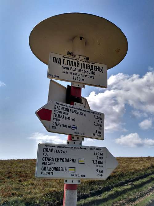 Signpost
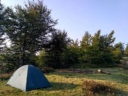 CAMPSITE IN THE SADDLE BETWEEN KYCHERA AND KRUHLA SUMMITS
 Moravian guy with paper map of Borzhava
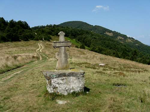 Pryslip pass
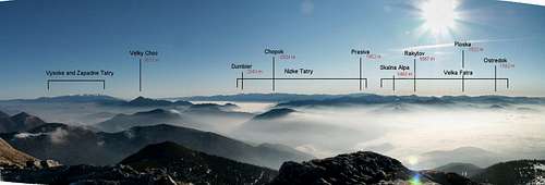 Fatra-Tatra area
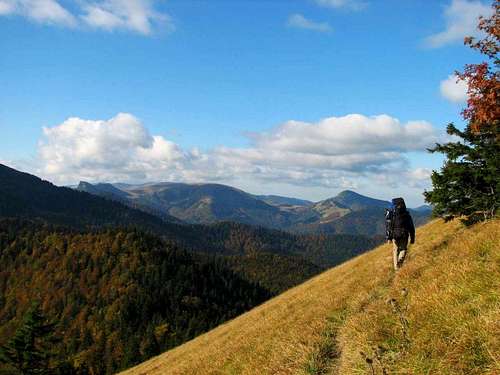 Heading south - for the Hôľna Fatra
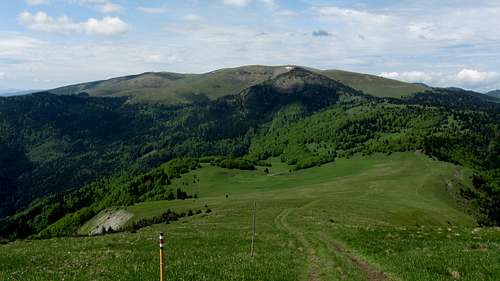 Hôľna Fatra
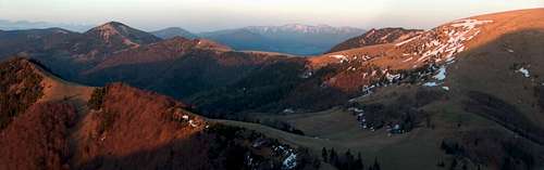 Turiec Ridge in foreground (left) and Liptov Ridge beyond Ľubochnianska Valley
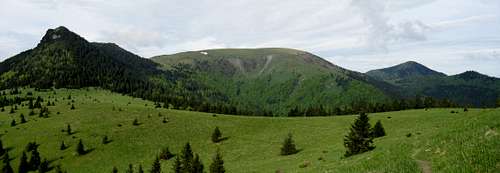 Čierny kameň (left), Ploská (center) and Borišov (right) seen from Liptov Ridge
 Malý Zvolen (1372 m)
 Zadný Šíp at 1143 m
 Sidorovo at 1099 m
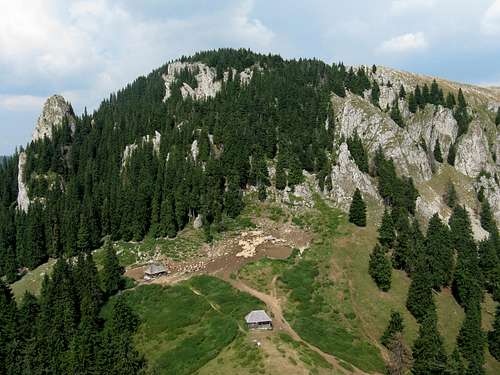 Buila Saddle
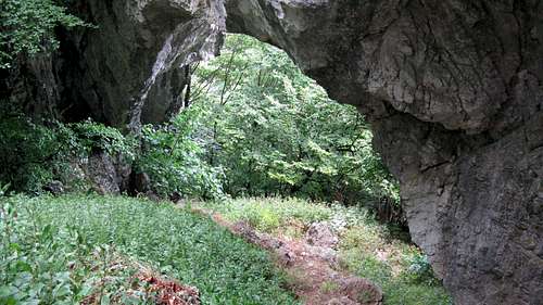 The House of Rock
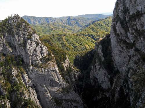 Cheia Gorge from Fotoreporter Ridge

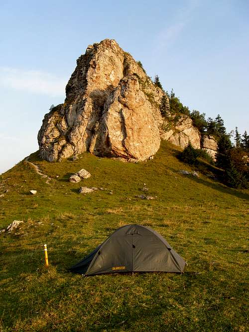 Bivouacking
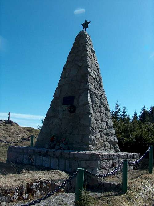 Memorial of Slovak national Uprising by Kráľova studňa
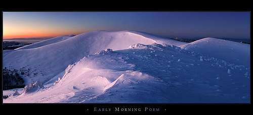 Early morning poem
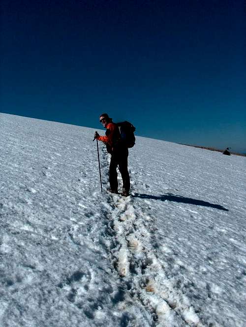 Winter traverse
 Scoruşu/lui Ciucă Falls
 Transalpina
 Lotru empties into Olt
 At Balota dam
 Crossroads
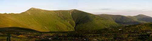 Corşor spur
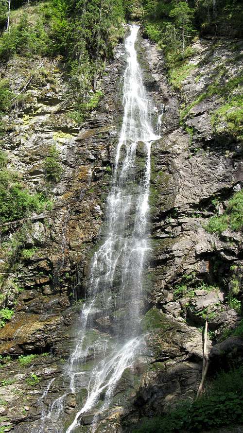 Scorus waterfall
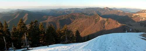 Western (Turčiansky) ridge (foreground) and Eastern (Liptovsky) ridge (background, divided by Lubochnianska valley
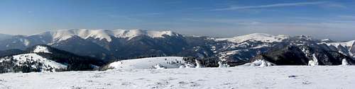 Main/Holná Fatra ridge
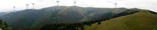 The highest segment of the Great Fatra
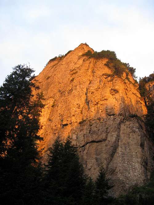 E face of Ocolaşul Mare
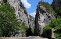 Rocky Dracula
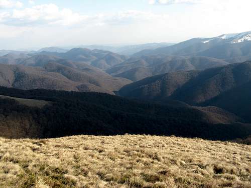 Největší bukový prales Evropy
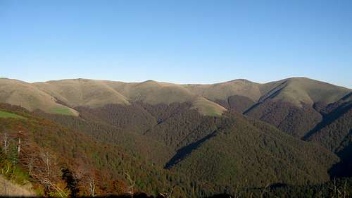 podzimní panorama horních partií Širokolužanského masívu
 - (+38 0321) 660 701, 660 114 or (+38 0442) 473 103 Emergency numbers of rescue services - 101 (only from UA operators)
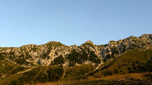 Jižní hřeben brzy zrána
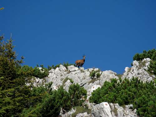 kamzík na hlídce
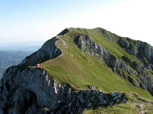 La Om aka Piscul Baciului (2239m) - nejvyšší bod Královského kamene s útulnou nad sedlem
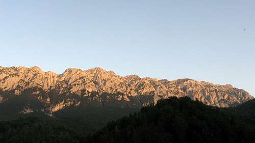 Královský kámen při západu slunce
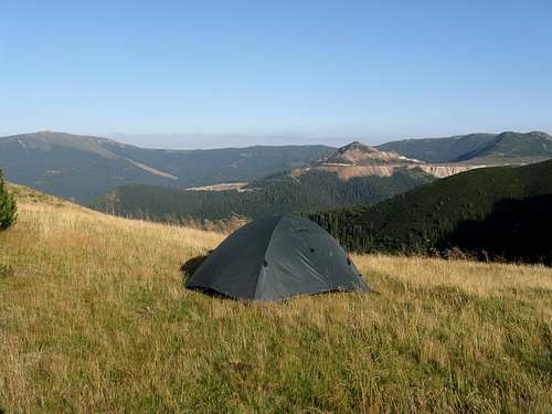 blízko srdce pradávné sopky
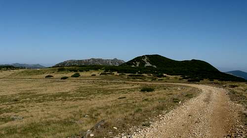 Transcălimanská středověká cesta
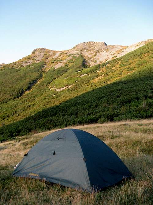 Vysněné ráno
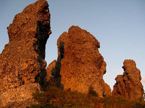 Dvanáct Apoštolů při východu slunce
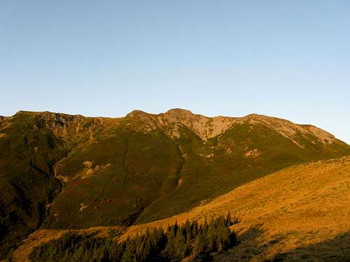 Maďarský Negoiu - Pietrosul
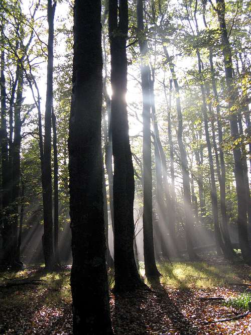 Aureole
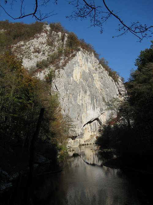 The canyon of the Nera river
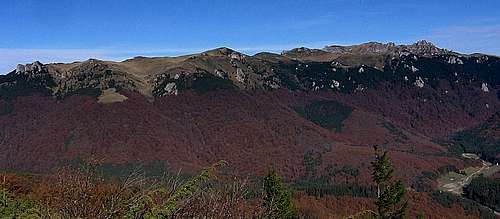 Bratocea Ridge, Ciucas Peak top right
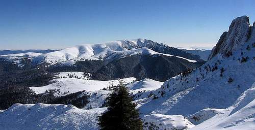 Junction between Bratocea and Zăganu (background) ridges, Ciucaş Hut to its right
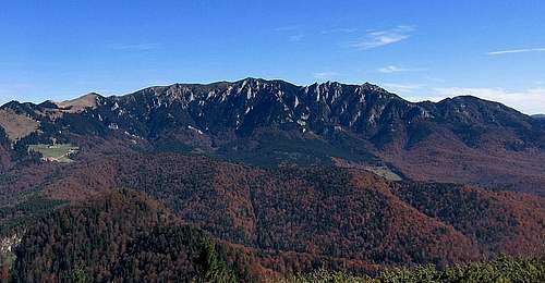 Zăganu Ridge and Muntele Roşu (wooded shoulder in the middle)
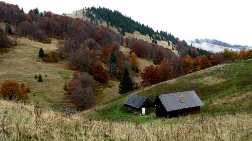 Sestričky
 Chata pod Borišovom
 Campsite
 Edelweiss
 Sunlit wall


")


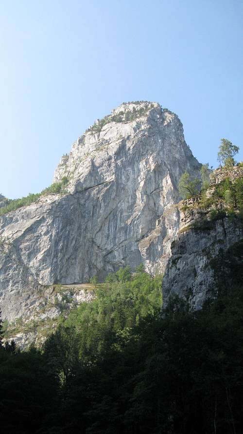
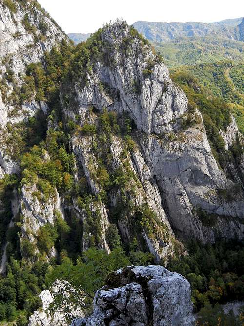


, Beleoaia at 2036 m (center) and the Corşor Ridge which branches off the main ridge at Beleoaia to run south")


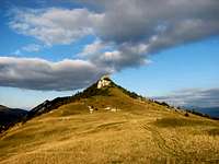


")
")
")
")


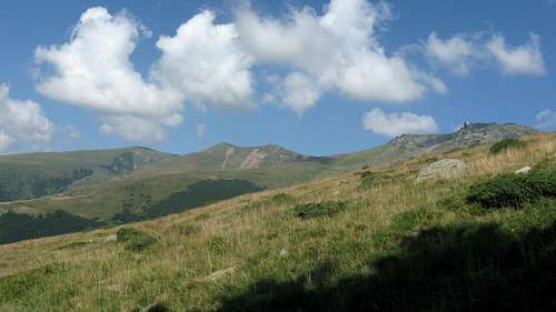


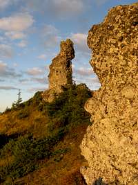


")
")


 – Great pans, (spring)")
 – Great pans, (summer)")
 – Great pans, (autumn)")
 – Great pans, (winter)")
 – Matchmakers, (summer)")
 – Matchmakers, (winter)")


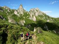
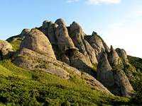


