

|
|
Area/Range |
|---|---|
|
|
49.16280°N / 20.12071°E |
|
|
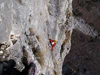
Hiking, Mountaineering, Trad Climbing, Bouldering, Ice Climbing, Via Ferrata, Skiing |
|
|
Spring, Summer, Fall, Winter |
|
|
8711 ft / 2655 m |
|
|
Overview
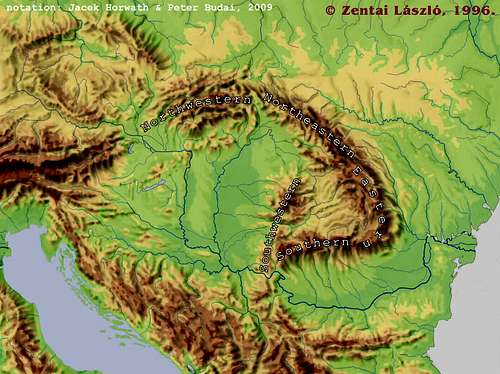
 Token flower Token flowerThe Carpathian Mountains constitute one of Europe's main mountain systems, whose characteristic arc spans some 1,500 km across, separating the Carpathian Basin from the vast lowlands of Eastern Europe. At both ends, it is cut off from the neighboring mountains – the Alps in the west, and the Stara Planina/Balkan Mountains in the south – by the Danube River, although in geologic terms the Carpathians extend a bit beyond the Danube (for further discussion please see the SW chapter). The Carpathians Mountains run across the political borders between half a dozen countries, which are Czechia, Slovakia, Poland, Hungary, Ukraine and Romania. Bearing in mind the sheer size of the Carpathians, we are not going to provide much information about their particular ranges. Our objective is to give a concise overview - detailed information is expected of the child pages. Relevant SP pages (varying widely in quality) have been attached, the most important ranges that do not have a page yet have been highlighted in bold print in the tables. We hope our page can provide good information as well as setting an example of transcarpathian collaboration between SP'ers who love the Carpathians as much as we do. Geology and Physiography Map from 1922 Map from 1922We have split the Carpathians into the following five parts: the Northwestern, Northeastern, Eastern (Northeastern and Eastern Carpathians are usually classified as one region named the East Carpathians), Southern and Southwestern Carpathians. This breakdown is generally based on the works of Hungarian geologists and geographers, and differs markedly from the physiographic divisions of the Carpathians usually drawn, for example, in Poland. The Carpathians are typically composed of three lithologic belts: the outer flysch belt (of relatively hard sandstone and soft shale), which can be broad but is rather low except the Chornohora (the apex of the Northeastern Carpathians, which tops out at 2061 m); the central crystalline (i.e. metamorphic/granitoid) belt, which contains nearly all of the highest ranges (the Tatras in the north and four ranges in the south exceed 2500 m in elevation); and the inner volcanic belt (rather low, like the flysch belt, except the Călimani Mountains, which rise above 2100 m). This pattern is best displayed in the Northwestern Carpathians, and also in the Eastern Carpathians. The crystalline chain is very poorly exposed in the relatively low Northeastern Carpathians (only several crystalline massifs of the Marmarosh Mountains break through the sedimentary cover). Also, the make-up of the Southern Carpathians, which are almost exclusively composed of crystalline blocks, is different. 
Within the Carpathians, the eastern sibling of the Alps, there are many blocks whose rocks were (trans-)formed by orogenic cycles older than the Alpine orogeny. Some of those blocks, e.g. the Rodnei Mountains constitute well-preserved pre-Mesozoic orogens, i.e. mountains last folded during the Hercynian (Variscan) or older cycles. Generally, what is now metamorphic rocks used to be pre-Mesozoic sediments (e.g. flysch or limestone) which were altered - mostly through contact with magma – in the late Paleozoic. The metamorphic rocks (usually gneiss and schists) along with the granitoid rocks (magma that has set) form the so-called crystalline cores of numerous ranges on the inner side of the flysch belt. These crystalline blocks are – to varying extent – covered by Mesozoic limestone, especially on the flanks, since prolonged erosion has usually removed the limestone from the central part of the ranges.
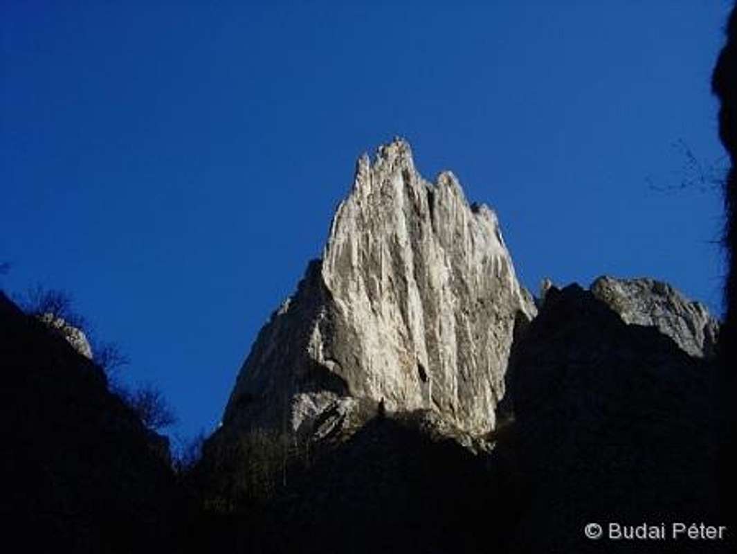
 Ancient crystalline rocks Ancient crystalline rocks
Babel of ToponymsThe Carpathians have always been inhabited by a number of peoples. In recent centuries, among those nations have been Czechs, Slovaks, Poles, Ukrainians, Romanians, Hungarians and Germans ('Saxons') and some smaller nations or ethic groups. Hence, most of the Carpathian ranges and sub-ranges have names in several languages. The topic is elaborated in this SP article.Since including all the names in each of the languages used in a particular area would make the text and the tables listing mountain ranges and peaks too clumsy, we have decided to normally stick to the name in the language of the country whose territory a particular area is part of nowadays (most of the Carpathians lies in Slovakia, Ukraine and Romania today), with some exceptions, e.g. when an English name is internationally known or when the translation to English brings out the meaning (then the name will be given in italics), and occasionally when local ethnic proportions justify it. However, we believe that it would be appropriate to list all the different names on the area and mountain pages. A dictionary of toponyms has been initiated for this purpose. Also, a little Carpathian Picture Dictionary, which lists about 150 words in eight languages, is available on SP.
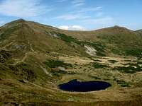
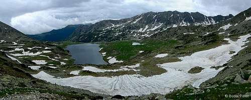
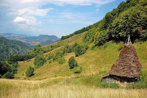
Wildlife and Wilderness
In the remote corners of the Southern or Northeastern Carpathians, you can easily find solitude and walk all day without meeting anybody, but this is also possible in the more touristy Northwestern Carpathians provided that you keep away from honeypots. Fortunately, a number of the most attractive places within the Carpathians have not become honeypots yet. Let us hope they will remain wild forever. Wolf filmed by LukZem in the NE Carpathians
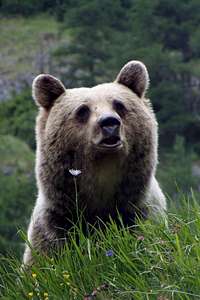
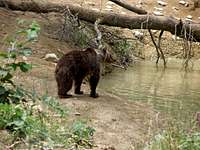
Bear filmed in the Eastern Carpathians
|


Northwestern Carpathians
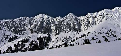
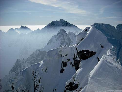
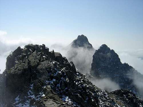
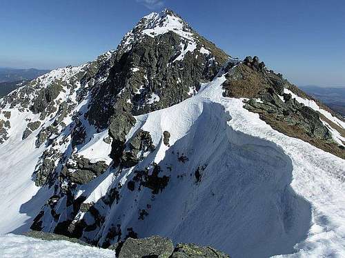
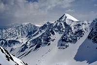
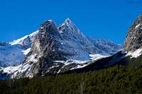
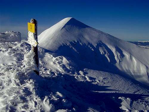
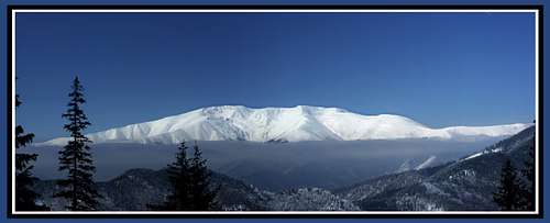
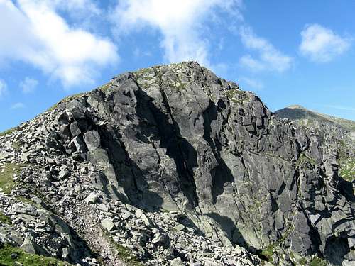
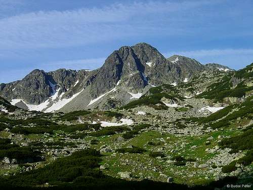
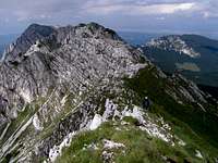
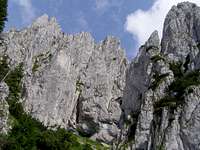
The Northwestern Carpathians are the widest and most complex part of the Carpathian mountain chain, stretching from the Danube River at Devín, east of Vienna (from the geologist’s perspective, the Carpathians extend a little beyond the Danube there, as the Hundsheimer/Hainburger Mountains at 480m, but we have decided to ignore such low hills on this page), to the valley of the Topľa River in the east of Slovakia. All three Carpathian lithologic belts – flysch, crystalline, and volcanic – are extensively developed here. It is also here that the the High Tatras (Gerlachovský štít, 2655 m) rise – the highest and most alpine in character mountain range in all of the Carpathians, which straddles the border between Slovakia and Poland.
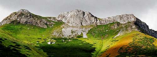
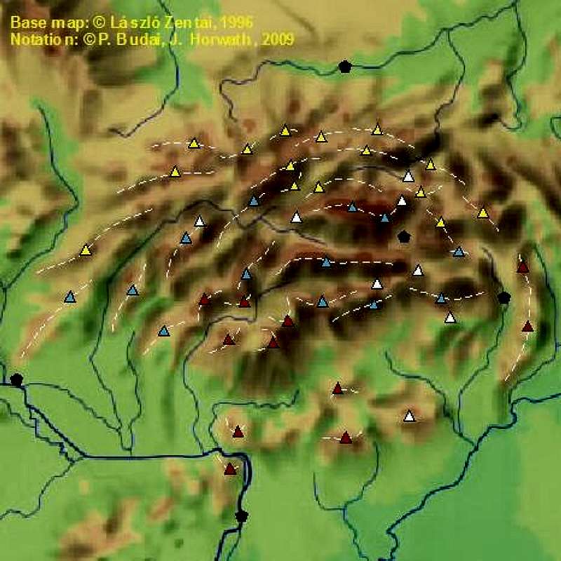
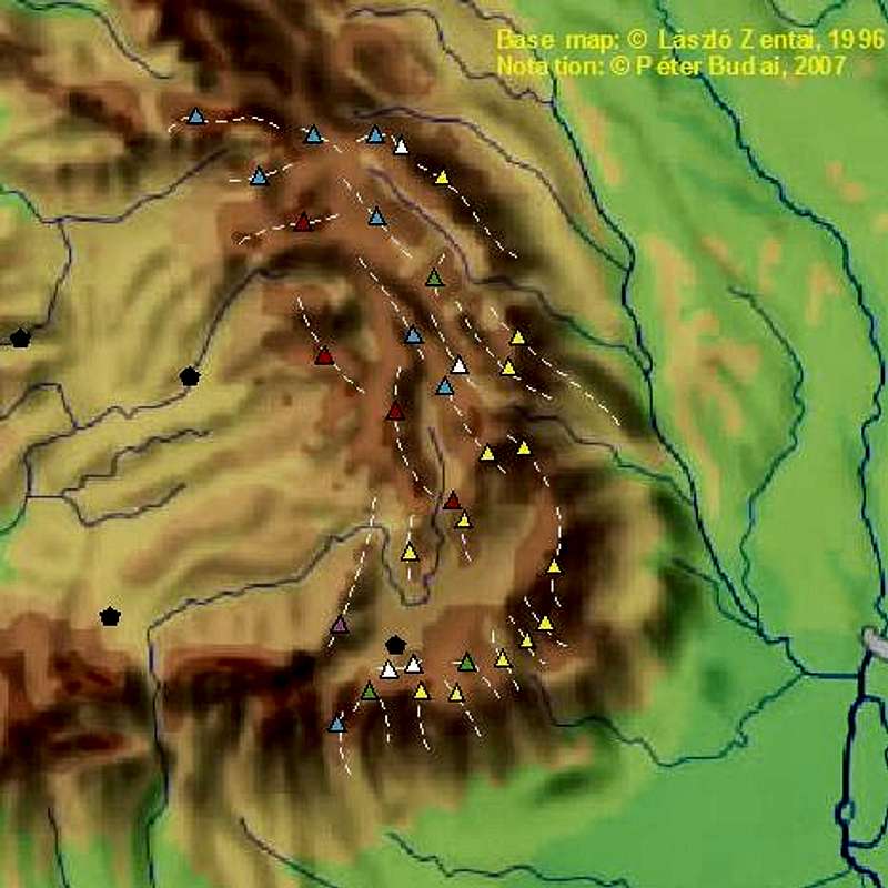
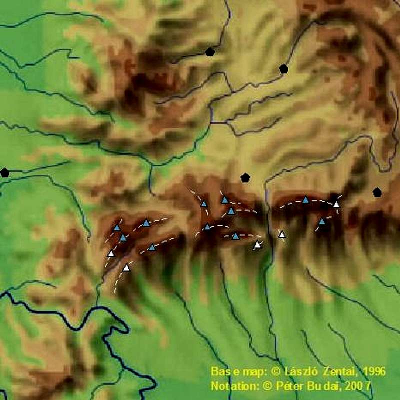
 Vysoké Tatry (High Tatras) from Nízké Tatry (Low Tatras) - fall Vysoké Tatry (High Tatras) from Nízké Tatry (Low Tatras) - fall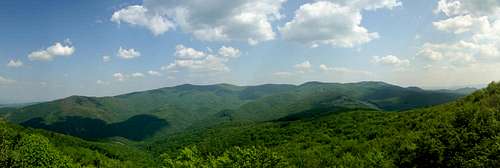 Börzsöny - spring Börzsöny - springIn the southern chunk of the Northwestern Carpathians there are about a dozen hilly areas where volcanic rocks dominate. The highest of them, heavily wooded Pol'ana, reaches 1458 m and represents the remnants of a large stratovolcano. The volcanic belt of Northern Hungary crosses the Danube north of Budapest to extend further west, towards Lake Balaton, as the Transdanubian Hills, which are not regarded as part of the Carpathians except the Visegrád Mountains. On the map below triangles indicate the highest peaks of particular ranges. If you hover the mouse over them, you will see the names of the ranges and peaks. Black pentagons indicate major towns (if available, links to airports open upon clicking). The table below the map lists the ranges of the Northwestern Carpathians, sorted by the dominant rock type, in the following format: mountain range - highest peak - elevation (in meters). Ranges composed almost exclusively of calcareous rocks (white triangles on the map) are marked green in the table. More information about limestone areas is to be found below the table.
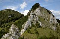
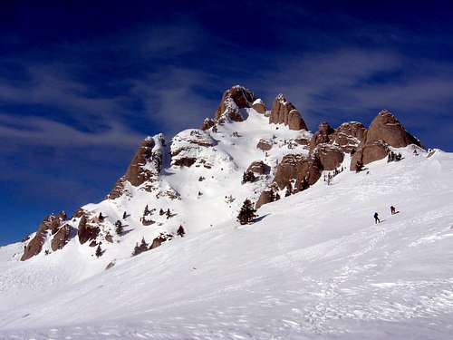
Limestone plateaus and canyon lands on the peripheries of the Slovenské rudohorie:  Slovak Paradise Slovak Paradise
 Belianske Tatry (Belá Tatras) - fall Belianske Tatry (Belá Tatras) - fall |


Northeastern Carpathians
|
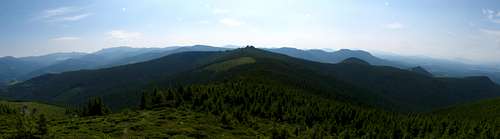
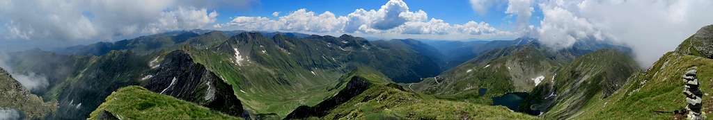
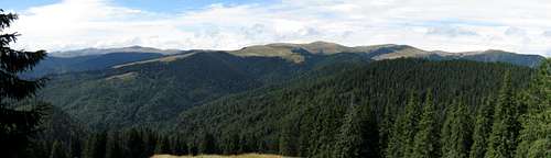
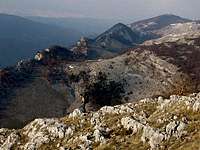
The lowest group of the Carpathians, located at the northeastern reaches of the Pannonian Basin, forms a stout flysch bridge between the old orogens of the Northwestern Carpathians and those of the Eastern Carpathians. The geology of the Northeastern Carpathians is rather monotonous. The outer belt of flysch is accompanied by an inner belt of Tertiary volcanoes. The elevation of the mountains and passes generally increases toward the southeast to finally culminate in the highest summits of the Chornohora range and the Marmarosh Mountains, but the highest summits hardly exceed 2000 m. In the Chornohora and Svydovets ranges fine corries with sizable tarns can be found, but traces of the Pleistocene glaciers also occur around the highest peaks of the Marmarosh and Ţibleş mountains. The Northeastern Carpathians are famed for what can be likened to alps and is known as polonynas here - vast swaths of grassland which are believed to be natural at the highest elevations, but have been greatly extended by man at the expense of the krumholz zone, consisting mostly of dwarf pine (Pinus mugo) and the montane forest, so that it makes way for mountains pastures. The term 'polonyna' is also often used instead of 'range' or 'ridge'. 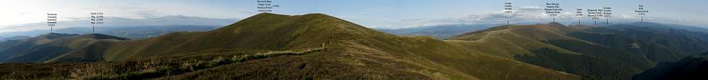
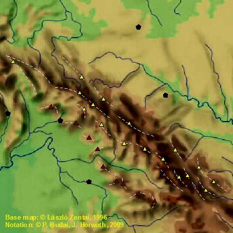
The borders of this quarter of the Carpathian Arc are drawn somewhat arbitrarily - we have opted for the valley of the Topľa River in the northwest and Prislop/Borşa pass in the southeast. The divisions and names of the subgroups within the sandstone chain are plenty and confusing. A case in point can be the borderline between the Eastern Beskids and the Marmarosh Mountains, which has had completely different versions: 1) Uzhok Pass (Użocka Przełęcz / Uzhots'kyi pereval) at the Poland-Ukraine border, 2) Verets'kyi Pass, 3) the source of Bela Tysa (White Tisa) River by the Ukrainian/Romanian border. Here we have used the last one, since it is the most commonly applied today, after new countries appeared or re-appeared in the East Central Europe, usually with different borders, in the 20th century. On the map below triangles indicate the highest peaks of particular ranges. If you hover the mouse over them, you will see the names of the ranges and peaks. Black pentagons indicate major towns (if available, links to airports open upon clicking).In the tables below the map, the member ranges of the Northeastern Carpathians have been listed from northwest to southeast, sorted by rock type, in the following format: mountain range - highest peak - elevation (in meters).
To demonstrate the complexity of the Marmarosh Mountains, it should suffice to list their four highest peaks along with the rock material they are composed of:  Marmarosh Mts
Such varying geology is also reflected in interesting geomorphology, which is enhanced by the fact that this part of the Carpathians is still pretty quickly being lifted by tectonic forces and by the results of the activity of the Ice Age glaciers at the highest elevations. The highest range in the Bukovina Carpathians (Obcina Mestecăniş) is geologically similarly patchworked, although it is less prominent. 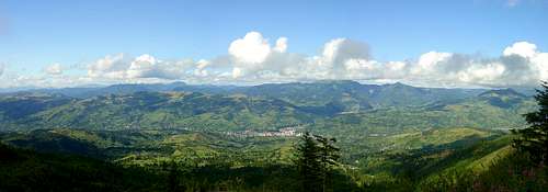 Marmarosh Mountains viewed from the Rodnei Mountains Marmarosh Mountains viewed from the Rodnei MountainsAs to the Ukrainian Carpathians / Eastern Beskids (PL), their various divisions can be perplexing. The table below aims to provide a concise list of the mountain ranges in accordance with the official Ukrainian and Polish classifications.
Remarks
In the sea of flysch only occasionally can small patches of limestone be found. The largest are in the south of Polonyna Krasna, which boasts an extraordinary, massive karst bridge, whose Ukrainian name Karstovyi mist, meaning just Karst Bridge, emphasizes its uniqueness.
Now we would like to present our own division of the area between the Low Beskid in the west and the Gorgany and Polonyna Borzhava in the east - what could be called the Bieszczady/Beschady Group. The real difference lies in distinguishing the Southern Bieszczady (SW part of the area), made up of the highest part of the Bieszczady's main ridge along with Polynyna Runa. Such a classification recognizes the Ukrainian objections to linking the Pikui Ridge with the Skole Beskyds, but refuses to do so as far as the eastern part of the main watershed, east of the Latirka Pass (Latirs'kyi pereval) and the Latorytsa River, is concerned. The Pikui Ridge is better connected to the Polonyna Runa (Rivna) group, rises to similar elevations and also features classic polonynas.
* Please see the remarks above this table ** Latirka Pass at 770 m, located five kilometers northwest of the much better known Verets'kyi (Verecke) Pass, is the lowest pass on the main ridge of the Carpathians in the territory of Ukraine. Eastern Carpathians
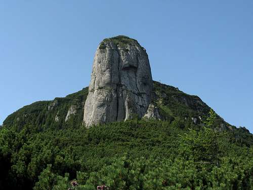
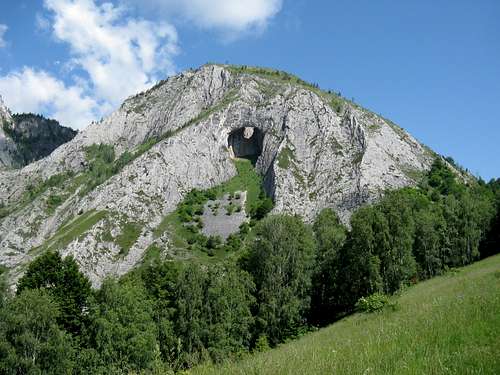
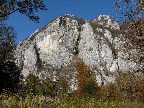
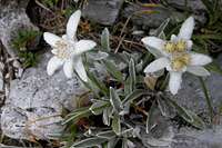 Edelweiss Edelweiss Băniţa Gorge
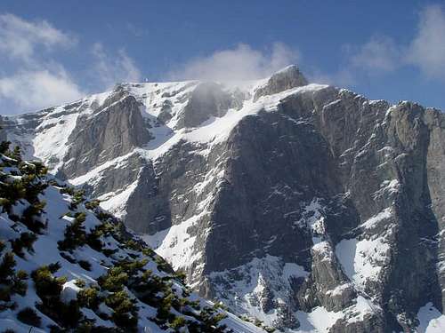
 Buila-Vânturariţa Buila-Vânturariţa
|


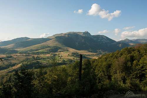
Southwestern Carpathians
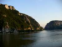
 Nera Gorges (Aninei Mountains) Nera Gorges (Aninei Mountains) Beusnita Falls (Aninei Mountains) Beusnita Falls (Aninei Mountains)1) By the Danube River, in the historic province of Banat, sits the last segment of the Carpathian Arc. The Banat Mountains and the northernmost mountains of Eastern Serbia can be seen as parts of the same mountain group - a link between the Carpathian chain and the Balkan (Stara Planina) Mountains - split by the canyon of the Danube. In fact, there are three options for the SW end of the Carpathians: a) The gorges of the Danube, for which we have opted here, b) The Juzna (South) Morava and the Timok rivers in Serbia, c) The Timiş (Temes) and Mehadica rivers in Romania. Regardless of whereabouts the Carpathians end, the eastern boundary of the mountains of Banat runs straight north from the Iron Gate proper, along the tectonic fault line which determines the course of the Mehadica and Timiş rivers, between the towns of Orşova and Caranşebeş.
2) To the northeast of these mountains, northwest of the Retezat Mountains, lies the massif of Poiana Ruscă - for centuries heavily grazed, and more recently heavily mined for iron. Both the mountains of Banat and the Poiana Ruscă contain fairly low mountains (below 1500 m) and are often regarded as parts of the Southern Carpathians.
 Bihor/Bihar, the highest range in the Apuseni Mountains Bihor/Bihar, the highest range in the Apuseni Mountains3) Finally, north of the Poiana Ruscă, across the valley of the Mureş (Maros) River, stands the largest and highest (above 1800 m) Carpathian "island" (some geological classifications exclude it from the Carpathians), bounded by the Pannonian Plain in the west and separated from the Carpathian Arc by the upland of Transylvania in the east. Romanian people call it Munţii Apuseni, which translates as the Western Mountains (before World War I, they were called the Island Mountains of Eastern Hungary, nowadays Hungarians refer to them as the Island Mountains of Transylvania).
The Southwestern Carpathians are the lowest and least forested of the five major parts of the Carpathians we have depicted on this page, each in a different chapter. What makes these mountains fascinating is the fact that they embrace vast limestone areas, including the most spectacular karst land in all of the Carpathians: the Padiş/Pádis Plateau in the north of the Bihor/Bihar Mountains. As for the ancient crystalline core of the Apuseni, some evidence suggests that it differs from that of the Carpathian Basin and could have once been part of the Dinarides.
On the flanks of the Apuseni, besides limestone plateaus, post-Paleozoic lava (creating most of the Vlădeasa/Vlegyásza Mountains) and flysch are also present.
On the map below triangles indicate the highest peaks of particular ranges. If you hover the mouse over them, you will see the names of the ranges and peaks. Black pentagons indicate major towns (if available, links to airports open upon clicking). The tables below the map list the ranges in each group north to south, sorted by the dominant rock type, in the following format: mountain range - highest peak - elevation (in meters). Ranges composed almost exclusively of calcareous rocks (white triangles on the map) are marked green in the tables. A little more information about limestone areas is to be found below the tables. Ranges marked with an asterisk (*) in the tables boast spectacular limestone karst.
|


Key Carpathian Statistics
|
Ranges ranked by the number of summits higher than 2500 m with at least 100 m of prominence (in brackets the part of the Carpathians the range lies in)
* The Bucegi range is more often considered part of the South Carpathians: please see here. 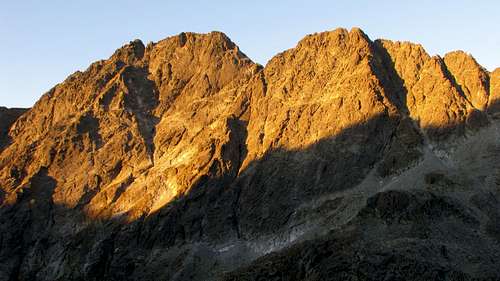
Ranges ranked according to the prominence of their highpoint
Ranges ranked by the number of summits with more than 500 m of prominence
|
Getting There
 Poland-Slovakia border
 Poland-Ukraine border
Romania-Ukraine border
 Train in Romania
Major flight destinations in the East Central Europe are Vienna, Bratislava, Budapest, Cracow, Bucharest, Belgrade, Closer to the Carpathian Mountains, but with fewer and less frequent connections, are the airports at Poprad, Košice, Timişoara, Cluj-Napoca, Târgu Mureş (Marosvásárhely), Sibiu, Satu Mare, Lviv, Ivano-Frankivsk and Uzhorod. There are plans for an airport at Braşov.
The region's rail network is extensive, several remote areas can be approached easily by train (quality of service varies, but it is generally acceptable). Discounts are usually available for students and for transboundary journeys. There are huge differences in price - usually long-distance international tickets cost much more than domestic ones. Consequently, many people choose the option of approaching the border on the domestic train, crossing the line somehow (possibly on another, local - not a long-distance - train), then continuing on the other side on another domestic train. This method requires more time and comes with extra hassle, but can save one a substantial amount of money. You should manage on condition that you speak a little of the languages of the countries being crossed, as you may have to talk to ticket officers who do not speak any international language. An up-to-date European timetable is available online from DB.
Car is the most convenient way of traveling around (and if you get enough people in the car, it is also the cheapest). In the Czech Republic, Slovakia and Hungary the motorways are toll roads (you have to purchase a vignette for a given period), the rest are free. In Romania a vignette (called Rovinieta) must be bought for each vehicle driven along any road. The vignette is valid everywhere, for a fixed period (1, 7, 30 days and 1-year).
As to visas and border crossing, Czechia, Slovakia, Poland, Hungary and Romania are members of the European Union. All of the countries except Romania belong in the Schengen Area, so crossing the borders between them is no problem - there are no border checkpoints anymore. This means that one will be able to hike around freely, from one Schengen country to another without any 'official treatment'.
Crossing the boundary of the Schengen Area is only possible at official border checkpoints, with some rigorous control. EU and US citizens entering Ukraine don't need a visa provided they stay less than 90 days. Passports (not ID cards!) are necessary though.
Last but not least, even if you are an EU or US citizen, it is always a good idea to check the current requirements before you go.
Maps
Very good hiking and regional maps are produced by the following companies: WiT (PL), Compass (PL), Sygnatura (PL), Galileos (PL), Hutyriak (UA), VKÚ Harmanec (SK), Dimap (HU), Muntii Nostri (RO), Bel Alpin (RO), Szarvas-Faragó (HU), Cartographia (HU) and Topográf (HU).Hiking Maps
| Muntii Nostri | waterproof maps of most of the Romanian ranges | |
| WiT | series of waterproof (plastic) maps of the Polish Carpathians (the maps cover the Slovak parts of the ranges that straddle the border too) including excellent (and cheap) maps of the Polish and Slovak Tatras | |
| VKÚ Harmanec | 1:50,000 | map series that covers the whole of Slovakia, thus most of the NW and a smaller part of the NE Carpathians |
| VKÚ Harmanec | 1:25,000 | map series that includes Western, High and Low Tatras, Little Carpathians, Kremnické vrchy and Slovenský raj (Slovak Paradise) |
| Polcart-Sygnatura | 1:50,000 | Slovenský raj (Slovak Paradise) and Beskid map series - approx. €2 each: Beskid Śląski, Beskid Mały, Beskid Żywiecki, Beskid Makowski, Beskid Wyspowy, Gorce & Beskid Sądecki, Beskid Niski, Bieszczady |
| Polcart-Sygnatura | 1:25,000 | map series which includes Polish Tatra National Park (English-German), Pieniny National Park, High Tatras, Western Tatras |
| Polcart-Sygnatura | 1:30,000 | Polish Tatras |
| Compass | 1:50,000 | map series - GPS-compatible, less than €2.50 each - which covers Polish Carpathians: Beskid Śląski & Beskid Żywiecki, Beskid Mały, Beskid Makowski, Beskid Wyspowy, Gorce, Podhale, Tatry, Orawa, Spisz, Beskid Sądecki, Beskid Niski, Sanok-Turka Mts (and the foothills) , Bieszczady |
| Compass | 1:30,000 | Polish Tatras |
| Compass | 1:25,000 | Pieniny |
| Compass | 1:100,000 | Małopolska Południowa (between Kraków and Slovakia) |
| PPWK Copernicus | 1:20,000 | Tatry Wysokie (High Tatras) |
| PPWK Copernicus | 1:20,000 | Tatry Zachodnie (Western Tatras) |
| PPWK Copernicus | 1:30,000 | Tatrzański Park Narodowy (Polish Tatra National Park) |
| Szarvas-Faragó | 1:30,000 | High Tatras (Magas-Tátra) - available from Szarvas |
| Cartographia | 1:40,000 | map series that include Börzsöny, Mátra, Bükk and Zemplén Mountains |
| Kárpátia-ISM | 1:50,000 | East Carpathians / Máramarosi-havasok - Svidovets, Chorna Hora (with Ukrainian and Hungarian names) - available from Szarvas |
| Dimap | 1:50,000 | Ceahlău, Rodnei, Retezat, Parâng, Gilăului, Pădurea Craiului, Vlădeasa, Trascăului (north), Trascăului (south) |
| Dimap | 1:60,000 | Bihor, Harghita, Ciucului, Giurgeu-Hăşmaş, Călimani, Făgăraş, Nemira, Tarcău, Gurghiului, Gutâi-Lăpuş-Ţibleş |
| Dimap | 1:70,000 | Rarău-Giumalău, Carpathian Bend (Piatra Craiului, Bucegi, Ciucaş, Grohotiş) |
| Bel Alpin | 1:50,000 | Retezat, Făgăraş, Piatra Craiului, Bucegi (available here) |
Regional Maps
| Polcart-Sygnatura | 1:100,000 | Around Tatras |
| Dimap | 1:250,000 | Transcarpathia (also sold with the Hungarian name "Kárpátalja") - covers all of the Ukrainian Carpathians, with both Ukrainian (in Cyrillic) and Hungarian names |
| Dimap | 1:400,000 | Transylvania - road map (with Romanian, Hungarian, German and Ukrainian names where applicable) |
| Dimap | 1:250,000 | Romania - road atlas |
| Dimap | 1:700,000 | Romania - road map |
| Cartographia | 1:300,000 | Romania - road atlas |
| Cartographia | 1:480,000 | Carpathian Basin - road atlas |
| Szarvas-Topográf | 1:360,000 | Slovakia - road atlas |
| Topográf | 1:360,000 | Carpathian Basin - road atlas ("A Kárpát-medence autósatlasza") |
| Szarvas-Topográf | 1:360,000 | Carpathian Basin - road atlas (sister publication of the above) |
Online Maps
- neat GPS-based online map on freemap.sk
- neat GPS-based online map with trail markings for Slovakian mountains on turistickamapa.sk
- neat GPS-based online maps with trail markings for Hungarian mountains on turistautak.hu
- neat GPS-based online map of Central Europe (under development, but functional) at openmaps.eu
- online version of Polkart-Sygnatura's High Tatras 1:25,000 on mapytatr.net
- online version of Polkart-Sygnatura's Polish Tatras 1:25,000 on mapytatr.net
- High Tatras 1:50,000 with Hungarian and Slovak toponyms
- sketches of several areas in the High Tatras
- Transcarpathia map set (with Cyrillic script) on Zakarpatska Oblast Map Server
- Ukrainian Carpathians 1:100 000 (Cyrillic script) made by the Soviet Army - from a Berkeley collection
- a page with map sections of Bieszczady and Western Ukraine (scroll down the page to the color maps)
- Another source of Transcarpathia maps
- scanned images of relatively old hiking maps from Transylvania and other parts of Romania on Fishinfo(warning - some might be a bit outdated)
- overview maps of ranges in Romania
Publications
This section lists the most important publications about broader areas of the Carpathians. Publications about the Tatra mountains are discussed in more detail on the High Tatra/Vysoké Tatry SP page. If you have suggestions about adding further items, please contact us by PM. Thanks jck for your input!.Books
| In English | Janneke Klop: The Mountains of Romania (2020, second edition, Cicerone Press) - This guide describes 27 short treks of 2-6 days and 10 day walks in the mountains of Romania, available from Cicerone |
| In English | Colin Saunders and Renáta Nározná: The High Tatras (1994, 2006, Cicerone Press) - guidebook that I've found on the Internet (haven't read it but seems to be a good one), available from Cicerone, Amazon and probably elsewhere as well |
| In English | Lucy Mallows: Transylvania (2008, Bradt Travel Guides) - guidebook whose bits can be read online; can be bought e.g. here |
| In English | Tom Chrystal and Beáta Dósa: Walking in Hungary (2003, Cicerone Press) - guidebook that I've found on the Internet (haven't read it but seems to be a good one), available from Cicerone, Amazon and probably elsewhere as well |
| In English | Ivan Vološčuk (ed.): The National Parks and Biosphere Reserves in Carpathians: The Last Nature Paradise (1999, ACANAP, Tatranská Lomnica) - monography, reviewed on CER, available from nhbs |
| In Polish | Józef Nyka: a couple of guidebooks about the Tatras, and their vicinity (i.e.: Tatry Polskie, Tatry Słowackie, Pieniny - see here) |
| In Polish | Guides to several Carpathian ranges, areas and countries (e.g.: Beskidy, Spisz, Gorgany, Góry Fogaraskie, Ukraina Zachodnia, Rumunia, Słowacja - Karpackie serce Europy) by various authors from the publisher named Bezdroża. |
| In Hungarian | Balázs Nagy: Gerinctúrák a Kárpátokban /Ridge Routes of the Carpathians/ (2002, Sziget, Debrecen) - Description of many long-distance hikes throughout the Carpathians, with useful tips and advice (out of print, hard to come by) |
| In Hungarian | various authors: Erdély hegyei /Mountains of Transylvania/ (1998-2006, Pallas-Akadémia, Csíkszereda/Miercurea-Ciuc) - Valuable guidebook (booklet series) with maps (most of them available - see publisher's site) |
| In Hungarian | Pusztay Sándor and Zsigmond Enikő (eds.): Erdélyi túrák /Hikes in Transylvania/ (2002, Kornétás, Budapest) - 512-page guidebook for 51 mountain areas in Transylvania |
| In Hungarian | 2500 km a Kárpátok főgerincén - Kárpát Koszorú Nemzetközi Túramozgalom /2500 km on the ridge of the Carpathians/ - photo album with pictures of an ambitious hiking endeavour all along the Carpathian Arc |
| In Hungarian | Ákos Neidenbach: A Kárpát-medence hegymászó és turista irodalma (1994, Budapest) - bibliography of Hungarian language literature about the Carpathian Basin (printed in small quantity - not available in shops) |
Periodicals
| In Hungarian | Turisták Lapja and Turistaság és Alpinizmus (1889-1944 and 1910-1935, respectively) - "legendary" periodicals from the "golden ages" of Hungarian mountaineering and hiking (some articles from the archives) |
| In Hungarian | Erdélyi Gyopár /Transylvanian Edelweiss/ - periodic publication of the (Hungarian) Transylvanian Carpathian Association (back issues are available online) |
| In Hungarian | Kárpáti Lapok - periodical publication of the (new) Hungarian Carpathian Association (available online: years 2004, 2005, 2006, 2007, 2008) |
| In Romanian | Munţii Carpaţi - periodical publication between 1997-2003, probably discontinued since then (list and contents of #1-37) |
| In Romanian | Invitaţie în Carpaţi - online monthly by alpinet.org (available online) |
| In Polish | Płaj - by the Polish Carpathian Society (online articles and abstracts) |
Select External Links
If you have suggestions about adding further interesting items, please contact us by PM. We'd like to thank SP members Tomas Kristofory, jck, kola and visentin for their input to this section.| In English | Carpathian Network of Protected Areas (with a nice overview map) |
| In a few languages | pages about Slovak Carpathians by Rudolf Kukura: High Tatras Low Tatras, Pienines, Slovak Paradise, Upper Hron region, Liptov region, Gemer region, Spiš region |
| In German | extensive list of climbing routes places in Ceahlău, Rarău, Bicaz, Piatra Craiului and Bucegi Mts. - with UIAA grades |
| In Romanian | Romanian mountaineering and climbing sites: alpinet.org, carpati.org, roclimbing.net - maps, plenty of photos |
| In Polish | homepage of Polish Carpathian Society (Towarzystwo Karpackie) |
| In Hungarian | homepage of the re-established Hungarian Carpathian Association (Magyarországi Kárpát Egyesület, MKE) - /note: the new MKE (1992-) is successor of the old MKE, the world's 7th alpine club (1873-1945)/ |
| In Hungarian | homepage of the re-established (Hungarian) Transylvanian Carpathian Association (Erdélyi Kárpát Egyesület, EKE) |
| In a few languages | information about the Ukrainian Carpathians on the Ukrainian-Polish Tourist Portal |
| In Czech | page about the Carpathians - plenty of information about the Carpathians in Czech |
| In German | page of the Carpathian Section of Deutscher Alpenverein, with further clues in German towards the re-founded (Saxon) Transylvanian Carpathian Association (Siebenbürgische Karpatenverein, SKV - 1880-1945, 1996-) |
| In German | more about SKV in articles of the Siebenbürgische Zeitung (Transylvanian Saxon Newspaper) and a university study |
| In Polish | homepage of Polish Tourist Country Lovers' Society (Polskie Towarzystwo Turystyczno Krajoznawcze, PTTK), owner of several mountain huts /note: PTTK was established in 1950 as a union of two associations: PTT (Polskie Towarzystwo Tatrzańskie, founded in 1873 in Kraków originally as Towarzystwo Tatrzańskie, reactivated in 1988 as a separate organization) and PTK (Polskie Towarzystwo Krajoznawcze, founded in 1906 in Warsaw) |
| In Ukrainian | page about Ukrainian Carpathians - Cyrillic script |
| In Hungarian | satellite images of Transylvania (and sometimes the whole of the Carpathian Basin) are regularly published on transindex.ro - some examples (with descriptive text in Hungarian): autumn colors, summer, summer clouds spring clouds and snow |
Further Resources
The comprehensive "Geography of the Carpathian Basin" by Béla Bulla and Tibor Mendöl (originally published in 1947, republished in 1999) discusses the complex structure of the Carpathians in detail - unfortunately it is only available in Hungarian. There is also a comprehensive volume entitled Geology of the Carpathian Region by G. Z. Földvary (Sydney, 1988), whose sections can be read online.Acknowledgements
|
||||
| Without a shade of a doubt, this page would look much less attractive without the photographic contribution of many SP'ers – kudos to them all, especially to LukZem and Tomek Lodowy. | ||||
|


aiwa - Feb 26, 2008 5:46 pm - Voted 9/10
LocationGeologically some parts of inner and outer western carpathians belongs to Austria
peterbud - Feb 28, 2008 9:22 am - Hasn't voted
Re: LocationYes, however they are often disregarded as such. There is also discussion about where do they "end" in the south. I did not want to go that deep into this kind of geological discussion as it is not the main focus of the site, but thanks for the addition.
visentin - Sep 30, 2009 4:16 pm - Voted 10/10
Re: LocationFew words would be also welcome to raise the issue - controversed or not - of what some call the "Serbian Carpathians". Karpaterna is the guy for that !
yatsek - Oct 1, 2009 7:49 am - Voted 10/10
Re: LocationThe FEW words :) are in the first paragraph: "in geologic terms the Carpathians extend a bit beyond the Danube"
visentin - Oct 1, 2009 9:10 am - Voted 10/10
Re: Location"beyond the Danube" north or south ? :) North => the unsignificant rock on the other shore in Austria, which the locals call proudly the "Austrian Carpathians" South => there is a famous national park in Serbia called Banat. Worth being mentionned, even considering it doesn't make the unanimity ! (you've mentioned Romanian Banat but Serbian not)
peterbud - Oct 1, 2009 11:13 am - Hasn't voted
Re: LocationNorth: Can you give some references? If you google "Österreichische Karpaten", the results will be anything but convincing. South: No trace of "Banat National Park", either (should be "Nacionalni Park Banat"). What you might be talking of is NP Derdap: http://www.npdjerdap.org. However, Banat is strictly north of the Danube, and is actually not the name of the mountains but a much broader area, including parts of the Pannonian Great Plain. The mountains of Banat are in the part which belongs to Romania now: http://upload.wikimedia.org/wikipedia/en/9/93/Banat_map.svg
visentin - Oct 1, 2009 1:19 pm - Voted 10/10
Re: LocationNorth : Hundsheimer Berge http://www.turistickamapa.sk/?x=16.93809&y=48.13248 South : yes, ?erdap (or Djerdap), I mixed the name. The page you found is probably the one I once watched, but I don't recognize it at all...
peterbud - Oct 1, 2009 5:55 pm - Hasn't voted
Re: LocationNorth: Yes, I am aware of the area (also called as Hainburger Berge, but not "Austrian Carpathians"). The question is that whether we shall talk about it in more detail or not. As you mentioned, it's an unsignificant block. The only noteworthy thing about it is that it's located on the other side of the Danube - otherwise it would be just the southern end of the Little Carpathians. Perhaps just mentioning the name in those brackets Jacek cited would do. South: As for Djerdap NP in the strict sense, it should be rather noted as such on a page dealing with NP-s of SE Europe. As for the whole group of those mountains south from the Iron Gate, I'd welcome further information. Right now the best I could find is Wiki, which is generally considered as a weak source needing reassurement.
yatsek - Oct 1, 2009 8:37 pm - Voted 10/10
Re: Beyond the Danube?The Austrian Carpathians, despite being an upland rather than real mountains, also boast fine scenery, plus interesting views of the Alps.:) Let's not forget the Visegrad Mts in Hungary.:)) The mts of Banat and those of the N chunk of Eastern Serbia's can be seen as two halves of the same mtn group. In geologic terms, they form one block cut by the gorge of the Danube. As far as I can remember, once you, Eric, compared it to the Pieniny split by the Dunajec River, and you were right. In fact, there are three river options for the SW end of the Carpathians: 1 The Danube. 2 The Velika Morava and Crni Timok rivers in Serbia. 3 The Upper Timis (Temes) and the Mehadica rivers in Romania.
yatsek - Oct 3, 2009 7:23 am - Voted 10/10
Re: SerbianThanks very much for your query, Eric, you're right - those Serbian "Carpatho-Balkans" ought to be mentioned on a page like this; we're currently working on the changes in the text.
peterbud - Jan 13, 2010 9:10 am - Hasn't voted
Re: SerbianThe info has been incorporated at last! It's solely me who's to be blamed for taking so long time, Jacek prepared the text much earlier. Sorry guys, sometimes I need way much time to chew things :)
visentin - Sep 30, 2009 4:09 pm - Voted 10/10
where are my...Cho?ské Vrchy in your diagram ? :(
peterbud - Sep 30, 2009 5:19 pm - Hasn't voted
Re: where are my...They're there and they're not there :) - The current link points to Velky Choc, because when I first compiled the links, the area did not have a page, only the mountain. Since then you've added the area, and I forgot to take note of that. Will be corrected soon!
peterbud - Sep 30, 2009 5:33 pm - Hasn't voted
Re: where are my...Corrected.
visentin - Oct 1, 2009 3:02 am - Voted 10/10
Re: where are my...Thanks ! But I meant, in the Crystalline belt table. Perhaps to small to have its place ?
yatsek - Oct 1, 2009 6:21 am - Voted 10/10
Re: where are my...Thanks for your question Eric. Although the term "crystalline" doesn't normally refer to limestone, most of the Carpathian limestone does occur within/around the crystalline (granite/gneiss) blocks (more info in the "Geology and Physiography" chapter), including some of your/our favourite areas, such as the Tatry Bielskie, or Vratna-Rozsutec in the Mala Fatra. We have listed the most interesting limestone areas, including your Chocske Vrchy, below the flysch-crystalline-volcanic tables. (On the maps, they're represented by white triangles.)
roamaniac - Feb 25, 2020 6:04 am - Hasn't voted
New Cicerone guide to the Romanian CarpathiansAs of 15 Feb 2020, a new Cicerone guide is available to the Romanian Carpathians, with the same title as the old one ('The Mountains of Romania') but a different author (me). You can find it here: https://www.cicerone.co.uk/948 It contains 37 routes and covers all the major and many lesser mountain ranges of Romania. Happy hiking!
peterbud - Feb 26, 2020 10:20 pm - Hasn't voted
Re: New Cicerone guide to the Romanian CarpathiansThanks for the update and congrats on the book! The book info section has been refreshed with the changes. Peter