


-
 4070 Hits
-
 84.82% Score
-
 19 Votes
|
|
Mountain/Rock |
|---|---|
|
|
45.77490°N / 7.41764°E |
|
|
Mixed |
|
|
Spring, Summer, Fall, Winter |
|
|
7257 ft / 2212 m |
|
|
Note
La montagna chiama i suoi figli, ed essi rispondono fedelmente al suo appello… Osvaldo Cardellina, Diario alpinistico, 1964-65 Page texts: @ OsvaldoCardellina "Osva", passed away on May 2, 2022. Page owners: Christian Cardellina e Osvaldo Cardellina. Any updates from September 12, 2022: Antonio Giani, page administrator, friend and climbing companion. Testi della pagina: @ OsvaldoCardellina "Osva", scomparso il 2 maggio 2022. Proprietari pagina: Christian Cardellina e Osvaldo Cardellina. Eventuali aggiornamenti dal 12 settembre 2022: Antonio Giani, amministratore della pagina, amico e compagno di salite. |
Hiking Ski-Mountaineering Snowshoes Overview
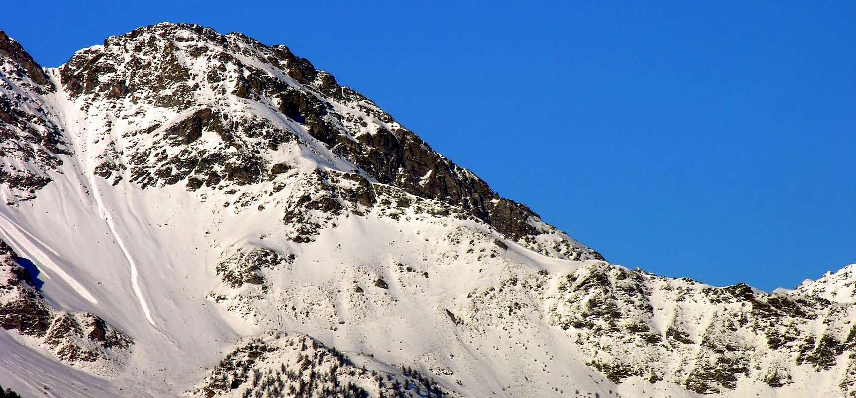
This Summit is located at the end of a long spur secondary act to divide the Comba Dèche from the East Basin Senevé also Cénevé on the opposite side, both above the Municipalities of Quart and Nus. The same takes start after the Summit of Eastern Tsaat a l’Etsena. From this point the main watershed between the Central Valley of Dora Baltea and Valpelline to the North is divided:
a) - a first branch continues Northward reaching the Becca Conge and the popular Saint Barthélemy Hill;
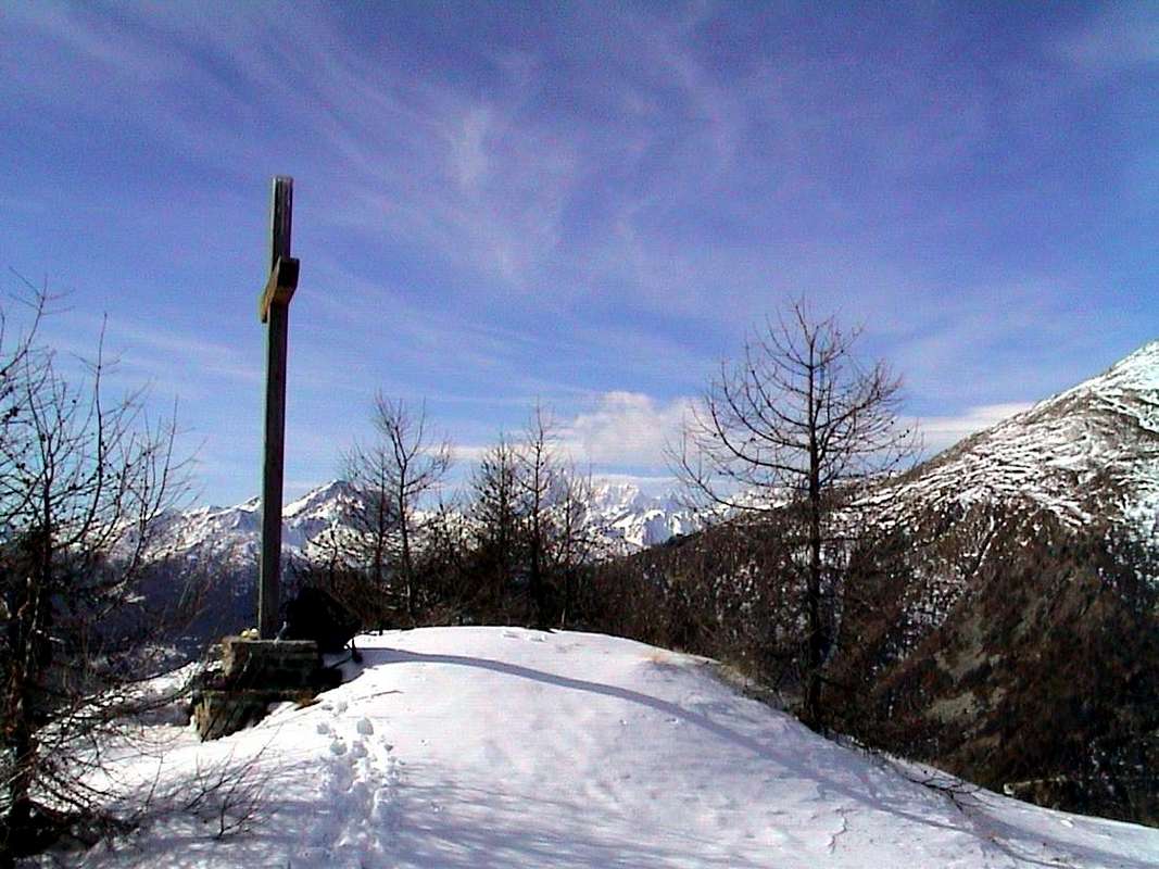
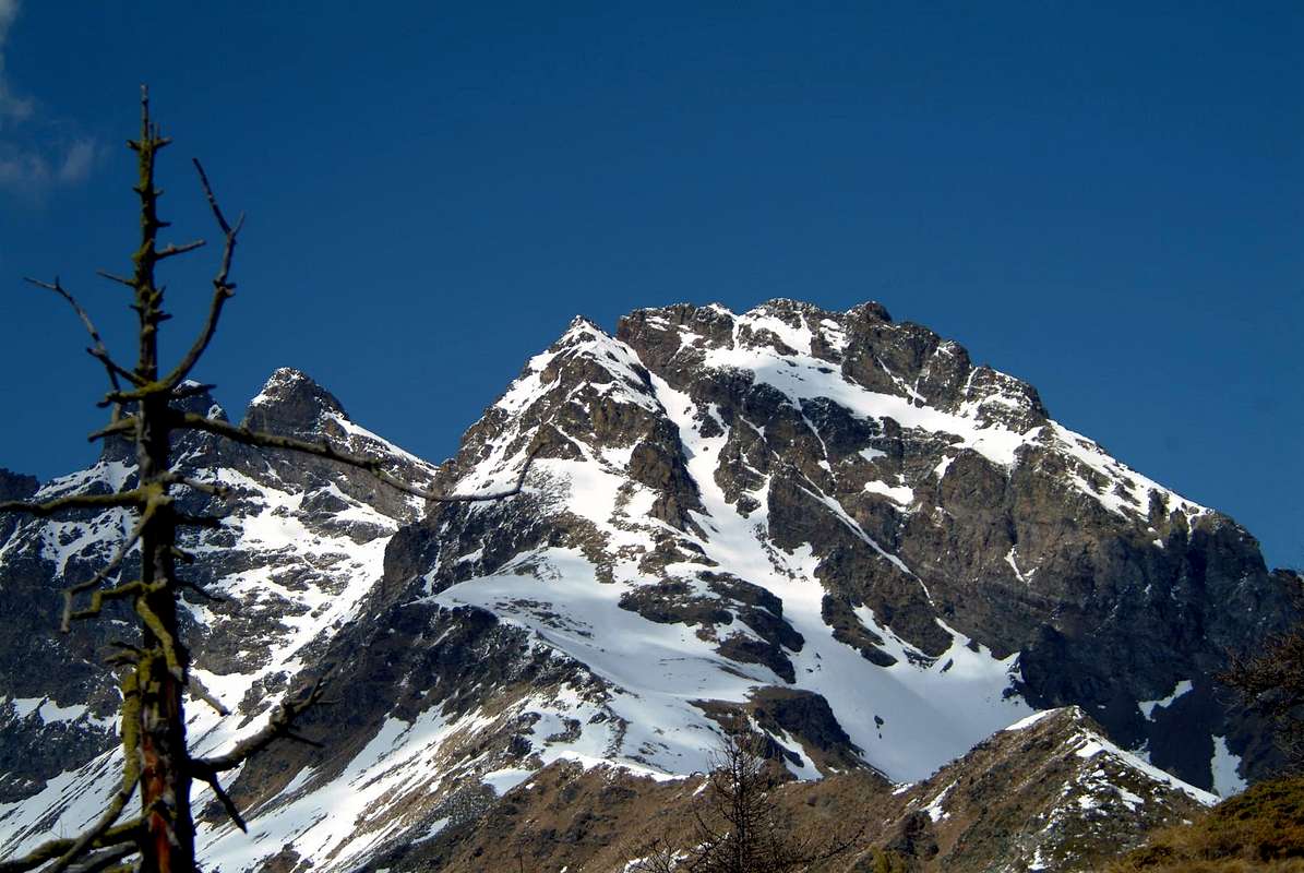
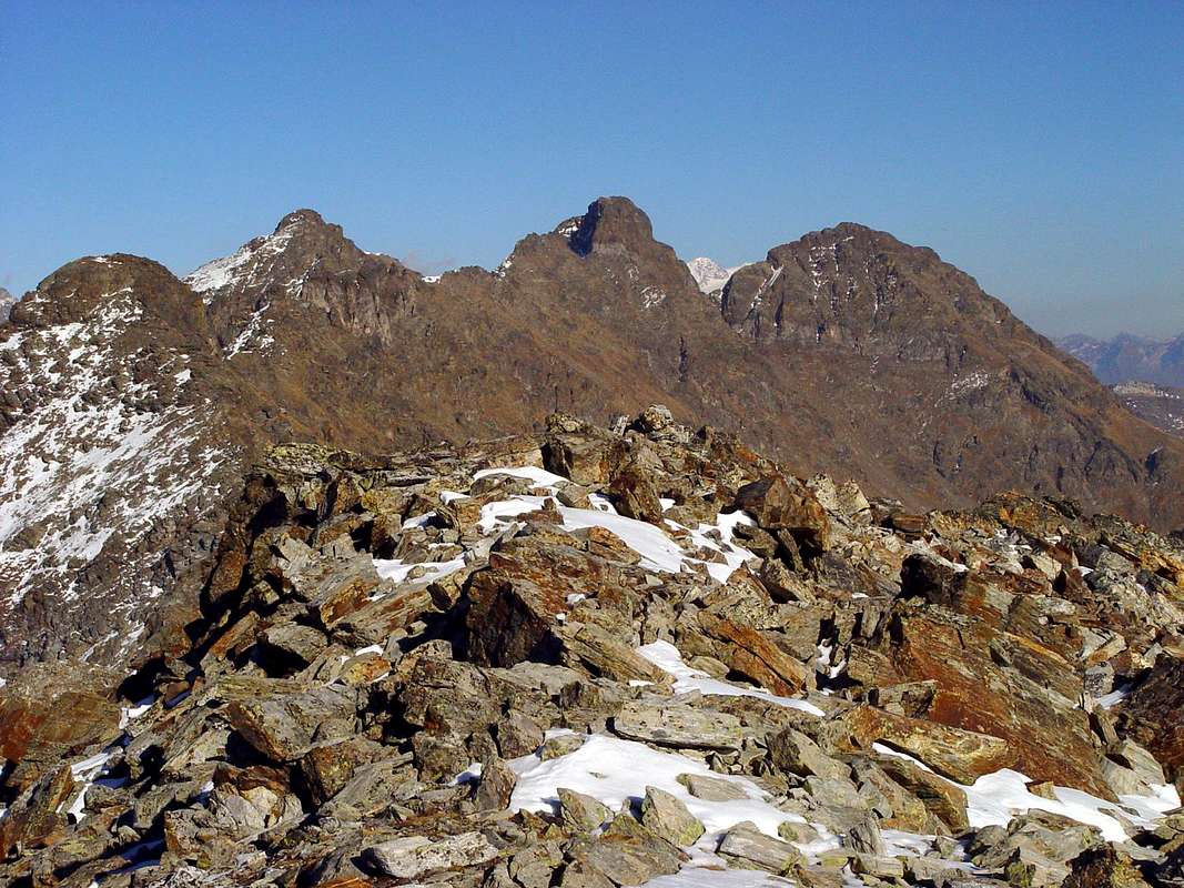
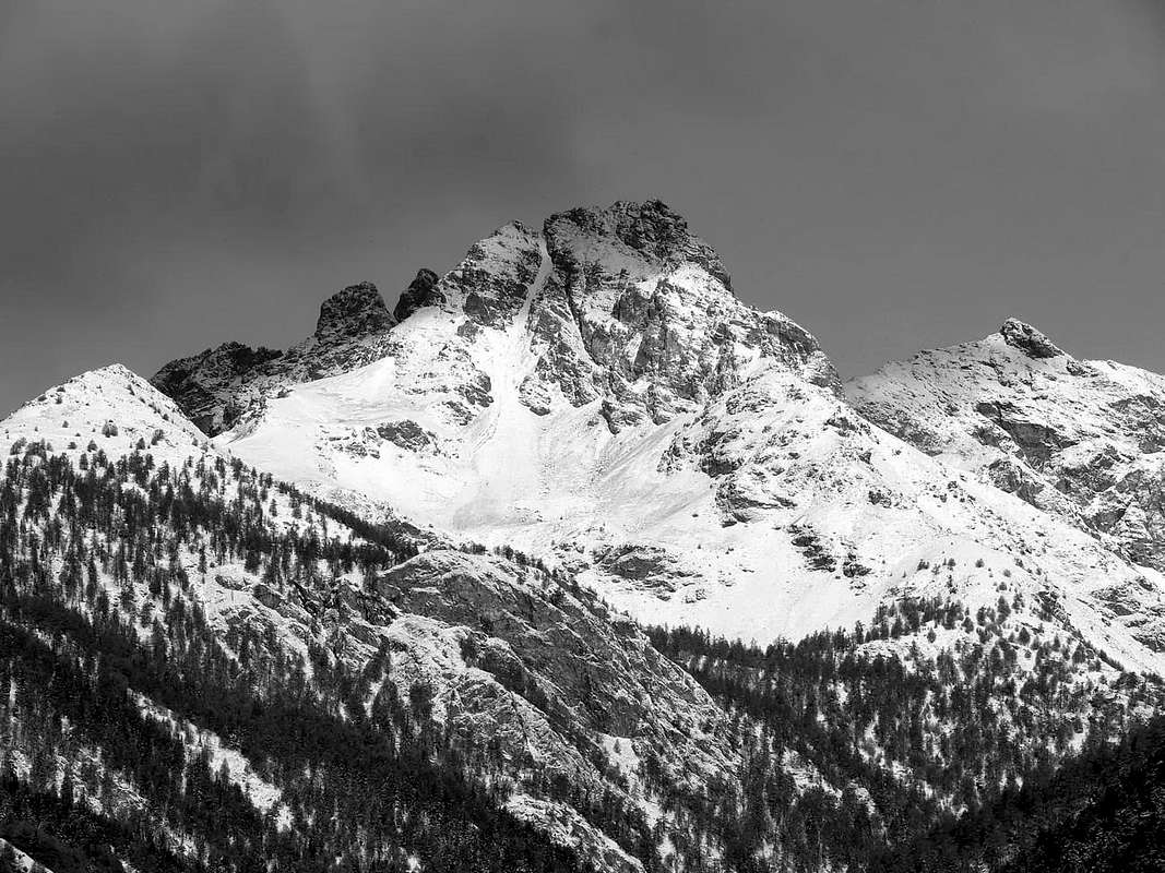
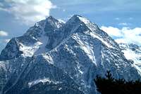
b) - a second, after forming the narrow Fana Pass, gets up to four homonyms Becchi (Beaks; 2.951m). After reaching the Western Antesummit (2.945 meters around), it goes down toward South-southeast in direction of the Central Valley of the Dora Baltea up to the three Villages of Trois Villes that is Porsan (1.299m), Trois Villes-Avisod (1.390/8m) and Fonteil (1.423m), above the Communes of Quart and Nus. This long buttress but of modest appearances it forms, road doing, the Tall Pass (2.540 meters around), the Northern Summit of the Point of Cornet also Quota 2.484 meters around, the homonym Hill (2.272m), the Southern Summit or Quota 2.306 meters, the Collar 2.226 meters to finish with the Croix de Fana (2.212m), splendid belvedere set to form of advanced balcony on the development of big part of the Central Valley of the main stream. Its three sides, usually covered with forest, down respectively towards the East on Comba Dèche, in the direction of Trois Villes South and West over the Oratory of Saint E'meric and the restructured Chateau de Quart, at the mouth of the Comba Sénevé. Three ridges nourish this division down to the Southeast over Fonteil, South-southwest towards the Val Sainte, and finally to the North on the spur above. All the routes are easy, but Notwithstanding it should follow the paths with relative directions or simply, if they do not exist, the same without venturing outside paths with the most tedious and tiring than rewarding (pay attention to the vipers!). This tour is a "classic" Hiking the beginning of the season, in relation to the low elevation, because it allows a good workout with 800 meters, but even for the whole winter; also can also be done on skis or (even better) with snowshoes. Beautiful views on the Central Valley of Baltea from farther Aosta Saint Vincent and the opposite Groups Avic, Glacier, Rafray, Tersiva, Roèses, Emilius that stand out as beautiful postcard to the South; behind (North) beautiful quick glances on the trio Sénevé/Tsaat a l’Etsena/Beaks of Fana that rise looming and "threatening" above Senevé Basin.
 |
Questa Sommità é situata al termine d'un lungo contrafforte secondario, atto a dividere la Comba Dèche ad Oriente dalla Conca di Senevé sul lato opposto, entrambe al di sopra del Comune di Quart. La stessa prende inizio dopo la Sommità à Est della Tsaat a l’Etsena. Da questo punto lo spartiacque principale tra la Valle Centrale della Dora Baltea e la Valpelline a Settentrione si divide:
a) - un primo ramo continua verso Nord raggiungendo la Becca Conge ed il frequentato Colle di Saint Barthélemy;
b) - un secondo, dopo aver formato lo stretto Colle di Fana, si rialza verso gli omonimi quattro Becchi (2.951 m). Dopo aver raggiunto l’Antecima Occidentale (2.945 metri circa) scende verso Sud-sudest in direzione della Valle Centrale della Dora insino ai tre Villaggi di Trois Villes ovvero Porsan (1.299 m), Trois Villes-Avisod (1.390/8 m) e Fonteil (1.423 m), al di sopra dei Comuni di Quart e di Nus. Questo contrafforte lungo ma di modeste apparenze forma, strada facendo, il Passo Alto (2.540 metri circa), la Punta Settentrionale del Cornet nella Quota 2.484 metri circa, l'omonimo Colle (2.272 m), la Punta Sud oppure Quota 2.306 metri, il Colletto 2.226 metri per terminare con la Croix de Fana (2.212 m), splendido belvedere posto a forma di balcone avanzato sullo sviluppo di gran parte della Valle Centrale della Dora Baltea. I suoi tre versanti, generalmente ricoperti da foresta, scendono rispettivamente verso Est sulla Comba Dèche, Sud in direzione di Trois Villes ed Ovest sopra l’Oratorio di Saint E'meric ed il Chateau de Quart, all’imbocco della Comba di Senevé. Tre creste assecondano questa spartizione scendendo a Sudest su Fonteil, a Sud-sudovest verso la Val Sainte ed infine a Nord sul contrafforte di cui sopra. Tutti i percorsi sono facili, ma cionostante conviene seguirne i sentieri con relative indicazioni o semplicemente, qualora non esistessero, i medesimi senza avventurarsi al di fuori con percorsi più noiosi e faticosi che gratificanti (attenzione alle vipere!). Questa gita costituisce una “classica” dell'Escursionismo d'inizio stagione, in rapporto alla bassa elevazione, perché permette un buon allenamento con 800 metri di dislivello, ma anche per tutto l'inverno; inoltre può essere effettuata anche con gli sci o (ancora meglio) con le racchette da neve. Belle viste sulla Valle Centrale della Dora da più in là d'Aosta a Saint Vincent e dirimpetto sui Gruppi d'Avic, Glacier, Rafray, Tersiva, Roèses ed Emilius che si staglian come splendida cartolina a Sud; alle spalle (Nord) splendidi colpi d’occhio sul trio Senevé/Tsaat a l’Etsena/Becchi di Fana ergentisi incombenti e “minacciosi” sopra la Comba di Senevé.

- From Turin or Milan: Motorway A5. Exit in Aosta East (nearby Nus Commune) continuing to the West on Main Road n°26 to various possibilities near Nus and Quart Fractions. From Switzerland: through the Grand St. Bernard Tunnel or the homonym Pass. Drive to Aosta, then follow, East direction on SS.26, to Quart and Nus Municipalities.
- Specific Road: just after the Fraction of Quart Commune (Etolin, Vieille Morte, la Plantaz-Chétoz (better), turn to the left or North-northeast, in the direction of Trois Villes (two parkings). Or with alternative road: from Aosta East toll of the highway follow on the right side toward Quart (556m near the Region Amérique); after the roundabout follow up toward Villair. After passing Argnod (857m) and Ville sur Nus (1.106m) turn to the left to Trois Villes Avisod (1.391m) wherefrom you must start walking. Or from Nus Commune.
BY PLANE:
- Aeroporto "Corrado Gex" Saint Christophe (Aosta).
Approaches & Routes
APPROACH A (From Avisod Village to Senevé also Cénevé Alp): from the Village of Avisod (1.390m; beautiful small church in the meadow back 1.398 meters, immediately to East) to take toward West the dirt road "poderale", leaving on the left the alternative for Valseinte shortly after (1.399m; attainable with beautiful walk through the path that from the beautiful one and restructured Castle of Quart (740m) it transits for the Oratoire de Saint E'meric (1.140m) with a slendid "passeggiata"/escursion); to continue instead more toward Northwest progressively inserting himself in the Basin of Senevé, leaving in low the Alps Chacotte (1.426m) and Séchot (1.409m). To revolve the wooded strata of the Slope Southwest of the Croix de Fana (2.211/2m; beautiful walk with departure from Trois Villes of which we will report in expectancy) and, crossing some small torrential furrows, to reach the Champchamoussin's Pasture than Above (1.856m); from this, always with slope in diagonal but more toward Northwest, to reach the Alpe of Latta or Lattaz (1.930m; currently almost in downfall), underlying to the With the Cornet (2.272m), and the following double and wide hairpin bend to quota 2.036 meters. To continue, same direction, toward the Alpage of Chavod (2.038m) and the following "tornante" (hairpin bend) in form of acute angle to quota 2.097 meters; from this the dirt road changes direction in Northeast reaching the quota 2.148 meters, where the path n° 1 arrive that it goes down from the aforesaid hill. From here the road it decidedly turns to West and it reaches shortly time the important Alp, recently restructured, of Senevé (2.199m; 2h'00/2h'30; other possibilities of run don't exist, since the path has been progressively "eaten" by vegetation, from the road built in the 70s).
Dal Villaggio di Avisod (1.390 m; bella chiesetta nel dosso prativo 1.398 m, subito ad Est) prendere verso Occidente la strada poderale, lasciando poco dopo sulla sinistra il bivio per Valseinte (1.399 m; raggiungibile con bella passeggiata tramite il sentiero che dal bel e recentemente ristrutturato Castello di Quart (740 m) transita per l'Oratoire de Saint E'meric (1.140 m) con una splendida passeggiata/escursione); continuare invece più verso Nordovest inserendosi progressivamente nella Conca di Senevé, lasciandosi in basso le Alpi Chacotte (1.426 m) e Séchot (1.409 m). Aggirare le falde boschive del Versante Sudovest della Croix de Fana (2.211/2 m; bella passeggiata con partenza da Trois Villes della quale relazioneremo in futuro) ed, attraversando alcuni piccoli solchi torrentizi, raggiungere l'Alpe Champchamoussin di Sopra (1.856 m); da questa, sempre con salita in diagonale ma più verso Nordovest, raggiungere l'Alpe di Latta o Lattaz (1.930 m; attualmente pressocché in rovina), sottostante al Col Cornet (2.272 m), ed il successivo doppio e largo tornante a quota 2.036 metri. Proseguire, stessa direzione, verso l'Alpe di Chavod (2.038 m), che si lascia dabbasso, ed il successivo tornante in forma di angolo acuto a quota 2.097 metri; da questo la strada poderale cambia direzione in Nordest raggiungendo la quota 2.148 metri, ove arriva il sentiero n° 1 discendente dal predetto colle. Da qui la medesima volge decisamente ancor più ad Occidente raggiungendo in breve tempo l'importante Alpe, da poco tempo ristrutturata, di Senevé (2.199 m; 2h'00/2h'30; non esiston altre possibilità di percorso, poiché il sentiero è stato nel tempo "mangiato" dalla vegetazione, dopo la costruzione della strada poderale avvenuta nel corso degli anni '70).
ROUTE A (From Avisod Village through Senevé also Cénevé Basin): If you do not want to Pasture continue by the conjunction a 2.148m, leaving West-northwest the dirt road that continues to this, definitely at first and then to Southeast going back more to the East, through the path n° 1 , which with three large bends leads to the Col Cornet (2.280m); from the collar, along the dividing ridge (between Senevé Basin/Comba or Vallon Dèche) to the South and overcoming or circumventing some bumps generally in the East grassy-rocky, quite easily and with short descent leads to a small "bowl" and immediately after the Summit Cross, set on a tiny promontory (2.212m; 0h'45 from the collar; F; 1h'30/1h'45 from Alp; 3h'30/4h'00 from Davisod). Variant Lower: instead of reaching the crossroads 2.148 meters to the Alp of Sénevé, follow the path, which coincides with a private dirt road, which starts from the Alp Champchamoussin Upper (1.851m) is directed towards the South-southeast; reached the same wide hairpin turns to the North-northeast ending below the Western slopes of the Croix de Fana. From this point turns exclusively on a small path through the upper part of the forest and some rock outcrops, reached the Summit just off the Cross. This way increases of nearly 300 meters, the altitude to go, but then avoid having to go back North/South on the watershed (practically the same time and difficulty).
Se non si vuol raggiungere l'alpe proseguire dalla congiunzione a 2.148 metri, abbandonando ad Ovest-nordovest la strada poderale che prosegue verso questa, decisamente dapprima verso Sudest e quindi maggiormente ad Est risalendo, tramite il sentiero n° 1, che con tre larghi tornanti conduce al Col Cornet (2.280m); dal questo, seguendo la cresta spartiacque (Senevé/Dèche) verso Sud e superando oppure aggirando in genere ad Est alcune asperità rocciose-erbose, abbastanza agevolmente e con corta discesa si raggiunge una piccola conca e subito dopo la Croce, posta su d'un minuscolo promontorio (2.212m; 0h '45 dal colletto; F; 1h '30/1h '45 dall'alpe; 3h '30/4h '00 da Davisod). Variante Bassa: invece di raggiungere il bivio 2.148 metri a l'Alpe di Senevé, seguire il sentiero, coincidente con una strada poderale, che partendo dall'Alpe Champchamoussin Superiore (1.851 m) si indirizza verso Sud-sudest; raggiunto un largo tornante il medesimo volge a Nord-nordest terminando sotto le pendici Occidentali della Croix de Fana. Da questo punto si tramuta esclusivamente in sentierino che, attraversando la parte superiore del bosco ed alcune costole rocciose, raggiunge la Sommità proprio presso la Croce. Questa via aumenta di quasi 300 metri il dislivello da percorrere, però evita di dover successivamente tornare indietro sullo spartiacque (in pratica stesso tempo e difficoltà).
 |
 |
 |
 |
 |
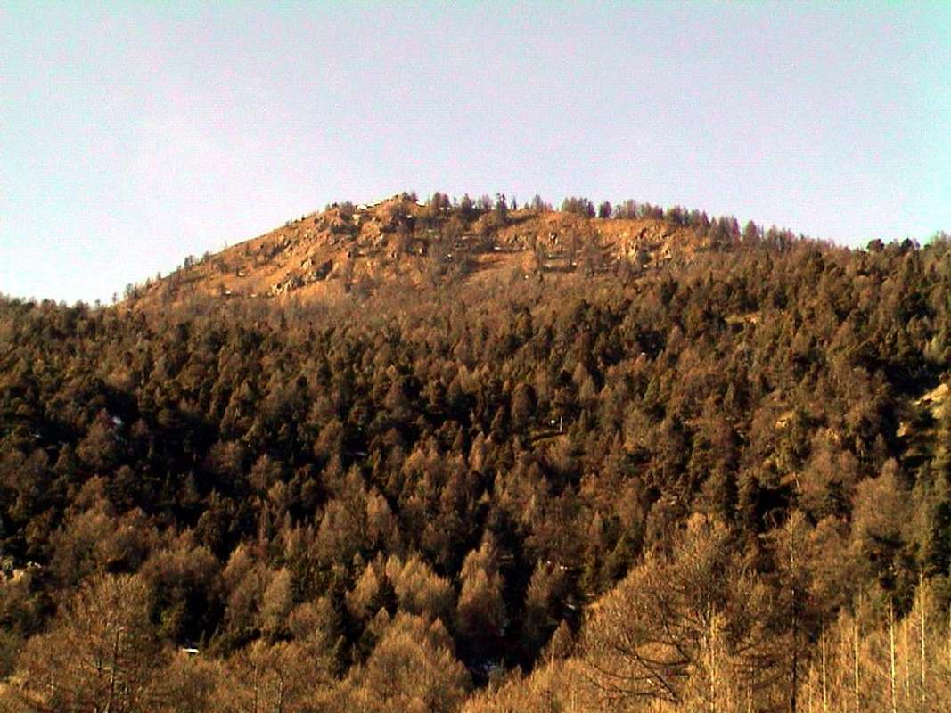
APPROACH B (From Fonteil Village towards Brunier Pasture into the Comba Dèche): from the little Village of Fonteil (1.423m; small parking lot at the last house, or larger and with signage at the entrance of the village), part of the small Hamlet of Trois Villes in the Municipality of Quart, take the private farm dirt road or "poderale" with concurrent paths n° 3/4/5 in the first section addressed to the Northeast, where it forms a junction with the trail was going up to the North to the Prelé and Chauvay (1.640m) Pastures and is linked back to the same back slightly, discard the right continuing this instead with the same. With the North-northwest reach in progression, with path going up and down through the forest on the Eastern Slopes of the Croix de Fana (2.212m) and dominating from the bottom of the Dèche Vallon, the Pastures Cré (1.652m), Nouva (1.733m), Salé and Brunier (1.761m), where comes the path n° 2 Flemagne (1.709m), that comes from the Alps (1.709m) with higher path to the West, always starting from Fonteil Hamlet, just after an intake of water (E; 1h'15/1h'30 from the small parking Fonteil).
AVVICINAMENTO B (Dal Villaggio di Fonteil all'Alpe di Brunier all'interno della Comba Dèche): dal Villaggetto di Fonteil (1.423 m; piccolo parcheggio presso l'ultima casa, oppure più grande e con segnaletica all'ingresso del villaggio), facente parte della piccola Frazione di Trois Villes nel Comune di Quart, prendere la strada poderale concomitante con i sentieri b° 3/4/5 nel primo tratto indirizzato a Nordest; ove questa forma un bivio con il sentiero che, salendo a Settentrione verso le Alpi di Prelé e Chauvay (1.640 m) e ricollegatesi ritornando leggermente all'indietro alla medesima, scartare sulla destra questi continuando invece con la medesima. Con direzione Nord-nordovest raggiungere in progressione, con percorso in saliscendi attraverso la foresta alle pendici orientali della Croix de Fana (2.212 m) e dominando dall'alto il fondo del vallone, le Alpi Cré (1.652 m), Nouva (1.733 m), Salé e Brunier (1.761 m), ove arriva anche il sentiero n° 2 proveniente dall'Alpe Flemagne (1.709 m) con percorso più in alto ad Occidente, sempre partendo da Fonteil, dopo una presa dell'acqua (E; 1h'15/1h'30 dal piccolo parcheggio di Fonteil).
ROUTE B (From Fonteil Village through Comba Dèche and Eastern Slope and East-southeast "Crestone"): from Alpage Brunier continue proceed in the opposite direction towards the South, reaching Flemagne Pasture and the next fork in altitude 1.740 meters around rejoining the paths gathered (in altitude about 1.590 meters, where he arrived at a pitch in the forest is also a private dirt road that starts just before Fonteil) that rise from Avisod and Fonteil. From this continue with the small path unnumbered using the "Crestone" East-southeast along the ridge and always within the forest; you will soon reach the plateau before the Summit and soon after the same (E; 1h'15/1h'30 by Brunier Pasture; 2h'15/2h'30 from Fonteil). Toilsome journey in the first half in the presence of snow.
Direct Variant: the narrow place can be reached, as mentioned above, most directly from the South (this is the route most followed by all) or starting with a small path from Trois Villes (1.390m) or with a more marked rising from Fonteil (1.423m) (signals at the parking lot); both are coming together at the same where also comes with a dirt road starting midway between the two fractions (E; 0h'30). This route is faster, but tedious and less impressive, because it does not offer much of a view and excludes the beautiful Dèche Walloon.
Dall'Alpeggio Brunier proseguire invece in direzione opposta verso Sud raggiungendo Flemagne ed il bivio successivo in altitudine 1.740 metri circa ricongiungendosi con i sentieri riuniti (in altitudine 1.590 metri circa, dove arriva presso una piazzola dentro la foresta anche una strada poderale che parte appena prima di Fonteil) che salgono da Avisod e da Fonteil. Da questo continuare con il piccolo sentiero non numerato tramite il Crestone Est-sudest seguendo il crinale e sempre all'interno del bosco; in breve si raggiunge la spianata precedente la Cima e subito dopo la medesima (E; 1h/15/1h'30 da Brunier; 2h'15/2h'30 da Fonteil). Percorso faticoso nella prima parte in presenza di neve alta.
Variante Diretta: lo spiazzo può essere raggiunto, come sopra accennato, più direttamente da Sud (é sicuramente questo l'itinerario maggiormente seguito) ovvero partendo con un piccolo sentiero da Trois Villes (1.390 m) oppure con un altro più marcato che sale da Fonteil (1.423 m; segnalazioni presso il parcheggio); entrambi si riuniscono presso la stessa ove arriva anche una poderale con partenza a mezza strada tra le due frazioni (E; 0h'30). Questo percorso é più rapido, ma noioso e certamente meno suggestivo.
Da escursionismo.
From the Top towards South & North
From the Cross to the Central Valley of Baltea with Graians from East to West and also from West/East behind your back.
 |
 |
 |
 |
 |
 |
 |
 |
 |
 |
Campings
Remember that free camping is forbidden (except for emergency reasons, over 2.500m, from darkness until dawn).
Mountain Conditions
- You can get meteo information at the official site of the Regione Valle d'Aosta:
- Valle d'Aosta Meteo
Books and Maps
BOOKS:
- "Guida della Valpelline" de l'Abbè Joseph-Marie Henry - Societè Editrice Valdotaine 1925 II Edition e Collana Reprint Musumeci (1986).
- "Guida dei Monti d'Italia - Alpi Pennine (Vol. 2)" di Gino Buscaini - Club Alpino Italiano/Turing Club Italiano, Luglio 1970 (In Italian).
- "80 itinerari di Escursionismo Alpinismo e Sci Alpinismo in Valle d'Aosta", di Osvaldo Cardellina, Ed. Musumeci, Giugno 1977 (in Italian); seconda Ed. Luglio 1981; terza Ed. Luglio 1984; (in French), prima Ed. Febbraio 1978; seconda Ed. Marzo 1980.
- "Diari Alpinistici" di Osvaldo Cardellina e Indice Generale accompagnato da Schedario Relazioni Ascensioni 1964-2019 (unpublished).
 |
 |
 |
MAPS:
- Kompass "Breuil/Cervinia-Zermatt" Carta turistica 1:50.000.
- I.G.C. Istituto Geografico Centrale "La Valpelline" (carta n° 115) Map1:30.000.
- I.G.M. Istituto Geografico Militare - Map 1:25.000.
- L'Escursionista Ed. Rimini "Gran San Bernardo-Ollomont" (carta n° 5) 1: 25.000.
Important Information
- REGIONE AUTONOMA VALLE D'AOSTA the official site.
- FONDAZIONE MONTAGNA SICURA Villa Cameron, località Villard de la Palud n° 1 Courmayeur (AO) Tel: 39 0165 897602 - Fax: 39 0165 897647.
- SOCIETA' DELLE GUIDE DELLA VALPELLINE Etroubles-Strada Nazionale, n° 13 - Tel +39 0165 78559 - Valpelline-Loc Capoluogo, n° 1 - Tel +39 0165 713502 (AO) Italia.
- A.I.NE.VA. (Associazione Interregionale Neve e Valanghe).
Useful numbers
- Protezione Civile Valdostana località Aeroporto n° 7/A Saint Christophe (Ao) Tel. 0165-238222.
- Bollettino Meteo (weather info) Tel. 0165-44113.
- Unità Operativa di Soccorso Sanitario Tel. 118.