
-
 8406 Hits
-
 89.77% Score
-
 30 Votes
|
|
Mountain/Rock |
|---|---|
|
|
45.88021°N / 7.54881°E |
|
|
Valle d'Aosta |
|
|
Mountaineering, Trad Climbing, Ice Climbing |
|
|
Summer |
|
|
10994 ft / 3351 m |
|
|
Overview
Dôme de Cian 3351 m
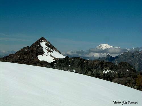
Dôme de Cian 3351 m is a mighty and complex snow-capped mountain situated in the Pennine Alps, Subgroup Cian, between Colle Cian and Monte Balanselmo. The summit is covered by a powerful ice-cap, but a small rocky peak emerges from the icy plateau: this is the mountain’s highest point, the Northern summit, lying North to the ice-cap, over which the rocky and sharp North Ridge ends. The other summits are the Central and the Southern ones. Most important sides are the rocky South-East side and the North-West and South sides, both snow-covered. Dôme de Cian is surrounded by three important valleys: Torgnon Valley on S side, Cignana Valley on SE side and Valpelline Valley on West side. Because of mountain’s secluded position, from the summit it's possible to enjoy an extraordinary view all around over the neighbouring valleys and peaks and far off over Monte Bianco and over some of the fourthousander mountains lying on the Italy-Switzerland border, like Matterhorn, Dent d’Hérens and Monte Rosa Group.

First summiters: J.B. Carrel – P. Pession with Origoni brothers across Passo Cian 16-9-1889
Getting There
Road access
Dôme de Cian can be approached from two main valleys: Valtournanche on East side and Valpelline on West side.
Getting to Valtournanche – From Monte Bianco autoroute exit Chatillon m. 550, then follow the SS 406, reaching Antey St-Andrè m. 1080 (km. 7,5 from Chatillon) and Valtournanche (km. 18,5 from Chatillon).
Getting to Valpelline – From Monte Bianco autoroute exit Aosta exit m. 583, then follow the SS 27 reaching Valpelline m. 960, Bionaz m. 1606 and the artificial Place Moulin Lake m. 1950 (km. 32,5 from Aosta). Parking inside a pull-out near the dam.
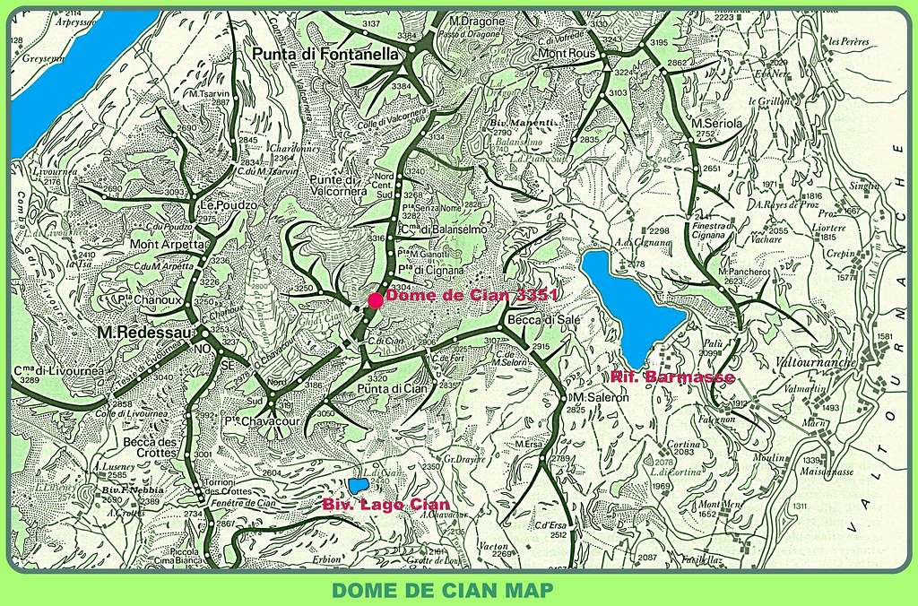
Dôme de Cian routes overview
NORMAL ROUTES
- SE Side Normal Route from Bivacco Lago Cian across Chavacour Col F, 870 m
- SE Side Normal Route from Bivacco Rivolta across Cian Col F, 450 m
- SW Side Normal Route from Prarayer Hut across Comba di Valcornera and Chavacour Col F+, 1350 m
NORTH FACE
- North Face Route from Northern Glacier – “Bonacossa Route” D inf. – ice climb
- North Face Route Direct Variant “Franco Spataro Route” D sup. – ice climb
- North Ridge “Bonacossa-Dumontel Route” from Punta di Cignana PD sup. – trad rock climb
SOUTH-EAST FACE
- “Carrel Route” to the Central Summit AD, 300 m – trad rock climb
- “Pellissier Route” to the Central Summit AD sup. 300 m – trad rock climb
- “Bazzi Route” to the Southern Summit D 250 m – trad rock climb The classic route of the face over solid rock.
- “Gastaldi Route” to Southern Summit - AD sup. 200 m- trad rock climb
Dôme de Cian Normal Route from Bivacco Lago Cian
DÔME DE CIAN NORMAL ROUTE FROM LAKE CIAN REPORT
Alpine F - Difference in level: 850 m. from Bivacco Lago Cian
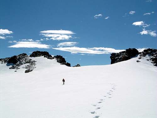
An easy and safe route inside a wild evironment.


From Bivacco Lago Cian, situated over a grassy hillock close to the small Lago Lake, go down reaching in a few minutes the western shore of the lake. A wide valley, named Chavacour Valley, overhung by Punta Cian m. 3322 and Punta Chavacour m 3184 on the right-hand side and by Cima Bianca m. 3009 on the left-hand side, is starting heading to West. Follow the track leading inside Chavacour Valley; where the valley is making a great turn towards right (North) and it’s blocked by a morain, leave on your left-hand side the marked track to the Fenetre de Cian and head towards right (North), following a steep track below Punta Chavacour which enters the upper and narrow part of Chavacour Valley.

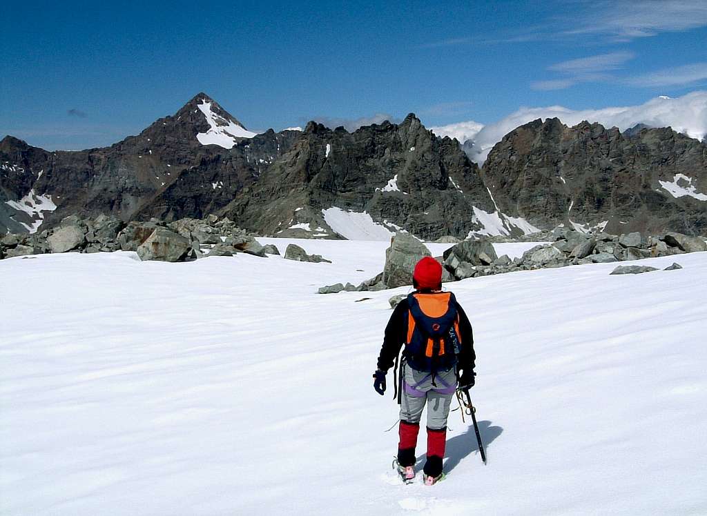
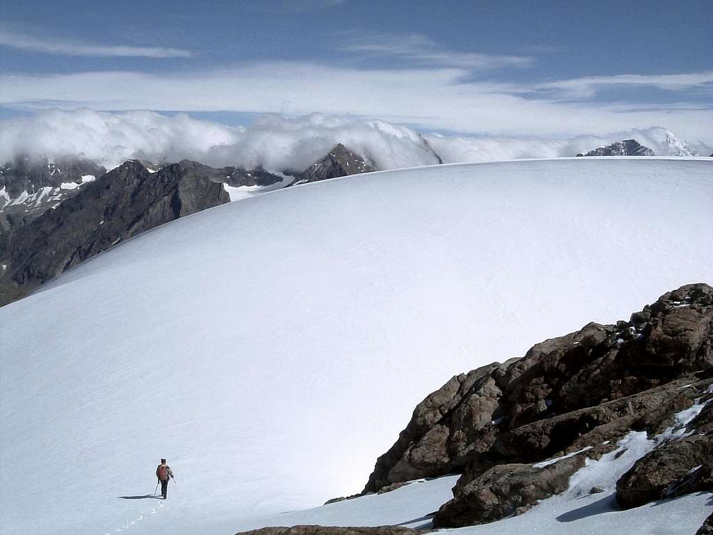
The track leads to a wide and characteristic terrace covered with flat stones; from the terrace head towards right, rising along moraines and snow-fields and reaching Chavacour Col m. 2965, where is getting also Normal Route from North-West Side (Prarayer Hut). From Chavacour Col the two routes rise together along the same itinerary: cross towards right the upper part of Chavacour Glacier, entering Cian Glacier.
Climb the steep iced-slopes leading to a moraine; climb it, reaching another steep icy-slope from where the obvious saddle named Colle Cian – situated between Dome de Cian on the left and Punta Cian on the right - appears on your right-hand side. Don’t reach the col but climb straightly the steep icy-slope in front of you. The slope leads to the wide ice-cap of the mountain, the lower Western summit. Frome here, following towards left the edge of a magnificent snow-basin situated between Central Summit and Northern Summit, reach the ending easy rocks leading to the highest summit (Northern Summit). The view is truly unbelivable!!!!
Descent: along the same route
Huts and Bivouacs
EAST SIDE (Valtournanche Valley)
*** Bivacco Lago Cian m.2482, 9 beds, always open – 2 hours from Loditor Pond (m. 1920). Useful to climb Dôme de Cian SE side Normal Route across Chavacour Pass.
Road Access: from Antey St-Andrè turn to left to Torgnon Valley, reaching Septumian, Chantornè, Chantè de Guerre as far as Loditor Pond m. 1920. Parking. Cars not allowed beyond the bridge. Don’t cross the bridge, but park the car a few meters before Loditor Pond. From here starts the track to Bivacco Lago Cian and Bivacco Rivolta.
Walking Approach: from Loditor Pond follow the track starting in your left-hand side – in the beginning not very marked – leading to Alpe Chateau m. 2084. Leave on your right-hand side the track to Bivacco Rivolta on Col de Fort and follow on your left-hand side the track to Bivacco Lago Cian, reaching Alpe Grotte de Loup m. 2160 (0,40 minutes from the parking). From here the path rises with several hairpins reaching the Bivouac.


*** Bivacco Rivolta at Col de Fort m. 2895 – 2 and a half hours from Loditor Pond (mt. 1920). Useful to climb Dôme de Cian SE side Normal Route across Cian Col.
Road Access: from Antey St. Andrè (see Bivacco Lago Cian road access)
Walking Approach: from Loditor Pond follow the track starting in your left-hand side – in the beginning not very marked – leading to Alpe Chateau m. 2084. A bit after Alpe Chateau leave on your left-hand side the track to Bivacco Lago Cian and turn to right following the track to Col de Fort.
***Rifugio Barmasse 2169 m (Lago Cignana) – 1,45 hours from Valtournanche
Road Access: from Chatillon follow the SS46 getting Valtournanche (km. 18,5)
Walking Approach: from Valtournanche graveyard reach tha small village of Crepin and from here follow on the left a good path leading to Promoron m. 1798, Falegnon m. 1912 and Cignana Lake Dam. Cross an iron bridge towards left, reaching the hut.
*** Bivacco Manenti m. 2789 at Lago Balanselmo (Upper Val Cignana) – 2,15 hours from Rifugio Barmasse Useful to climb the rocky SE Face along “Bazzi Route” and the other routes on this face.
Walking approach: from Rifugio Barmasse get back a bit along the approach-path reaching Cignana Lake. Follow the track skirting the North-East shore of the lake. Before reaching a chapel, turn to right rising towards Alpe Cignana; before reaching it head towards left following the path to Balanselmo Lake. Reach the lake, then the bivouac.
WEST SIDE (Valpelline)
*** Rifugio Prarayer m. 2005 (Lago Place Moulin) - 50 beds, open from july to september - 1 hour from the dam. Useful to climb Dome de Cian SW side Normal Route and North-Face Routes.
Road Access: from Aosta follow the road SS27 to Valpelline and Lago Place Moulin (km. 32,5).
Walking Approach: from the parking follow the large gravel road running along the western shore of the lake and leading to the hut (5 km.).
Red tape

No fees no permits required. A wild environment.
Cars are not allowed beyond Loditor Pond on East Side and beyond Place Moulin Dam on West Side.
When to climb
Best season goes from middle June to middle September
Meteo
Guidebooks and maps

“Alpi Pennine Volume II” by Gino Buscaini - Guide dei Monti d’Italia TCI-CAI
Maps:
“Cervino-Matterhorn and Monte Rosa” – IGC 1:50.000
“Becca di Luseney” F 29 – IGM 1.25.000
“Breuil-Cervinia/Zermatt” n. 87 – Kompass 1:50.000
External Links
Rifugio Barmasse
Rifugio Prarayer