
|
|
Mountain/Rock |
|---|---|
|
|
38.95613°N / 107.01048°W |
|
|
Download GPX » View Route on Map |
|
|
Mountaineering |
|
|
Summer |
|
|
12625 ft / 3848 m |
|
|
Overview
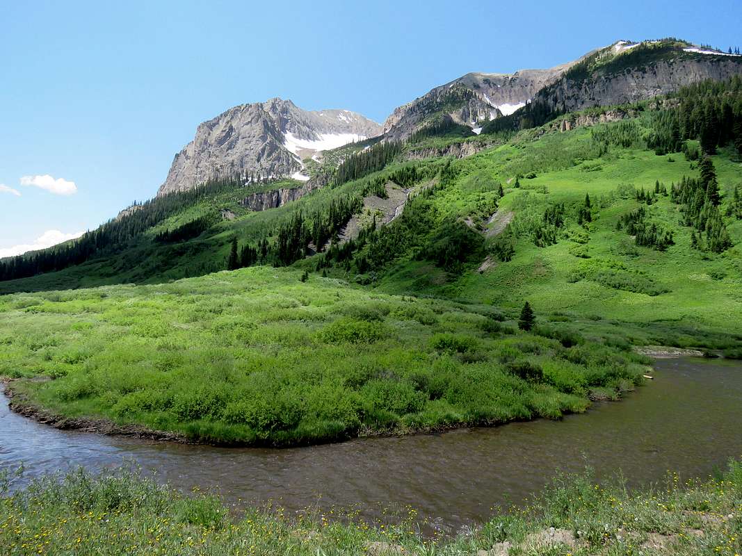
The northeastern face of Gothic Mountain from a spot to the north of the ghost town of Gothic.
Gothic Mountain sits to the north of the town of Crested Butte in the Elk Mountains of central Colorado. It is so called because the rocky formations on its ridgelines are reminiscent of gothic architecture. A trail starts in the East River Valley to the east of Gothic Mountain and goes to a 10980 ft saddle to the to the north of the mountain before descending into Washington Gulch to the west. A beaten path can be followed from the saddle first to the false summit and then the true summit.
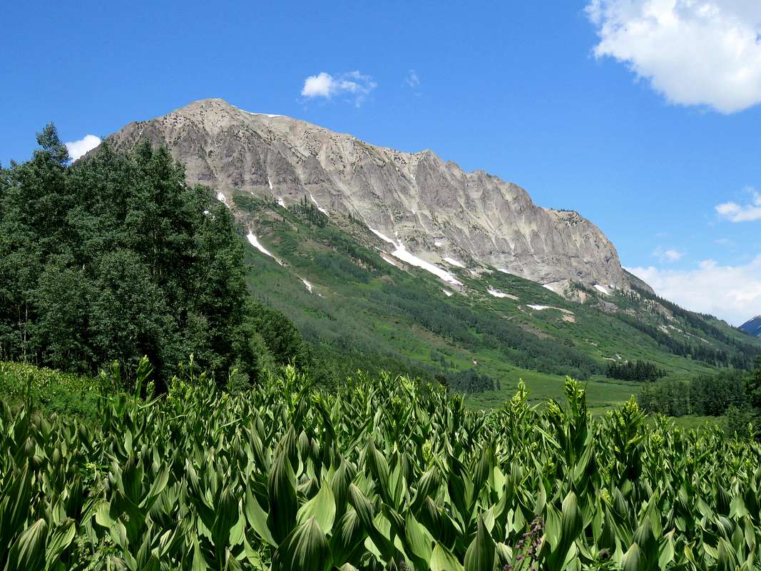
The southeastern face of Gothic Mountain from a spot to the south of the ghost town of Gothic.
Getting There
The 10980 ft saddle can be reached from the east via East River Valley or the west via Washington Gulch. Here are the directions via East River Valley:From Mt. Crested Butte Ski Area in central Colorado, get on Route 317 (Gothic Road, Schofield Pass Road) and drive 6 miles north going past the ghost town of Gothic and Gothic Campground to Washington Gulch Trailhead. The road is unpaved but well graded and passable to trailhead by any vehicle under dry conditions.
Route
All distances are per my GPS.At Washington Gulch Trailhead, head east and follow the zigzagging steep trail up a beautiful grassy slope getting good views of the nearby mountains. The trail goes up 900 vertical feet in the first mile.
 Avery Peak Avery Peak |
 Gothic Road Gothic Road |
 Mount Bellview
After about a mile, the slope eases and the false summit of Gothic Mountain (Point 12490 ft) comes to view to the south.
 The 12490 ft false summit The 12490 ft false summit |
 |
The reddish Avery Mountain will be visible to the east.
 Avery Peak
The trail crosses the stream and enters a pine forest. When I was in the area, patches of snow covered much of the trail in the forest.
 Snow in the forest
At 2 miles from trailhead, you will reach the 10980 ft saddle where a beautiful meadow appears with the false summit rising above it. You will need to leave the main trail and head toward the false summit. When I was there, a cairn and a well beaten path were visible.
 The 12490 ft false summit The 12490 ft false summit |
 Deer Deer |
The beaten path heads south/southeast and enters a pine forest. I lost the path in the forest under patches of snow but kept hiking toward the false summit to the top of a 11170 saddle and then a little down to reach the base of the false summit where the forest thinned out. As I went higher, the forest went away and the beaten path turned into a well-defined trail.
 False summits
From the top of the false summit, the true summit will come to view to the south.
 True summit from false summit
From the top of the 12490 ft false summit, follow the ridgetop down to a 12340 ft saddle. A big cirque can be seen to the east between the false and the true summits.
 Cirque to the east
True summit from the saddle.
 True summit
Looking back at the false summit from the saddle.
 False summit
Views from the summit.
 Zoomed view of Maroon Bells Zoomed view of Maroon Bells |
 Zoomed view of Owen, Afley, Hancock Zoomed view of Owen, Afley, Hancock |
 Ghost town of Gothic Ghost town of Gothic |
 Mts. Crested Butte & Whetstone Mts. Crested Butte & Whetstone |
 Mts. Emmons, Axtell Mts. Emmons, Axtell |
 Pyramid, Avery, Whiterock Peaks Pyramid, Avery, Whiterock Peaks |
 East River Valley East River Valley |
 False summit, Mt. Baldy False summit, Mt. Baldy |
 Maroon Bells, Pyramid Peaks Maroon Bells, Pyramid Peaks |
 Owens, Afley Owens, Afley |
ArikYa - Sep 20, 2020 6:59 pm - Hasn't voted
small issue with the gpx fileI used the attached gpx file, and it leaves the main trail a little too early, you can stay with the trail until the clearing to a clear junction to the summit trail.
nader - Sep 23, 2020 6:29 am - Hasn't voted
Re: small issue with the gpx fileThanks for the note. Maybe the trail has changed since 2017. Where I left main trail, there was a cairn and a beaten path.