
|
|
Mountain/Rock |
|---|---|
|
|
46.88800°N / 10.03200°E |
|
|
Mountaineering, Trad Climbing |
|
|
Spring, Summer, Fall |
|
|
10240 ft / 3121 m |
|
|
Overview
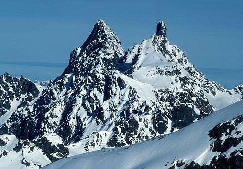
Gross Seehorn (left) and Gross Litzner from the SSE
There are several fine alpine routes on the mountain, the most famous one being the full traverse of next door neighbor Gross Litzner followed by Gross Seehorn.
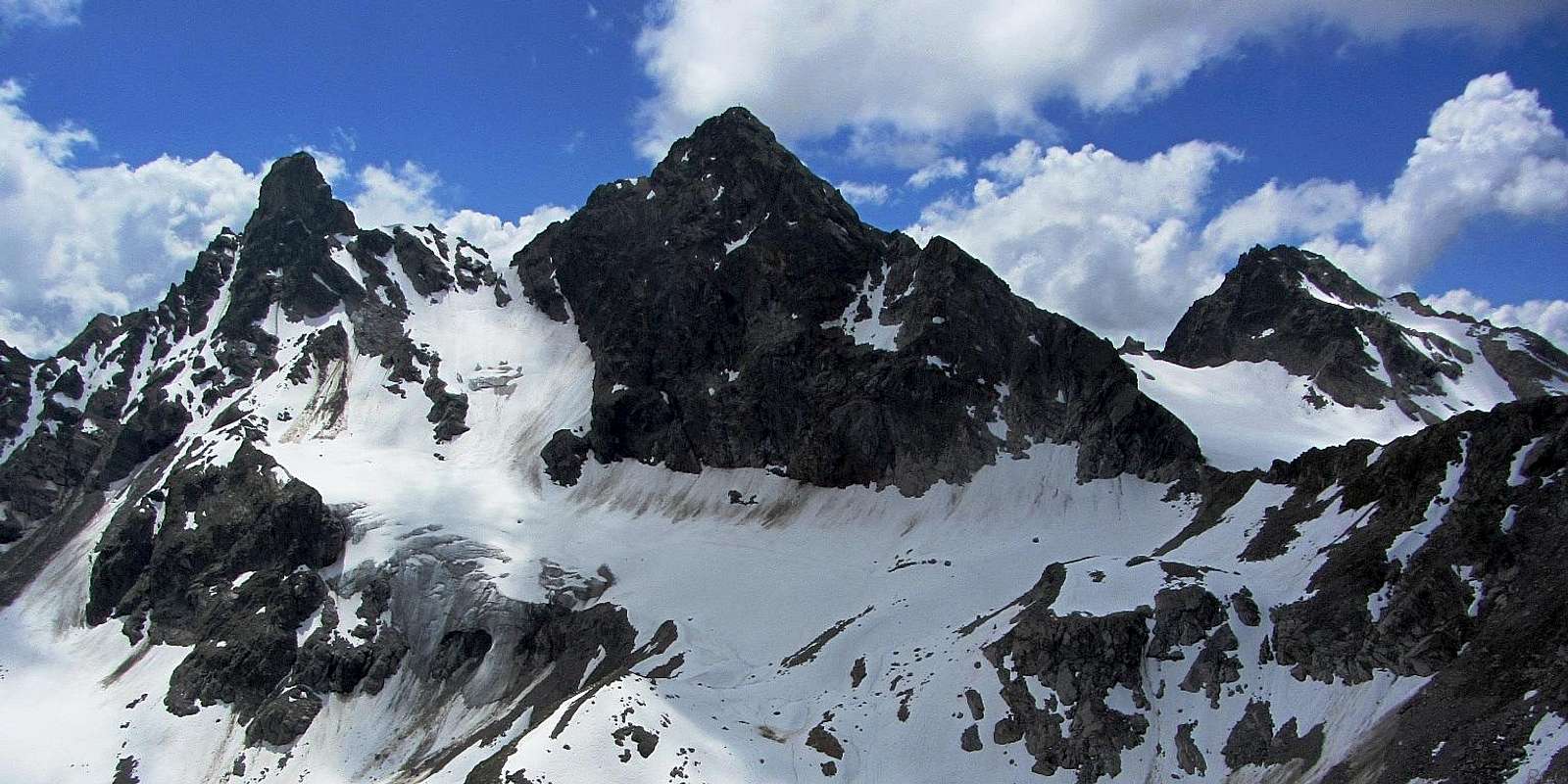
Left to right: Gross Llitzner, Gross Seehorn and Chlein Seehorn. Seen from the north, from Kleinlitzner.
Faces and ridges
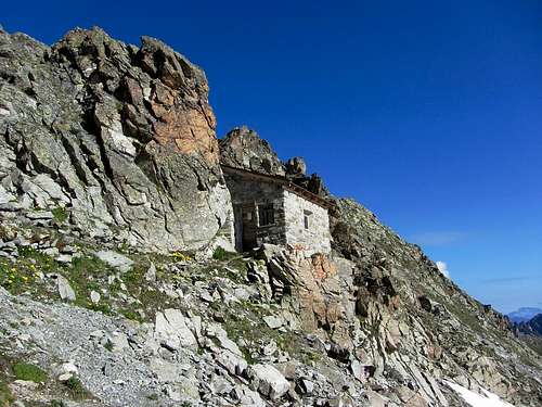
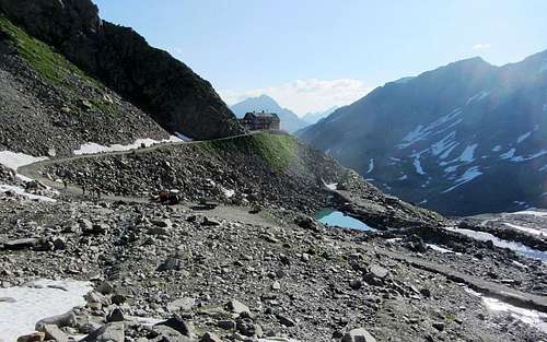
Old abandoned customs building at the Seelücke
A third, much less pronounced ridge connects Gross Seehorn with smaller sibling Chlein Seehorn (3032m) to the west. The saddle between them is the Seehornscharte (2860m).
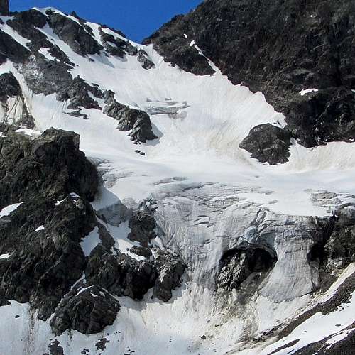
The Litzner Gletscher on the north side of the saddle between Gross litzner and Gross Seehorn
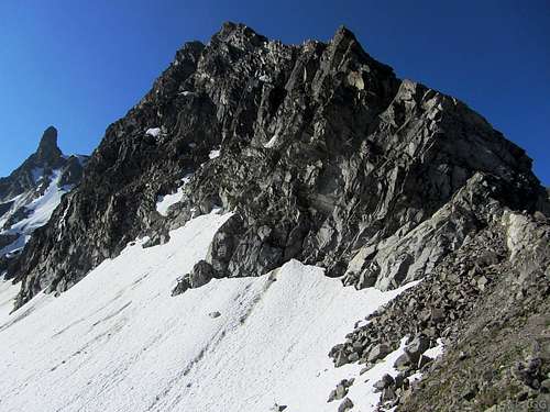
The rugged northeast face, seen from the Seelücke. Gross Litzner is on the left.
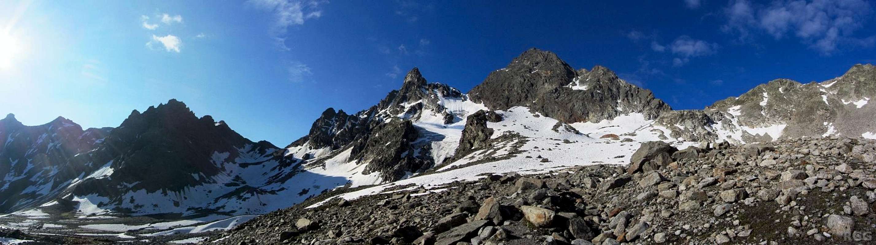
The southwest face has two distinct parts. Although still exclusively climbers' territory, the part between the summit and the Seelücke, the saddle NNE of the mountain, is the least steep. At its base, stretching towards the northwest, are the gentle slopes of the small Seegletscher. In stark contrast, the southwest face between the summit and the saddle with the Gross Litzner is the steepest face of all.
A note on names, and other differences
Although the language on both sides of the border is German, there is a small difference in the name of the mountain: the Austrians call it Großes Seehorn, the Swiss Gross Seehorn. Similarly, the Austrian name for Gross Litzner is Groß Litzner or also Großlitzner. Since both "ß" and "ss" are pronounced as "s", the differences are only in the spelling.There is also the matter of the elevation. Austrian sources say it's 3121 m, Swiss ones 3122 m.
Getting There
From Austria
The nearest road is at the Vermunt Stausee, a dammed lake along the Silvretta Stausee. The road is the "Silvretta Hochalpenstraße", a toll road, connecting the Montafon valley on the northwest with the Paznaun valley on the northeast. The highest point of the road is Bielerhöhe, a high pass directly north side of the scenic Silvretta Stausee, another dammed lake. Bielerhöhe is easy to reach by bus from both sides, but if you come from Paznaun, you may have to transfer to another bus or simply start walking from there. If you do arrive by public transport, ask the driver to let you off at the "Obervermuntwerk" at the south side of the Vermunt Stausee.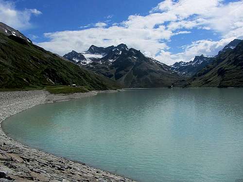
View across the Silvretta Stausee from Bielerhöhe
If you come by car, there is some room to park south of the Vermunt Stausee and there are big parking lots at Bielerhöhe.
From the Vermunt Stausse it's an easy walk up the Kromer valley to the Seelücke, about 2.5 hours. With a mountain bike you can easily ride up to as far as the Saarbrücker Hütte, from where it's a just over half an hour more on foot. If you start walking at Bielerhöhe, count on one more hour.
From Switzerland
The nearest settlement of note is Klosters-Monbiel, in winter a ski resort. Klosters has a train station, and Swiss trains have a fine reputation. Usually they go often and are punctual. Unfortunately they are also rather expensive.It's a long hike up from Switzerland. From Klosters to the Seetalhütte takes about 4 hours, to the Seelücke 2.5 hours more.
Routes
OSM map of the surrounding trails
The Normal Route
The normal route starts by going up the SW face between the Seelücke and Seehornscharte, reaching the NNW ridge high up. Climbing the face is a no harder than UIAA grade II, mostly easier. There are some bolts, widely spaced. The crux comes shortly after gaining the ridge, with an exposed section (UIAA grade III). The final part on the ridge is easier again.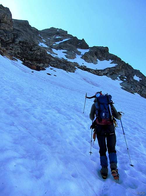
In the shadow of Gross Seehorn, approaching the base of the SW face
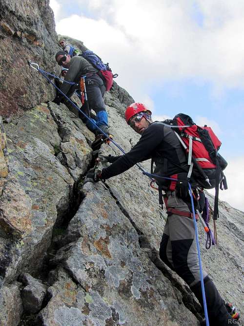
Climbing the face
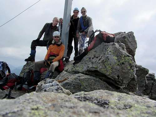
The whole gang on top of Gross Seehorn
The Southeast Ridge
If you want to do a traverse of the mountain, you can climb the SE ridge (UIAA grade II). The base of this ridge, the saddle with Gross Litzner, can be reached via the Litzner Gletscher. You can then descend the normal route.This route can be combined with a traverse of Gross Litzner, which used to be UIAA grade III+. However, in 2013 we learned that rockfall on Gross Litzner had wiped out part of the route.
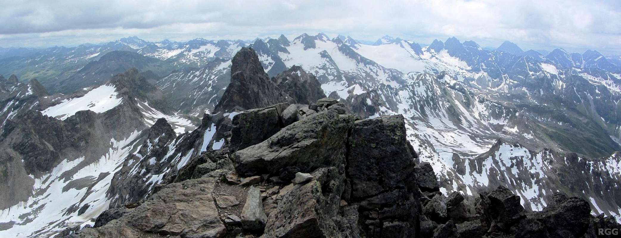
Gross Seehorn summit panorama towards Gross Litzner and beyond
Red Tape
The Silvretta High Alpine road is a toll road. Even bus passengers have to pay extra on top of the bus ticket.When to Climb
Best from mid or late spring to fall.If you consider a winter ascent, be advised that the slopes are much too steep for a ski descent. However, smaller next door neighbor Chlein Seehorn (3032m) offers a very long ski route down to the valley, first down to the Seelücke and from there either down the Kromer valley to the north, or the Seetal to the south.
Accommodation
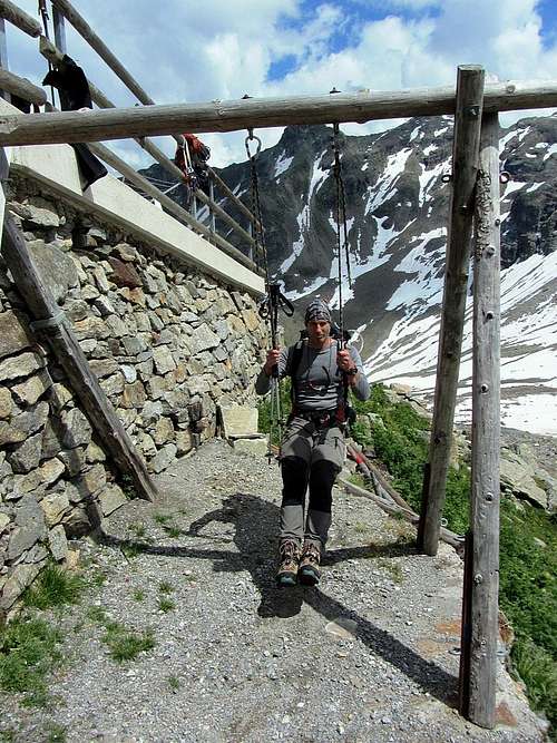
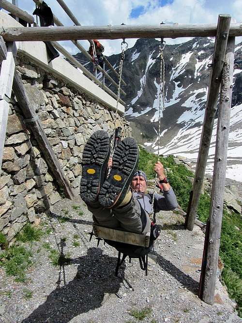 Having fun on the swing at the Saarbrücker Hütte
- Madlenerhaus: A refuge located next to the road, a few minutes west of Bielerhöhe. Excellent food!
- Saarbrücker Hütte: A fine hut on a shoulder of the Kleinlitzner west ridge, just over a kilometer north of the mountain. If you visit, try the cake.
The warden lives there with his young family, which may explain the swing outside the refuge. It's sturdy enough for playful adults too.
- Seetalhütte: A small hut, south of the mountain. As of 2012 without hut warden.
The Saarbrücker Hütte in the morning, from the trail to the Seelücke
Books and Maps
A good (German) guidebook for the area is the Silvretta Alpenvereinsführer, Günther Flaig, Rother Verlag. ISBN 978-3-7633-1097-5.The best map is the Alpenvereinskarte Silvrettagruppe, 1:25 000. On the Austrian side, it covers everything that matters, but on the Swiss side it doesn't cover Klosters-Monbiel.
A fine alternative is the Freytag&Bernd map WK 374, 1:50 000. It covers a larger area, including Klosters.
External Links
| Bielerhöhe | In German and English. |
| Gross Seehorn on hikr.org | In German. |
Panorama of Gross Llitzner and Gross Seehorn from the Kromer valley