
-
 1928 Hits
-
 77.48% Score
-
 8 Votes
|
|
Mountain/Rock |
|---|---|
|
|
Hiking, Skiing |
|
|
Spring, Summer, Fall, Winter |
|
|
6673 ft / 2034 m |
|
|
Overview
The groups of the eastern end of Lechtaler Alpen, mostly an area rich of geological diversity, is geologically rather monotone. Loreagruppe is no exception. Consisting mainly of Hauptdolomit, a dolomitic limestone built in a huge lagoon in the Trassic age, and Plattenkalk, a well stratified pure limestone of the same age, those peaks have a rugged and frail, nevertheless interesting appearance.
However, no rule without exception! In our case the exception are the jurassic deposits of the so called Allgäuschichten or Allgäu Fleckenmergel. These marls and limestones are more supple, have less resistance against mechanical weathering and thus build soft mountain forms, allow meadows rich of plants and wildflowers and are a stark contrast against the rocky peaks in their neighbourhood.
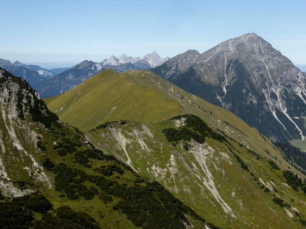
Such a zone of Allgäuschichten can be found on the north side of Loreagruppe. There are three, south – north running ridges, interrupted by likewise orientated valleys: Bleispitze to the east, Kamp in the center and Hönig / Sonnberg / Joch to the west.


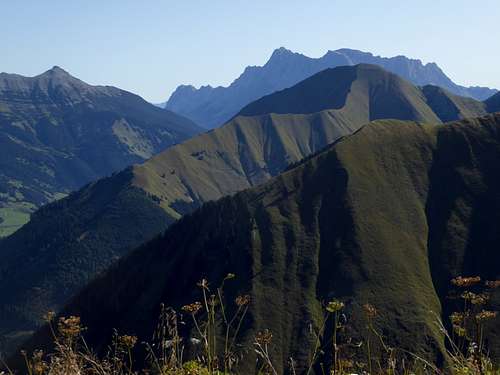
The west ridge is the longest of these three ridges and has three culmination points: Hönig to the north, Sonnberg in the center and Joch to the south. Between Hönig and Sonnberg are only 40 m of altitude difference to “overcome”. Joch is a southern outcrop of the Sonnberg summit ridge. For that I summarize these three “summits” as “Hönig / Sonnberg ridge”.
This ridge is an easy and nice hike. Many hikers do it as a half day outing. But Hönig / Sonnberg ridge can be included into a longer traverse and can even be a part of the full traverse of all mountains and summits, bordering the Älpelestal, the valley east of the ridge. Hönig rises above the village of Berwang. Next summit to the south are Suwaldspitzen.
In winter Hönig is a small and nice but very steep ski area with two ski lifts. The steepness of the northern slopes require a protection against avalanches, threatening parts of Berwang village. So huge avalanche steel barriers “adorne” the uppermost north and northwest slopes of Hönig. Not a nice view for hikers but necessary.
Getting There
Trailhead for Hönig / Sonnberg is Berwang and Rinnen.
You reach the trailheads by car:
- From Reutte or Arlberg direction use road number 198 to Stanzach. Turn on the “Berwang-Namloser Landesstraße” (signs for Namlos, Berwang) and proceed to Rinnen or Berwang with the trailhead.
- Alternatively use road number 179 from Reutte to Bichlbach and turn on the “Berwang-Namloser Landesstraße” until you reach first Berwang, then Rinnen.
- From Innsbruck go on highway A 12 to the exit “Telfs”, proceed on road number 189 to Nassereith and on road number 179 to Fernpass, Lermoos and Bichlbach. Follow the signs to Berwang and Namlos to the Berwang or Rinnen trailhead.
- Take Highway A95 from Munich to its end and proceed on road number B2 and B23 / 187 to Lermoos. Turn on road number 179 to Bichlbach and go on like described above.


Berwang trailhead: At Berwang center follow the signs for Gröben, an upper part of Berwang village. There is a huge parking area at the Hönig ski lift valley station.
Rinnen trailhead: Entering the small village you will find a hikers parking area along the road.
Public transportation:
Nearby railroad station is: Bichlbach. Bus number 151 goes to Berwang and Rinnen.
Routes Overview
Routes Overview: Hönig / Sonnberg ridge, Suwaldspitzen and Steinmandlspitze
Hikers Routes:
From Berwang / Höniglift parking area take the road tp Gröben and into Älpelestal. Go straight on to the trail into Älpelestal and ascend the valley until you reach a trail junction. Go right and follow the trail up to Sonnberg col, also called Neederiger Sattel. Turn right there and follow the ridge trail to the summit crosses of Joch, Sonnberg and at last Hönig.

Alternatively use the direct ascent from Berwang parking area. Due to works on the avalanche barriers below Hönig, this ascent actally is closed. However I used it on a Sunday without problems (and without construction works going on). I think that from 2020 on this route will be open again. Follow the road to Gröben and into Älpelestal. Take the right hand forest road which leads up Hönig east slopes to the north ridge, where a narrow trail starts zigzagging up the north ridge to the summit.


These routes can be combined to a loop route.
Traverse of the whole meadow ridge from Hönig to Sonnberg col is about 15 to 20 minutes.
From Rinnen trailhead follow the trail to Kögelehütte. Proceed then on a trail to Sattelkopf, an outcrop of the east ridge of Hönig. The trail zigzags up this ridge to the Hönig summit.

Ski route:
The winter ski tour route to Hönig starts at the ski lift valley station on the road between Berwang and Rinnen. Ascend the mountain following the ski run to the mountain station. Use then the northwest ridge and the uppermost northwest slope to reach the summit.
Red Tape & Accommodation
No restrictions as far as I know
Accommodation:
No mountain huts in this area
Gear & Mountain Condition
Hönig is an easy hiking summit for late spring, summer and autumn.
In winter and spring with sufficient snow Hönig is an easy, in the upper part steep ski tour.
Avalanche gear is required. See the Tirol avalanche bulletin here.


Weather at Berwang:
Maps
Alpenvereinskarte, scale 1 : 25000
Number 4/1, Wetterstein und Mieminger Gebirge West, edition 2016 with trails and UTM-grid
Österreichische Karte, scale 1 : 50000
Number 2221, Imst, with UTM-grid, BEV – Bundesamt für Eich- und Vermessungswesen, Wien
Österreichische Karte, scale 1 : 25000
Number 2221-Ost, Erwald, with UTM-grid, BEV – Bundesamt für Eich- und Vermessungswesen, Wien, edition 2013
