-
 1581 Hits
-
 78.27% Score
-
 9 Votes
|
|
Mountain/Rock |
|---|---|
|
|
47.27707°N / 10.76933°E |
|
|
Hiking, Mountaineering |
|
|
Summer, Fall |
|
|
7700 ft / 2347 m |
|
|
Overview
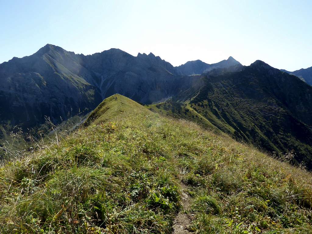
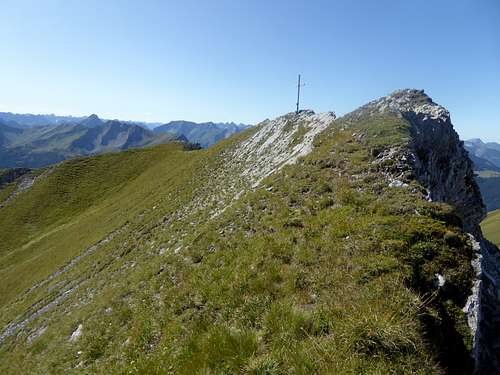
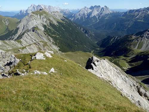
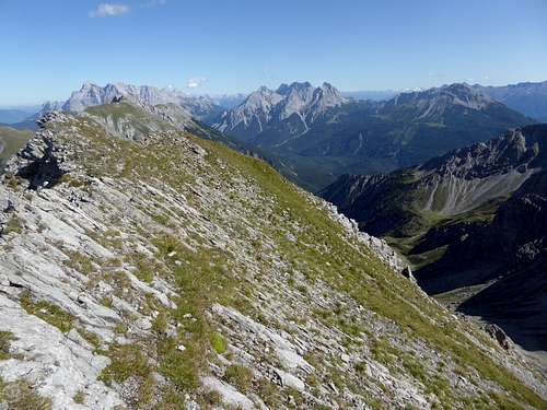
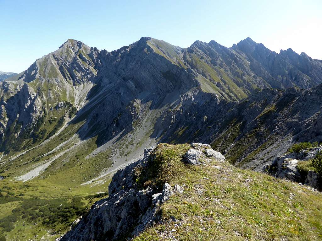
Steinmanndlspitze is part of Loreagruppe in the eastern part of Lechtaler Alpen. It is located south of the village of Berwang and north of the Fernpass, an important alpine col, where even the Romans built one of their roads through the Alps. Its neighbours are Suwaldspitzen to the west and Roter Stein to the east. Whereas Roter Stein receives many visits the whole year round, Steinmanndlspitze, only some meters lower than Roter Stein, is lonely and seems lost in time and space.
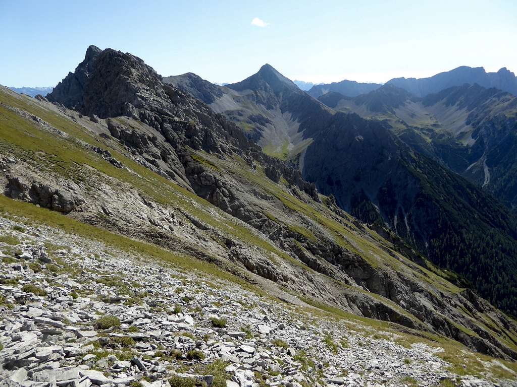
I went there for the first time in September 2019, traversing Hönig and Suwaldspitzen. I was really fascinated. After passing Hönig, where I met some hikers, I was completely alone in an almost untouched dream landscape. The mainly off-trail ascent of Steinmanndlspitze was easy and entertaining and I sat on that summit for about an hour, not willing to leave (well, end of September days tend to be shorter than expected…). There were loads of hikers on Roter Stein whereas I had “my” summit for myself.
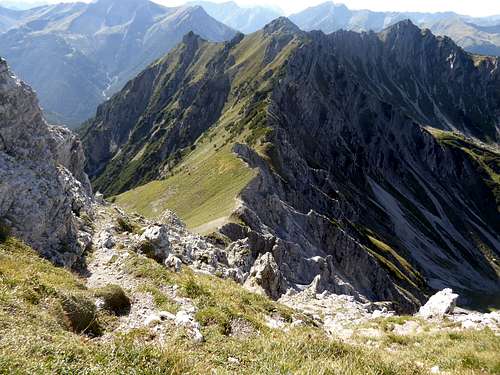
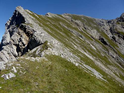
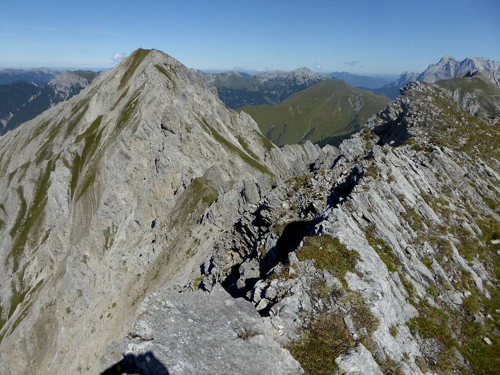
Steinmanndlspitze is one of those two – face – mountains, showing an uninviting rock face to the north and a more gentle rock and meadow slope with a minor ridge to the southeast, dropping down into Lacknerkar cirque. The south ridge leads to Galtbergspitze, a rock peak with frail and disintegrated rock faces and aretes.
Steinmanndlspitze is part of the whole traverse of the Älpelestal – summits: Kamp, Roter Stein, Steinmanndlspitze, Suwaldspitzen, Sonnberg/Hönig, a near epic day! As I was alone that day I ended the traverse at Steinmanndlspitze – the connecting ridge to Roter Stein is complicated and I did not like the idea of a solo – and explored descending the northern direct route to the summit.
Getting There
Trailhead for Steinmandlspitze is Berwang or Fernpass.
You reach the Berwang trailhead by car:
- From Reutte or Arlberg direction use road number 198 to Stanzach. Turn on the “Berwang-Namloser Landesstraße” (signs for Namlos, Berwang) and proceed to Berwang. Alternatively use road number 179 from Reutte to Bichlbach and turn on the “Berwang-Namloser Landesstraße” until you reach Berwang village.
- From Innsbruck go on highway A 12 to the exit “Telfs”, proceed on road number 189 to Nassereith and on road number 179 to Fernpass, Lermoos and Bichlbach. Follow the signs to Berwang.
- Take highway A95 from Munich to its end and proceed on road number B2 and B23 / 187 to Lermoos. Turn on road number 179 to Bichlbach and go on like described above.
Berwang trailhead: At Berwang center follow the signs for Gröben, an upper part of Berwang village. There is a huge parking area at the Hönig ski lift valley station.
Public transportation:
Nearby railroad station is: Bichlbach. Bus number 151 goes to Berwang.
You reach the trailhead Fernpass by car:
- from Reutte directions on road number 179 until you reach Fernpass;
- from Munich directions on highway A95 and road number B2 to Garmisch and on road number B23 and 187 to Lermoos. Turn on road number 179 to Fernpass trailhead;
- from Innsbruck using highway A 12 to exit “Telfs”, road number 189 to Nassereith and 179 to Fernpass;
- from Arlberg and Landeck directions on highway A12 to exit “Imst”, then on road number 171, turning on road number 189 to Nassereith. Go on road number 179 to Fernpass.
There are not many parking lots for hikers on Fernpass, better have an early start!
Public transportation:
Nearest railway stations are Lermoos to the north and Imst / Pitztal to the south.
- Bus number 150 serves Fernpass road.
- Bus number 4206 goes from Imst to Nassereith, change into bus number 150.
- From Lermoos take bus number 150 to Fernpass directly.
Routes Overview
Routes to Steinmandlspitze
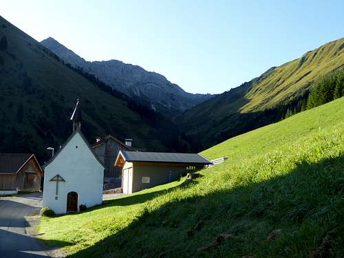
Trailhead Berwang / Höniglift parking area.
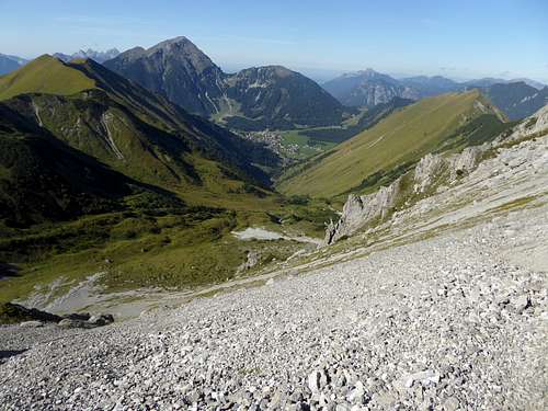
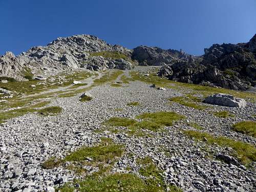
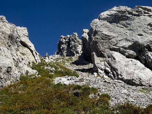
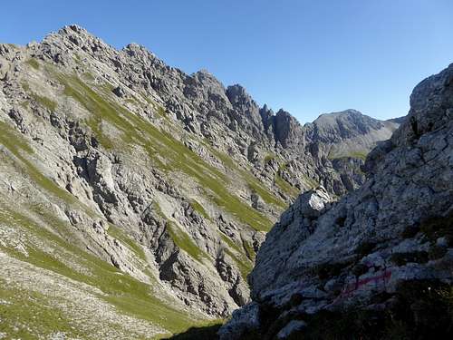
Follow the road to the village of Gröben. Enter Älpelestal first on a road, then on a marked trail which leads up the valley to a trail junction. Turn right and follow the trail until it starts to ascend. Leave the trail to the left and ascend off-trail the northern slopes in front of you (some bushwacking required) until you reach an upper near level part of the valley. There is a scree field in front of you reaching up to the col between Steinmanndlspitze and Hintere Suwaldspitze. You soon will find an unmarked trail going up to this col. Turn left there and climb up an easy rock chute (cairns, red arrow) to the top of a rock outcrop. Follow then some tracks and off-trail the west ridge to the summit.
Trailhead Fernpass
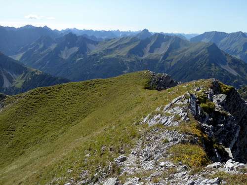
From Fernpass follow the forest road to the west, slightly descending. At a road junction turn right and ascend the valley until the road ends. Take the left hand trail there, it ascends to the end of the valley and takes a huge bend to the south to an Alm hut. At the trail junction after the hut take the right hand trail back to the north and follow it until you reach the lower east ridge of Steinmandlspitze. Leave the trail to the left and ascend off-trail the easy east ridge to the summit.
Traverse from Suwaldspitzen
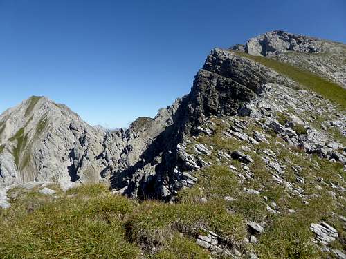
Follow the ridge descending from Hintere Suwaldspitze to the east. Keep mostly on or slightly north of the ridge to navigate around the dwarf pines. From the col between Suwaldspitzen and Steinmandlspitze follow the west ridge of the latter as described above.
Traverse from Roter Stein
Easy route: Descend on trail number 612 from the summit of Roter Stein in eastern directions to Lacknerkar. Leave the trail there an traverse Lacknerkar in southern direction to the beginning of the east ridge of Steinmandlspitze. Ascend the easy east ridge off-trail to the summit.
Connecting ridge: The ridge traverse Roter Stein – Steinmandlspitze is a complicated route in frail and loose Hauptdolomit rock. You have to navigate round rock spires on the north and the south side several times. Climbing up to grade II / II+, the existence of some cairns is reported in the internet.
Red Tape & Accommodation
No restrictions as far as I know
Accommodation:
No mountain huts in this area
Gear & Mountain Condition
Steinmandlspitze can be summited in late spring, summer and autumn. The summit requires hiking gear and good shoes. Both routes have off-trail parts, the route from Berwang some short grade I moves at the beginning of the west ridge.
The ridge traverse from Suwaldspitzen is easy but off-trail with one short grade I move in front of the col between the two summits.
The ridge traverse from Roter Stein is more difficult due to bad rock, a rather complicated route and parts grade II / II+.
Weather at Berwang:
Maps
Alpenvereinskarte, scale 1 : 25000
Number 4/1, Wetterstein und Mieminger Gebirge West, edition 2016 with trails and UTM-grid
Österreichische Karte, scale 1 : 50000
- Number 2221, Imst, with UTM-grid, BEV – Bundesamt für Eich- und Vermessungswesen, Wien
- Number 2221-Ost, Erwald, with UTM-grid, BEV – Bundesamt für Eich- und Vermessungswesen, Wien, edition 2013


