Overview
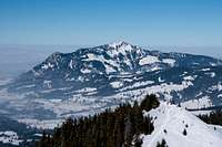
![Sonnenköpfe]() Sonnenkopf, Heidelbeerkopf, Schnippenkopf and Rubihorn seen through the valley fog from Altstädten Sonnenkopf, Heidelbeerkopf, Schnippenkopf and Rubihorn seen through the valley fog from Altstädten |
is the central summit of
Sonnenköpfe, a three summit ridgeline which rises between the
Iller Valley in the west and
Retterschwanger Tal in the east. The ridgeline with
Sonnenkopf,
Heidelbeerkopf and
Schnippenkopf rises just across the timberline so that on either of the summits only part of the vista is free. The
Sonnenköpfe Ridge is one of the most popular hiking destinations in the Allgäu Alps in summer, and certainly an even more popular tour-ski and snowshoe destination in winter. While in summer the whole traverse is usually climbed in winter, most skiers and snowshoers stop at the lowest summit
Sonnenkopf, from which ski descents are possible in many directions.
Heidelbeerkopf, due to a steep and exposed (at least in winter it feels exposed) north ridge is far less often visited and
Schnippenkopf sees only a few ascents, almost all from the south.
In summer things look different. Here Schnippenkopf is the main location, which thanks to its elevation is high enough to offer unobstructed views. The other two summits are climbed en route. All three are typical Allgäu Alps summits, steep, grass-covered with deep ruts where the paths go. Howver, the ridges are rather broad so that the only exposure you get is during the steep ascents themselves.
The mountains are usually climbed from either
Schöllang,
Hinang or
Altstädten, all on the western side of the ridge. Though the ascent cannot be called difficult, thanks to the elevation gain, it is rather demanding. From Altstädten you have to scale more than 1200m to reach Heidelbeerkopf. Still, also thanks to the fact that the web pages of Oberstdorf and Fischen advertise the traverse, many people set out to do it. Mountain Inns on either side of the traverse (Gaisalpe, Altstädter Hof) make sure you can refuel after the traverse.
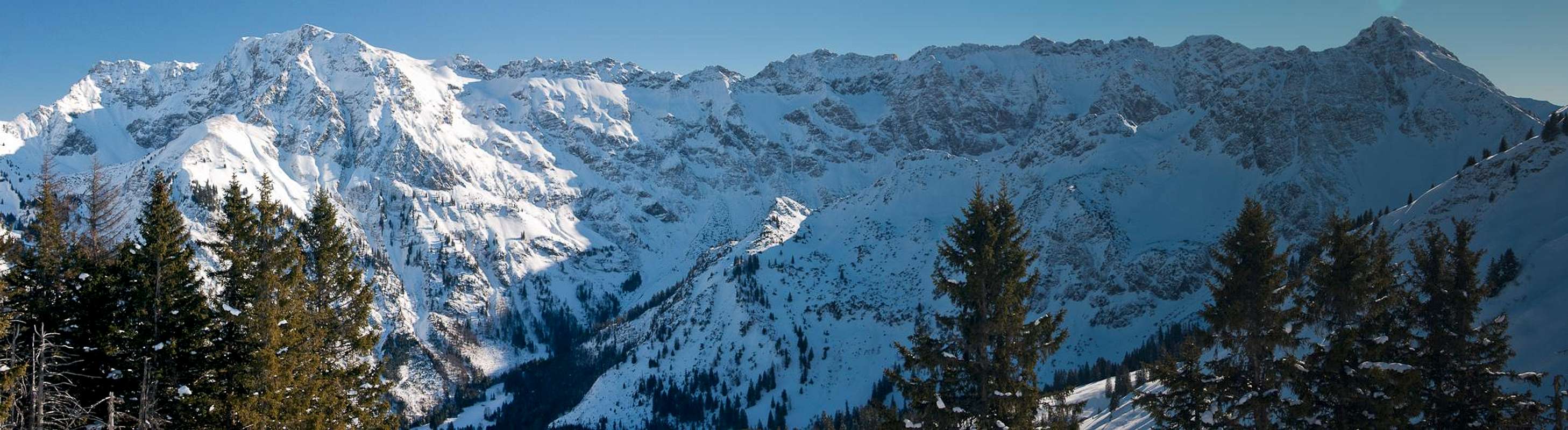
Summit Panorama
Summit panorama towards the north and east |
Getting There
Heidelbeerkopf can be reached from the dead end Iller Valey in the Allgäu Alps. Trailheads are at Schöllang, Hinang and Altstädten. The closest airports are at Stuttgart and Munich, both cities being connected by motorway
A8.
- Take motorway A8 to the intersection Kreuz Ulm-Elchingen.
- Turn onto motorway A7 south, direction Kempten and Füssen.
- At the intersection Dreieck Allgäu switch to A980.
- A few km later turn onto B19, direction Oberstdorf.
- At Sonthofen switch to OA4, direction Altstädten. All trailheads are located on this road.
Red Tape
Kleiner Daumen, Großer Daumen, Wengenköpfe, Nebelhorn and Entschenkopf |
is located on the western boundary of
Naturschutzgebiet Allgäuer Hochalpen, a nature preserve which includes the majority of the German part of the
Allgäu Alps. The usual restrictions apply.
Accommodation
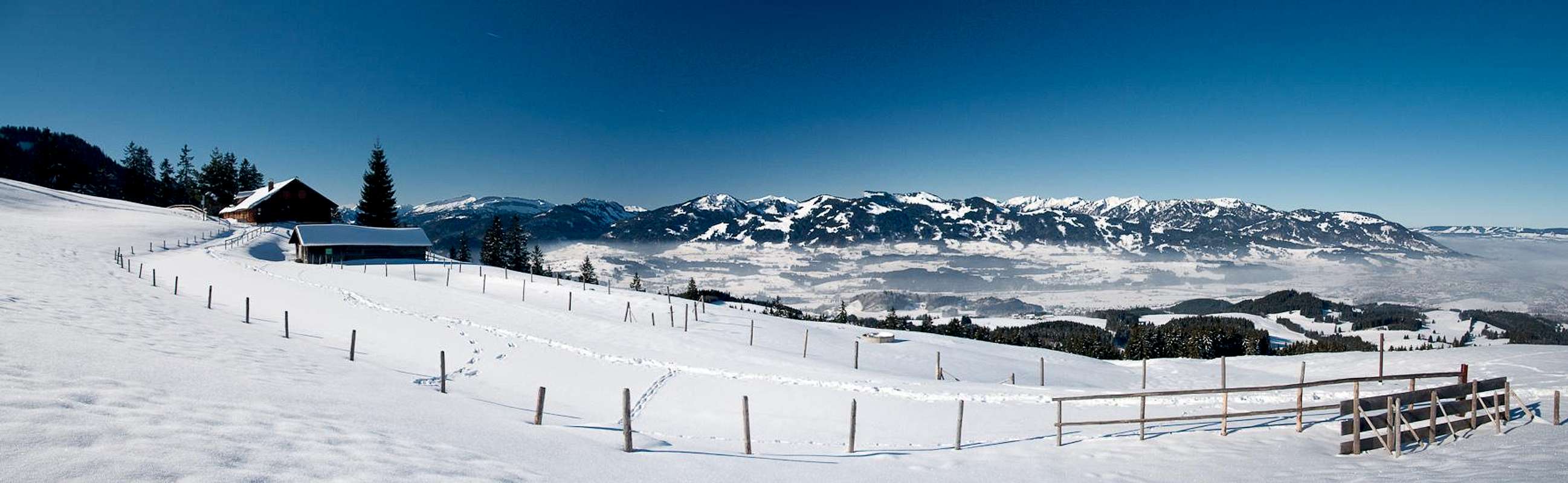
Altstädter Hof and Hörnergruppe above the foggy Iller Valley |
You can choose between campgrounds, farm holidays, vacation homes and hotel rooms on most of the sites of the Allgäu villages. A Good starting point for your search is:
Weather Conditions
Maps & Books
Maps
- Allgäuer Alpen / Kleinwalsertal
1:50000
Kompass Map WK 3
Kompass Verlag
ISBN: 3-85491-005-3
- Alpenvereinskarten : Allgäu-West
1:25000
Deutscher Alpenverein
ISBN: 3928777130
Books
- Allgäuer Alpen und Ammergauer Alpen Alpin
D. Seibert
Alpenvereinsführer
Rother Verlag
ISBN: 3-7633-1126-2
- Allgäu 1 - Oberallgäu und Kleinwalsertal
D. Seibert
Rother Verlag
ISBN: 3-7633-4289-3

 3040 Hits
 80.49% Score
 12 Votes
 Sonnenkopf, Heidelbeerkopf, Schnippenkopf and Rubihorn seen through the valley fog from Altstädten