
-
 7188 Hits
-
 86.85% Score
-
 23 Votes
|
|
Mountain/Rock |
|---|---|
|
|
47.43064°N / 10.33161°E |
|
|
Hiking, Scrambling |
|
|
Spring, Summer, Fall |
|
|
6703 ft / 2043 m |
|
|
Overview
 Entschenkopf seen from Nebelhorn Entschenkopf seen from Nebelhorn |
Entschenkopf is the northernmost mountain of the Daumen Group trinity of the Allgäu Alps: Rubihorn, Nebelhorn, Entschenkopf. It is far less impressive than Rubihorn with its massive north face, nor is it as popular as Nebelhorn (courtesy of the Nebelhornbahn cable-car) but it is a very fine mountain to hike and scramble to. Also, it is not exactly easy to climb. There are UIAA 1 sections on the normal route and the final ridge traverse is long and rather exposed. Moreover, from the trailhead at Breitenbach you have to scale about 1200m (with all ups and downs) so it is a long day tour to get to its top and back.
 |  |  |
Speaking of routes - the most popular route is from Breitenbach across Gaisalpe, passing the lower and upper Gaisalp Lakes then finally uses the north ridge through the Gängele Saddle. This north ridge is long and exposed, in some places even overhanging on its eastern side. Most climbers head down the south ridge (equally exposed) towards Falkenjoch and complete the loop near Gaisalpe. An even longer loop is the one from Bad Hindelang, which follows the Retterschwang Valley. It joins the north and south ridges of Entschenkopf in the same places as the normal loop from Breitenbach but requires long approach hikes. In winter a ski tour leads up to the mountain from Retterschwang Valley directly across the east slopes of Entschenkopf.
Getting There
EntschenkopfRubihornGaisalphornNebelhornZeigerHüttenkopfSeeköpfelSchattenbergSchneckGroßer /Hinterer Wilder 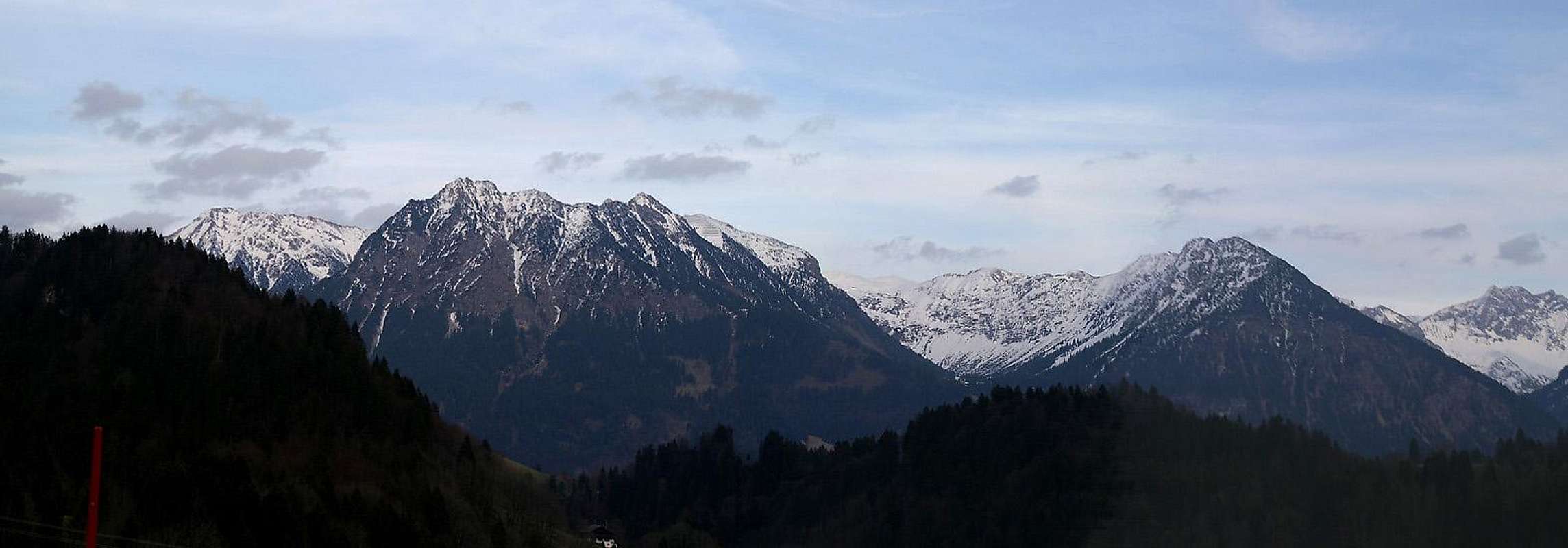  |
The main route to Entschenkopf starts at the village of Reichenbach to the north-west of the Oberstdorf. The town is located in a dead end valley in the midst of the Allgäu Alps. The closest airports are at Munich and Stuttgart, cities which are connected by motorway A8. Quite central between the two cities there is the intersection "Ulm-Elchingen" from where motorway A7 leads southward in direction of the Allgäu Alps. South of Kempten take A980 west, which ends after a couple of miles/kms where you have to switch to B19 south. This highway takes you all the way to Oberstdorf. For the Reichenbach trailhead you have to switch to OA4 right before you enter Oberstdorf and drive north-eastward for a few km.
 |  |  |
There is another popular, though much longer, route which starts at Bad Hindelang to the east of the mountain. The route follows the Retterschwang Valley, and either climbs to Falkenjoch in the north of Entschenkopf or to Am Gängele in the south. To reach Bad Hinterstein you need to leave B19 at Sonthofen and turn onto B308 until you reach Bad Hindelang.
Red Tape
 Chamois sprinting across the path from Gaisalpsee to Gaisalpsattel en route to Entschenkopf
The whole Daumen Group, to which Entschenkopf belongs, is part of the natural preserve "Naturschutzgebiet Allgäuer Hochalpen". The usual rules apply - don't disturb wild animals, don't collect any plants, stay on the marked trails. Dogs should be kept on leash. These rules seem to be rather outdated when you see the brouhaha around the Nebelhorn cable-car stations. But remember, that parts of the group still are remote and can be solitary.
Parking lots: you have to pay for almost all parking lots in Oberstdorf. There is a large unguarded one to the south of the cable-car which is (still) free of charge. Also, the parking lots at Bad Hindelang require a fee. As to my knowledge the parking lot at Reichenbach is still free of charge.
Accommodation
 |
You can choose between campgrounds, farm holidays, vacation homes and hotel rooms on most of the sites of the Allgäu villages. A good starting point for your search is: All of the towns and villages of Allgäu have their web sites, most of them with weather information and live cams. Here is a small selection

Maps & Books
Maps- Allgäuer Alpen / Kleinwalsertal
1:50000
Kompass Map WK 3
Kompass Verlag
ISBN: 3-85491-005-3
- Alpenvereinskarten : Allgäu-West
1:25000
Deutscher Alpenverein
ISBN: 3928777130
Books
- Allgäuer Alpen und Ammergauer Alpen Alpin
D. Seibert
Alpenvereinsführer
Rother Verlag
ISBN: 3-7633-1126-2
- Allgäu 1 - Oberallgäu und Kleinwalsertal
D. Seibert
Rother Verlag
ISBN: 3-7633-4289-3