
|
|
Mountain/Rock |
|---|---|
|
|
39.03292°N / 106.63517°W |
|
|
Pitkin |
|
|
Mountaineering |
|
|
Summer |
|
|
12908 ft / 3934 m |
|
|
Overview

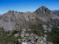
West face of Larson

SW face of Larson
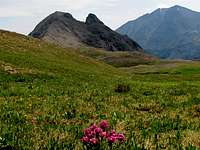
The upper portions of Lincoln Creek create a wide U-shaped valley that marks the boundary between the Elk and Sawatch Mountains of Colorado. This incredible valley is surrounded by jagged peaks and high alpine lakes.
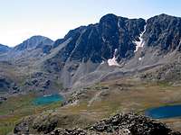
The double summit of Larson Peak is one of the jagged mountains that rise to the west of the valley of Lincoln Creek. To the south, the slopes of Larson drop very steeply into a basin that houses Petroleum Lake. The eastern and northern slopes of Larson drop just as steeply into the valleys of Lincoln & Galena Creeks. To the west/southwest, a rocky ridgeline goes down to an elevation of 12500 ft where a broad and grassy saddle separates Larson from Peak 13505 ft.
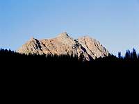
The eastern summit of Larson Peak is a rocky buttress that is surrounded by wall-like slopes. Reaching its top is probably a technical climb. Although from some angles the eastern summit of Larson might appear as the taller one, peak baggers will be glad to know that the true summit sits to the west. It can be reached via a Class II hike up the rocky western ridgeline of Larson Peak.
The hardest part of climbing Larson Peak is probably reaching the trailhead. This requires a 10 mile drive up the rough Lincoln Gulch dirt road.

North Face of Larson
Getting There

North face, the closer peak is Larson
SW face of Larson
From the town of Aspen, drive roughly 10 miles east on Route 82 until you see the sign for the Lincoln Gulch Road (Forest Road 106) on the right (south) side of the road.
Guidebooks might say that most cars can drive up Lincoln Gulch Road but I found it to be pretty rough and will not drive it in anything less than an SUV.
Drive the pot hole ridden Lincoln Gulch Road east. After 3.3 miles, you will reach the junction of New York Creek Road. Continue straight (left). 0.75 miles later you will reach the Tabor Creek Trailhead.
After the Tabor Creek Trailhead, the road seems to become much smoother. It continues east for another 2.5 miles to reach the Grizzly Reservoir. Here the road turns south and becomes rough again. 4WD is recommended. Drive the road another 3.5 miles to reach the signed junction of the trail to Anderson & Petroleum Lakes (11200 ft)
Route, West Ridge, Anderson/Petroleum Lakes
All distances are per my GPS:Place…………….Elevation (ft)…Distance (miles)
Trailhead…………11200………...Zero
Anderson
Lake………………11820…………1.1
Nameless
Lake (Lower
Petroleum)………..12060………….0.65
Petroleum
Lake………………12300………….0.3
Saddle……………..12500
Larson……………..12908…………0.7
Total……………………………………….2.75 miles
Once you reach Grizzly Reservoir (see “Getting There” above), the jagged summits of Peak 13631 ft and Truro Peak appear to the south. As you drive south past Truro Peak, Larson appears on the right.
 North Face of Larson |  East Face of Larson |
At the trailhead to Anderson & Petroleum Lakes, cross the creek (can hop on boulders) to the east side and follow a Jeep Road a short distance into a Pine Forest. You will soon reach a gate. The road is closed to motorized vehicles beyond this spot. Follow the trail up the forested slopes. You will have great views of the Magnificent Peak 13631 ft to the south. Just before you reach Anderson Lake, you will go above the tree-line. The double summits of Larson Peak appear to the north.
 Larson | 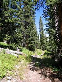 Pine Forest |  Peak 13631 ft |
You will then reach Anderson Lake which sits at the base of Peak 13631 ft.
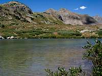 Larson & Anderson Lake | 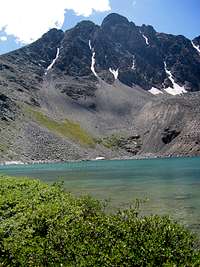 Peak 13631 ft & Anderson Lake |
Turn north and follow the trail over lush grassy slopes toward Petroleum Lake.
 Larson |  Lush |  Lush | 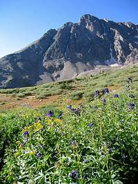 Peak 13631 ft |
You will soon reach a nameless lake (Lower Petroleum Lake) that sits directly at the base of the Larson Peak.
 Lower Lake | 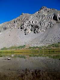 Larson from Lower Lake |  Grizzly from Lower Lake |
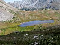
Follow the trail a little higher to the end of it at Petroleum Lake.
 Petroleum Lake & Peak 13631 ft | 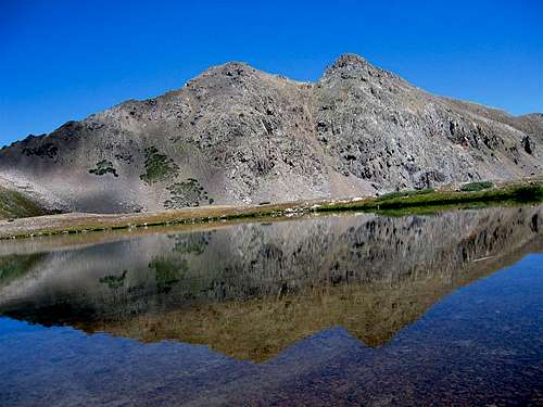 Petroleum Lake & Larson Peak |  Petroleum Lake & Peak 13505 ft |
Leave Petroleum Lake and head north up beautiful and gently sloped grassy slopes to reach a broad saddle.
 Larson |  Larson |
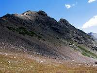
Head northeast and follow the rocky western ridgeline of Larson to reach the top of its western summit. A faint trail may be seen in some places.
 Ridgetop | 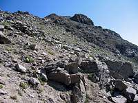 Ridgetop | 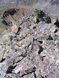 Ridgetop |
Views from the summit of Larson Peak:
 Truro Peak | 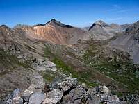 Tabor Peak | 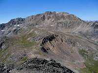 Peak 13505 ft |
 Peak 13631 ft |  Grizzly Peak | 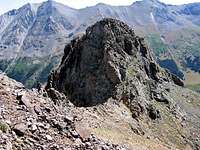 East Summit |
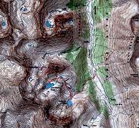
Map
Weather
Click to see the forecast for the nearby town of Aspen.Red Tape
No fees or permits needed for day hikes.For other regulations, see the website for White River National Forest.