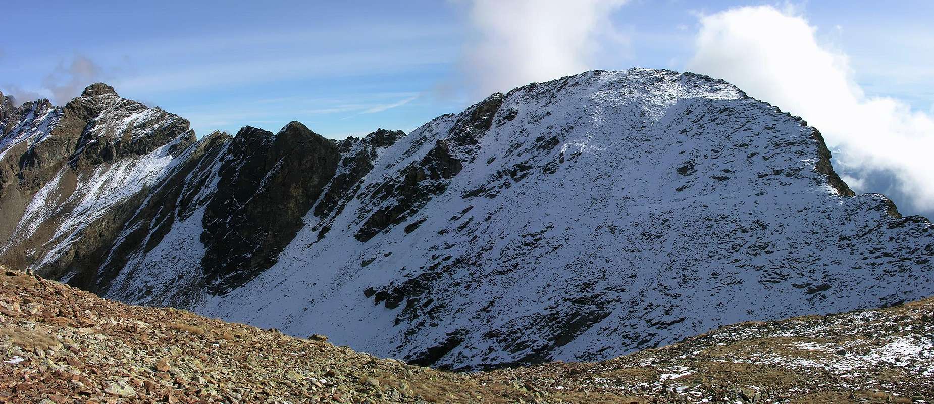
Mont Mary is a nice, rounded summit rising between Colle di Chaudière (2.681m) to the northeast and Colle di Viou (2.716m) to the northwest. It belongs to a small mountain group, including (starting from West):
Becca de Roisan (2.546m)
Becca di Viou (2.855m)
Mont Mary (2.815m)
Tête d'Arpisson (2.856m)
Pointe de Seneve (2.928m)
Tsaat à l'Etsena (2.971m)
Pointe Henry (2.918m)
Becca Conge (2.914m)
In ancient times it was also known by the name of Saint Joseph. From its summit one enjoys excellent views of the entire City of Aosta with its surroundings and of a great deal of the Valle d'Aosta mountains.
First Ascents
First climbers: unknown.
First winter climb: Ilario Antonio Garzotto and Osvaldo Cardellina, (Mar 19th, 1968).
Getting There
BY CAR:
From Torino, Milano, etc: Motorway A5. Exit at Aosta Est.
From Switzerland: through the Grand Saint Bernard Tunnel or the namesake pass.
From France: through the Mont Blanc Tunnel or Petit Saint Bernard Pass: It is not necessary to take Motorway A5: you can drive on SS.26, in the direction of Aosta.
BY PLANE:
Aeroporto "Corrado Gex" Saint Christophe (Aosta).
From the Aosta Est exit of the motorway, go towards the City of Aosta. Soon after the Corrado Gex airport turn right toward the Village of Saint Christophe (615m). Follow the signs for Sorreley (790m). Past Sorreley, continue to the Village of Parleaz (1.214m) and on to the Village of Blavy (1.471m). (Be warned that the road, although paved, is very narrow and twisty).
Route
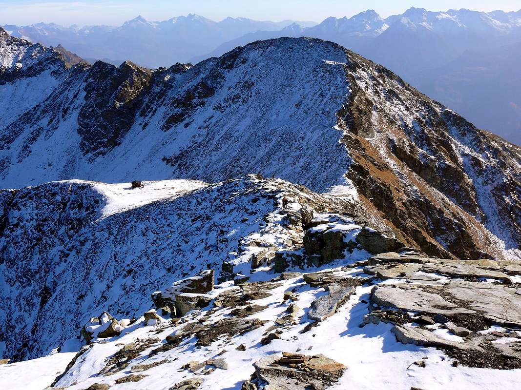
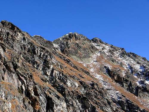
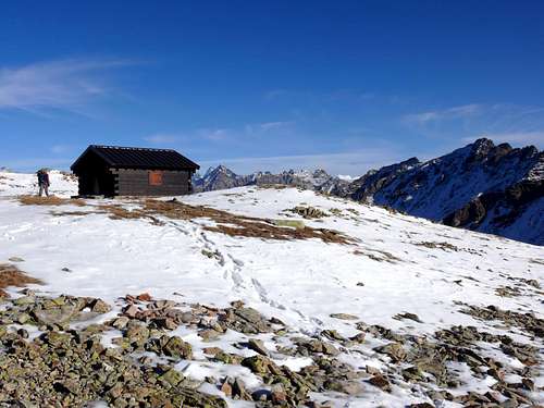
Park at the beginning of the dirt road (which is accessible only to authorized vehicles). Hike along the farm road that leads to the Praperia Pastures (1.737m). After about 10 minutes the road forks: keep right and reach the Viou Pastures at 2.062m after about 1h'30. Right behind the pastures starts the well-marked trail for Colle di Viou (2.716m): a comfortable fixed Bivouac "Penne Nere" (2.730m) was opened recently (Jul 16th, 2005) near the saddle. The wooden building sleeps 14 and can be reached in about 2 hours from the pastures. Keep right (southwest) and once past the initial grassy slopes start the ascent of the rocky ridge staying on the north side of the mountain a short distance from the crest. Climb a few easy slabs and short cliffs to reach the Summit of Mont Mary, marked by a small cairn. Total ascent time from the start of the dirt road is 3h'40/4h'30. Elevation gain: approximately 1.300m.
ALTERNATIVE DESCENT ROUTE: descend northwards from Col di Viou: after the Lac d'Arpisson (2.480m) (enchanting reflection of Grand Combin) follow towards Fouillou Ruines (2.092m), Alpe Neuve (2.026m), Arpisson (1.882m). A further long descent will lead you to the valley bottom, not far from Valpelline (1.022m).
Difficulty
This route is an easy walk-up except for the last stretch from the bivouac to the summit, which may be tricky if there is snow.
Equipment
Normal hiking equipment. A short rope is recommended for the ridge if there is snow.
"Guida della Valpelline" de l'Abbè Joseph-Marie Henry - Societè Editrice Valdotaine 1925 II Edition e Collana Reprint Musumeci (1986).
"Guida dei Monti d'Italia - Alpi Pennine (Vol. 2)" di Gino Buscaini - Club Alpino Italiano/Turing Club Italiano, Luglio 1970 (In Italian).
"80 itinerari di Escursionismo Alpinismo e Sci Alpinismo in Valle d'Aosta", di Osvaldo Cardellina, Ed. Musumeci, Giugno 1977 (in Italian); seconda Ed. Luglio 1981; terza Ed. Luglio 1984; (in French), prima Ed. Febbraio 1978; seconda Ed. Marzo 1980.
"Dove andiamo in montagna? in Valle d'Aosta" di Domenico Caresio Edit. Tipografia Ferraro Ivrea, Marzo 1996.
"Ascensioni 1964-1969" Diario Alpinistico di Ilario Antonio Garzotto (unpublished).
"Diari Alpinistici" di Osvaldo Cardellina e Indice Generale accompagnato da Schedario Relazioni Ascensioni 1964-2019 (unpublished).
FONDAZIONE MONTAGNA SICURA Villa Cameron, località Villard de la Palud n° 1 Courmayeur (AO) Tel: 39 0165 897602 - Fax: 39 0165 897647.
SOCIETA' DELLE GUIDE DELLA VALPELLINE Etroubles-Strada Nazionale, n° 13 - Tel +39 0165 78559 - Valpelline-Loc Capoluogo, n° 1 - Tel +39 0165 713502 (AO) Italia.
A.I.NE.VA. (Associazione Interregionale Neve e Valanghe).
Useful numbers
Protezione Civile Valdostana località Aeroporto n° 7/A Saint Christophe (Ao) Tel. 0165-238222.
Bollettino Meteo (weather info) Tel. 0165-44113.
Bollettino Valanghe Tel. 0165-776300.
Unità Operativa di Soccorso Sanitario Tel. 118.
Acknowledgements
I want to thank Fabio (Brenta) for the translation of the text from Italian and also Livioz who provided the coordinates of the summit and helped with the edit.
Parents refers to a larger category under which an object falls. For example, theAconcagua mountain page has the 'Aconcagua Group' and the 'Seven Summits' asparents and is a parent itself to many routes, photos, and Trip Reports.

 9527 Hits
 93.58% Score
 43 Votes