
-
 570 Hits
-
 80.49% Score
-
 12 Votes
|
|
Mountain/Rock |
|---|---|
|
|
45.78449°N / 7.75108°E |
|
|
8806 ft / 2684 m |
|
|
Overview
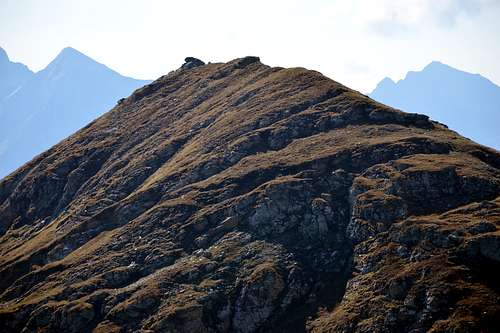
Monte Chiapa or also Quiappa takes its name from the mountain pasture of the same name (2.245m) located immediately South-southeast of the same, in turn dominating the "Bois de Raccard" at the entrance of the Vallone of the lakes of Palasina or Palasinaz in the section that connects with the Alpe di Lavassey (1.999m). Consisting of a rounded grassy hill, it is capable of separating the Bringuez Valley with its lake (2.529m) from the upper Vallone dei Laghi di Palasina (della Battaglia, de la Pocia, Vert, du Couloir and Long), located at the foot of the South-Eastern side of the Corno Bussola (3.023m) and the Southern ones of the Punta del Lago Lungo (2.792m) and the Punte di Palasina (2.782/3m). A narrow rocky collar, called Brenguez or Bringuez and known locally as "Bocchet" (2.661/4m), separates it from the Unnamed Altitude 2.899 meters located just South of Colle Bussola or Boussolaz (2.807m), where a small starts buttress which, dominating between the Villages of Extrepierre and Brusson, ends with the Punta della Gua (2.776m). In general, it is easily climbed starting from path 3B on the Western shore of Lago della Battaglia (of the battle; 2.484m) along medium-slope grassy slopes or from the carving of "Bocchet" itself.
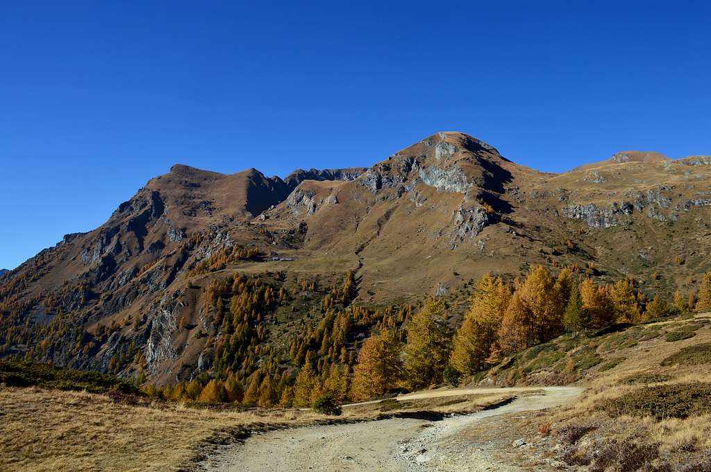
Il Monte Chiapa od anche Quiappa prende il nome dall'omonimo alpeggio (2.245 m) posto subito a Sud-sudest del medesimo, a sua volta dominante il "Bois de Raccard" all'ingresso del Vallone dei laghi di Palasina o Palasinaz nel tratto che si collega con l'Alpe di Lavassey (1.999 m). Costituito da un dosso erboso tondeggiante é atto a separare il Vallone di Bringuez con relativo lago (2.529 m) dal superiore Vallone dei Laghi di Palasina (della Battaglia, de la Pocia, Vert, du Couloir e Long), posti ai piedi del lato Sudorientale del Corno Bussola (3.023 m) e di quelli Meridionali della Punta del Lago Lungo (2.792 m) e delle Punte di Palasina (2.782/3 m). Uno stretto colletto roccioso, detto di Brenguez oppure Bringuez ed in loco meglio conosciuto siccome "Bocchet" (2.664 m), lo separa dalla Quota Innominata 2.899 metri posta subito a Sud del Colle Bussola o Boussolaz (2.807 m), là dove inzia un piccolo contrafforte che, dominando tra gli abitati di Extrepierre e Brusson, va a terminare con la Punta della Gua (2.776 m). In genere viene salito con facilità partendo dal sentiero 3B sulla sponda Occidentale del Lago della Battaglia lungo pendii erbosi di media pendenza oppure ugualmente dall'intaglio del "Bocchet" medesimo.
First Ascents
- First on the summit: Unknown.
- In winter: Unknown.
Getting There
BY CAR:
- From TORINO, MILANO, etc: Motorway A5. Exit at IVREA or Quincinetto (PIEDMONT).
- From IVREA Town: in West (Southern side) to Pont Saint Martin, Verrès Municipalities in East from Aosta Town. From Verrès to Val d'Ayas Valley From Verrès (549m), with Regional Road, to Challant Saint Victor (765m), Challant Saint Anselme (1.060m), Brusson (1.332m) Municipalities; wanting, continuing to Northwest to Antagnod-Ayas (1.709m) Commune, below Mounts Tantané and Zerbion also in North towards Champoluc (1.570m) and Saint Jacques (1.670m) Communes at the end of Evançon or Ayas Valley and under the Western side of Monte Rosa (Rollin Hump, Breithorns, Pollux and Castor).
- From Courmayeur Resort: in East-southeast to Aosta, Nus, Chatillon, Saint Vincent, Verrès Municipalities.
- From FRANCE: through the Mont Blanc Tunnel to Entrèves/Courmayeur. By Little Saint Bernard Pass, closed since November until half May to La Thuile Valley - Pré Saint Didier - Aosta - Verrès Municipalities. It is not necessary to take Motorway A5: you can drive on SS.26, in the direction of AOSTA - IVREA - TURIN.
BY PLANE:
- Aeroporto "Corrado Gex" Saint Christophe (Aosta).
 |
 |
 |
 |
 |
Itinerary
Common route from Verres to Estoul (Brusson): Verrès is the village at feet of Ayas Valley. A5 motorway exit is directly linked to Val d'Ayas Regional Road (SR.45). Once arrived in Brusson (km. 15), cross the gracious village and turn right to "Rue du Col Ranzola". The road ends in Estoul (km 21 from Verrès). There are two big free car parks at the end of paved road. As told in Overview chapter, in summer this place can be very crowded.
Itinerario comune da Verrès a Estoul (Brusson): Verrès è il paese all'inizio della Valle di Ayas. L'uscita dell'autostrada A5 è direttamente collegata alla Strada Regionale Val d'Ayas (SR.45). Una volta arrivati a Brusson (15 km), girare a destra in "Rue du Col Ranzola". La strada termina a Estoul (km 21 da Verrès). Ci sono due grandi parcheggi gratuiti alla fine della strada asfaltata, in estate questo posto può essere molto affollato. Route from Estoul Hamlet.
Route
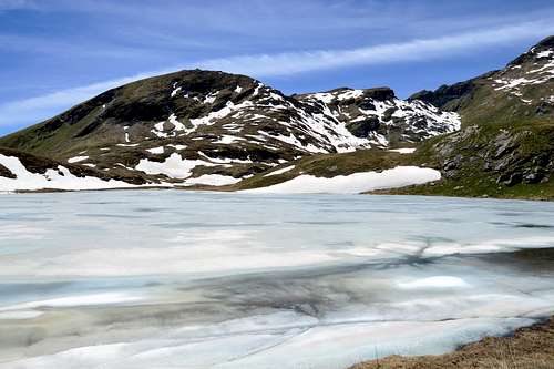
Monte Chiapa or Quiappa (2.684m) Approach through Palasinaz Vallon: from Brusson to Estoul Village (+; 1.818m; great parking; variaous signals) with Regional Road; from this, in North through dirt road and paths n° 5/4/105, towards Fenillettaz (1.840m), following alternative (1.882m; signal no transit), Fontaine (1.903m), Chanlochère (2.012m), junction 2.029 meters, Chavanne (2.107m) Pastures, alternatives (2.103m, 2.209m) nearby Litteran Lake (2.226m), fork 2.231 meters. From this A)-: in Northwest towards Chavanne (2.347m), Palasinaz (2.402m) Pastures, to 1)- "Baita Dino" (about 2.435 meters; private house); from the same, with path n° 4/105 before along an effluent into a small vallon and after South shore of Battaglia (Battle) Lake, to Long Lake. Through path n° 3B to the West and, leaving in the West-northwest over a debris promontory that one to Bussola Hill (2.807m), continue at the Brenguez Pass also directly goes up along easy and grassy slopes (E/F; 2h'30/3h'00 from Estoul Hamlet; 1h'00/1h'15 from "Baita Dino").
 |
 |
Monte Chiapa o Quiappa (2.684 m) Avvicinamento dal Vallone dal Vallone di Palasina: da Brusson salire al Villaggio di Estoul (+; 1.818 m; ampio parcheggio con pannelli e varie segnalazioni) tramite la Strada Regionale; da qui, verso Settentrione con la poderale dapprima concomitante ai sentieri n° 5/4/105, verso i vari Alpeggi di Fenillettaz (1.840 m), il successivo bivio (1.882 m; segnale di divieto per i mezzi), Fontaine (1.903 m), Chanlochère (2.012 m), bivio 2.029 metri, Chavanne (2.107 m), le due alternative (2.103 m, 2.209 m) viciniori al Lago Litteran (2.226 m), bivio 2.231 metri. Da questo punto A)-: a Nordovest in direzione delle Alpi Chavanne (2.347 m) e Palasinaz (2.402 m) verso la 1)- "Baita Dino" (circa 2.435 metri; casa privata); dalla stessa, dapprima con sentiero n° 4/105 in un valloncello e lungo l'emissario e quindi presso la sponda Sud del Lago della Battaglia verso il Lago Lungo. Con sentiero n° 3B verso Ovest e, lasciando ad Ovest-nordovest al di sopra d'un promontorio detritico quello verso il largo Colle Bussola (2.807 m), continuare verso il Col de Brenguez oppure salire direttamente tramite i facili dossi prativi (E/F; 2h'30/3h'00 da Estoul; 1h'00/1h'15 dalla "Baita Dino").
Gear
For Hiking or with snowshoeing also by ski.
Da Escursionismo o con racchette da neve oppure sci.
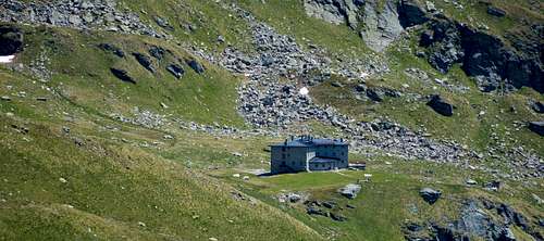
Huts
Campings
Remember that free camping is forbidden (except for emergency reasons, over 2.500m, from darkness until dawn).
Mountain Conditions
- You can get meteo information at the official site of the Regione Valle d'Aosta:
- Valle d'Aosta Meteo
- Meteo: You can find more weather information on the website 3B Meteo:
- Meteo Brusson
Webcam
- WEBCAM on Aosta Valley:
- Webcam
Books and Maps
- "Guida delle Alpi Occidentali" di Giovanni Bobba e Luigi Vaccarone C.A.I. Sezione di Torino Volume II (parte II), 25 Maggio 1896.
- "Diari Alpinistici" di Osvaldo Cardellina e Indice Generale accompagnato da Schedario Relazioni Ascensioni 1964-2019 (unpublished).
- "Guida dei Monti d'Italia" Monte Rosa di Gino Buscaini - Club Alpino Italiano/Turing Club Italiano, Maggio 2002 (In Italian).

|

|

|
MAPS:
- I.G.C. Istituto Geografico Centrale Torino "IVREA-BIELLA e Bassa Valle d'Aosta" 1:50.000.
- I.G.C. Istituto Geografico Centrale Torino "Cervino e Monte Rosa" 1:50.000.
- L'Escursionista editore "Alte Valli d'Ayas e del Lys" Carta dei sentieri (8) 1:25.000.
Important Information
- REGIONE AUTONOMA VALLE D'AOSTA the official site.
- FONDAZIONE MONTAGNA SICURA Villa Cameron, località Villard de la Palud n° 1 Courmayeur (AO) Tel: 39 0165 897602 - Fax: 39 0165 897647.
- A.I.NE.VA. (Associazione Interregionale Neve e Valanghe).

Useful numbers
- Protezione Civile Valdostana località Aeroporto n° 7/A Saint Christophe (Ao) Tel. 0165-238222.
- Bollettino Meteo (weather info) Tel. 0165-44113.
- Unità Operativa di Soccorso Sanitario Tel. 118.