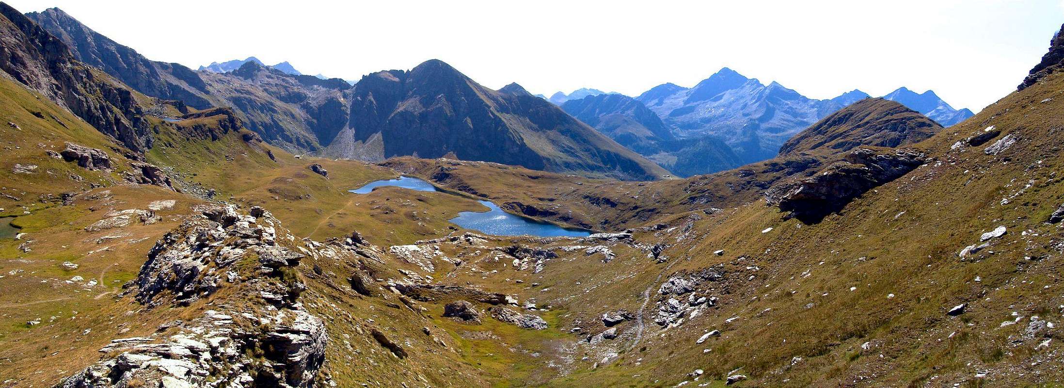
This mountain is located at the end of the watershed that, down from Punta Valfredda (2.944m) and exceeded that of Valnera (2.754m), it acts as a divider between the two vallons to the North of the village of Estoul, (1.815m), above Brusson in Ayas Valley. Indeed toward Northwest opens the most extensive and important that, through the Lakes Palasinaz, reaches the Corno Bussola (Horn Compass; 3.023m); in the Northeast instead we find a smaller vallon that leads to the Estoul Lakes and is contained by the same Bieteron, the Tip Valnera and Mount Ciosé or Stallerhorn (2.680m), before the important Ranzola Pass with the Gressoney Valley (2.170m). The Bieteron is arranged on the axis Northeast/Southwest, bounded by the Collar unnamed 2.681 meters, where the path 5C/105 comes from Refuge Arp (2.446m), and its large shoulder to the South (2.589m) called on site Mount Palon (as written in paint on the Summit). The same is generally considered as a point of arrival, especially in Ski-Mountaineering, because the next stretch that leads to the Summit is formed by rocks easy but exposed. But not all sides are easy to follow, as it is written on page 185 of the old "Guide of Monte Rosa" 1960, because to the North-northwest (towards Arp Refuge) down a wall of about 300 meters, made up of rocks much steep as dangerous and likely to climbed once sole and also the West Slope is steep. However both points you will get beautiful views on the Ayas Valley in its middle part and lower the Mont Nery or Becca Frudiera and, in the distance, towards the Eastern Graian Alps.
Questa montagna é collocata al termine dello spartiacque che, scendendo dalla Punta di Valfredda (2.944 m) ed oltrepassata quella di Valnera (2.754 m), funge da divisorio tra i due valloni a Settentrione del Villaggio d'Estoul (1.815 m), sopra Brusson in Val d’Ayas. Infatti verso Nordovest si apre la parte più vasta ed importante che, attraverso i Laghi di Palasinaz, raggiunge il Corno Bussola (3.023 m); a Nordest invece troviamo un più ristretto valloncello che conduce ai Laghi di Estoul ed è contenuto dallo stesso Bieteron, dalla Punta di Valnera e dal Monte Ciosè o Stallerhorn (2.680 m), prima dell'importante Colle della Ranzola con la Valle di Gressoney (2.170 m). Il Bieteron è disposto sull'asse Nordest/Sudovest e compreso tra il Colletto innominato 2.681 metri, dove arriva il sentiero 5C/105 dal Rifugio Arp (2.446 m), ed un suo spallone a Meridione (2.589/94 m) chiamato in loco Monte Palon (come da scritta in vernice sulla Cima). La stessa in genere viene considerata quale punto di arrivo, soprattutto in Sci-Alpinismo, poiché il tratto successivo che conduce alla cima risulta formato da rocce facili ma esposte. Ma non tutti i versanti sono facilmente percorribili, come si trova scritto a pagina 185 della vecchia "Guida del Monte Rosa" 1960, poiché verso Nord-nordovest (in direzione del Rifugio Arp) scende una parete di circa 300 metri, formata da rocce tanto ripide quanto pericolose e probabilmente salita un'unica volta, mentre anche il Versante Occidentale, ancora più elevato, scende alquanto dirupato verso la sottostante poderale che sale al Rifugio Arp. Da entrambi i punti si ottengono belle vedute sulla Val d'Ayas nella sua parte medio inferiore ed il Mont Néry o Becca di Frudiera e, più in lontananza, sulle Graie Orientali.
First Ascents
First on the Summit: Unknown.
In winter: Unknown.
N-NW Wall: Osvaldo Cardellina and Emilio Bertona, (Sep 20th, 1992), in ascent.
NE Ridge: Osvaldo Cardellina and Emilio Bertona, (Jan 05th, 2002), in descent.
Getting There
BY CAR:
From TORINO, MILANO, etc: Motorway A5. Exit at IVREA or Quincinetto (PIEDMONT).
From IVREA Town: in West (Southern side) to Pont Saint Martin, Verrès Municipalities in East from Aosta Town.
From Courmayeur Resort: in East-southeast to Aosta, Nus, Chatillon, Saint Vincent, Verrès Municipalities.
BY PLANE:
Aeroporto "Corrado Gex" Saint Christophe (Aosta).
Specific Road
From Verrès to Val d'Ayas Valley, from Verrès (549m), with Regional Road, to Challant Saint Victor (765m), Challant Saint Anselme (1.060m), Brusson (1.332m) Municipalities; wanting, continuing to Northwest to Antagnod-Ayas (1.709m) Commune, below Mounts Tantané and Zerbion also in North towards Champoluc (1.570m) and Saint Jacques (1.670m) Communes at the end of Evançon or Ayas Valley and under the Western side of Monte Rosa (Gobba di Rollin, Breithorns, Pollux and Castor). From France: through the Mont Blanc Tunnel to Entrèves/Courmayeur. By Little Saint Bernard Pass, closed since November until half May to La Thuile Valley - Pré Saint Didier - Aosta - Verrès Municipalities. It is not necessary to take Motorway A5: you can drive on SS.26, in the direction of AOSTA - IVREA - TURIN.
Approach and Route
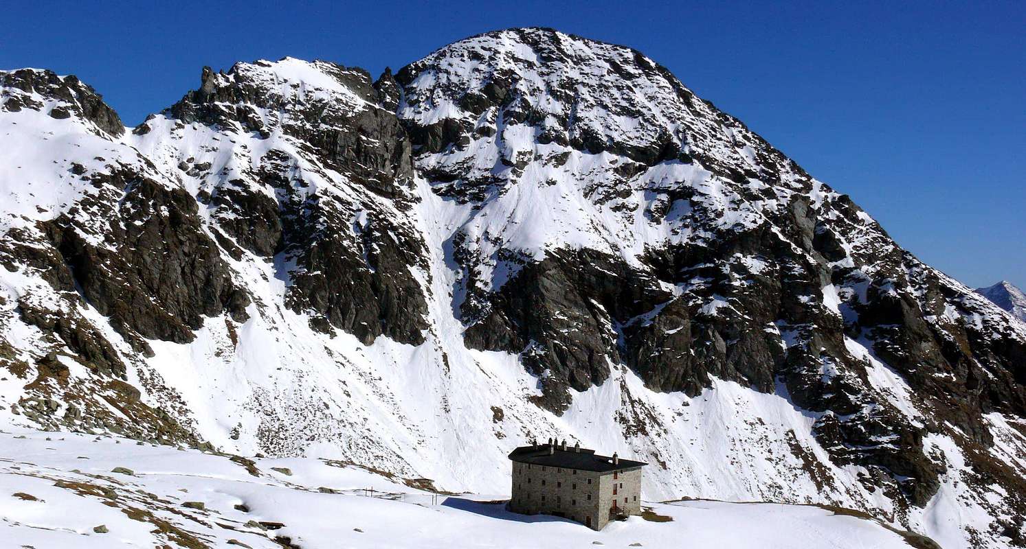
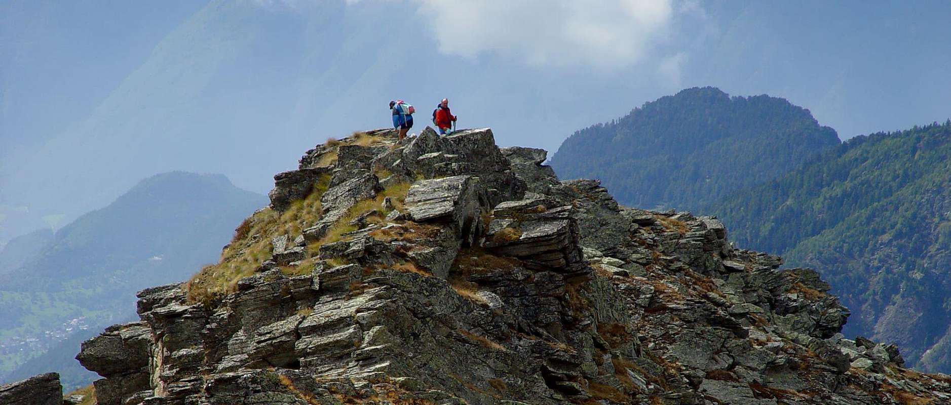
From Estoul parking (1.815m) follow the farm road, concomitant with the trail n° 5/6 towards the Northwest in the direction Lakes Palasinaz and the Refuge Arp (2.446m) reaching the junction that leads, with trail n° 6, to the nearby Lake Literan (2.226m) to the Southwest of Mount Bieteron, where it ends at an altitude of 2.276 meters. From this point continue with unnumbered path through the easy Southwestern Slope of Mount Palon (2.589/94m), climb through the foothills South-southwest of the same reaching the enough large Summit (2.589/94m). From big shoulder down through the rocks easy but exposed a short distance; then continue by flexing just to the North-northeast and through a small track, which often gets lost between the grassy slopes, with some small rock (sometimes delicate passages of I°/I°+, moreover not forced and thus easily bypassed on both sides, but always with caution above all in fresh snow or ice presance) to reach the Summit small cairn formed by an iron topographical and trigonometric signal (EE/F+; 2h'50/3h'10 from the lake or, more in bottom, from private dirt road).
Note: you absolutely can not crossing down the grassy slopes of the East-Northeast Slope to the Lakes Estoul and Chamen, because really treacherous and dangerous, even in the absence of snow but covered grass as "olline", very slippery. Better, it should go down again, and then navigate through the same route of the ascent.
Departure Variant: those wishing to avoid spreading around the Northwest to the Lake Literan, you can get more directly from the Estoul Vallon: from the junction 1.993 meters on the dirt farms road before Chanlochère Pasture crossing the path base into Estoul Bois (Wood) de Moucheroulaz to the Estoul Lakes until the next crossing 2.177 meters: here, going on traces up to an altitude of about 2.300 meters, there is a not numbered and secondary path diagonally to the beautiful Alp Literan (2.276m) just above the lake, where there is a link to the previous route (EE/F; a quarter of an hour less).
Dal parcheggio di Estoul (1.815 m) seguire la strada poderale, concomitante con il sentiero n° 5/6 verso Nordovest in direzione dei Laghi di Palasinaz e del Rifugio Arp (2.446 m) raggiungendo il bivio 2.209 metri che porta, con sentiero n° 6, al soprastante Lago Literan (2.226 m) a Sudovest del Monte Bieteron, dove termina a quota 2.276 metri. Da questo punto continuare con sentiero non numerato tramite il facile Versante Sudovest del Monte Palon, e salire attraversando le pendici Sud-sud-ovest dello stesso raggiungendone la Sommità (2.589/94 m). Dallo spallone scendere brevemente attraverso rocce facili ma esposte; poi continuare flettendo appena a Nord-nordest per mezzo d’una piccola traccia di sentiero, che spesso si perde tra i pendii erbosi, con qualche roccetta (incontrando brevi ma delicati passaggi di I°/I°+, del resto, con via non obbligata tale da permettere più facili aggiramenti su entrambi i lati, ma sempre richiedenti attenzione soprattutto con neve fresca o ghiaccio) per infine raggiungere con abbastanza noiosi ed erbosi pendii il minuscolo ometto della Vetta costituito da un segnale trigonometrico in ferro (EE/F +; 2h'50/3h'10 dal lago o, più in basso, dalla strada sterrata privata).
Nota in discesa: è meglio non scendere ai Laghi Estoul e Chamen attraversando lungo i ripidi pendii erbosi del versante Est-Nordest, perché veramente infidi e pericolosi, anche in assenza di neve, ma ricoperti da erba "ollina", alquanto scivolosa. Di certo risulta megliore la decisione di scendere per la via già percorsa durante la salita.
Variante di partenza: inoltre si può evitare il largo giro a Nordovest verso il Lago Literan, risalendo più direttamente dal Vallone di Estoul. Dal bivio 1.993 metri sulla strada poderale prima dell'Alpeggio di Chanlochère con percorso che attraversa alla base nel Bois d'Estoul de Moucheroulaz risalendo ai laghi di Estoul fino al successivo incrocio 2.177 metri, da questo punto si continua su tracce fino ad una altitudine di circa 2.300 metri dove si incontra un sentiero non numerato e secondario in diagonale verso la bella Alpe di Literan (2.276 m) appena sopra il lago, dove esiste una connessione con il percorso precedente (EE/F; un quarto d'ora meno).
Difficulty
The route is rated EE; from F to F+.
L'itinerario è da classificarsi in EE; da Fa F+.
Gear
Hiking equipment.
Da Escursionismo.
Campings
Remember that free camping is forbidden (except for emergency reasons, over 2.500m, from darkness until dawn).
Mountain Conditions
You can get meteo information at the official site of the Regione Valle d'Aosta:
Parents refers to a larger category under which an object falls. For example, theAconcagua mountain page has the 'Aconcagua Group' and the 'Seven Summits' asparents and is a parent itself to many routes, photos, and Trip Reports.

 1922 Hits
 80.49% Score
 12 Votes