
-
 668 Hits
-
 83.1% Score
-
 16 Votes
|
|
Mountain/Rock |
|---|---|
|
|
44.39201°N / 10.06669°E |
|
|
Hiking, Scrambling, Skiing |
|
|
Spring, Summer, Fall, Winter |
|
|
5427 ft / 1654 m |
|
|
Overview
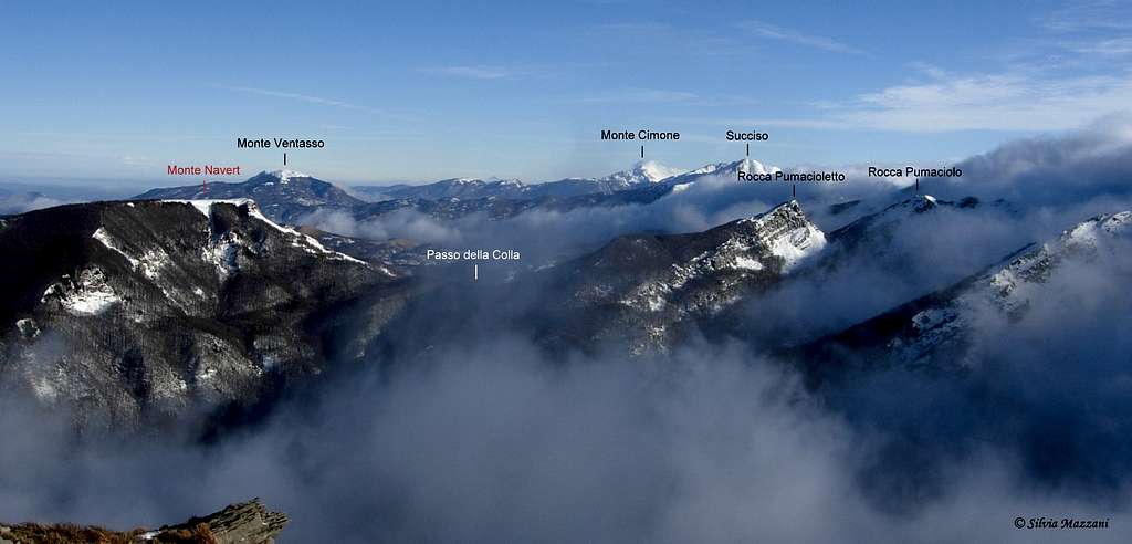
Monte Navért 1654 m
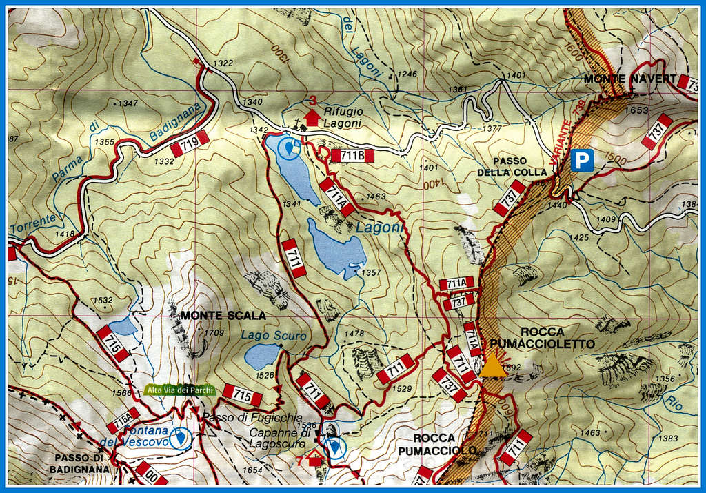
Monte Navért is a minor summit located on the watershed between Val Parma to the West, Val Bratica to the North and Val Cedra to the East and belonging to the Appennino Parmense Orientale, a chain in the Eastern part of Parma province. From the main Apennine ridge, located along the watershed between Tuscany and Emilia-Romagna with mainly West-East direction, a few ridges branch off to the North. Monte Navèrt is placed along one of these secondary ridges and precisely along the ridge that branches off from the main Apennine watershed near Monte Paitino in the North-East direction and forming at first Rocca Pumaciolo and Pumacioletto, then Monte Navert. This one is divided from Pumacioletto by a broad saddle named Passo della Colla 1474 m, a road col passable by vehicles only in the absence of snow connecting the locality of Lagoni in the municipality of Corniglio with Valditacca in the municipality of Monchio delle Corti.
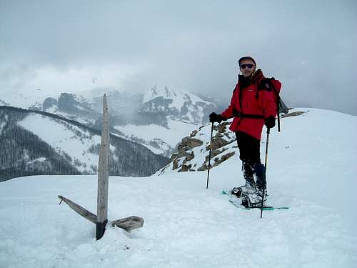
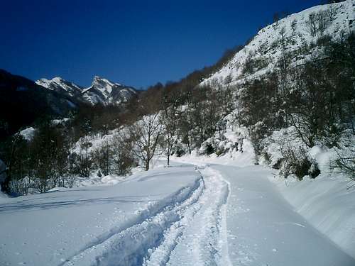
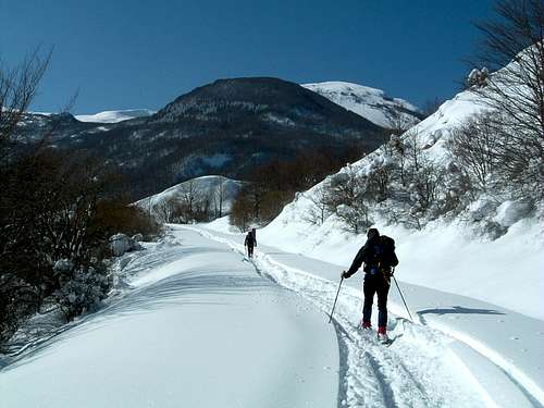
Monte Navèrt is located just above the Passo della Colla from where hikers can climb the Normal route. From here it's a really short climb to reach the summit and enjoy the vast panorama offered. This itinerary can be attended in any season, in wintertime obviously with the necessary gear (crampons or snowshoeing or ski, depending on snow conditions). In wintertime in the presence of snow the road to Passo della Colla is close near Valditacca and in the locality of Cancelli on the side of Corniglio, so the winter ascents must be started from Valditacca.
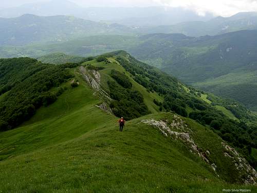
Monte Navert has two parallel ridges that join right at the top, resembling, as the toponym indicates, the bow of a ship.
A few different other itineraries, all with greater elevation gain, allow you to reach the top of this interesting mountain.
Getting There
Road access
The closest town is Parma, a 200.000 inhabitants town located 110 km from Milan and 90 km from Bologna, while the closest villages are Corniglio, Bosco di Corniglio and Valditacca.
Road access to Passo della Colla
Coming from A1 motorway exit Parma main and take the SP 665R (Massese) towards Langhirano and Capoponte; at Pastorello traffic roundabout take the right exit, reaching Corniglio, Bosco di Corniglio and the locality named Cancelli, where you are at a road fork. Turn to left and take the gravel road running inside the beautiful Val Parma Forest getting after about 5 km. to the locality named Lagoni, then Passo della Colla. Passo della Colla can also be reached from Valditacca. In wintertime the road to Passo della Colla is closed near Valditacca.
Road access to Grammatica
From Parma follow the directions to Langhirano (SP 665R); at Pastorello, follow the directions to Corniglio (SP13-SP106) and once in Corniglio take the SP75 to Monchio delle Corti. After about 6.5 km you will arrive in Grammatica (about 60 km from Parma)
Round trip from Passo della Colla
Vertical gain: 180 m
Starting point: passo della Colla 1474 m
Once you have reached Passo della Colla 1474 m (from the Lagoni or alternatively from Valditacca), where you park, you immediately turn to the left (if coming from Lagoni) or to the right (if coming from Valditacca) onto a rather steep and very panoramic path with no number, until you reach the summit of Monte Navert. In wintertime the road to Passo della Colla is closed near Valditacca. In this case the ascent starts from the same Valditacca and the vertical gain is about 480 meters.
Descent: reversing the same route
Loop from Passo della Colla
Vertical gain: 180 m
Starting point: passo della Colla 1474 m
Once you reach Passo della Colla 1474 m from the Lagoni (or alternatively from Valditacca), where you park, you immediately turn left onto a rather steep and very panoramic path with no number, until you reach the summit of Monte Navert. From the top of Navert, instead of returning along the same ascent route, it is possible to make a short loop: go down on the crest in the opposite direction, less steep than the way you went, reaching the path n. 739 which you follow for a few hundred meters until you meet path 737 which you follow and which turns right passing at the foot of the mountain in the direction of the road that leads to the pass. Once we reach the road, we have two possibilities:
- follow it to return to the Passo della Colla
- alternatively follow it for a few hundred meters and near a curve, take an unmarked road to the left that goes in the direction of Pumacioletto, another 250 m and on the left we find the path 737 which we take again, skirting a large slab and crossing a beech forest with strange shaped trees. We reach the foot of Pumacioletto near Passo della Colla, then the pass
Loop from Grammatica
Vertical gain: 740 m
Starting point: Grammatica
The provincial road takes you to Corniglio, here you keep left towards Monchio delle Corti, reaching the hamlet of Grammatica at 1008 m of altitude.
The start of the path CAI n. 739 is near the Church. Take the wide CAI path n. 739. After about half an hour from the start of the path you reach a crossroads, where you keep left, reaching Groppo Fosco. Shortly after you reach a second crossroads, where you ignore the path to the left for the Pian del Monte hut and continue through the woods, continuing to climb up to Pian del Monte 1575m, a beautiful grassy plain. We keep to the left until we return to the beech forest which has something magical in this section. Here the red and white trail signs are once again present, indicating that we are on the right track. With the last uphill stretch you reach the summit.
For the return you can follow the same itinerary, or by making a loop, there are two alternatives: the CAI 737 path which leads to Casarola through Passo dello Zucchero, or the Nature Path which leads to the hamlet of Riana. In both cases, you reach the starting point in Grammatica along a stretch of the state road.
Red Tape
No fees no permits required. Monte Navert is located inside Parco Nazionale Appennino Tosco-Emiliano, established in 1997. Fires are strictly forbidden and the whole fauna and flora is protected. Don’t disturb fauna and other mountaineering and hikers’ peacefulness with every kind of noise.

When to Climb
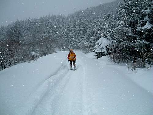
The hikers can enjoy the trails all around the year. Summer condition from May to the end of October; during these months the summit of Navèrt can be easily climbed without the use of technical gear. Winter climbs along the normal routes - from December to April - are not difficult, but may require the use of axe and crampons.
Huts and other accomodation
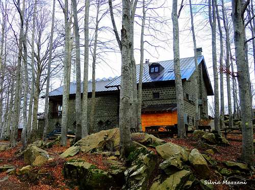
Rifugio Lagoni at Great Twin Lakes m.1507 – 5 km. by car from Cancelli – always open in the week-end, all the day from June to September
Rifugio Lagdei m. 1250 – 1 km. by car from Cancelli
Meteo
- Meteo ARPA Emilia-Romagna
- Meteo Lagdei
Guidebooks
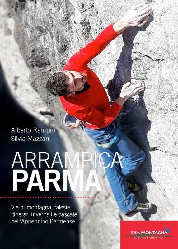
APPENNINO PARMENSE NEW GUIDEBOOK 2019
"Arrampicaparma" III edition - Alberto Rampini and Silvia Mazzani - Idea Montagna ed. 2019
A detailed, complete and updated guidebook including Multipitches, Crags, Ice-falls and winter mountaineering in Appennino Parmense
Guida dettagliata, completa e aggiornata comprendente vie lunghe, falesie, cascate di ghiaccio e itinerari di alpinismo invernale nell'Appennino Parmense
ALTRE GUIDE
- "ArrampicaParma - climbing, bouldering & mountaineering" - Alberto Rampini and Silvia Mazzani Pareti Edizioni 2011 (II edition)
- "Appennino Ligure e Tosco-Emiliano" - M. Salvo, D. Canossini - Guida dei Monti d'Italia
- “Alto Appennino Parmense Est” Map 1:50.000 (CAI-Regione Emilia-Romagna)
 |
 |
 |
xcvbnm
Maps
Click below on the link to CAI PARMA website to see the
Appennino Parmense online maps
- “Alto Appennino Parmense Est” Map 1:50.000 (CAI-Regione Emilia-Romagna)
External links
Parco Nazionale Appennino Tosco-Emiliano