
-
 2317 Hits
-
 83.69% Score
-
 17 Votes
|
|
Mountain/Rock |
|---|---|
|
|
44.37200°N / 10.06882°E |
|
|
Emilia-Romagna |
|
|
Hiking, Mountaineering, Scrambling |
|
|
Spring, Summer, Fall, Winter |
|
|
5781 ft / 1762 m |
|
|
Overview
Geographical classification: Appennino Tosco-Emiliano e Tosco-Romagnolo > Appennino Parmense > Rocca Pianaccia
Rocca Pianaccia 1762 m
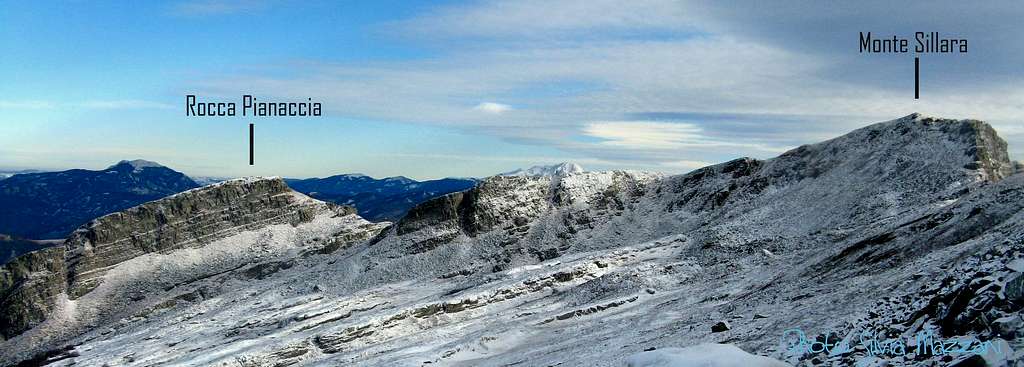
Appennino Parmense Orientale is a chain located in the Eastern part of Parma Province administrative boundaries, allined between Passo del Cirone in the Western end and Passo del Lagastrello in the Eastern end. The Eastern end of this area, surrounding Sillara, the highest peak, is the wildest and less attended sector, characterized by few points of support. Rocca Pianaccia 1762 m is a secluded summit located on a secondary ridge, separated by a valley from the main Apennine watershed, just in front of the highest peak, Monte Sillara.

As a result of its special position, outside the main boundary ridge between Emilia-Romagna and Tuscany, this summit is located entirely within the province of Parma. The mountain has also another feature: it is the highest peak situated entirely in Parma territory, being the other major peaks shared with Tuscany. Rocca Pianaccia is a low climbed mountain that offers very interesting routes crossing in the starting part the beautiful Pianaccia beech forest.
Getting There
Road approach
Parma is the nearest town to Rocca Pianaccia; it’s a 200.000 inhabitants town with a small airport, offering some domestic flies and only a few international ones. A good choice of international flies is provided by Milan and Bologna International Airports, both situated at a reasonable distance (Milan 110 km., Bologna 90 km.). Parma is linked to other Italian and European towns by A1 and A15 motorways, so logistic is not a problem.
- Access from A1 (Autostrada del Sole) If you’re getting there from A1, coming from Bologna or from Milano, take the main Parma exit.

Rocca Pianaccia can be climbed following two main normal routes, having the same starting point: Valditacca.
- Road access from Parma to Valditacca
Follow the SP 665 (Massese) towards Langhirano and Pastorello; pass Langhirano and getting the roundabout in Pastorello keep straightly the main road SP 665 to Capoponte. Here cross the bridge over the torrente Parma, reaching Lagrimone, Ranzano, Palanzano, Lugagnano. After Lugagnano, leave the main road and turn to right towards Pianadetto and Valditacca.
Rocca Pianaccia main routes
Rocca Pianaccia from North-East
Difficulty: Alpine F in winter condition, otherwise E
Vertical gain: 700 m. from the parking lot
From Valditacca take the road towards Passo della Colla and about 1 km from the village, leave your car in a small parking lot. With little amount of snow you can continue by car for a few hundred meters and turn to left into a downhill road closed by a bar (Roncacci parking lot). After passing the bar, you cross the bridge over the stream Cedra and soon you meet a crossroads.


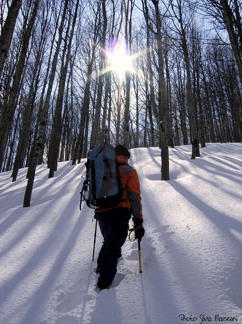
Turn to right and follow the wide forest track inside the beautiful beech forest with several bends (Signal CAI 709) until you reach the small emergency shelter at about 1270 m of altitude. Beyond the hut they are to be omitted both the trail mark on the left with the signpost "Lago Ballano" and the green stamps "Ippovia". Carry on to the right along the forest track. Further the path is not marked, but intuitive enough. Follow the forest track until you reach a signpost CAI "Lago Verde". You should ignore it and always carry on along the forest track for a short distance, until its end. Now climb directly on the sparse beech wood on progressively steeper terrain, then gradually decreasing.
Rocca Pianaccia NE slope |
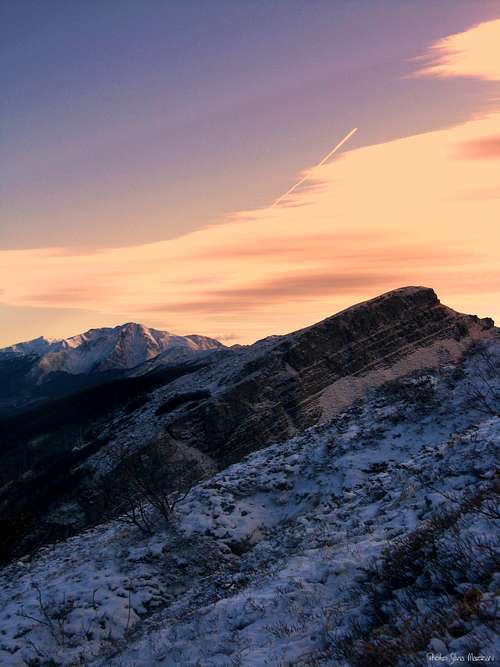
Sunset on Rocca Pianaccia |
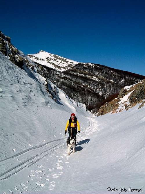
Rocca Pianaccia |
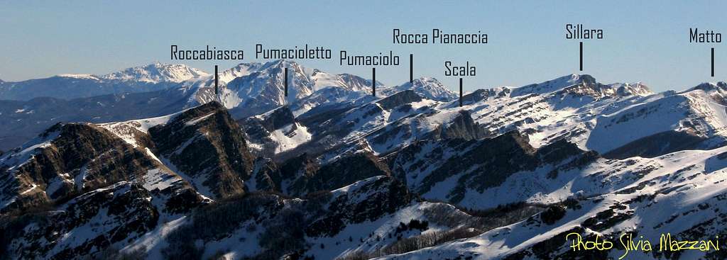
Slightly to the right reach a shoulder, from which, crossing a beech wood lower and twisted (a sign that we are now close to the summit ridge) you will soon come to the edge of the wood, with a view towards the summit and the last stretch of the route. This latter is a large ridge on open ground. The summit is near. From the summit (cairn) it opens a wide view over the peaks lined up on the nearby ridge (Sillara, Losanna) and over Sillara lakes; westward Orsaro, Marmagna, Scala, Roccabiasca and Pumacioletto; to the North Navert, and if the visibility is good, the Alps. To the East Pietra di Bismantova and the imposing Succiso.
Descent: reversing the same itinerary

East Ridge - Sella Pianaccia crossing
Difficulty: Alpine F in winter condition, otherwise E
Vertical gain: 700 m. from the parking lot
Vertical gain: 700 m. from the parking lot
From Valditacca take the road towards Passo della Colla and about 1 km from the village, leave your car in a small parking lot. With little amount of snow you can continue by car for a few hundred meters and turn to left into a downhill road closed by a bar (Roncacci parking). After passing the bar, you cross the bridge over the stream Cedra and soon you meet a crossroads. Turn to right and follow the wide forest track inside the beautiful beech forest with several bends (Signal CAI 709) until you reach the small emergency shelter at about 1270 m of altitude. Beyond the hut, follow the signs CAI and "Ippovia" (Horse trail) to the left; approximately at an altitude of 1300 m. meets leaves out a first junction on the left (to Lago Ballano, n. 709/b).


A little further you meet on the left the signpost to Lago Verde (n. 709/a): our itinerary also omits this branch and definitely turns to the right (West), continuing on the main path n. 709. The route, varied and impressive in the beech forest, which is now a bit sparse, goes up the Valletta del Rio Frasconi, reaching a third fork; here turn sharply to the right following the route n. 711 to Sella Pianaccia and Lagoni. Initially traced directly then straining the left (west), up the steep wooded ridge with some white and red signs on the trees; out of the woods continue in the same direction always along n. 711 (be careful because at this point the trail markers are no longer visible) until you reach a characteristic steep funnel of snow that falls from the saddle Pianaccia. Turn sharply to the right to go up a steep but short slope that leads to reach the East ridge. Going up the wide and panoramic ridge you will soon reach the peak signal.


From the top head to South towards the Sella Pianaccia, rapidly catching up (a few short rock passage, grade I). From the pass it descends to the East by the distinctive and wide valley shaped like a funnel, finally backtracking on CAI 711. Following back the same route you return to the parking lot.

It’s possible to climb and hike all around the year on Rocca Pianaccia; winter ascents require the essential gear as crampons, an ice-axe, eventually a short rope.
Climate and nature
Climate is subcontinental, with cold and snowing winters and good summertime, generally dry but not too hot, because of the mitigating influence of the Tyrrenian Sea and the action of the winds. The area, usually as far as 1.600 m. of altitude, is covered by a dense magnificent forest, perfectly preserved through several years of massive deforestation (in the beginning of the twentieth century), due to mountain people’s poverty situation in that period. Due to the great difference between winter climate – snowy and cold – and summer’s climate – relatively warm – the arboreal species that succeed in this environment have adaptations to both seasons.
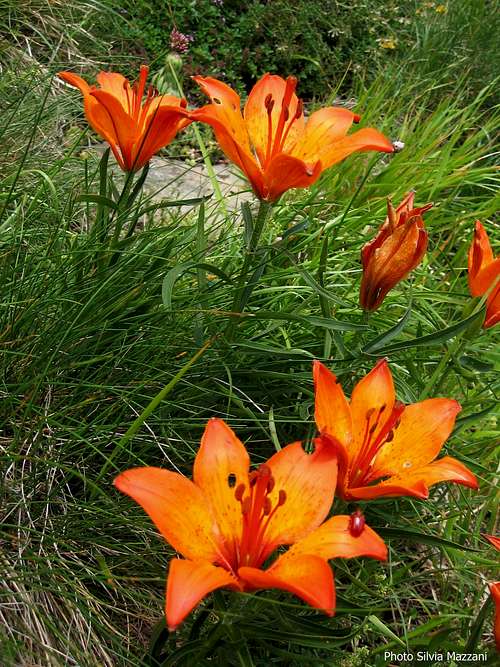
St John's lilies (Lilium bulbiferum) |
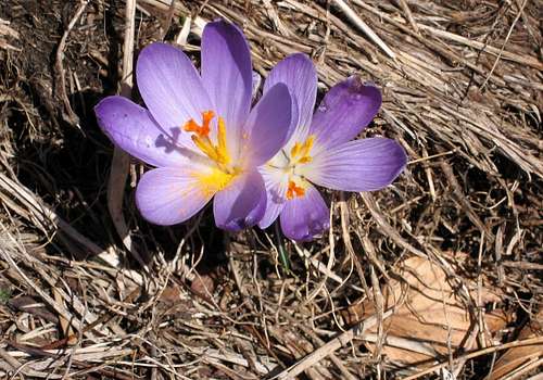
Crocus Vernus 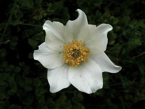
Anemone Narcissiflora |
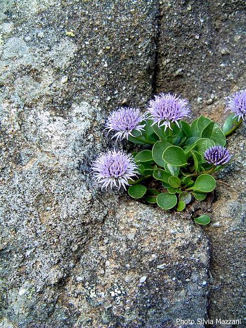
Globularia cordifolia |
The autochthonous beech (Fagus Sylvatica) is the original and largest specie in the area. We can find a lot of wonderful specimen which can reach heights of 20-30 mts, with characteristic straight trunks. Evergreen conifers as White Firs (Abies Alba) where added later as the result of the forestation work.

Rocks, forests and climate create a landscape similar to the north Scandinavian one.
Red Tape
Rocca Pianaccia is located inside Parco Nazionale Appennino Tosco-Emiliano, established in 1997. Fires are strictly forbidden and the whole fauna and flora is protected. Don’t disturb fauna and other mountaineering and hikers’ peacefulness with every kind of noise.


- Capanna Forestale della Pianaccia m. 1270 on the Normal route from Valditacca. Very basic, always open, table, chair, heater, water in a nearby stream.
Where to stay
Bed and Breakfast in ValditaccaMeteo
Meteo ARPA Emilia-Romagna
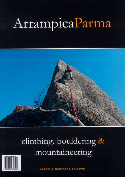 |
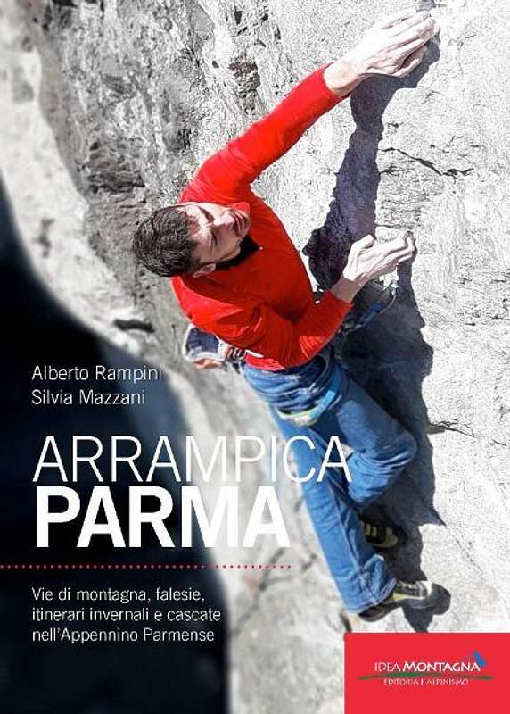
ArrampicaParma - climbing, bouldering & mountaineering
Alberto Rampini - Silvia Mazzani
Rock climbing, ice climbing and winter mountaineering in Appennino Parmense guidebook - II updated edition
Pareti Edizioni 2011
|
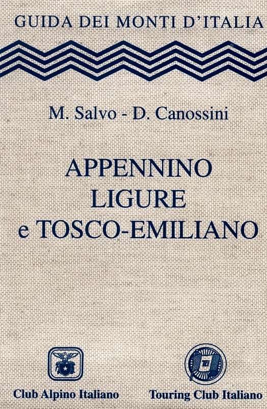 |
Appennino Ligure e Tosco-Emiliano
M. Salvo - D. Canossini
Guida dei Monti d'Italia
Club Alpino Italiano - Touring Club Italiano 2002
|


“Le valli del Cedra e del Parma (The Cedra and Parma Valleys)” Map 1:25.000 (CAI-Regione Emilia-Romagna) “Alto Appennino Parmense Est” Map 1:50.000 (CAI-Regione Emilia-Romagna)
PARCO NAZIONALE APPENNINO TOSCO EMILIANO
External Links
CLUB ALPINO ITALIANO SEZ. DI PARMAPARCO NAZIONALE APPENNINO TOSCO EMILIANO