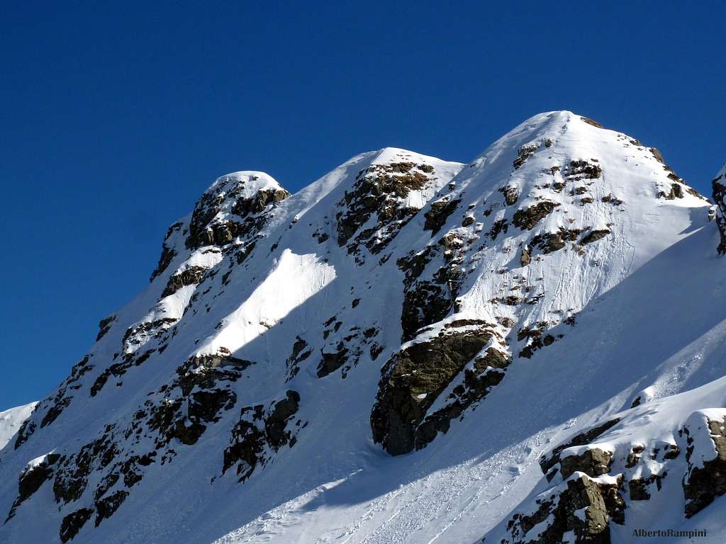
Monte Torricella is a twice summit belonging to the Appennino Parmense Orientale and located on a secondary branch starting from the main boundary ridge between Emilia-Romagna and Tuscany. The peak overlooks with rocky and steep sides both the basin of Lago Verde towards West and the sky station of Pratospilla towards East. It’s an interesting summit, entirely located in Parma province, frequently climbed all round year; an outing is particularly advisable in winter time, in reason to climb the various ice-gullies lying on the Western side of the peak. This face overlooks the Lago Verde basin m. 1484 with some rocky spurs, originating some different gullies, rising from the indistinct basal slopes and becoming steeper in their upper part.
Torricella Western gullies
The most interesting sector of Western face is located on the right and it's situated between two gullies: a wide slope-gully named Canalone dei Ghiri on the left hand side, rising to a wide saddle, and a direct narrow gully, named Canale dei Merli, on the right hand side.
Climbing the Canale Bianco (White Gully)
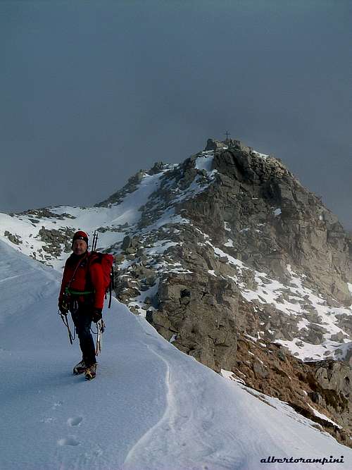
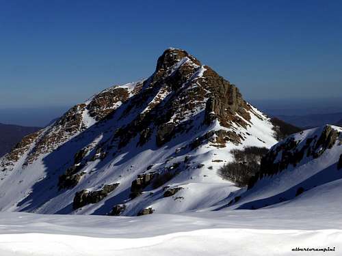
In the middle of the summit ridge a wide obvious saddle separates the true summit, the Southern one, which is the highest and lies on the right, from the easier conventional summit, the Northern one, on the left, where it's located the summit cross.
The twin summits of Torricella
The Southern summit in full winter
Getting There
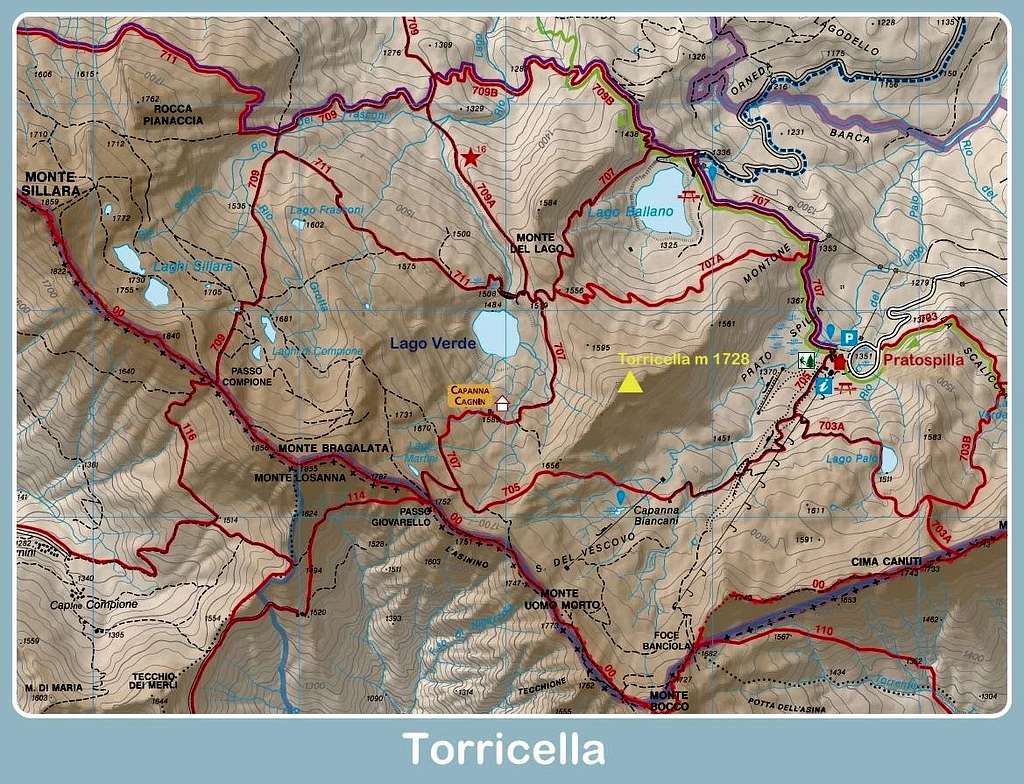
The starting point is Pratospilla m. 1351, a sky station located nearby the great lake named Lagastrello and the village of Rigoso in the Eastern Appennino Parmense.
The nearest town is Parma, a 200.000 inhabitants town, with a small airport offering some domestic flies and only a few international ones. A good choice of international flies is provided by Milano and Bologna International Airports, both situated at a reasonable distance (Milano 110 km., Bologna 90 km.). Parma is well linked to Milano and Bologna by the A1 motorway (Autostrada del Sole) and to Tuscany by the A15 motorway (Autocisa).
- Access from A1 Motorway (Autostrada del Sole) If you’re getting there from A1, coming from Bologna or from Milano, take the main Parma exit.
- Access from Parma to Pratospilla: follow the road SP 665 (Massese) towards Langhirano and Pastorello; getting the Pastorello roundabout carry on straightly to Ranzano, Palanzano and Monchio delle Corti, getting to Pratospilla, a sky station nearby the village of Rigoso.
Approaching the South ridge normal route
Detail of Torricella South summit
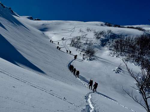
Walking approach to South ridge normal route and West face
From Pratospilla m. 1351 follow the trail n. 707 to Lago Ballano; after 10 minutes leave it and take on the left the variant n. 707a, which skirts the Northern slopes of Monte Torricella, getting the Lago Verde. Don't reach the lake, but stay high over the left shore of the lake (summer mark n. 707), traversing under the West slopes of Torricella (1 hour from Pratospilla)
Approaching West side from Lago Verde
Torricella in background seen from Rocca Pianaccia
Routes overview
Torricella is climbed all year round, but especially in wintertime. The main winter routes are the following ones:
Standard routes
- South ridge (Normal route from Lago Verde)
Diffculty: Alpine PD Vertical gain: 400 m. from Pratospilla, longer develop
The most interesting amongst the two normal routes, but not the easiest. The starting point is located on a saddle on the right hand of West face. The ridge, involving some short easy sections of rock climb, reachs the Southern summit.
On Torricella South ridge route
A winter image of S ridge in poor snow condition
- North ridge (Normal route from Pratospilla)
Diffculty: Alpine F Vertical gain: 400 m. from Pratospilla
This route has a shorter approach that the previous one and it's an easier climb to the Northern summit (the conventional one); anyhow it's much less interesting that the previous route. This route is starting along the trail 707a, without reaching Lago Verde.
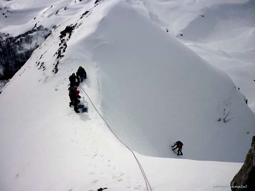
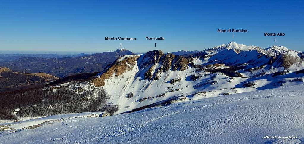
Torricella main winter routes: A Canalone dei Ghiri - B Central Gully - C Canale Bianco (White Gully) - D Canale dei Merli - E South ridge
West Face winter gullies
- Canalone dei Ghiri
Difficulty: Alpine PD, 45° Climbing length: m. 200
A wide slope rather than a gully, the easiest amongst the Western winter routes, located on the left hand side of the face. There is not a compulsive itinerary and it's a good route for beginners. Last meters are a bit steeper. The route leads on a wide saddle between the two summits.
Exit of Torricella Central Gully
Central Gully
Summit ridge and Northern summit
- Central Gully
Diffculty: Alpine AD, 60° Climbing length: m. 200, 4 pitches First ascent: Pietro Bianchi, Alberto Rampini, Gianluca Pasquali, Federico Saccani 26-1-2008 - An interesting ice-climb with some mixed sections running in the middle of West face. The most technical of the face
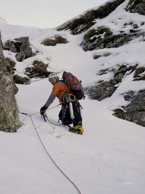
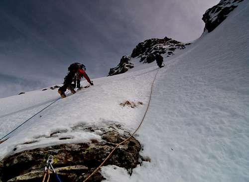
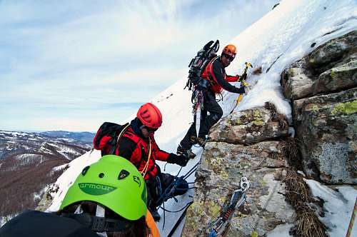
- Canale Bianco
Difficulty: Alpine AD- Climbing length: m. 200 - A good classic route, frequently climbed and entirely on ice or snow
- Canale dei Merli
Difficulty: Alpine PD+ Climbing length: m. 200 - It's the shorter gully located on the right hand side of W face. Entirely on ice or snow.
A climber exiting from Canale Bianco
Parties climbing Canale Bianco
Descent: the South ridge is more difficult, but panoramic. Moreover, if you have climbed one of the gullies on the West side, the descent along the South ridge has the advantage to return to the same starting point of the climb up. The descent on the North side is shorter and joins the trail n. 707a without returning to the starting point of West face ice-gullies.
Annotated pano from Monte Bragalata
Red Tape
Torricella West side seen from above
There are not particular restrictions in hiking, climbing and mountaineering. Anyhow, since 1995 the areas of Val Cedra and Val Parma are located under the rules of the Regional Park named Parco dei Cento Laghi (One Hundred Lakes Park). In late years these areas had been included inside a largest national park, named Parco Nazionale dell’Appenino Tosco-Emiliano (Tosco-Emiliano National Park); wood fires are prohibited as well as free camping and other harmful activity. The whole fauna and flora are protected. Don’t disturb fauna and other mountaineering and hikers’ peacefulness.
When to Climb
On Monte Torricella it’s possible to climb all around the year. Winterascents require the essential gear as rope, helmet, crampons, ice-axe, ice-anchors.
Ice-climbing schooling on Torricella West face
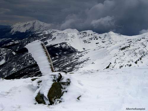
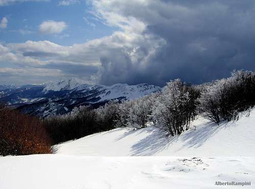
A winter storm approaching Torricella
Climate and Meteo info
Climate is subcontinental, with cold and snowing winters and pleasant summers, dry but not too hot, because of the mitigating influence of the Tyrrenian Sea and the action of the winds. METEO ARPA EMILIA-ROMAGNA
Where to stay
Capanna Cagnin buried by the snow
Capanna Cagnin and Torricella
- Rifugio Pratospilla m. 1351 +390521890194 Rifugio Pratospilla - Capanna Cagnin is a little emergency shelter always open nearby Lago Verde
Guidebooks
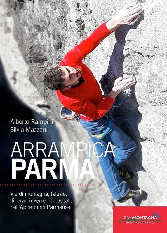
APPENNINO PARMENSE NEW GUIDEBOOK 2019
"Arrampicaparma" III edition - Alberto Rampini and Silvia Mazzani - Idea Montagna ed. 2019
A detailed guidebook including Multipitches, Crags, Ice-falls and winter mountaineering in Appennino Parmense
Guida dettagliata, completa e aggiornata comprendente vie lunghe, falesie, cascate di ghiaccio e itinerari di alpinismo invernale nell'Appennino Parmense
"Arrampicaparma - Climbing, bouldering & mountaineering" by Silvia Mazzani and Alberto Rampini - Pareti e Montagne Edizioni, II ed. 2011 "Arrampicaparma - montagna, falesie, bouldering" by Alberto Rampini and Silvia Mazzani - Pareti e Montagne Edizioni, 2003 “Appennino Ligure e Tosco-Emiliano” by M. Salvo and D. Canossini - Collana Guide dei Monti d'Italia CAI-TCI
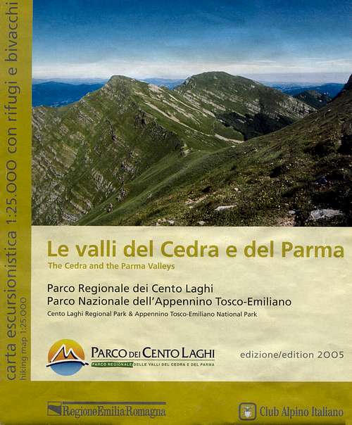
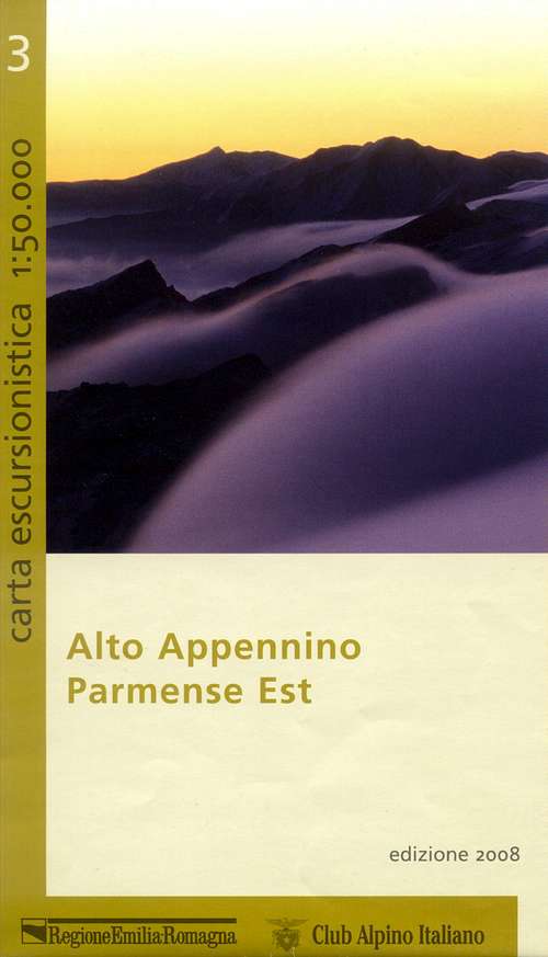
Maps
To see the APPENNINO PARMENSE ONLINE MAPS click below on the link to CAI PARMA website:
Parents refers to a larger category under which an object falls. For example, theAconcagua mountain page has the 'Aconcagua Group' and the 'Seven Summits' asparents and is a parent itself to many routes, photos, and Trip Reports.

 4456 Hits
 89.39% Score
 29 Votes