
-
 3220 Hits
-
 84.27% Score
-
 18 Votes
|
|
Mountain/Rock |
|---|---|
|
|
44.38368°N / 10.04200°E |
|
|
Emilia - Romagna |
|
|
Hiking, Mountaineering, Trad Climbing, Sport Climbing, Ice Climbing, Scrambling |
|
|
Spring, Summer, Fall, Winter |
|
|
5627 ft / 1715 m |
|
|
What's new on this page?
PAGINA COMPLETA DI TRADUZIONE IN LINGUA ITALIANA - THE ITALIAN TRANSLATION ADDED TO THE PAGE (2022, December)
Overview
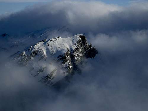
Monte Scala 1715 m
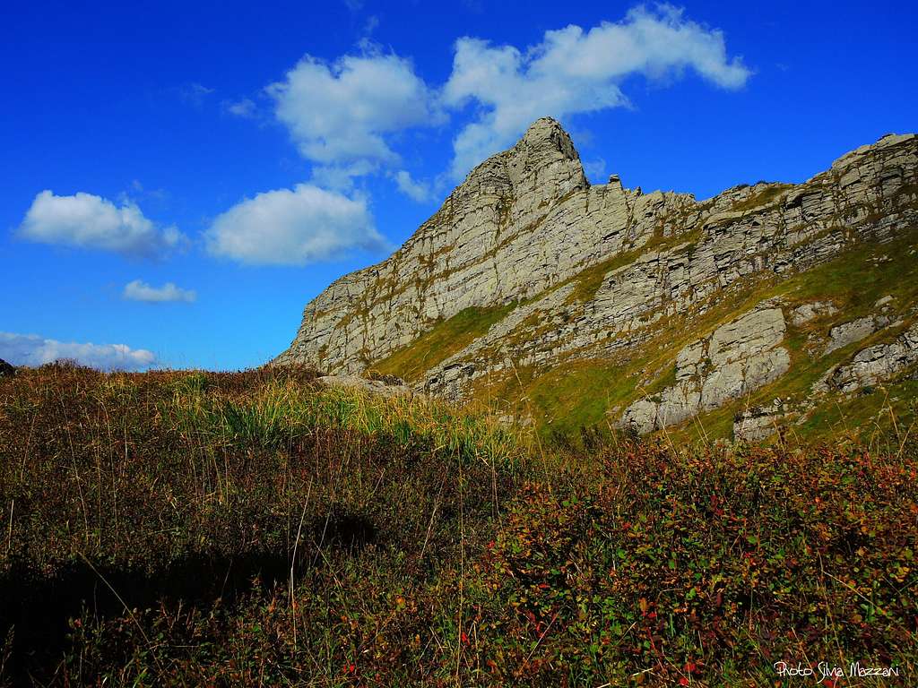
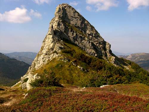
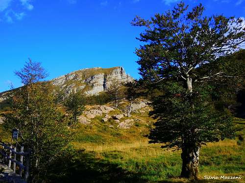
Monte Scala 1715 m is a rocky peak belonging to the Appennino Parmense Orientale, a chain located in the Eastern part of Parma province, running between Passo Cirone on the Western end and Passo Lagastrello on the Eastern one. From the main Apennine watershed, situated between Emilia-Romagna to the North and Tuscany to the South, some secondary buttresses branch off in the North direction. Monte Scala is located along one of these secondary ridges and precisely along the ridge starting from Monte Matto, on the main watershed, at first descending to Passo Fugicchia and then rising suddenly to create the massive rocky structure of Monte Scala. Being located North of the main Apennine watershed, Monte Scala is entirely included in the territories of the province of Parma.
Together with Roccabiasca, Rocca Pumacioletto, Rocca Pianaccia and Monte Torricella, Monte Scala is part of the so-called "rocche" of the Parma Apennines, mountains characterized by steep-looking rock walls, which nevertheless present a more inclined Northern side mostly covered by woods. The toponym "Scala" probably derives from the "stepped" appearance of the rock face that overlooks the Fugicchia Pass. The slender summit crest of Monte Scala culminates with two twin summits very close together: the Southern one 1715 m is the highest, while the Northern one is slightly lower (1709 m). They are separated by Sella dello Scala, a saddle at the altitude of 1698 m.
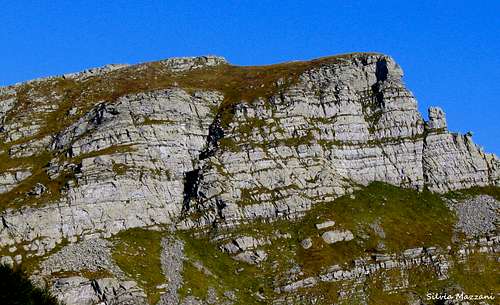
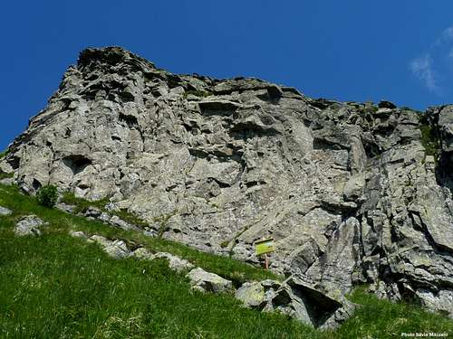
Monte Scala acts as a watershed between the Valle di Badignana to the west and the Valle del Lago Scuro to the east. To the West the mountain overlooks the Valle di Badignana with a wide rock face, about a hundred meters high, engraved about halfway by a deep gully, the Canalino della Scala. Difficult multi-pitches climbing routes have been traced on this vertical rock wall. On the other hand, towards the South East, above the Lago Scuro, Monte Scala projects some small rocky strips of limited height. The most interesting of these is the Falesia del Lago Scuro, a crag equipped with several single pitches. Toward the South we note a marked rocky prow, preceded by a small spire, the Gendarme della Scala. The rock of Monte Scala is the typical Apennine "macigno", a sandstone similar to the gres but much more wrinkled, characterized by technical slabs and sometimes more athletic walls.
Monte Scala is not among the easiest mountains in this Apennine area: the only hiking access route, the Normal route through the Lago Scuro and the south-eastern slope, is in any case a bit demanding walk along steep grassy slopes and stony ground. From the top you can enjoy a wide panorama with a sensational aerial view of Lago Scuro.
ITALIAN VERSION
Il Monte Scala 1715 m è una vetta rocciosa appartenente all'Appennino Parmense Orientale, catena situata nella parte orientale della provincia di Parma, compresa tra il Passo Cirone all'estremità occidentale e il Passo Lagastrello all'estremità orientale. Dal principale spartiacque appenninico, posto tra l'Emilia-Romagna a nord e la Toscana a sud, si diramano in direzione nord alcuni contrafforti secondari. Il Monte Scala si trova lungo uno di questi crinali secondari e precisamente lungo il crinale che prende origine dal Monte Matto, sullo spartiacque principale, dapprima scendendo al Passo Fugicchia e poi salendo improvvisamente a creare la massiccia struttura rocciosa del Monte Scala. Essendo situato a nord del principale spartiacque appenninico, il Monte Scala è interamente compreso nei territori della provincia di Parma.
Insieme a Roccabiasca, Rocca Pumacioletto, Rocca Pianaccia e Monte Torricella, il Monte Scala fa parte delle cosiddette "rocche" dell'Appennino Parmense, montagne caratterizzate da pareti rocciose dall'aspetto ripido, che tuttavia presentano un versante settentrionale più inclinato per lo più ricoperto da boschi. Il toponimo "Scala" deriva probabilmente dall'aspetto "a gradoni" della parete rocciosa che sovrasta il Passo Fugicchia. L'esile cresta sommitale del Monte Scala culmina con due cime gemelle molto ravvicinate: quella meridionale 1715 m è la più alta, mentre quella settentrionale è leggermente più bassa (1709 m). Sono separate dalla Sella dello Scala, una sella a quota 1698 m.
Il Monte Scala fa da spartiacque tra la Valle di Badignana a ovest e la Valle del Lago Scuro a est. Ad Ovest il monte si affaccia sulla Valle di Badignana con un'ampia parete rocciosa, alta circa un centinaio di metri, incisa circa a metà da un profondo canale, il Canalino della Scala. Su questa verticale parete rocciosa sono state tracciate difficili vie di più tiri. Verso Sud Est, invece, sopra il Lago Scuro, il Monte Scala proietta alcune piccole fasce rocciose di altezza più contenuta. La più interessante di queste è la Falesia del Lago Scuro, una falesia attrezzata con diversi monotiri. Verso Sud si nota una spiccata prua rocciosa, preceduta da una piccola cuspide, il Gendarme della Scala. La roccia di Monte Scala è il tipico "macigno" appenninico, un'arenaria simile al gres ma molto più rugosa, caratterizzata da placche tecniche con sezioni talvolta atletiche.
Il Monte Scala non è tra le montagne più facili di questa regione appenninica: l'unica via di accesso escursionistica, la Via Normale attraverso il Lago Scuro e il versante sud-orientale, è comunque una camminata un po' impegnativa lungo ripidi pendii erbosi e pietraie. Dalla cima si gode un vasto panorama con una sensazionale veduta aerea del Lago Scuro.
Getting There
Road approach
The closest town is Parma, a 200.000 inhabitants town located 110 km from Milano and 90 km from Bologna, while the closest villages are Corniglio and Bosco di Corniglio, both located on the Emilia-Romagna side. Coming from Milano or Bologna (A1 motorway) exit Parma main and take the SP 665 (Massese) towards Langhirano and Capoponte; pass Langhirano and at Pastorello traffic roundabout take the right exit, reaching Corniglio, Bosco di Corniglio and the locality named Cancelli, where you are at a road fork. Turn to left and take the gravel road running inside the beautiful Val Parma Forest getting after about 4,5 km. to a small parking lot near the forest road to the Badignana huts and after about 5 km. the locality named Lagoni, meaning Great Twin Lakes (65 km. from Parma).
Accesso stradale
La città più vicina è Parma, cittadina di 200.000 abitanti situata a 110 km da Milano e 90 km da Bologna, mentre i paesi più vicini sono Corniglio e Bosco di Corniglio, entrambi situati sul versante emiliano. Provenendo da Milano o Bologna (autostrada A1) uscire a Parma capoluogo e prendere la SP 665 (Massese) in direzione Langhirano e Capoponte; superare Langhirano e alla rotonda di Pastorello prendere l'uscita a destra raggiungendo Corniglio, Bosco di Corniglio e la località Cancelli, dove ci si trova ad un bivio. Svoltare a sinistra e prendere la strada sterrata che corre all'interno della bellissima Foresta Val Parma, raggiungendo dopo circa 4,5 km. un piccolo parcheggio nei pressi della strada forestale per le Capanne di Badignana e dopo circa 5 km. la località denominata Lagoni, ovvero Grandi Laghi Gemini (65 km. da Parma).
Hiking: Normal route from Lagoni
Difficulty: EE
Difference in level: 375 m
From the locality Lagoni 1342 m, take the first path on the right (n. 711, signposts), which begins before the small bridge over the effluent of the lower lake. The paved path skirts briefly the right bank of the first lake (the lower) and after passing next to a building enters the beech forest and begins to going up. After an aqueduct cabin, the path skirts some rocky slabs. Descending briefly reach a small peat bog at 1472 m, then turn right going up through the woods and crossing a stream on a small wooden bridge. You will soon reach a clearing where there is a crossroads with signposts. Turn to right (path n. 715), leaving on the left the path to the Capanne del Lago Scuro. After a few minutes you reach the Lago Scuro 1527 m. Ignore the left path n. 715 to Passo Fugicchia, cross the little stream and from the right shore of the lake continue along the marked trail following an indication on a boulder for "Monte Scala" (it's the Normal route uphill to the mountain). The path passes through the beech-wood, goes up some stones, then skirts some huge boulders and walls (Falesia degli Anelli) and exit the wood. At a junction ignore the left branch and take the direct path rising up among some big boulders located at the base of the rock face of the foresummit of Monte Scala (the Falesia del Lago Scuro), well visible above. Reached the crag, skirt it in the left direction, following the trail that continues steeply. After a short rocky passage, bend right up to the Sella dello Scala, between the summit and the fore-summit. From here turn to left getting within a couple of minutes the summit of Monte Scala 1715 m, excellent panoramic point (50 minutes from Lagoni). 1 hour from Lagoni.
 |
 |
 |
 |
 |
Dalla località Lagoni 1342 m si imbocca il primo sentiero a destra (n. 711, segnavia), che inizia prima del ponticello sull'emissario del lago inferiore. Il sentiero lastricato costeggia brevemente la sponda destra del primo lago (quello inferiore) e dopo essere passato accanto ad una costruzione entra nella faggeta e comincia a salire. Dopo una costruzione dell'acquedotto, il sentiero costeggia alcune placche di roccia. Scendendo brevemente si raggiunge una piccola torbiera a 1472 m, quindi si piega a destra salendo nel bosco e attraversando un torrente su un ponticello di legno. In breve si raggiunge una radura dove si trova un bivio con indicazioni. Si svolta a destra (sentiero n. 715), lasciando a sinistra il sentiero per le Capanne del Lago Scuro. Dopo pochi minuti si raggiunge il Lago Scuro 1527 m. Si ignora il sentiero di sinistra per il Passo Fugicchia, si attraversa il torrentello e dalla sponda destra del lago si prosegue lungo il sentiero segnato seguendo un'indicazione su un masso per "Monte Scala" (è la Via Normale di salita al monte). Il sentiero attraversa la faggeta, risale una pietraia, poi costeggia alcuni grossi massi e paretine (Falesia degli Anelli) ed esce dal bosco. Ad un bivio si ignora il ramo di sinistra e si imbocca il sentiero diretto che sale tra grossi massi posti alla base della parete rocciosa dell'anticima del Monte Scala (la Falesia del Lago Scuro), ben visibile in alto. Raggiunta la falesia, si costeggia a sinistra seguendo la traccia che prosegue ripida. Dopo un breve passaggio roccioso si piega a destra fino alla Sella dello Scala, tra la vetta e l'anticima. Da qui si svolta a sinistra raggiungendo in un paio di minuti la vetta del Monte Scala 1715 m, ottimo punto panoramico (50 minuti da Lagoni). 1 ora da Lagoni.
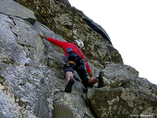
Rock climbing: multipitches
From the point of view of rock climbing, the West wall, the South ridge and the shorter South-East crag, named Falesia del Lago Scuro, are of particular interest.
Approach to the West wall
- To climb the routes of the left sector: from the bar near the forest road to the Capanne di Badignana (4.1 km from Cancelli, signposts, 1320 m). take the forest road CAI n. 719 and follow it for about 15 minutes, until a sharp turn to the right, flanked by a boulder, just beyond which you take a trail on the left in the beech forest (red arrow on a boulder) that turns into a mule track and after about 15 minutes exits the wood in open land near the characteristic Piana delle Antiche Pietre 1510 m, under the West Face of the Scala. From here to the steep stony ground that descends from the base of the recessed and narrow West gully in the middle of the wall you reach the start of the various routes. 50 minutes from the parking lot.
- To climb the routes of the right sector: they can be reached from Passo Fugicchia 1669 m, from where a track heads to the North along a ridge and then descends shortly on the Badignana side to skirt the West wall. To Passo Fugicchia: from Lagoni 1342 m follow the path 711 and then 715 to Lago Scuro and Passo Fugicchia. 45 minutes.
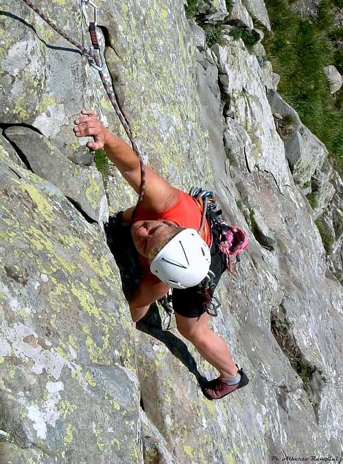
Rock climbing: Falesia del Lago Scuro
Beautiful mountain crag about 25 meters high, located at an altitude of 1670 meters in a beautiful position overlooking the Lago Scuro. There are 19 single pitches with difficulty from the 3a to the 6c, offering a pleasant and safe climbing on solid and rough sandstone, thanks to the ideal exposure and the excellent equipment. The climbing style is essentially technical and of movement. The single pitches are fully equipped with 10 mm stainless steel fix. Closed loop anchors. Variable length from 20 to 25 meters.


Bella falesia di montagna alta circa 25 metri, situata a quota 1670 metri in bella posizione panoramica con vista sul Lago Scuro. Sono presenti 19 monotiri con difficoltà dal 3a al 6c, che offrono un'arrampicata piacevole e sicura su arenaria solida e ruvida, grazie all'esposizione ideale e all'ottima attrezzatura. Lo stile di arrampicata è essenzialmente tecnico e di movimento. I monotiri sono completamente attrezzati con fix in acciaio inox da 10 mm. Ancoraggi ad anello chiuso. Lunghezza variabile da 20 a 25 metri.
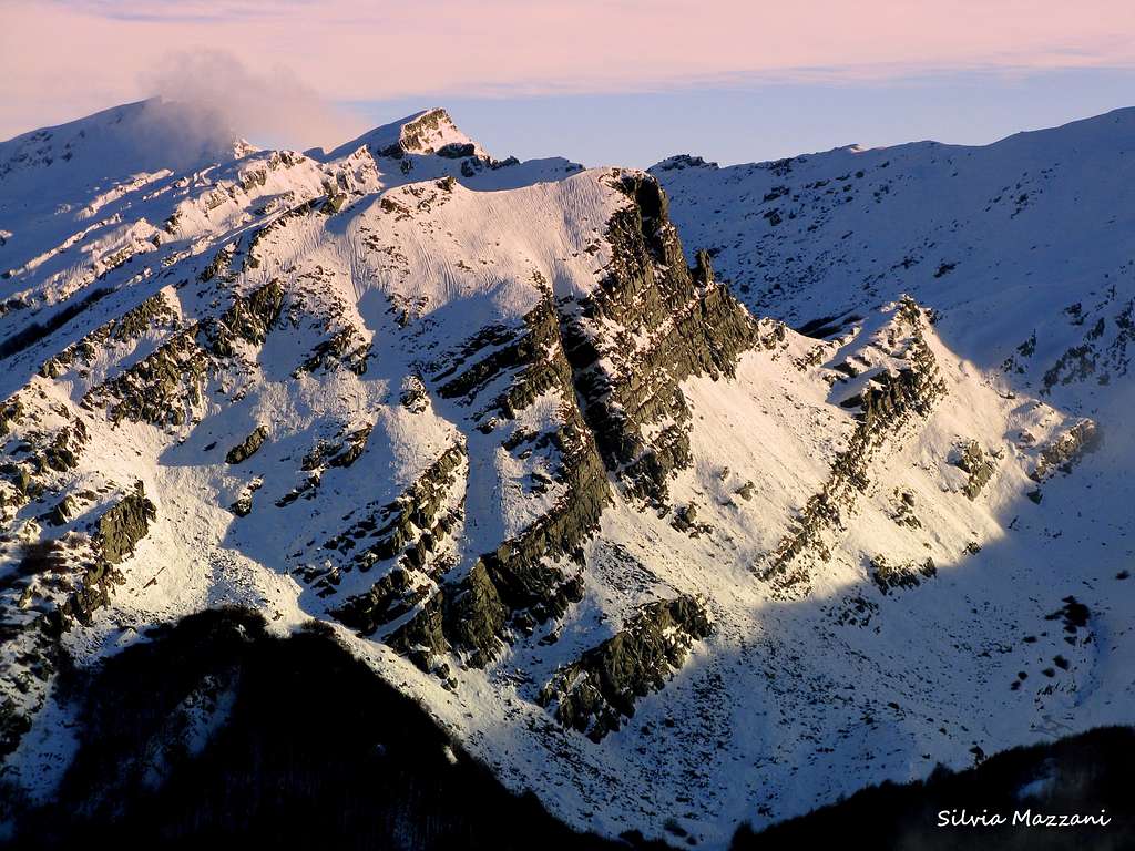
Ice climbing
From the point of view of the ice climbing the West face in its winter look offers a couple of interesting itineraries:
- Via Rampini-Saccani to the Canalino della Scala, an interesting and technical Scottish-style ice climbing
- the most affordable but always rewarding Canale dell'Angelo
Red Tape

Monte Scala is located inside Parco Nazionale Appennino Tosco-Emiliano, established in the year 1997. Fires are strictly forbidden and the whole fauna and flora is protected. Don’t disturb fauna and other mountaineering and hikers’ peacefulness with every kind of noise.

Nature and climate
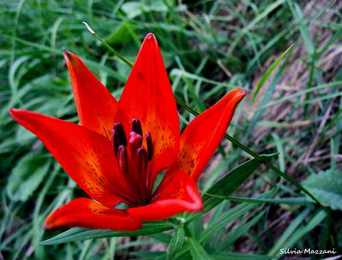
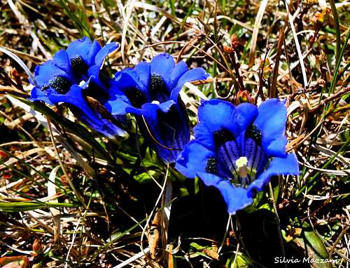
The area, usually as far as 1.600 m. of altitude, is covered by a dense magnificent forest, perfectly preserved through several years of massive deforestation (in the beginning of the twentieth century), due to mountain people’s poverty situation in that period. Due to the great difference between the winter climate – snowy and cold – and the summer climate – relatively warm – the arboreal species grown up in this environment have developed a good adaptation to both the climatic extremes.
The autochthonous beech (Fagus Sylvatica) is the original and largest specie in the area. We can find a lot of wonderful specimen which can reach heights of 20-30 mts, with characteristic straight trunks. Evergreen conifers as White Firs (Abies Alba) where added later as the result of forestation’s work. Rocks, forests and climate create a landscape similar to the north Scandinavian one. The climate is a sub-continental one, so we have cold and snowing winter and summer not too hot due to the sea influence and wind action.
L'area, di solito fino a 1.600 m. di altitudine, è ricoperta da una magnifica e fitta foresta, che si è perfettamente conservata anche dopo diversi anni di massiccio disboscamento (inizio del XX secolo), dovuto alla situazione di povertà della gente di montagna in quel periodo. A causa della grande differenza tra il clima invernale - nevoso e freddo - e il clima estivo - relativamente caldo - le specie arboree cresciute in questo ambiente hanno sviluppato un buon adattamento a entrambi gli estremi climatici.
Il faggio autoctono (Fagus Sylvatica) è la specie originaria più grande della zona. Possiamo trovare molti splendidi esemplari che possono raggiungere altezze di 20-30 m, con caratteristici tronchi diritti. Conifere sempreverdi come Abeti bianchi (Abies Alba) sono state aggiunte in seguito come risultato del lavoro di forestazione. Rocce, foreste e clima creano un paesaggio simile a quello della Scandinavia settentrionale. Il clima è subcontinentale, quindi abbiamo inverni freddi e nevosi ed estati non troppo calde per l'influenza del mare e l'azione del vento.
When to Climb
Rock climbing - The best period goes from the end of May to October
Ice climbing - The best period goes from middle December to the end of March
Scrambling and hiking - It’s possible to hike all year round on Monte Scala; winter ascents require the essential gear as crampons and an ice-axe
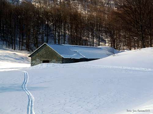
Where to stay
- Rifugio Lagoni at Great Twin Lakes m.1507 – 5 km. by car from Cancelli – always open in the week-end, all the day from june to september
- Rifugio Lagdei m. 1250 – 1 km. by car from Cancelli
- Capanne di Badignana
Meteo
- Meteo ARPA Emilia-Romagna
- Meteo Lagdei
Guidebooks
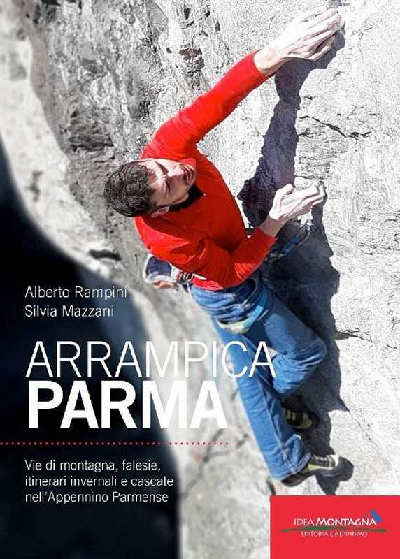
APPENNINO PARMENSE NEW GUIDEBOOK 2019
"Arrampicaparma" III edition - Alberto Rampini and Silvia Mazzani - Idea Montagna ed. 2019
A detailed guidebook including Multipitches, Crags, Ice-falls and winter mountaineering in Appennino Parmense
Guida dettagliata, completa e aggiornata comprendente vie lunghe, falesie, cascate di ghiaccio e itinerari di alpinismo invernale nell'Appennino Parmense


"Arrampicaparma - climbing, bouldering & mountaineering" by Silvia Mazzani and Alberto Rampini Pareti e Montagne Edizioni, II ed. 2011
"Arrampicaparma - montagna, falesie, bouldering" by Alberto Rampini and Silvia Mazzani Pareti e Montagne Edizioni, 2003
“Appennino Ligure e Tosco-Emiliano” by M. Salvo and D. Canossini Collana Guide dei Monti d'Italia CAI-TCI
"Appennino di neve e di ghiaccio" by Andrea Greci - Ed. Idea Montagna 2014
Maps
To see the APPENNINO PARMENSE ONLINE MAPS click below on the link to CAI PARMA website:
Appennino Parmense maps
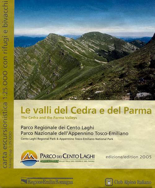
“Le valli del Cedra e del Parma (The Cedra and Parma Valleys)” Map 1:25.000 (CAI-Regione Emilia-Romagna)
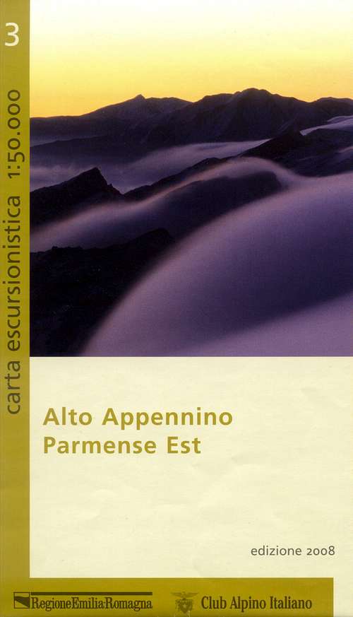
“Alto Appennino Parmense Est” Map 1:50.000 (CAI-Regione Emilia-Romagna)
|
|
External Links
Parco Nazionale Appennino Tosco-Emiliano
Club Alpino Italiano Sez. di Parma